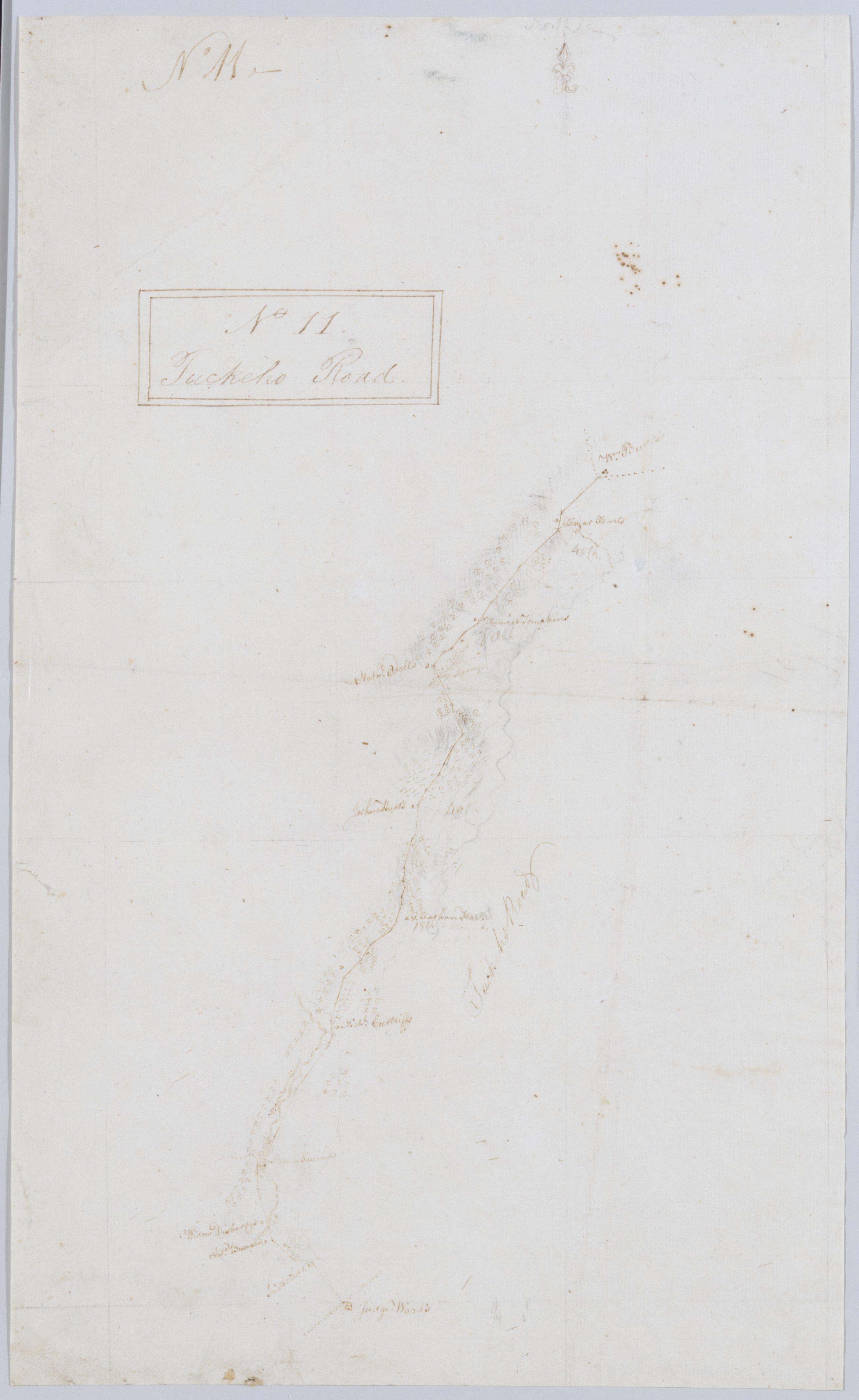
Cartographic Tuckeho Road. No 11 / by Robert Erskine F.R.S. Geogr. A. U.S. and Assistants. Coordinates approximate. Orientation of map unknown. Foxed, creased and abraded. Mounted on cloth, bound and cropped, disbound and silked by subsequent owners. Cleaned after removal of backings 1999; some fill remains. Sheathed in mylar. In ink on recto and verso: "No. 11" In pencil on verso: "No 11." Military topographic map. Covers a small area in southern Westchester County, New York; shows road running through White Plains, Scarsdale and Tuckahoe; the "Younkers River" was later Troublesome Brook. Map shows roads and owners' names; also landforms. Pen-and-ink, pencil on laid paper. View Item
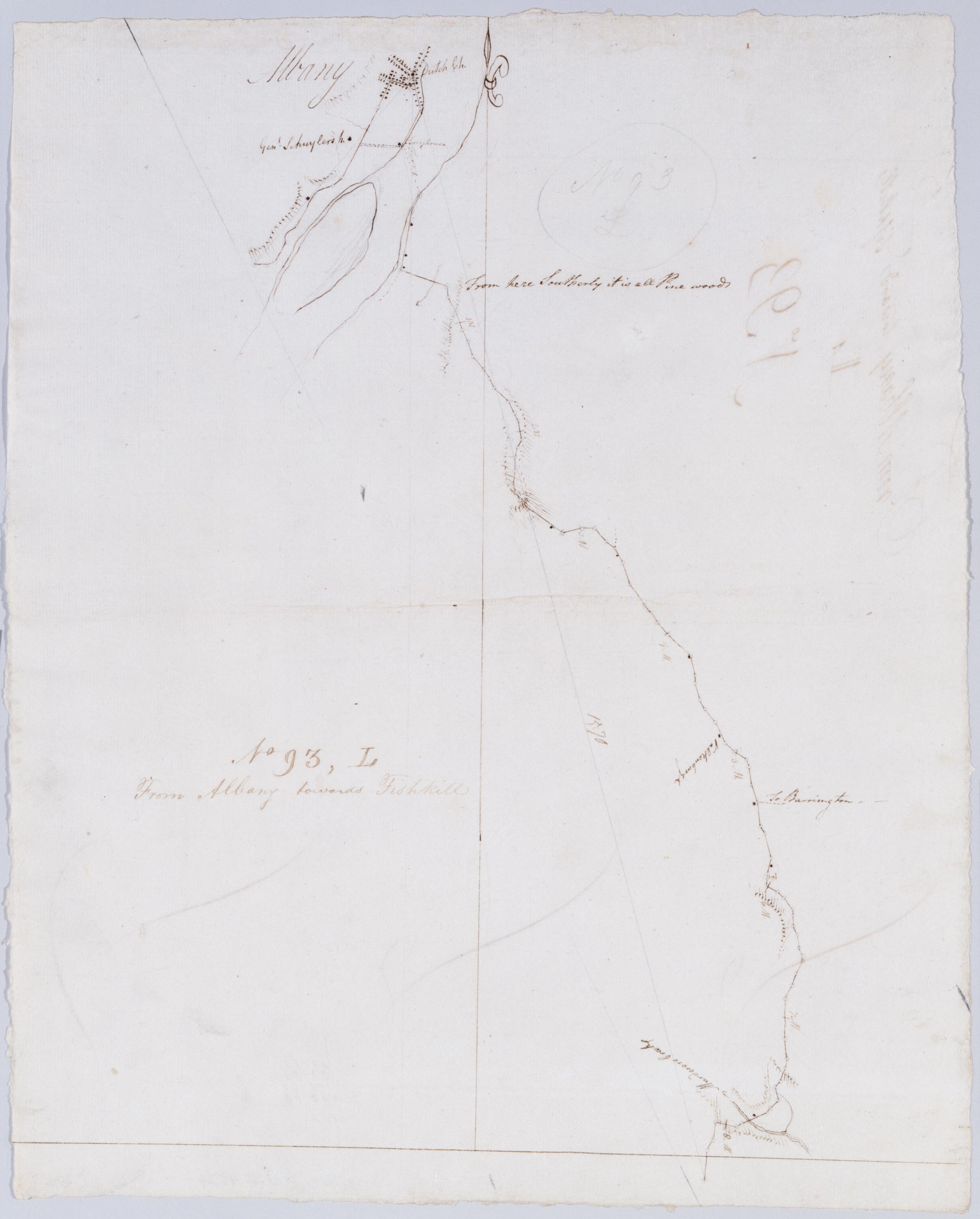
Cartographic From Albany towards Fishkill. No 93, L / by Robert Erskine F.R.S. Geogr. A. U.S. and Assistants. In ink on verso: "L L L". In pencil on recto: "No 93 L". Military topographic map. Covers the townships of Bethlehem in Albany County, East Greenbush and Schodack in Rensselaer County, New York. Shows roads running through Albany, East Greenbush and Schodack Center. Also shows buildings and owners names, landforms and streams. Pen-and-ink, pencil on laid paper. Shows relief by hachures. Stained, soiled, creased and abraded. Mounted on cloth, bound, disbound and silked by subsequent owners. Cleaned after removal of backings 1999; some fill remains. Sheathed in mylar. View Item
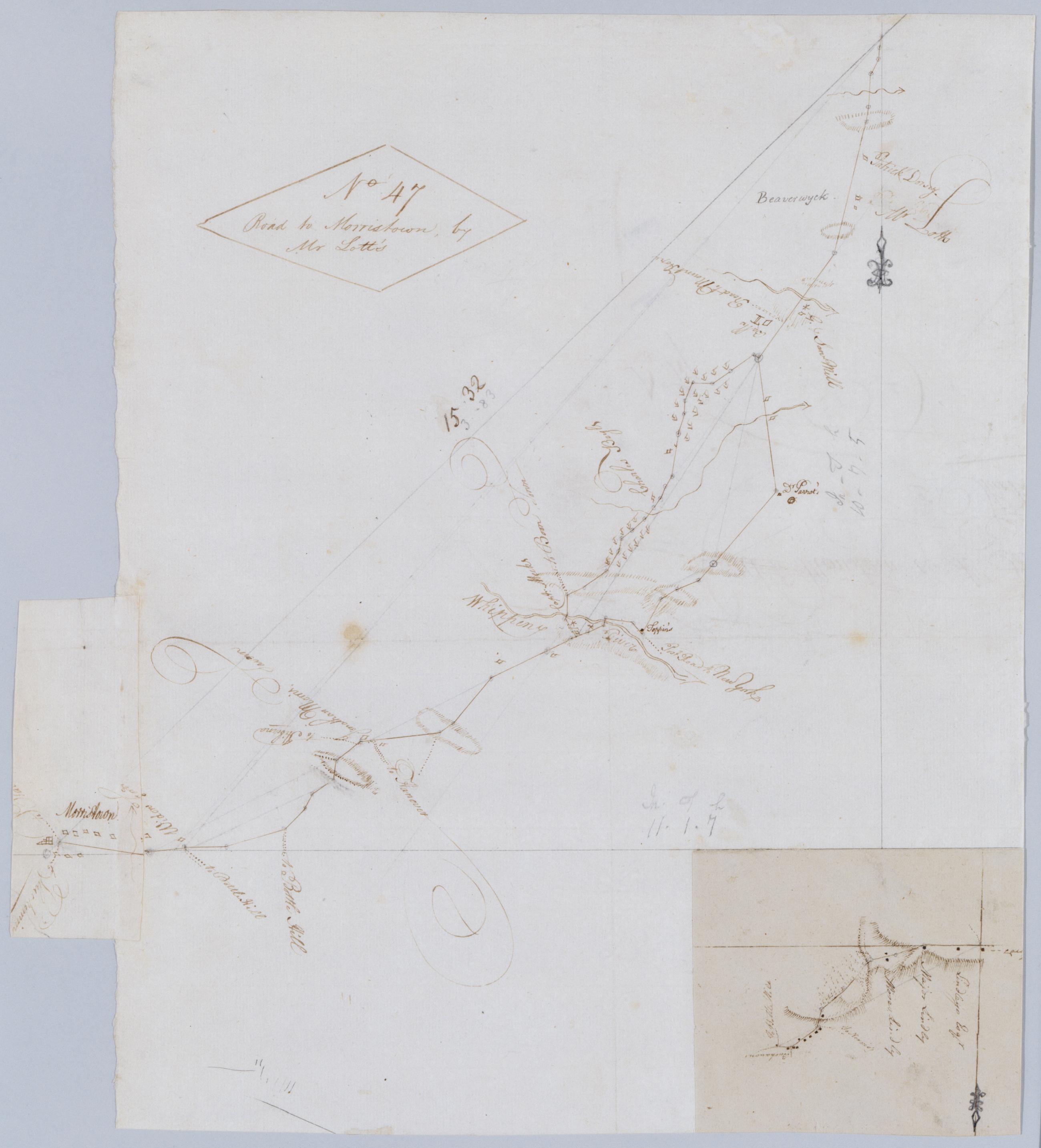
Cartographic Road to Morristown, by Mr Lott's. No 47 / by Robert Erskine F.R.S. Geogr. A. U.S. and Assistants. Foxed, creased, frayed, and abraded. Mounted on cloth, bound and cropped, disbound and silked by subsequent owners. Cleaned after removal of backings 1999; some fill remains. Sheathed in mylar. In ink on verso: William. Includes an untitled inset map pasted upside down at lower right of main sheet. This inset shows the road between Morristown and Monroe in greater detail. Military topographic map. Covers the township of Hanover in Morris County, New Jersey. Shows roads running through Morristown, Monroe, Whippany and Troy Hills. Also shows buildings and owners' names, landforms and streams. View Item
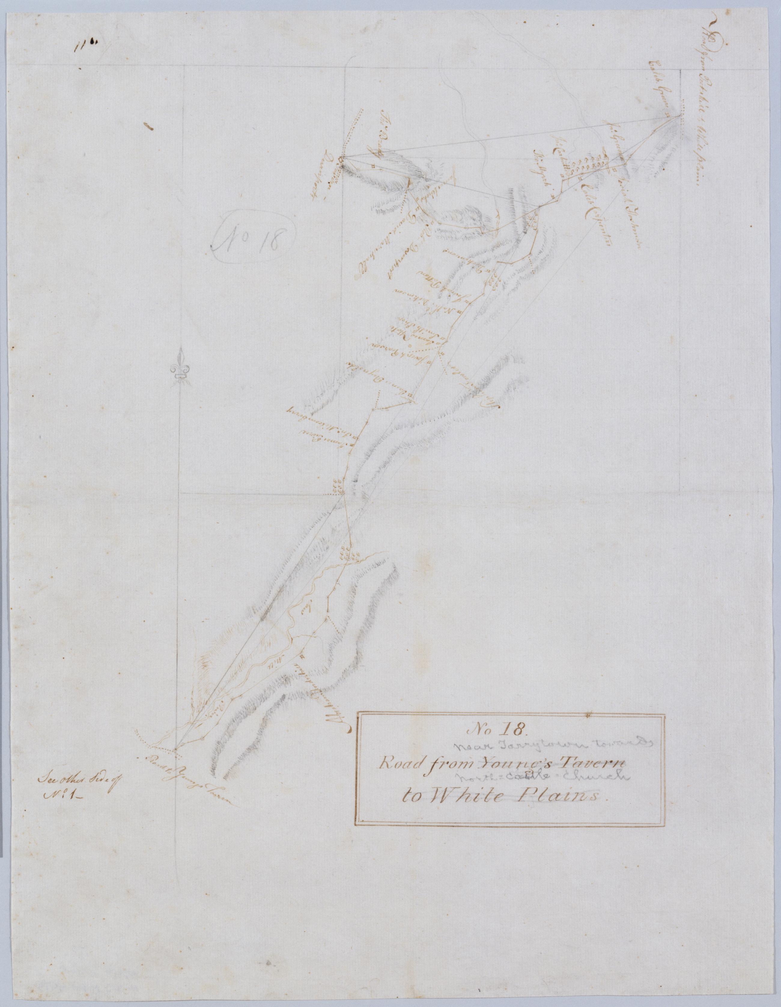
Cartographic Road from Young's Tavern to White Plains. No 18 / by Robert Erskine F.R.S. Geogr. A. U.S. and Assistants. Foxed, creased and abraded. Mounted on cloth, bound and cropped, disbound and silked by subsequent owners. Cleaned after removal of backings 1999; some fill remains. Sheathed in mylar. In ink on verso: "No. 18". In pencil on recto: "No 18". Includes text: "See other Side of No. 1--". Military topographic map. Covers an area in the town of Mount Pleasant, Westchester County, New York. Shows roads running through Neperan, Sherman Park, Pleasantville, Chappaqua and Newcastle. Also shows buildings and owners' names, landforms and streams. Pen-and-ink, pencil on laid paper. View Item
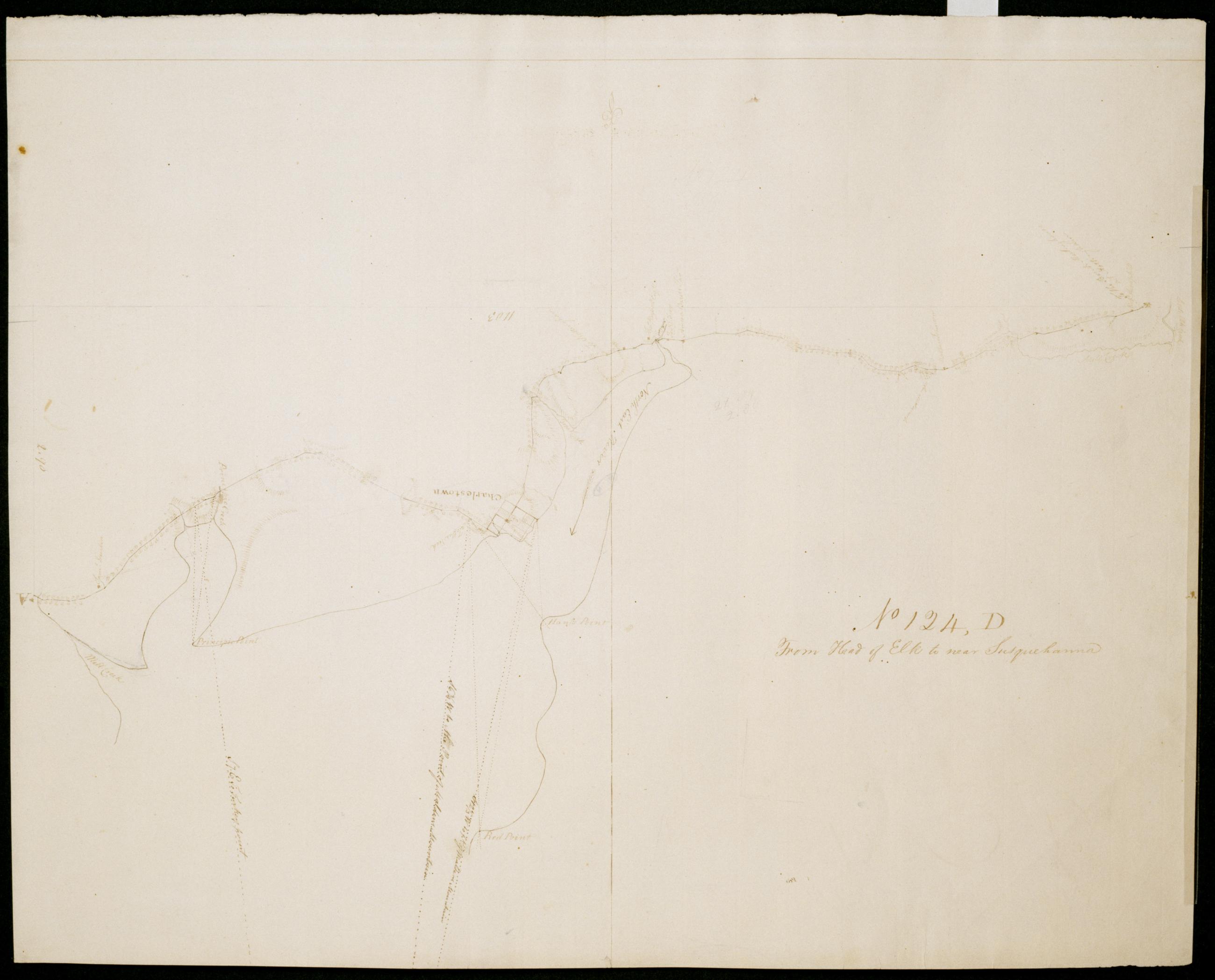
Cartographic From Head of Elk to near Susquehanna. No 124, D / by Robert Erskine F.R.S. Geogr. A. U.S. and Assistants. Date 1781 inferred by cataloger. Military topographic map. Covers Cecil County, Maryland. Shows roads running through Elkton, Bacon Hill, Charlestown, Principio Furnace and Perryville. Also shows buildings and owners' names, landforms and streams. Pen-and-ink, pencil on laid paper. Shows relief by hachures. Stained, soiled, creased and abraded. Mounted on cloth, bound and cropped, disbound and silked by subsequent owners. Cleaned after removal of backings 1999; some fill remains. Sheathed in mylar. View Item
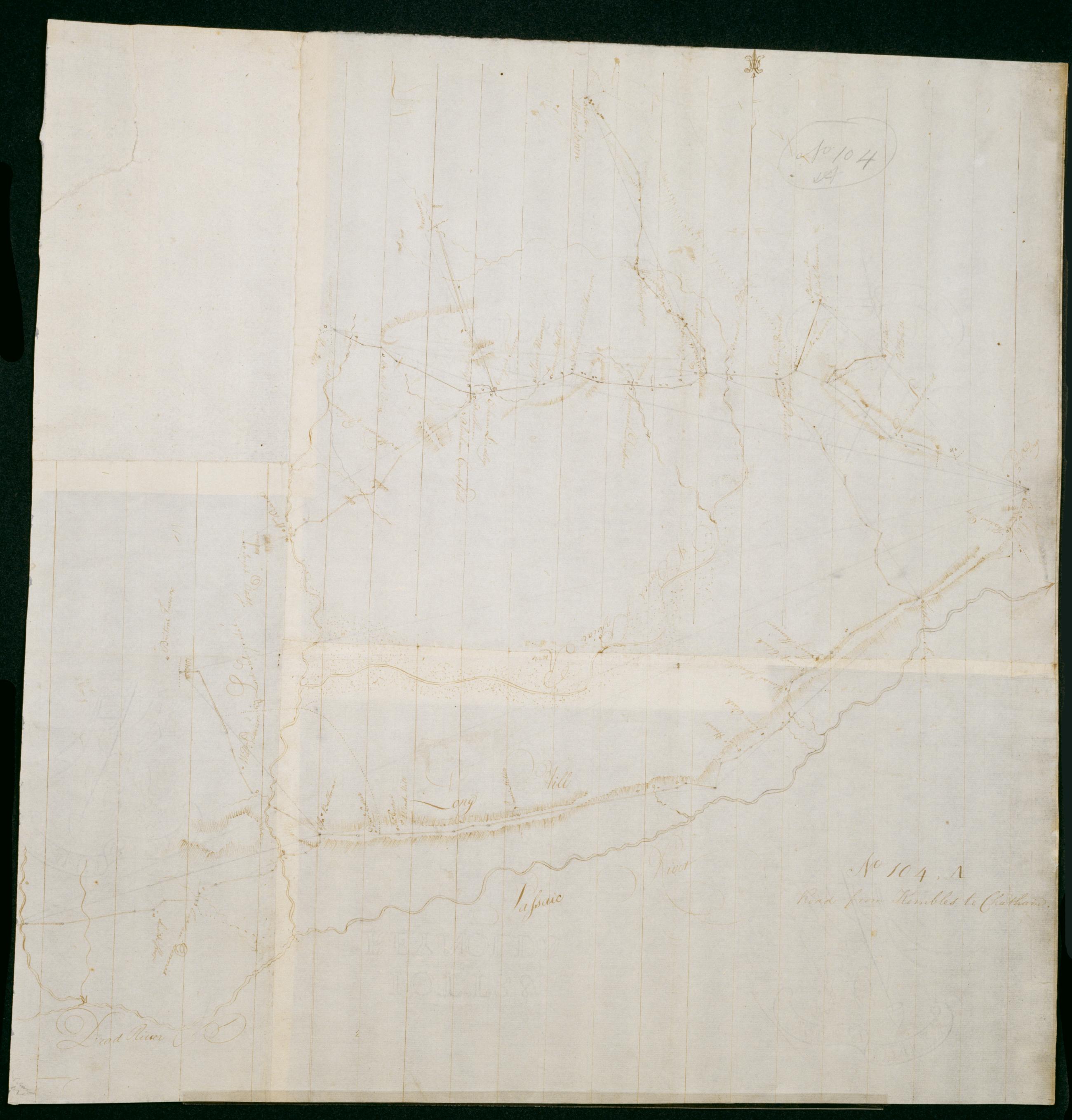
Cartographic Road from Kembles to Chatham. No 104, A / by Robert Erskine F.R.S. Geogr. A. U.S. and Assistants. Foxed, creased, frayed and abraded. Mounted on cloth, bound and cropped, disbound and silked by subsequent owners. Cleaned after removal of backings 1999; some fill remains. Sheathed in mylar. In pencil on recto: "No 104 A". Military topographic map. Covers the townships of Passaic and Morris in Morris County and of Bernard in Somerset County, New Jersey. Shows roads running through Chatham, Morristown, Logansville, Millington and Liberty Corner. Also shows buildings and owners' names, landforms and streams. Pen-and-ink, pencil on laid paper. Shows relief by hachures. View Item
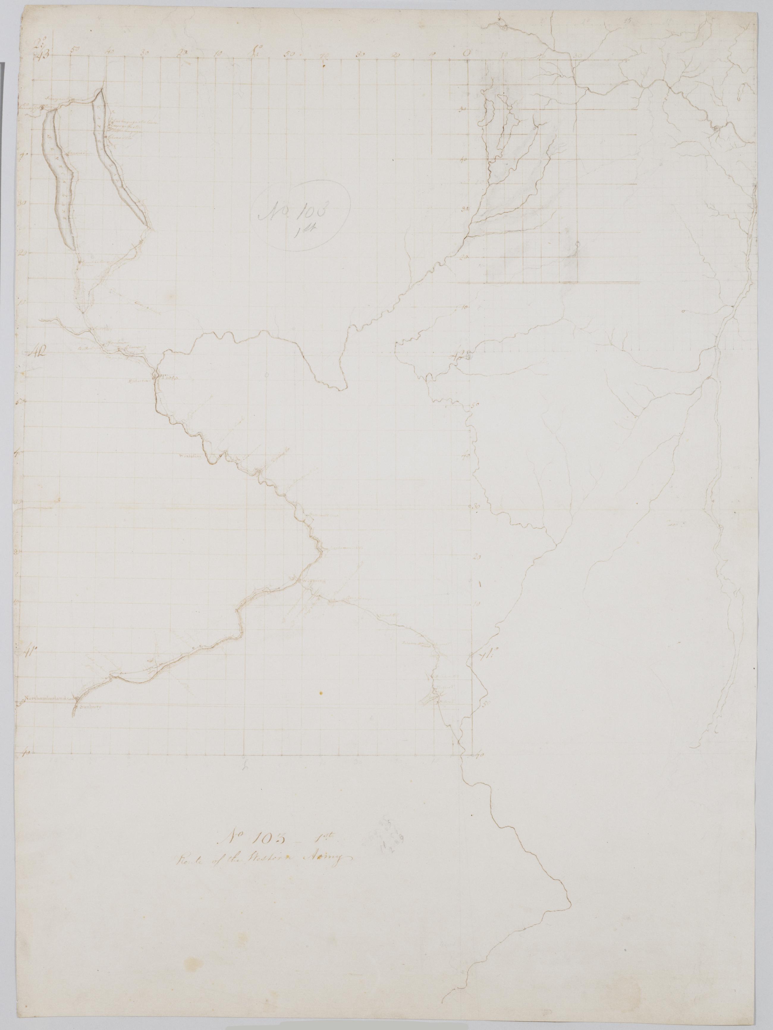
Cartographic Route of the Western Army. No 103-1st [i.e., No. 101-3rd] by R.E. ; by Robert Erskine F.R.S. Geogr. A. U.S. and Assistants. In pencil on recto: "No 103 1st" and on verso "No 103." Military topographical map. Covers parts of New York, Pennsylvania and New Jersey. Pen-and-ink, pencil on laid paper. Sheet carries no title on verso. Shows relief by hachures. Soiled, stained, creased and abraded. Mounted on cloth, bound and cropped, disbound and silked by subsequent owners. Cleaned after removal of backings 1999; some fill remains. Sheathed in mylar. Title proper from recto is the work of a later editor--Simeon DeWitt or his assign--subsequent to 1820. View Item
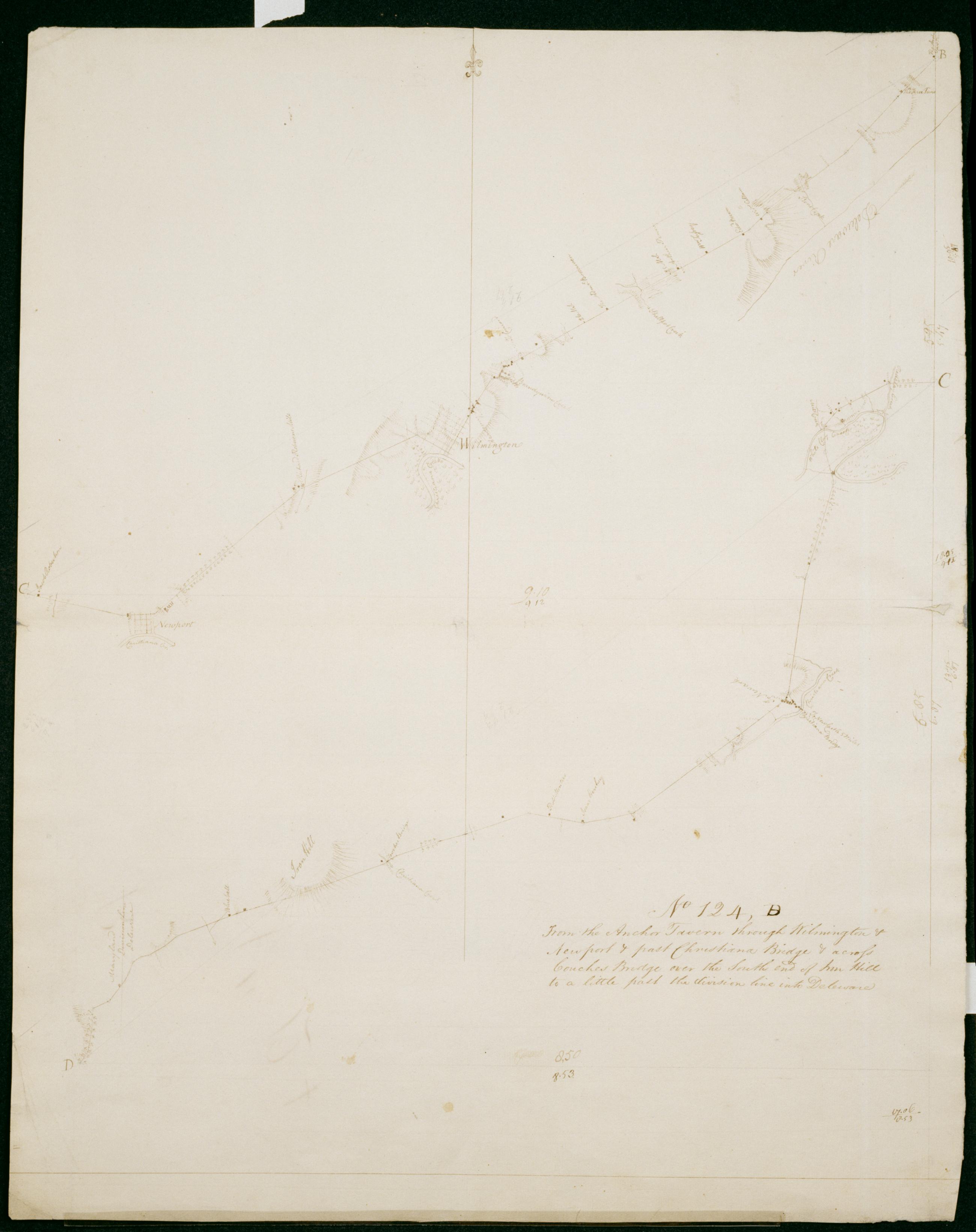
Cartographic From the Anchor Tavern through Wilmington + Newport + past Christiana Bridge + across Couches Bridge over the South end of Iron Hill to a little past the division line into Deleware. No 124, B / by Robert Erskine F.R.S. Geogr. A. U.S. and Assistants. Date 1781 inferred by cataloger. Military topographic map. Covers the counties of New Castle in Delaware and of Cecil in Maryland. Shows roads running through Bellevue State Park, Wilmington, Silview, Newport, Stanton, Christiana and Cooches Bridge. Also shows buildings and owners' names, landforms and streams. Pen-and-ink, pencil on laid paper. Shows relief by hachures. Stained, soiled, creased, frayed and abraded. Mounted on cloth, bound and cropped, disbound and silked by subsequent owners. Cleaned after removal of backings 1999; some fill remains. Sheathed in mylar. View Item
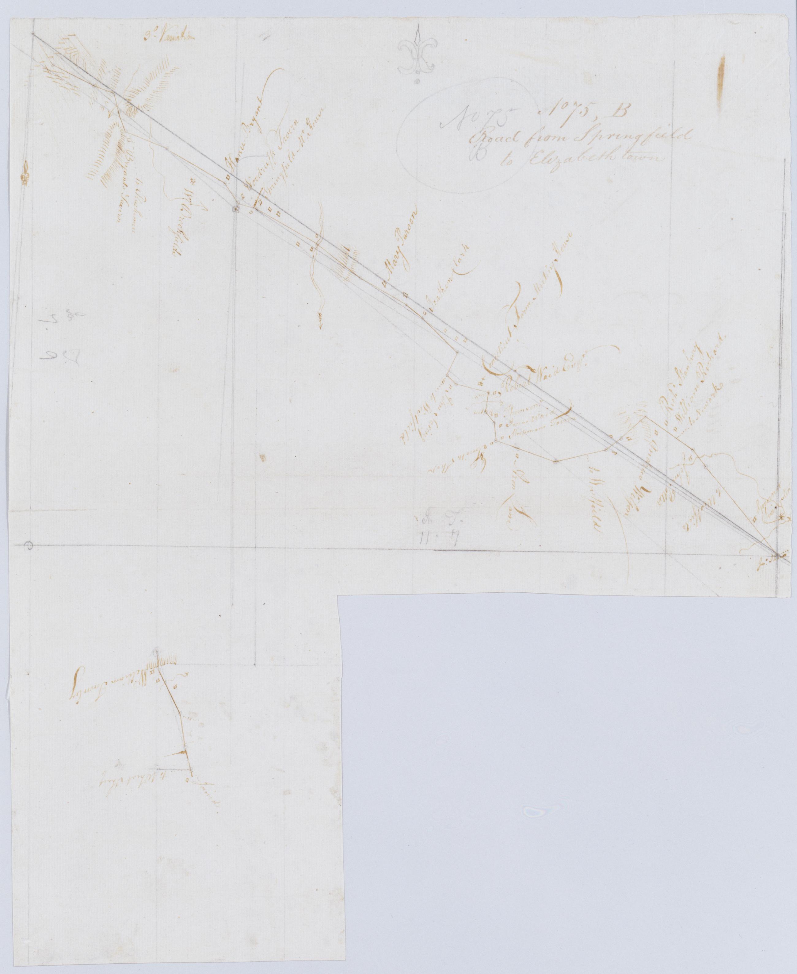
Cartographic Road from Springfield to Elizabeth town. No 75, B / by Robert Erskine F.R.S. Geogr. A. U.S. and Assistants. Imperfect: 15 x 19 cm. at lower right corner cut out after drawing complete; compare cuts to those on 75,A. In pencil on recto: "No 75 B". Military topographic map; lower segment fits to the southeast of the upper one. Map covers the townships of Summit, Springfield and Union in Union County, New Jersey. Shows roads running through Springfield and Elizabeth. Also shows buildings and owners' names, landforms and streams. Pen-and-ink, pencil on laid paper. Shows relief by hachures. Stained, creased and abraded. Mounted on cloth, bound and cropped, disbound and silked by subsequent owners. View Item
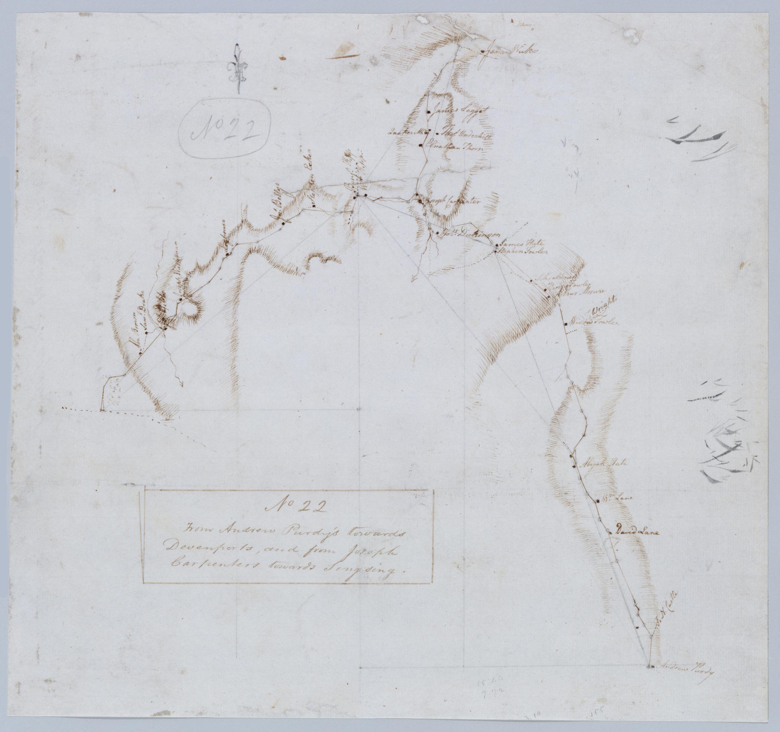
Cartographic From Andrew Purdy's towards Devenports, and from Joseph Carpenters towards Singsing. No 22 / by Robert Erskine F.R.S. Geogr. A. U.S. and Assistants. Foxed, creased, frayed, and abraded. Mounted on cloth, bound and cropped, disbound and silked by subsequent owners. Cleaned after removal of backings 1999; some fill remains. Sheathed in mylar. In pencil on recto, in ink on verso: "No 22". Military topographic map. Covers the towns of Ossining, Newcastle and North Castle in Westchester County, New York. Shows roads running through Briarcliff Manor and Chappaqua. Also shows buildings and owners' names, landforms and streams. Pen-and-ink, pencil on laid paper. Shows relief by hachures. View Item
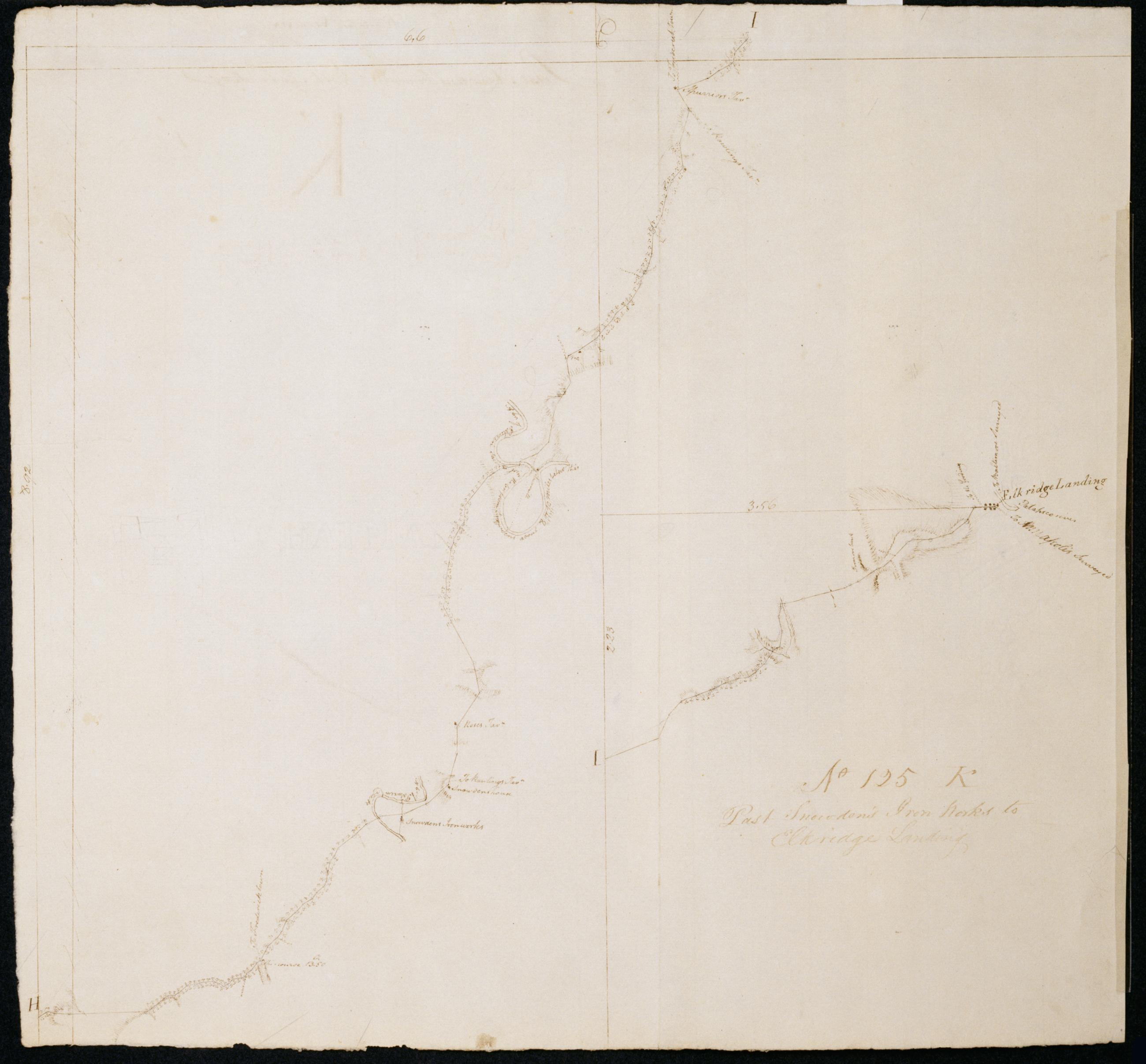
Cartographic Past Snowden's Iron Works to Elkridge Landing. No 125 K / by Robert Erskine F.R.S. Geogr. A. U.S. and Assistants. Date inferred by cataloger. Foxed, soiled and abraded. Mounted on cloth, bound and cropped, disbound and silked by subsequent owners. Cleaned after removal of backings 1999; some fill remains. Sheathed in mylar. Military topographic map. Covers Prince Georges and Howard counties in Maryland. Shows buildings, landforms and streams. Pen-and-ink, pencil on laid paper. Shows relief by hachures. Title proper from recto is the work of a later editor--Simeon DeWitt or his assign--subsequent to 1820. Title from verso is contemporaneous with map and may be cited as such. View Item
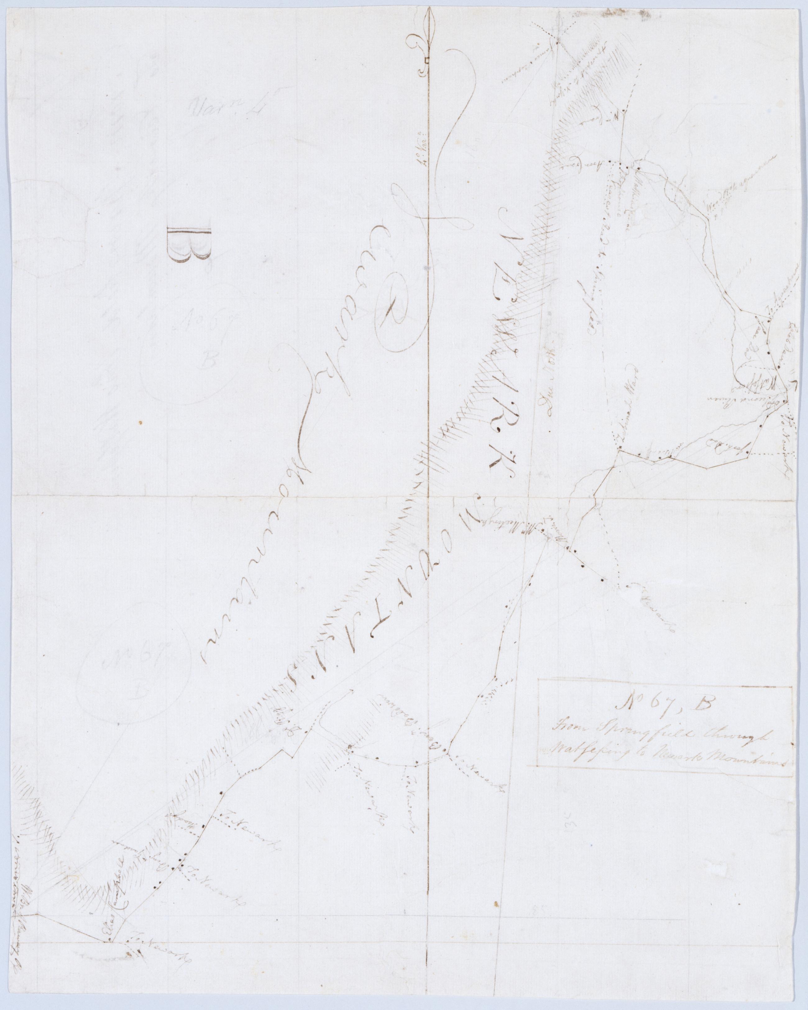
Cartographic From Springfield through Watsessing to Newark Mountains. No 67, B / by Robert Erskine F.R.S. Geogr. A. U.S. and Assistants. In ink on recto: "B". In pencil on recto: "No 67 B". Military topographic map. Covers the townships of Montclair, Plainfield, West Orange, South Orange and Milburn in Essex County, New Jersey. Shows roads running through Brookdale, Franklin, Bloomfield, Watsessing, South Orange and Wyoming. Also shows buildings and owners' names, also landforms and streams. Pen-and-ink, pencil on laid paper. Shows relief by hachures. Stained, foxed, creased, frayed and abraded. Mounted on cloth, bound and cropped, disbound and silked by subsequent owners. View Item
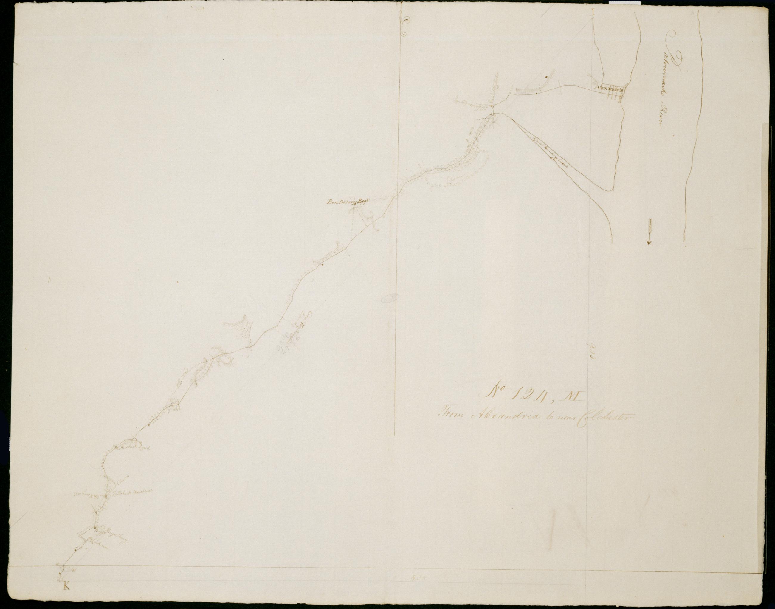
Cartographic From Alexandria to near Colchester. No 124, M / by Robert Erskine F.R.S. Geogr. A. U.S. and Assistants. Date 1781 inferred by cataloger. Military topographic map. Covers the city of Alexandria and the counties of Arlington, Fairfax and Prince William in Virginia. Shows roads running through Arlington, Alexandria, Hayfield and Pohick. Also shows buildings, landforms and streams. Pen-and-ink, pencil on laid paper. Shows relief by hachures. Soiled, creased and abraded. Mounted on cloth, bound and cropped, disbound and silked by subsequent owners. Cleaned after removal of backings 1999; some fill remains. Sheathed in mylar. View Item
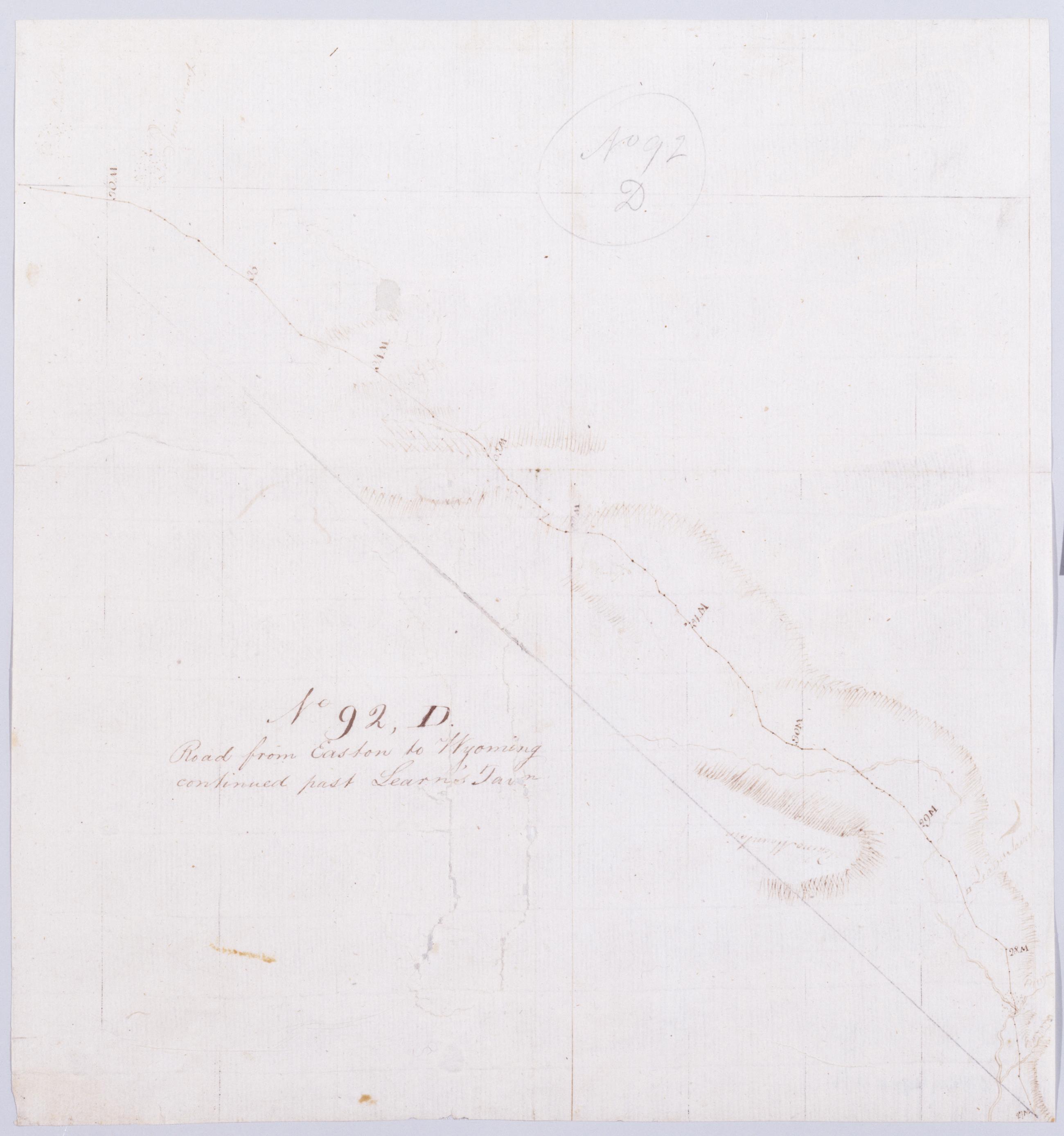
Cartographic Road from Easton to Wyoming continued past Learn's Tavn. No 92, D / by Robert Erskine F.R.S. Geogr. A. U.S. and Assistants. Creased, stained, soiled, torn and severly abraded. Mounted on cloth, bound and cropped, disbound and silked by subsequent owners. Cleaned after removal of backings 1999; some fill remains. Sheathed in mylar. In pencil on recto: "No 92 D". Military topographic map. Covers Monroe County, Pennsylvania. Shows roads running through Mount Pocono. Also shows buildings and owners' names, landforms and streams. Pen-and-ink, pencil on laid paper. Paper itself highly imperfect. Scale from index title; confirmed by measuring the map itself. Shows relief by hachures. View Item
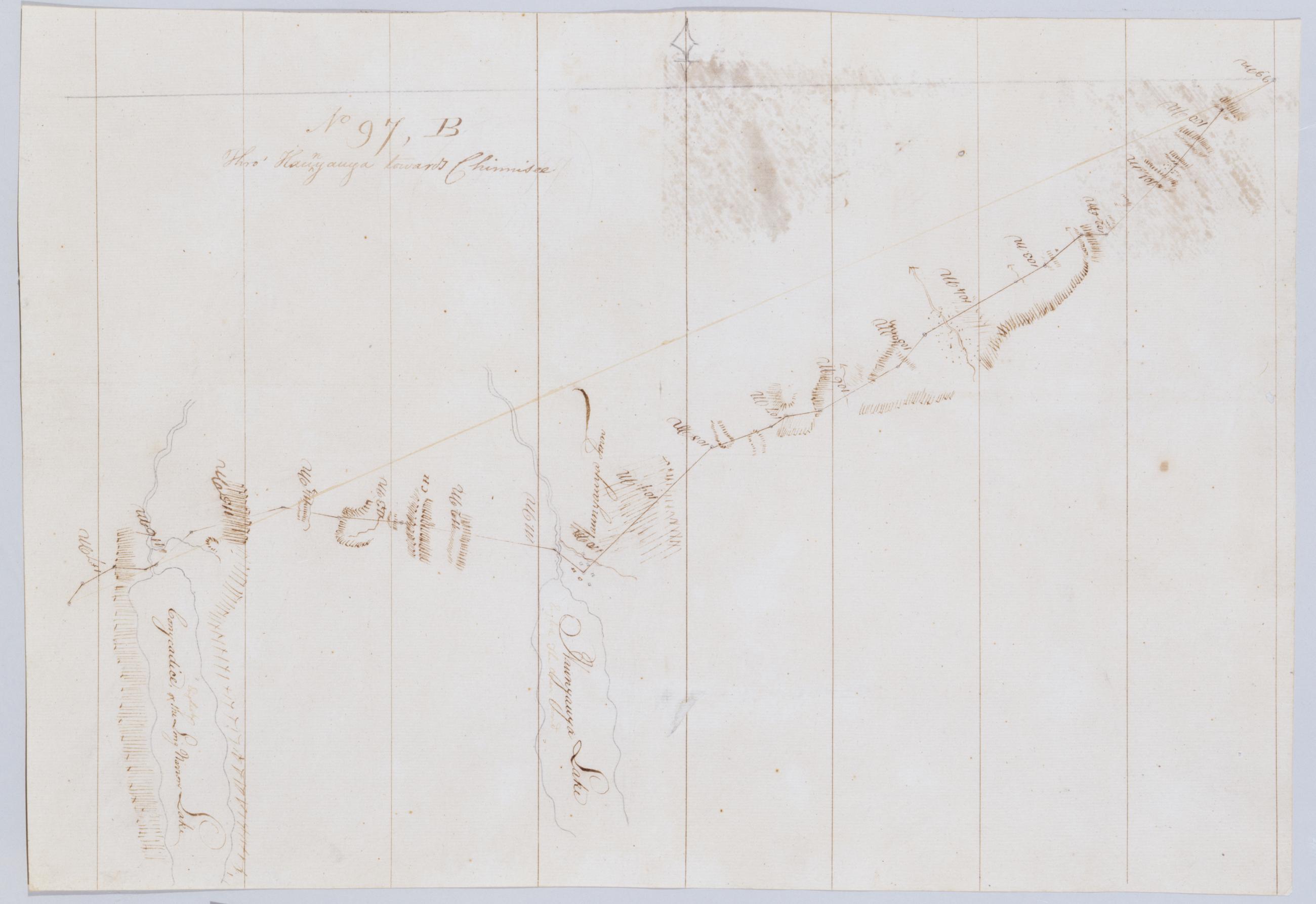
Cartographic Thro' Kaunyauya towards Chinnisee. No 97, B / by Robert Erskine F.R.S. Geogr. A. U.S. and Assistants. In erased pencil on recto, "No 97 B". Military topographic map. Covers the towns of Canandaigua, Bristol and Richmond in Ontario County and of Livonia in Livingston County, New York. Shows roads running through Canandaigua, Vicent, Honeoye and Glenville. Also shows landforms and streams. Hemlock formerly Conesus Lake is incorrectly labeled as Conycadice Lake. Pen-and-ink, pencil on laid paper. Shows relief by hachures. Stained, creased and abraded. Mounted on cloth, cropped, bound, disbound and silked by subsequent owners. Cleaned after removal of backings 1999; some fill remains. View Item
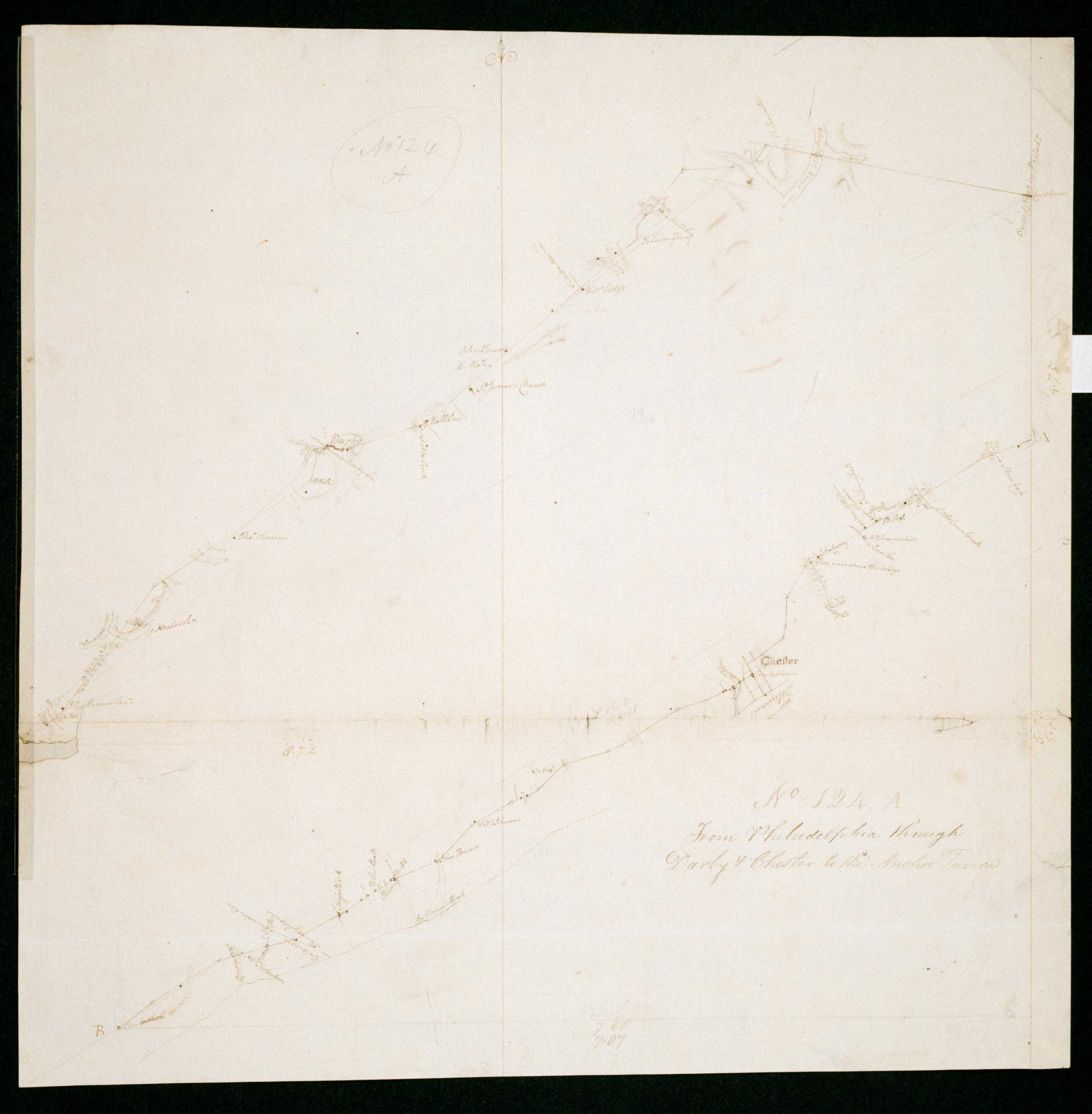
Cartographic From Philadelphia through Darby + Chester to the Anchor Tavern. No 124, A / by Robert Erskine F.R.S. Geogr. A. U.S. and Assistants. Date 1781 inferred by cataloger. Imperfect: lacking 1 x 3 cm. at left margin. In pencil on recto: "No 124 A". Military topographic map. Covers the counties of Philadelphia and Delaware in Pennsylvania and of New Castle in Delaware. Shows roads running through Philadelphia, Norwood, Chester and Linwood. Also shows buildings and owners' names, landforms and streams. Pen-and-ink, pencil on laid paper. Shows relief by hachures. Soiled, creased, frayed and abraded. Mounted on cloth, bound and cropped, disbound and silked by subsequent owners. View Item
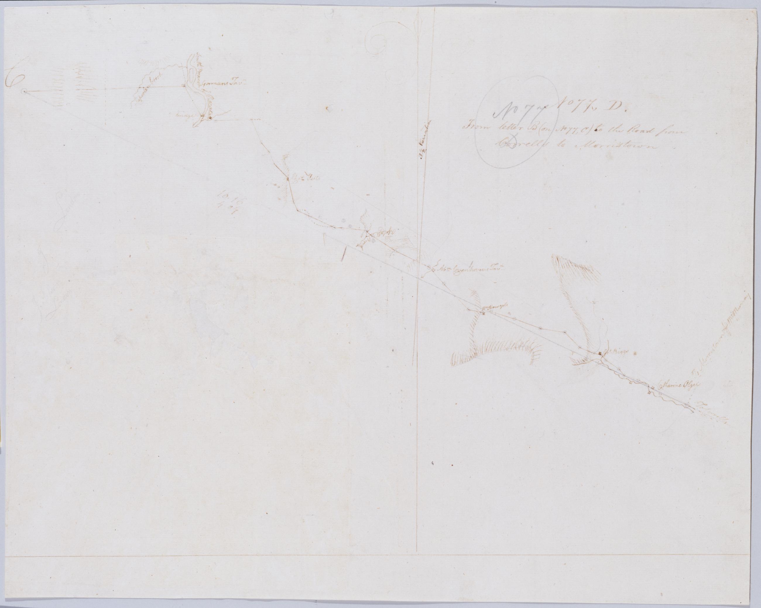
Cartographic From letter B (on No 77, C) to the Road from Corrells to Morristown. No 77, D / by Robert Erskine F.R.S. Geogr. A. U.S. and Assistants. In erased pencil on recto: "No 77 C". Military topographic map. Covers the townships of Franklin and Readington in Hunterdon County, New Jersey. Shows roads running through Lansdowne, Hamden, Sunnyside, Stanton and Pleasant Run. Also shows buildings and owners' names, landforms and streams. Notice that the verso title's "Letter B of the same number" properly refers to sheet 77,B not to any mark on sheet 77,C. Pen-and-ink, pencil on laid paper. Shows relief by hachures. Title proper from recto is the work of a later editor--Simeon DeWitt or his assign--subsequent to 1820. View Item
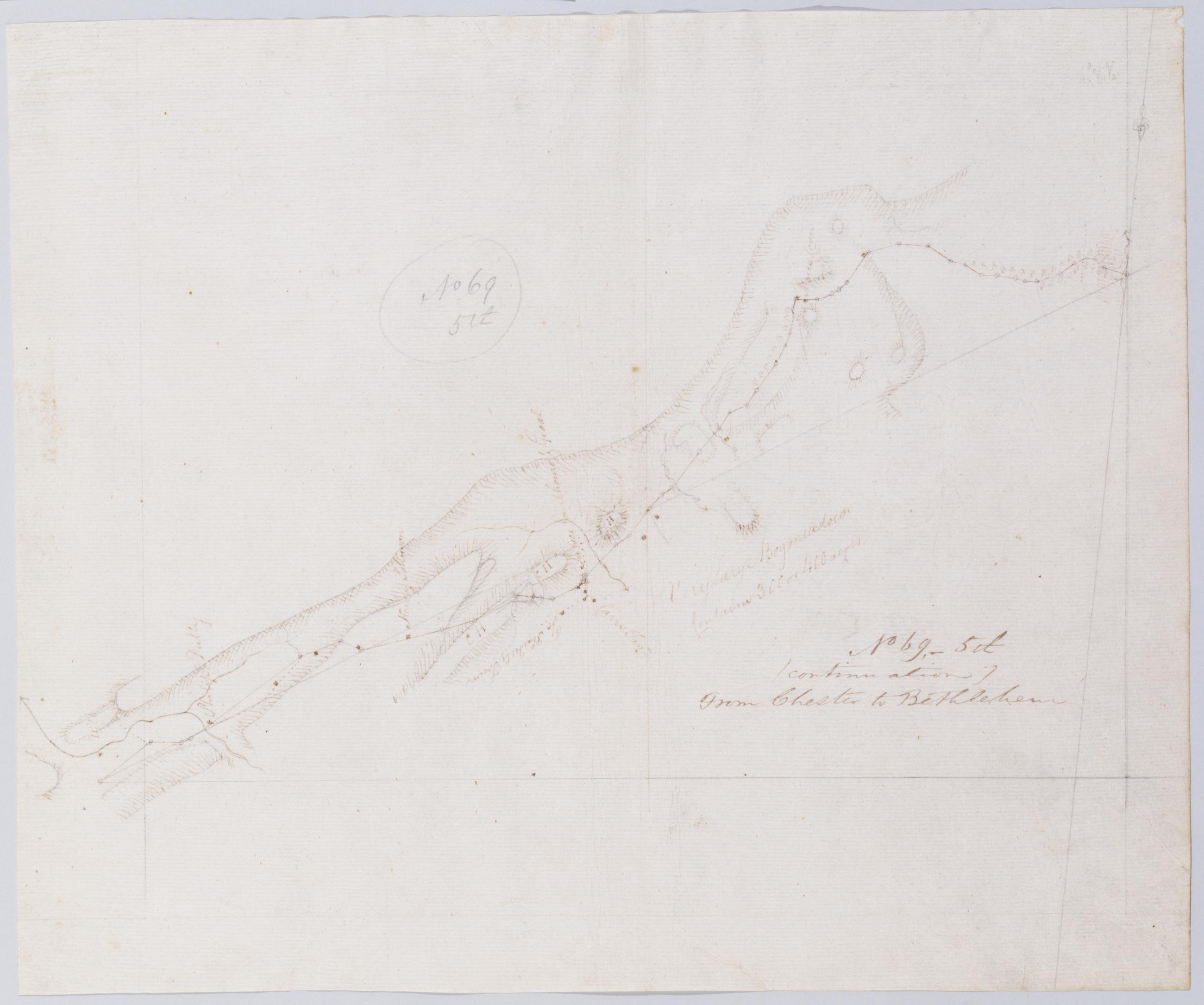
Cartographic (Continuation) From Chester to Bethlehem. No 69-5th / by Robert Erskine F.R.S. Geogr. A. U.S. and Assistants. In pencil on recto: "No 69 5th". Military topographic map. Covers the townships of Lafayette and Hampton in Sussex County, New Jersey. Shows roads running through Newton. Also shows buildings and owners' names, landforms and streams. Pen-and-ink, pencil on laid paper. Shows relief by hachures. Stained, foxed, creased and abraded. Mounted on cloth, bound and cropped, disbound and silked by subsequent owners. Cleaned after removal of backings 1999; some fill remains. Sheathed in mylar. Title proper on recto is the work of a later editor--Simeon DeWitt or his assign--subsequent to 1820. View Item
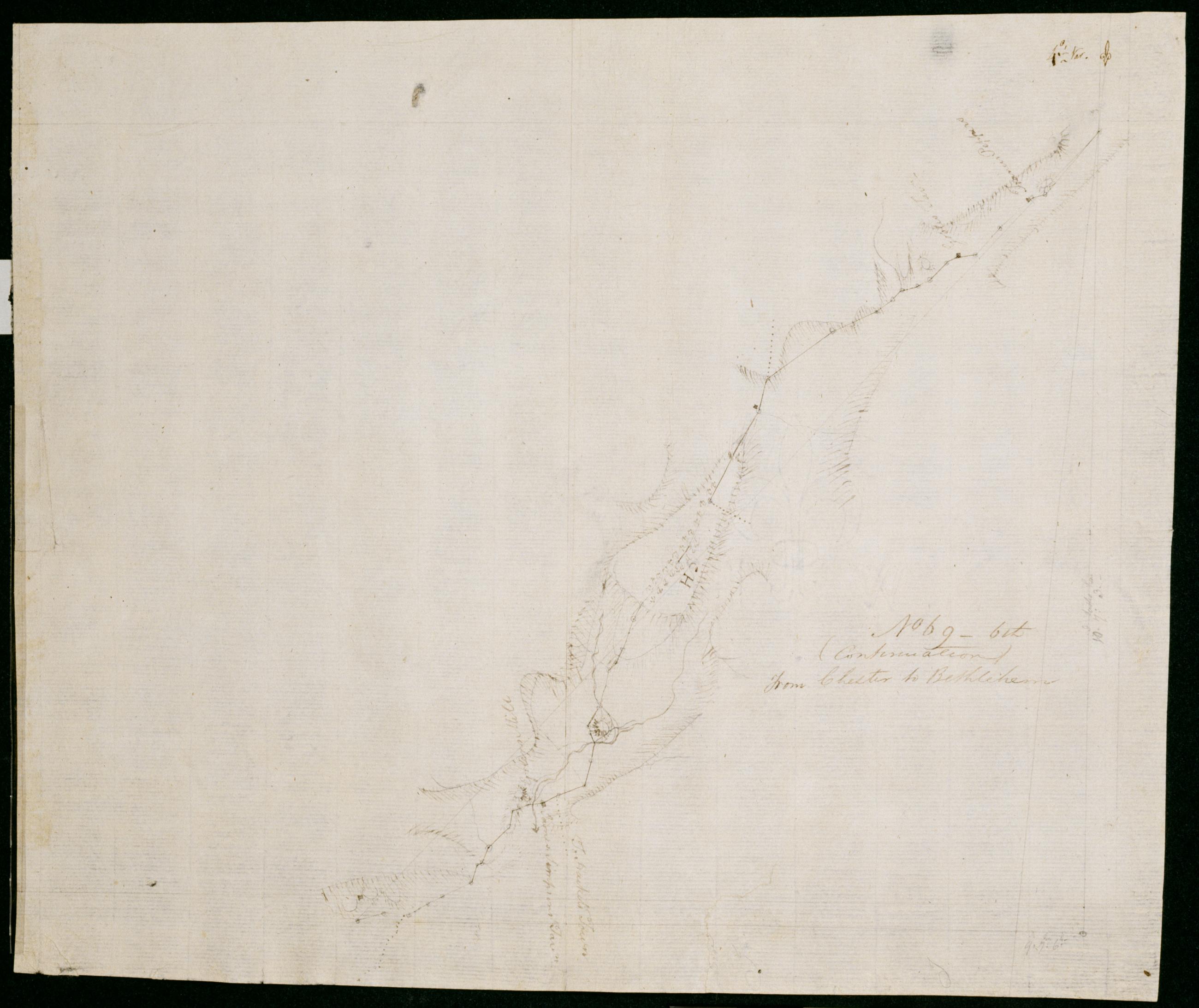
Cartographic (Continuation) From Chester to Bethlehem. No 69-6th / by Robert Erskine F.R.S. Geogr. A. U.S. and Assistants. In ink on verso: "No. 69 6th. Sheet SD SD SD SD SD SD". In pencil on recto: "No 69 6th". Military topographic map. Covers the township of Frelinghuysen in Warren County, New Jersey. Also shows buildings and owners' names, landforms and streams. Pen-and-ink, pencil on laid paper. Shows relief by hachures. Stained, creased and abraded. Mounted on cloth, bound and cropped, disbound and silked by subsequent owners. Cleaned after removal of backings 1999; some fill remains. Sheathed in mylar. Title proper on recto is the work of a later editor--Simeon DeWitt or his assign--subsequent to 1820. View Item
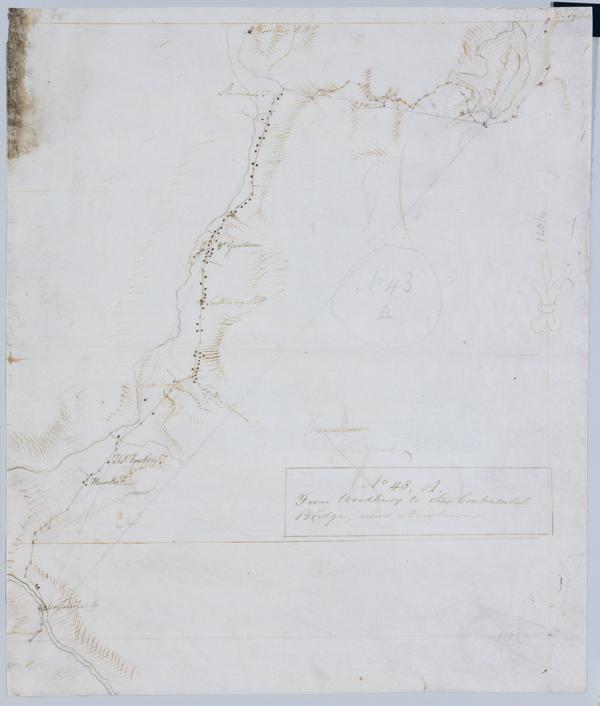
Cartographic From Woodbury to the Continental Bridge, near Newtown. No 43, A / by Robert Erskine F.R.S. Geogr. A. U.S. and Assistants. In pencil on recto: "No 43 A". Military topographic map. Covers the townships of Southbury, Woodbury and Middlebury in New Haven County and of Newtown in Fairfield County, Connecticut. Shows roads running through Woodbury, White Oaks, Southbury, Pomperaug Valley and Bennetts Bridge. Also shows buildings and owners' names, landforms and streams. Pen-and-ink, pencil on laid paper. Shows relief by hachures. Soiled, foxed, creased, frayed, and abraded. Mounted on cloth, bound and cropped, disbound and silked by subsequent owners. Cleaned after removal of backings 1999; some fill remains. View Item
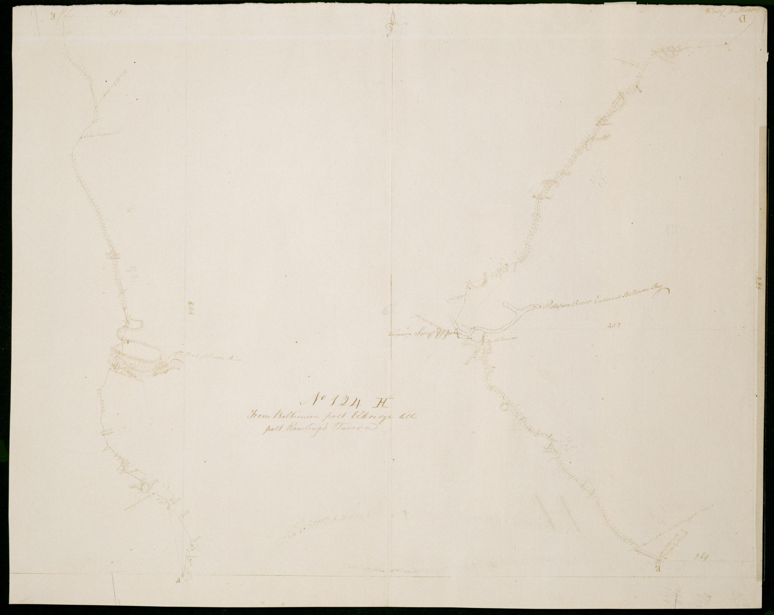
Cartographic From Baltimore past Elkridge till past Rawling's Tavern. No 124, H / by Robert Erskine F.R.S. Geogr. A. U.S. and Assistants. Date 1781 inferred by cataloger. Military topographic map; right segment is north of the left one. Covers the City of Baltimore and the counties of Baltimore, Howard and Anne Arundel in Maryland. Shows roads running through Baltimore, Elkridge, BWI Airport and Doors Corner, and Crownsville. Also shows buildings, landforms and streams. Pen-and-ink, pencil on laid paper. Shows relief by hachures. Soiled, creased and abraded. Mounted on cloth, bound and cropped, disbound and silked by subsequent owners. Cleaned after removal of backings 1999; some fill remains. Sheathed in mylar. View Item
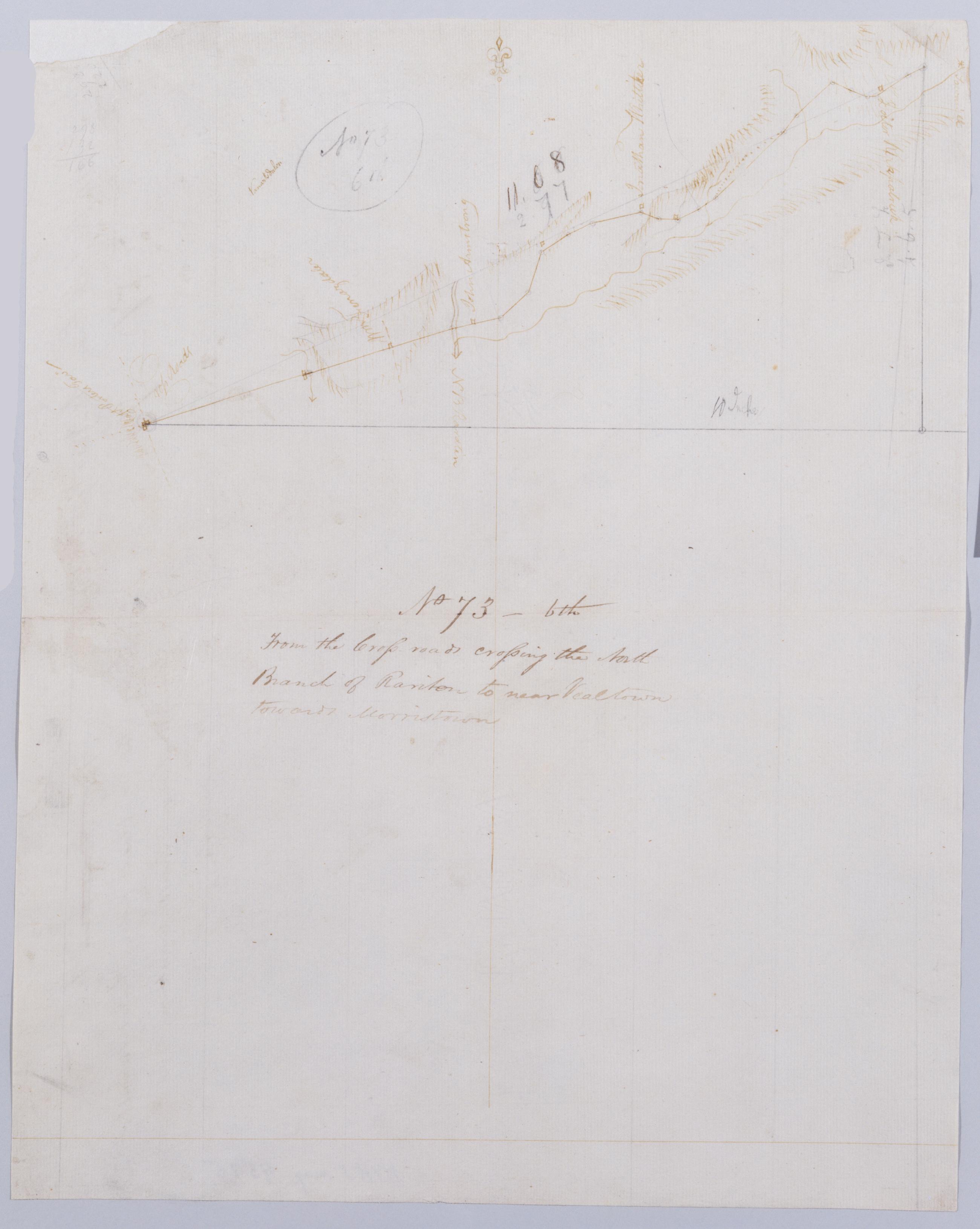
Cartographic From the Cross-roads crossing the North Branch of Rariton to near Vealtown towards Morristown. No 73, 6th / by Robert Erskine F.R.S. Geogr. A. U.S. and Assistants. Also in ink on verso: "Road from near Veal". Foxed, creased, torn, frayed and abraded. Mounted on cloth, bound and cropped, disbound and silked by subsequent owners. Cleaned after removal of backings 1999; some fill remains. Sheathed in mylar. In pencil on recto: "No 73 6th". Military topographic map. Covers the townships of Bedminster and Bernard in Somerset County, New Jersey. Shows roads running through Greater Crossroads, Bedminster and Far Hills. Also shows buildings and owners' names, landforms and streams. Pen-and-ink, pencil on laid paper. Shows relief by hachures. View Item
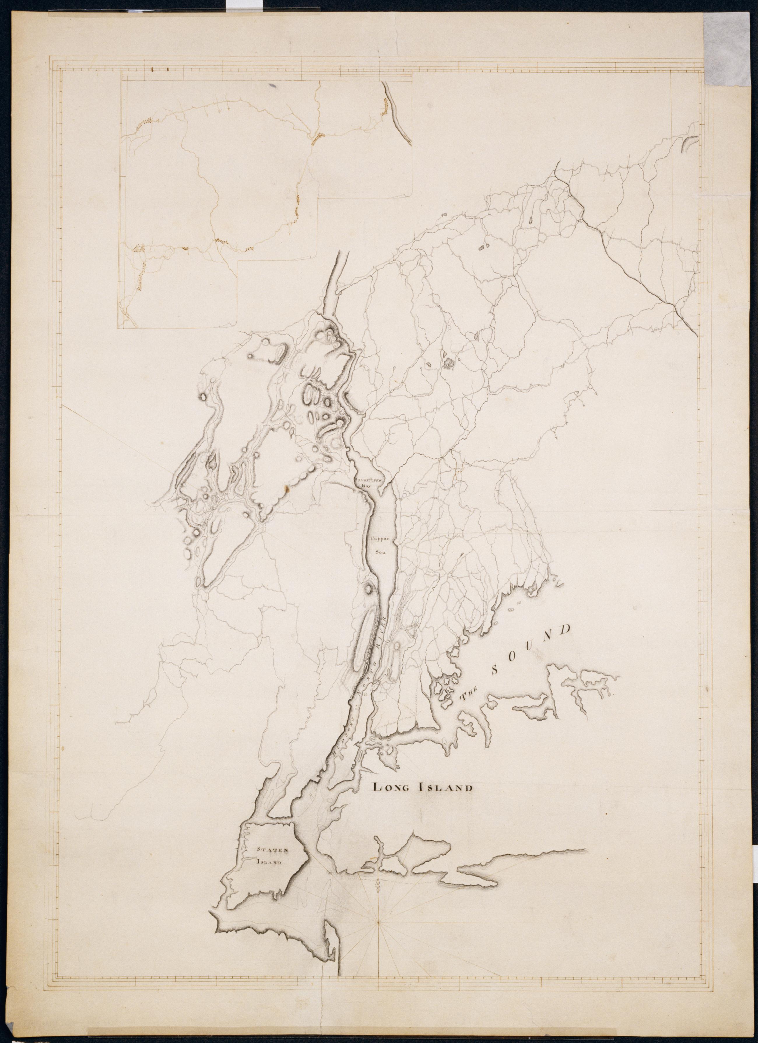
Cartographic General Contraction 4 Miles to an Inch. No 54 / by Rt Erskine ; by Robert Erskine F.R.S. Geogr. A. U.S. and Assistants [unsigned ed.] Title as given by Guthorn: North Eastern New Jersey, the Hudson Highlands, Westchester Couty, Western Connecticut, Western Long Island and New York Bay to the base of Sandy Hook. B. Part 1. In pencil on verso "Maps by DeWitt Geo. U.S.A. for F. De Peyster Esq." This is a later text; Frederic De Peyster was an officer of the New-York Historical Society during the mid-19th century. Includes inset covering central Connecticut. Military topographic map. Covers northern New Jersey, the southernmost tip of New York and western Connecticut. Shows roads, landforms and streams. View Item
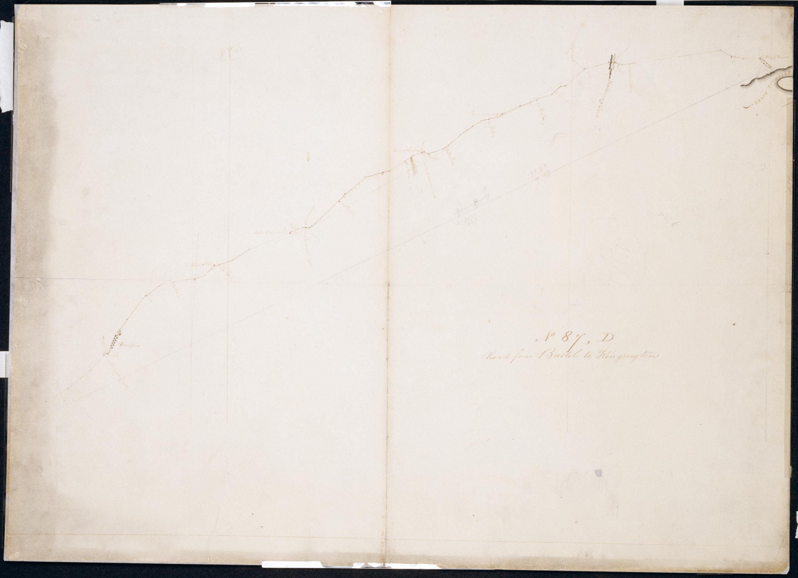
Cartographic Road from Bristol to Kingsington. No 87, D / by Robert Erskine F.R.S. Geogr. A. U.S. and Assistants. In pencil on recto: "No 87 D". Military topographic map. Covers the city of Philadelphia and the townships of Bristol and Bensalem in Bucks County, Pennsylvania. Shows roads running through Bristol, Eddington, Maud, Andalusia, Holmesburg and Frankford, now in Philadelphia. Also shows buildings and owners' names, landforms and streams. Pen-and-ink, pencil on laid paper. Shows relief by hachures. Soiled, creased, torn, frayed and abraded. Mounted on cloth, cropped, bound, disbound and silked by subsequent owners. Cleaned after removal of backings 1999; some fill remains. Lined with China paper. View Item
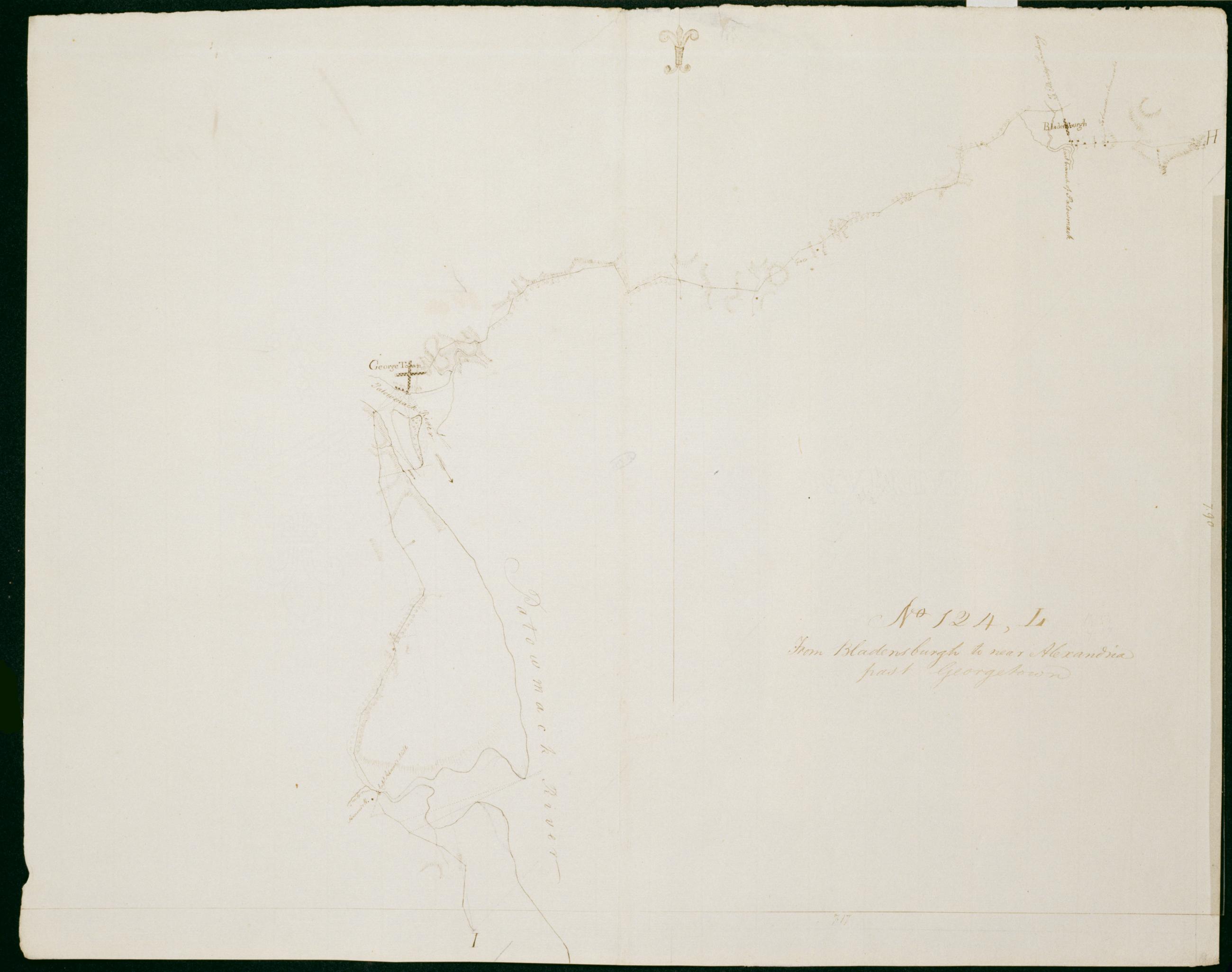
Cartographic From Bladensburgh to near Alexandria past Georgetown. No 124, L / by Robert Erskine F.R.S. Geogr. A. U.S. and Assistants. Date 1781 inferred by cataloger. Military topographic map. Covers Prince Georges County, Maryland, the District of Columbia and Arlington County, Virginia. Also shows buildings, landforms and streams. Pen-and-ink, pencil on laid paper. Shows relief by hachures. Soiled, creased and abraded. Mounted on cloth, bound and cropped, disbound and silked by subsequent owners. Cleaned after removal of backings 1999; some fill remains. Sheathed in mylar. Title proper from recto is the work of a later editor--Simeon DeWitt or his assign--subsequent to 1820. View Item
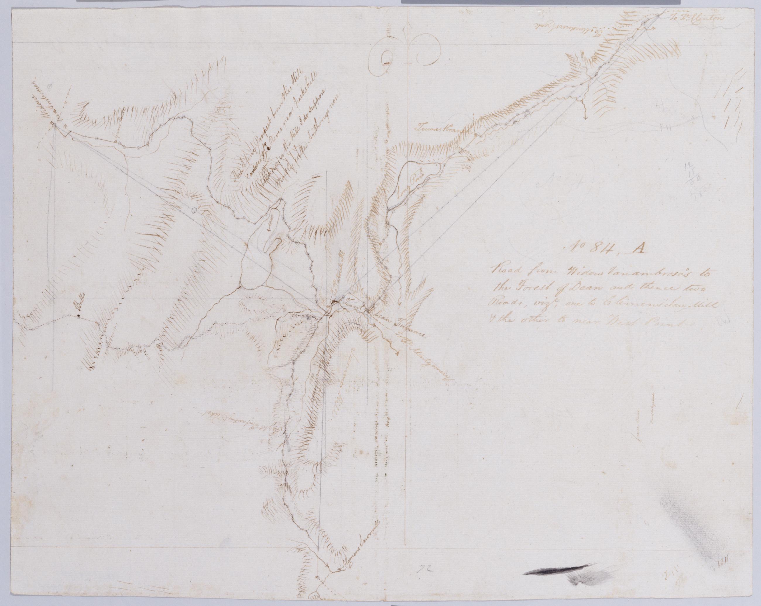
Cartographic Road from Widow Vanambrose's to the Forest of Dean and thence two Roads, vizt, one to Clemens' Saw-Mill + the other to near West Point. No 84, A / by Robert Erskine F.R.S. Geogr. A. U.S. and Assistants. In pencil on recto: "No [8]4". Includes brief text. Military topographic map. Covers the townships of Highland and Woodbury in Orange County, New York. Shows roads, buildings and owners' names, also landforms and streams. Pen-and-ink, pencil on laid paper. Shows relief by hachures. Stained, creased and abraded. Mounted on cloth, bound and cropped, disbound and silked by subsequent owners. Cleaned after removal of backings 1999; some fill remains. Sheathed in mylar. Title proper from recto is the work of a later editor--Simeon DeWitt or his assign--subsequent to 1820. View Item
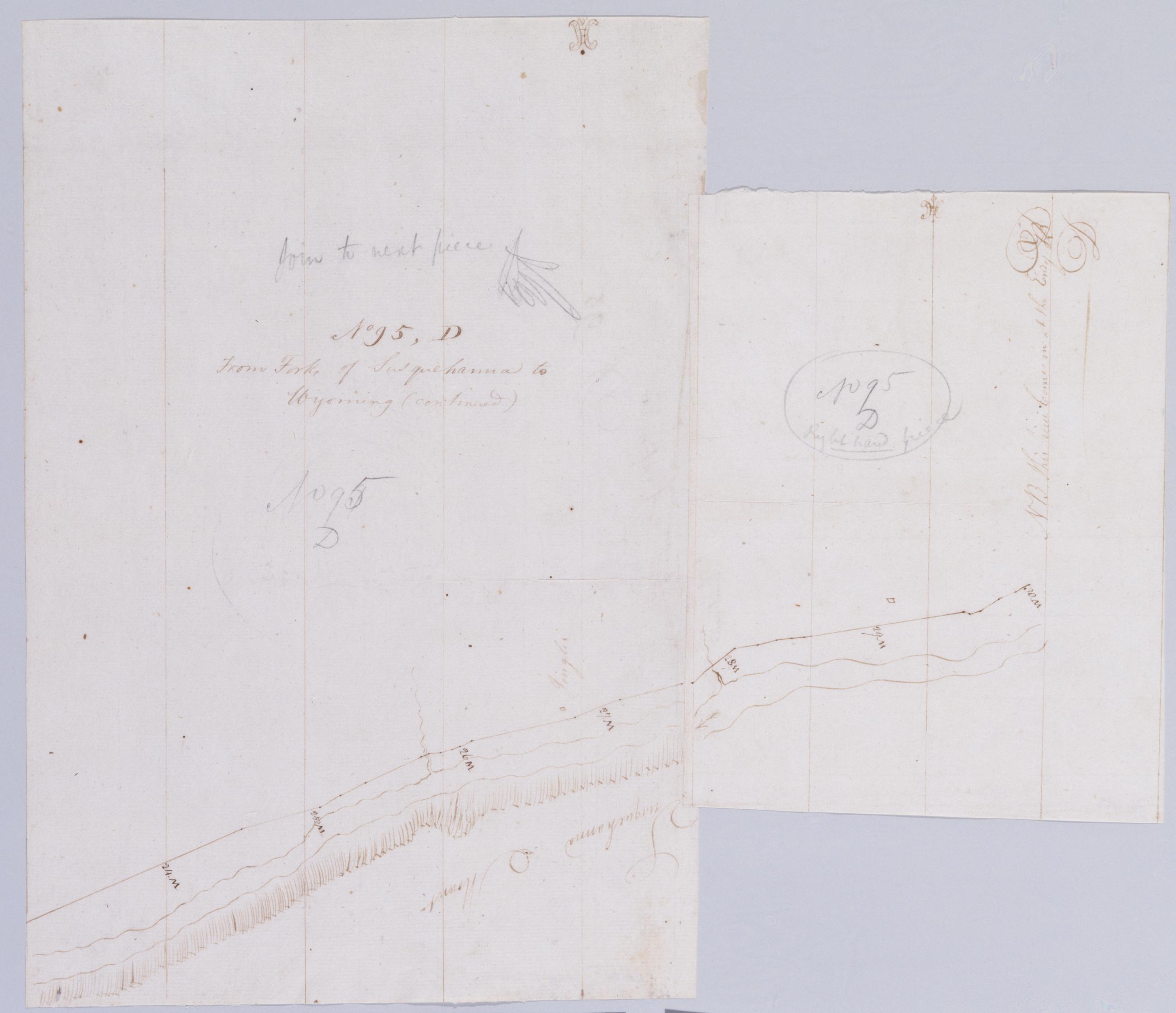
Cartographic From Forks of Susquehanna to Wyoming (continued). No 95, D / by Robert Erskine F.R.S. Geogr. A. U.S. and Assistants. Foxed, creased and abraded. Mounted on cloth, cropped and bound, disbound and silked by subsequent owners. Cleaned after removal of backings 1999; some fill remains. Sheathed in mylar. In ink on verso of second piece: "D. Continued--". In pencil on recto, lefthand piece: "No 95 D" and "Join to next piece." On righthand piece: "No 95 D right hand piece." Military topographic map. Covers part of Columbia County in Pennsylvania. Shows roads running through Almedia and Bloomsburg. Also shows landforms and streams. Pen-and-ink, pencil on laid paper. Shows relief by hachures. View Item
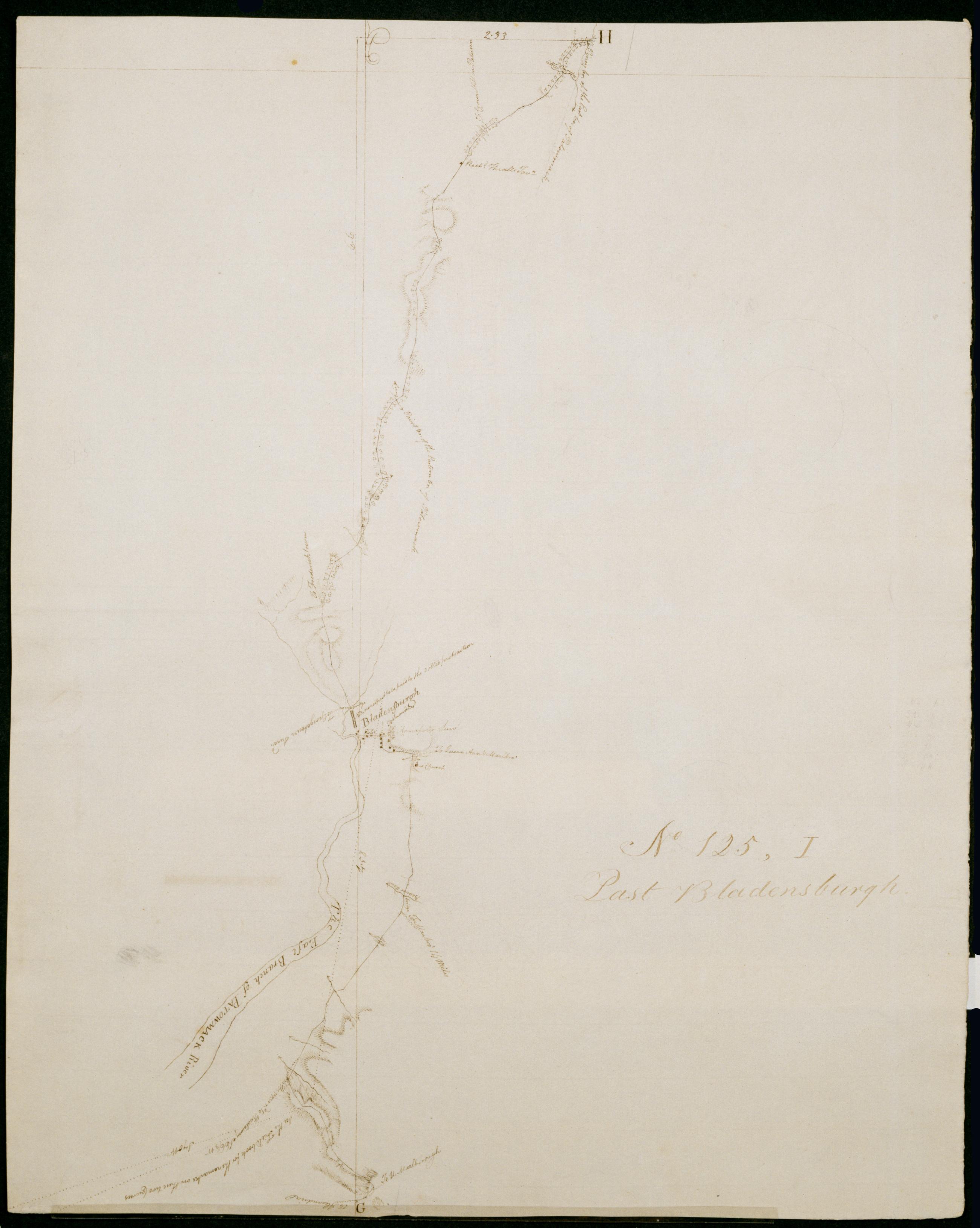
Cartographic Past Bladensburgh. No 125, I / by Robert Erskine F.R.S. Geogr. A. U.S. and Assistants. Date inferred by cataloger. Foxed, soiled and abraded. Mounted on cloth, bound and cropped, disbound and silked by subsequent owners. Cleaned after removal of backings 1999; some fill remains. Sheathed in mylar. Military topographic map. Covers Prince Georges County in Maryland and Washington D.C. Shows roads running through Washington, Bladensburg Md. and College Park Md. Also shows buildings, landforms and streams. Pen-and-ink, pencil on laid paper. Shows relief by hachures. Title proper from recto is the work of a later editor--Simeon DeWitt or his assign--subsequent to 1820. View Item
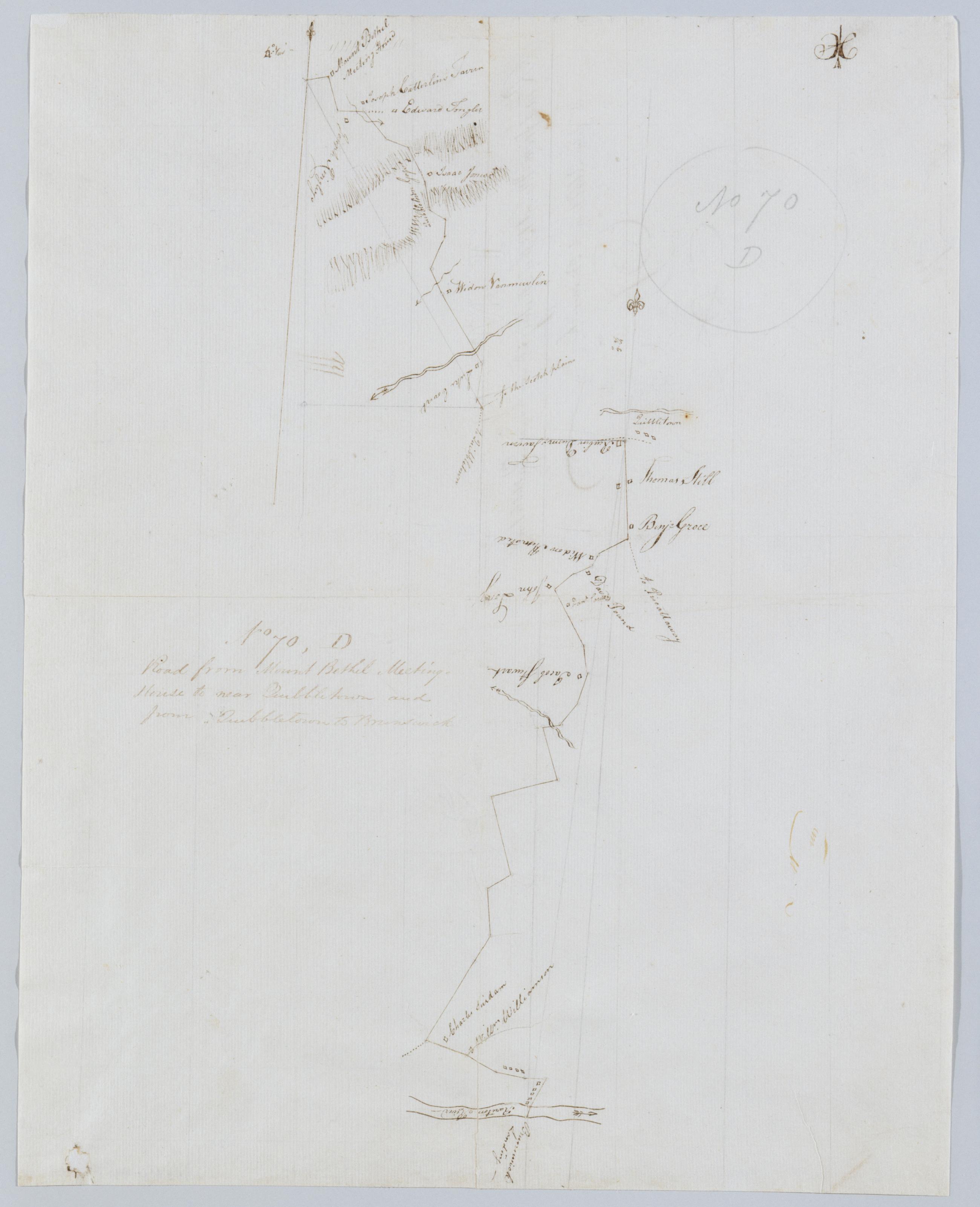
Cartographic Road from Mount Bethel Meeting House to near Quibbletown and from Quibbletown to Brunswick. No 70, D / by Robert Erskine F.R.S. Geogr. A. U.S. and Assistants. Foxed, creased and abraded. Mounted on cloth, bound and cropped, disbound and silked by subsequent owners. Cleaned after removal of backings 1999; some fill remains. Sheathed in mylar. Imperfect: lacking small piece at lower left corner. In pencil on recto: "No 70 D". Military topographic map. Covers the townships of Warren and North Plainfield in Somerset County and of Piscataway in Middlesex County, New Jersey. Shows roads running through Mt. Bethel, Newmarket, Newtown and New Brunswick. Also shows buildings and owners' names, landforms and streams. Pen-and-ink, pencil on laid paper. View Item
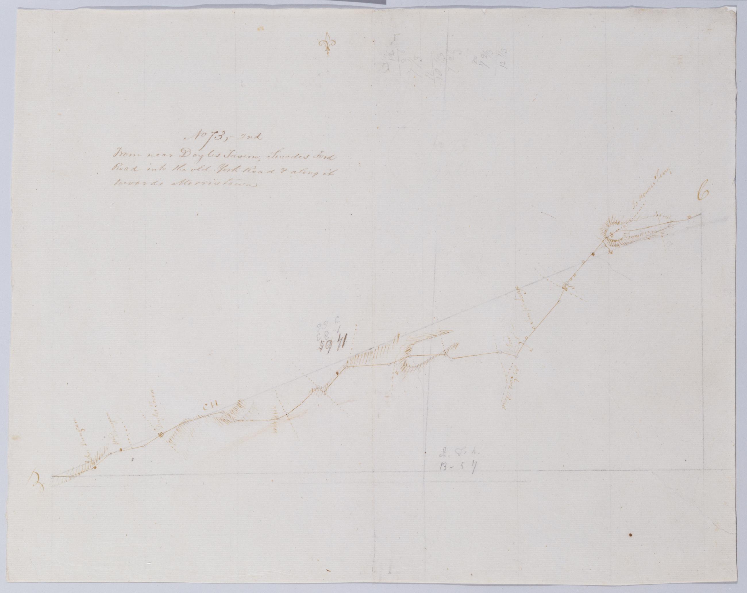
Cartographic From near Doyles Tavern, Swedes Ford Road into the old York Road + along it towards Morristown. No 73, 2nd / by Robert Erskine F.R.S. Geogr. A. U.S. and Assistants. Creased, torn, frayed and abraded. Mounted on cloth, bound and cropped, disbound and silked by subsequent owners. Cleaned after removal of backings 1999; some fill remains. Sheathed in mylar. Military topographic map. Covers Bucks County, Pennsylvania. Shows roads running through Doylestown, Buckingham and Lahaska. Also shows buildings and owners' names, landforms and streams. Pen-and-ink, pencil on laid paper. Shows relief by hachures. Title proper from recto is the work of a later editor--Simeon DeWitt or his assign--subsequent to 1820. View Item