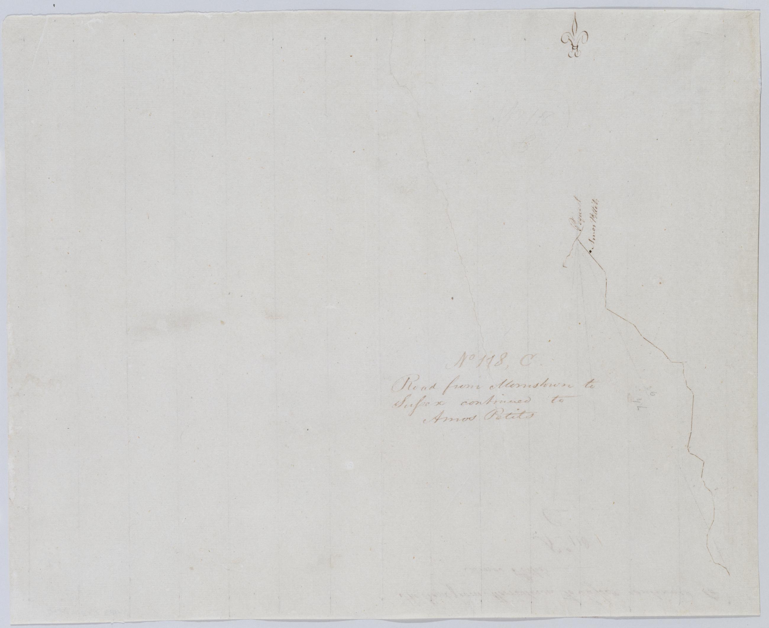
Cartographic Road from Morristown to Sussex continued to Amos Petits. No 118, C / by J Armstrong ; by Robert Erskine F.R.S. Geogr. A. U.S. and Assistants. In erased pencil on recto: "No 118 C". Military topographic map. Covers the townships of Byram and Green in Sussex County, New Jersey. Shows roads running through Whitehall and Brighton. Also shows buildings and owners' names, and streams. Pen-and-ink, pencil on laid paper. Soiled, creased and abraded. Mounted on cloth, bound and cropped, disbound and silked by subsequent owners. Cleaned after removal of backings 1999; some fill remains. Sheathed in mylar. Title proper from recto is the work of a later editor--Simeon DeWitt or his assign--subsequent to 1820. View Item
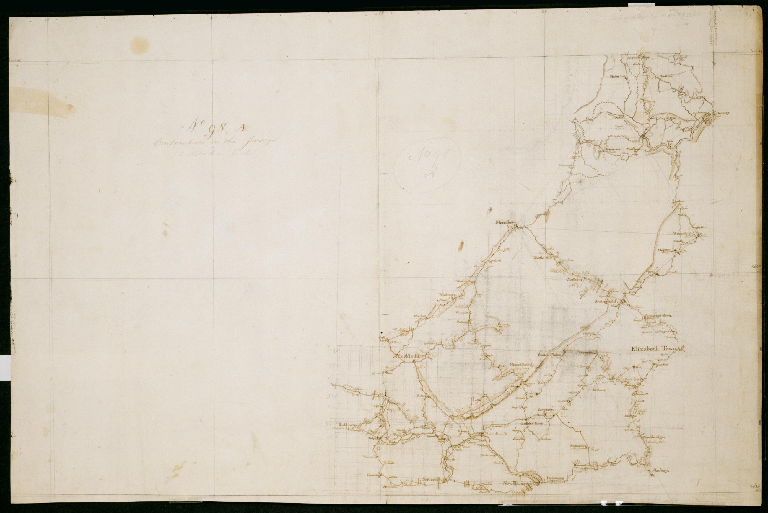
Cartographic Contraction in the Jerseys. No 98, A / Large Paper by Capt. Scull ; by Robert Erskine F.R.S. Geogr. A. U.S. and Assistants. In ink on verso: " No. 98 A A". In pencil on recto: "No 98 A". Military topographic map. Covers parts of Bergen, Essex, Hunterdon, Middlesex, Morris, Passaic, Somerset and Union counties in New Jersey. Also shows buildings and owners' names, landforms and streams. Pen-and-ink, pencil on laid paper. Shows relief by hachures. Stained, soiled, creased, frayed and abraded. Mounted on cloth, bound and cropped, disbound and silked by subsequent owners. Cleaned after removal of backings 1999; some fill remains. Sheathed in mylar. View Item
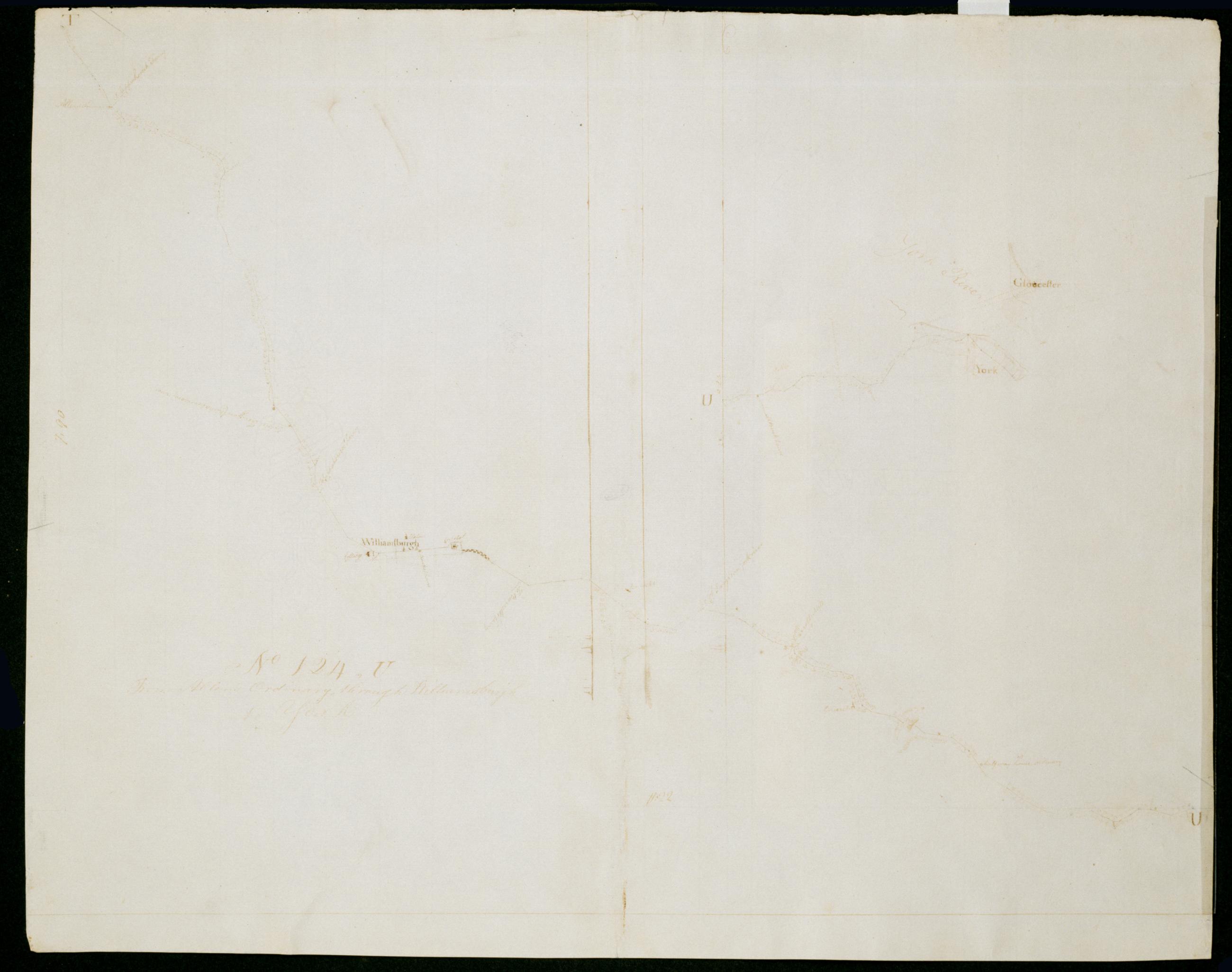
Cartographic From Allen's Ordinary through Williamsburgh to York. No 124, U / by Robert Erskine F.R.S. Geogr. A. U.S. and Assistants. Date 1781 inferred by cataloger. Foxed, soiled, creased and abraded. Mounted on cloth, bound and cropped, disbound and silked by subsequent owners. Cleaned after removal of backings 1999; some fill remains. Sheathed in mylar. Military topographic map. Covers the counties of James City and York, also Williamsburg City in Virginia. Shows roads running through Lightfoot, Williamsburg, Charles Corner, Sawmill Corner, Blacksmith Corner and Yorktown. Also shows buildings, landforms and streams. Pen-and-ink, pencil on laid paper. Shows relief by hachures. View Item
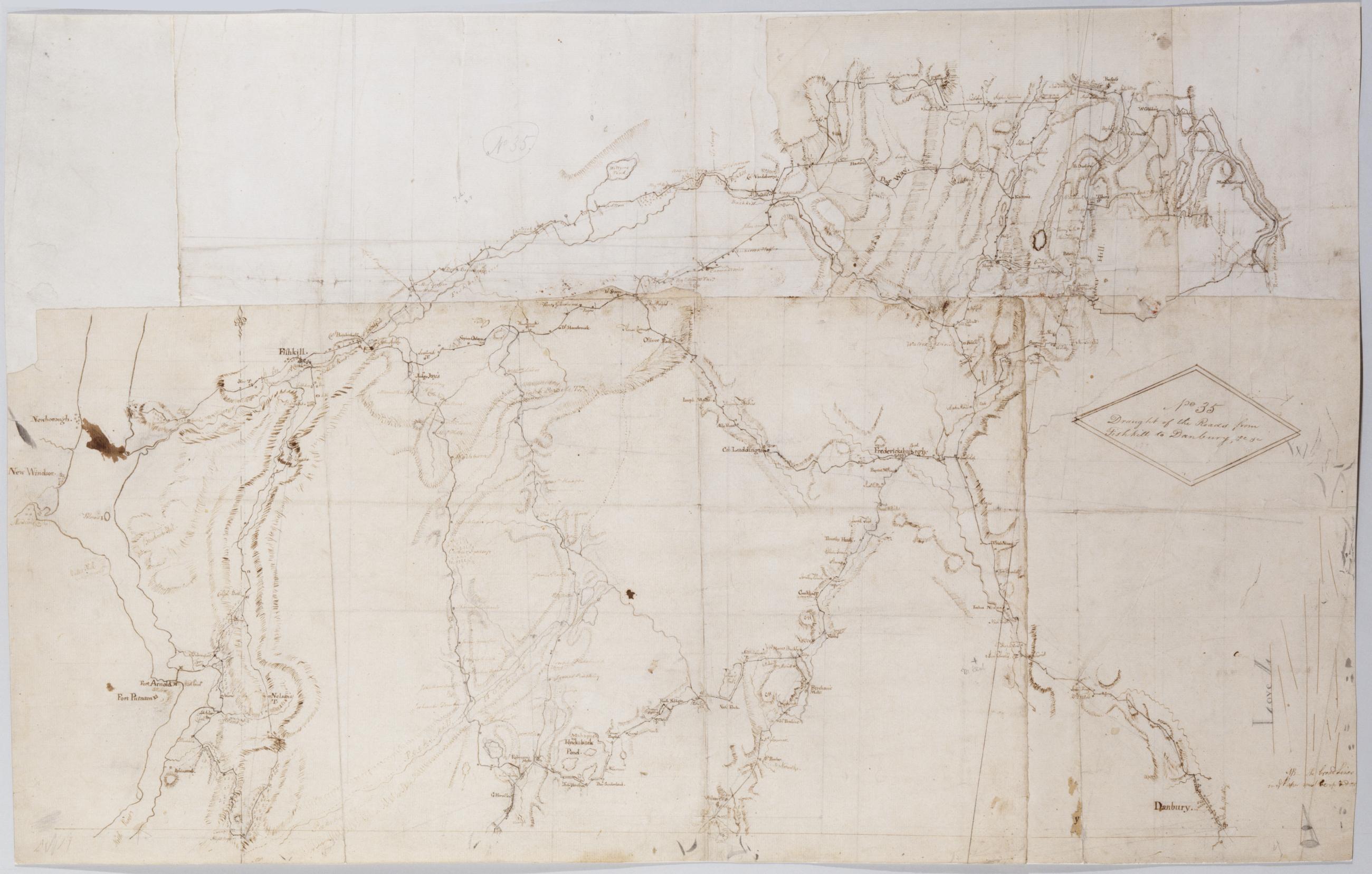
Cartographic Draught of the Roads from Fishkill to Danbury &c. &c. No 35 / by Robert Erskine F.R.S. Geogr. A. U.S. and Assistants. In pencil on recto: "No 35," "Love L". Military topographic map. Covers an area between the Hudson and Houstonic Rivers; i.e., most of Putnam and Dutchess Counties in New York, northern Fairfield County and part of Litchfield County in Connecticut. Shows roads, buildings and owners' names, also landforms and streams. Pen-and-ink, pencil on five pieces laid paper, assembled. Sixth piece at upper left has wove finish. Shows relief by hachures. Title proper from recto is the work of a later editor--Simeon DeWitt or his assign--subsequent to 1820. View Item
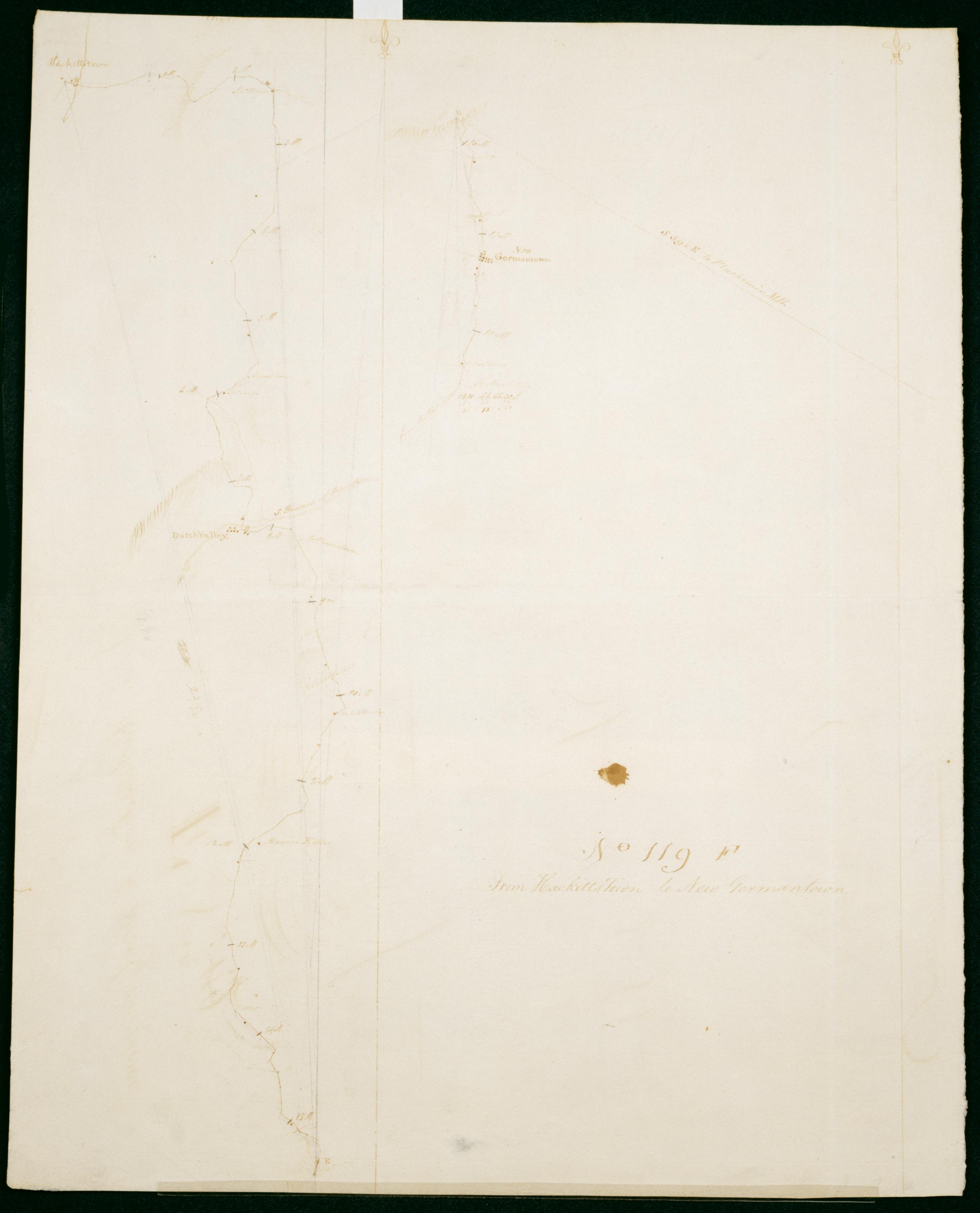
Cartographic From Hacketts Town to New Germantown. No 119, F / S De Witt Geographer to the Army of the United States ; by Robert Erskine F.R.S. Geogr. A. U.S. and Assistants. First statement of responsibility and detailed date from verso text: "Finis Jany 20th 1781 S De Witt Geographer to the Army of the United States". In erased pencil on recto: "No 119 F". Military topographic map. Covers the townships of Washington in Morris County and of Tewksbury in Hunterdon County, New Jersey. Shows roads running through Hackettstown, Drakestown, German Valley, Parker, Fairmont and New Germantown. Also shows buildings and owners' names, landforms and streams. Pen-and-ink, pencil on laid paper. Shows relief by hachures. Stained, soiled , creased and abraded. View Item
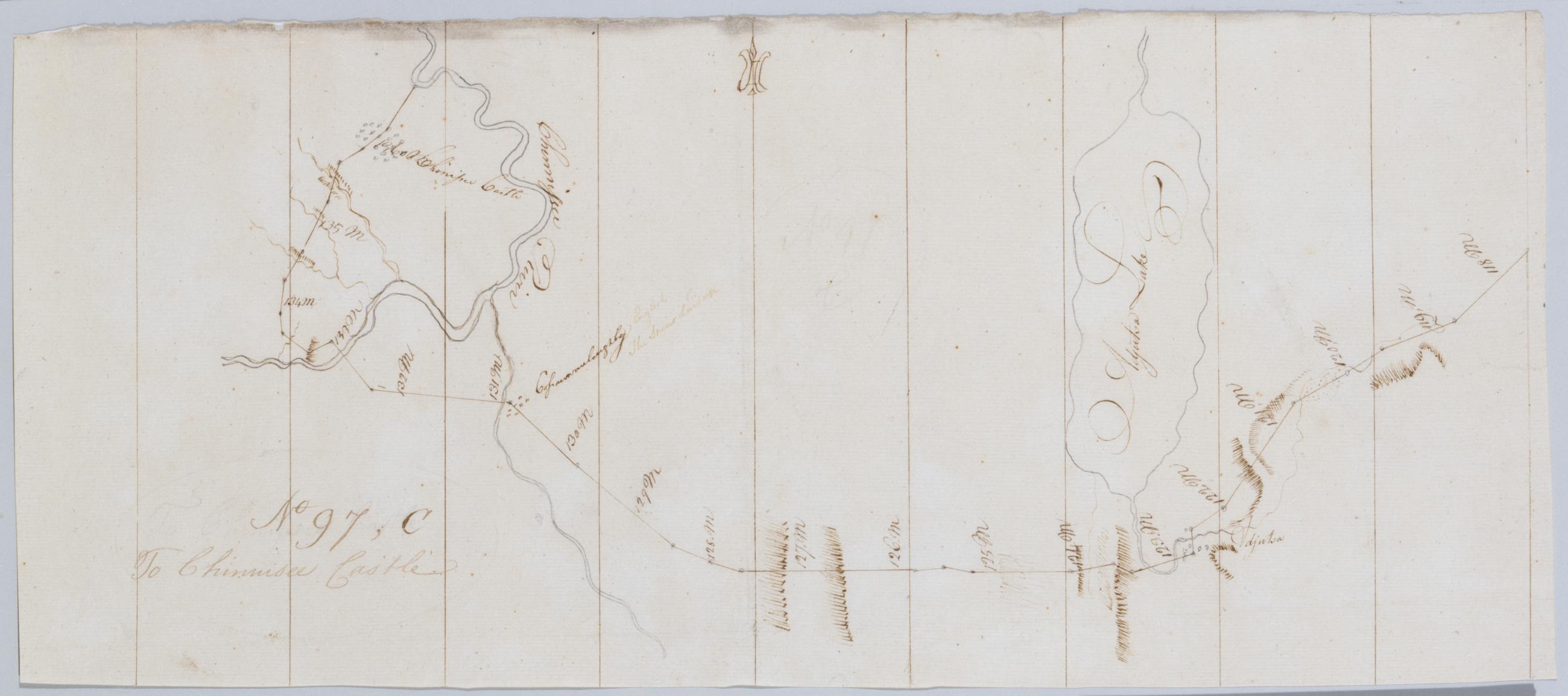
Cartographic To Chinnisee castle. No 97, C / by Robert Erskine F.R.S. Geogr. A. U.S. and Assistants. In erased pencil on recto, "No 97 C". Military topographic map. Covers the towns of Livonia in Livingston County and of Conesus, Groveland and Leicester in Ontario County, New York. Shows roads running through Cemetery Hill, Foots Corners and Mount Morris. Also shows landforms and streams. Adjusta Lake is now called Consesus Lake. Pen-and-ink, pencil on laid paper. Shows relief by hachures. Stained, creased and abraded. Mounted on cloth, cropped, bound, disbound and silked by subsequent owners. Cleaned after removal of backings 1999; some fill remains. Sheathed in mylar. View Item
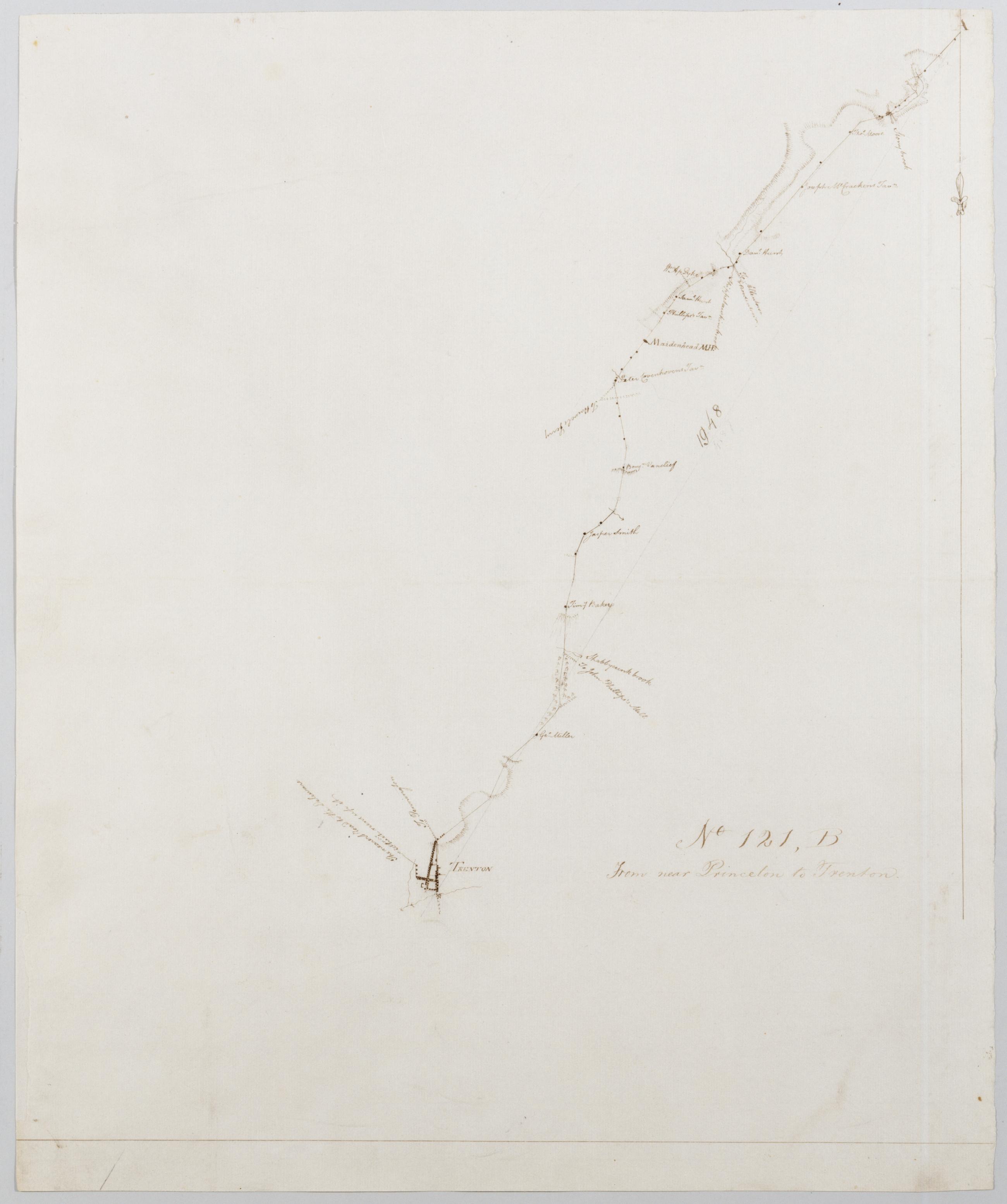
Cartographic From near Princeton to Trenton. No 121, B / by Robert Erskine F.R.S. Geogr. A. U.S. and Assistants. Military topographic map. Covers the township of Lawrence in Mercer County, New Jersey. Shows roads running through Princeton, Lawrenceville and Trenton. Also shows buildings and owners' names, landforms and streams. Pen-and-ink, pencil on laid paper. Shows relief by hachures. Soiled, creased and abraded. Mounted on cloth, bound and cropped, disbound and silked by subsequent owners. Cleaned after removal of backings 1999; some fill remains. Sheathed in mylar. Title proper from recto is the work of a later editor--Simeon DeWitt or his assign--subsequent to 1820. View Item
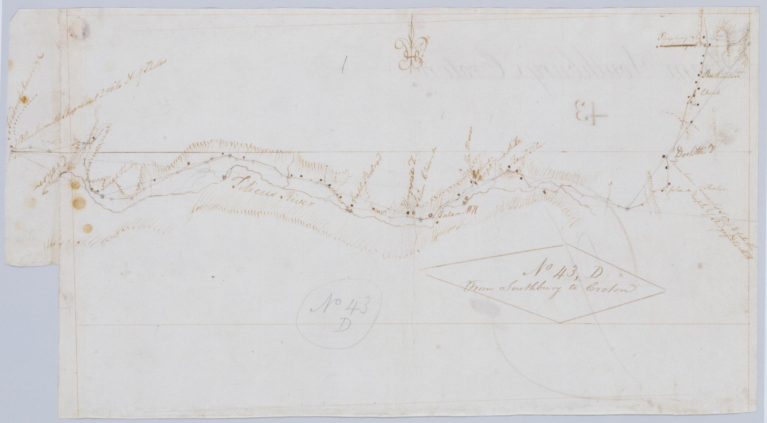
Cartographic From Southbury to Croton. No 43, D / by Robert Erskine F.R.S. Geogr. A. U.S. and Assistants. Foxed, creased, frayed, and abraded. Mounted on cloth, bound and cropped, disbound and silked by subsequent owners. Cleaned after removal of backings 1999; some fill remains. Sheathed in mylar. In pencil on recto: "No 43 D". Military topographic map. Covers the townships of North Salem and Somers in Westchester County, New York, and of Ridgefield in Fairfield County, Connecticut. Shows roads running through Ridgebury, North Salem, Salem Center, Purdy and Somers. Also shows buildings and owners' names, landforms and streams. Pen-and-ink, pencil on laid paper. Shows relief by hachures. View Item
Cartographic From Bethlehem to Broad Axe. No 58 / by Robert Erskine F.R.S. Geogr. A. U.S. and Assistants. In ink on verso: "No 58" (partly damaged by cropping). In pencil on recto: "58". Military topographic map. Covers Northhampton, Bucks and Montgomery counties, Pennsylvania. Shows roads running through Bethlehem, Hellertown, Pleasant Valley, Strawntown, Keelersville, Hagersville, Doyles Corner, Trewigtown, Montgomeryville, Spring House, Ambler and Fort Washington. Also shows buildings and owners' names, landforms and streams. Pen-and-ink, pencil on laid paper. Shows relief by hachures. Stained, foxed and abraded. Mounted on cloth, bound and cropped, disbound and silked by subsequent owners. View Item
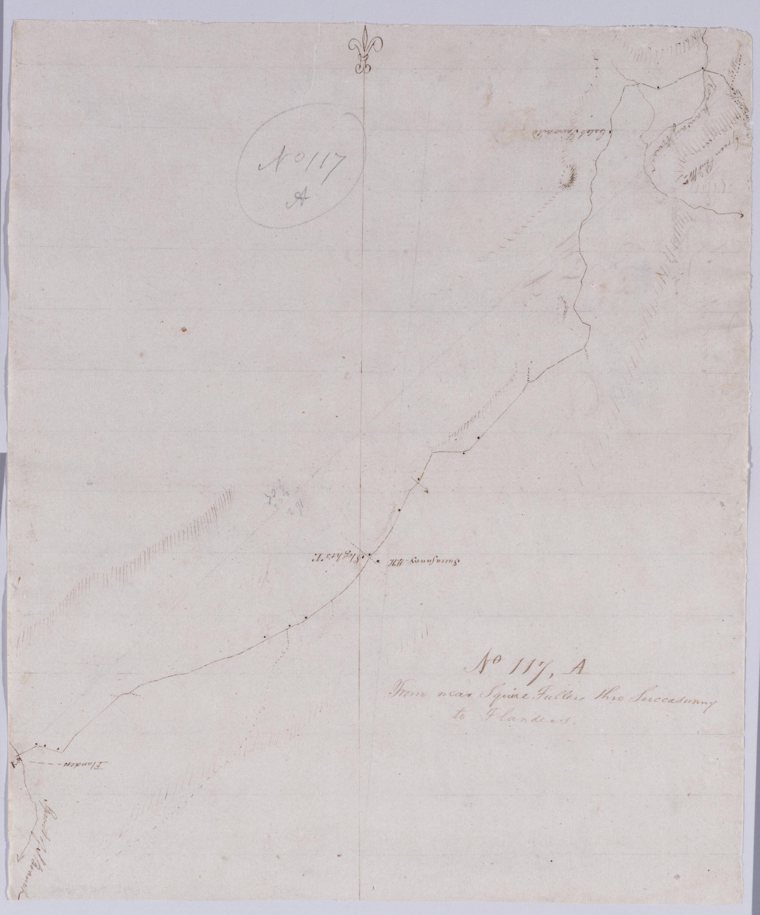
Cartographic From near Squire Fullers thro Succasunny to Flanders. No 117, A / by Robert Erskine F.R.S. Geogr. A. U.S. and Assistants. Drawing attributed to Simeon DeWitt, based on verso text between title and number, "D R Simeon D." In pencil on recto: "No 117 A". Military topographic map. Covers the townships of Mount Olive, Roxbury and Jefferson in Morris County, New Jersey. Shows roads running through Flanders, Succasunna, Kenvil and Berkshire Valley. Also shows buildings and owners' names, landforms and streams. Pen-and-ink, pencil on laid paper. Shows relief by hachures. Soiled, creased and abraded. Mounted on cloth, bound and cropped, disbound and silked by subsequent owners. View Item
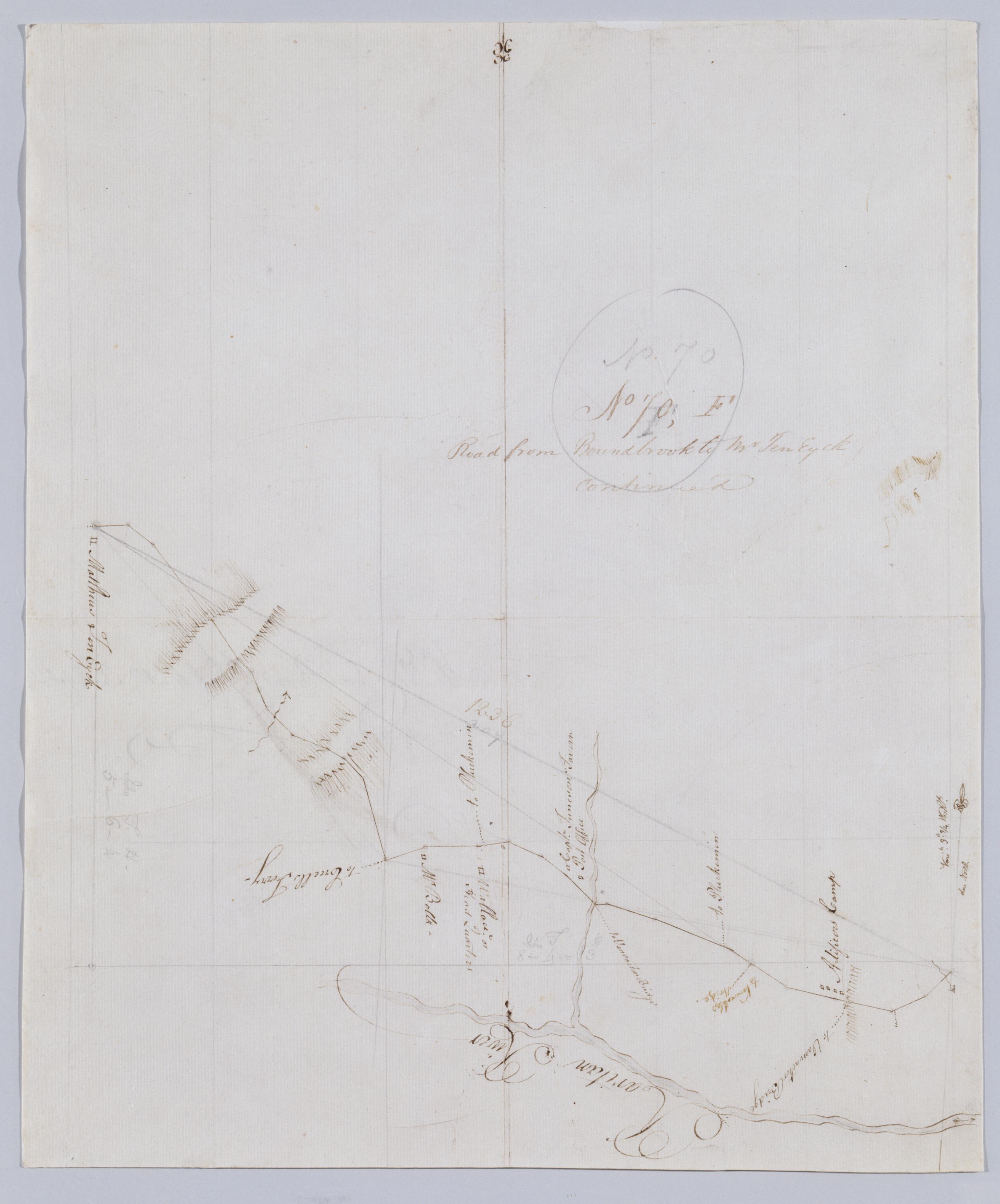
Cartographic Road from Boundbrook to Mr Ten Eyck continued. No 70, F / by Robert Erskine F.R.S. Geogr. A. U.S. and Assistants. In pencil on recto: "No 70 F". Military topographic map. Covers the township of Bridgewater in Somerset County, New Jersey. Shows roads running through Somerville. Also shows buildings and owners' names, landforms and streams. Pen-and-ink, pencil on laid paper. Scale distorted in parts; varies between ca. 1:30,000 and ca. 1:40,000. Shows relief by hachures. Stained, foxed, torn, creased and abraded. Mounted on cloth, bound and cropped, disbound and silked by subsequent owners. Cleaned after removal of backings 1999; some fill remains. Sheathed in mylar. View Item
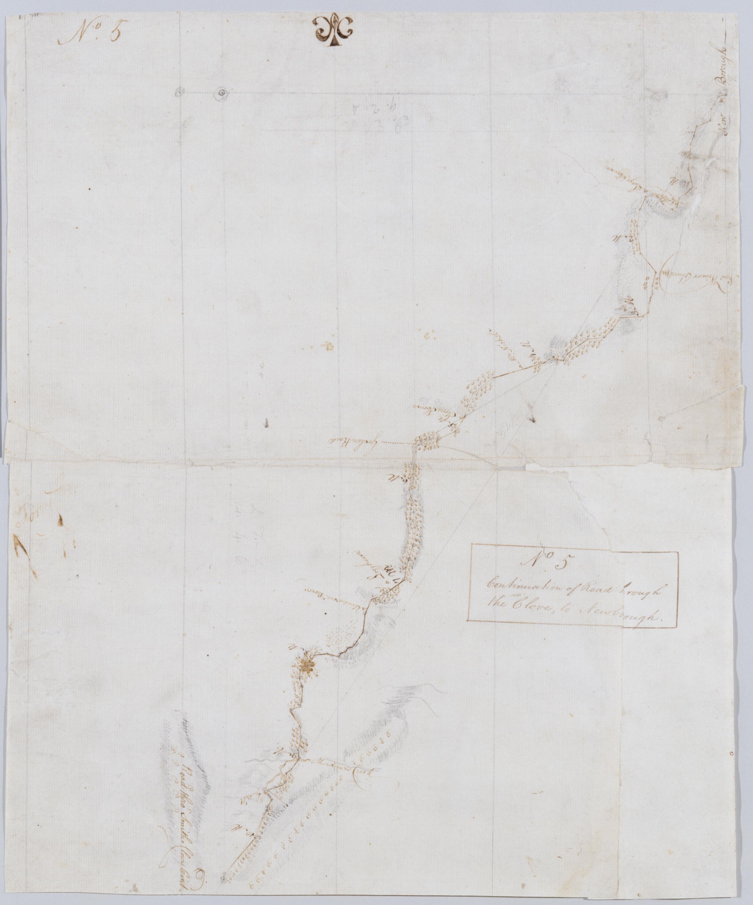
Cartographic Continuation of Road [t]hrough the Clove, to Newbo[r]ough No 5 / by Robert Erskine F.R.S. Geogr. A. U.S. and Assistants. In ink on both recto and verso: "No. 5". Military topographic map. Covers an area in the towns of New Windsor and Cornwall, Orange County, New York; "Murderers Creek" is now called Moodna Creek. Shows roads running through Newburg, New Windsor, Vailsgate, Idlewild and Houghton Farm. Also shows buildings and owners' names, landforms and streams. Pen-and-ink, pencil on laid paper. Lower corner uses paper of a different origin. Shows relief by hachures. Title proper from recto is the work of a later editor--Simeon DeWitt or his assign--subsequent to 1820. View Item
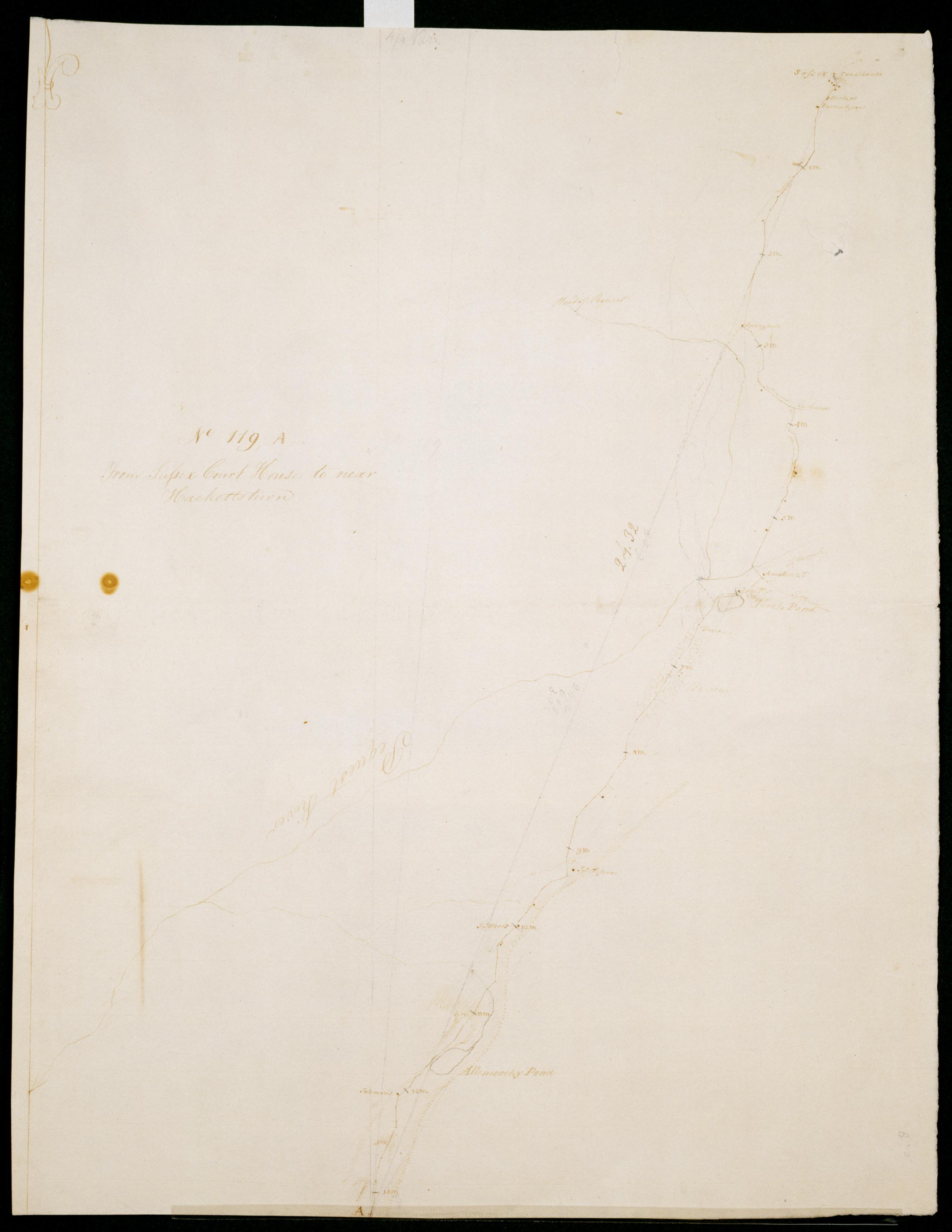
Cartographic From Sussex Court House to near Hackettstown. No 119, A / S DeWitt Geographer to the Army of the United States ; by Robert Erskine F.R.S. Geogr. A. U.S. and Assistants. Date of 1780 or 1781 based on verso text to sheet 119,F of series. First statement of responsibility from verso text on sheet 119,F of series. In erased pencil on recto: "No 119 A". Military topographic map. Covers the townships of Newton, Andover and Green in Sussex County and of Allamuchy in Warren County, New Jersey. Shows roads running through Newton, Brighton, Huntsville, Tranquillity and Warrenville. Also shows buildings and owners' names, landforms and streams. Pen-and-ink, pencil on laid paper. Shows relief by hachures. Stained, soiled , creased and abraded. View Item
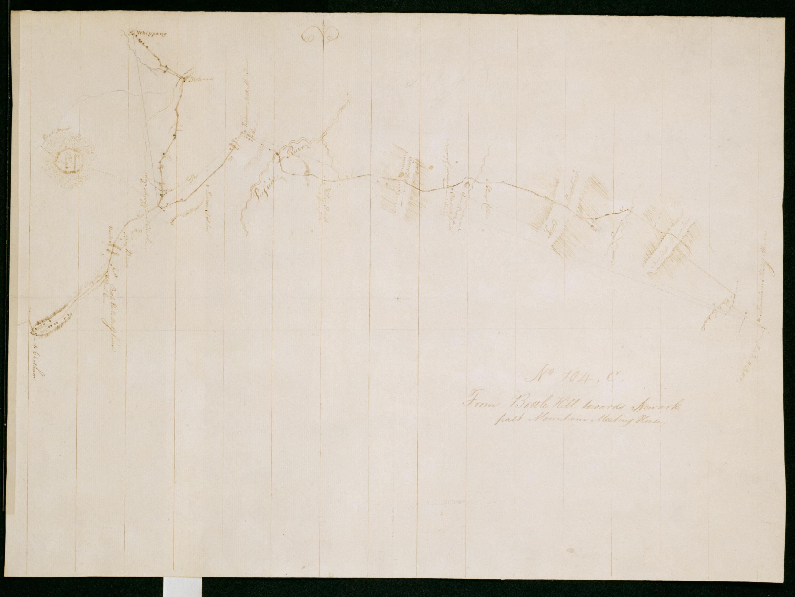
Cartographic From Bottle Hill towards Newark past Mountain Meeting House. No 104, C / by Robert Erskine F.R.S. Geogr. A. U.S. and Assistants. Creased and abraded. Mounted on cloth, bound and cropped, disbound and silked by subsequent owners. Cleaned after removal of backings 1999; some fill remains. Sheathed in mylar. In erased pencil on recto: "No 104 C". Military topographic map. Covers the townships of Livingston, West Orange, South Orange and East Orange in Essex County, New Jersey. Shows roads running through Whippany, Florham Park, Madison, Hanover and Livingston. Also shows buildings and owners' names, landforms and streams. Pen-and-ink, pencil on laid paper. Shows relief by hachures. View Item
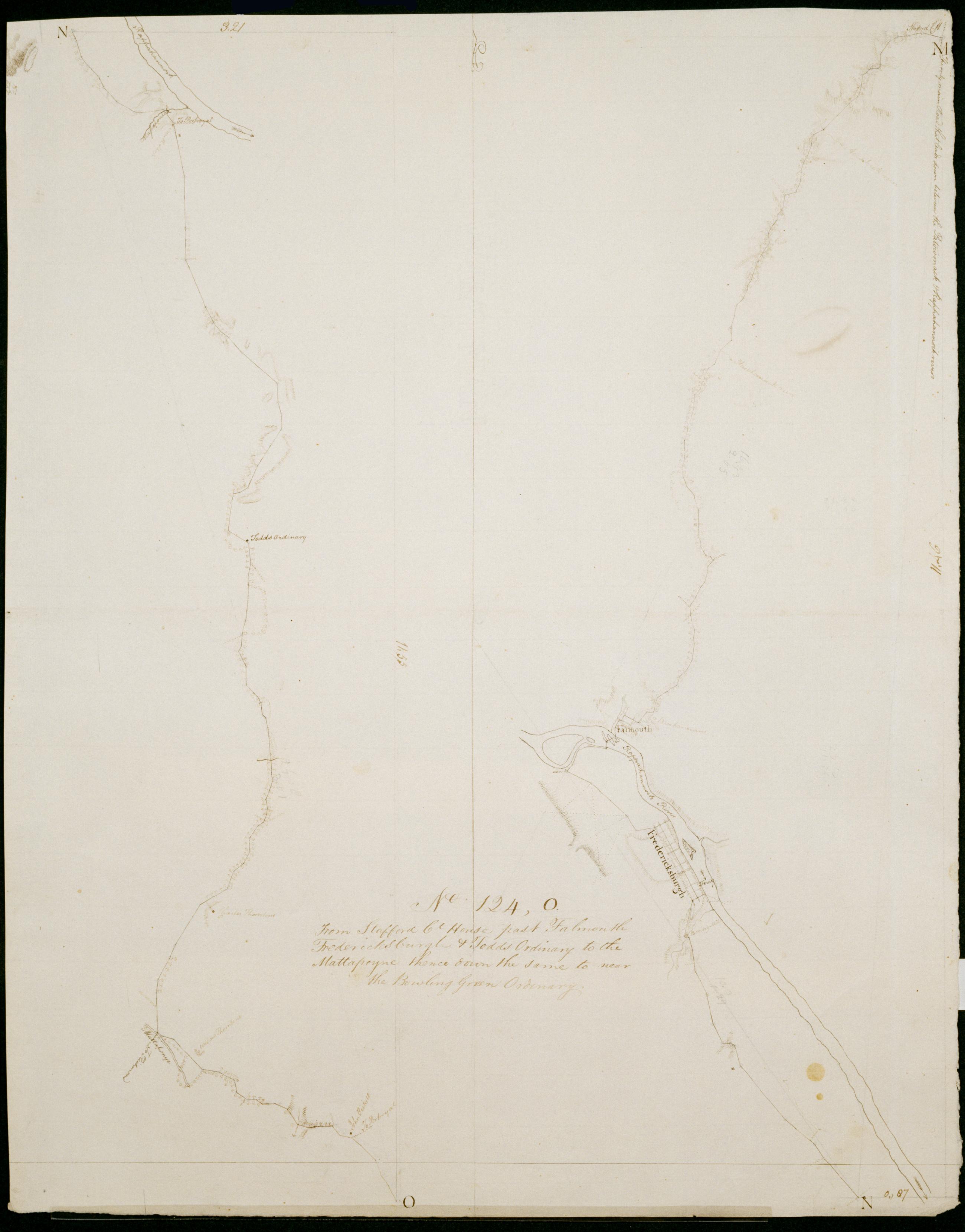
Cartographic From Stafford Ct House past Falmouth Fredericksburgh + Todds Oridnary to the Mattapoyne thence down the same to near the Bowling Green Ordinary. No 124, O / by Robert Erskine F.R.S. Geogr. A. U.S. and Assistants. Date 1781 inferred by cataloger. Military topographic map; right segment is north of the left one. Covers the counties of Stafford, Spotsylvania and Caroline in Virginia. Shows roads running through Stafford, Cranes Corner, Falmouth, Fredericksburg, New Post, Corbin, Villboro, Woodford and Farmers. Also shows buildings, landforms and streams. Pen-and-ink, pencil on laid paper. Shows relief by hachures. Stained, soiled, creased and abraded. Mounted on cloth, bound and cropped, disbound and silked by subsequent owners. Cleaned after removal of backings 1999; some fill remains. View Item
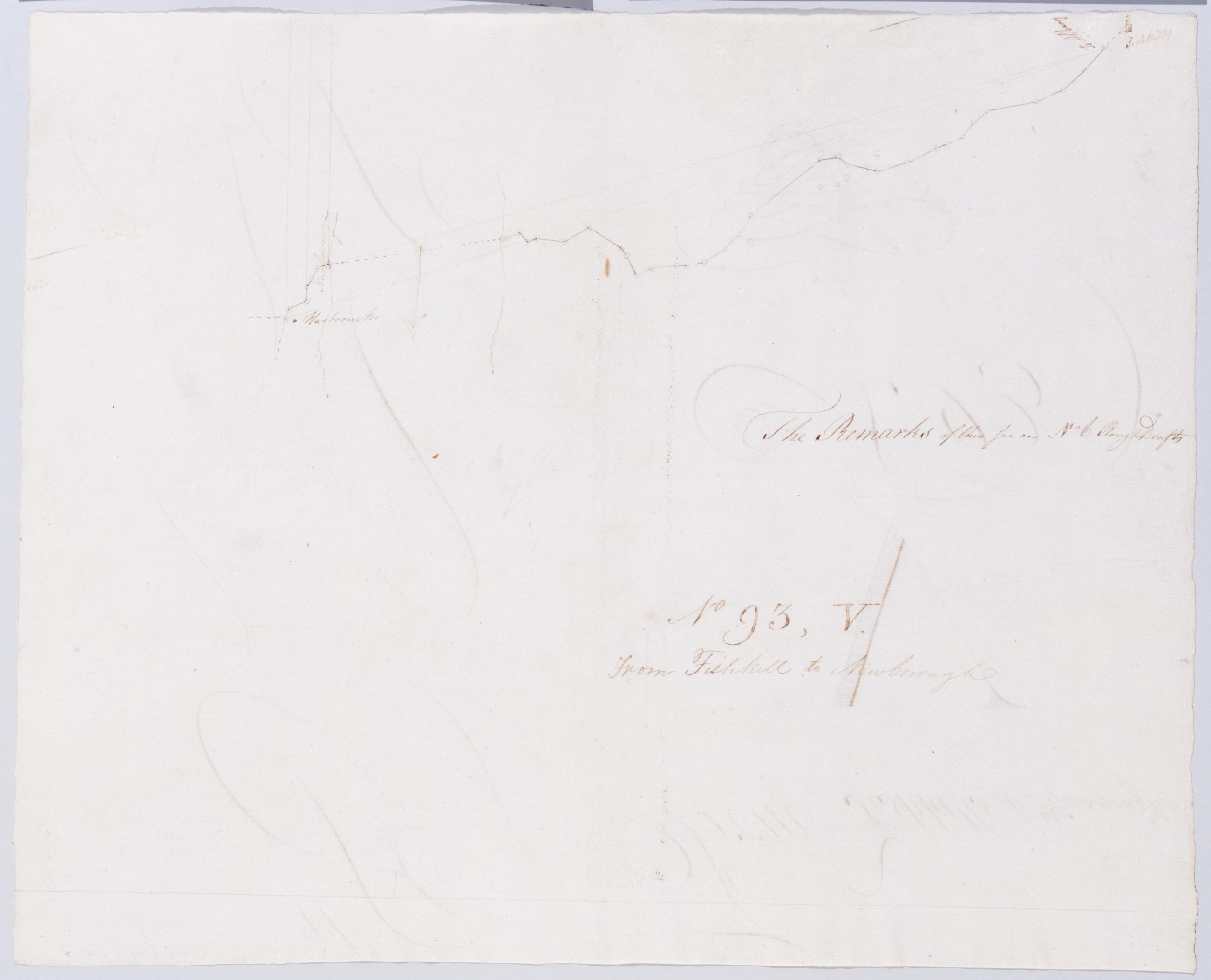
Cartographic From Fishkill to Newborough. No 93, V / by Robert Erskine F.R.S. Geogr. A. U.S. and Assistants. In ink on verso: lots of squiggles. In pencil on recto: "No 93 V". Includes text: "The Remarks of this See on No 6 Rough Drafts". Military topographic map. Covers the township of Fishkill in Dutchess County, New York. Shows roads running through Fishkill Village, Glenham, Groveville and Fishkill. Also shows buildings and owners' names, landforms and streams. Pen-and-ink, pencil on laid paper. Shows relief by hachures. Stained, creased and abraded. Mounted on cloth, bound, disbound and silked by subsequent owners. Cleaned after removal of backings 1999; some fill remains. Sheathed in mylar. View Item
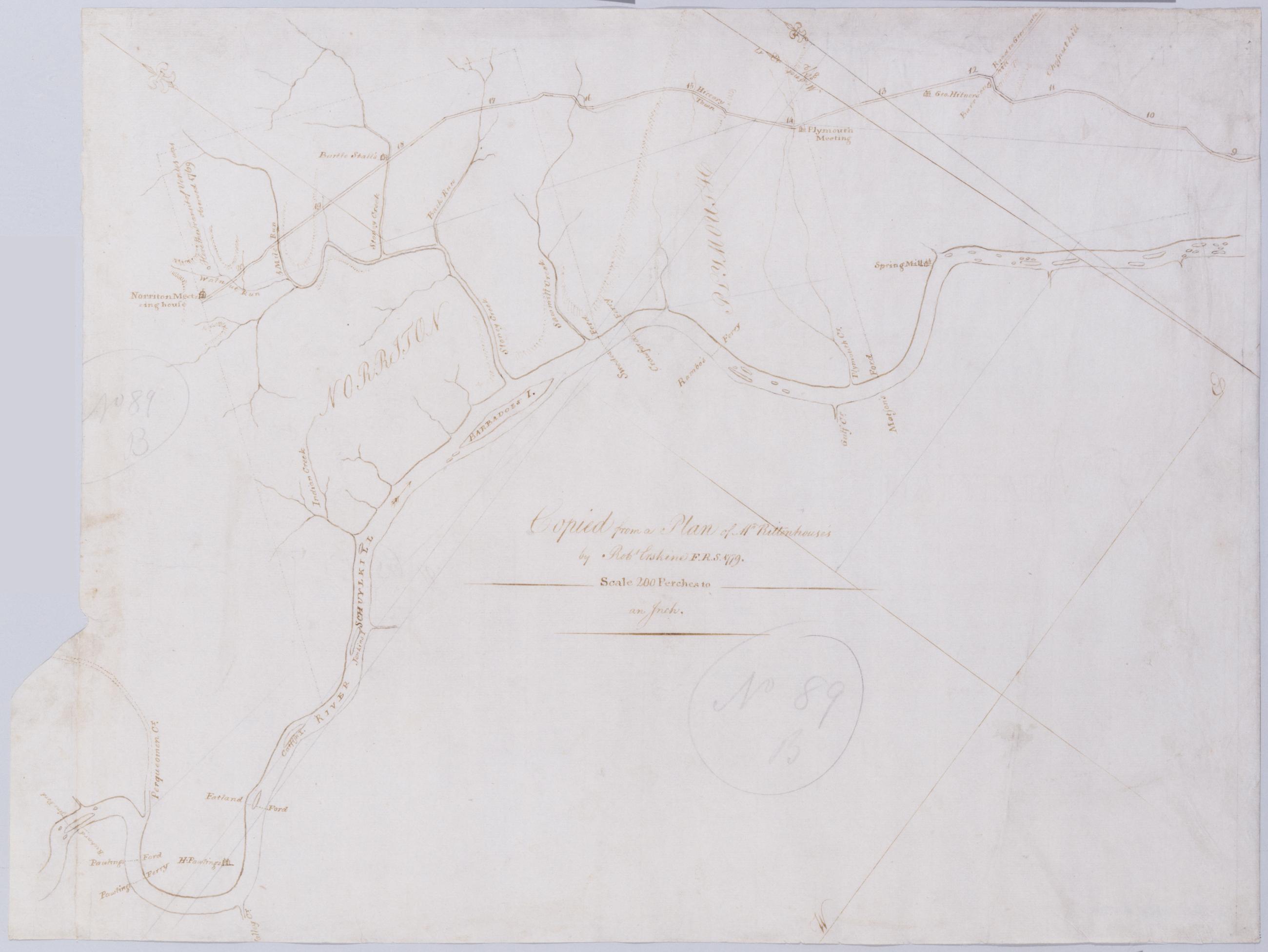
Cartographic [A Contraction of Do.] No. 89 B. / Copied from a Plan of Mr Rittenhouse's by Robt Erskine F.R.S. 1779 ; by Robert Erskine F.R.S. Geogr. A. U.S. and Assistants. Foxed, soiled, frayed. Sheathed in mylar. In ink on verso: "No. 89 B." In pencil on recto: "No 89 B". Military topographic map. Covers the counties of Chester, Montgomery and Delaware, Pennsylvania. Shows roads running through Norristown and Philadelphia. Also shows buildings and owners' names, landforms and streams. No title on recto or verso; title proper supplied by cataloger. Title number from map verso. First statement of responsibility from map recto. View Item
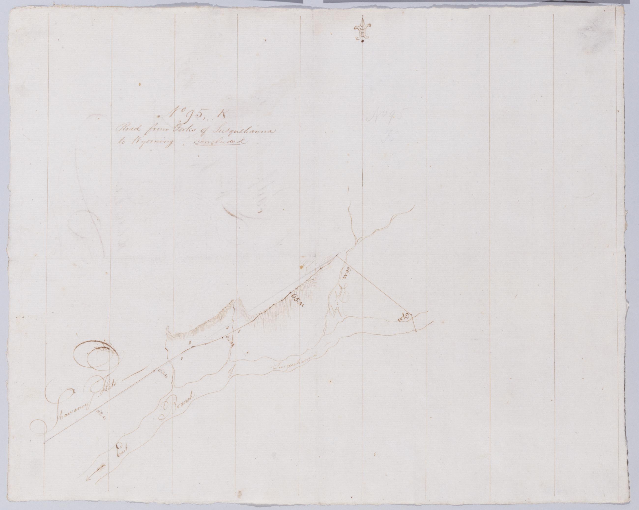
Cartographic Road from Forks of Susquehanna to Wyoming, concluded. No 95, K / by Robert Erskine F.R.S. Geogr. A. U.S. and Assistants. Also in ink on verso: "the last sheet". In pencil on recto, "No 95 K". Military topographic map. Covers part of Luzerne County in Pennsylvania. Shows roads running through Wilkes Barre and Plymouth. Also shows landforms and streams. Pen-and-ink, pencil on laid paper. Shows relief by hachures. Soiled, foxed, creased and abraded. Mounted on cloth, bound, disbound and silked by subsequent owners. Cleaned after removal of backings 1999; some fill remains. Sheathed in mylar. Title proper from recto is the work of a later editor--Simeon DeWitt or his assign--subsequent to 1820. View Item
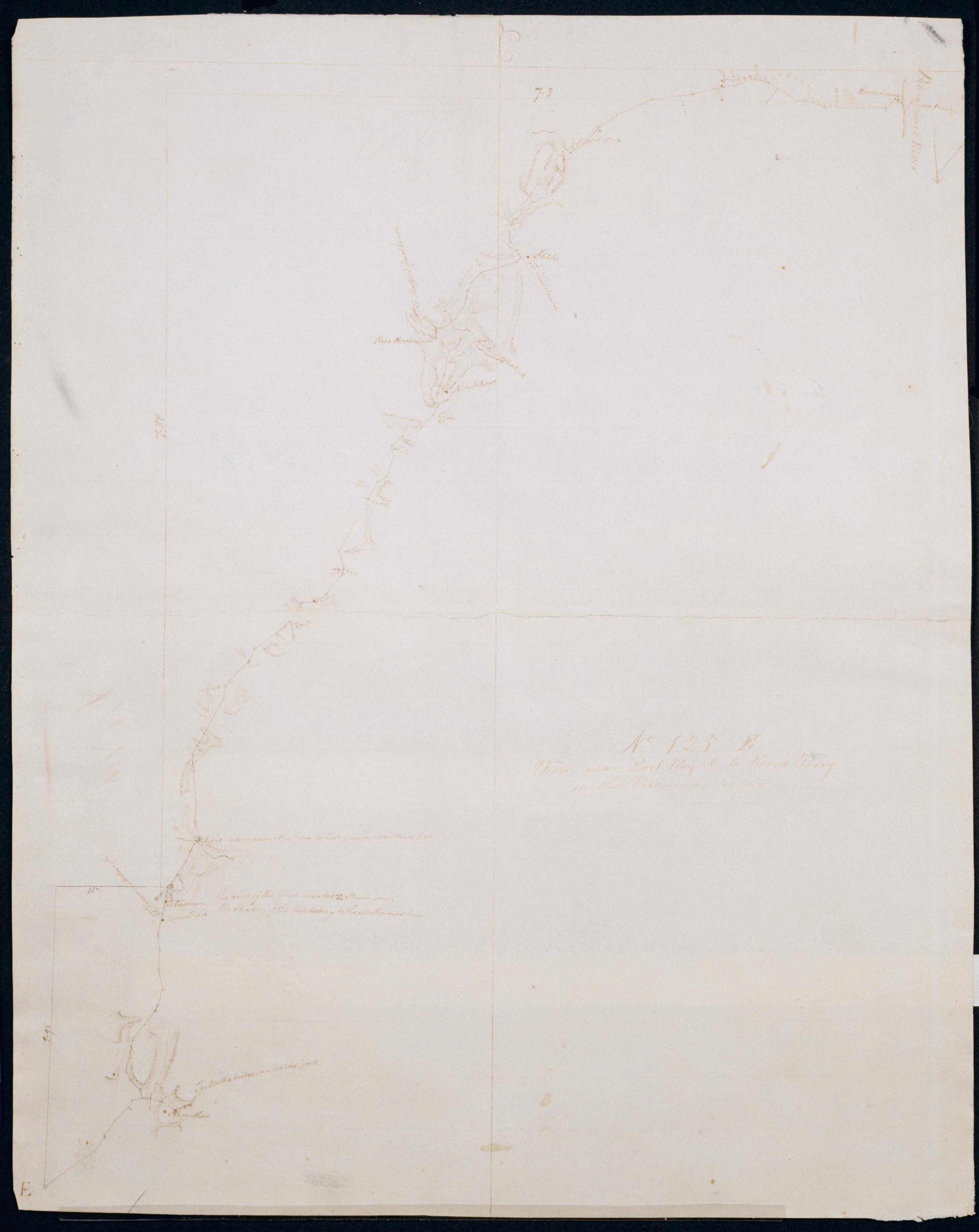
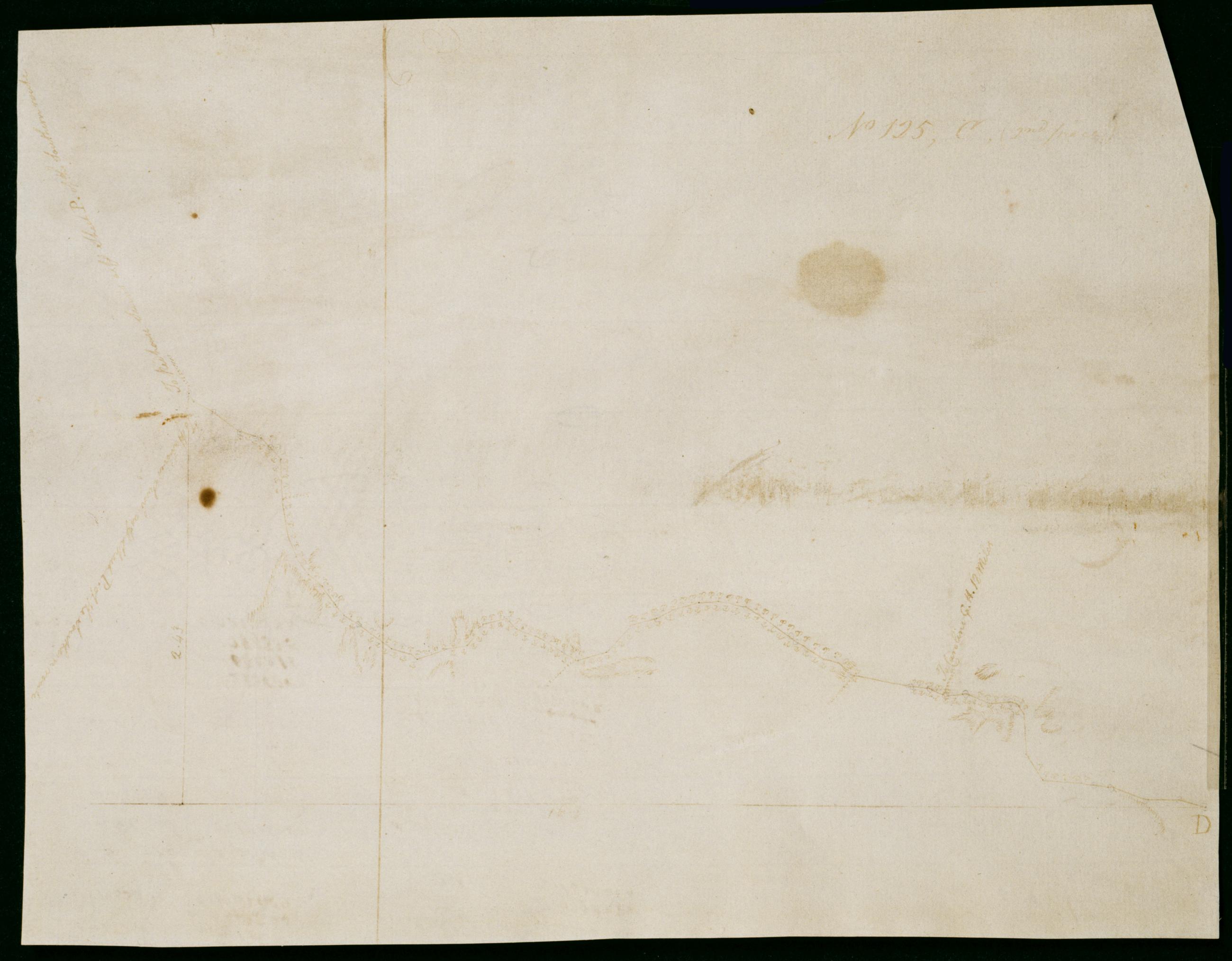
Cartographic From near Port Royal to Hooes Ferry on the Potowmac River. No 125, E / by Robert Erskine F.R.S. Geogr. A. U.S. and Assistants. Date inferred by cataloger. Foxed, soiled, creased and abraded. Mounted on cloth, bound and cropped, disbound and silked by subsequent owners. Cleaned after removal of backings 1999; some fill remains. Sheathed in mylar. Military topographic map. Covers King George County in Virginia. Shows roads running through Nocam, Office Hall, Edgehill, Owens and Hooes. Also shows buildings, landforms and streams. Pen-and-ink, pencil on laid paper. Shows relief by hachures. Title proper from recto is the work of a later editor--Simeon DeWitt or his assign--subsequent to 1820. View Item
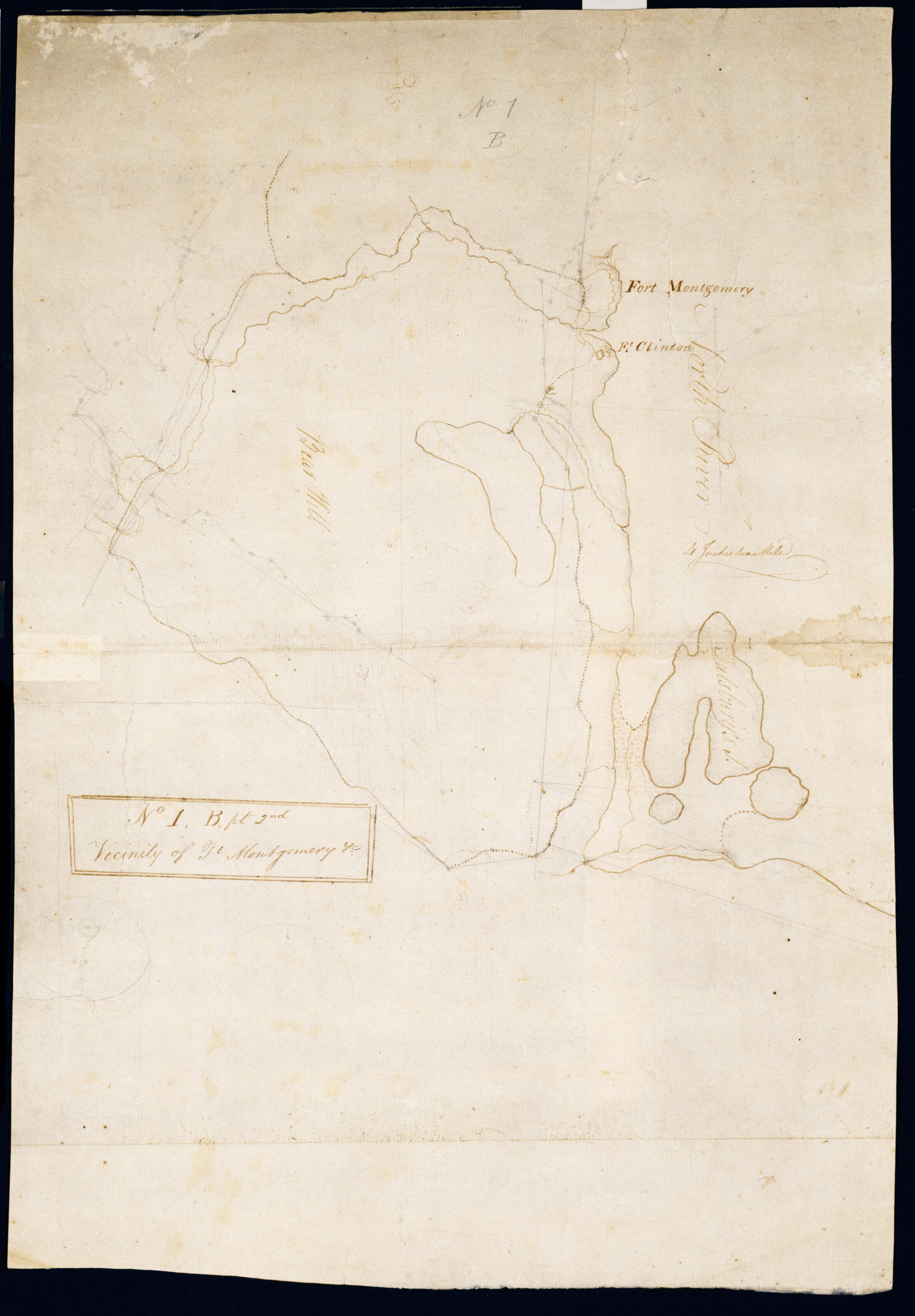
Cartographic Vicinity of Ft Montgomery +c. No 1, B, pt. 2nd / by Robert Erskine F.R.S. Geogr. A. U.S. and Assistants. Foxed, creased, frayed and abraded. Mounted on cloth, bound and cropped, disbound and silked by subsequent owners. Cleaned after removal of backings 1999; some fill remains. Sheathed in mylar. In ink on verso "Part of No. 1 Large Scale N.1.B". In pencil on recto: "No 1 B." Military topographic map. Covers the towns of Stony Point in Rockland County and of Highland and Woodbury in Orange County, New York. Shows roads, forts, landforms, streams and wetlands. Pen-and-ink, pencil on laid paper. Shows relief by hachures. View Item
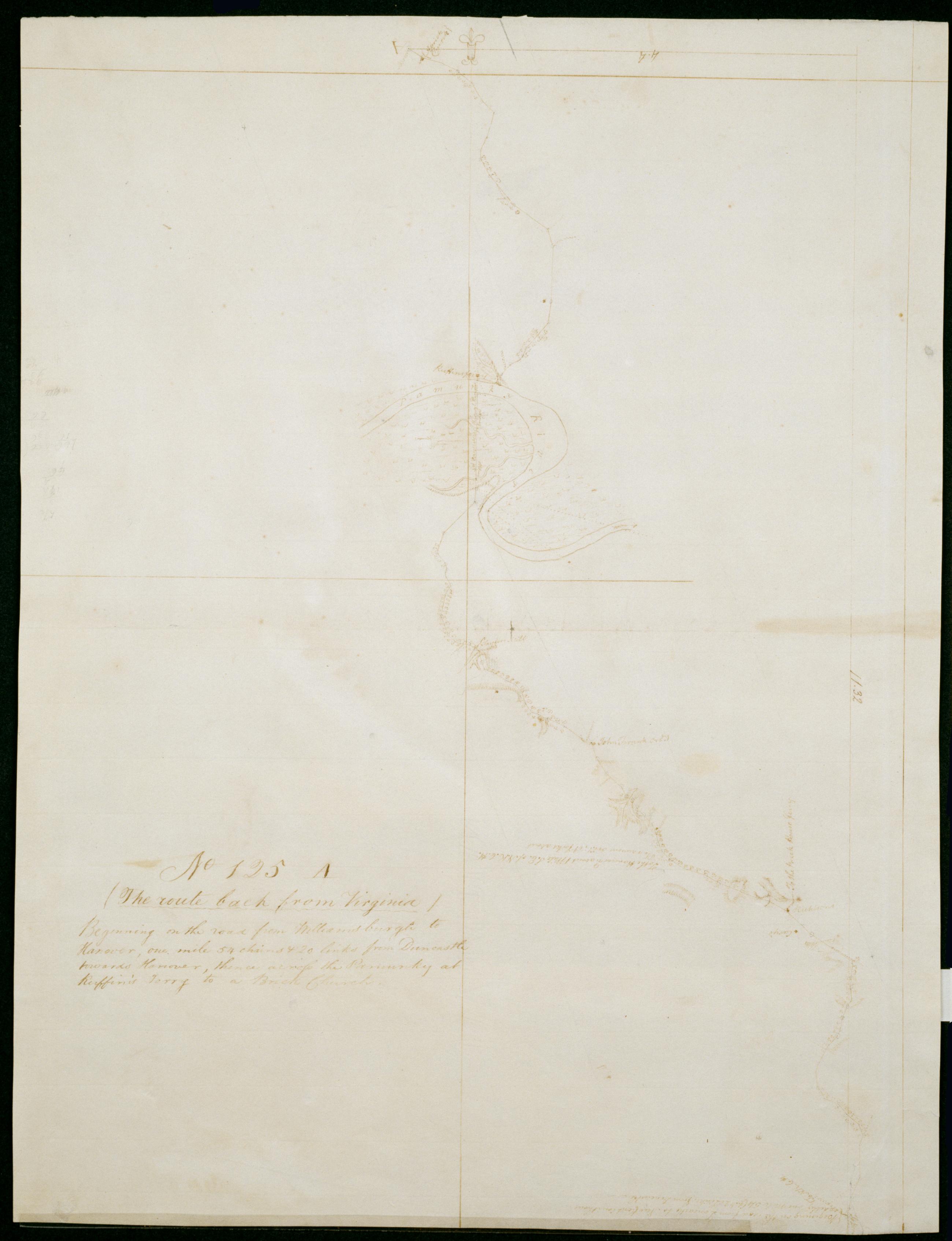
Cartographic Beginning on the road from Williamsburgh to Hanover, one mile 54 chains + 20 links from Duncastle towards Hanover, thence across the Pamunky at Ruffin's Ferry to a Brick Church. No 125 A / by Robert Erskine F.R.S. Geogr. A. U.S. and Assistants. Date inferred by cataloger. Foxed, creased and abraded. Mounted on cloth, bound and cropped, disbound and silked by subsequent owners. Cleaned after removal of backings 1999; some fill remains. Sheathed in mylar. In erased pencil on recto: "No 125 A". Military topographic map. Covers New Kent City and King William County in Virginia. Shows roads running through Barnhamsville, Sweet Hall and Rosegarden. Also shows buildings, landforms and streams. Pen-and-ink, pencil on laid paper. Shows relief by hachures. View Item
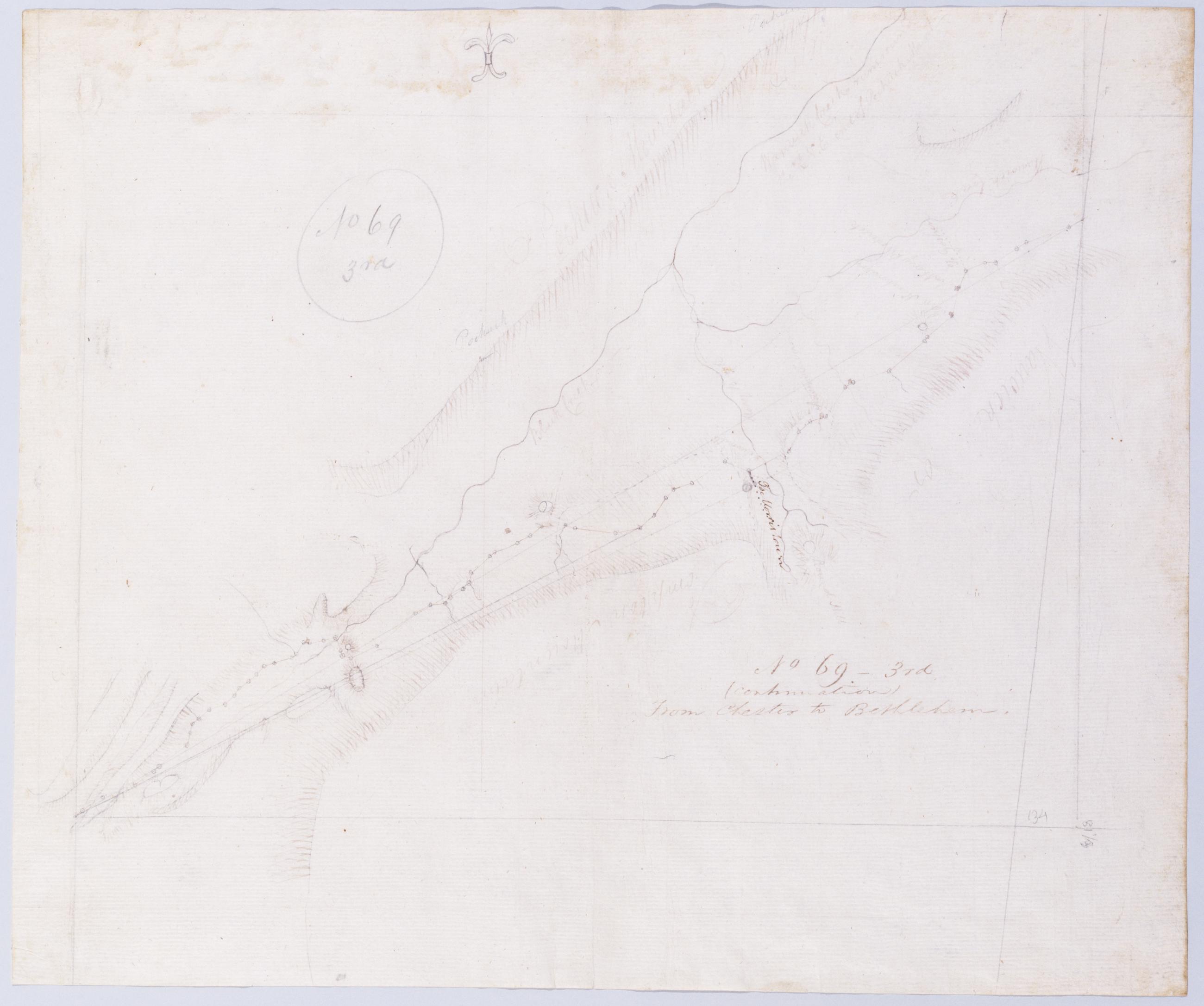
Cartographic (Continuation) From Chester to Bethlehem. No 69-3rd / by Robert Erskine F.R.S. Geogr. A. U.S. and Assistants. In pencil on recto: "No 69 3rd". Military topographic map. Covers the township of Vernon in Sussex County, New Jersey. Shows roads running through Maple Grange and Vernon. Also shows buildings and owners' names, landforms and streams. Pen-and-ink, pencil on laid paper. Shows relief by hachures. Stained, creased and abraded. Mounted on cloth, bound and cropped, disbound and silked by subsequent owners. Cleaned after removal of backings 1999; some fill remains. Sheathed in mylar. Title proper on recto is the work of a later editor--Simeon DeWitt or his assign--subsequent to 1820. View Item
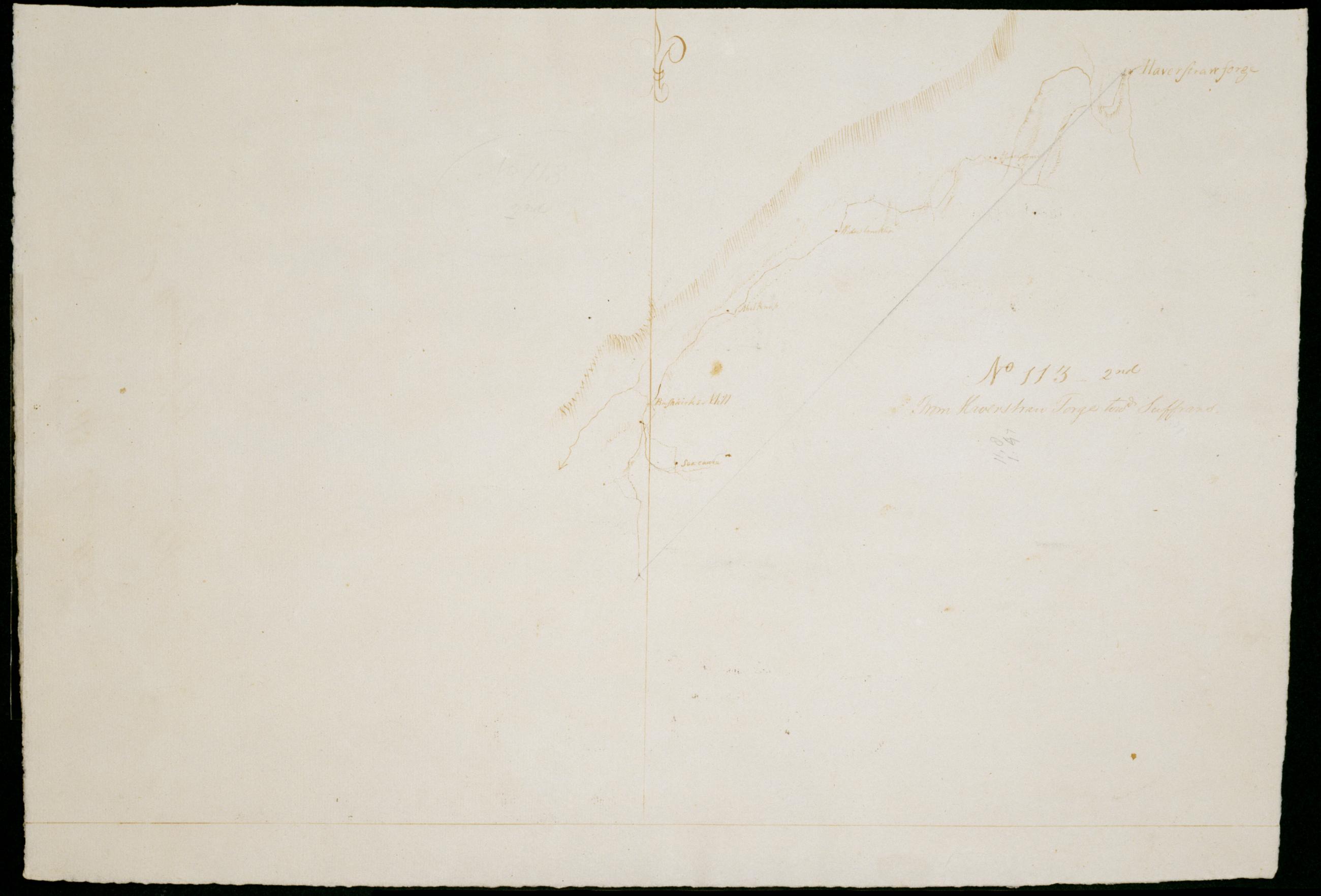
Cartographic From Haverstran Forge towd Suffrans. No 113 - 2nd / by Robert Erskine F.R.S. Geogr. A. U.S. and Assistants. Foxed, soiled, creased and abraded. Mounted on cloth, bound and cropped, disbound and silked by subsequent owners. Cleaned after removal of backings 1999; some fill remains. Sheathed in mylar. In erased pencil on recto: "No 113 2nd". Military topographic map. Covers the townships of Haverstraw and Ramapo in Rockland County, New York. Shows roads running through Thiels, Camp Hill, Ladentown and Wesley Chapel. Also shows buildings and owners' names, landforms and streams. Pen-and-ink, pencil on laid paper. Shows relief by hachures. View Item
Cartographic The Route back from VIRGA. No 125, C. / by Robert Erskine F.R.S. Geogr. A. U.S. and Assistants. Calculations on verso. Date inferred by cataloger. Military topographic map. Covers Caroline County, Virginia. Shows roads running through Gether, Bagby, Shumansville, Kidds Fork and Wrights Fork. Also shows landforms and streams. Pen-and-ink, pencil on laid paper. Shows relief by hachures. Stained, foxed, creased and abraded. Cropped, mounted on recto of sheet 125,C,[1st piece] and silked by subsequent owners. Separated from first piece and cleaned after removal of backings 1999; some fill remains. Sheathed in mylar. View Item
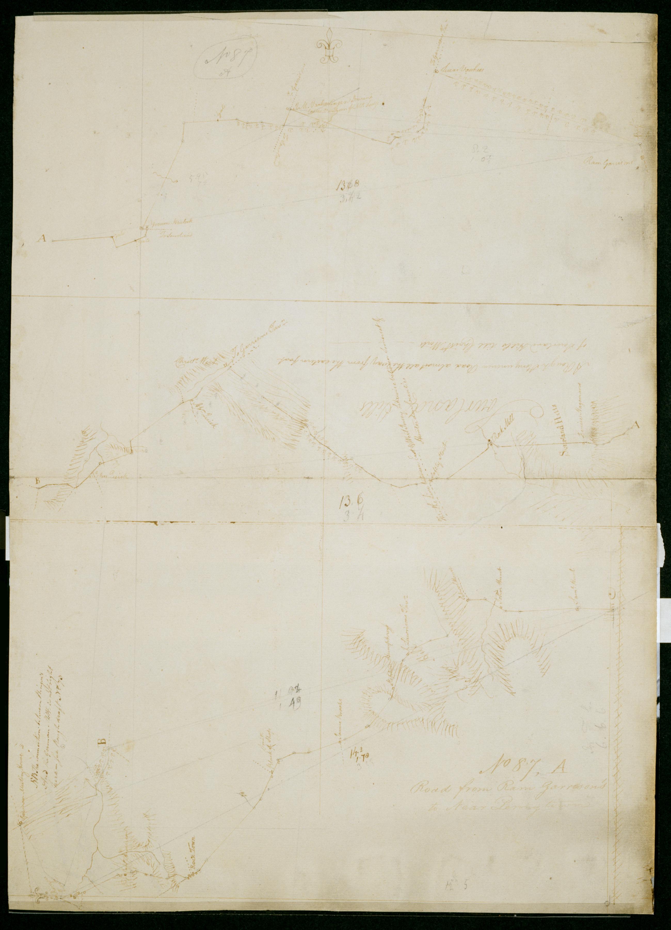
Cartographic Road from Ram Garrison's to Near Penny town. No 87, A / by Robert Erskine F.R.S. Geogr. A. U.S. and Assistants. In pencil on recto: "No 87 A". Military topographic map in three segments meant to be joined at points marked "A" and "B." Top and middle segments oriented with north to top of sheet; bottom segment oriented with north to left of sheet. Map covers the townships of Hillsboro and Montgomery in Somerset County, East Amwell and West Amwell in Hunterdon County and Hopewell in Mercer County, New Jersey. View Item
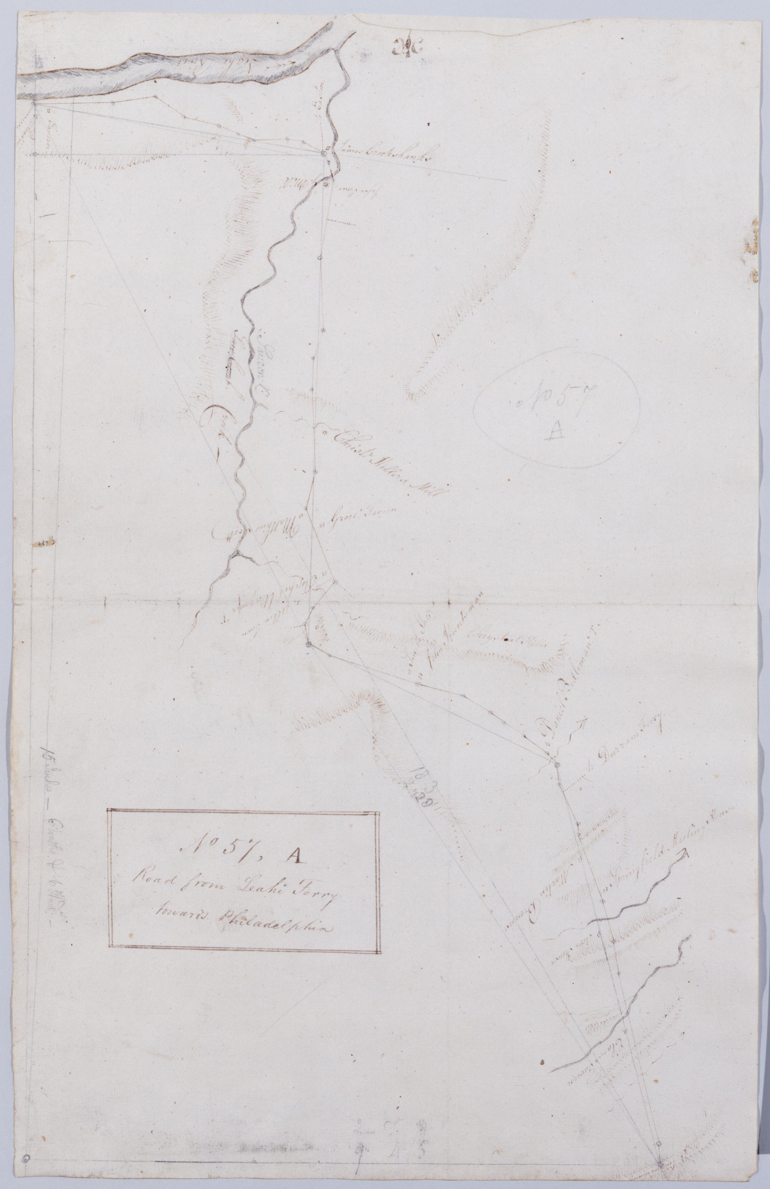
Cartographic Road from Leahi Ferry towards Philadelphia. No 57, A / by Robert Erskine F.R.S. Geogr. A. U.S. and Assistants. In pencil on recto: "57 A". Military topographic map. Covers Northhampton and Bucks counties, Pennsylvania. Shows roads running through Bethlehem, Hellertown and Pleasant Valley. Also shows buildings and owners' names, landforms and streams. Pen-and-ink, pencil on laid paper. Shows relief by hachures. Soiled, creased and abraded. Mounted on cloth, bound and cropped, disbound and silked by subsequent owners. Cleaned after removal of backings 1999; some fill remains. Sheathed in mylar. Title proper from recto is the work of a later editor--Simeon DeWitt or his assign--subsequent to 1820. View Item
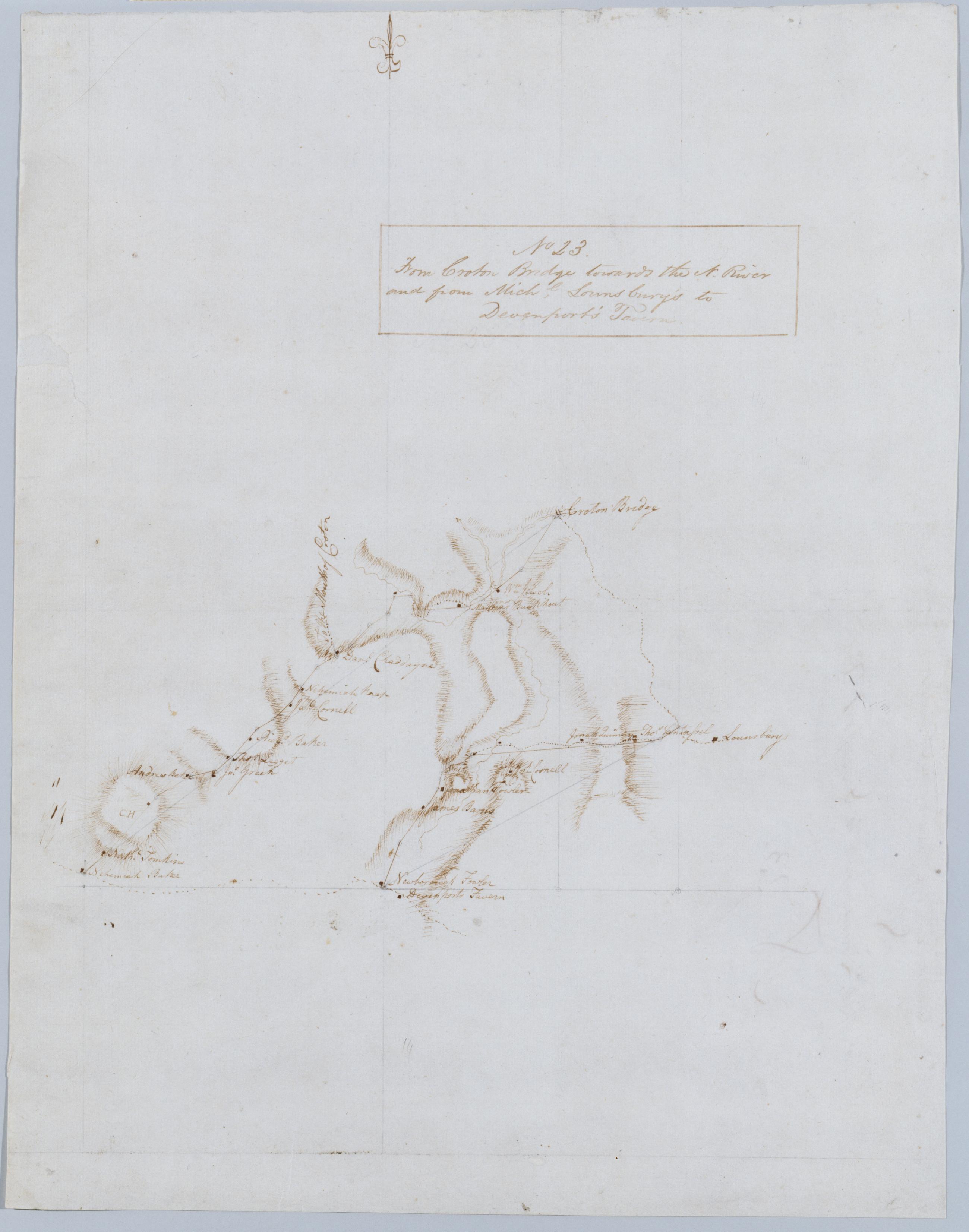
Cartographic From Croton Bridge towards the N. River and from Michl. Lounsbury's to Devenport's Tavern. No 23 / by Robert Erskine F.R.S. Geogr. A. U.S. and Assistants. Foxed, creased and abraded. Mounted on cloth, bound and cropped, disbound and silked by subsequent owners. Cleaned after removal of backings 1999; some fill remains. Sheathed in mylar. In ink on verso: "No 23". Military topographic map. Covers the towns of Yorktown and Newcastle in Westchester County, New York. Map shows roads running through Kitchawan, Pine Bridge and Tompkins Corners. Also shows buildings and owners' names, landforms and streams. Pen-and-ink, pencil on laid paper. Shows relief by hachures. View Item
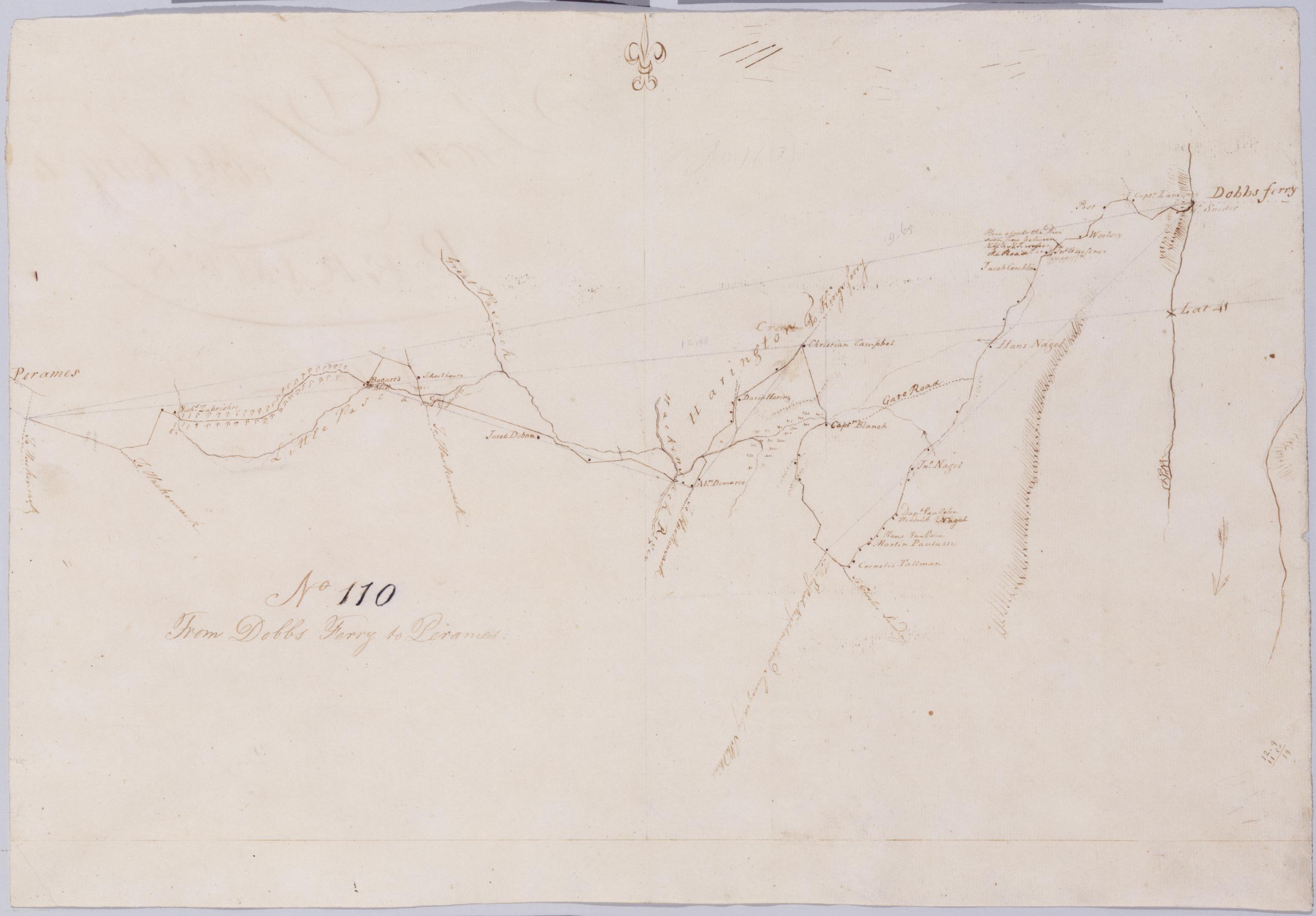
Cartographic From Dobbs Ferry to Peramus. No 110 / by Robert Erskine F.R.S. Geogr. A. U.S. and Assistants. In erased pencil on recto: "No 110". Military topographic map. Covers the townships of Orangetown in Rockland County, New York, and of Harrington and Washington in Bergen County, New Jersey. Shows roads running through Sneden Landing N.Y., Harrington Park, Westwood and Paramus N.J. Also shows buildings and owners' names, landforms and streams. Pen-and-ink, pencil on laid paper. Shows relief by hachures. Soiled, creased and abraded. Mounted on cloth, bound and cropped, disbound and silked by subsequent owners. Cleaned after removal of backings 1999; some fill remains. Sheathed in mylar. View Item
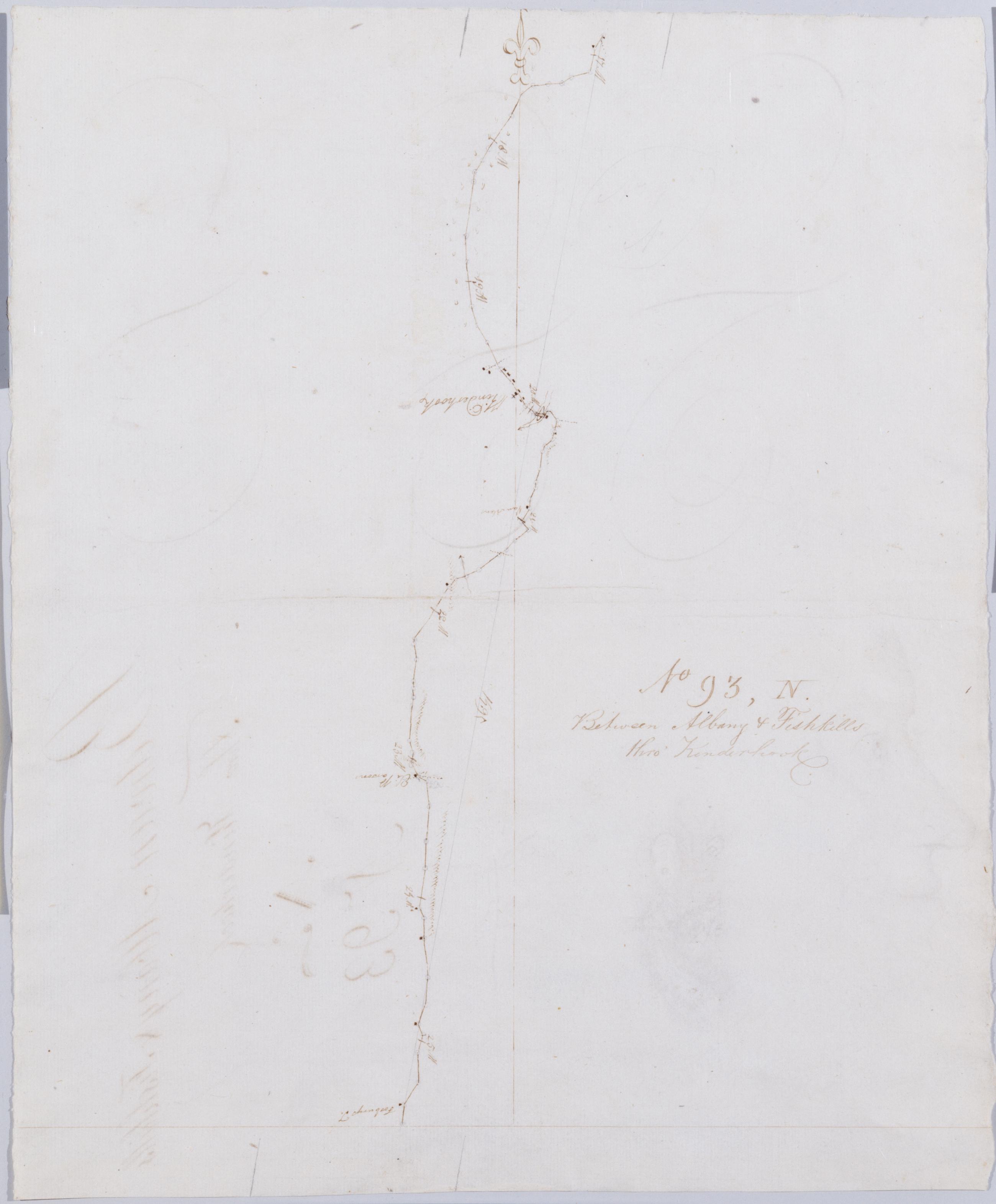
Cartographic Between Albany + Fishkills thro' Kinderhook No 93, N / by Robert Erskine F.R.S. Geogr. A. U.S. and Assistants. Also on verso: fully developed hatchures of unidentified mountains and the profile portrait of a youthful man, both in Erskine's hand. It is possible that the portrait is of Erskine himself; no other portrait is known. In erased pencil on recto: "No 93 N". In ink on verso: "N N N". Military topographic map. Covers the townships of Kinderhook and Ghent in Columbia County, New York. Shows roads running through Kinderhook and West Ghent. Also shows buildings and owners' names, landforms and streams. Pen-and-ink, pencil on laid paper. Shows relief by hachures. Soiled, creased and abraded. View Item
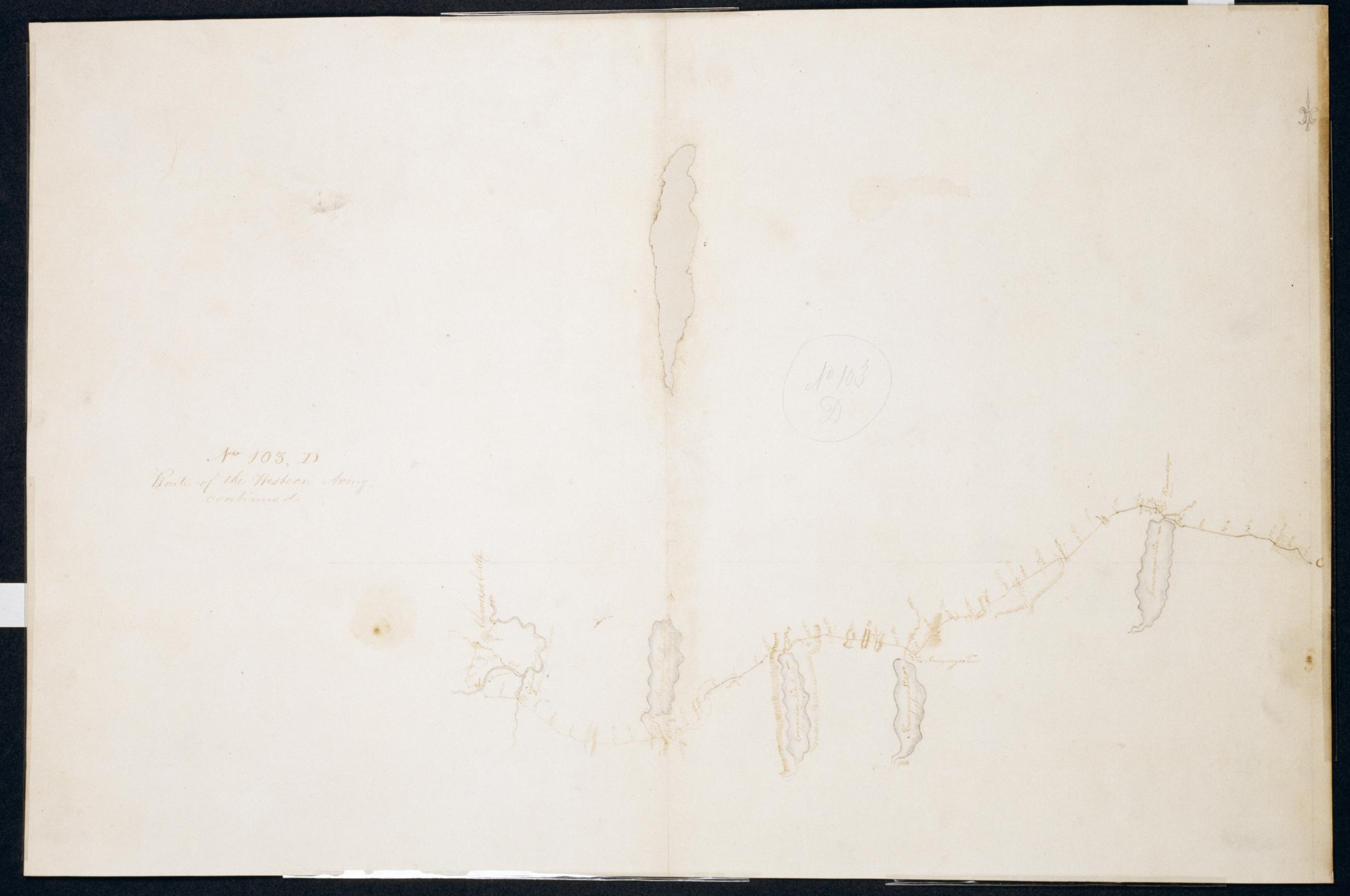
Cartographic Route of the Western Army continued. No. 103, D / by Lt. Lodge ; by Robert Erskine F.R.S. Geogr. A. U.S. and Assistants. Creased, soiled, stained, frayed and abraded. Mounted on cloth, bound and cropped, disbound and silked by subsequent owners. Cleaned after removal of backings 1999; some fill remains. Sheathed in mylar. Imperfect: lacking 3 x 14 cm. at upper center of map. In ink on verso "D No. 103". In pencil on recto: "No 103 D". Military topographic map. Covers the counties of Ontario and Livingston in New York. Also shows landforms and streams. Pen-and-ink, pencil on laid paper. Shows relief by hachures. View Item