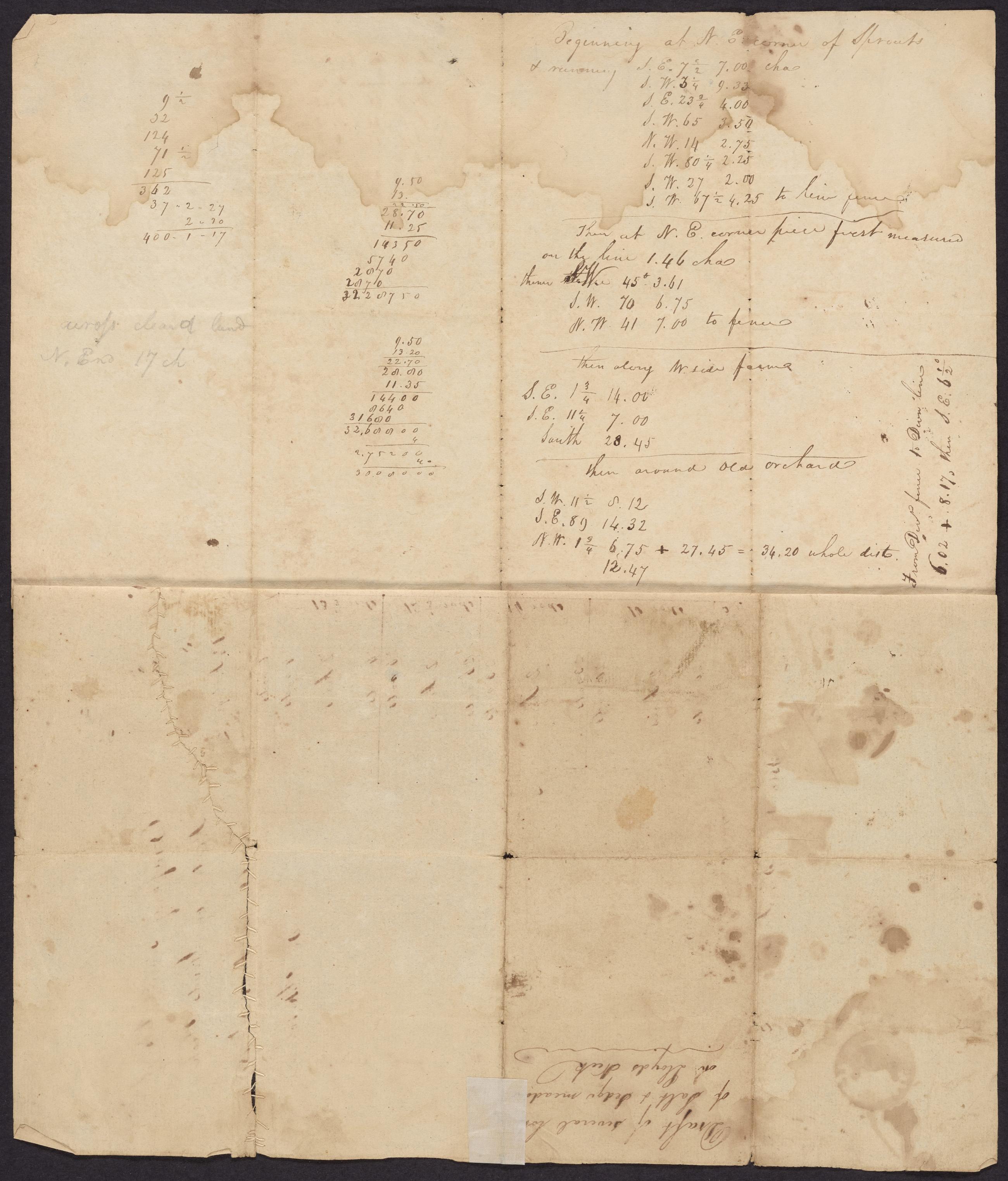
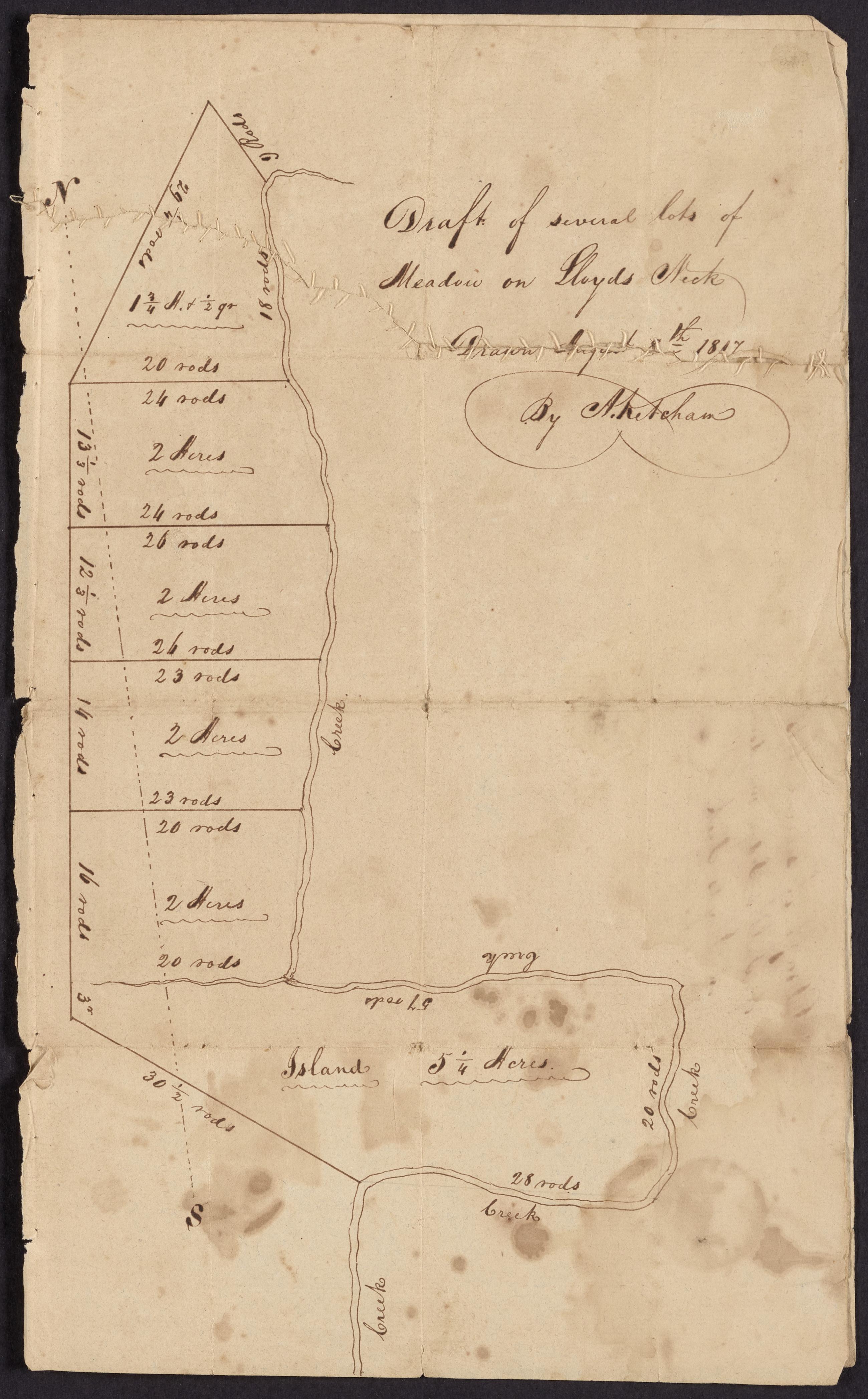
Text Map of meadows in western part of Lloyd Neck, August 8, 1817, verso, with docket title and Surveyor's field notes, April 10, 1819, recto. View Item
Image Text 3 Items Map of meadows in western part of Lloyd Neck, August 8, 1817 and Surveyor's field notes, April 10, 1819. Draft map made by surveyor Abel Ketcham of meadowlands divided into lots in western Lloyd Neck. Upper quarter torn; repaired with stitches. View Item
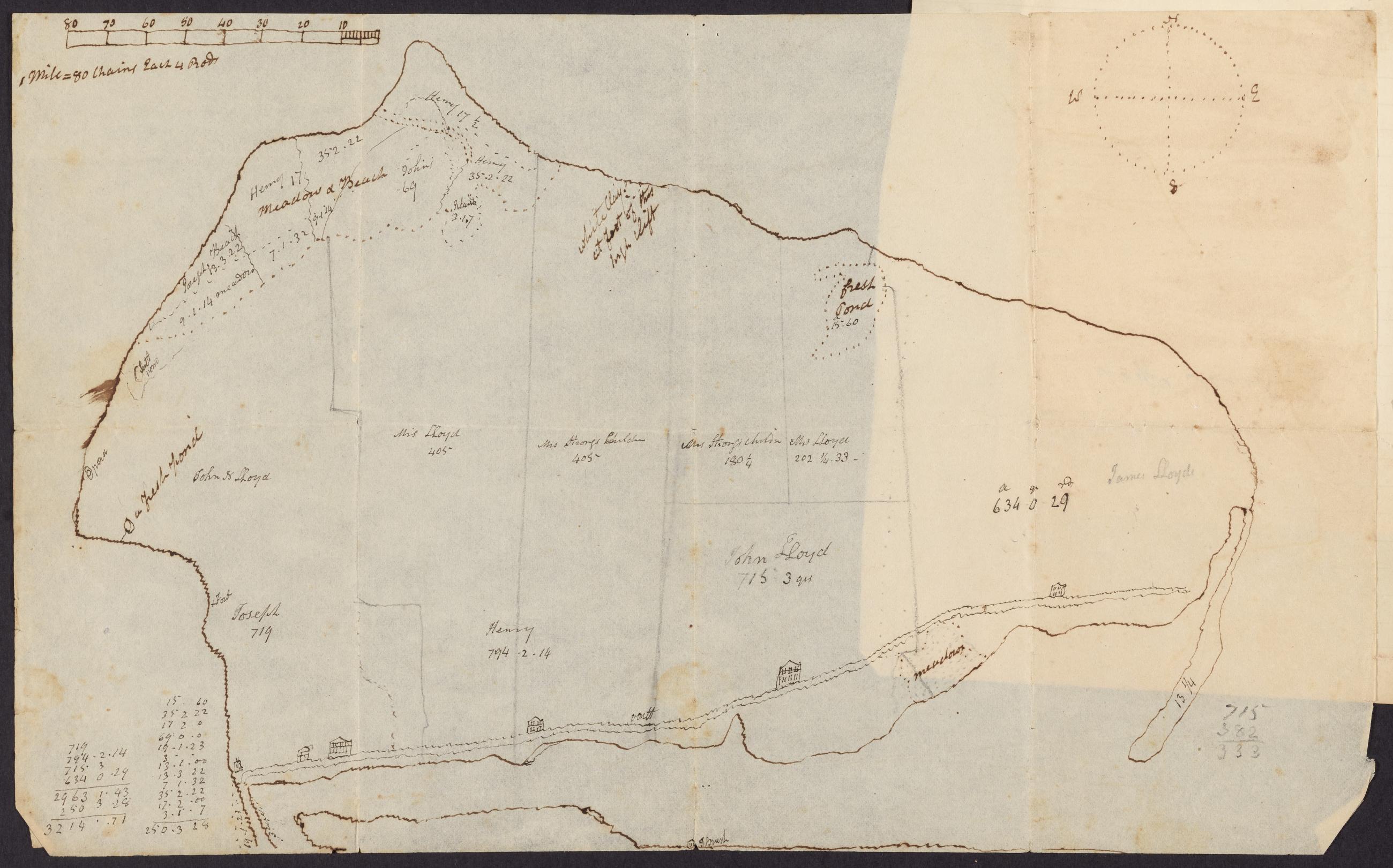
Cartographic Manuscript map of Lloyd Neck, 19th century. 19th century manuscript map of Lloyd Neck showing the holding of different Lloyd family members. View Item
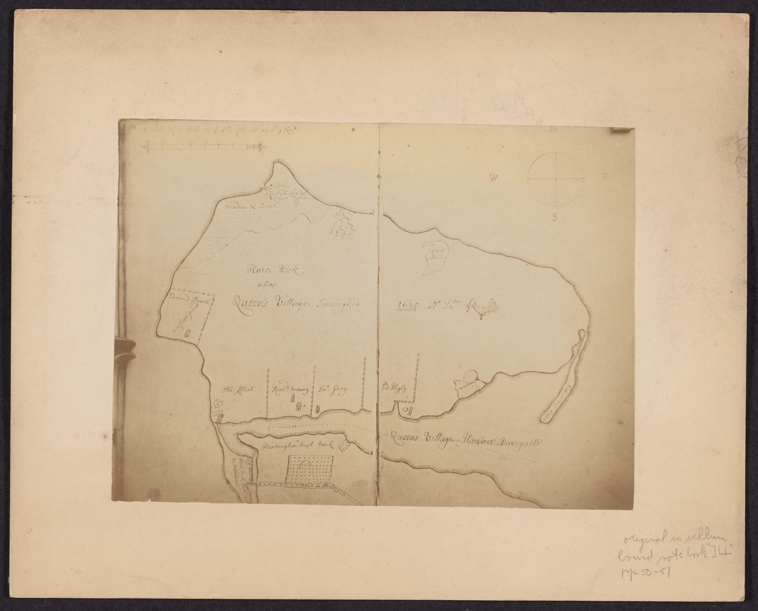
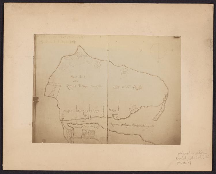
Image Text 2 Items Photograph of manuscript map of Queen's Village, Lloyd Neck. Mounted 19th century photograph of late 17th century manuscript map of Queen's Village, Lloyd Neck. View Item
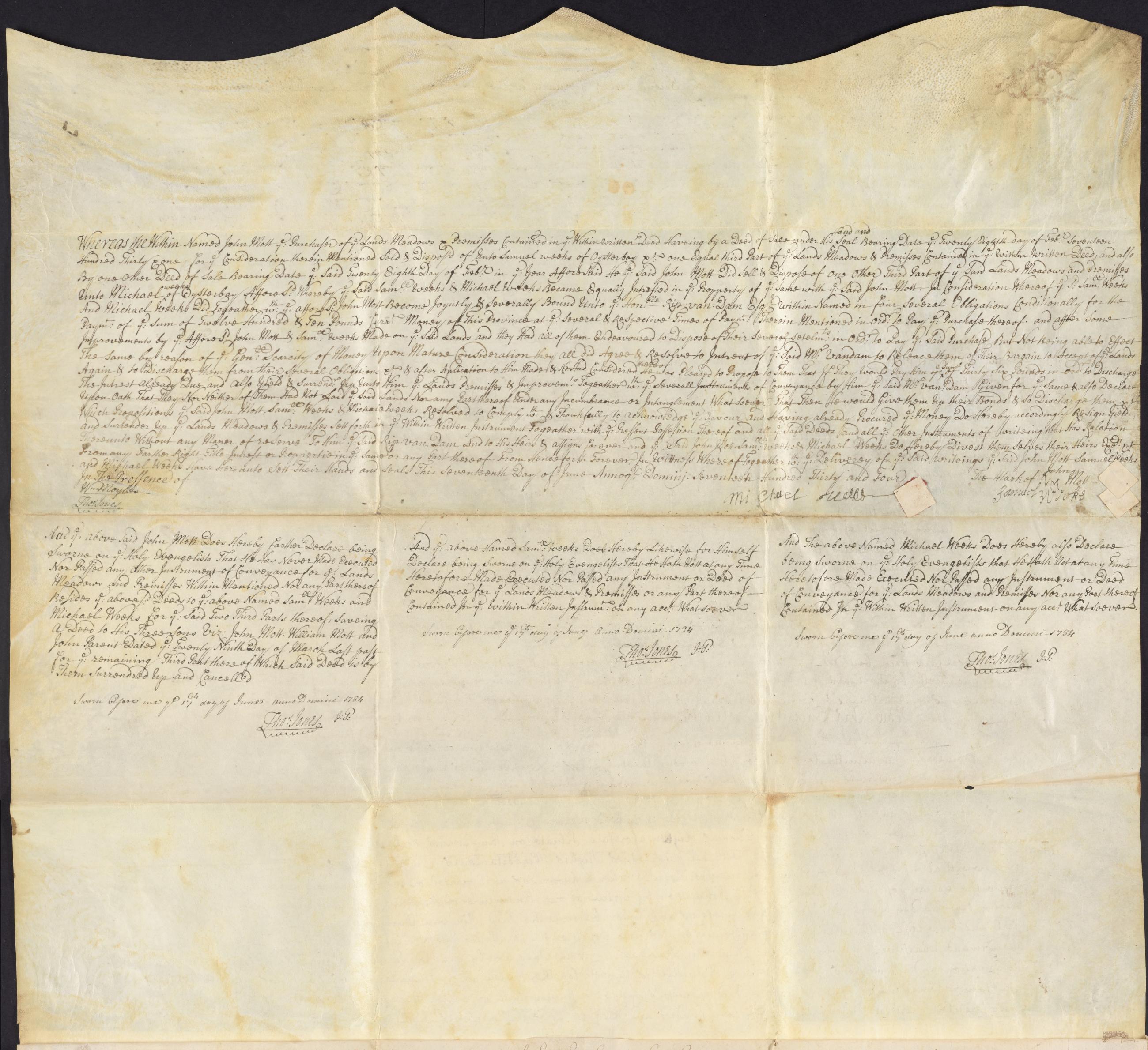
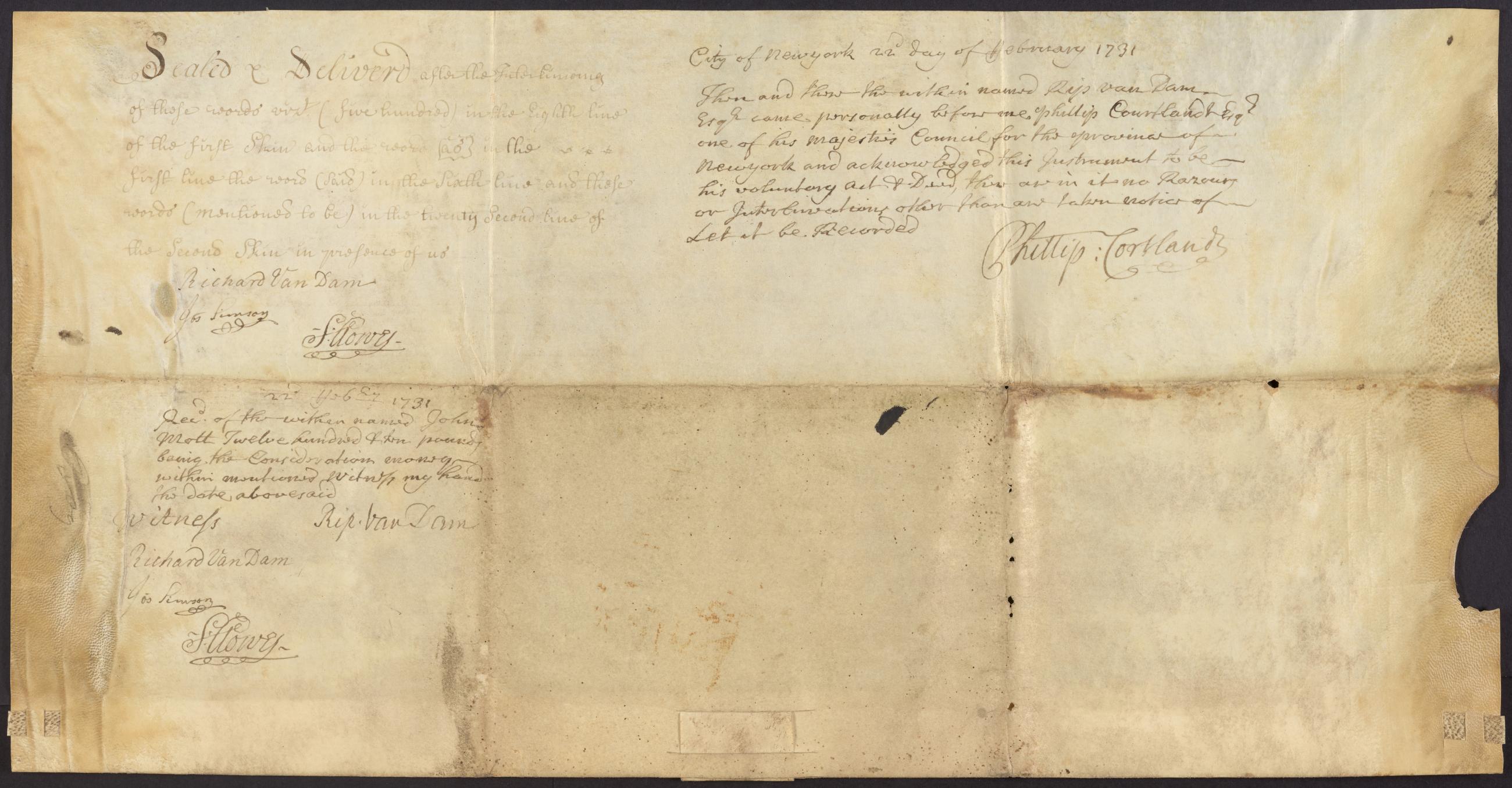
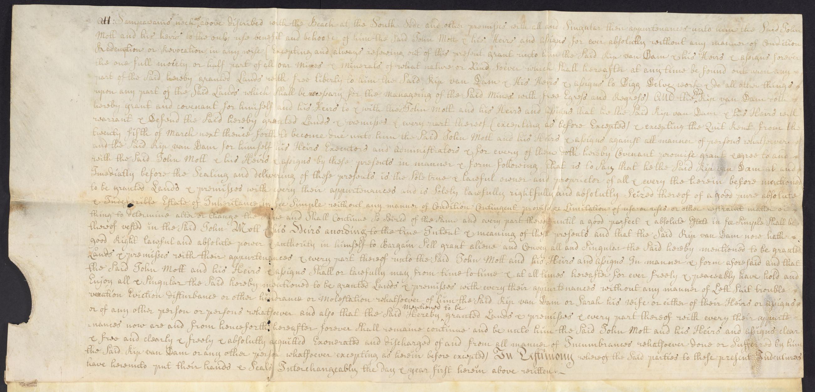
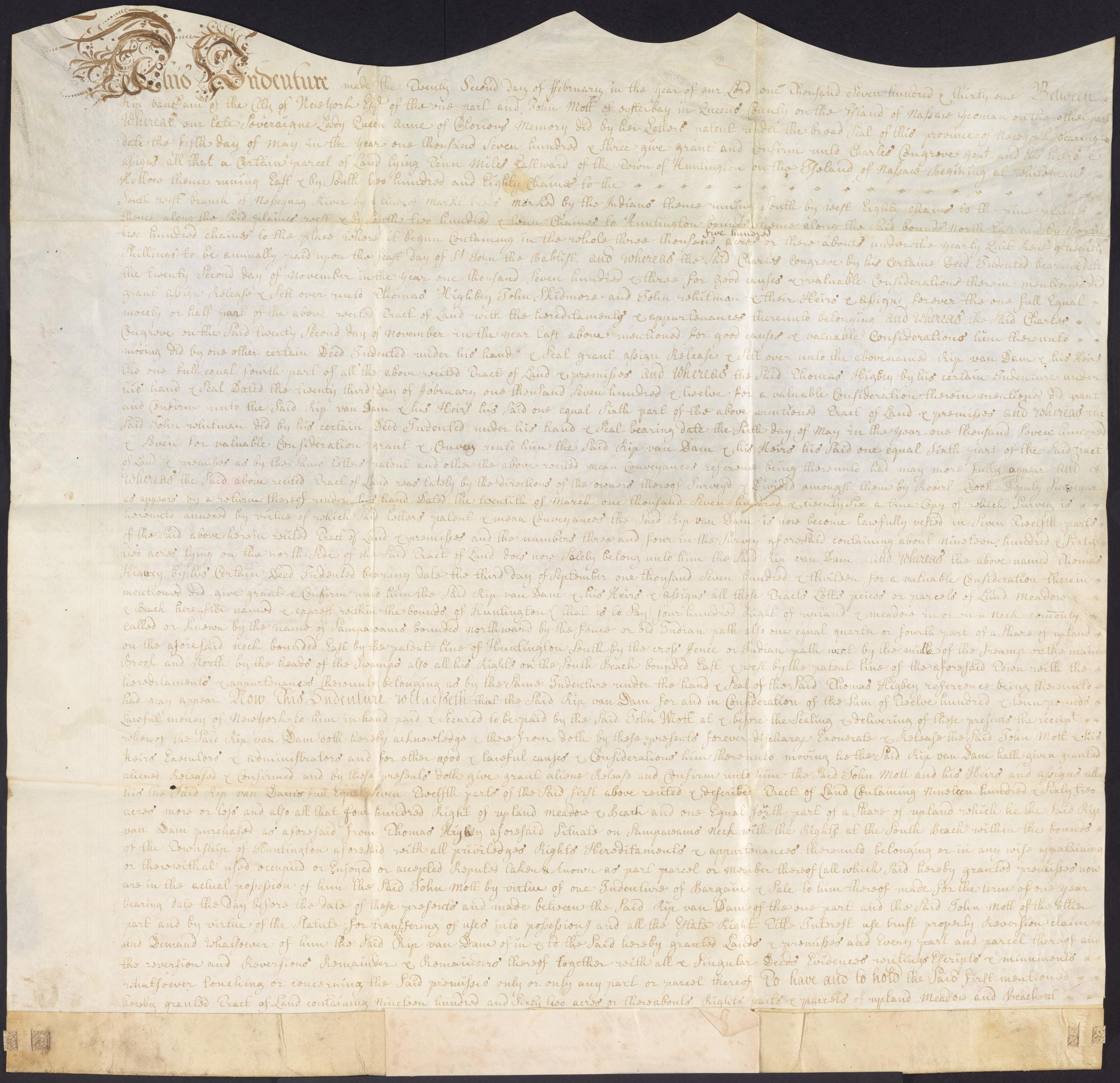
Image Text 6 Items Rip Van Dam indenture, February 22, 1731. Indenture from Rip Van Dam, New York, to John Mott, Oyster Bay, for the sale of 1,962 acres near modern day Commack and property on Sampawams Neck for £1210; the first was originally part of a larger property owned in common by several people and divided in 1726 by surveyor, Robert Crooke, with a recitation of the property's ownership history; Van Dam retains the right to mine minerals at Sampawams Neck; witnessed by Richard Van Dam, Joseph Simson, and Samuel Clowes; attested by Rip Van Dam before Phillip Van Cortlandt, member of the Council. View Item
Text Cadastral map of part of Newtown in western Queens County, [early 18th century], recto. View Item
Text Cadastral map of part of Newtown in western Queens County, [early 18th century], recto. View Item
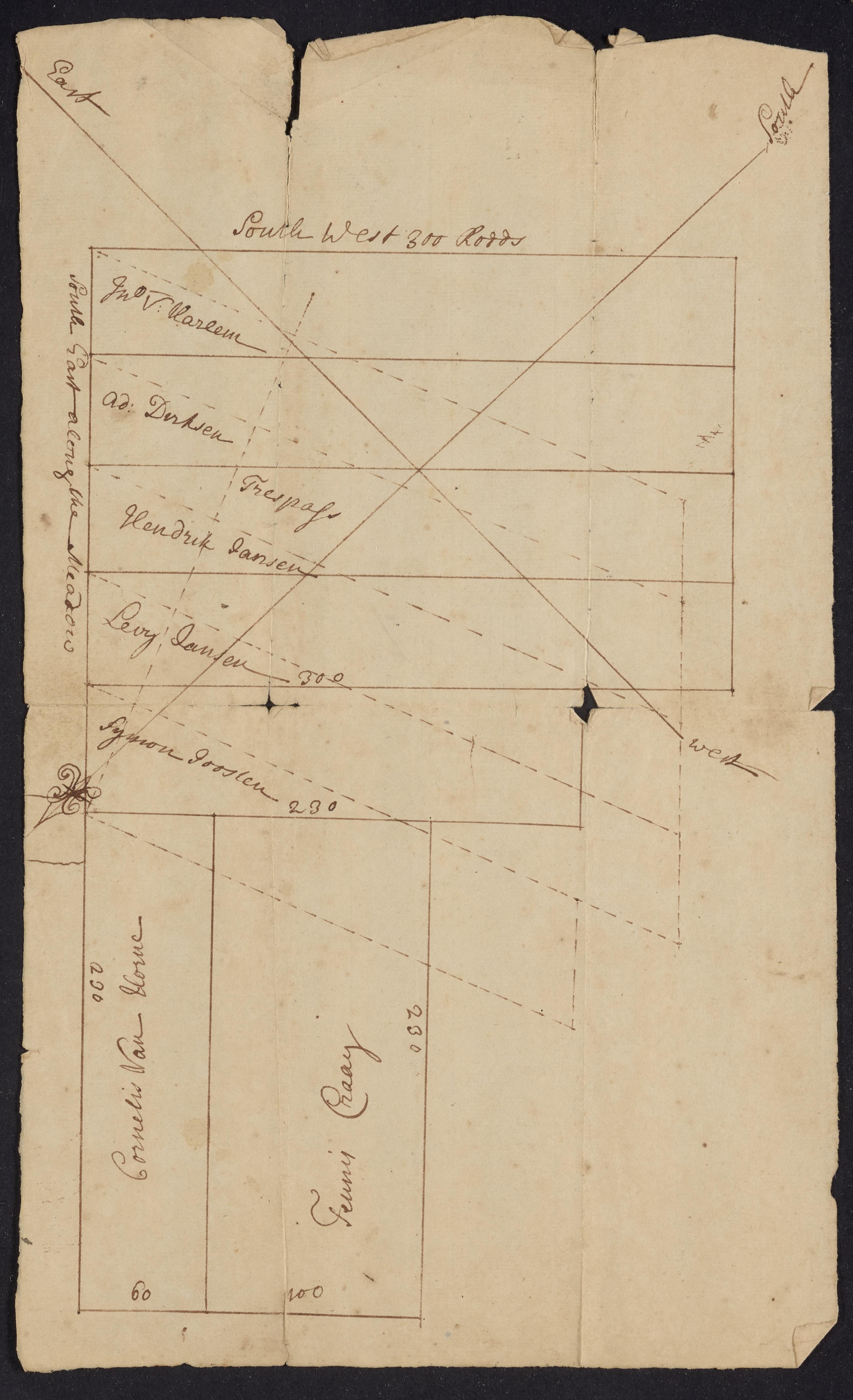
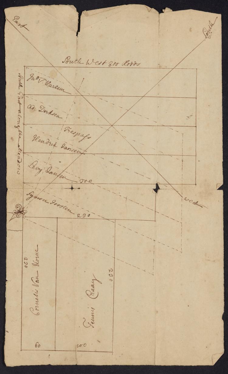
Image Text 2 Items Cadastral map of part of Newtown in western Queens County, [early 18th century] Manuscript cadastral map by an unidentified surveyor of Thomas Lawrence's property near Hellgate in western Queens relative to the holdings of earlier landowners. View Item
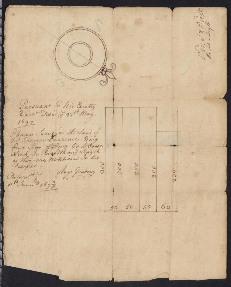
Image Text 2 Items Augustine Graham map, January 8, 1698. Manuscript cadastral map of Thomas Lawrence's property near Hellgate in western Queens prepared by Augustine Graham from his survey. View Item
Image Text 2 Items Map of proposed road in Hempstead, [1870] Map of proposed road (Central Ave.?) in Hempstead showing the adjacent property owners with a list of how much land to be taken from each owner for the construction of the road. View Item
Still Image [Map of the area later bounded by 52nd and 74th Streets, Park Avenue, and 8th Avenue or Central Park West, Manhattan, New York, N.Y.]. Scale [ca. 1:2,450]. Cadastral map. Shows property lines and owners' names, some existing roads and projected streets. Pen-and-ink, watercolor on paper. Annotations in a later hand on this recto of this sheet give the number 34. The map on recto of this sheet belongs to the same series and is separately cataloged under the title, [Map of the area later bounded by 8th and 34th Streets, the East River and 5th Avenue, Manhattan, New York, N.Y.]. View Item
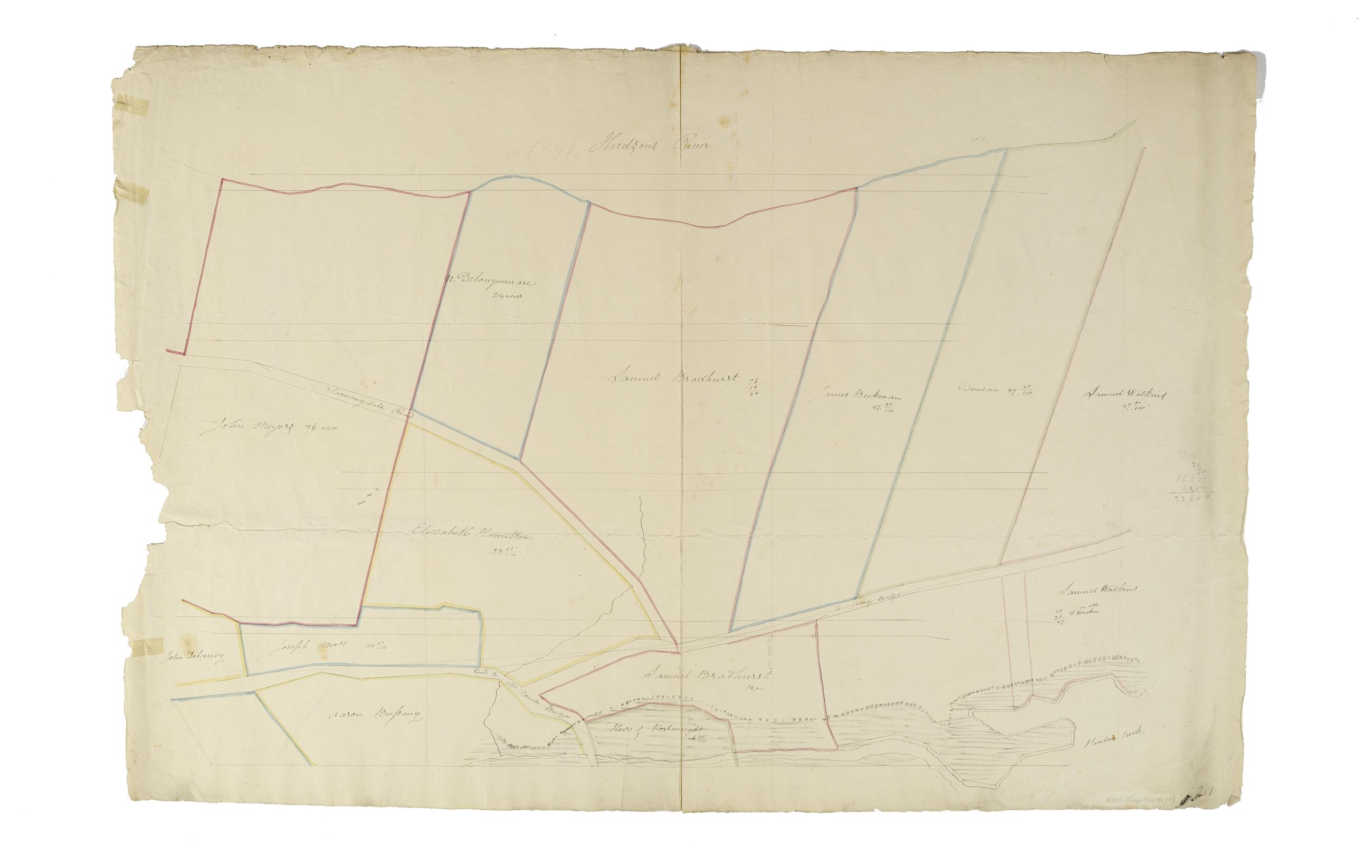
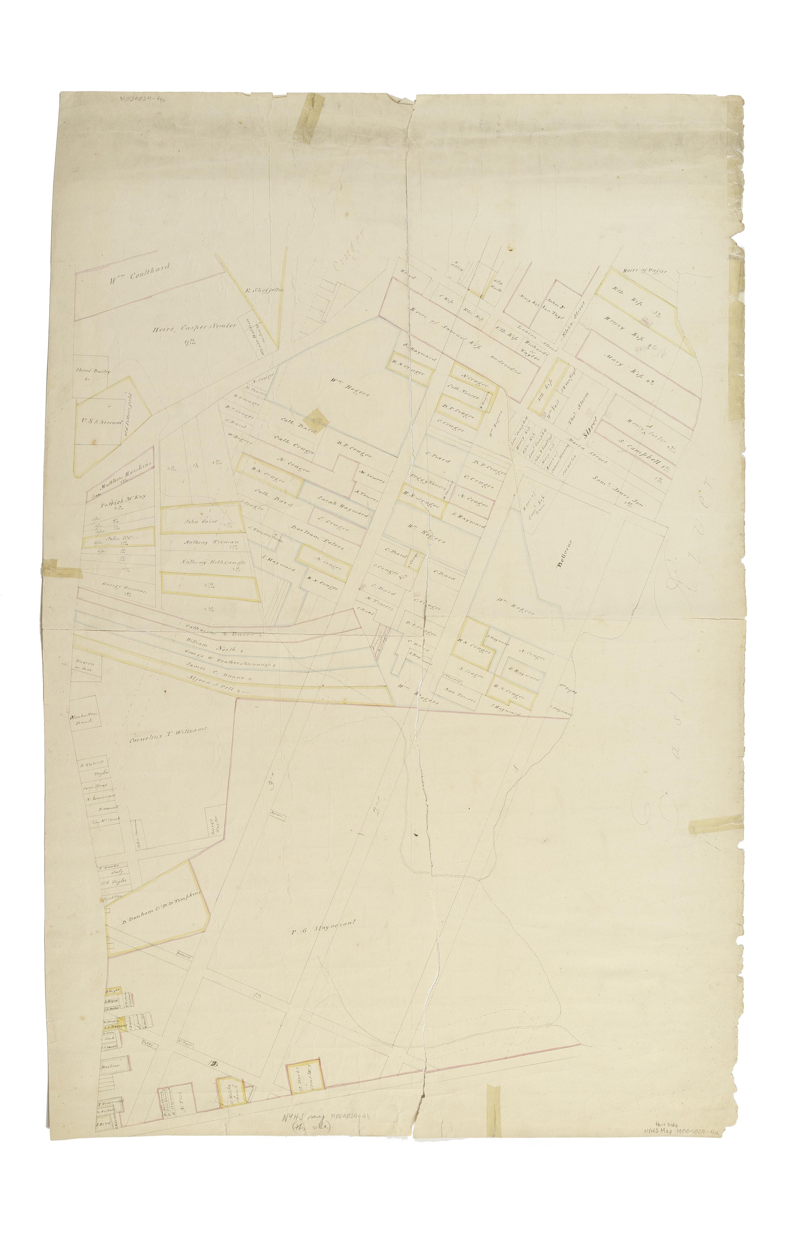
Still Image [Map of the area later bounded by 93rd and 115th Streets, the East or Harlem River and Park Avenue, Manhattan, New York, N.Y.]. Scale [ca. 1:2,450]. Cadastral map. Shows property lines and owners' names, some existing roads and projected streets. Shows relief by hachures. Pen-and-ink, watercolor on paper. Annotations in a later hand on the recto of this sheet give the number 15. The map on recto of this sheet belongs to the same series and is separately cataloged under the title, [Map of the area later bounded by 93rd and 118th Streets, 8th Avenue and the Hudson River, Manhattan, New York, N.Y.]. View Item
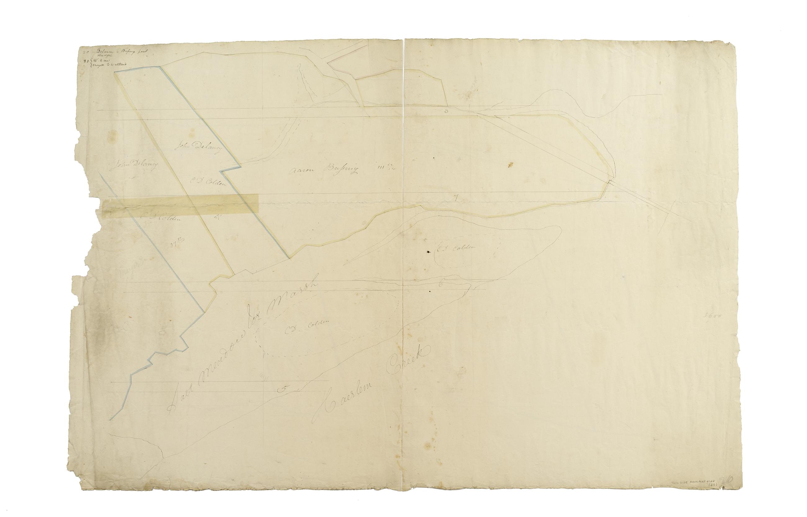
Still Image [Map of the area later bounded by 135th and 157th Streets, the Harlem River and Douglas Boulevard, Manhattan, New York, N.Y.]. Scale [ca. 1:2,450]. Cadastral map. Shows property lines and owners' names, some existing roads and projected streets. Shows relief by hachures. Pen-and-ink, watercolor on paper. Annotations in a later hand on the recto of this sheet give the number 20. The map on verso of this one belongs to the same series and is separately cataloged under the title, [Map of the area later bounded by 129th and 158th Streets, Douglass Boulevard and the Hudson River, Manhattan, New York, N.Y.]. View Item
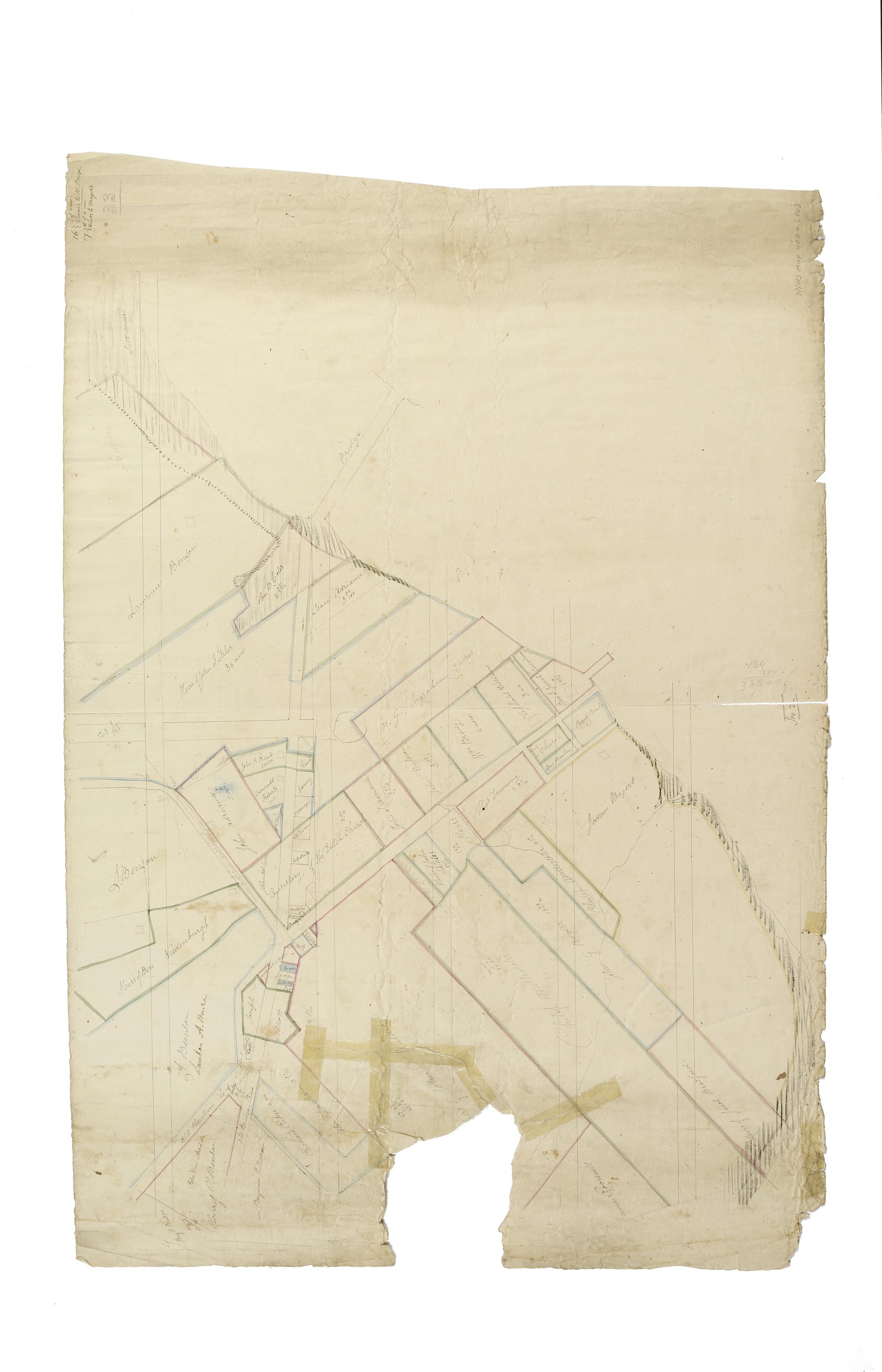
Still Image [Map of the area later bounded by 114th and 137th Streets, the Harlem River and 5th Avenue, Manhattan, New York, N.Y.]. Scale [ca. 1:2,450]. Cadastral map. Shows property lines and owners' names, some existing roads and projected streets. Shows relief by hachures. Pen-and-ink, watercolor on paper. Imperfect: lacking 15 cm. square at bottom center margin. Annotations in a later hand on the recto of this sheet give the number 16. The map on verso of this one belongs to the same series and is separately cataloged under the title, [Map of the area later bounded by 113th and 136th Streets, Park or Morningside and St. Nicholas Avenues, Manhattan, New York, N.Y.]. View Item
Still Image [Map of the area later bounded by 129th and 158th Streets, Douglass Boulevard and the Hudson River, Manhattan, New York, N.Y.]. Scale [ca. 1:2,450]. Cadastral map. Shows property lines and owners' names, some existing roads and projected streets. Shows relief by hachures. Pen-and-ink, watercolor on paper. Annotations in a later hand on the recto of this sheet also give the number 21. The map on recto of this sheet belongs to the same series and is separately cataloged under the title, [Map of the area later bounded by 135th and 157th Streets, the Harlem River and Convent Avenue, Manhattan, New York, N.Y.]. View Item
Still Image [Cadastral map of Manhattan]. Scale [ca. 1:2,450]. Digital composite of a cadastral map of Manhattan in 26 sections on 13 sheets which appears to be a draft for another map, owned by New York City and printed in Sackersdorff, Otto. Maps of farms, commonly called the Blue Book 1815 (New York: 1868). Shows property lines and owners' names, some existing roads and projected streets. Shows relief by hachures. Pen-and-ink, watercolor on paper. Sackersdorff gives the date of the manuscript map as circa 1815. Title and edition statement devised by cataloger. Attributed to Randel by cataloger; for provenance, see Stokes, I.N.P. View Item
Still Image [Map of the area later bounded by 8th and 34th Streets, the East River and 5th Avenue, Manhattan, New York, N.Y.]. Scale [ca. 1:2,450]. Cadastral map. Shows property lines and owners' names, some existing roads and projected streets. Pen-and-ink, watercolor on paper. The map on verso of this one belongs to the same series and is separately cataloged under the title, [Map of the area later bounded by 52nd and 74th Streets, Park Avenue, and 8th Avenue or Central Park West, Manhattan, New York, N.Y.]. View Item