Text Map of meadows in western part of Lloyd Neck, August 8, 1817, verso, with docket title and Surveyor's field notes, April 10, 1819, recto. View Item
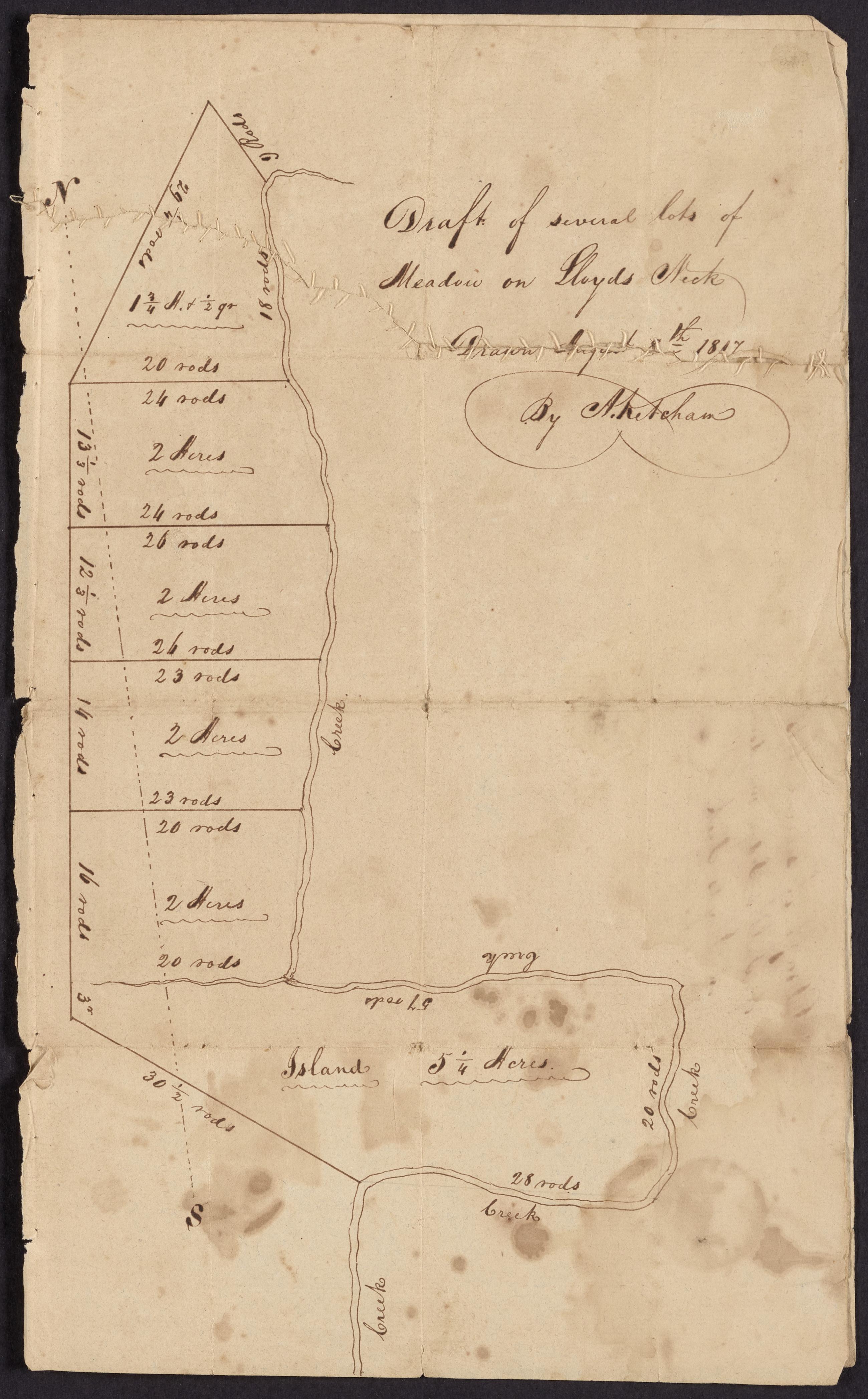
Image Text 3 Items Map of meadows in western part of Lloyd Neck, August 8, 1817 and Surveyor's field notes, April 10, 1819. Draft map made by surveyor Abel Ketcham of meadowlands divided into lots in western Lloyd Neck. Upper quarter torn; repaired with stitches. View Item
Text Map of meadows in western part of Lloyd Neck, [August 8, 1817?], verso, with docket title. View Item
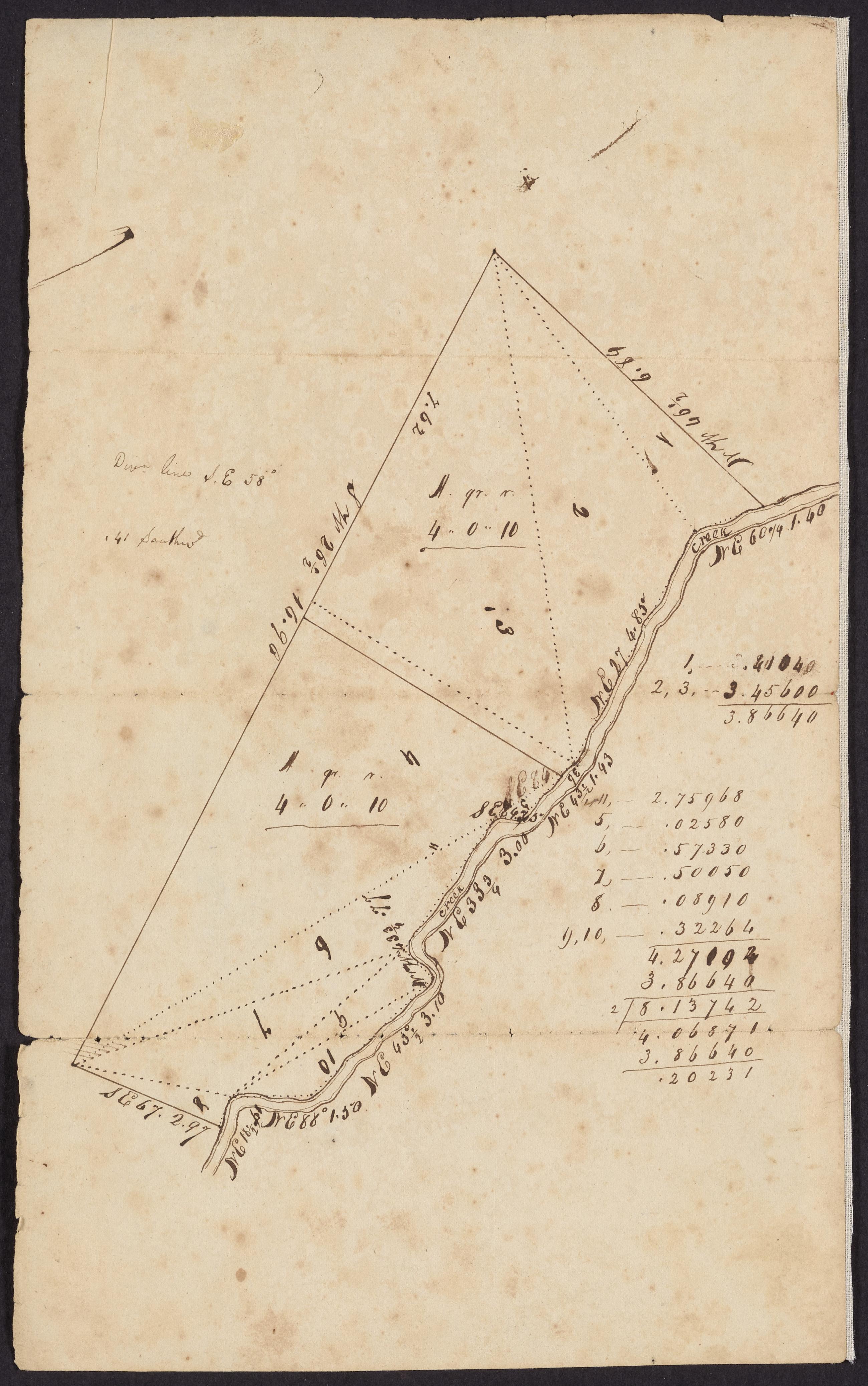
Image Text 2 Items Map of meadows in western part of Lloyd Neck, [August 8, 1817?] Draft map made by a surveyor (Abel Ketcham?) of meadowlands in western Lloyd Neck. View Item
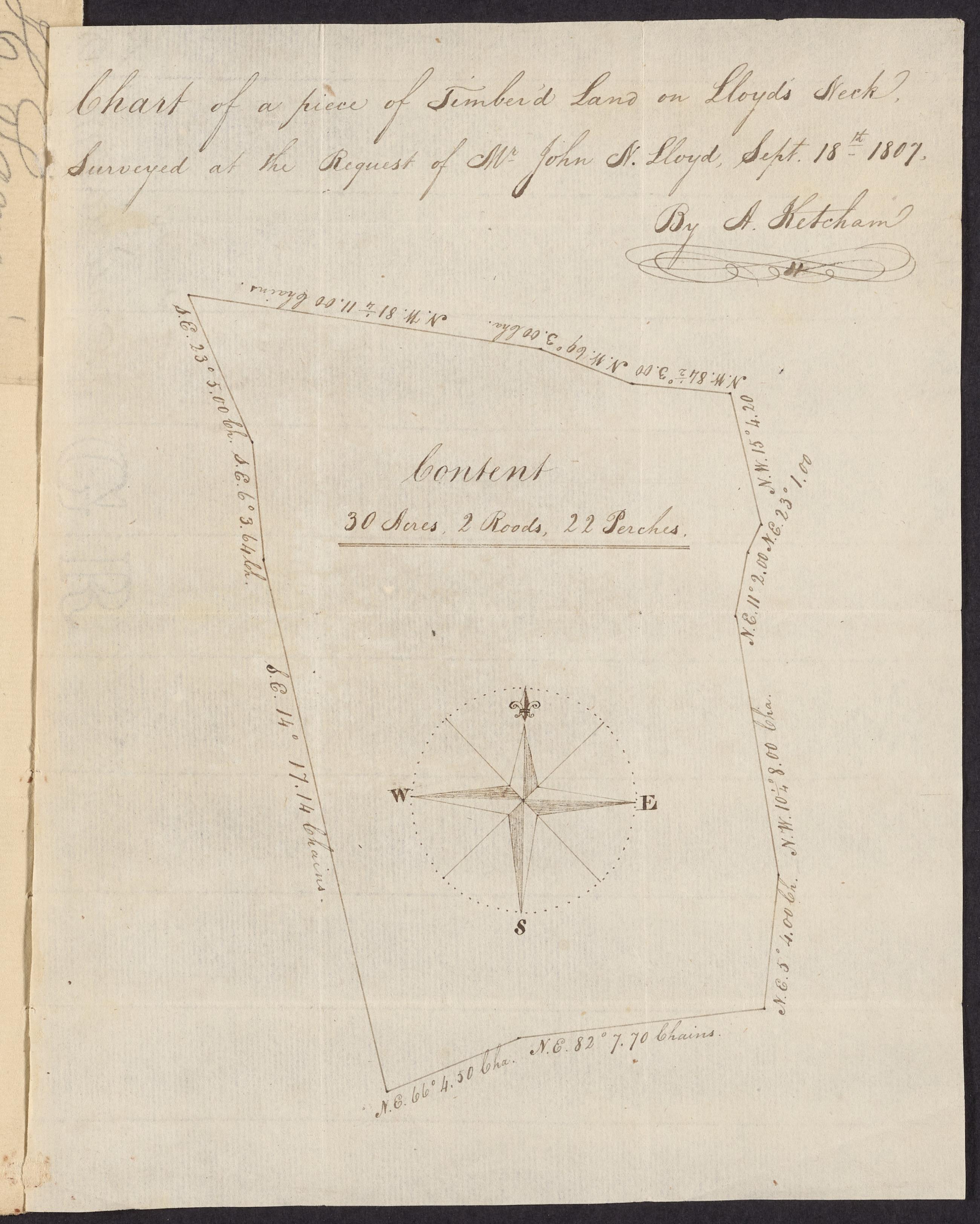
Text Chart of a piece of timbered land on Lloyd's Neck, September 18, 1807. Map made for John Nelson Lloyd by surveyor Abel Ketcham, Huntington, of a wooded section of Lloyd Neck to determine its area. View Item
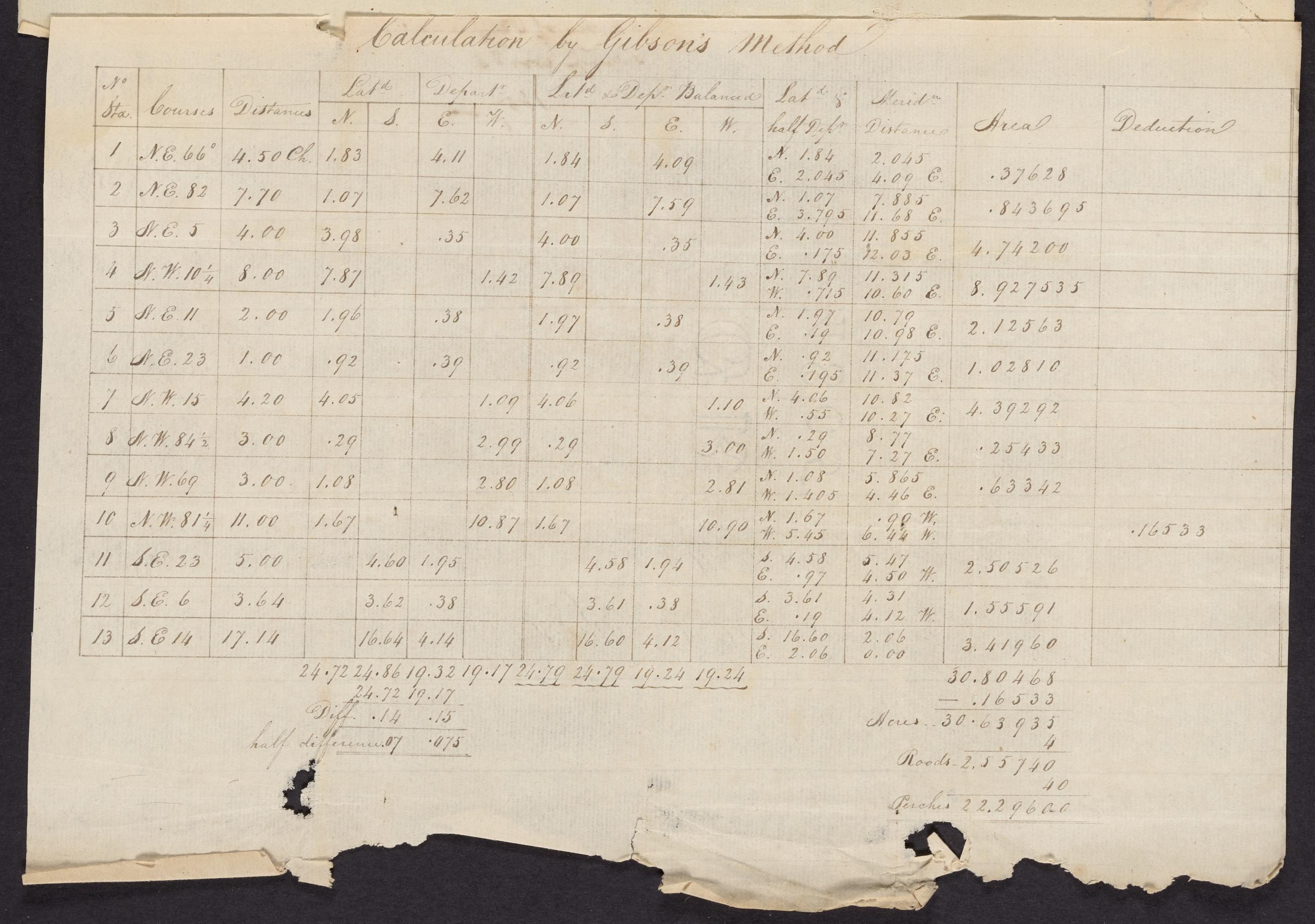
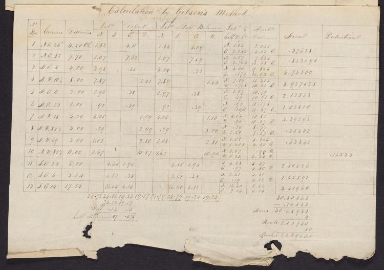
Image Text 2 Items Survey of pasturage, swamp, woods, 1807. Survey of land at Lloyd Neck for John Nelson Lloyd "calculation by [Robert] Gibson's method." View Item
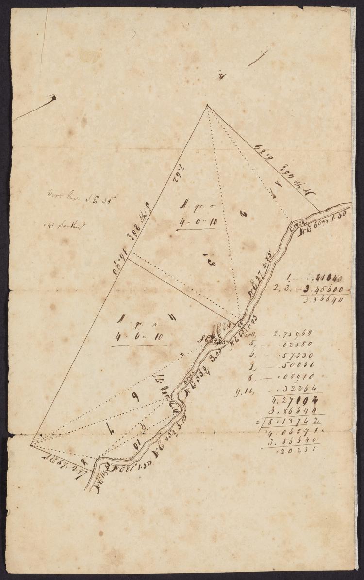
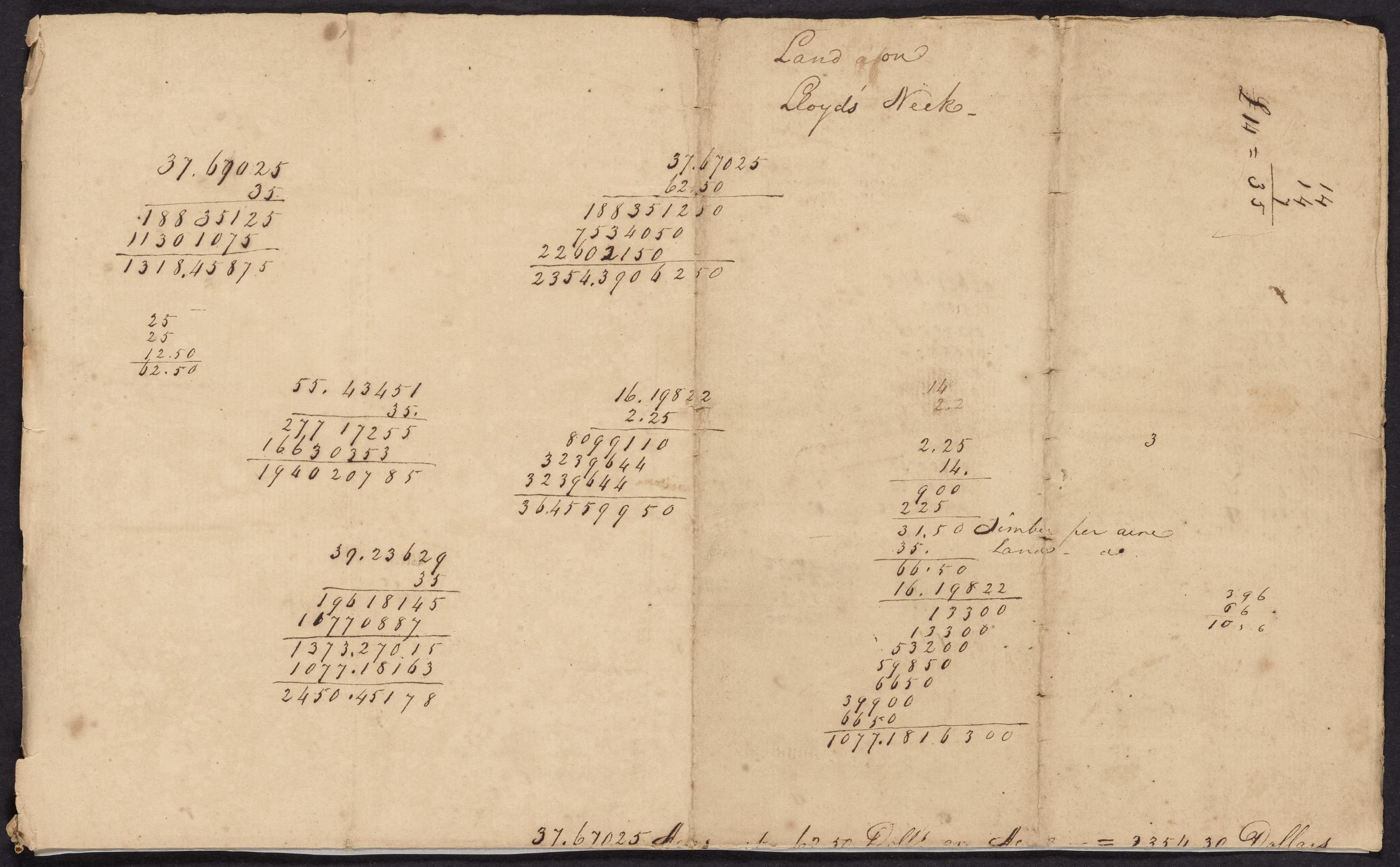
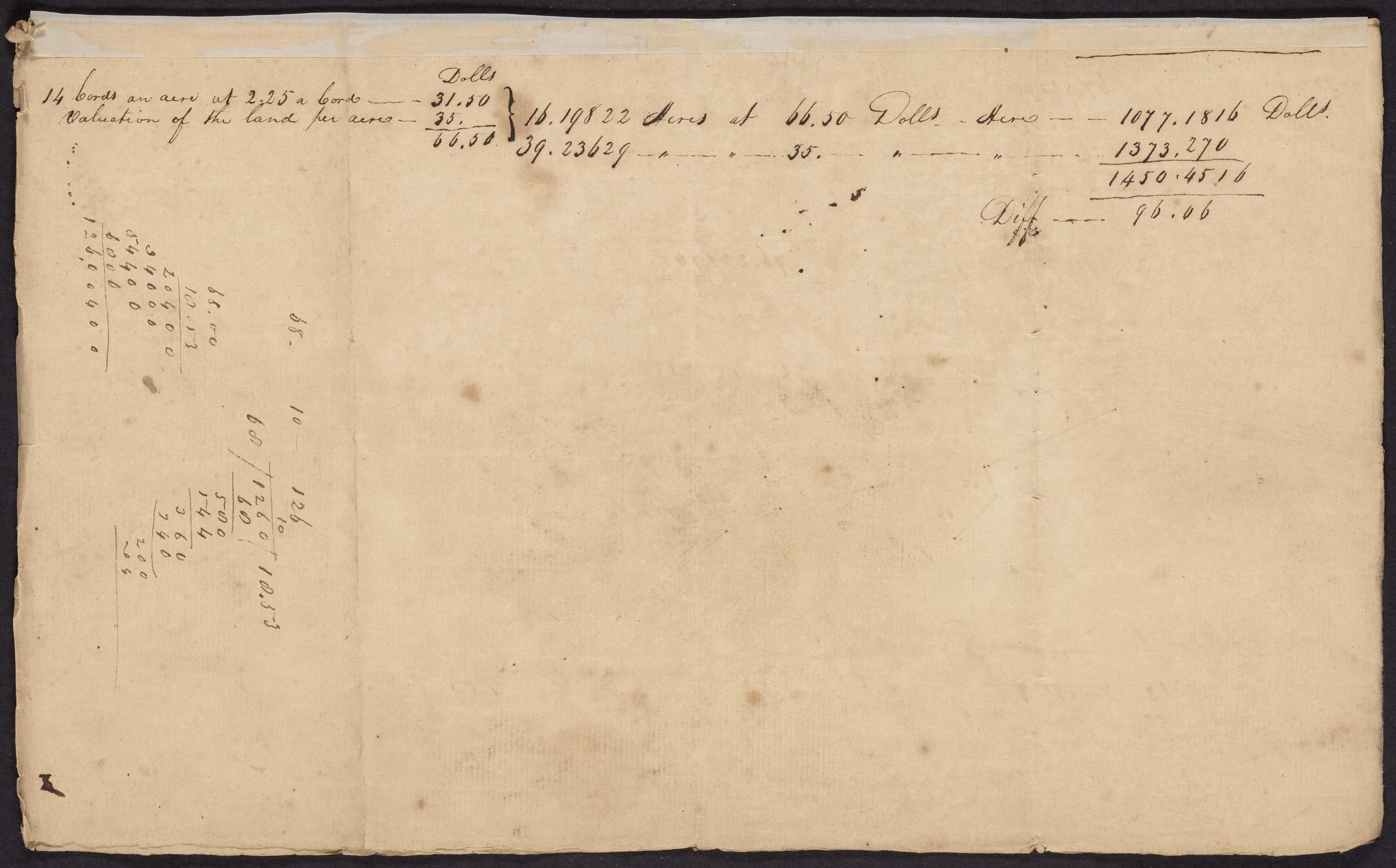
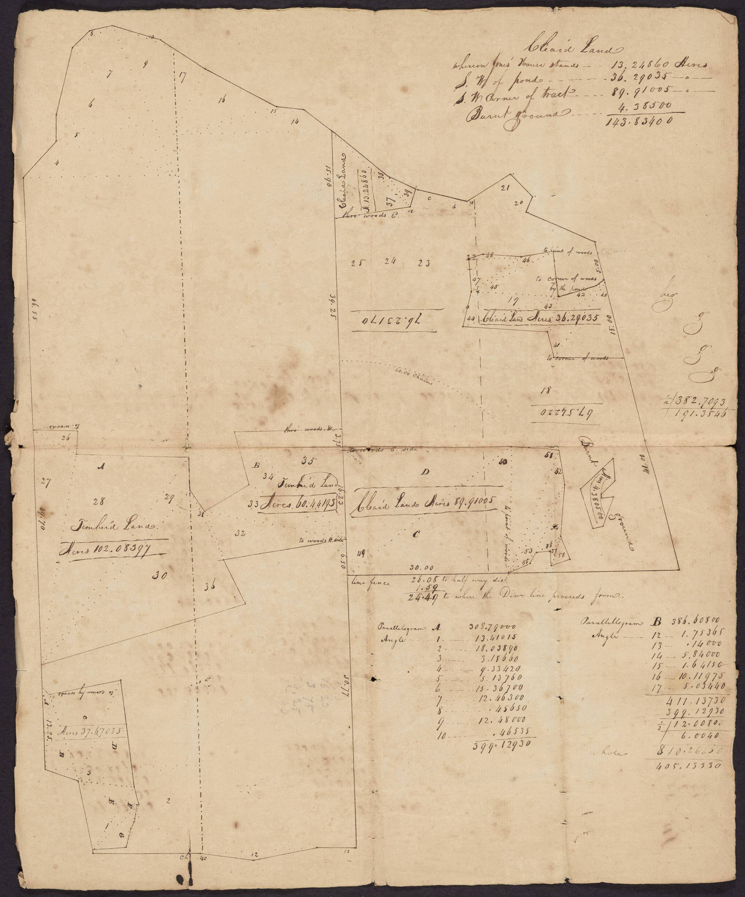
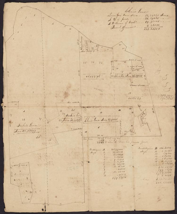
Image Text 3 Items Manuscript map of central part of Lloyd Neck, [ca. 1800] Manuscript map depicting the central part of Lloyd Neck with particular reference to cleared land and forested areas; with calculations of valuations on verso. View Item
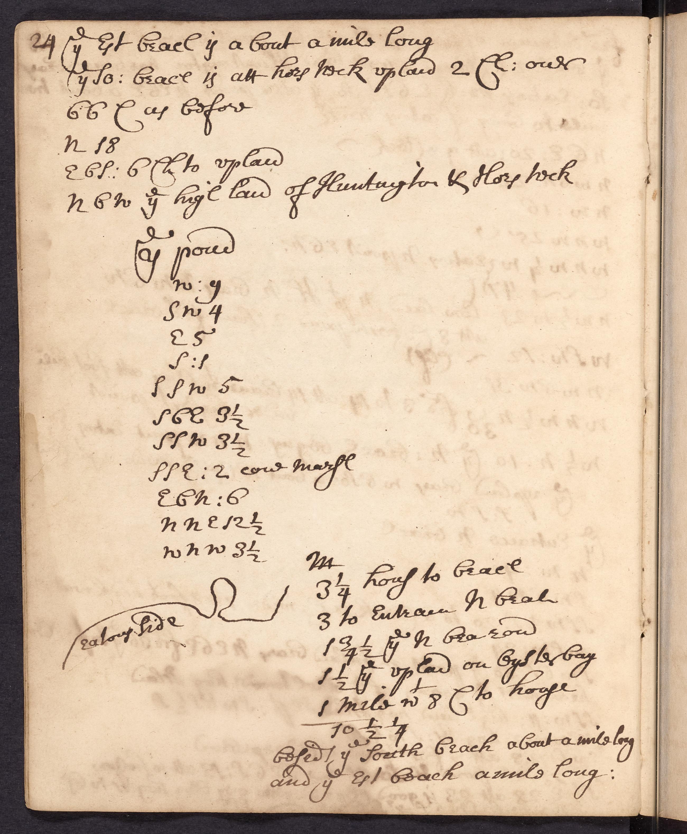
Text James Lloyd copy and account book, 1674-1823, page 24. Copy of measurements made by James Lloyd in a March 9, 1686 survey of Horse Neck continued). View Item
Text James Lloyd copy and account book, 1674-1823, page 23. Copy of measurements made by James Lloyd in a March 9, 1686 survey of Horse Neck continued). View Item
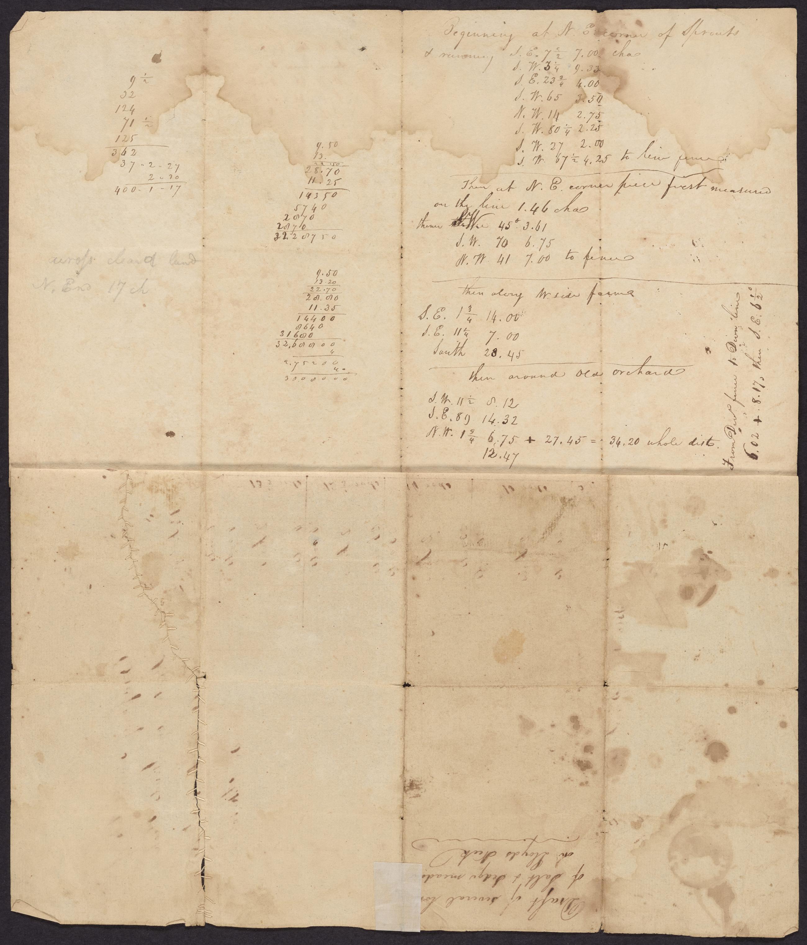
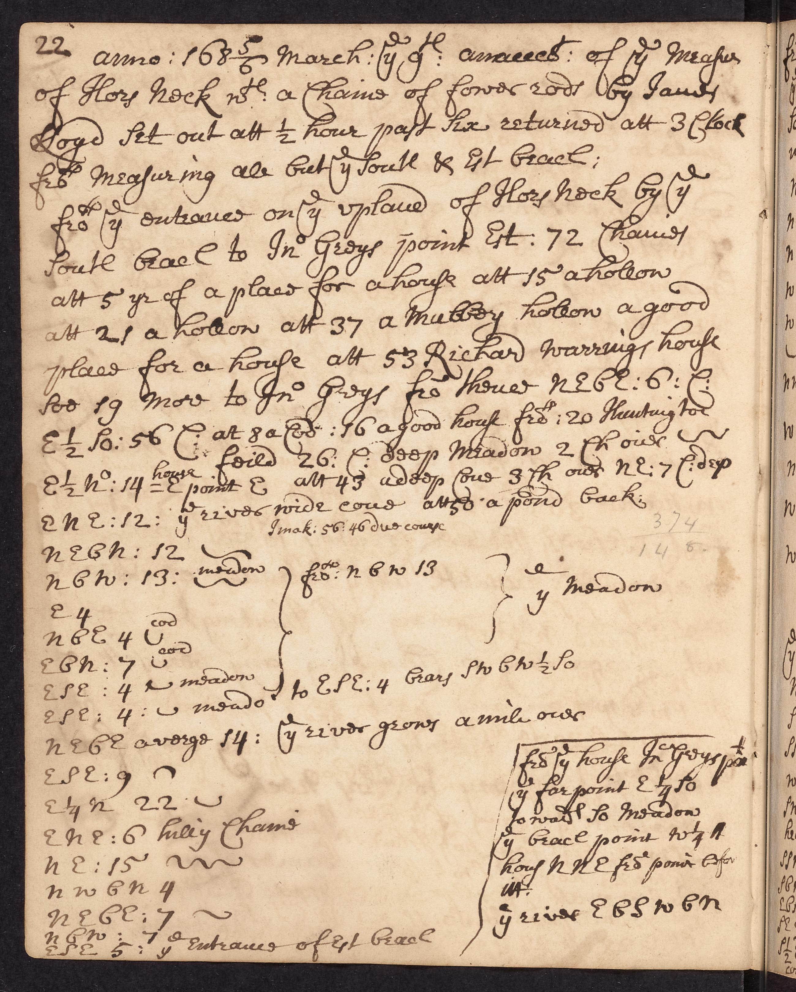
Text James Lloyd copy and account book, 1674-1823, page 22. Copy of measurements made by James Lloyd in a March 9, 1686 survey of Horse Neck. View Item
Text Lloyd family record book, 1654-1894, page 49, James Lloyd's survey of Lloyd Neck, March 9, 1686 (continued) View Item
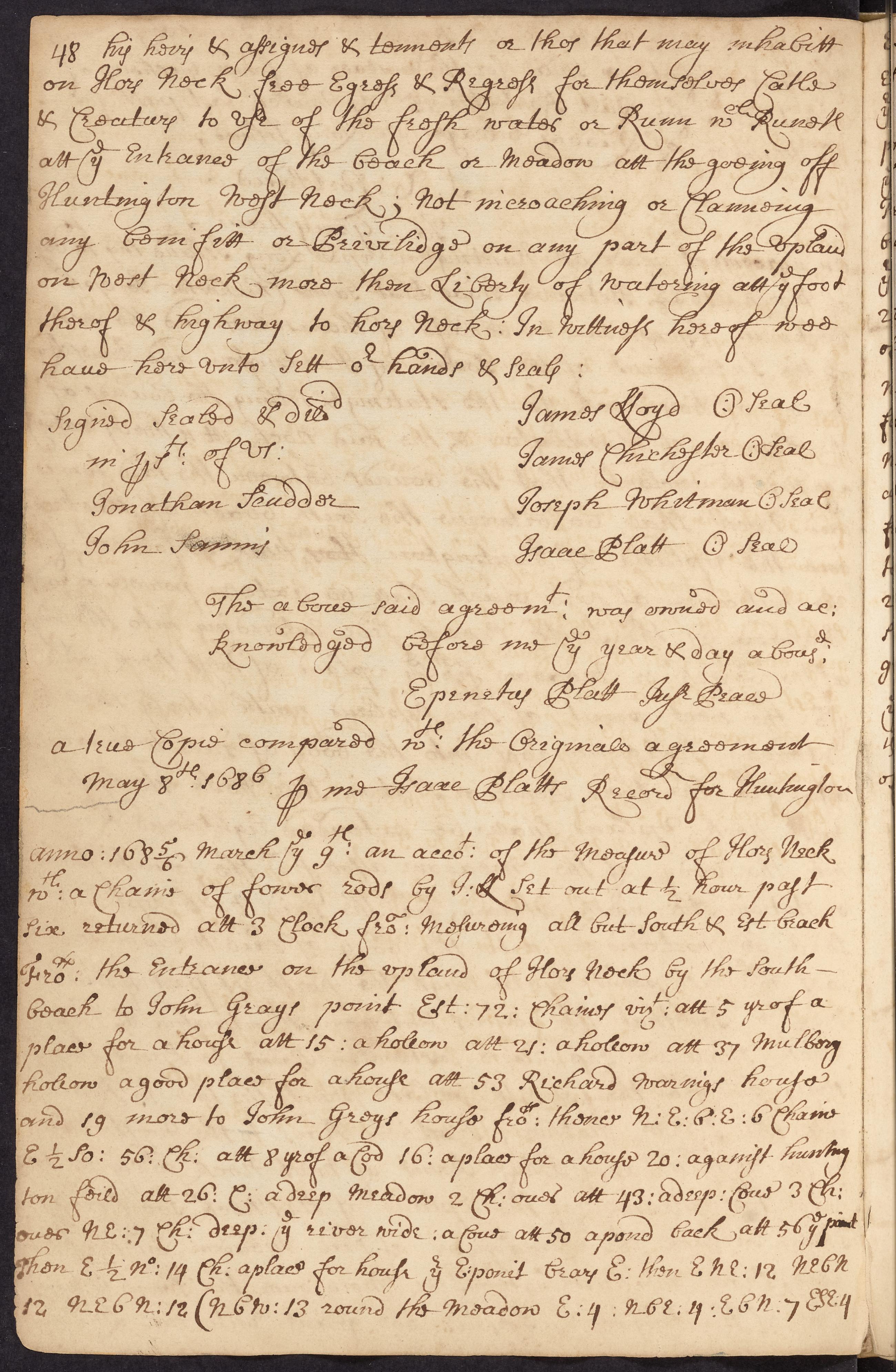
Text Lloyd family record book, 1654-1894, page 48, James Lloyd's survey of Lloyd Neck, March 9, 1686. Copy of measurements made by James Lloyd in a survey of Lloyd Neck. View Item
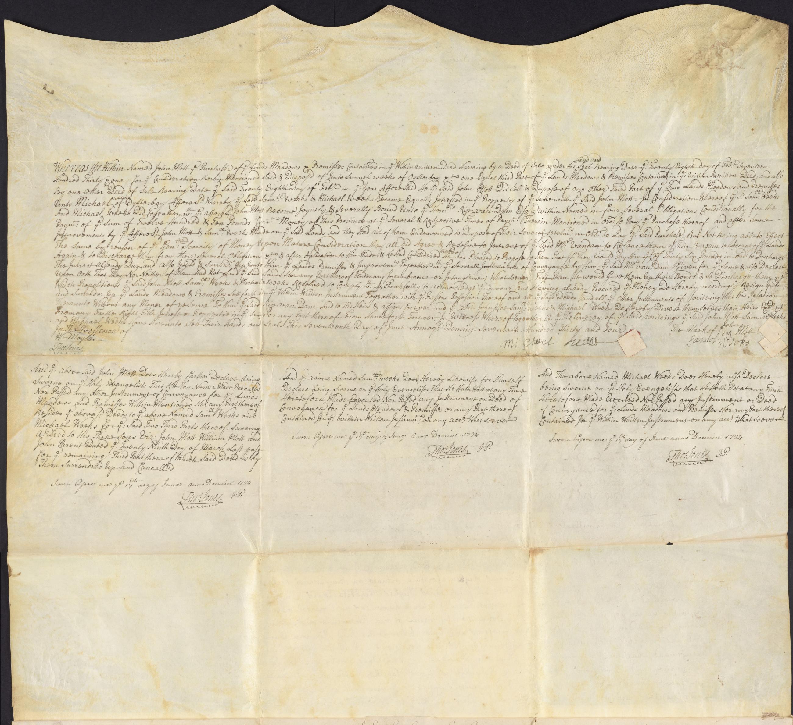
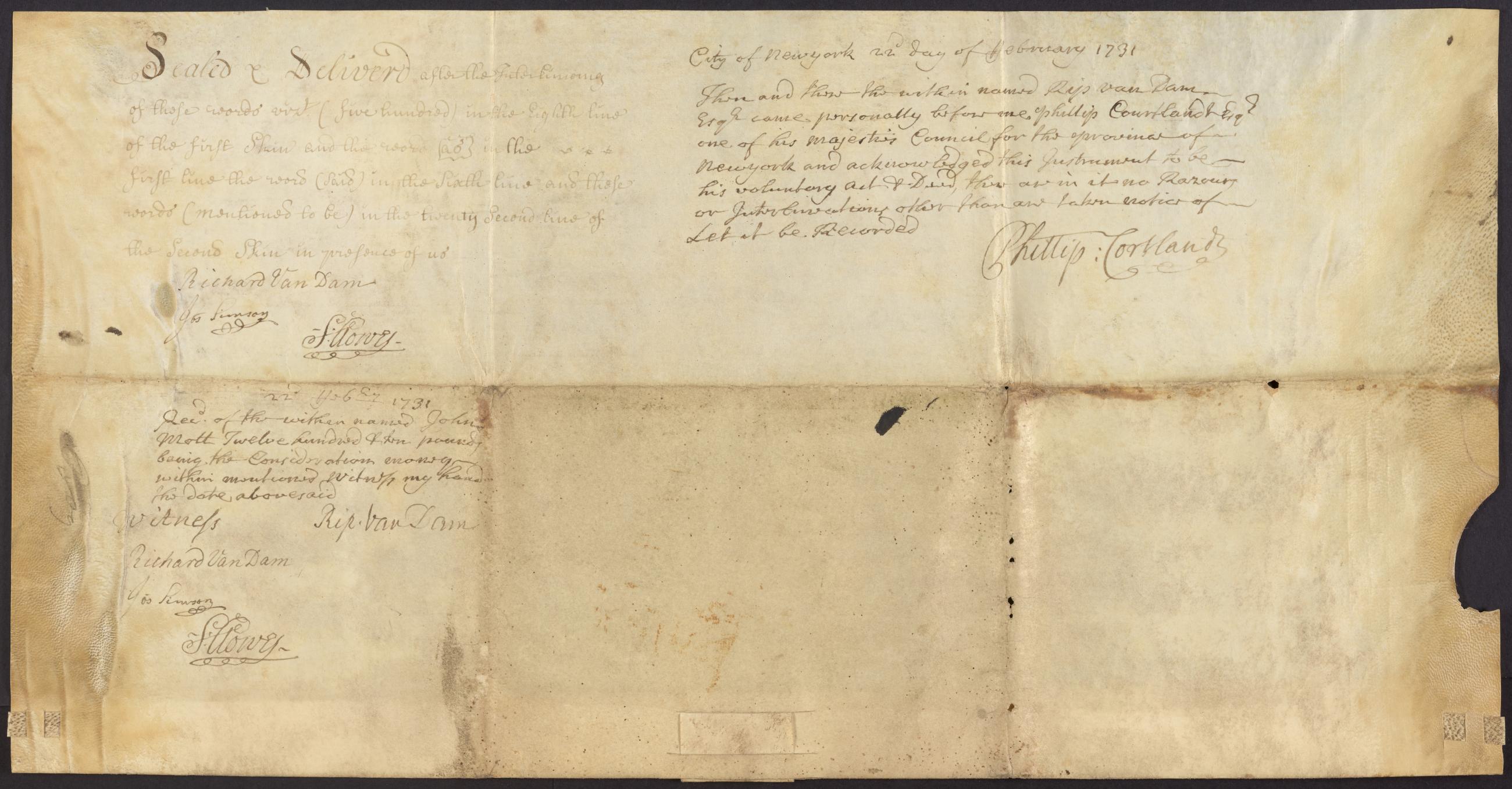
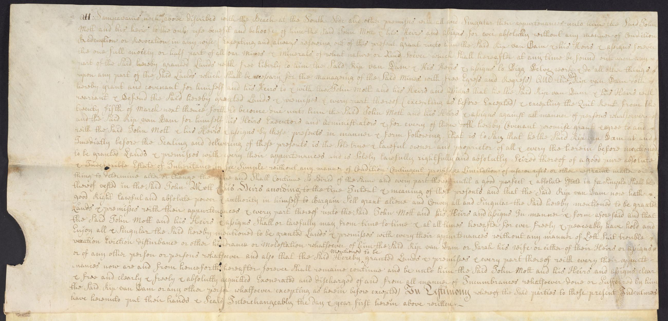
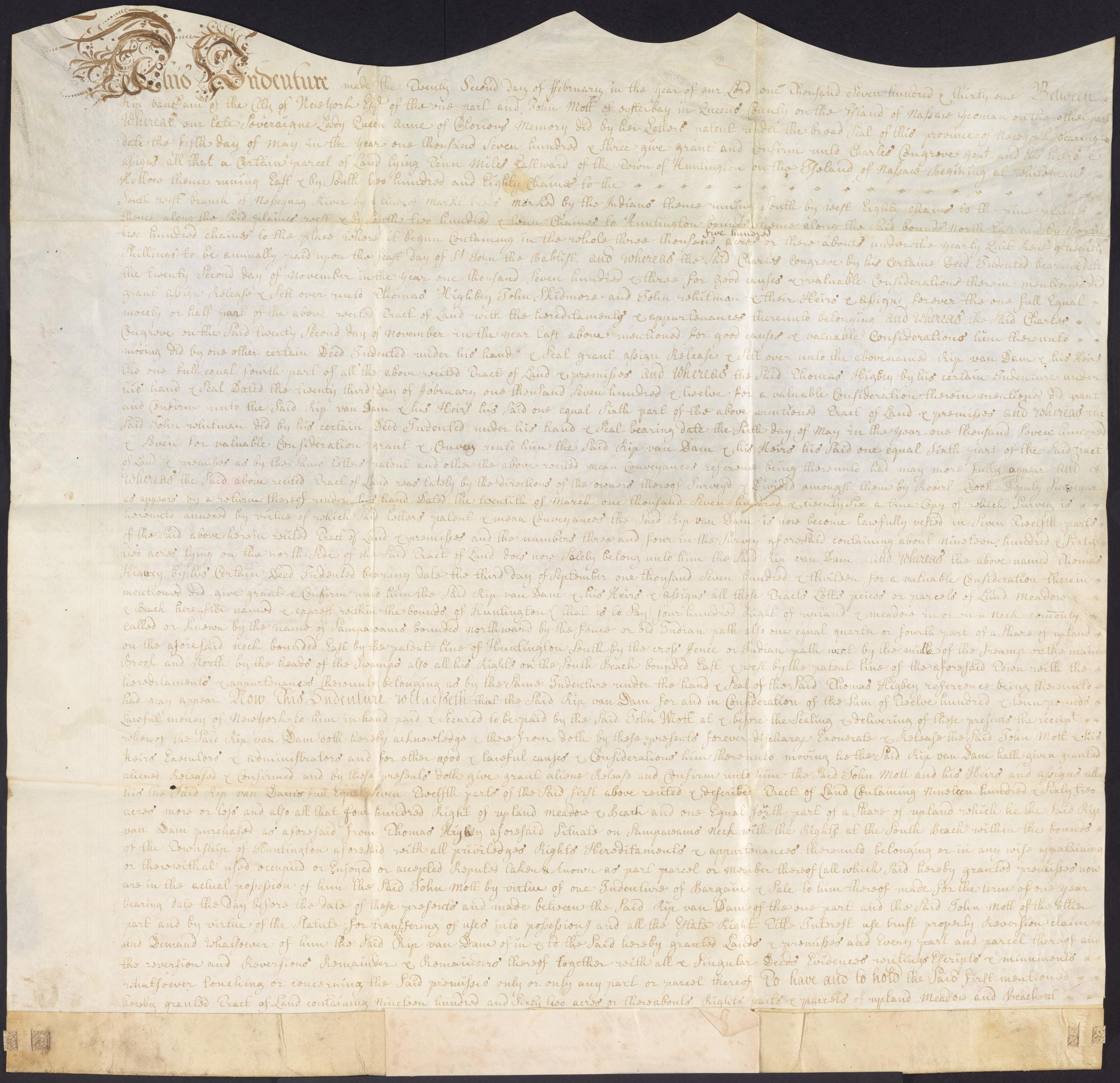
Image Text 6 Items Rip Van Dam indenture, February 22, 1731. Indenture from Rip Van Dam, New York, to John Mott, Oyster Bay, for the sale of 1,962 acres near modern day Commack and property on Sampawams Neck for £1210; the first was originally part of a larger property owned in common by several people and divided in 1726 by surveyor, Robert Crooke, with a recitation of the property's ownership history; Van Dam retains the right to mine minerals at Sampawams Neck; witnessed by Richard Van Dam, Joseph Simson, and Samuel Clowes; attested by Rip Van Dam before Phillip Van Cortlandt, member of the Council. View Item
Image Collection 5 Items Duane family papers, 1665-1916 (bulk 1756-1900) This collection contains papers relating to the Duane family and associated families. The bulk of the collection concerns the papers of James Duane, a prominent New York lawyer, patriot, and land developer. James Duane (1733-1797) became the ward of Robert Livingston after his father's death around 1734 and married Livingston's daughter Mary in 1759. He made a number of profitable real estate investments and was a prominent lawyer by the time of the American Revolution. View Collection