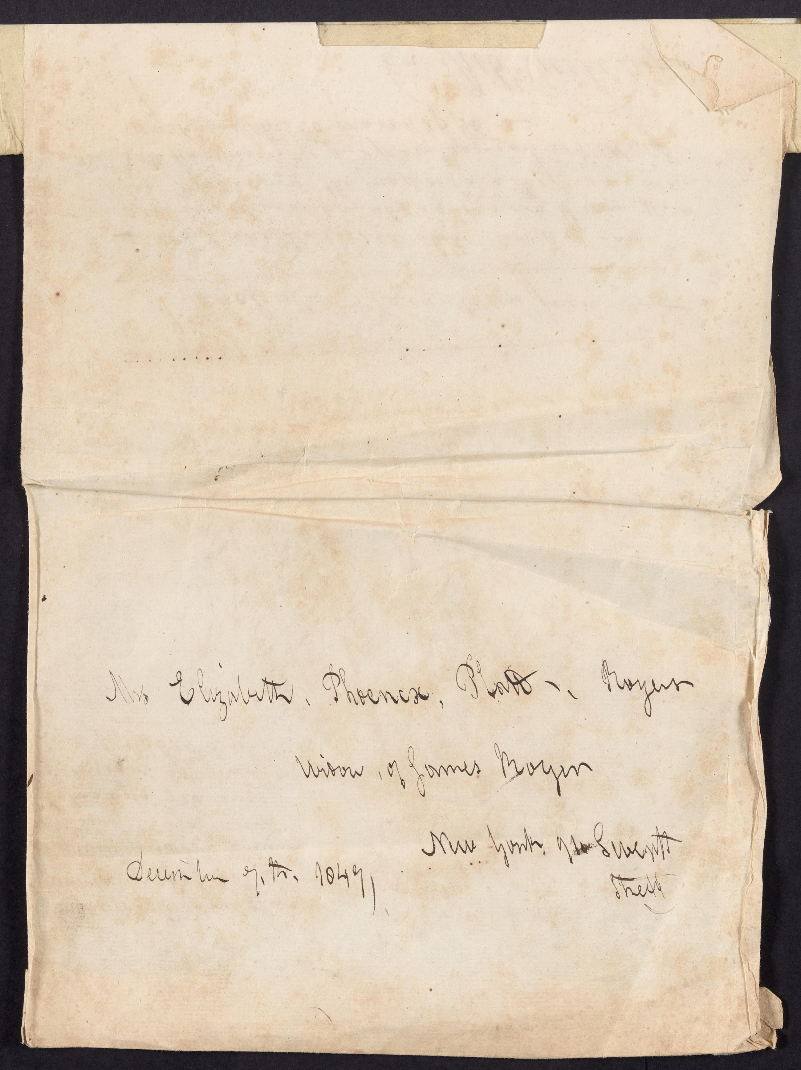
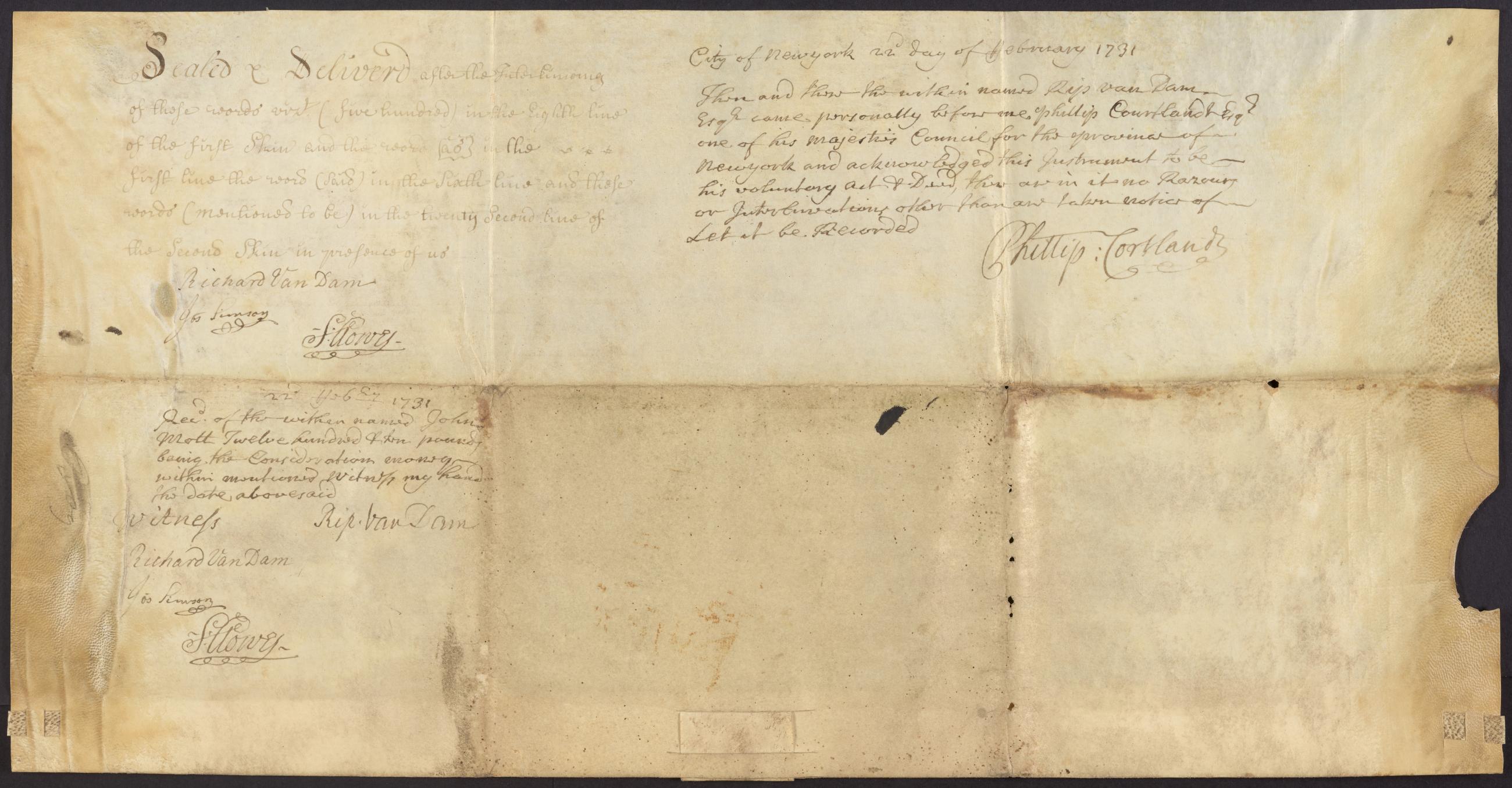
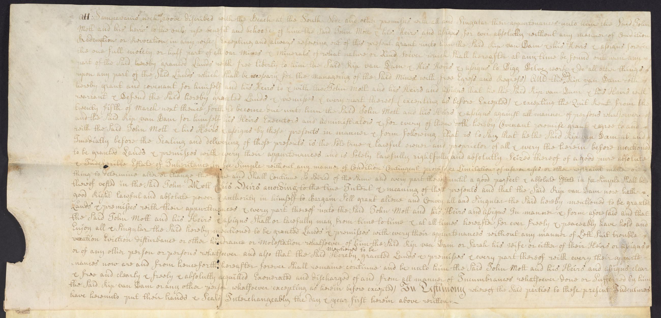
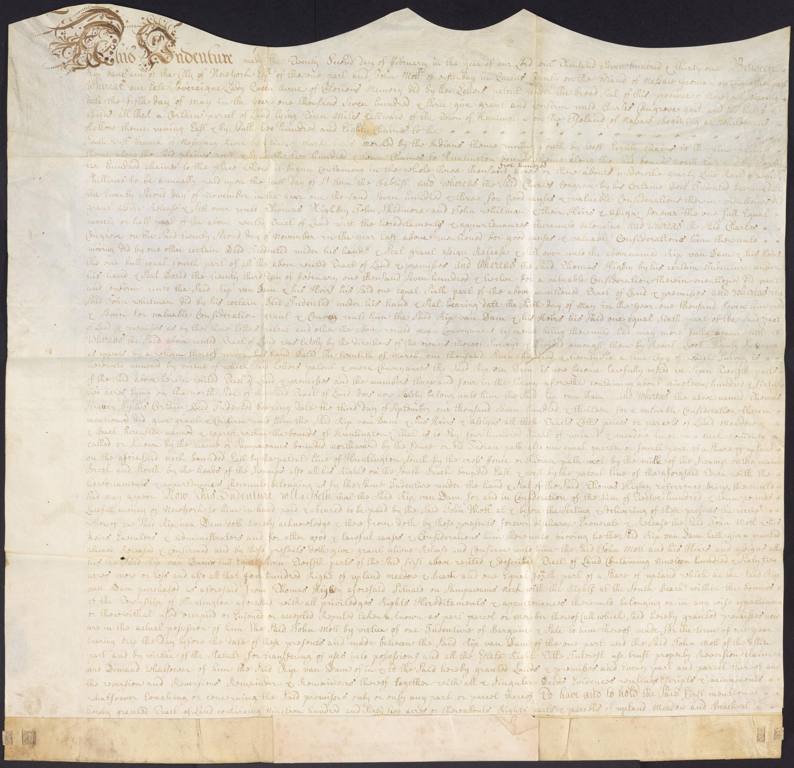
Image Text 6 Items Rip Van Dam indenture, February 22, 1731. Indenture from Rip Van Dam, New York, to John Mott, Oyster Bay, for the sale of 1,962 acres near modern day Commack and property on Sampawams Neck for £1210; the first was originally part of a larger property owned in common by several people and divided in 1726 by surveyor, Robert Crooke, with a recitation of the property's ownership history; Van Dam retains the right to mine minerals at Sampawams Neck; witnessed by Richard Van Dam, Joseph Simson, and Samuel Clowes; attested by Rip Van Dam before Phillip Van Cortlandt, member of the Council. View Item
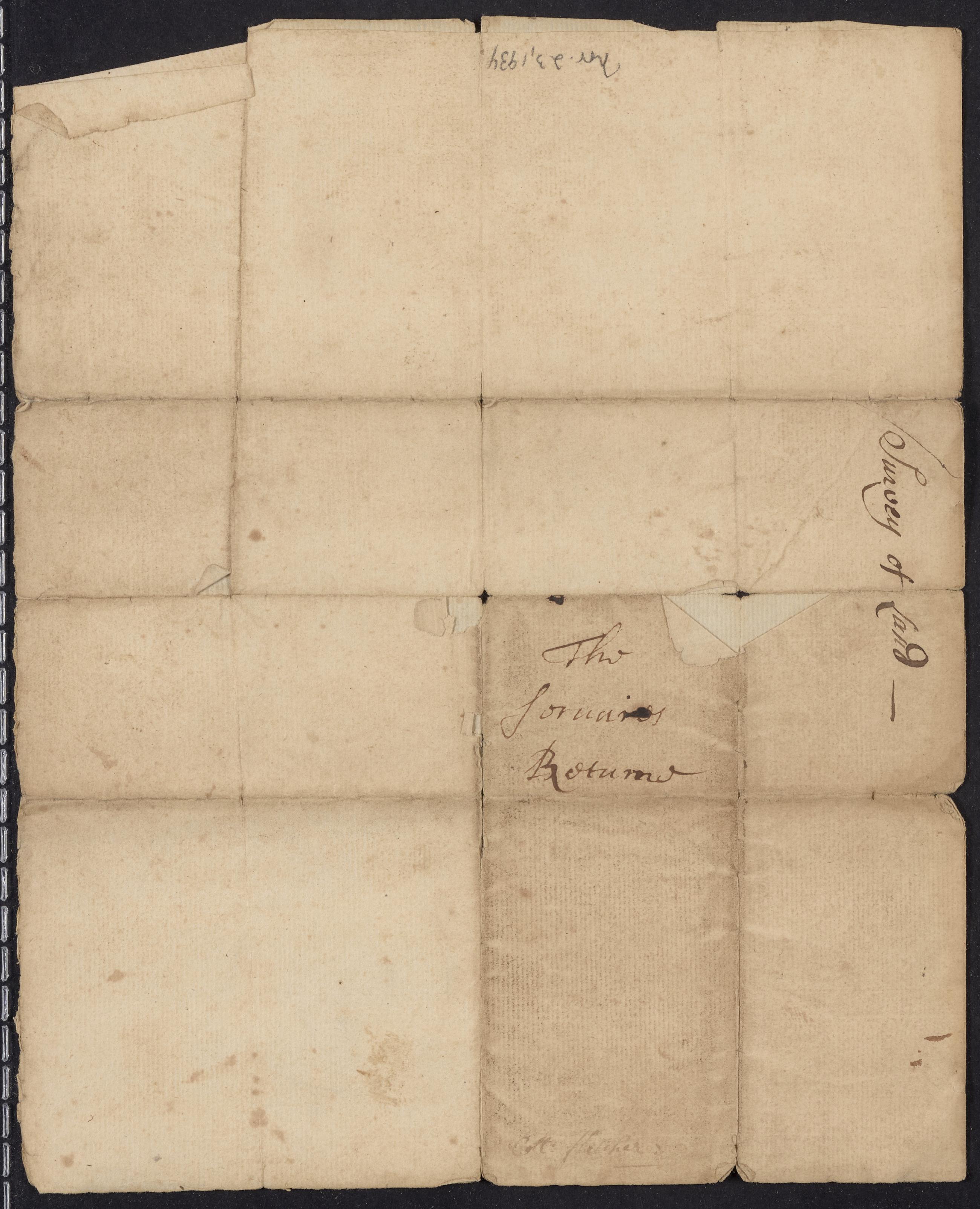
Text Cadastral map of part of Newtown in western Queens County, [early 18th century], recto. View Item
Text Cadastral map of part of Newtown in western Queens County, [early 18th century], recto. View Item
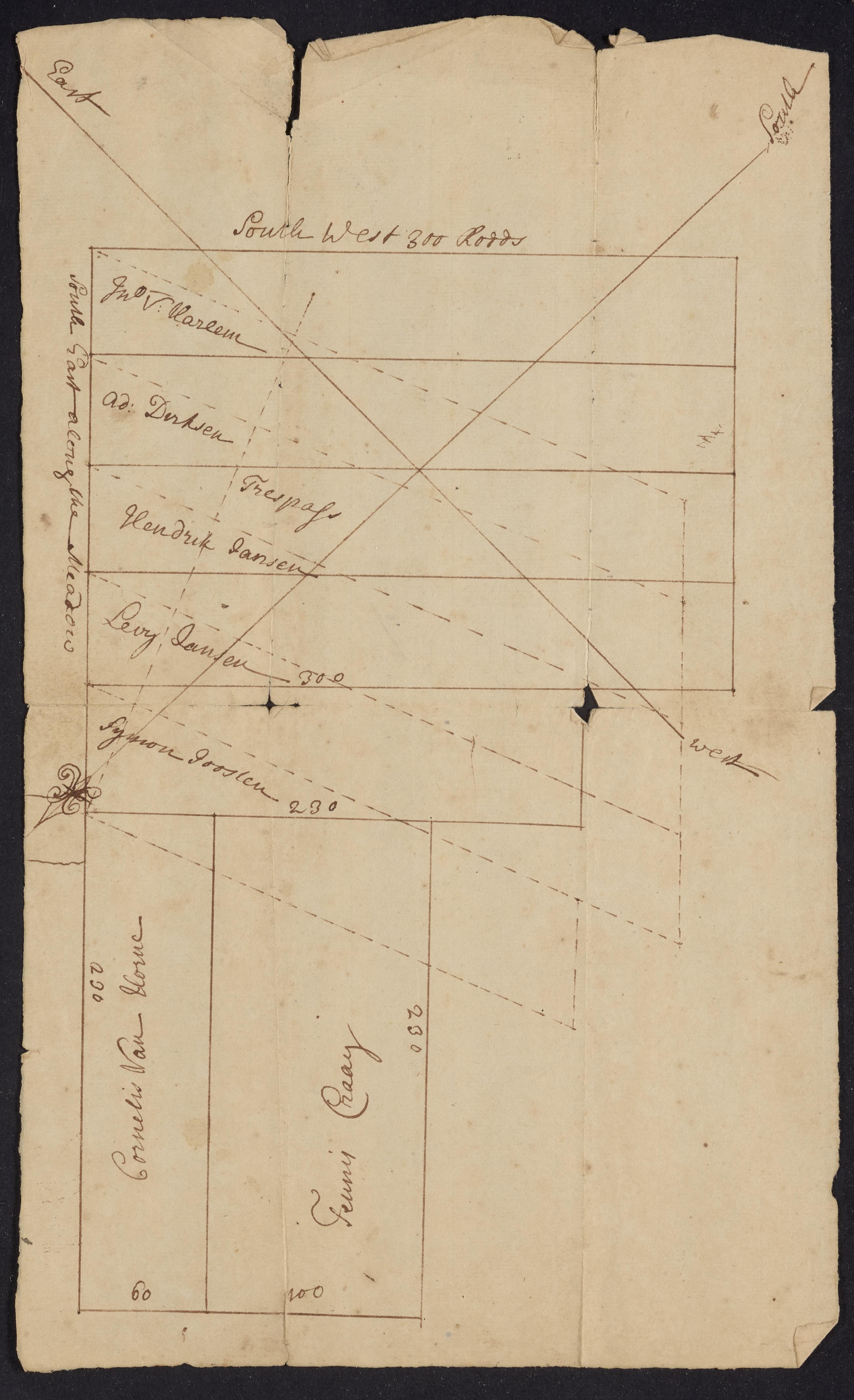
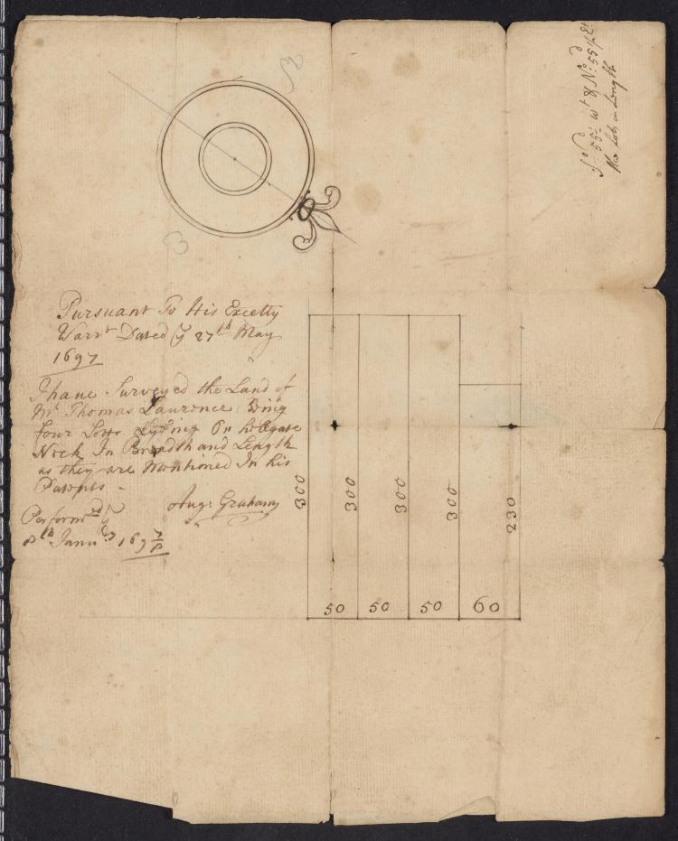
Image Text 2 Items Cadastral map of part of Newtown in western Queens County, [early 18th century] Manuscript cadastral map by an unidentified surveyor of Thomas Lawrence's property near Hellgate in western Queens relative to the holdings of earlier landowners. View Item
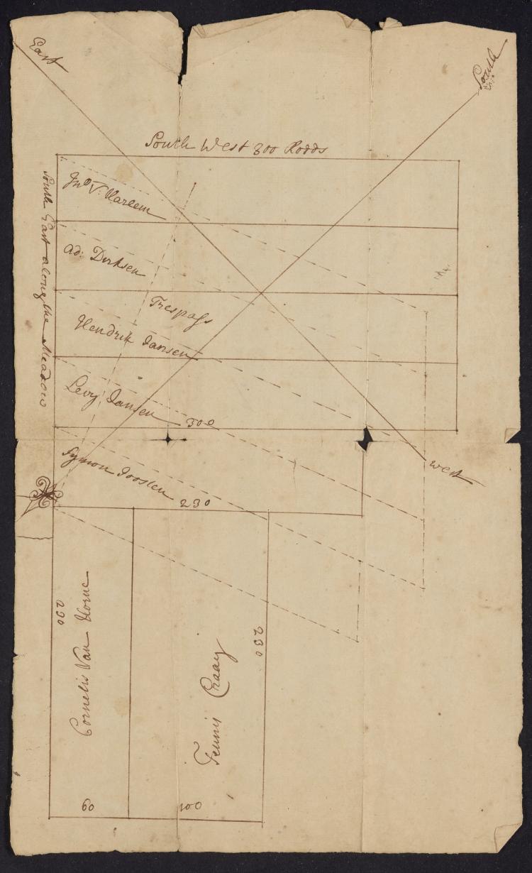
Image Text 2 Items Augustine Graham map, January 8, 1698. Manuscript cadastral map of Thomas Lawrence's property near Hellgate in western Queens prepared by Augustine Graham from his survey. View Item
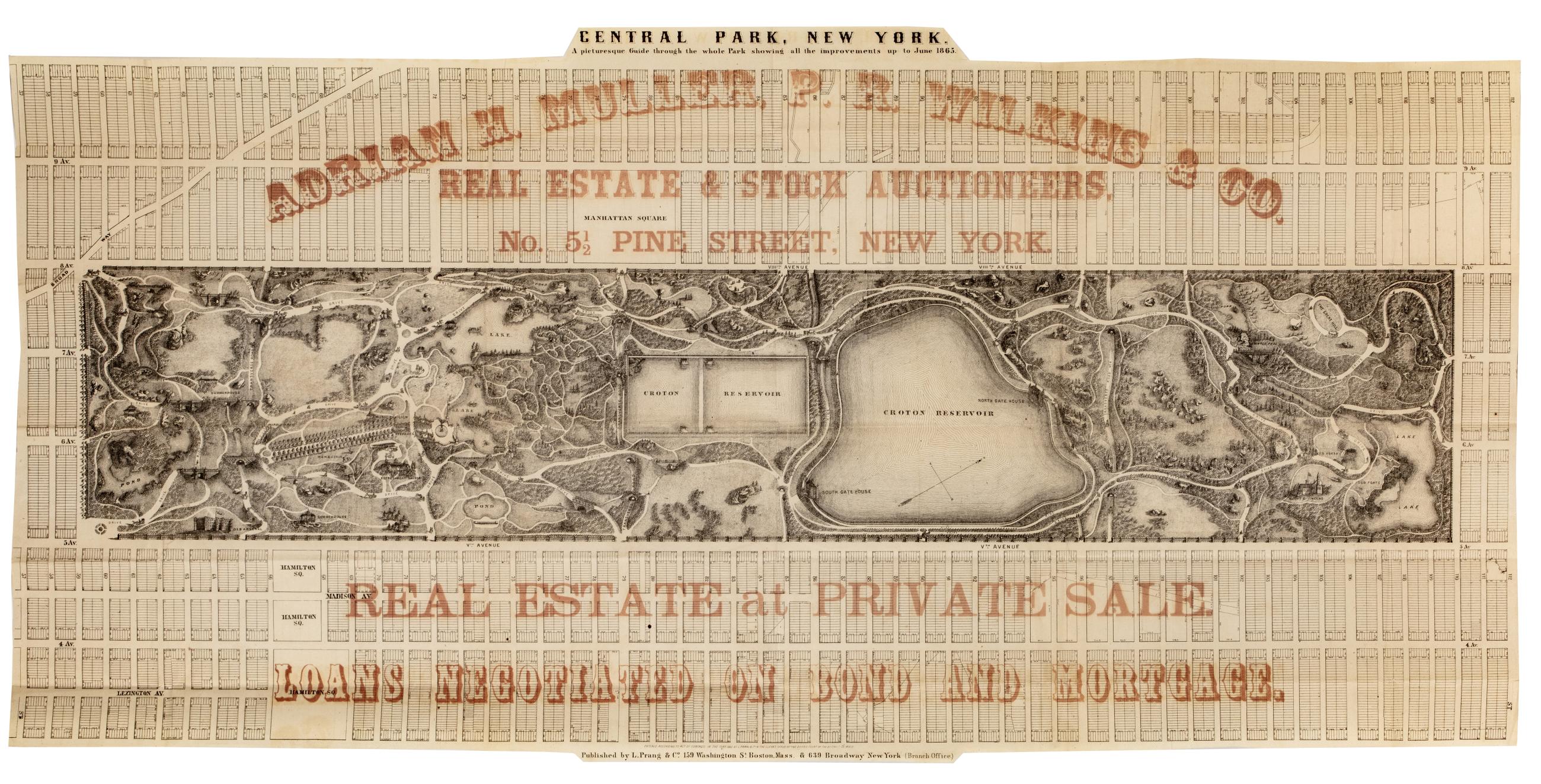
Cartographic Central Park, New York : a picturesque guide through the whole park showing all the improvements up to June 1865 Park map. Covers the area later bounded by 57th and 112th Streets, Third and Amsterdam Avenues, Manhattan, New York (N.Y.). Shows roads, trails, bridges, buildings, reservoir, gardens and plantings pictorially. Also shows landforms and streams. Oriented with north to right of sheet. "Entered according to act of Congress in the year 1865, by L. Prang & Co, in the Clerk's Office of the District Court of the District of Mass." Overprinted in red ink with: "Adrian H. Muller, P.R. Wilkins & Co., real estate and stock auctioneers, No. 5 1/2 Pine Street, New York. View Item
Image Text 2 Items Map of proposed road in Hempstead, [1870] Map of proposed road (Central Ave.?) in Hempstead showing the adjacent property owners with a list of how much land to be taken from each owner for the construction of the road. View Item
Hospital & Military Prison at Point Lookout. Hospital & Military Prison at Point Lookout. Lithograph: 5 3/4 x 8 1/8 in. Map of layout of buildings at Point Lookout. View Item
Still Image This plan of the City of New York (within the palisades which were erected in the year 1743) was made for the purpose of shewing the progress and extent of the great fire which happened in the year 1776, the number of houses that was consumed, and also th "Presented to the New York Historical Society by David Grim." Attributed by cataloger to Grim. Brittle, varnished, cracked and frayed. ; mounted on paper in turn backed by cloth. Date of ms. after 1804 foundation of the N-YHS. Date before Grim's death 1826. Historical map. Covers Manhattan Island south of modern Chambers Street, New York (N.Y.) Shows buildings and other urban features. Includes index. Pen-and-ink, watercolor on paper. Ships shown pictorially. View Item
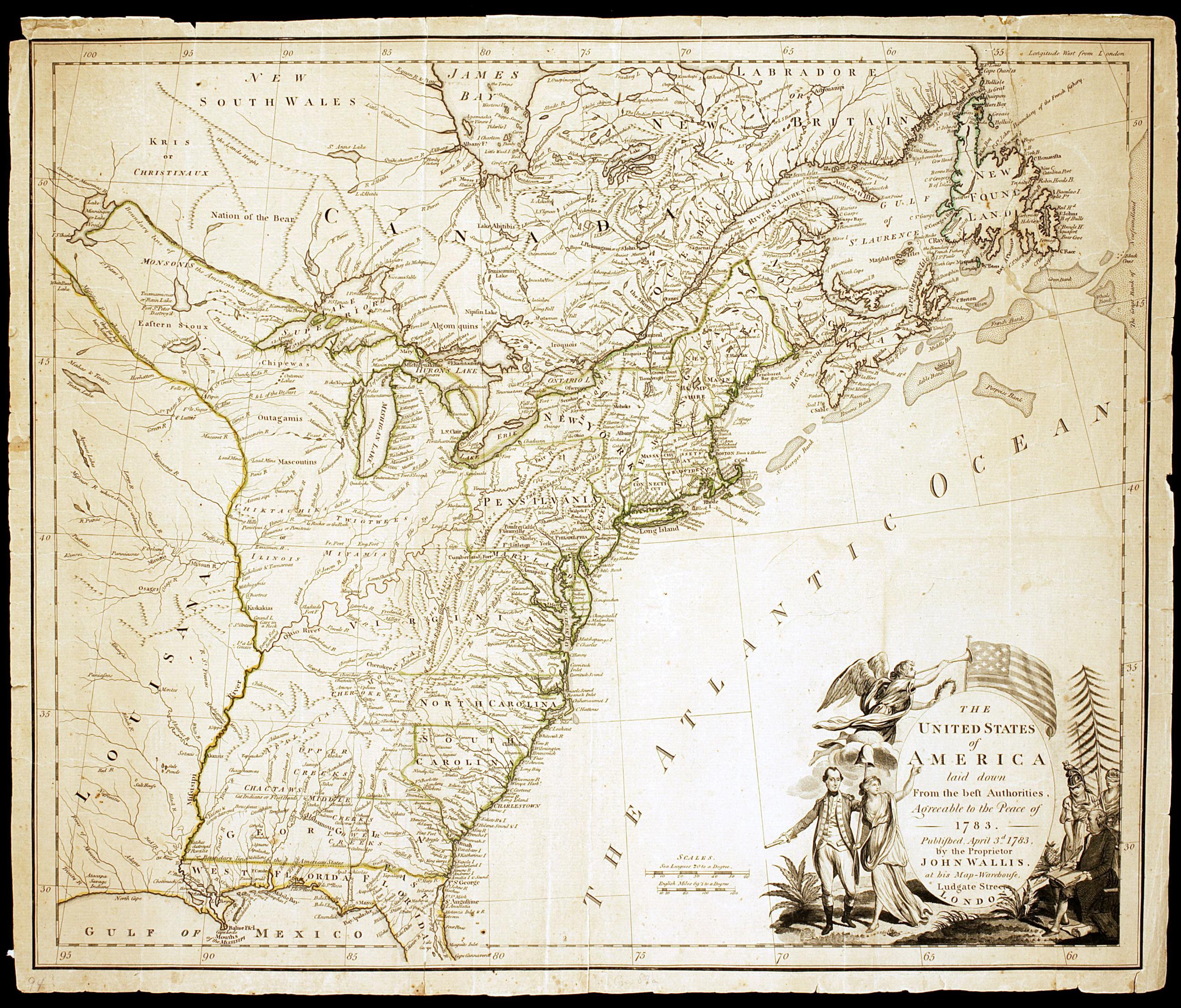
Still Image The United States of America laid down from the best authorities, agreeable to the Peace of 1783 Hand colored. Relief shown pictorially. Prime meridian: London. The first printed map known to bear the nation's standard, it appeared five months before the signing of the Treaty of Paris, and indicated the national boundaries established by same. The title cartouche is flanked by likenesses of Washington and Franklin, attended by female personifications of Columbia, Liberty and Justice. View Item
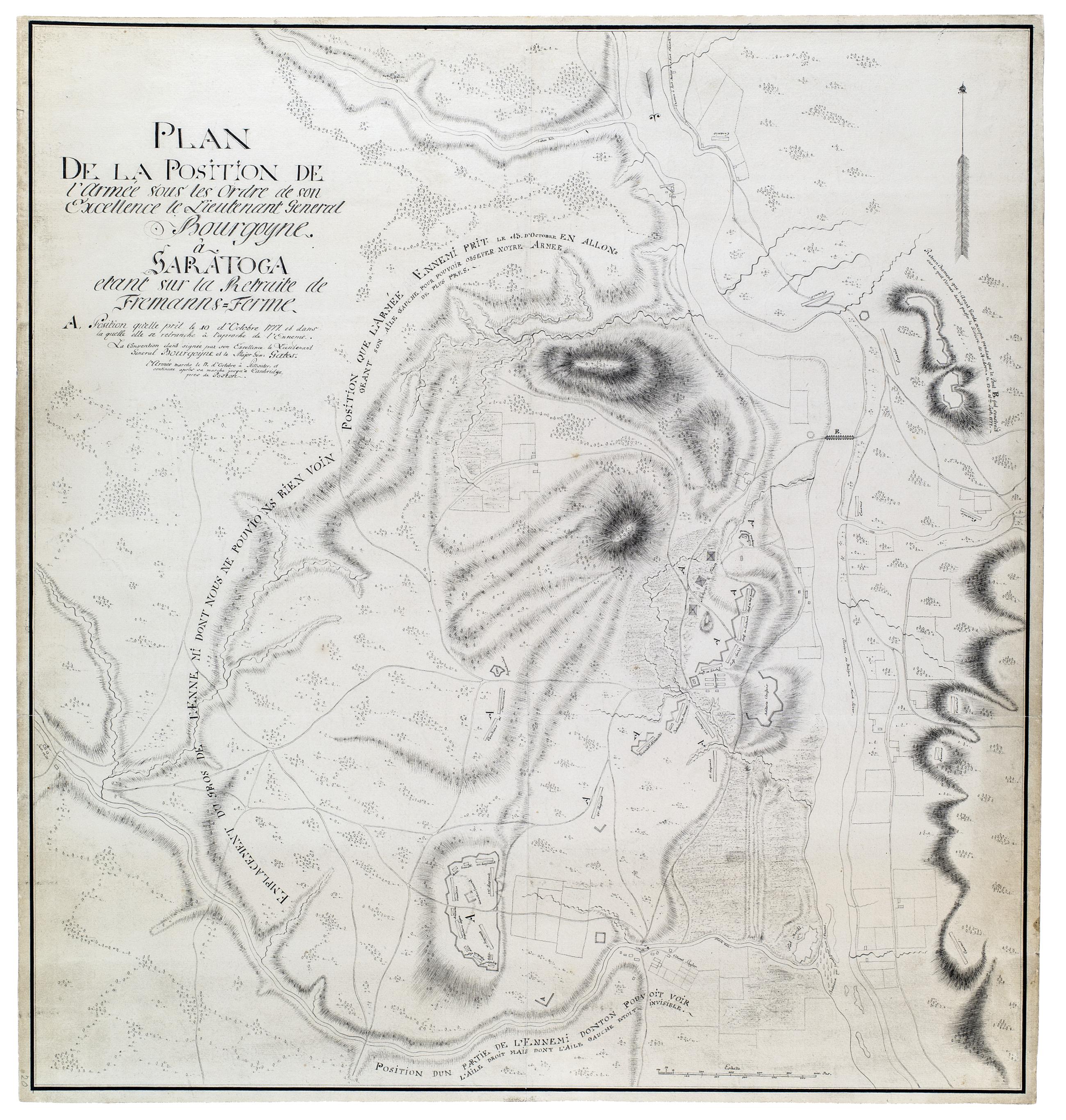
Still Image Plan de la position de l'armée sous les ordre de son Excellence le Lieutenant General Bourgoyne à Saratoga etant sur la Retraite de Fremanns-Ferme. British watermark: "[J WHATM]AN TURKEY MILL 1773." Creased; lightly soiled and slightly frayed. Bleached. Fair condition. Includes key and descriptive text. Military battlefield map. Shows troop and artillery dispositions in Sep. and Oct. 1777. American troops called "L'armée Ennemi." Shows "Canadien et Provinceaux" in a forward position. Pen-and-ink on laid paper. Shows relief by hachures in the French style. View Item
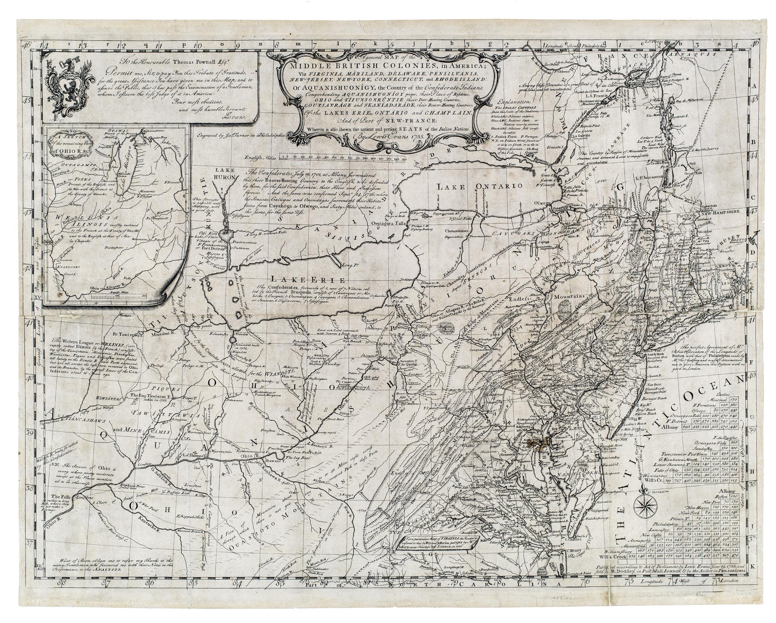
Still Image A general map of the middle British colonies, in America : viz Virginia, Màriland, Dèlaware, Pensilvania, New-Jersey, New-York, Connecticut, and Rhode Island : of Aquanishuonîgy, the country of the Confederate Indians ; comprehending Aquanishounigy proper Prime meridian: London and Philadelphia. Relief shown by hachures. From Evans, L. Geographical, historical, political, philosophical and mechanical essays, Philadelphia, 1755. Inset: A sketch of the remaining part of Ohio R. &c. "To the honourable Thomas Pownall Esqr. Permit me, Sir, to pay you this tribute of gratitude. for the great assistance you have given me in this map ... View Item
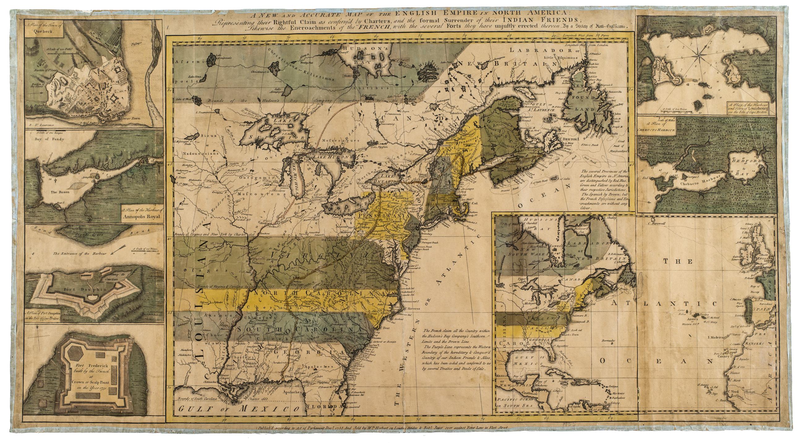
Still Image A new and accurate map of the English empire in North America : Representing their rightful claim as confirm'd by charters, and the formal surrender of their Indian friends : likewise the encroachments of the French, with the several forts they have unjus Relief shown pictorially. Designed to be colored. Shows English claims across North America. Untitled inset shows North America in relation to Europe. View Item
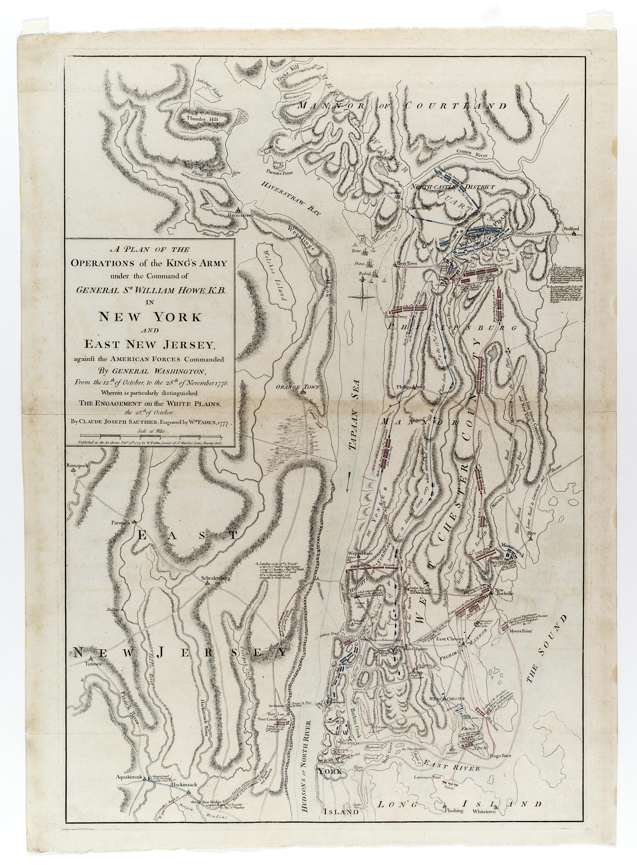
Still Image A plan of the operations of the King's army under the command of General Sr. William Howe, K.B. in New York and east New Jersey, against the American forces commanded by General Washington, from the 12th. of October, to the 28th. of November 1776. : Where This map is the first state. Two states noted. In the first state, there are no British ships off "Terry Town." [i.e. Tarrytown]. In the second state, British ships are lying off "Terry Town," three being named "Tartar," "Phoenix," and "Roebuck" with their course up the Hudson shown by a dotted line up the center of the river. Several new place names are also inserted. cf. Stevens and Tree. Comparative cartography. Shows movements of British and American forces prior to, during, and after the Battle of White Plains. Many notations provide details of movements and events. View Item
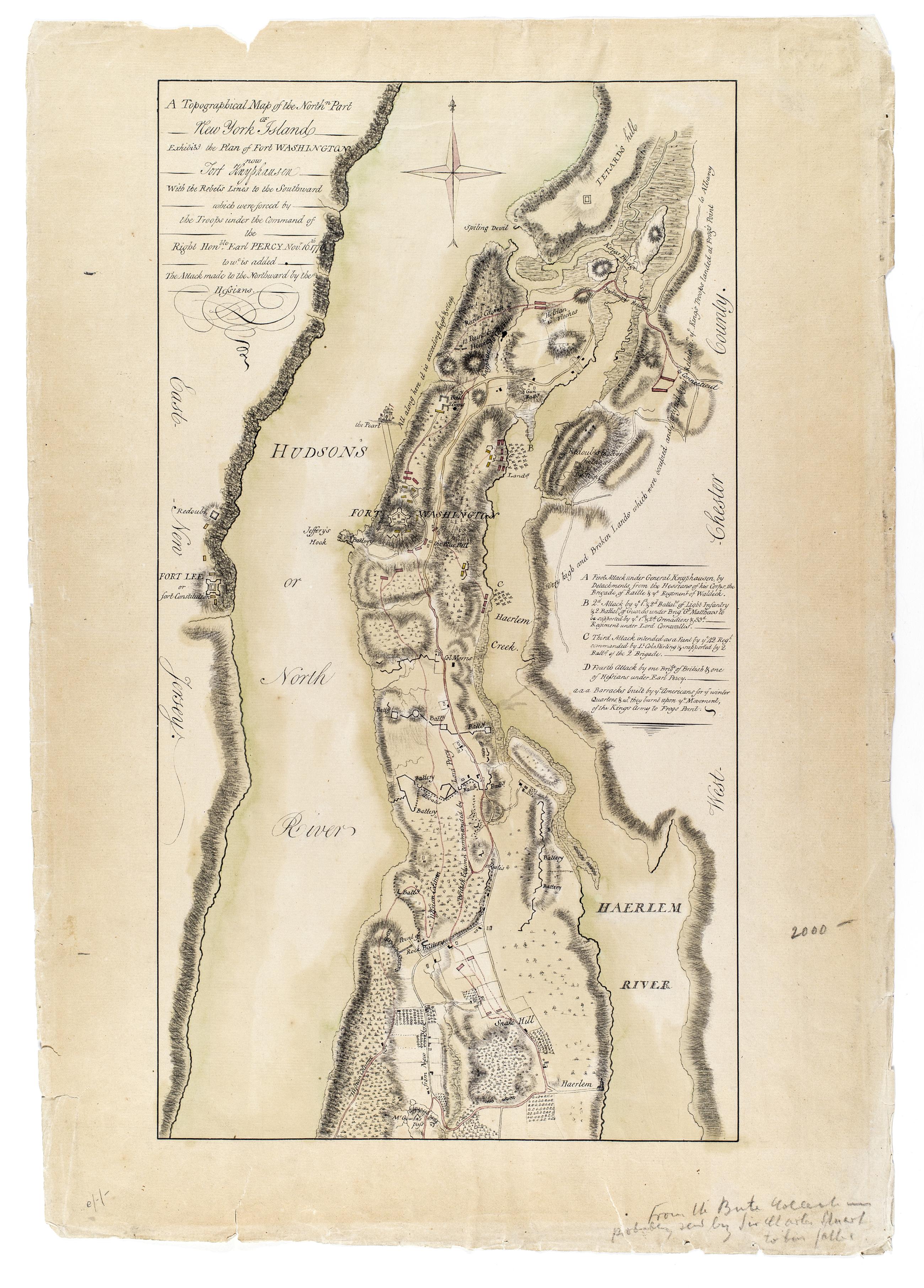
Still Image A Topographical map of the northn. part of New York Island, exhibitg. the plan of Fort Washington now Fort Knyphausen, with the rebel's lines to the southward, which were forced by the troops under the command of the Right Honble. Earl Percy Novr. 16th. 1 Annotated by library on recto: "From the Bute collection probably sent by Sir Charles Stuart to his father." Date of ms. ca. 1777. This ms. appears to be a copy of Sauthier's printed map of that date--compare Maps and charts of North America and the West Indies. Washington: Library of Congress, 1981, p. 250. Also Stokes, I.N. Phelps. Iconography of Manhattan Island, v. 6, p. 355. Date of situation 1776 Nov. Includes descriptive key. Library label on verso. Military topographical map. Covers Manhattan north of modern 105th Street and also the coast of New Jersey and the Bronx. View Item
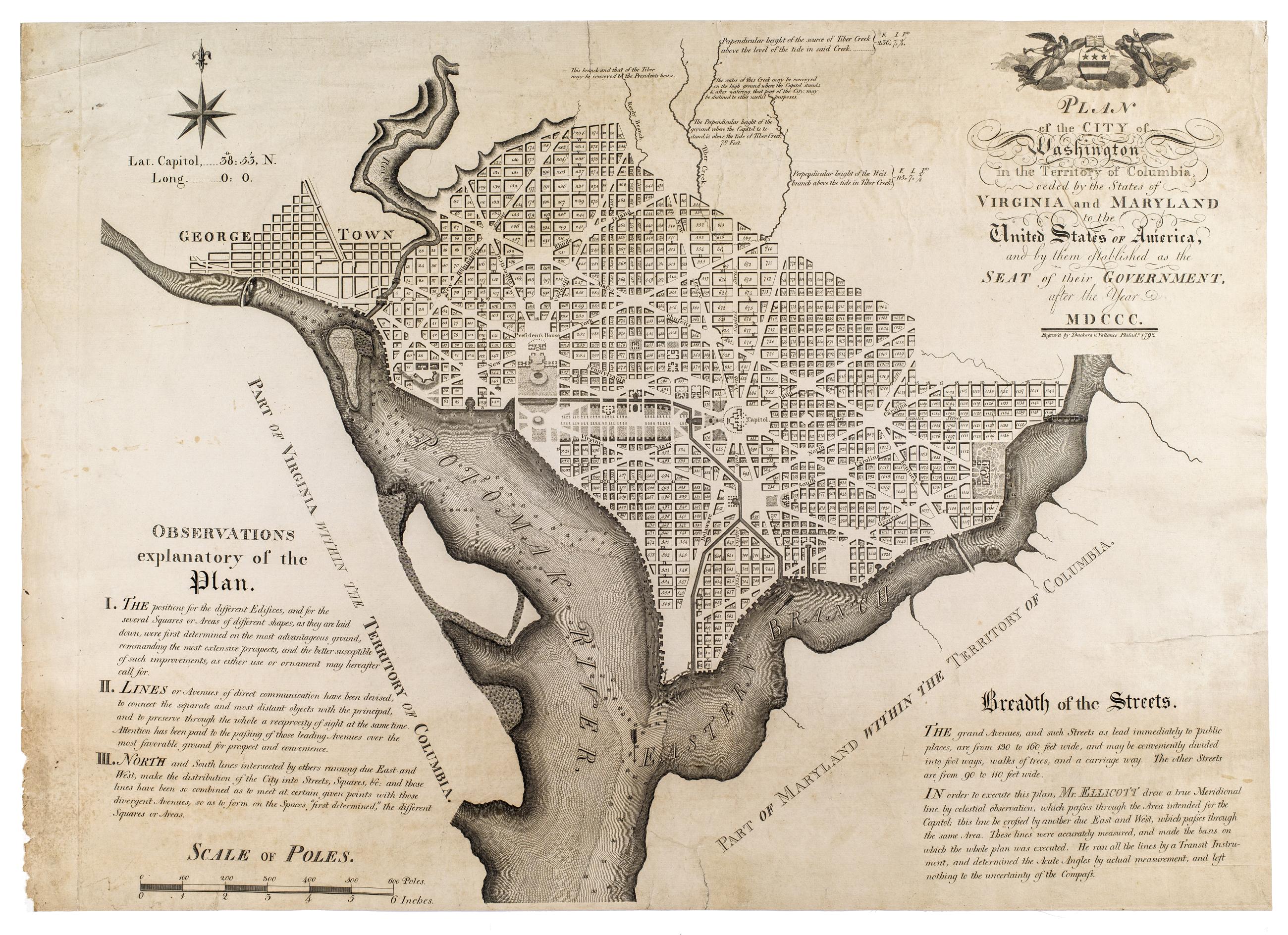
Still Image Plan of the city of Washington in the territory of Columbia : ceded by the states of Virginia and Maryland to the United States of America, and by them established as the seat of their government, after the year MDCCC First official plan of city. Shows block and lot numbers and proposed government buildings. Relief shown by hachures. Depths shown by soundings. Also covers Georgetown. Text in lower left and right hand corners explains the plan and describes width of streets. View Item
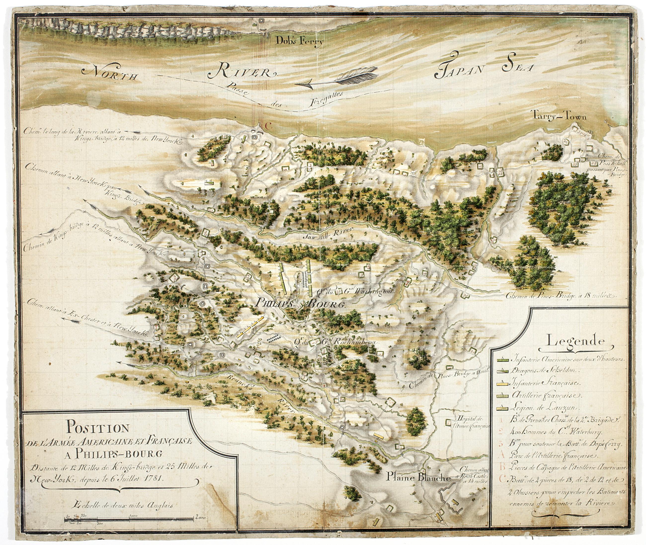
Still Image Position de 'larmee Américane et Française a Philips-bourg : distante de 12 milles de Kings-bridge et 25 milles de New-York, depuis le 6 Juillet 1781 Includes key. Military battlefield map. Covers the town of Greenburgh in Westchester County, New York: Shows disposition of troops, cavalry and artillery. Also shows roads running through Tarrytown, Dobbs Ferry and White Plains. Also shows buildings, landforms, streams and vegetative cover. On verso: "[?]aris Dessins topographiques" Pen-and-ink, watercolor on laid paper. Shows relief by shading. Stained, lightly soiled. Mounted on (probably contemporaneous) hardboard. View Item
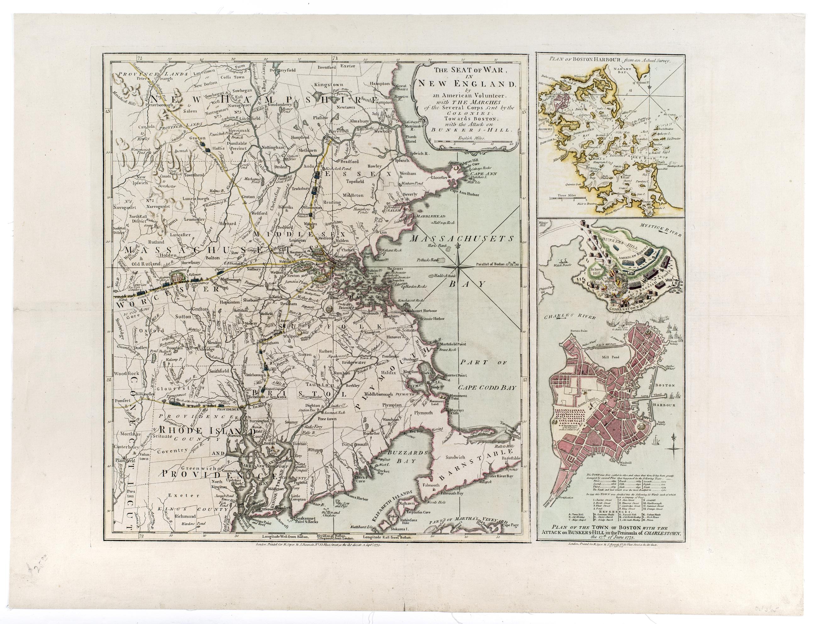
Still Image The seat of war, in New England, by an American volunteer : with the marches of the several corps sent by the colonies, towards Boston, with the attack on Bunkers-Hill Hand colored. Prime meridian: Boston. Relief shown by hachures. Map of New England shows routes of march and encampments of colonial forces towards Boston. Insets are an addition to the main map from a separate plate with same imprint date. Movements of Battle of Bunker Hill shown by illustrations of troops and the burning of Charlestown. Text and table of references with inset map of Boston provide additional information about the city. View Item
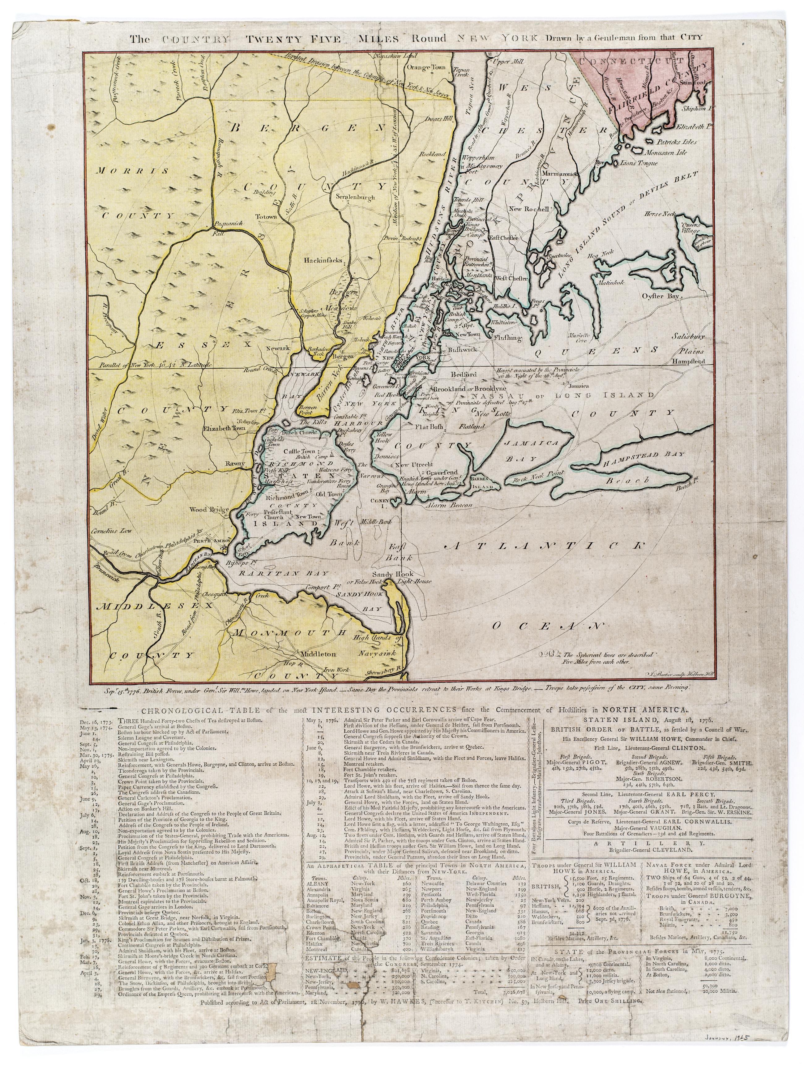
Still Image The Country twenty five miles round New York Hand colored. Relief shown pictorially. Shows radial distances. Engraved by: J. Barber, Holborn Hill. Includes letterpress below map entitled: Chronological table of the most interesting occurrences since the commencement of hostilities in North America. Letterpress includes chronology of events from Boston Tea Party through Battle of Long Island and provides notes on British military strength. View Item