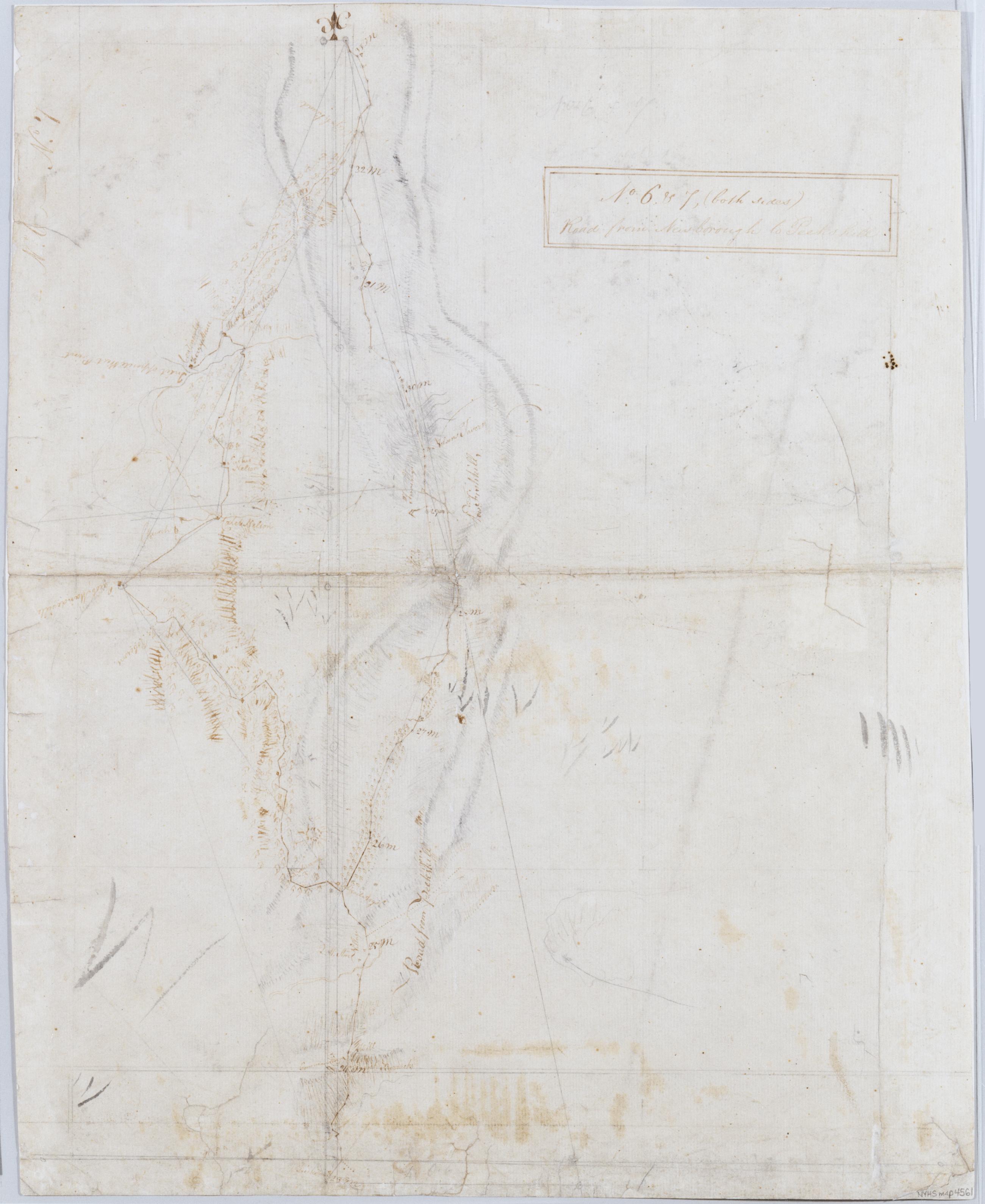
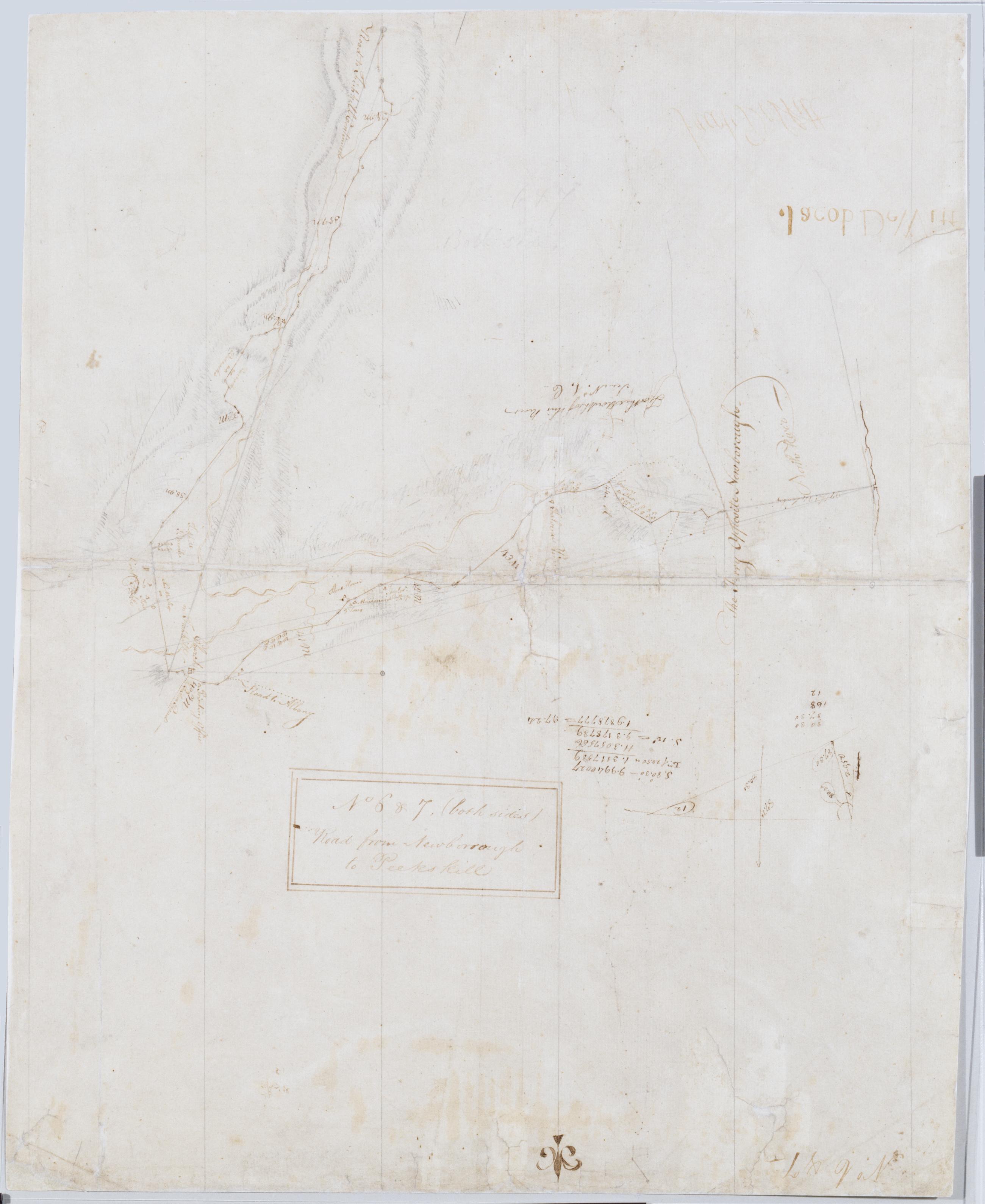
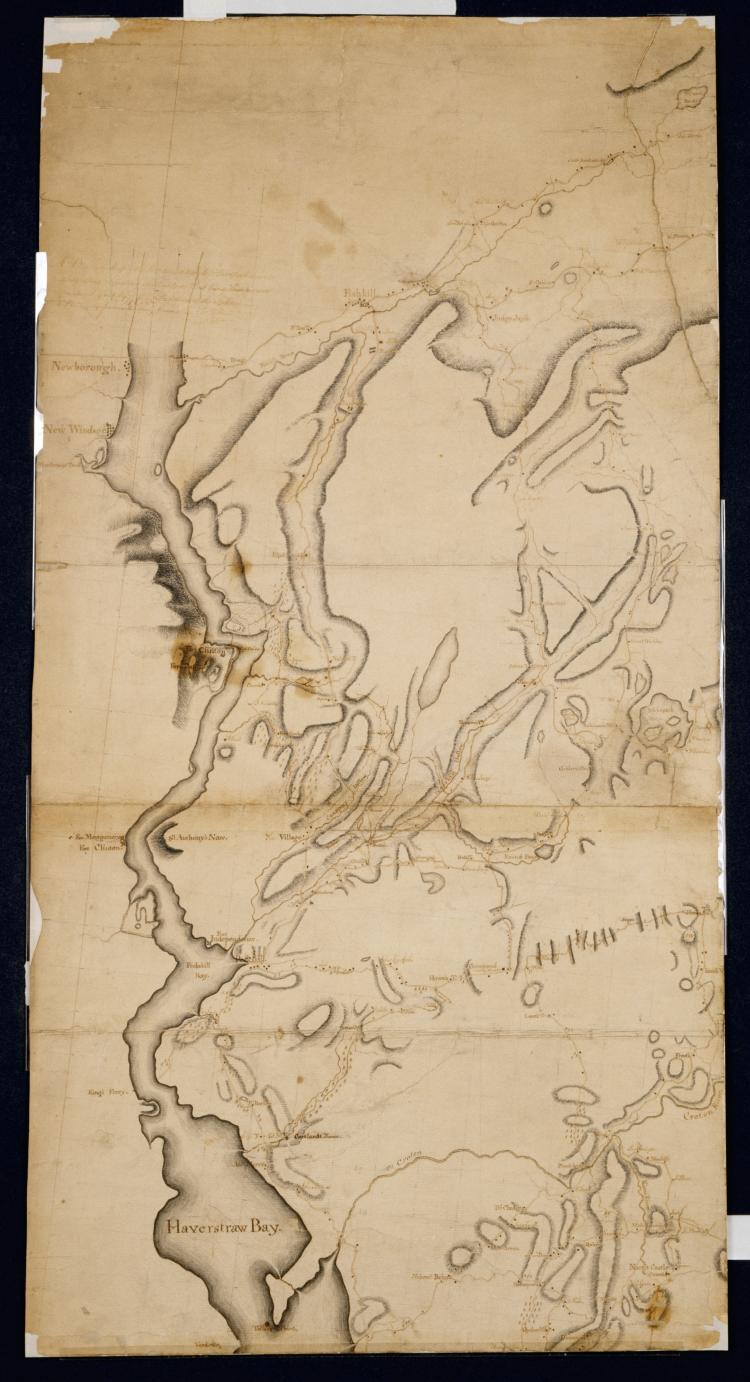
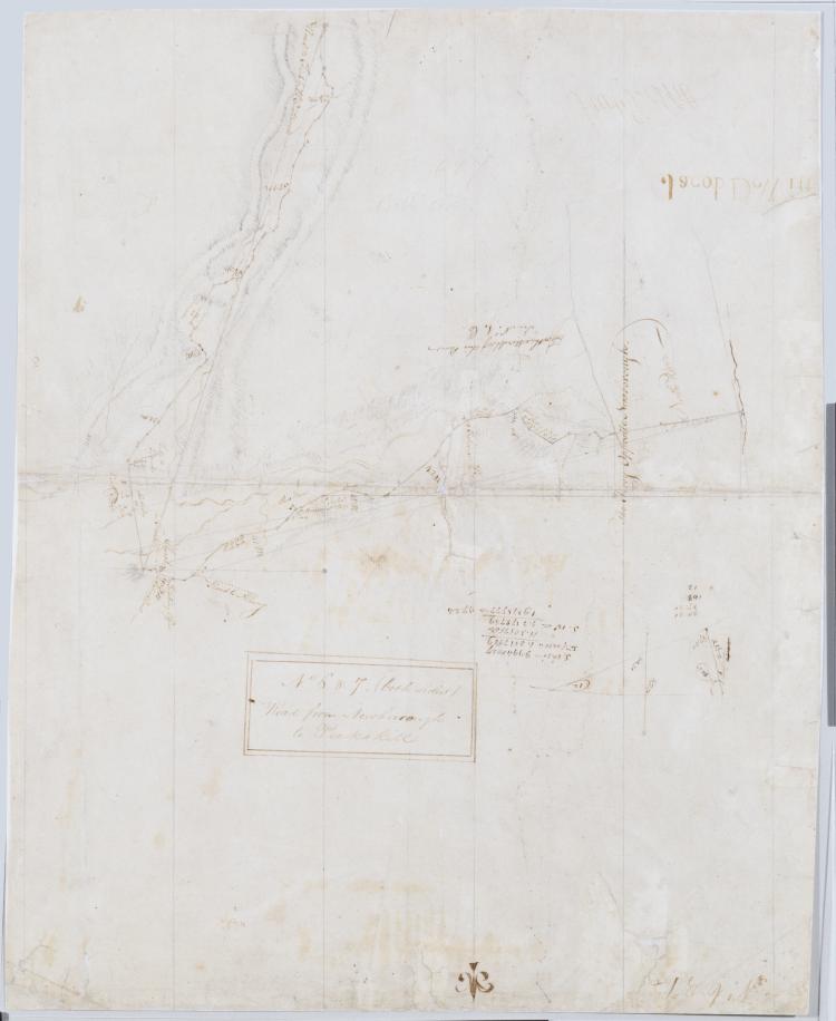
Cartographic Road from Newborough to Peeks kill. No. 6. & 7 (both sides) ; Road from Newborrough to Peeks kill. No. 6 & 7, (both sides) / by Robert Erskine F.R.S. Geogr. A. U.S. and Assistants, verso [no. 7] Frayed, creased, foxed and abraded. Mounted on cloth, bound and cropped, disbound, silked by later owners. Cleaned after removal of backings 1999. Sheathed in mylar. In ink on recto, but in reverse writing: "Jacob DeWitt" (printed), "Jacob DeWitt" (signature). In ink on recto: "No. 6 - No. 7". In ink on verso: "No. 6 + 7". Maps show relief by hachures. Military topographic maps. Maps cover the towns of Fishkill and Phillipstown in Putnam County and of Peekskill in Westchester County, New York. View Item
Cartographic Road from Newborough to Peeks kill. No. 6. & 7 (both sides) ; Road from Newborrough to Peeks kill. No. 6 & 7, (both sides) / by Robert Erskine F.R.S. Geogr. A. U.S. and Assistants, recto [no. 6] Frayed, creased, foxed and abraded. Mounted on cloth, bound and cropped, disbound, silked by later owners. Cleaned after removal of backings 1999. Sheathed in mylar. In ink on recto, but in reverse writing: "Jacob DeWitt" (printed), "Jacob DeWitt" (signature). In ink on recto: "No. 6 - No. 7". In ink on verso: "No. 6 + 7". Maps show relief by hachures. Military topographic maps. Maps cover the towns of Fishkill and Phillipstown in Putnam County and of Peekskill in Westchester County, New York. View Item
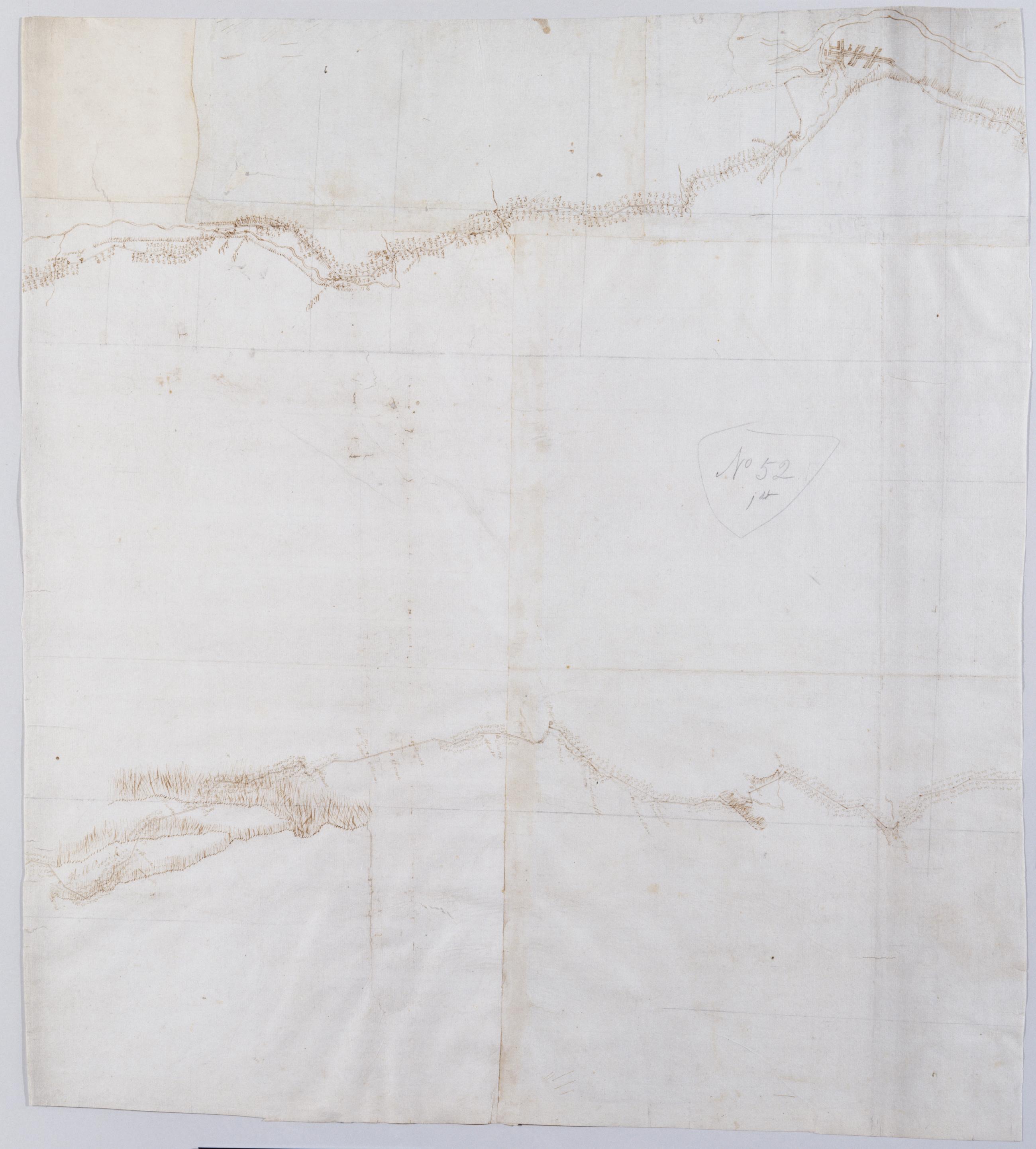
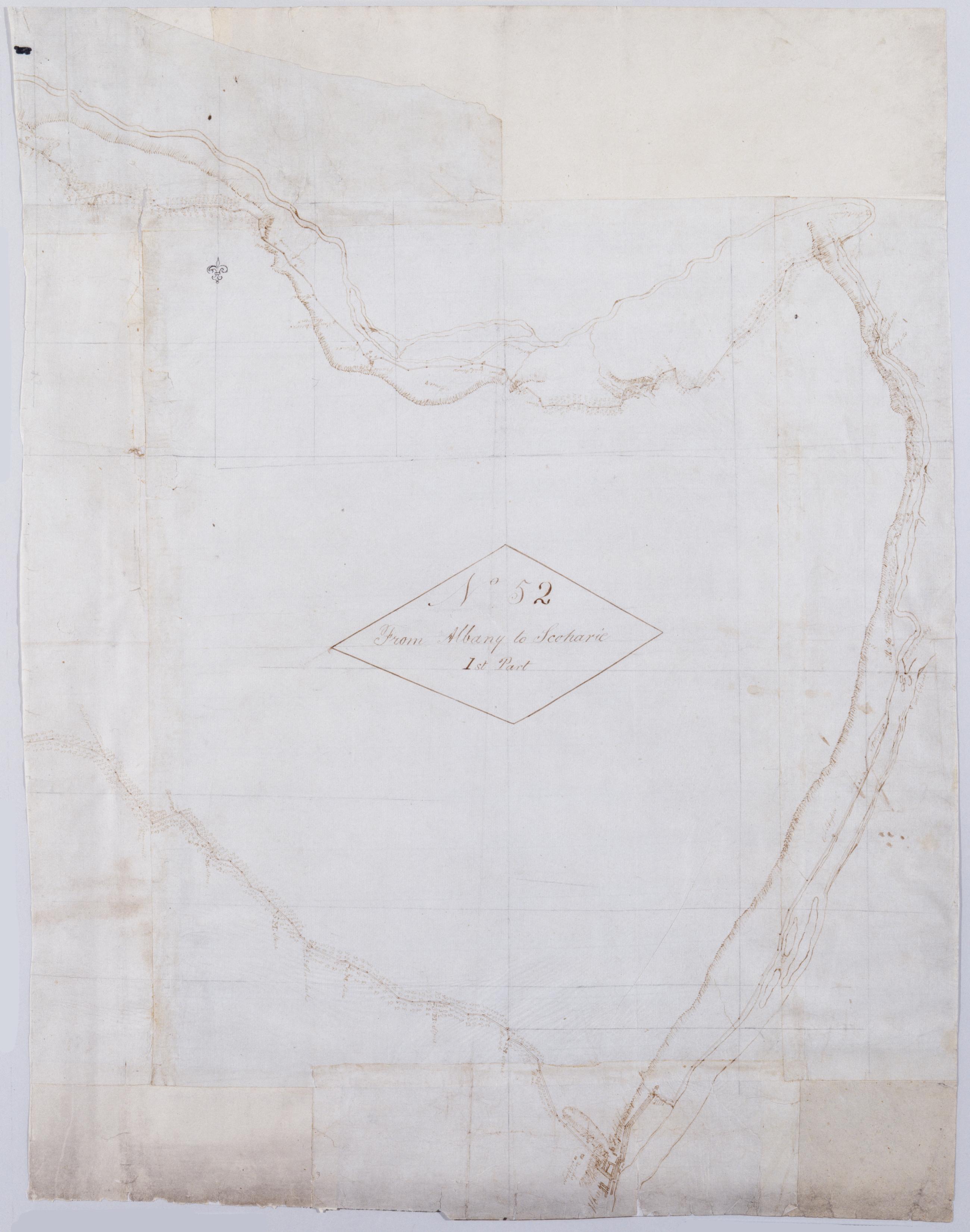
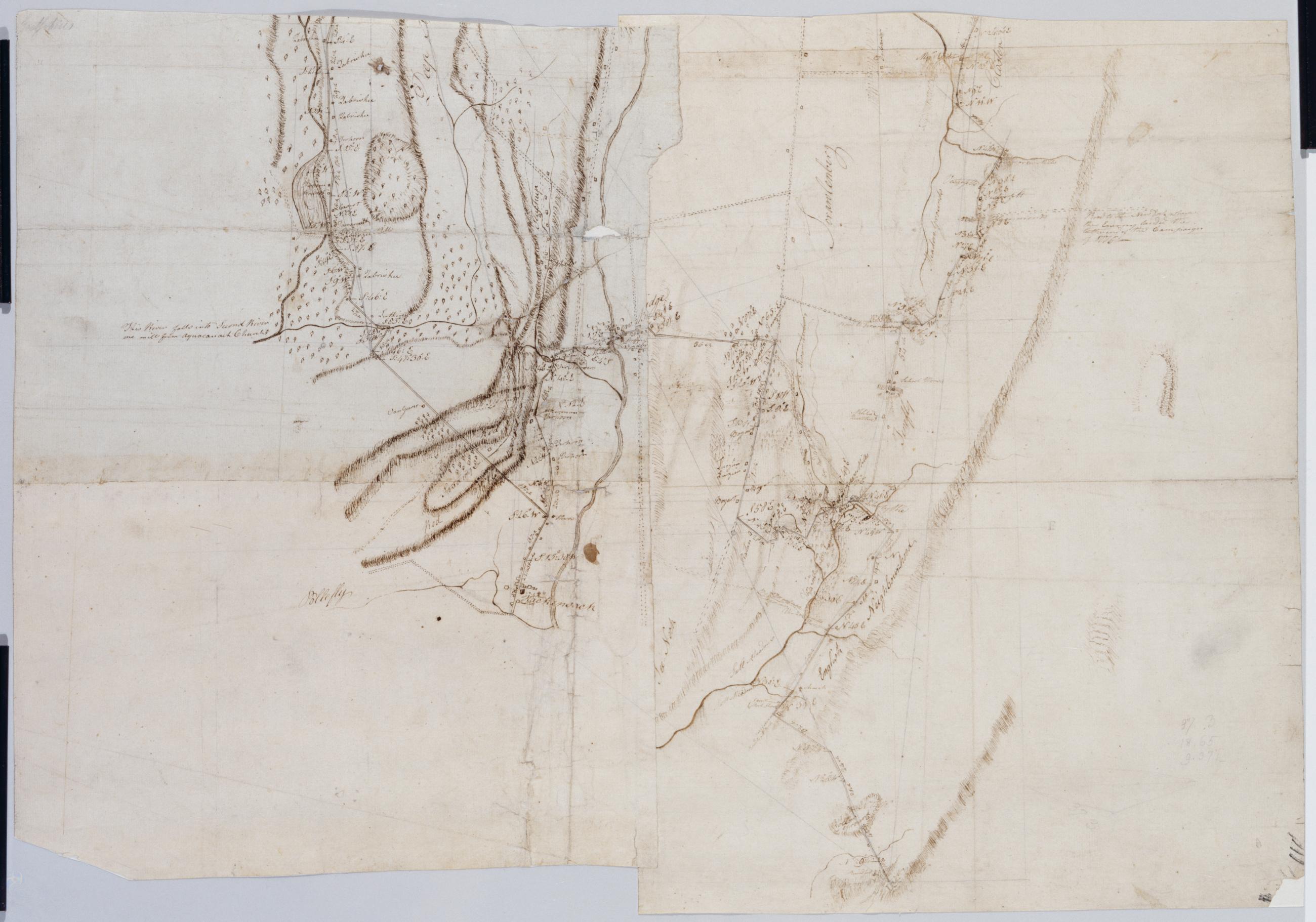
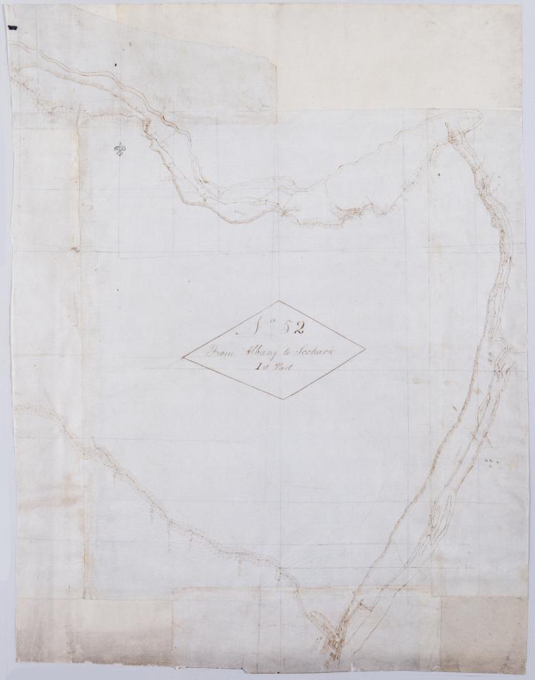
Cartographic From Albany to Scoharie. No 52 1st Part [sic] / by Robert Erskine F.R.S. Geogr. A. U.S. and Assistants ; by Capt. Gray, second sheet Military topographic map. Covers the counties of Albany, Schenectady and Scoharie, New York. Shows roads running through Albany, Westmere, Guilderland, Hartmans Corners, Guilderland Center, Altamont, Knox, Gallupville, Shutter Corners and, just north of Schoharie, Vrooman Corners; also Quaker Street, Duanesburg, Princeton or Kelley Station, Rotterdam, Schnectady, Hawthorne Hill, Niskayuna, Freligh, Crescent Station to near Crescent, Cohoes and Watervliet. Map also shows buildings and owners' names, landforms and streams. Shows relief by hachures. View Item
Cartographic From Albany to Scoharie. No 52 1st Part [sic] / by Robert Erskine F.R.S. Geogr. A. U.S. and Assistants ; by Capt. Gray, first sheet Military topographic map. Covers the counties of Albany, Schenectady and Scoharie, New York. Shows roads running through Albany, Westmere, Guilderland, Hartmans Corners, Guilderland Center, Altamont, Knox, Gallupville, Shutter Corners and, just north of Schoharie, Vrooman Corners; also Quaker Street, Duanesburg, Princeton or Kelley Station, Rotterdam, Schnectady, Hawthorne Hill, Niskayuna, Freligh, Crescent Station to near Crescent, Cohoes and Watervliet. Map also shows buildings and owners' names, landforms and streams. Shows relief by hachures. View Item
Cartographic From Albany to Scoharie. No 52 1st Part [sic] / by Robert Erskine F.R.S. Geogr. A. U.S. and Assistants ; by Capt. Gray, third sheet Military topographic map. Covers the counties of Albany, Schenectady and Scoharie, New York. Shows roads running through Albany, Westmere, Guilderland, Hartmans Corners, Guilderland Center, Altamont, Knox, Gallupville, Shutter Corners and, just north of Schoharie, Vrooman Corners; also Quaker Street, Duanesburg, Princeton or Kelley Station, Rotterdam, Schnectady, Hawthorne Hill, Niskayuna, Freligh, Crescent Station to near Crescent, Cohoes and Watervliet. Map also shows buildings and owners' names, landforms and streams. Shows relief by hachures. View Item
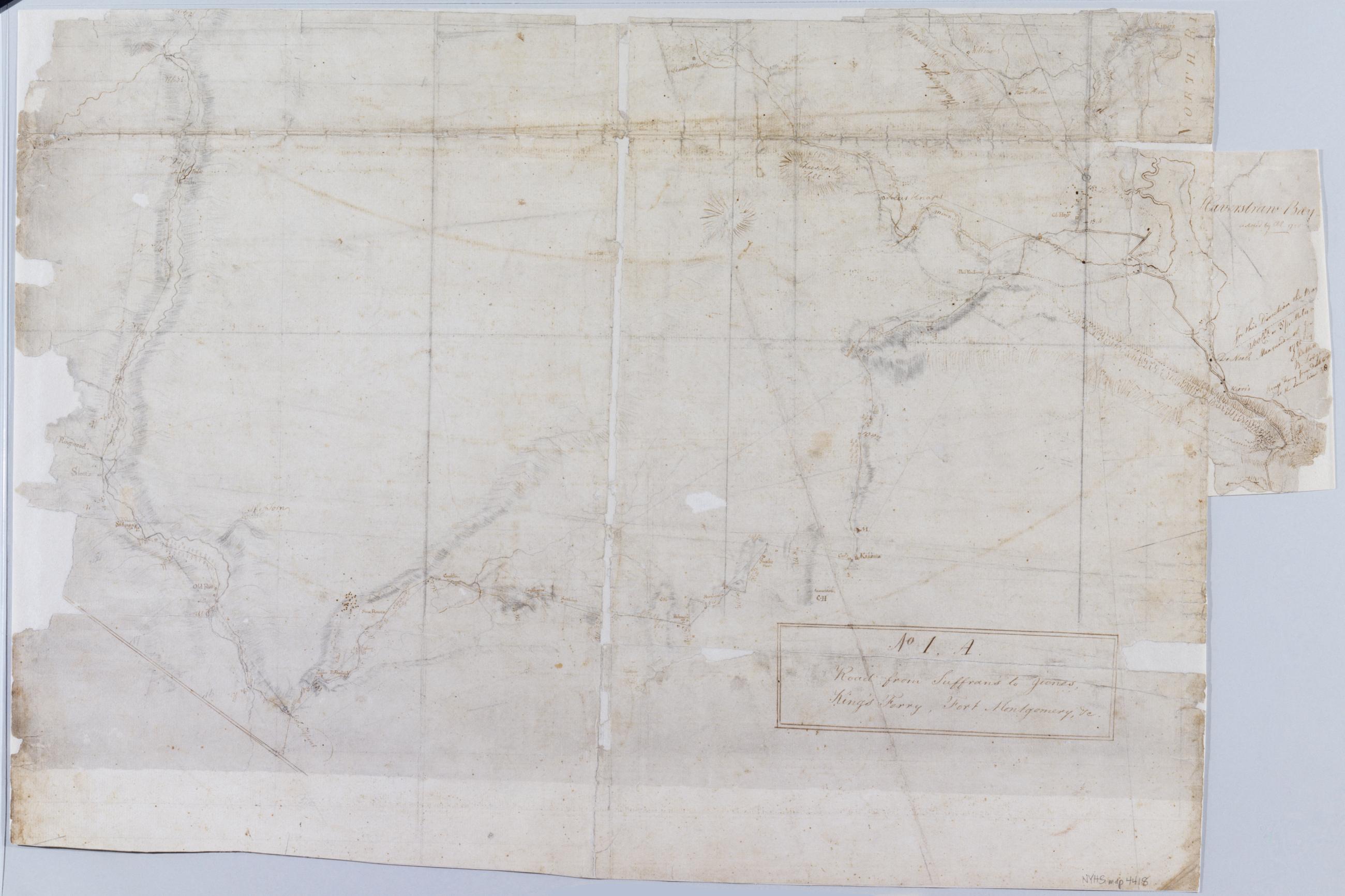
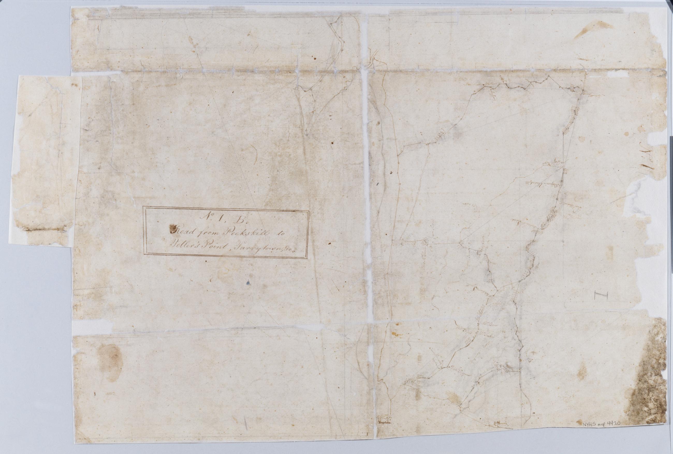
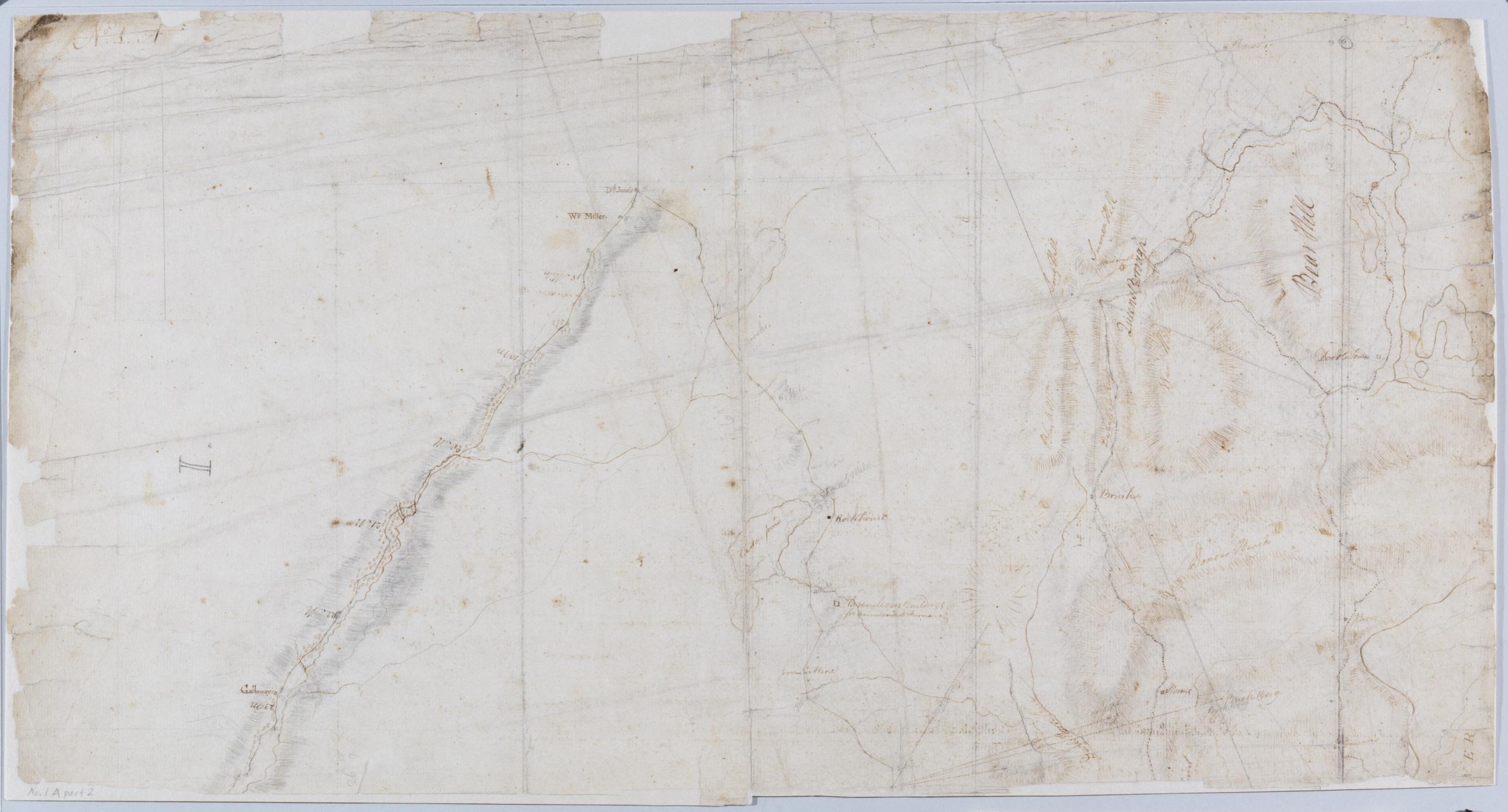
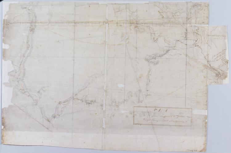
Cartographic Road from Suffrans to June's, King's Ferry, Fort Montgomery, +c. No 1, A ; Road from Peekskill to Teller's Point, Tarrytown, +c. No 1, B / by Robert Erskine F.R.S. Geogr. A. U.S. and Assistants, 1B, part 2 Military topographic maps. Map 1A on recto covers the towns of Woodbury and Tuxedo in Orange County, and of Highland, Stoney Point, Haverstraw and Ramapo in Rockland County, New York; it shows roads running through Fort Montgomery, West Haverstraw, Hempstead, Viola, Suffern, Ramapo, Sloatsburg, Tuxedo, Southfield, Arden, Willow Grove and Thiells. Map 1B on verso covers the towns of Cortlandt, Newcastle, Ossining and Mt. View Item
Cartographic Road from Suffrans to June's, King's Ferry, Fort Montgomery, +c. No 1, A ; Road from Peekskill to Teller's Point, Tarrytown, +c. No 1, B / by Robert Erskine F.R.S. Geogr. A. U.S. and Assistants., 1A, part 1 Military topographic maps. Map 1A on recto covers the towns of Woodbury and Tuxedo in Orange County, and of Highland, Stoney Point, Haverstraw and Ramapo in Rockland County, New York; it shows roads running through Fort Montgomery, West Haverstraw, Hempstead, Viola, Suffern, Ramapo, Sloatsburg, Tuxedo, Southfield, Arden, Willow Grove and Thiells. Map 1B on verso covers the towns of Cortlandt, Newcastle, Ossining and Mt. View Item
Cartographic Road from Suffrans to June's, King's Ferry, Fort Montgomery, +c. No 1, A ; Road from Peekskill to Teller's Point, Tarrytown, +c. No 1, B / by Robert Erskine F.R.S. Geogr. A. U.S. and Assistants, 1B, part 1 Military topographic maps. Map 1A on recto covers the towns of Woodbury and Tuxedo in Orange County, and of Highland, Stoney Point, Haverstraw and Ramapo in Rockland County, New York; it shows roads running through Fort Montgomery, West Haverstraw, Hempstead, Viola, Suffern, Ramapo, Sloatsburg, Tuxedo, Southfield, Arden, Willow Grove and Thiells. Map 1B on verso covers the towns of Cortlandt, Newcastle, Ossining and Mt. View Item
Cartographic Road from Suffrans to June's, King's Ferry, Fort Montgomery, +c. No 1, A ; Road from Peekskill to Teller's Point, Tarrytown, +c. No 1, B / by Robert Erskine F.R.S. Geogr. A. U.S. and Assistants, 1A, part 2 Military topographic maps. Map 1A on recto covers the towns of Woodbury and Tuxedo in Orange County, and of Highland, Stoney Point, Haverstraw and Ramapo in Rockland County, New York; it shows roads running through Fort Montgomery, West Haverstraw, Hempstead, Viola, Suffern, Ramapo, Sloatsburg, Tuxedo, Southfield, Arden, Willow Grove and Thiells. Map 1B on verso covers the towns of Cortlandt, Newcastle, Ossining and Mt. View Item
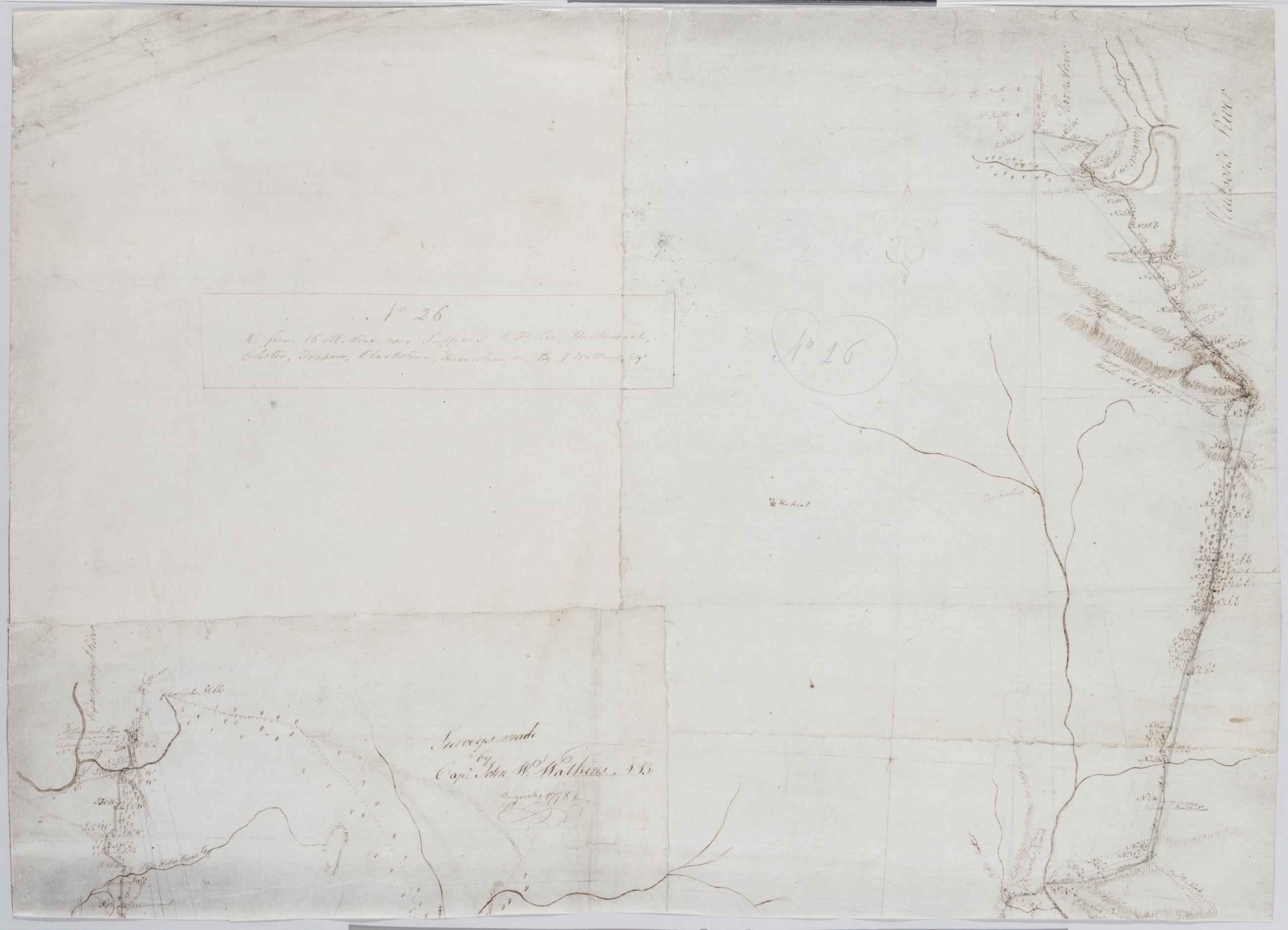
Cartographic R. from 15 M. stone, near Suffran's to Ft Lee, Hackensack, Closter, Tappan, Clarkstown, Haverstraw +c. No 26 / by J. Watkins Esqr ; surveys made by Capt: John W: Watkins A:B: ; by Robert Erskine F.R.S. Geogr. A. U.S. and Assistants, bottom Military topographic map. Covers most of Rockland County, New York, and Bergen County, New Jersey. Shows roads running through Suffern, Saddle River, Paramus and Hackensack, as well as Haverstraw, Clarksville, Tappan, Tenefly and Closter. Also shows buildings and owners' names, landforms, ground cover, wetlands and streams. Shows relief by hachures. Title proper and first statement of responsibility from recto are the work of a later editor--Simeon DeWitt or his assign--subsequent to 1820. Second statement of responsibility and detailed date also from apparently written by Watkins. View Item
Cartographic R. from 15 M. stone, near Suffran's to Ft Lee, Hackensack, Closter, Tappan, Clarkstown, Haverstraw +c. No 26 / by J. Watkins Esqr ; surveys made by Capt: John W: Watkins A:B: ; by Robert Erskine F.R.S. Geogr. A. U.S. and Assistants, top Military topographic map. Covers most of Rockland County, New York, and Bergen County, New Jersey. Shows roads running through Suffern, Saddle River, Paramus and Hackensack, as well as Haverstraw, Clarksville, Tappan, Tenefly and Closter. Also shows buildings and owners' names, landforms, ground cover, wetlands and streams. Shows relief by hachures. Title proper and first statement of responsibility from recto are the work of a later editor--Simeon DeWitt or his assign--subsequent to 1820. Second statement of responsibility and detailed date also from apparently written by Watkins. View Item
Cartographic R. from 15 M. stone, near Suffran's to Ft Lee, Hackensack, Closter, Tappan, Clarkstown, Haverstraw +c. No 26 / by J. Watkins Esqr ; surveys made by Capt: John W: Watkins A:B: ; by Robert Erskine F.R.S. Geogr. A. U.S. and Assistants, center Military topographic map. Covers most of Rockland County, New York, and Bergen County, New Jersey. Shows roads running through Suffern, Saddle River, Paramus and Hackensack, as well as Haverstraw, Clarksville, Tappan, Tenefly and Closter. Also shows buildings and owners' names, landforms, ground cover, wetlands and streams. Shows relief by hachures. Title proper and first statement of responsibility from recto are the work of a later editor--Simeon DeWitt or his assign--subsequent to 1820. Second statement of responsibility and detailed date also from apparently written by Watkins. View Item
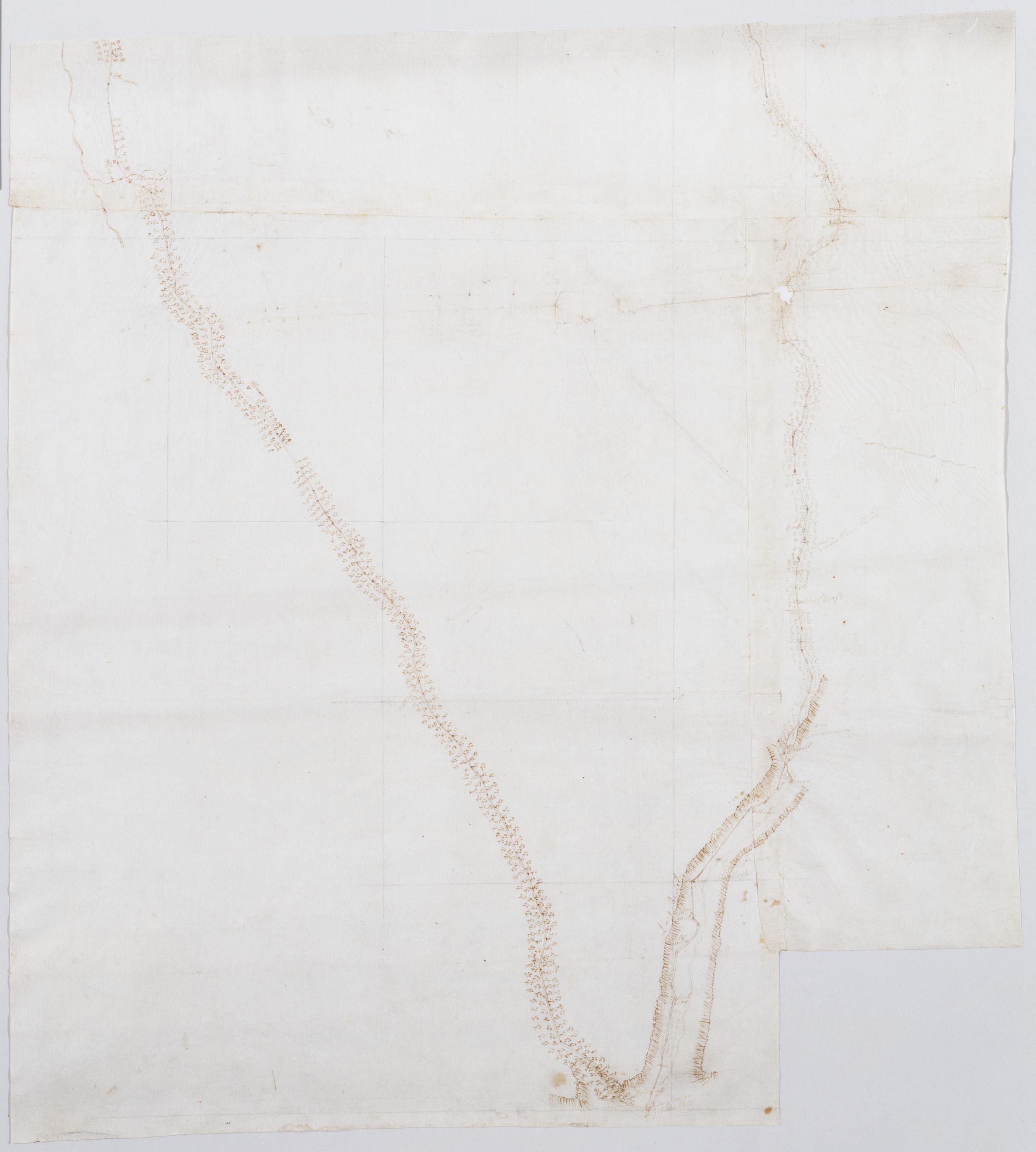
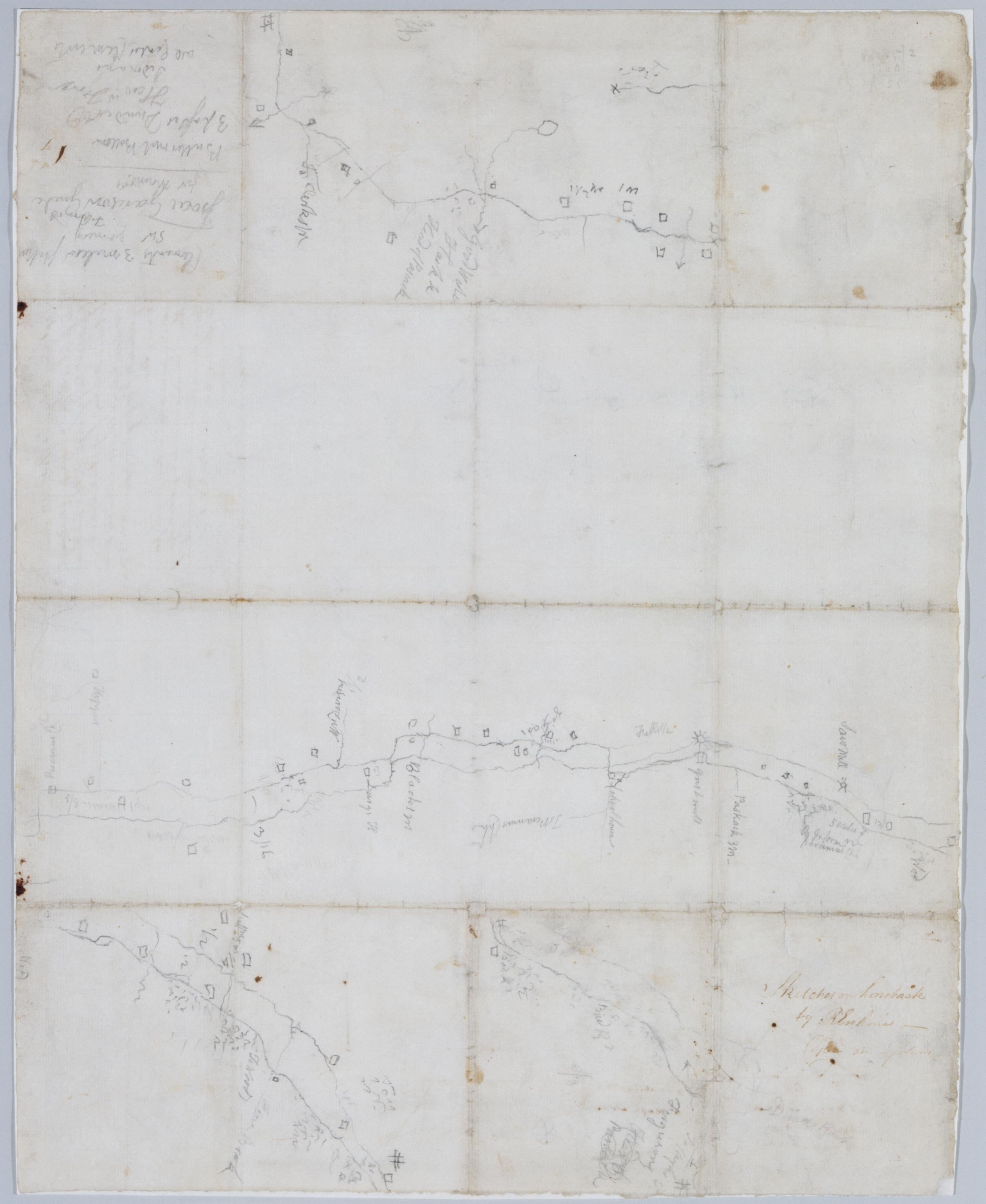
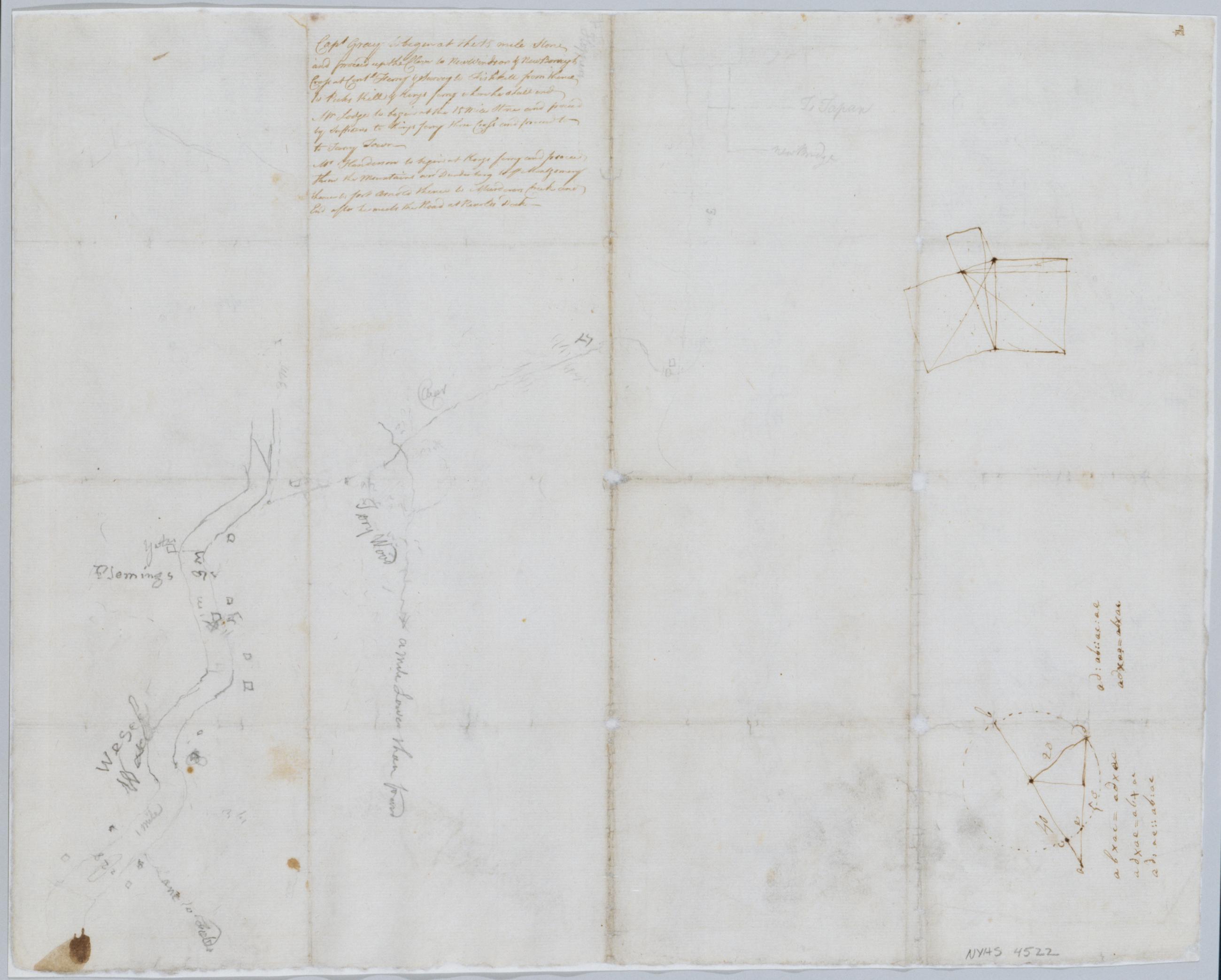
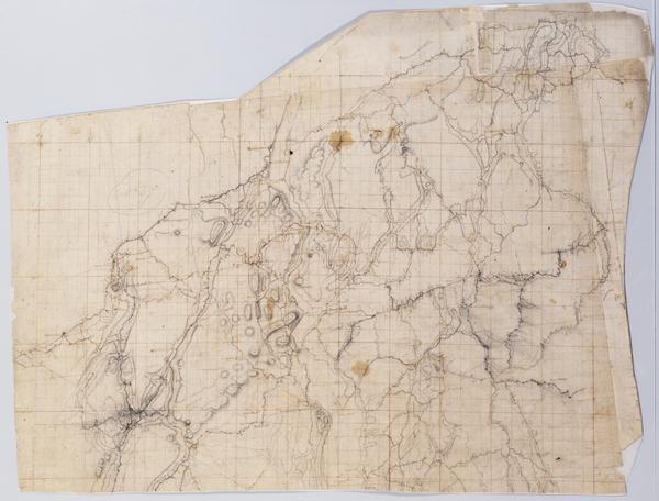
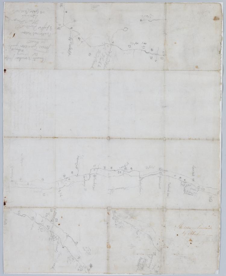
Cartographic Sketches on horseback / by R Erskine cop[ied] on plans, recto Date based on comparison with Erskine's "Surveys Done for His Excy General Washington 1778 & 1779." Foxed, creased and abraded. Cleaned after removal of backings 1999; some fill remains. Sheathed in mylar. Includes unrelated text in ink on verso: "Capt Gray to begin at the 15 mile Stone and proceed up the Clove to New Windsor & New Borough Cross at Contl Ferry & Survey to Fishkill from thence to Peeks Kill & Kings ferry where he shall end. Mr Lodge to begin at the 15 Mile Stone and proceed by Suffrans to Kings ferry there Cross and proceed to to [sic] Tarry Town. View Item
Cartographic Sketches on horseback / by R Erskine cop[ied] on plans, verso Date based on comparison with Erskine's "Surveys Done for His Excy General Washington 1778 & 1779." Foxed, creased and abraded. Cleaned after removal of backings 1999; some fill remains. Sheathed in mylar. Includes unrelated text in ink on verso: "Capt Gray to begin at the 15 mile Stone and proceed up the Clove to New Windsor & New Borough Cross at Contl Ferry & Survey to Fishkill from thence to Peeks Kill & Kings ferry where he shall end. Mr Lodge to begin at the 15 Mile Stone and proceed by Suffrans to Kings ferry there Cross and proceed to to [sic] Tarry Town. View Item
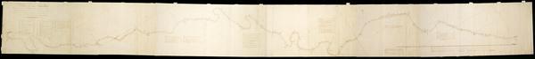
Image Cartographic 3 Items Surveys in New York & Connecticut States for His Excellency General Washington : Anno 1778 by Robert Erskine F.R.S. Geogr: to the Army of the United States & Assistants ; W Scull delint. Has projection grid in faint pencil. Imperfect: lacks 19 x 12 at upper right corner and 3 x 8 cm. at center. Minor losses along frayed top and left edge. Military topographic map; not listed in Heusser nor Guthorn. Covers the counties of Fairfield in Connecticut and of Dutchess, Putnam and Westchester in New York; New York City and the northern shore of Long Island are also shown, but with less detail. Shows some buildings and owners' names, landforms and streams. Pen-and-ink, pencil on laid paper. View Item
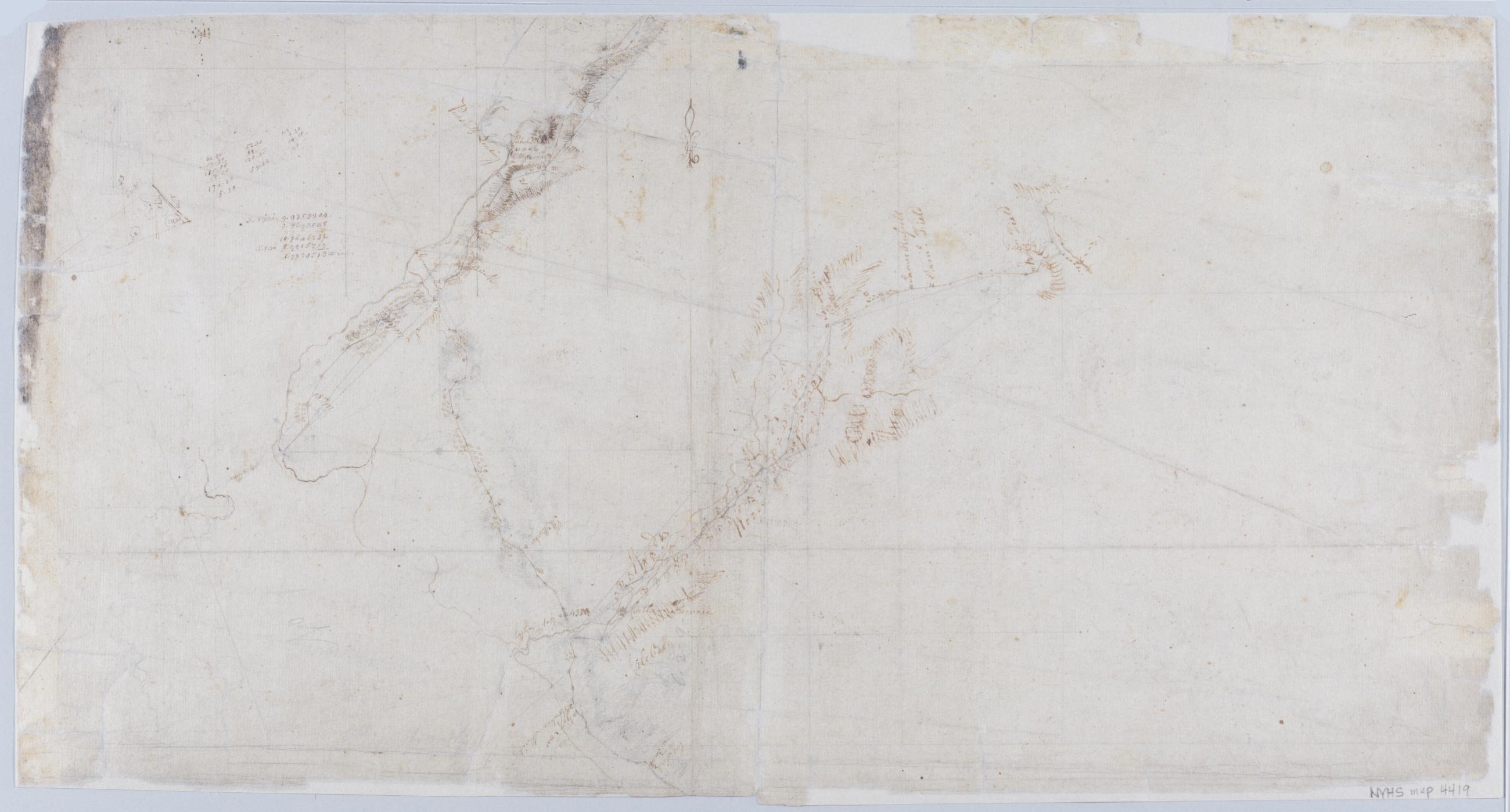
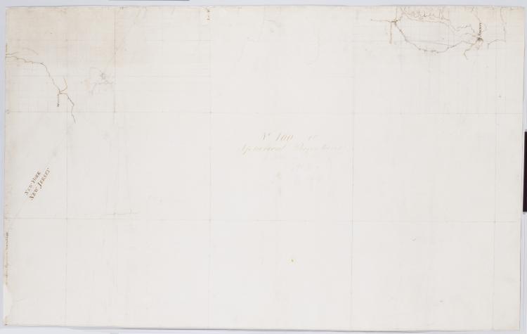
Image Cartographic 2 Items Spherical Projections. No 100 / by R.E. ; by Robert Erskine F.R.S. Geogr. A. U.S. and Assistants, first sheet Collection of unfinished military topographic maps. The coordinates describe much of New Jersey but, aside from the coordinate grid itself, only small areas about Elizabethtown and Amboy, New Jersey, and about Warwick and Chester, New York, were ever mapped onto it. Title proper from recto of 1st sheet is the work of a later editor--Simeon DeWitt or his assign--subsequent to 1820. Index title, both statements of responsibility, date, scale statement, series title and series numbering by Erskine, but on separate index sheet filed at head of series. Pen-and-ink, pencil on laid paper. View Item
Image Cartographic 3 Items Roads from Newborough to Fort Lee. No 36 / by Robert Erskine F.R.S. Geogr. A. U.S. and Assistants. Military topographic map. Covers Orange and Rockland Counties in New York and Bergen, Passaic, Morris and Essex Counties in New Jersey. Shows roads, buildings and owners' names, also landforms, wetlands and streams. Shows relief by hachures. Title proper from recto is the work of a later editor--Simeon DeWitt or his assign--subsequent to 1820. Index title, statement of responsibility, date, series title and series numbering also by Erskine, but on separate index sheet filed at head of series. Pen-and-ink, pencil on laid paper. View Item
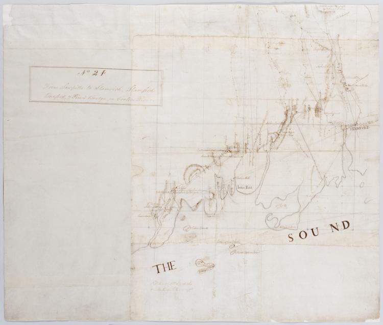
Image Cartographic 2 Items From Sawpitts to Stanwich, Stamford Bedford, & Pine's Bridge on Croton River. No. 24 / by Robert Erskine F.R.S. Geogr. A. U.S. and Assistants. Military topographic map. Covers the towns of Yorktown, Newcastle, Bedford, North Castle and Pound Ridge in eastern Westchester County, New York, and the towns of Stamford and Greenwich in Fairfield County, Connecticut. The map itself gives Stamford as "Stanford" and the Mill or Rippowam River as the "Stanford River." It shows roads, buildings and owners' names, also landforms and streams. Maps shows relief by hachures. Titles proper from recto and recto of inset are the work of a later editor--Simeon DeWitt or his assign--subsequent to 1820. View Item
Image Cartographic 2 Items Surveys Done for His Excy General Washington : 1778 & 1779 / by Robt Erskine F.R.S. Geogr to the Army & Assistants Military topographic map; not listed in Heusser nor Guthorn. Covers the counties of Orange and Rockland in New York and of Passaic, Bergen, Hudson and Essex in New Jersey. Shows some roads; map appears to be incomplete in this respect as of date given. Also shows some buildings and owners' names, landforms and streams. Shows relief by hachures. Title proper and statement of responsibility from recto is original. Titles on verso are later. Date by cataloger, based on comparison to Erskine's dated sketch, "Mensurations on the Ice". Pen-and-ink, pencil on laid paper. View Item
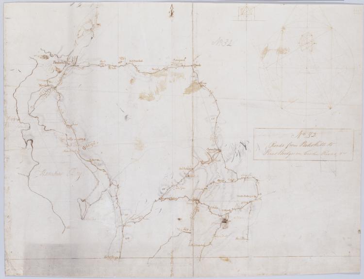
Image Cartographic 2 Items Roads from Peekskill to Pines Bridge on Croton River, +c. No 32 / by Robert Erskine F.R.S. Geogr. A. U.S. and Assistants. Also in ink on verso, a crossed-out text of which 500 words are extant; incipit "plane of which the representation is to be drawn, and the place of the Eyes. [Paragraph] The General principle [on which--crossed out] of Perspective [is the--crossed out] supposes pencils of rays...." Ancillary geometric drawings in ink and pencil on recto and verso. In pencil on recto: "No 32". Military topographic map. Covers the towns of Cortlandt, Ossining, Mt. Pleasant, Yorktown and Newcastle in Westchester County, New York. View Item
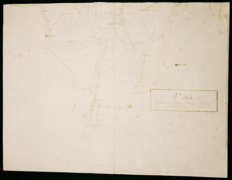
Image Cartographic 2 Items Roads between Suffrans, Tappan, Kakeate Peramus, Dobbs Ferry, Clarkstown +c. No 113, 1st / by Robert Erskine F.R.S. Geogr. A. U.S. and Assistants. Military topographic map. Covers the townships of Orangetown, Ramapo and Clarkstown in Rockland County, New York, and of Herrington, Washington, Palisades, Midland, Ridgewood and Orvil in Bergen County, New Jersey. Shows buildings and owners' names, landforms and streams. Shows relief by hachures. Title proper from recto is the work of a later editor--Simeon DeWitt or his assign--subsequent to 1820. Title from verso is in Erskine's hand and may be cited as such. View Item
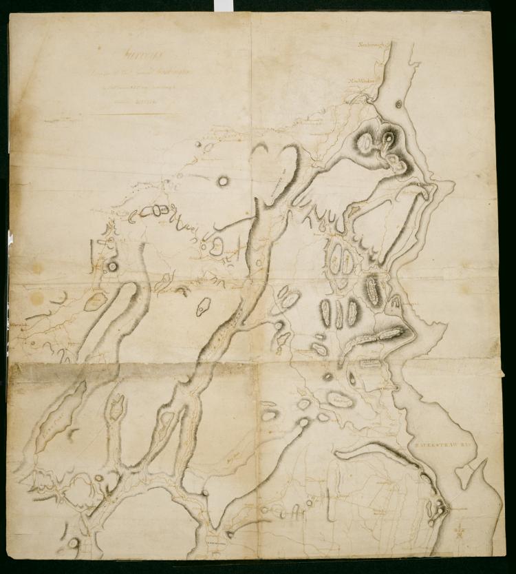
Image Cartographic 2 Items A General Contraction 2 Miles to an Inch. No 37 / by R.E. ; by Robert Erskine F.R.S. Geogr. A. U.S. and Assistants. Military topographic map. Covers the lower Hudson River Valley in New York, New Jersey and Connecticut, from Warwick (N.Y.) and Pompton Plains (N.J.) to New Milford and Danbury (Conn.), and from Newburgh (N.Y.) to Staten Island (N.Y.). Shows roads, buildings and owners' names, also landforms and streams. Shows relief by hachures. Title proper from recto is the work of a later editor--Simeon DeWitt or his assign--subsequent to 1820. Index title, both statements of responsibility, date, series title and series numbering by Erskine, but on separate index sheet filed at head of series. View Item
Image Cartographic 7 Items A Plan of the River Schuylkill Wherein are laid down the several Shoals with the depth of Water on each in Inches, also the Depth of the Channel in general in the beginning of August 1773, Together with the means proposed for improving the Navigation of s Foxed, soiled, stained and creased. Mounted on cloth and cropped. In pencil on recto: "No 89". Includes index to 66 numbered features. Military topographic map. Covers the counties of Berks, Chester, Montgomery and Philadelphia, Pennsylvania, between Reading and Philadelphia. Shows river features and depths by soundings. Does not show landward features. Pen-and-ink, pencil on laid paper. Title proper and first statement of responsibility from map recto. Title number supplied by cataloger. View Item
Image Cartographic 2 Items Road from Newborough to Peeks kill. No. 6. & 7 (both sides) ; Road from Newborrough to Peeks kill. No. 6 & 7, (both sides) / by Robert Erskine F.R.S. Geogr. A. U.S. and Assistants. Frayed, creased, foxed and abraded. Mounted on cloth, bound and cropped, disbound, silked by later owners. Cleaned after removal of backings 1999. Sheathed in mylar. In ink on recto, but in reverse writing: "Jacob DeWitt" (printed), "Jacob DeWitt" (signature). In ink on recto: "No. 6 - No. 7". In ink on verso: "No. 6 + 7". Maps show relief by hachures. Military topographic maps. Maps cover the towns of Fishkill and Phillipstown in Putnam County and of Peekskill in Westchester County, New York. View Item
Image Cartographic 3 Items From Albany to Scoharie. No 52 1st Part [sic] / by Robert Erskine F.R.S. Geogr. A. U.S. and Assistants ; by Capt. Gray. Military topographic map. Covers the counties of Albany, Schenectady and Scoharie, New York. Shows roads running through Albany, Westmere, Guilderland, Hartmans Corners, Guilderland Center, Altamont, Knox, Gallupville, Shutter Corners and, just north of Schoharie, Vrooman Corners; also Quaker Street, Duanesburg, Princeton or Kelley Station, Rotterdam, Schnectady, Hawthorne Hill, Niskayuna, Freligh, Crescent Station to near Crescent, Cohoes and Watervliet. Map also shows buildings and owners' names, landforms and streams. Shows relief by hachures. View Item
Image Cartographic 4 Items Road from Suffrans to June's, King's Ferry, Fort Montgomery, +c. No 1, A ; Road from Peekskill to Teller's Point, Tarrytown, +c. No 1, B / by Robert Erskine F.R.S. Geogr. A. U.S. and Assistants. Military topographic maps. Map 1A on recto covers the towns of Woodbury and Tuxedo in Orange County, and of Highland, Stoney Point, Haverstraw and Ramapo in Rockland County, New York; it shows roads running through Fort Montgomery, West Haverstraw, Hempstead, Viola, Suffern, Ramapo, Sloatsburg, Tuxedo, Southfield, Arden, Willow Grove and Thiells. Map 1B on verso covers the towns of Cortlandt, Newcastle, Ossining and Mt. View Item
Image Cartographic 3 Items R. from 15 M. stone, near Suffran's to Ft Lee, Hackensack, Closter, Tappan, Clarkstown, Haverstraw +c. No 26 / by J. Watkins Esqr ; surveys made by Capt: John W: Watkins A:B: ; by Robert Erskine F.R.S. Geogr. A. U.S. and Assistants. Military topographic map. Covers most of Rockland County, New York, and Bergen County, New Jersey. Shows roads running through Suffern, Saddle River, Paramus and Hackensack, as well as Haverstraw, Clarksville, Tappan, Tenefly and Closter. Also shows buildings and owners' names, landforms, ground cover, wetlands and streams. Shows relief by hachures. Title proper and first statement of responsibility from recto are the work of a later editor--Simeon DeWitt or his assign--subsequent to 1820. Second statement of responsibility and detailed date also from apparently written by Watkins. View Item
Image Cartographic 2 Items Sketches on horseback / by R Erskine cop[ied] on plans. Date based on comparison with Erskine's "Surveys Done for His Excy General Washington 1778 & 1779." Foxed, creased and abraded. Cleaned after removal of backings 1999; some fill remains. Sheathed in mylar. Includes unrelated text in ink on verso: "Capt Gray to begin at the 15 mile Stone and proceed up the Clove to New Windsor & New Borough Cross at Contl Ferry & Survey to Fishkill from thence to Peeks Kill & Kings ferry where he shall end. Mr Lodge to begin at the 15 Mile Stone and proceed by Suffrans to Kings ferry there Cross and proceed to to [sic] Tarry Town. View Item
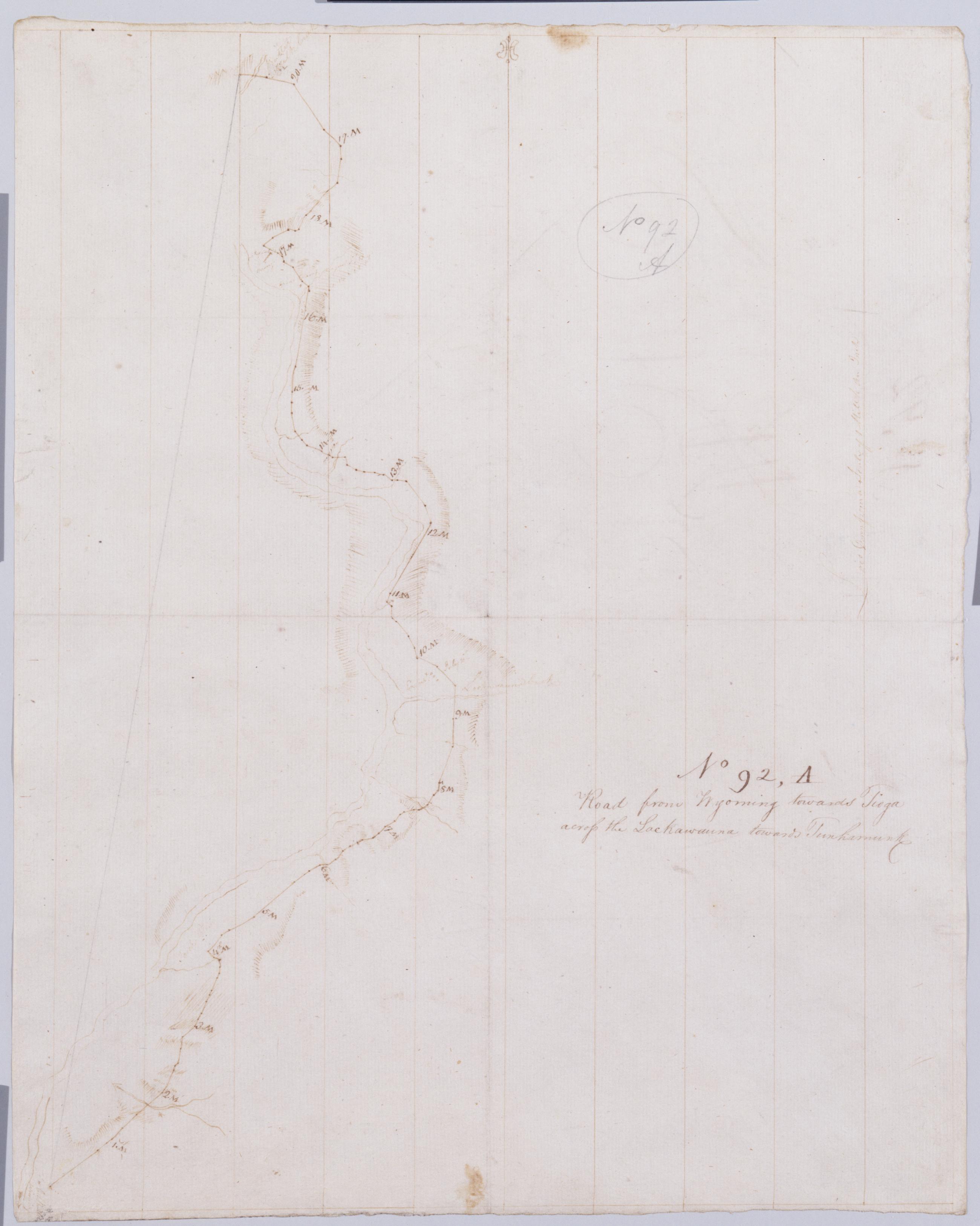
Cartographic Road from Wyoming towards Tioga across the Lackawauna towards Tunhamunk. No 92 A [sic]/ by Robert Erskine F.R.S. Geogr. A. U.S. and Assistants. Creased- foxed stained- soiled and abraded. Mounted on cloth- bound and cropped- disbound and silked by subsequent owners. Cleaned after removal of backings 1999; some fill remains. Sheathed in mylar. In pencil on recto and verso: "No 92 A". Military topographic map. Covers the counties of Lackawanna- Luzerne and Wyoming- Pennsylvania. Shows roads running through Wyoming Valley and Pittston. Also shows landforms and streams. Number accompanying verso title written in different ink. View Item
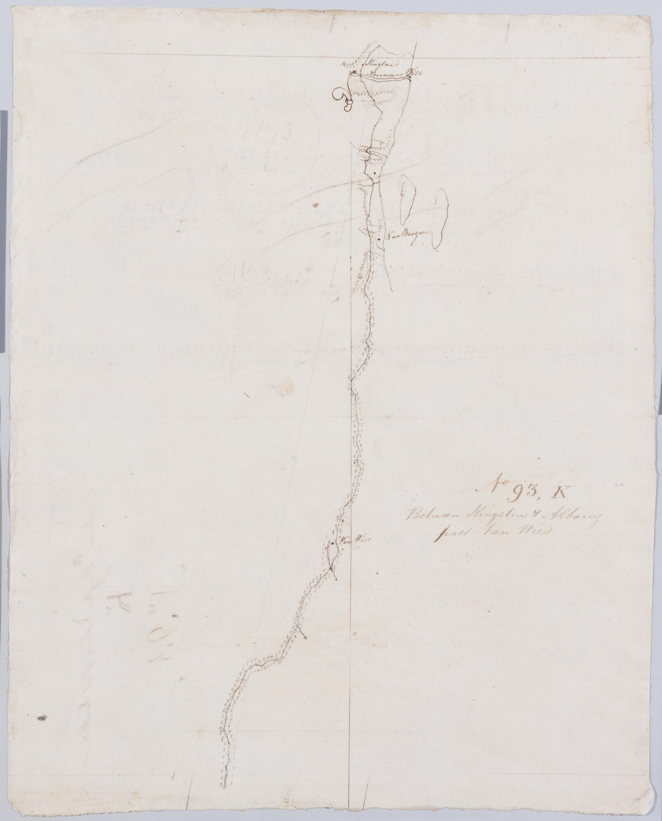
Cartographic Between Kingston + Albany past Van Wie's. No 93 K / by Robert Erskine F.R.S. Geogr. A. U.S. and Assistants. Foxed- stained- soiled- creased and abraded. Mounted on cloth- bound and cropped- disbound and silked by subsequent owners. Cleaned after removal of backings 1999; some fill remains. Sheathed in mylar. In ink on verso: "K K K". In pencil on recto: "No 93 K". Military topographic map. Covers the townships of Coeyman and Bethlehem in Albany County- New York. Shows roads running through Cedar Hill and Glenmont. Also shows buildings and owners' names- landforms and streams. Pen-and-ink- pencil on laid paper. Shows relief by hachures. View Item