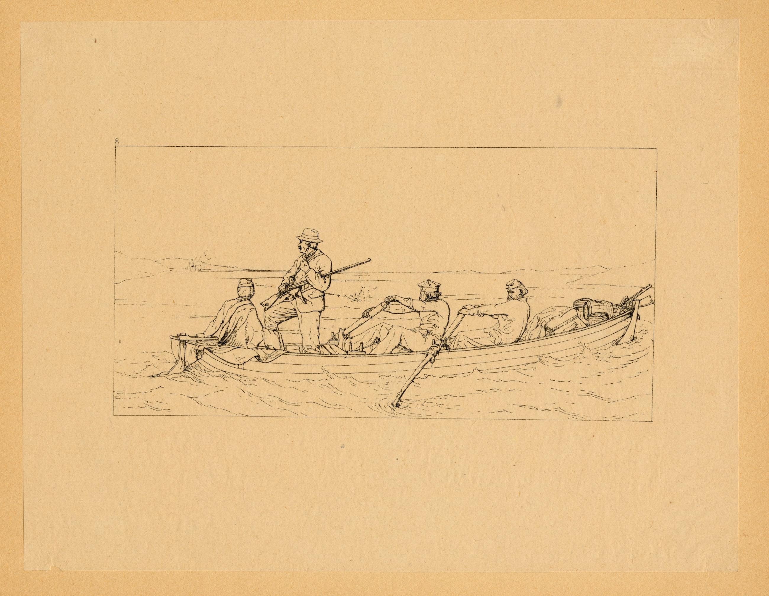
Marylanders Crossing the Potomac to Join the Southern Army. Marylanders Crossing the Potomac to Join the Southern Army. Etching: 1 p. Four men cross a river in a rowboat stocked with guns and barrels. They seem to be fleeing a fort on one side of the river which is firing at them. View Item
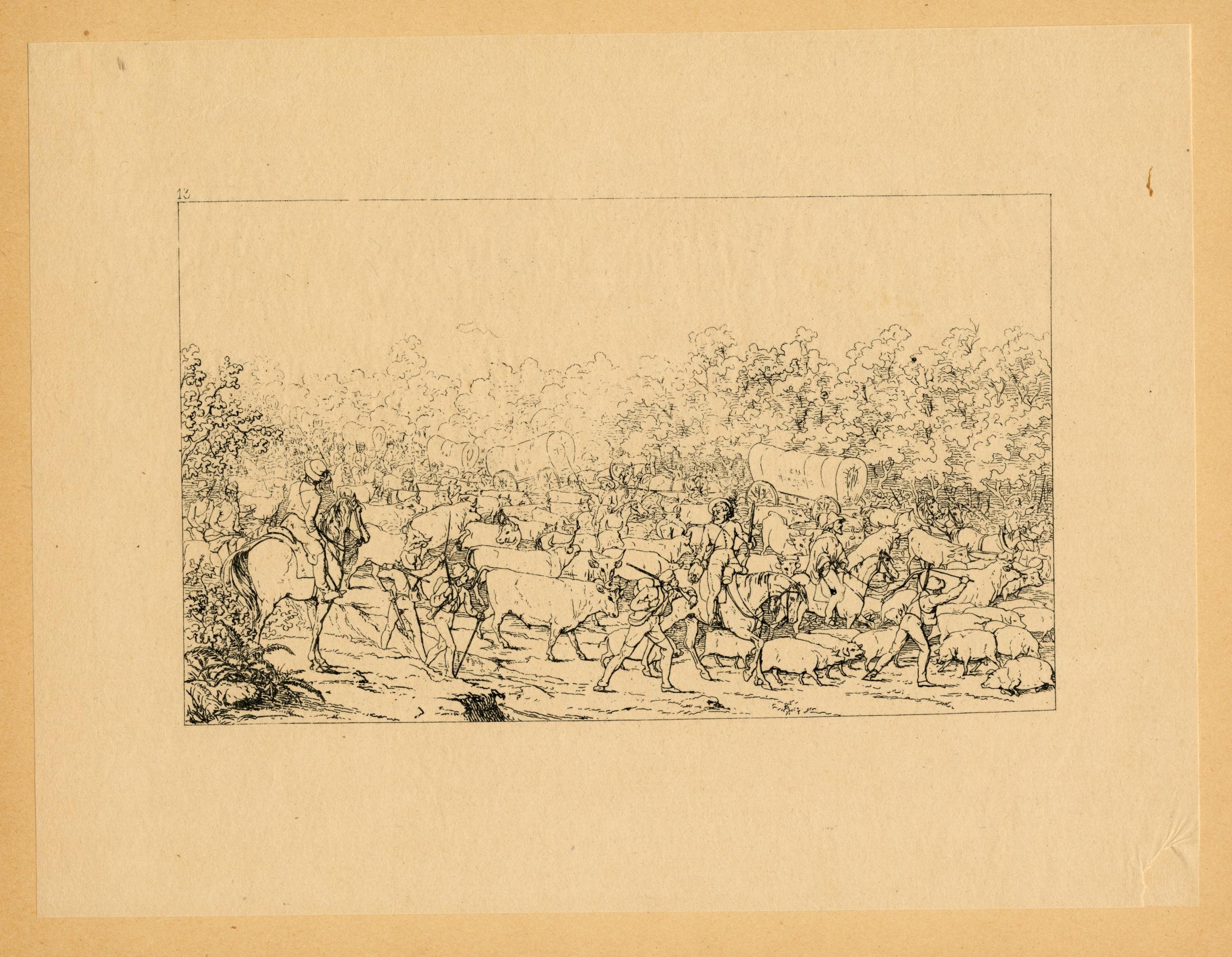
Return of a Raiding Party from Pennsylvania. Return of a Raiding Party from Pennsylvania. Etching: 1 p. Confederate soldiers, some on horseback, are herding a large group of pigs, cows and covered wagons, obtained during a raid on Union forts, toward a river. View Item
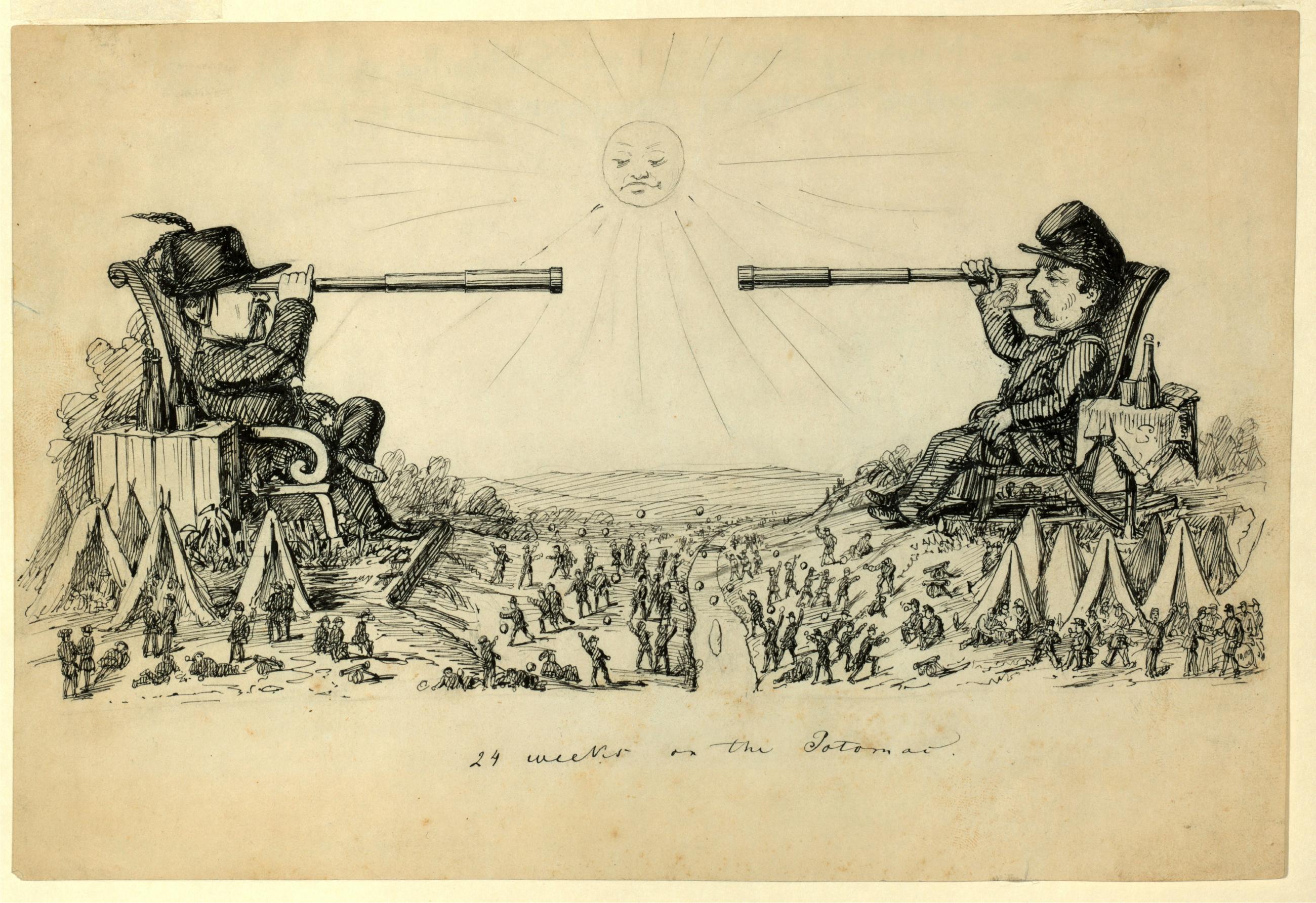
Cartoon: '24 Weeks on the Potomac': Illustration for Frank Leslie's Illustrated Newspaper (February 1, 1862). On verso: study for the same subject. Cartoon: '24 Weeks on the Potomac': Illustration for Frank Leslie's Illustrated Newspaper (February 1, 1862). On verso: study for the same subject. Drawing: Black ink over graphite on ivory paper. 6 1/4 x 9 1/8 in. Larger than life Union and Confederate generals, [McClellan and Beauregard] each seated leisurely in a chair with drink nearby, view each other through telescopes. They are separated by a river, on each side military camps are set up, and soldiers throw stones across the river at each other. At upper center, a sun with facial features looks down at the soldiers. View Item
Image Collection 288 Items Robert Erskine-Simeon DeWitt maps, 1778-1783 This series of field sketches and finished maps of projected battle sites in New York, New Jersey, Connecticut and Pennsylvania during the Revolutionary war was begun by Robert Erskine, geographer and surveyor-general to the Continental Army, and completed by his successor, Simeon De Witt. Robert Erskine (1735-1780) was appointed Geographer to Washington's army in 1777. He surveyed both sides of the Hudson River and a large area covering the adjoining states. Many of the maps are rough field sketches, from which more detailed maps were later drawn. View Collection