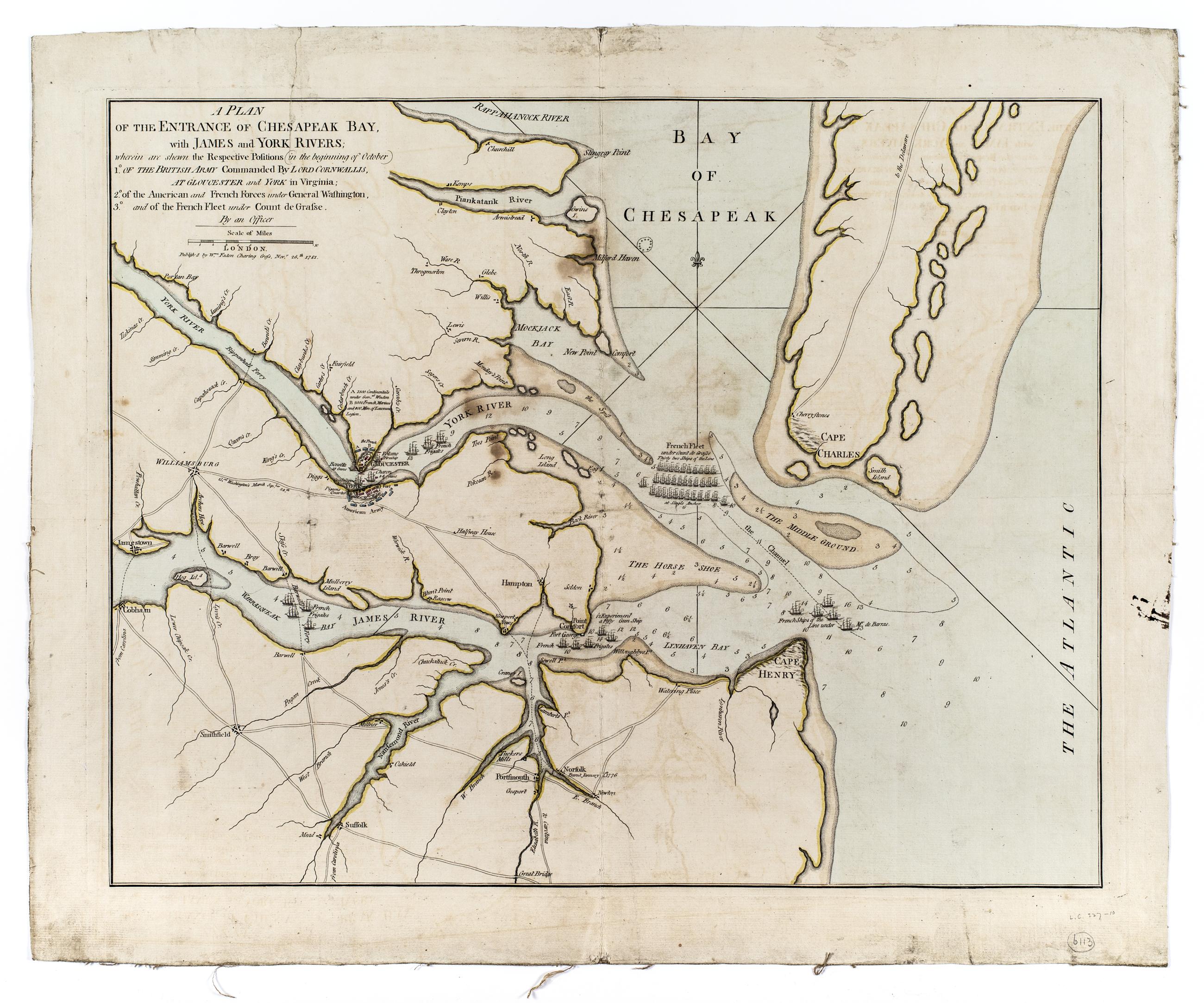
Still Image A plan of the entrance of Chesapeak Bay, with James and York Rivers; : wherein are shown the respective positions (in the beginning of October) 1° of the British army commanded by Lord Cornwallis, at Gloucester and York in Virginia; : 2° of the American a Shows James River peninsula and general positions of armies and the French fleet. N-YHS copy has a printed clipping mounted on verso, dated March 4, 1812, giving the names of vessels in the French Navy. View Item
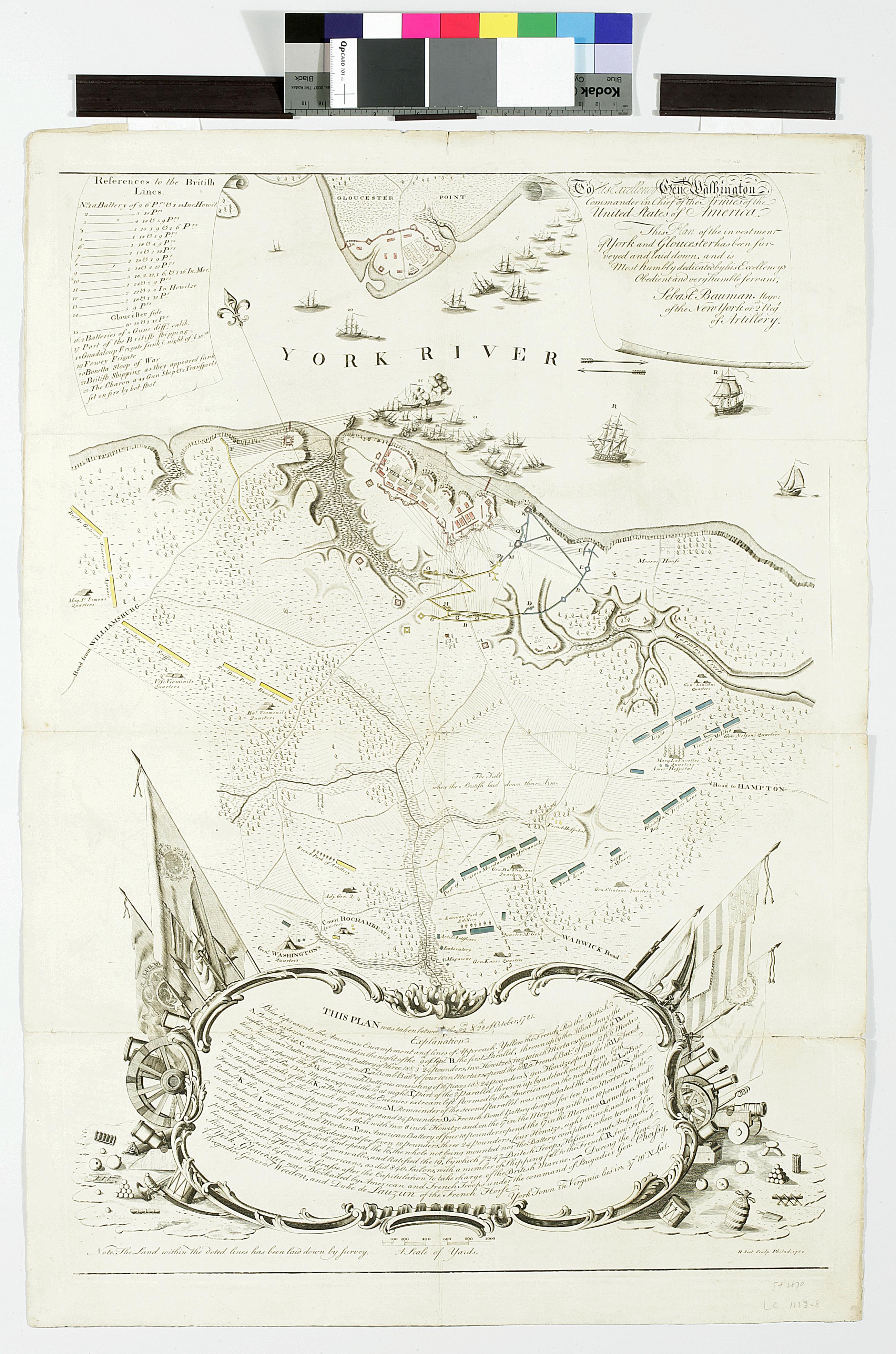
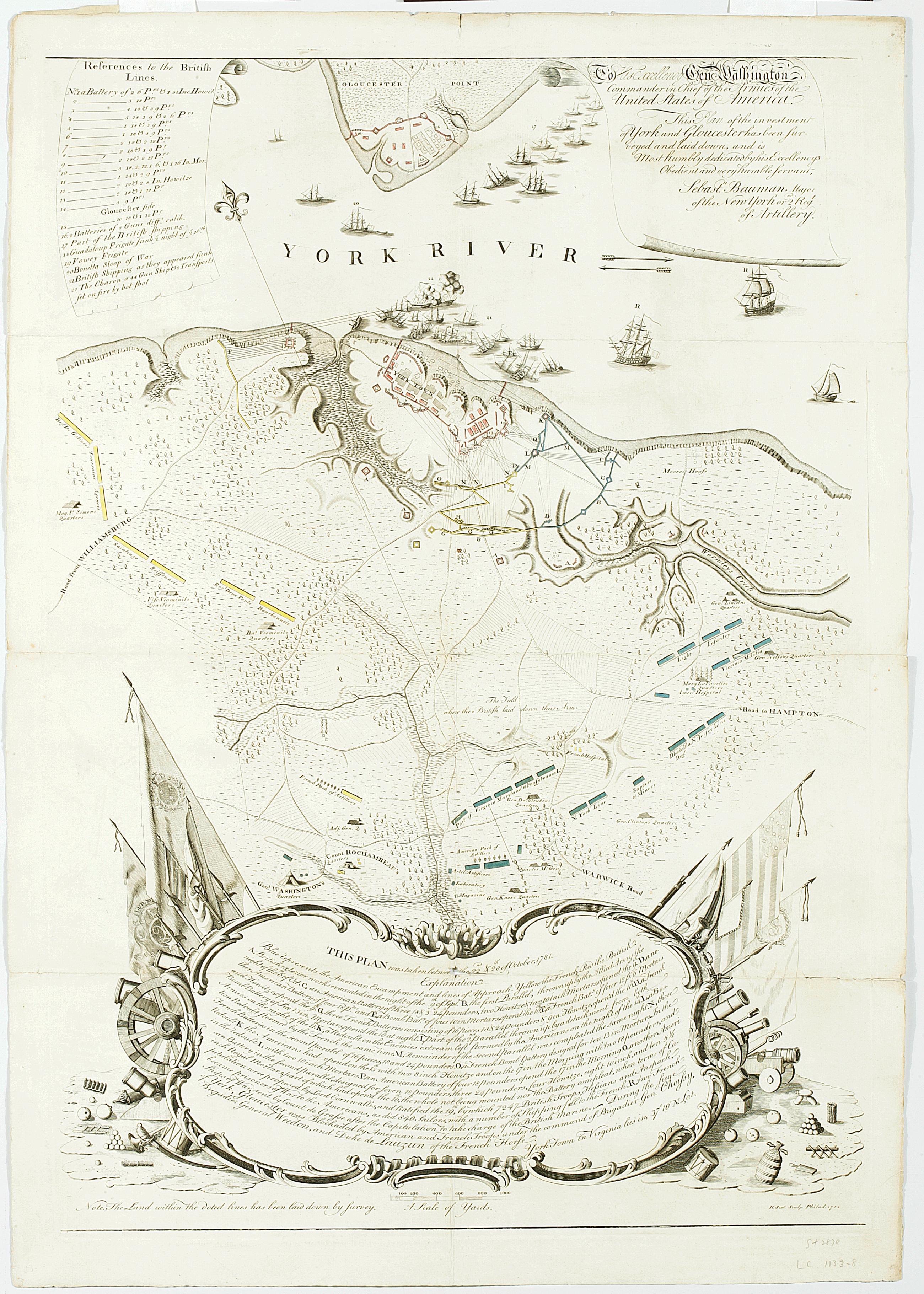
Still Image To His Excellency Genl. Washington, Commander in Chief of the armies of the United States of America : this plan of the investment of York and Gloucester has been surveyed and laid down, and is most humbly dedicated by His Excellency's obedient servant "This plan was taken between the 22nd & 28th of October, 1781."-- cartouche at foot. "Note. The Land within the doted [sic] lines has been laid down by survey." Relief shown by hachures. View Item
Still Image To His Excellency Genl. Washington, Commander in Chief of the armies of the United States of America. : this plan of the investment of York and Gloucester has been surveyed and laid down, and is most humbly dedicated by His Excellency's obedient servant, General Washington asked Major Sebastian Bauman, an American artillery officer and military engineer, to survey the terrain and battle positions at Yorktown, three days after the British surrendered there. It was the first large-scale battle map printed in the United States, sold by subscription only with relatively few sheets printed. New-York Historical holds two copies, one of which is believed to be Bauman's personal copy. View Item
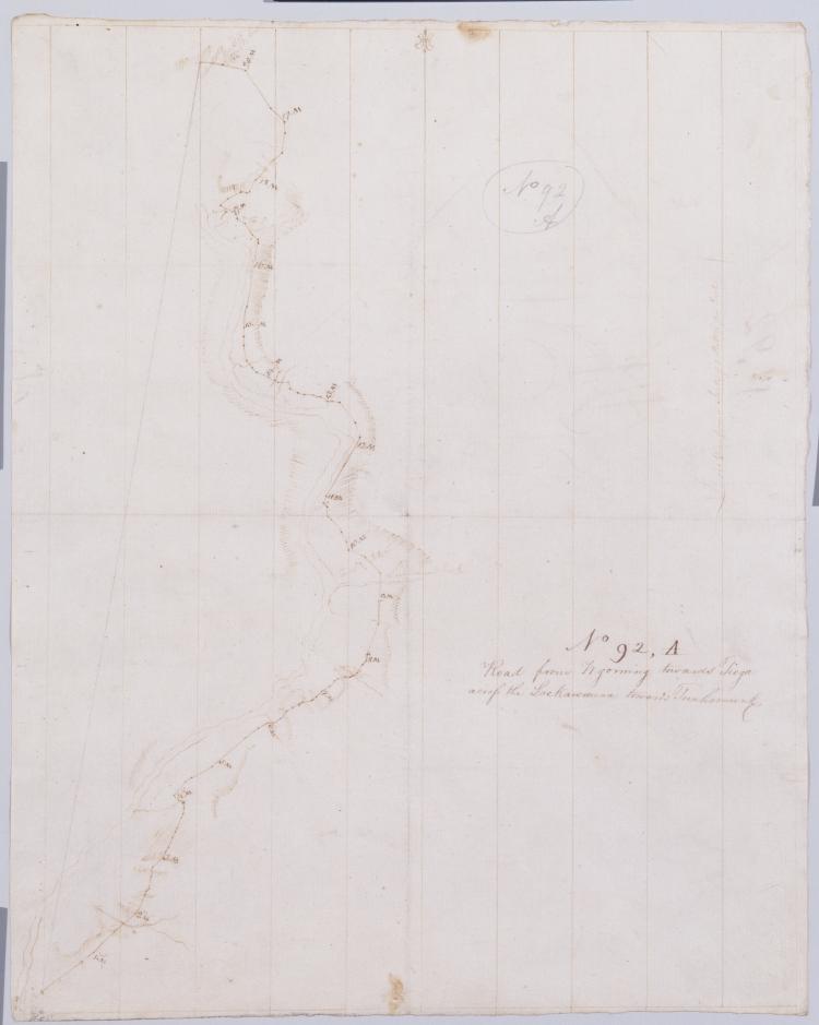
Image Collection 288 Items Robert Erskine-Simeon DeWitt maps, 1778-1783 This series of field sketches and finished maps of projected battle sites in New York, New Jersey, Connecticut and Pennsylvania during the Revolutionary war was begun by Robert Erskine, geographer and surveyor-general to the Continental Army, and completed by his successor, Simeon De Witt. Robert Erskine (1735-1780) was appointed Geographer to Washington's army in 1777. He surveyed both sides of the Hudson River and a large area covering the adjoining states. Many of the maps are rough field sketches, from which more detailed maps were later drawn. View Collection
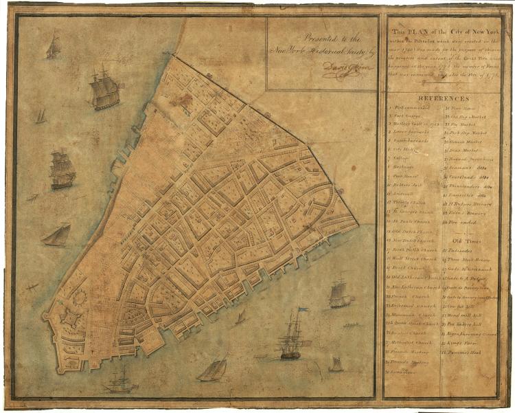
Image Collection 20 Items Revolutionary Era Maps These highlights from the Patricia D. Klingenstein Library's extensive map collection illuminate the tremendous geographic, political, and economic changes that transformed thirteen distinct colonies in North America into a new nation. View Collection