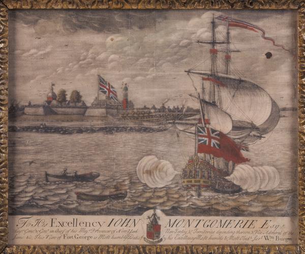
Still Image To His Excellency Iohn Montgomerie Esqr. Capn. Genel. & Govr. in Chief of His Maj's provinces of New-York, New-Jersey, & territories depending thereon, & Vice-Admiral of the same, &c., this view of Fort George is most humbly dedicd. by His Excellency's mo This unique copy of William Burgis's hand-colored mezzotint view of Fort George is the first known engraved view of New York City from the west and the first mezzotint view of the city. It emphasizes English control of Manhattan island with an oversized Union Jack, which is repeated on the warship in the harbor. View Item
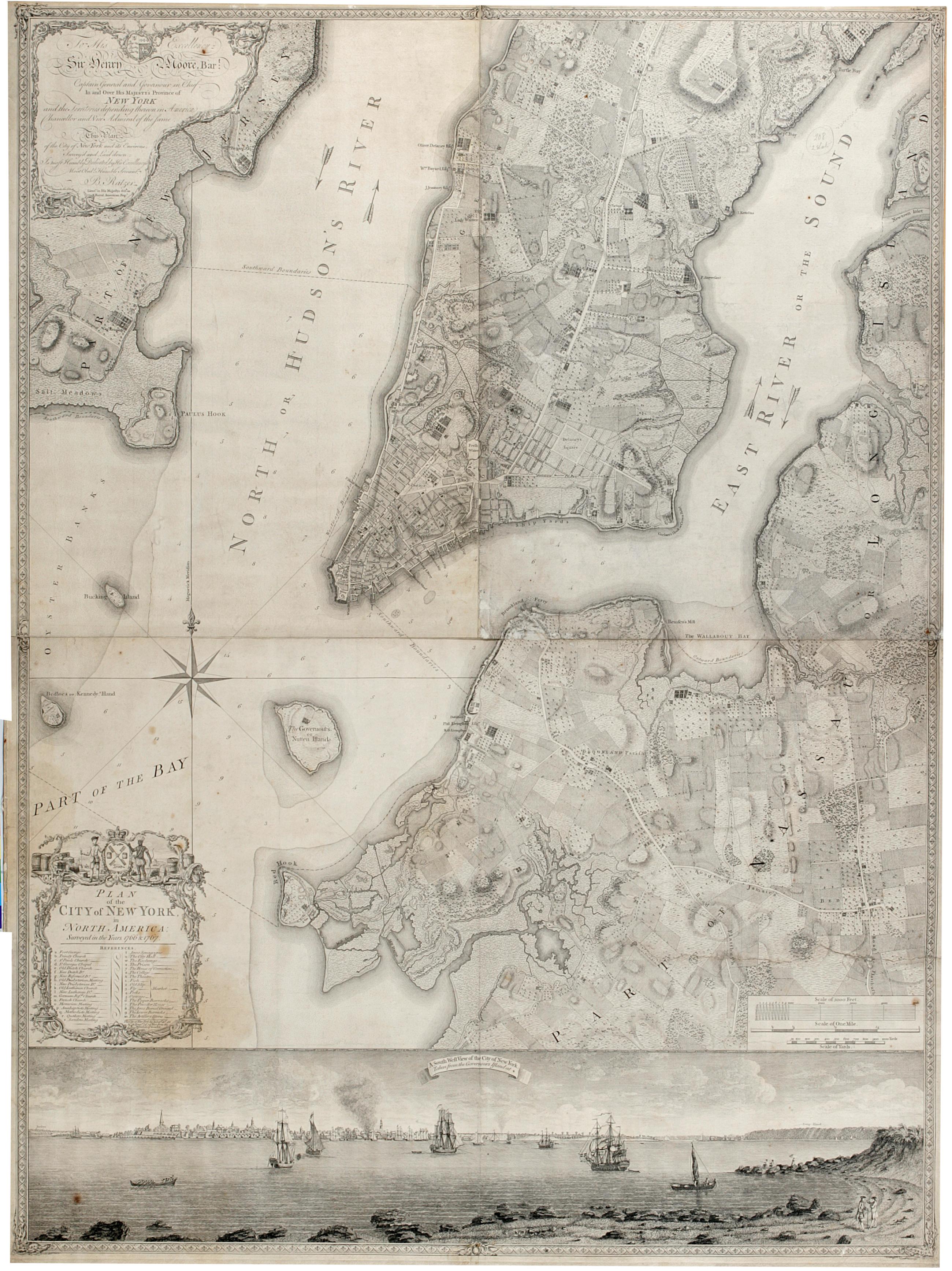
Still Image Plan of the city of New York in North America : surveyed in the years 1766 & 1767. The Ratzer map of New York City. First state, 1770. Covers part of modern New York City: Manhattan below the later 60th Street and Brooklyn north of the later 30th Street and west of the later Union Avenue; also a small part of modern Queens and of Jersey City, New Jersey. Shows built up and cultivated areas, streets and rural roads, some buildings, piers. Also shows streams, ponds and wetlands. Shows relief by hachures. Shows depths by soundings. Dedication at upper left: "To His Excellency Sir Henry Moore, Bart. View Item
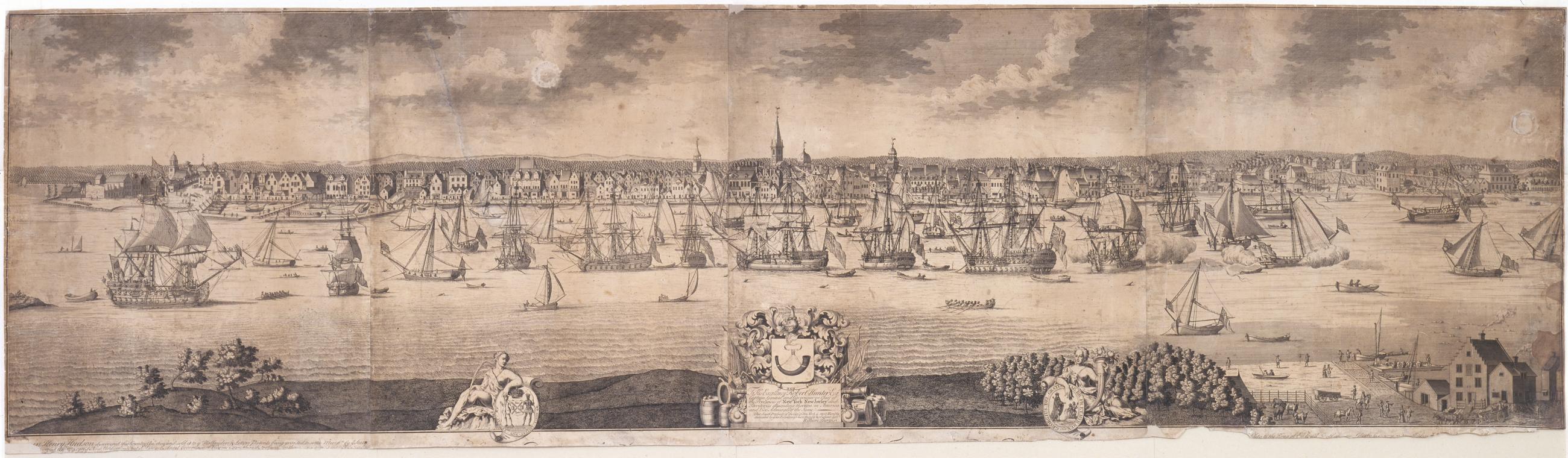
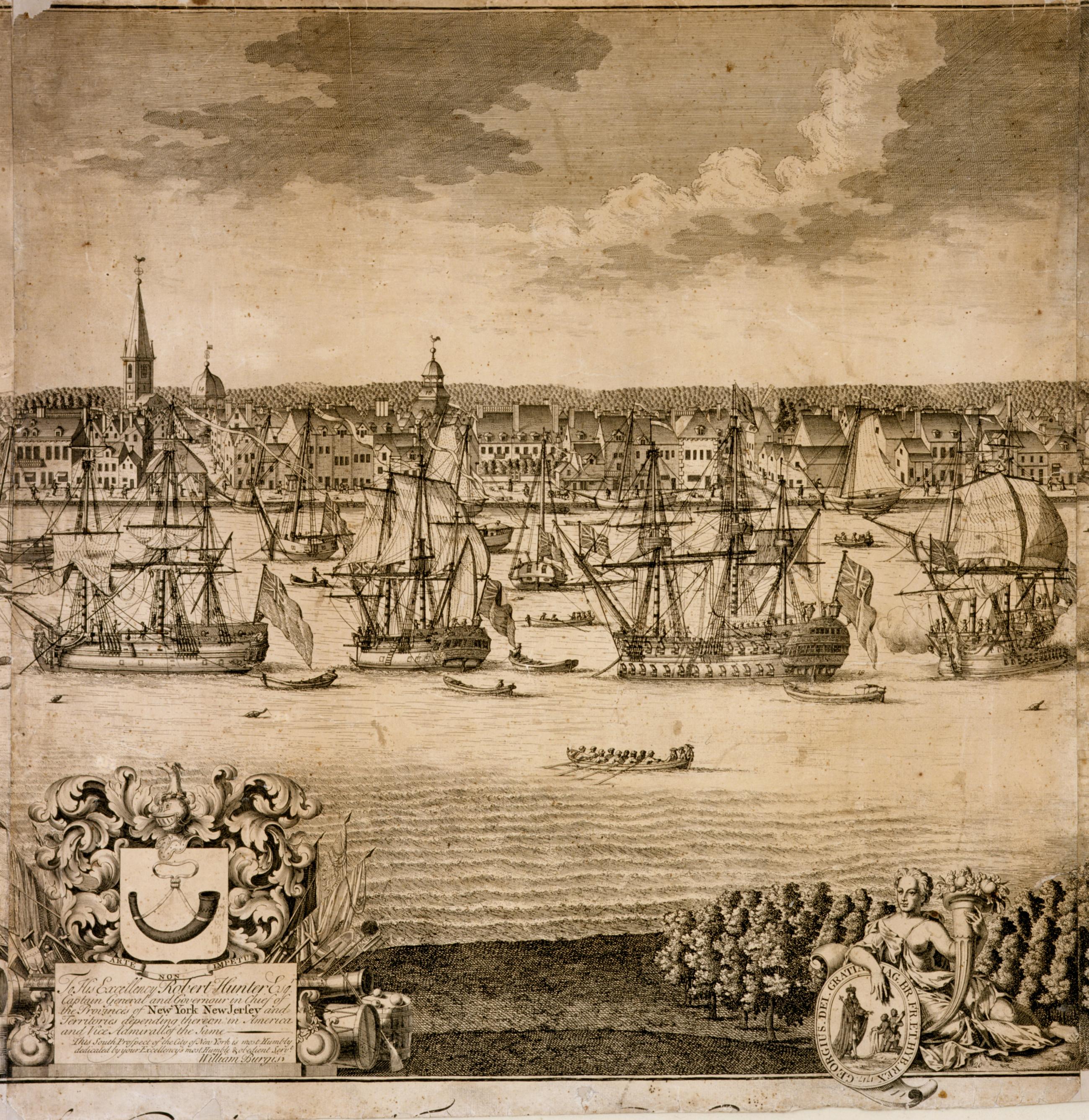
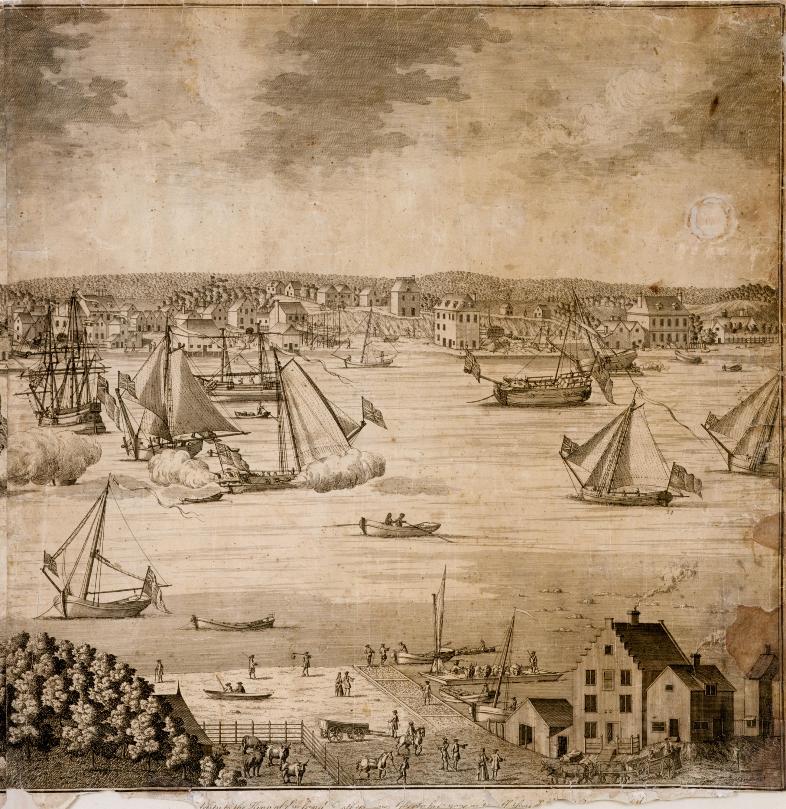
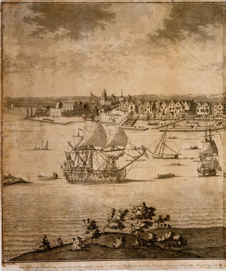
Still Image [A south prospect of ye flourishing city of New York in the province of New York in America, circa 1719-1721] The earliest panoramic view of the East River and New York City, called "The Burgis View". Engraving from four plates on four sheets, issued circa 1719-1721. Drawn by William Burgis in 1717 from what is now known as Brooklyn Heights, and engraved in London by John Harris. Dedication reads: "To His Excellency Robert Hunter Esqr. View Item
Still Image [A south prospect of ye flourishing city of New York in the province of New York in America, circa 1719-1721], plate [2] View Item
Still Image [A south prospect of ye flourishing city of New York in the province of New York in America, circa 1719-1721], plate [3] View Item
Still Image [A south prospect of ye flourishing city of New York in the province of New York in America, circa 1719-1721], plate [4] View Item
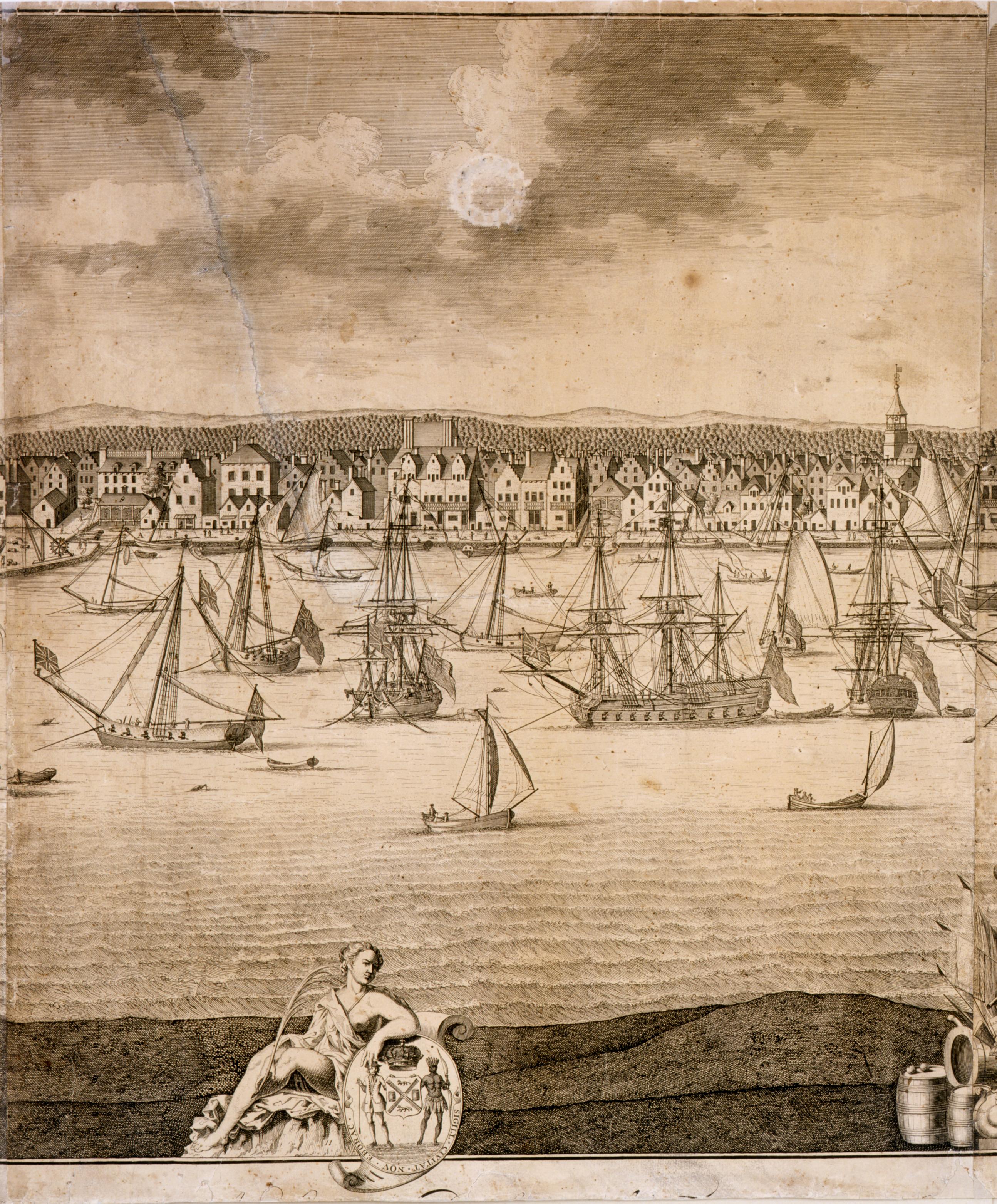
Still Image [A south prospect of ye flourishing city of New York in the province of New York in America, circa 1719-1721], plate [1] View Item
Image Still Image 5 Items [A south prospect of ye flourishing city of New York in the province of New York in America, circa 1719-1721] The earliest panoramic view of the East River and New York City, called "The Burgis View". Engraving from four plates on four sheets, issued circa 1719-1721. Drawn by William Burgis in 1717 from what is now known as Brooklyn Heights, and engraved in London by John Harris. Dedication reads: "To His Excellency Robert Hunter Esqr. View Item