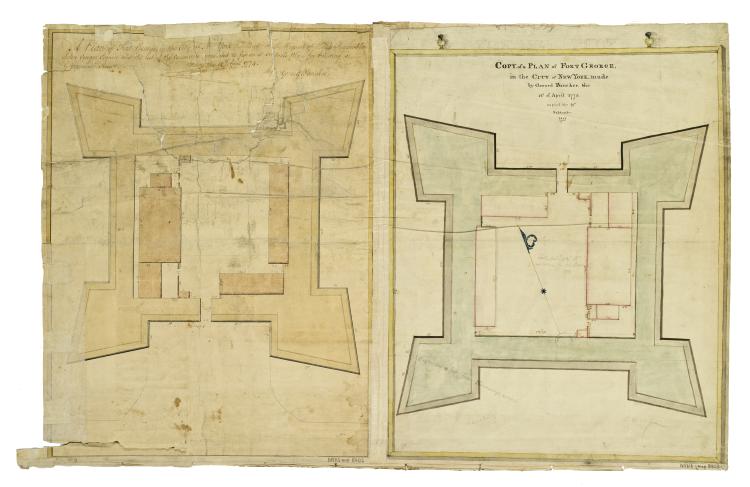
Cartographic A plan of Fort George in the City of New York, Made at the Request of the Honorable John Cruger, Esquire, and the rest of the Committee appointed to fix on a suitable place for building a Government House. Made this 12th April 1774 by Gerard Bancker. ; Co View Item
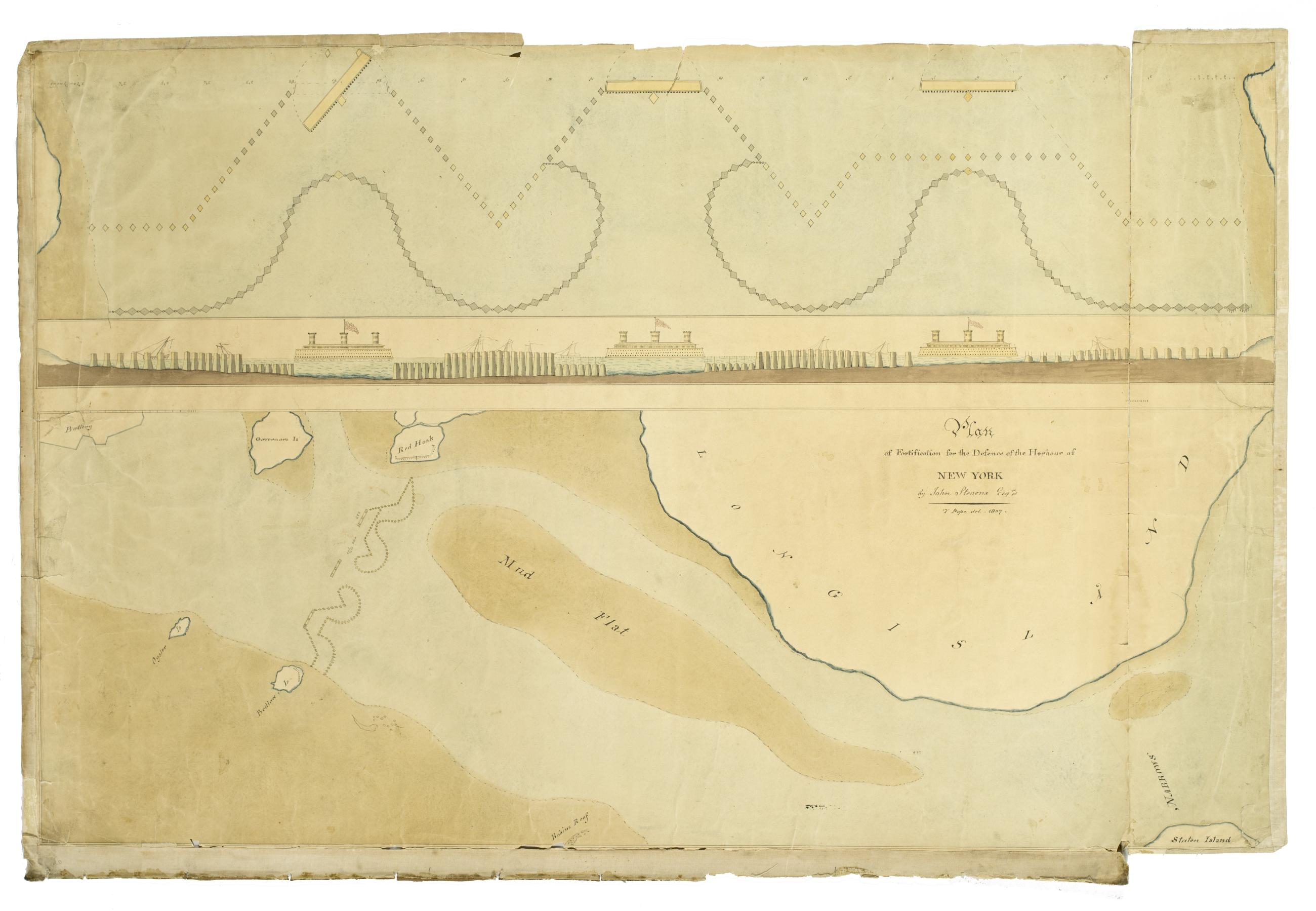
Cartographic Plan of Fortifications for the Defence of the Harbour of New York by John Stevens Esqr. T. Pope del. 1807. View Item
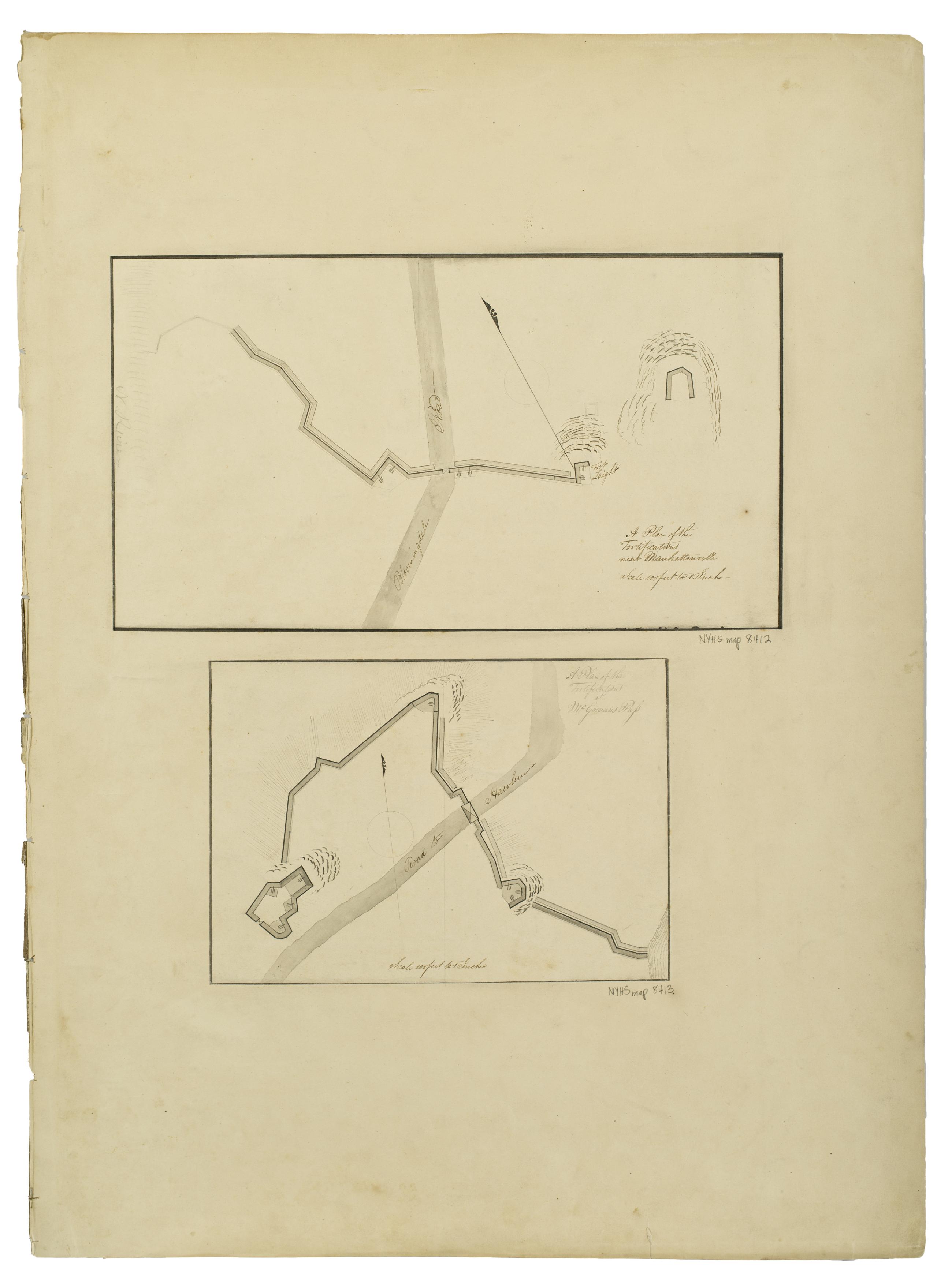
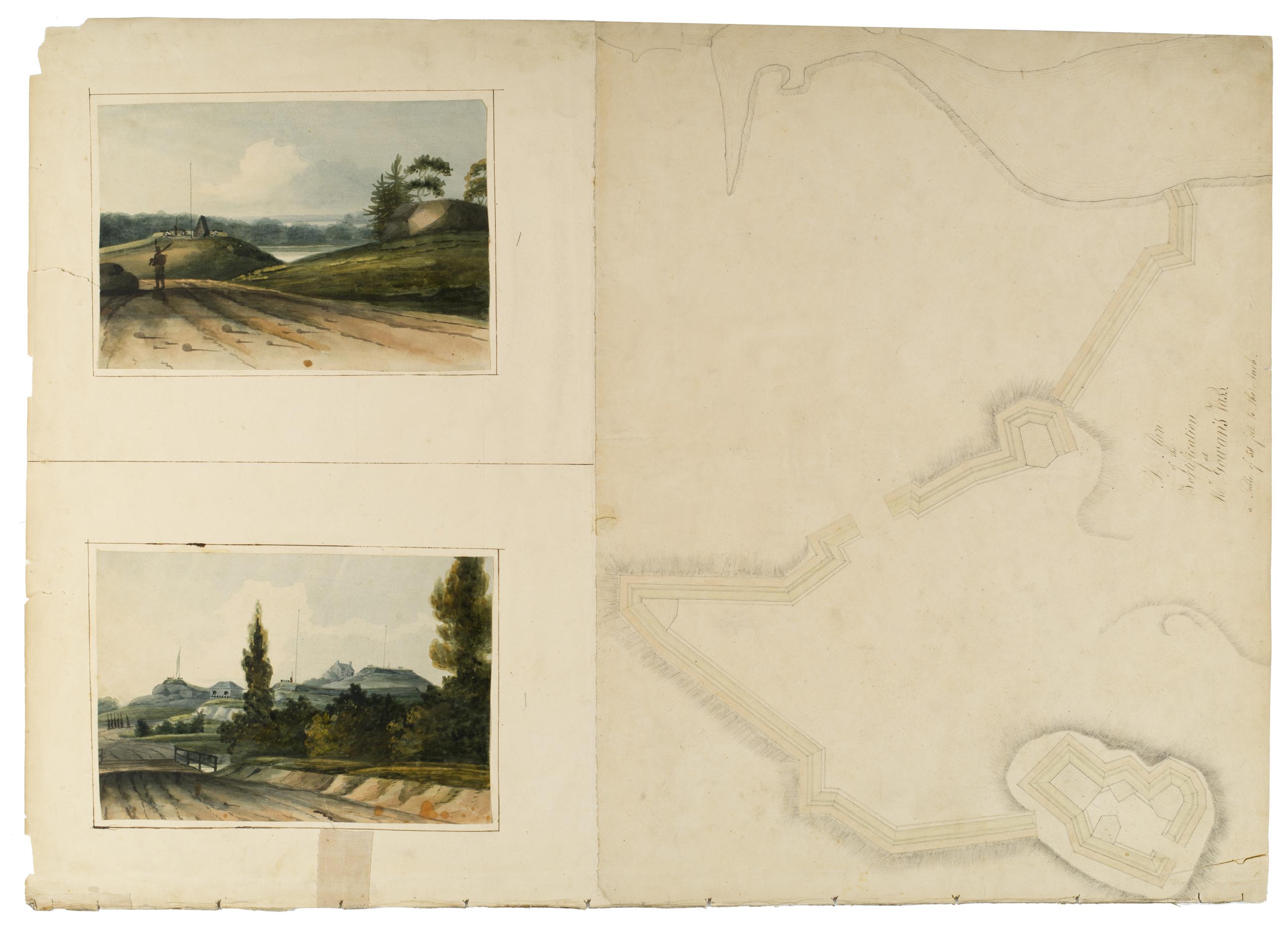
Cartographic A Plan of the Fortifications Near Manhattanville. ; A Plan of the Fortifications at McGowan's Pass. View Item
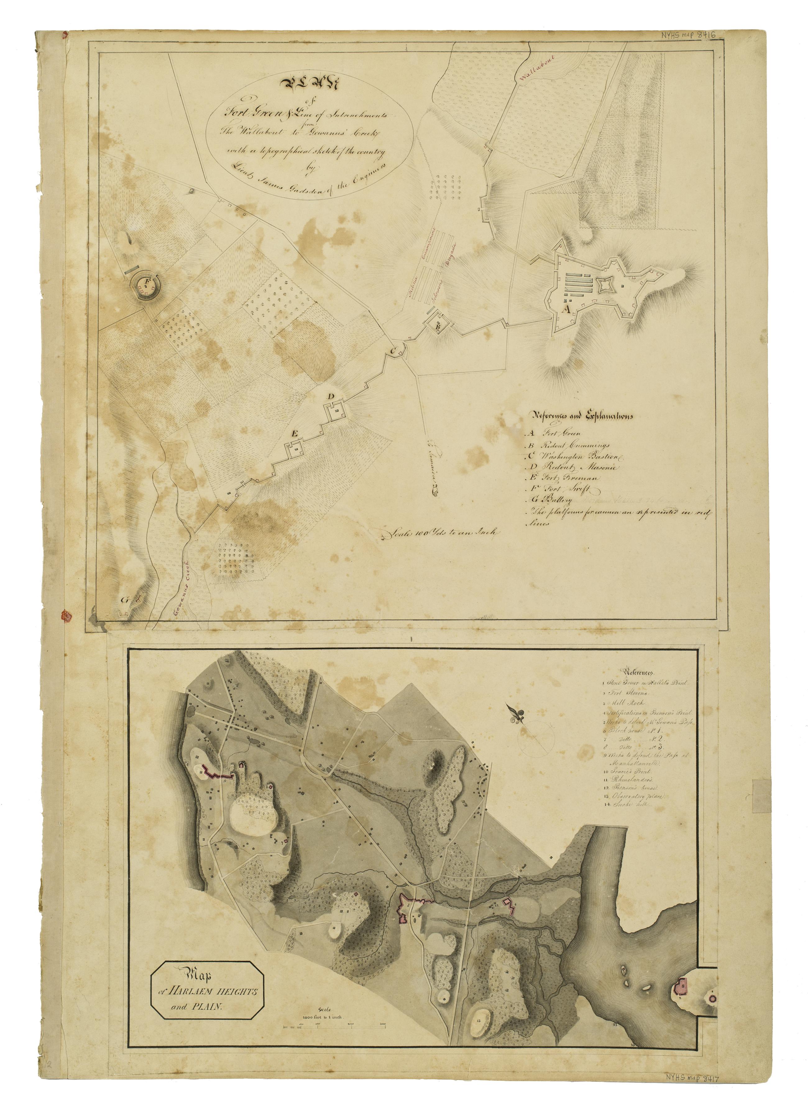
Cartographic Plan of Fort Green & Line of Intrenchments from The Wallabout to Gowanus' Creek with a topographical sketch of the country by Lieut. James Gadsden of the Engineers. ; Map of Harlaem Heights and Plain. View Item
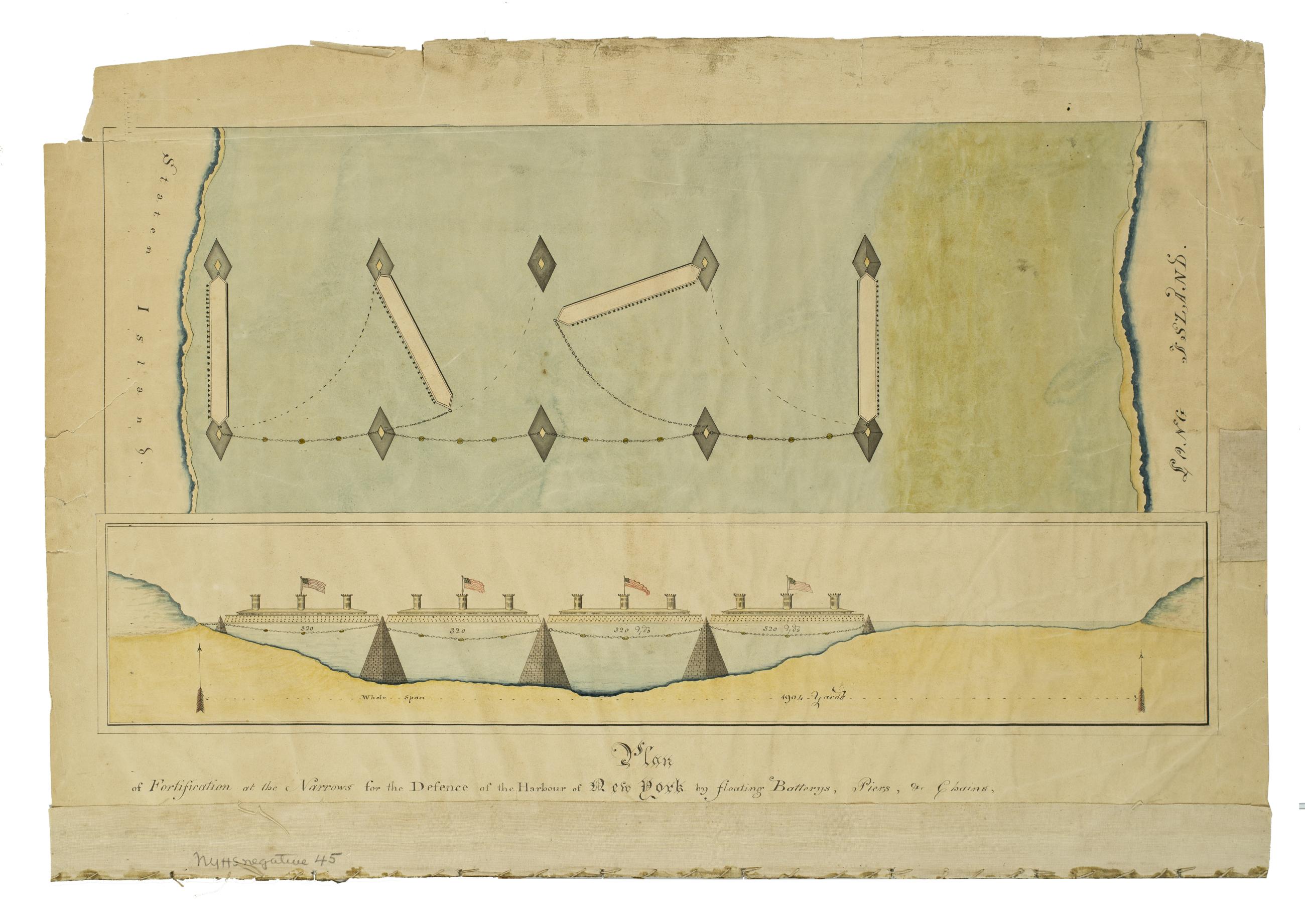
Still Image Plan of Fortification at the Narrows for the Defence of the Harbour of New York by Floating Batterys, Piers, & Chains […] View Item
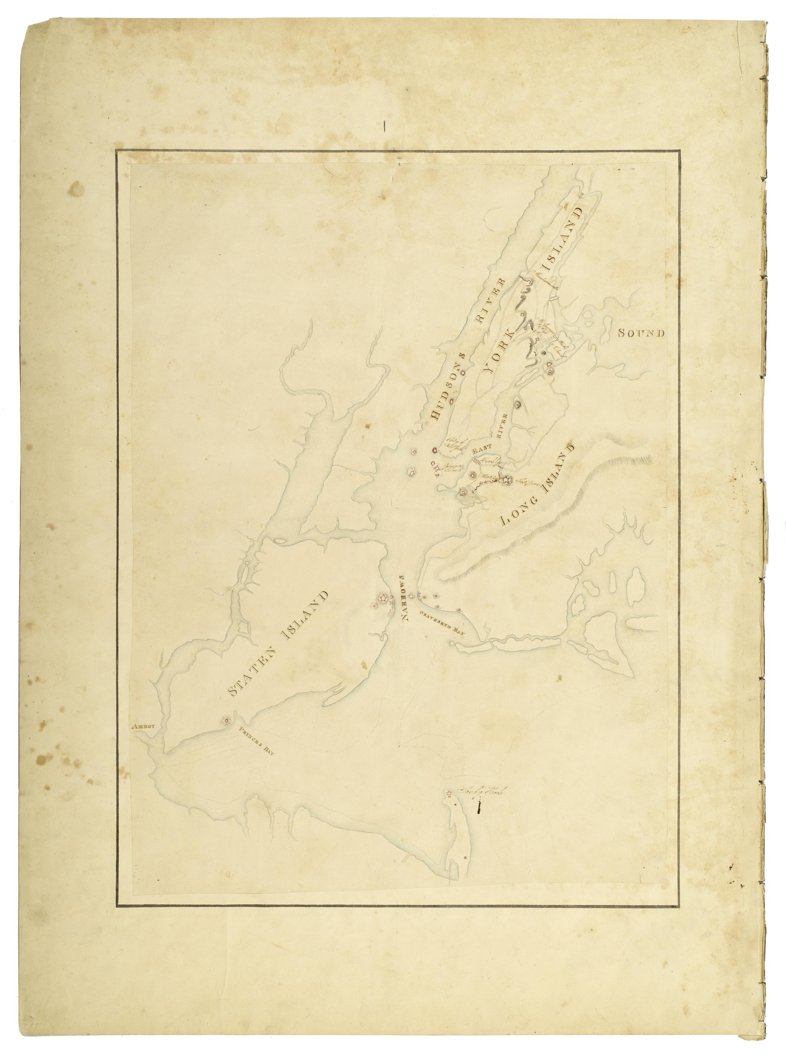
Cartographic An unnamed plan of Staten Island, Long Island, and York Island, showing forts, etc. View Item
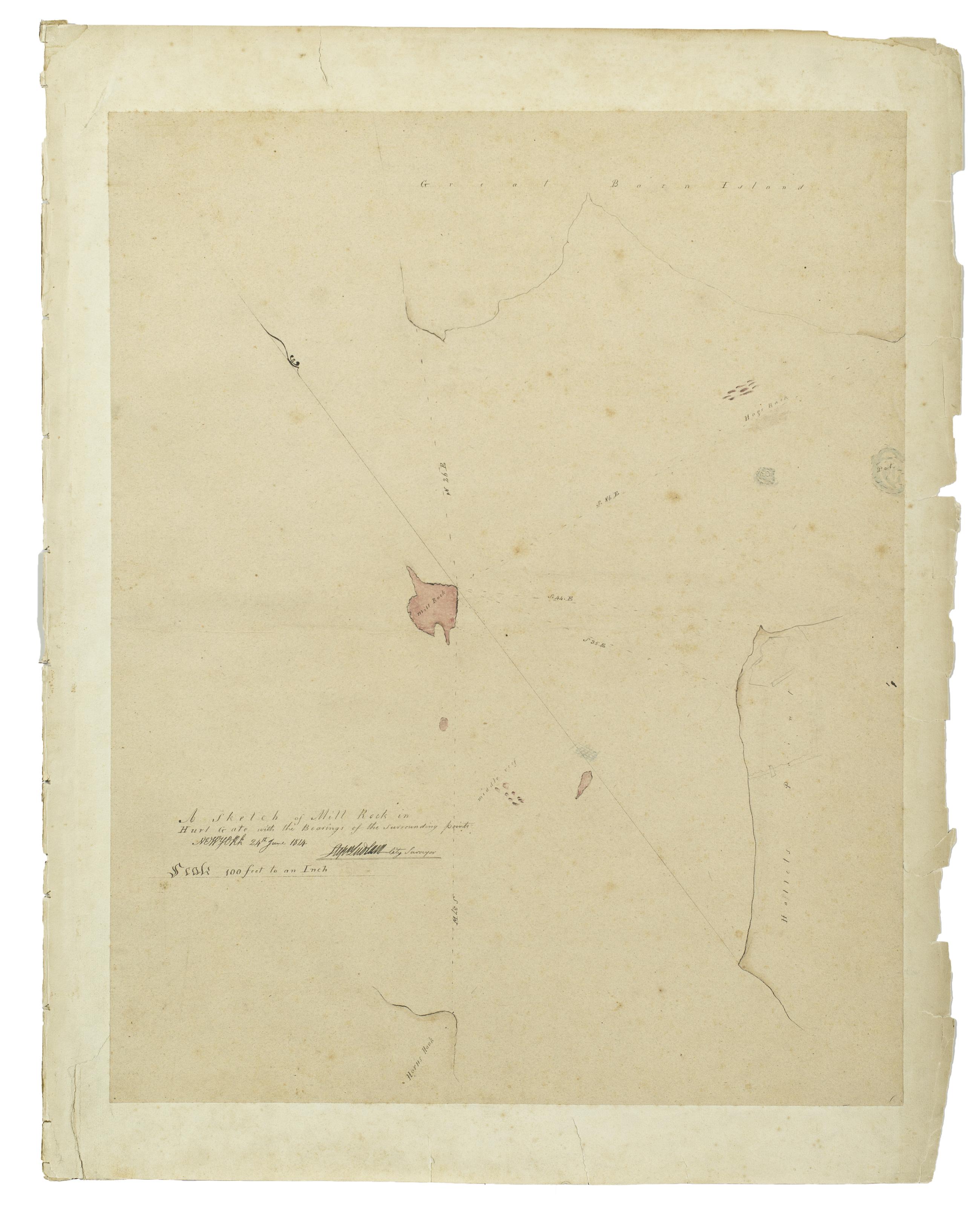
Cartographic A Sketch of Mill Rock in Hurl Gate with the Bearings of the Surrounding Points. Stepn Ludlam City Surveyor, 24th June 1814. View Item
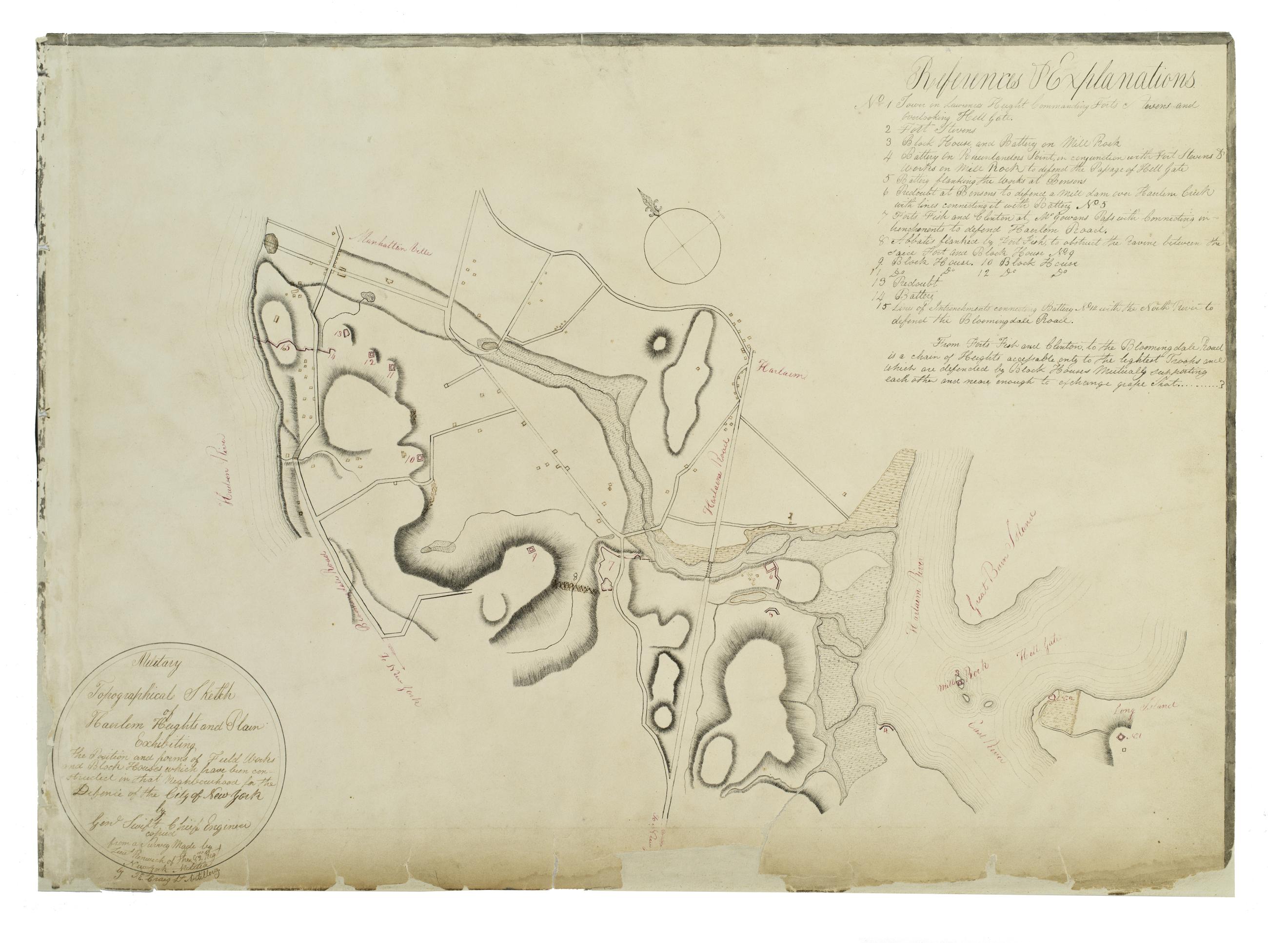
Cartographic Military Topographical Sketch of Haerlem Heights and Plain Exhibiting the Position and forms of Field Works and Block Houses which have been constructed in that Neghbourhood [sic] for the Defence of the City of New York by Genl Swift Chief Engineer copied View Item
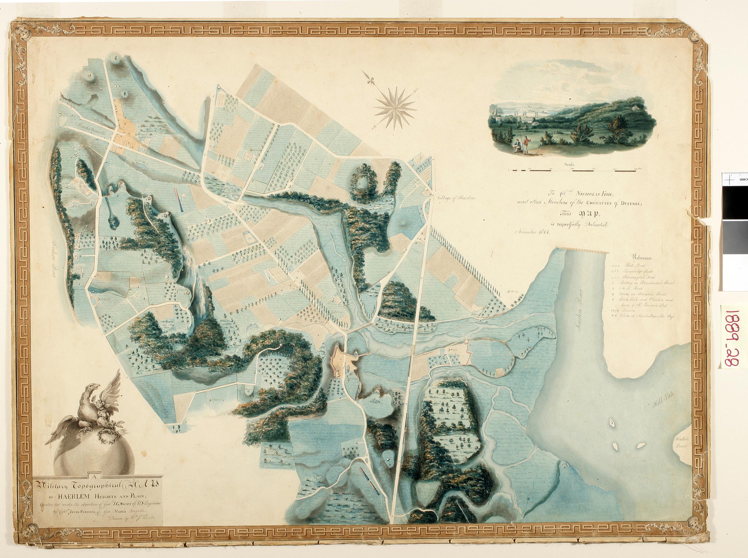
Still Image A Military Topographical Map of Haerlem Heights and Plain. Constructed under the direction of Genl. J. G. Swift of US Engineers. By Captn. James Renwick, of Genl. Mape's Brigade. Drawn by Wm. Js. Proctor To Colnel [sic?] Nicholas Fish, and other Memb View Item
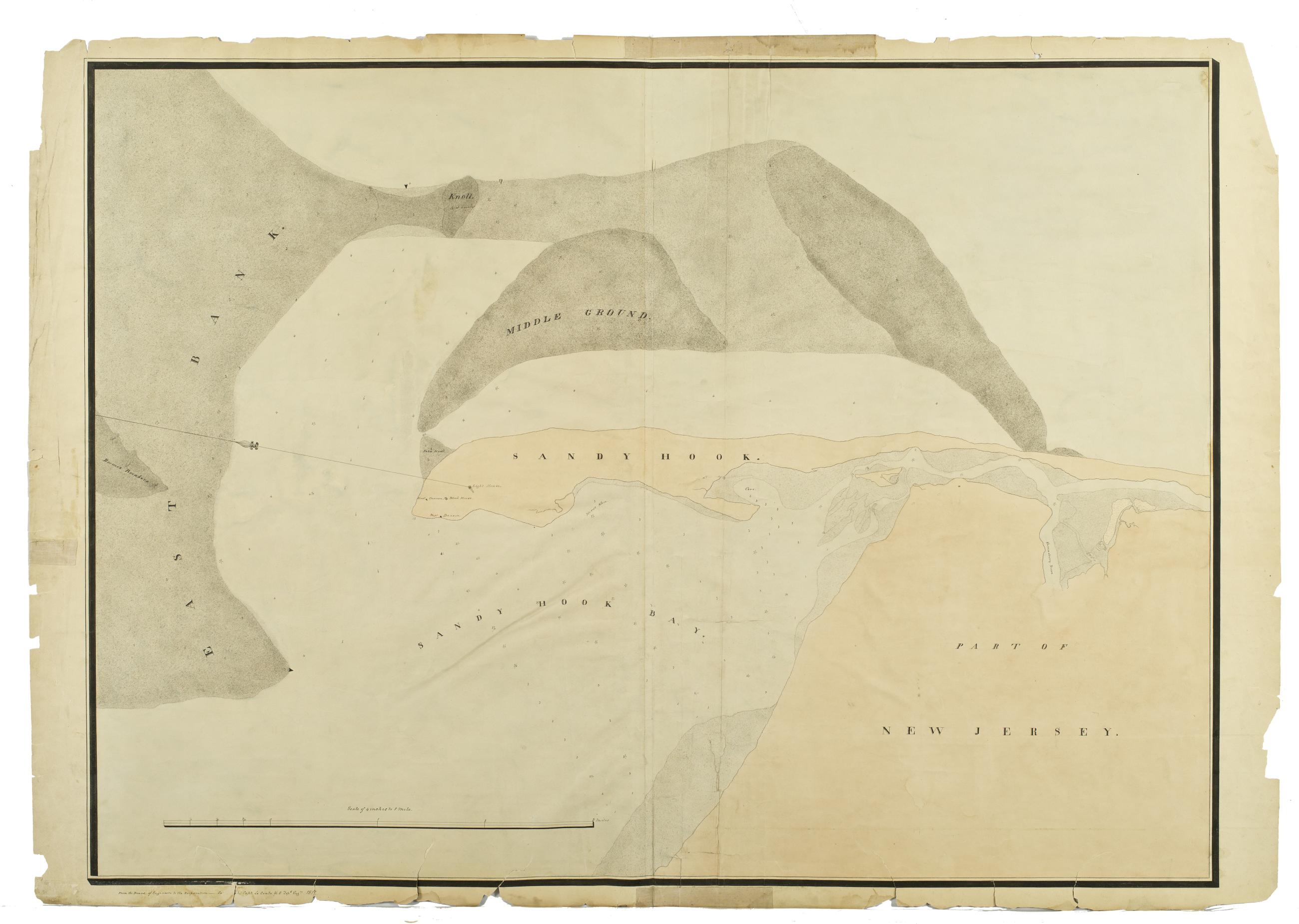
Cartographic An unnamed plan of Sandy Hook, the sand banks in the bay, and part of New Jersey. View Item
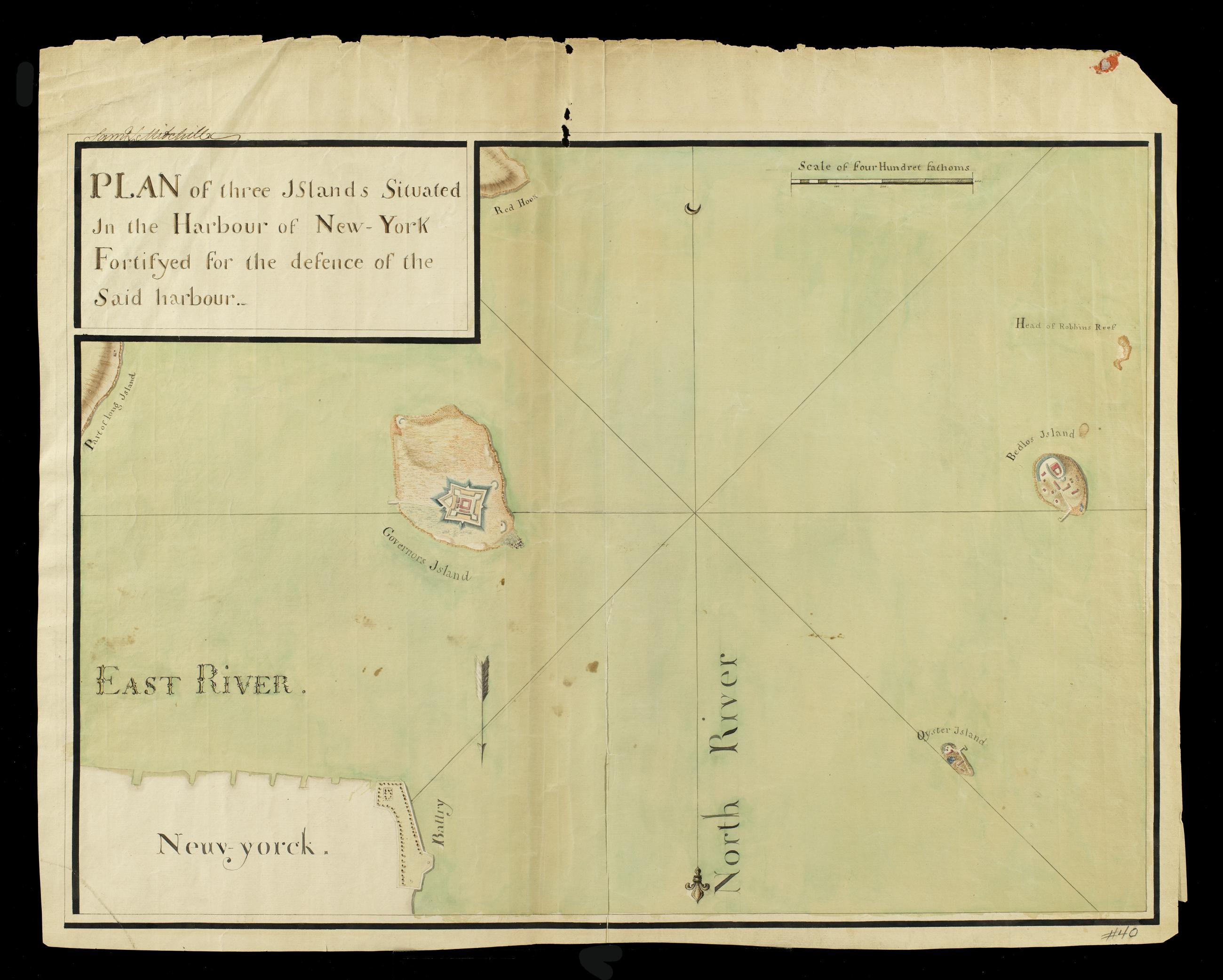
Cartographic Plan of three Islands Situated in the Harbour of New-York Fortifyed for the defence of the Said harbor. View Item
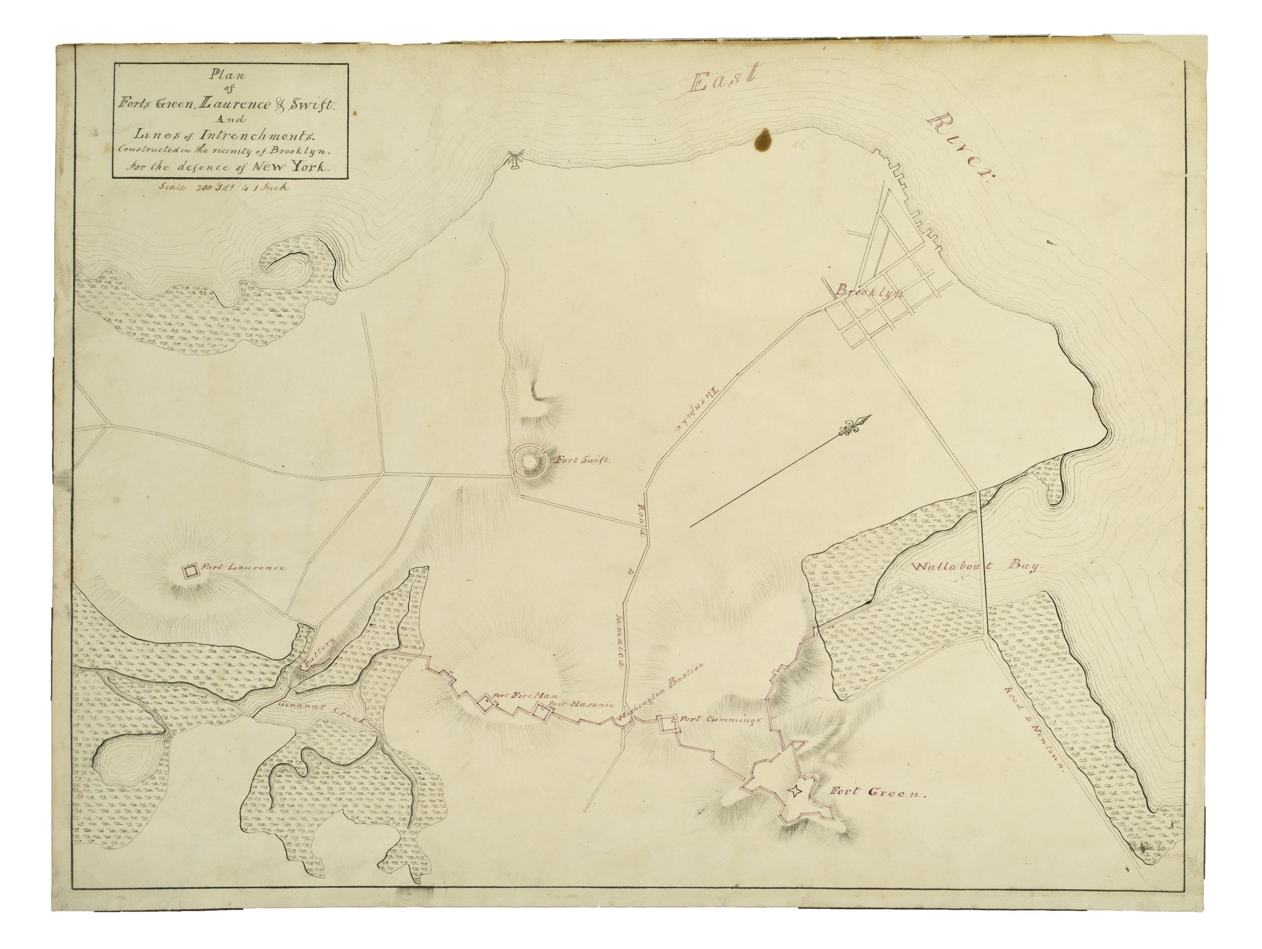
Cartographic Plan of Forts Green, Laurence & Swift, And Lines of Intrenchments. Constructed in the Vicinity of Brooklyn for the Defence of New York. View Item
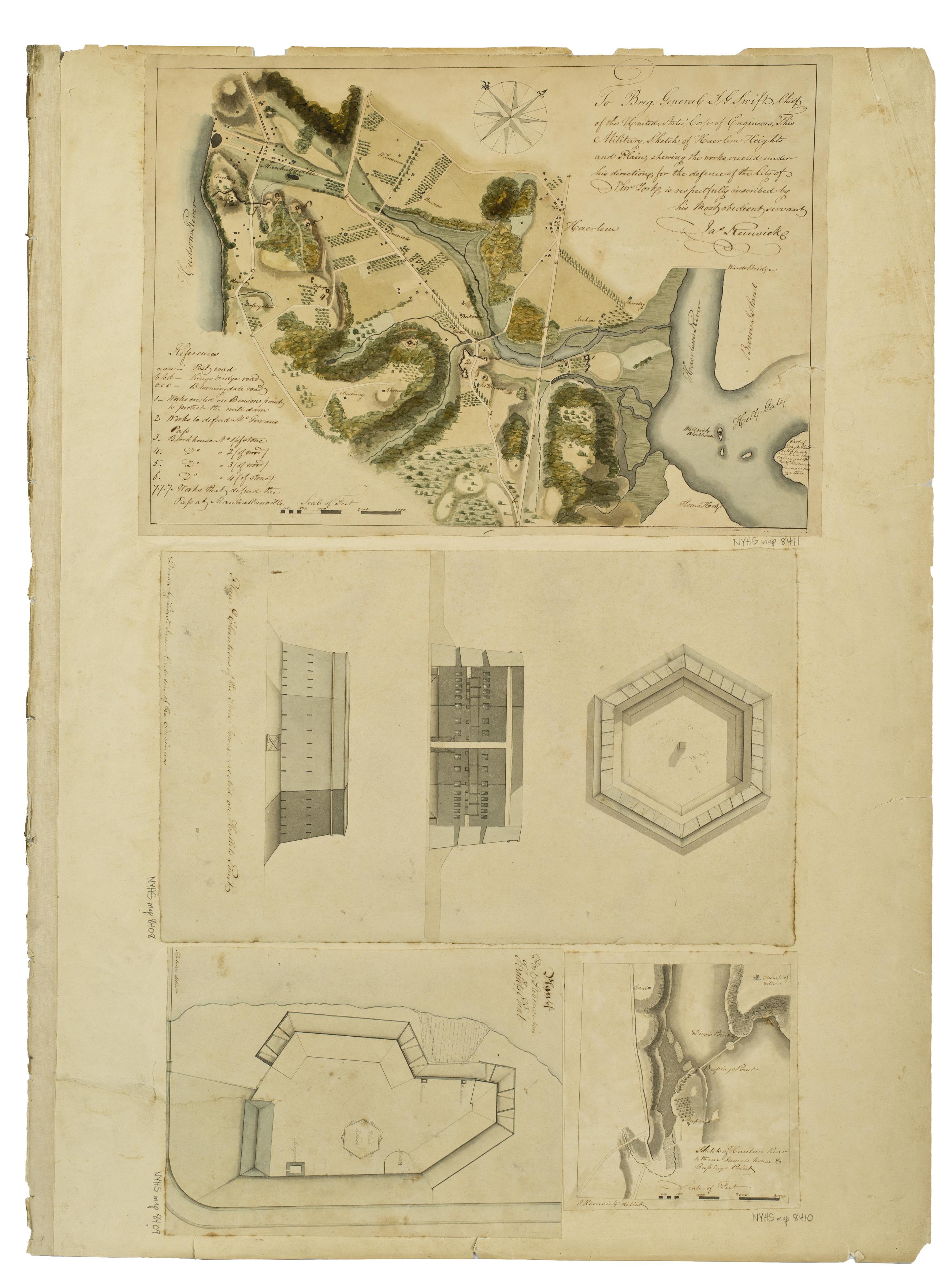
Still Image To Brig. General J.G. Swift, Chief of the United States Corps of Engineers, This Military Sketch of Haerlem Heights and Plain, shewing the works erected, under his direction, for the defence of the City of New York, … Jas Renwick. ; Plan & Elevations of t View Item
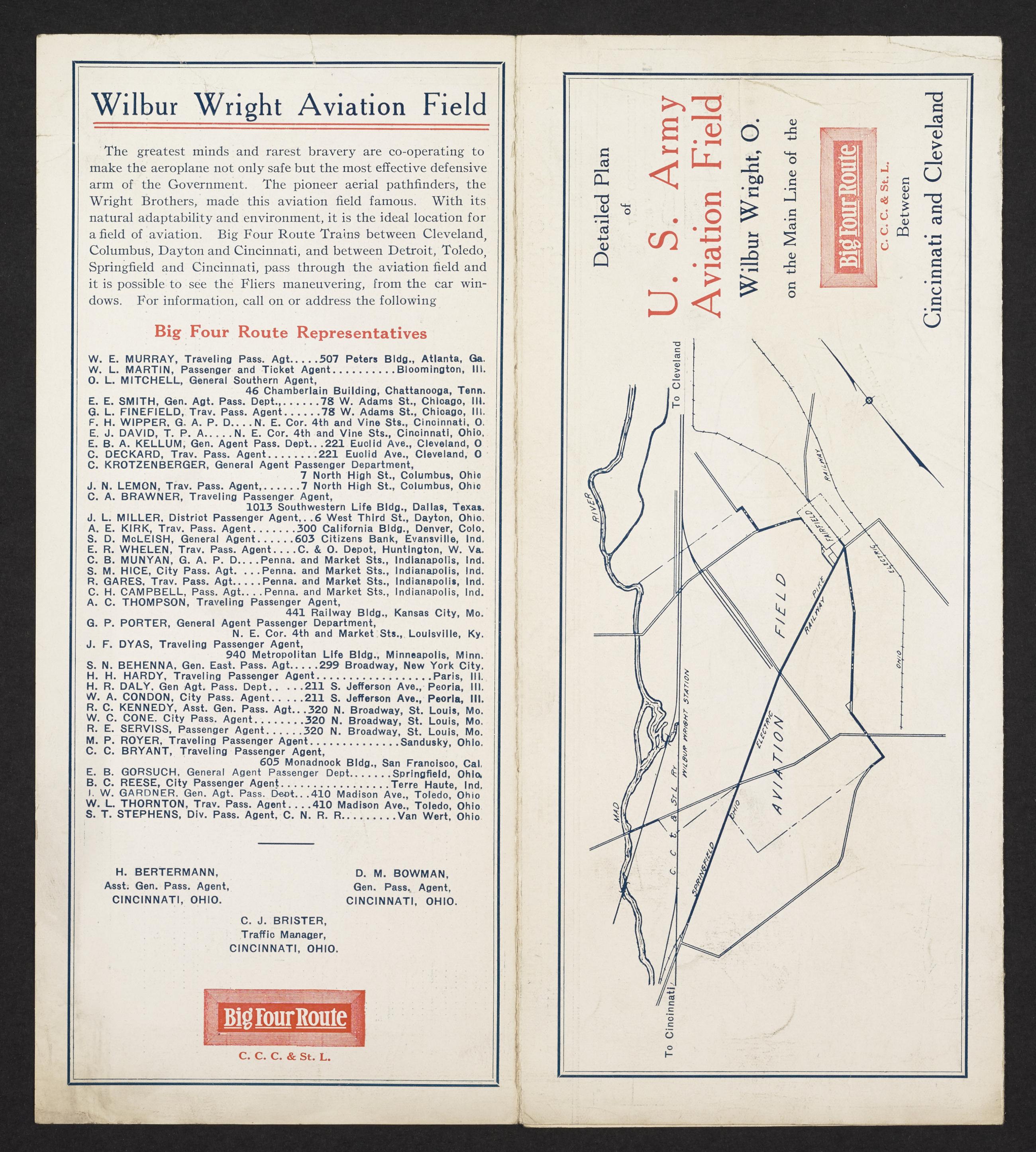
Text U.S. Army Aviation Field Wilbur Wright, Ohio, located between Cincinnati and Cleveland (6.5 miles east of Dayton, Ohio) on the main line of Big Four Route (C.C.C. & St. L. Ry.), page [3], with map of the Wilbur Wright Aviation Field. View Item
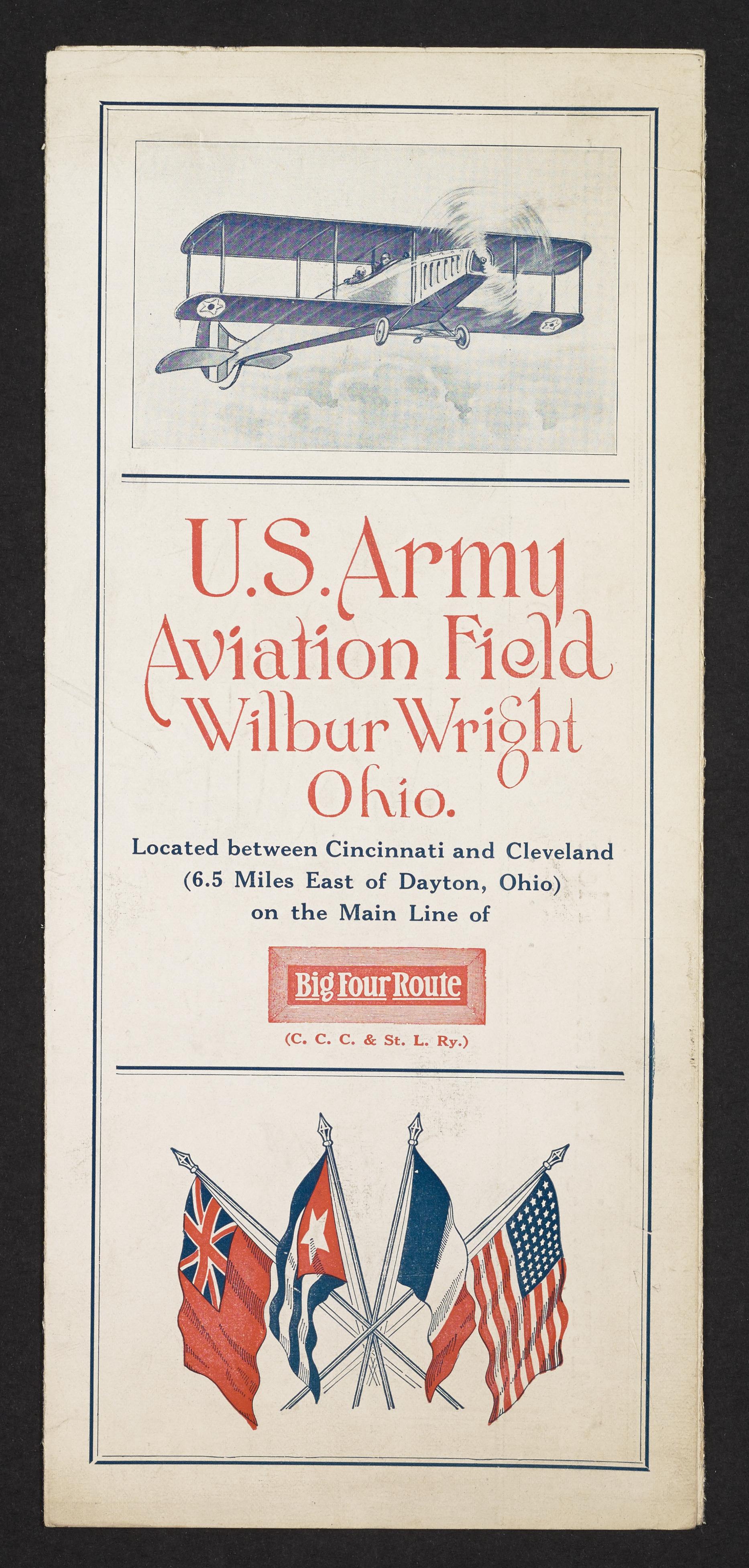
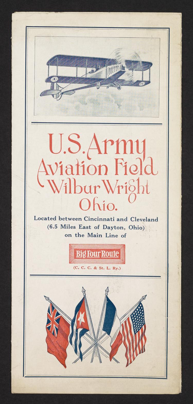
Text U.S. Army Aviation Field Wilbur Wright, Ohio, located between Cincinnati and Cleveland (6.5 miles east of Dayton, Ohio) on the main line of Big Four Route (C.C.C. & St. L. Ry.), page [1]. View Item
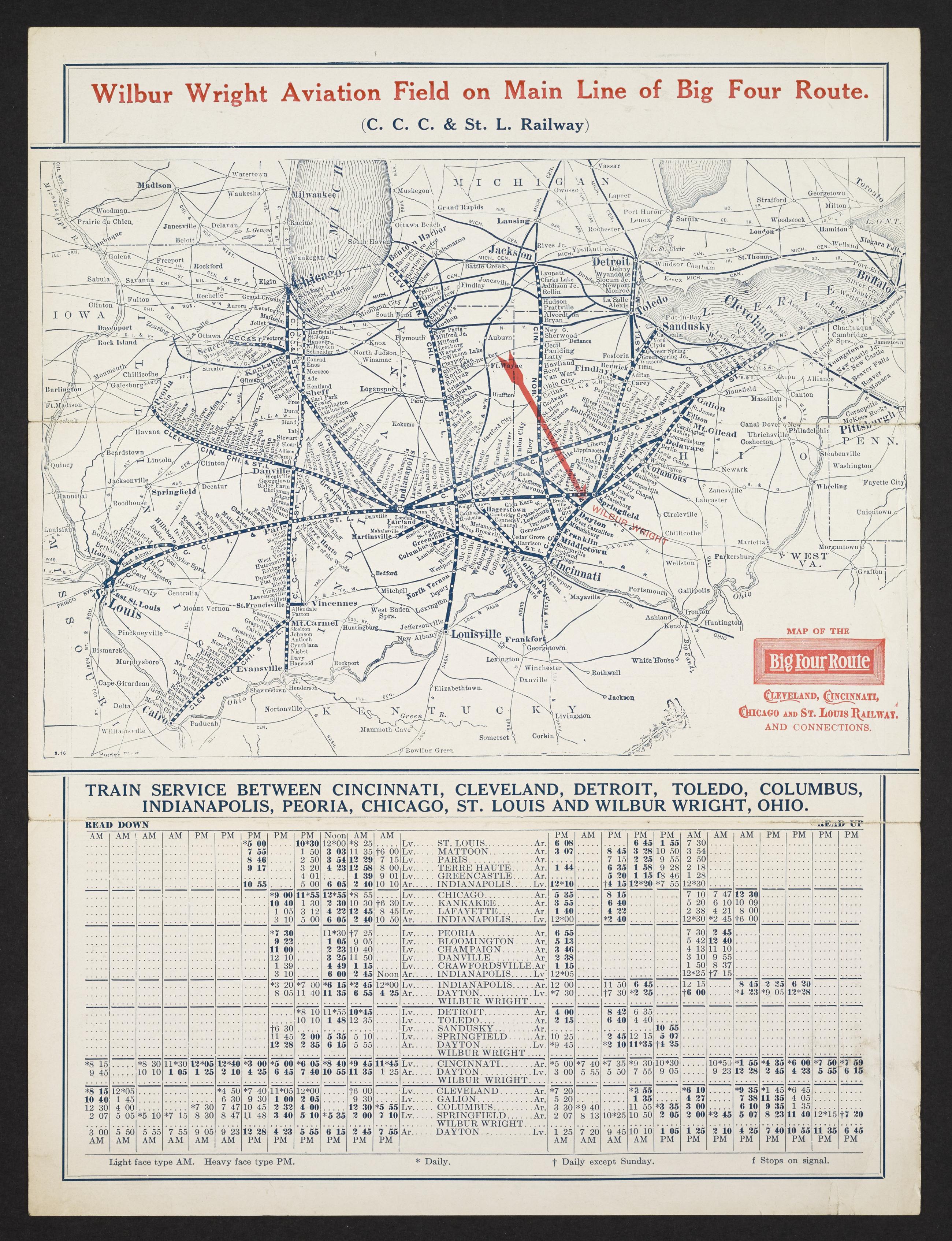
Text U.S. Army Aviation Field Wilbur Wright, Ohio, located between Cincinnati and Cleveland (6.5 miles east of Dayton, Ohio) on the main line of Big Four Route (C.C.C. & St. L. Ry.), page [2], with map of Ohio train service. View Item
Image Text 3 Items U.S. Army Aviation Field Wilbur Wright, Ohio, located between Cincinnati and Cleveland (6.5 miles east of Dayton, Ohio) on the main line of Big Four Route (C.C.C. & St. L. Ry.). View Item
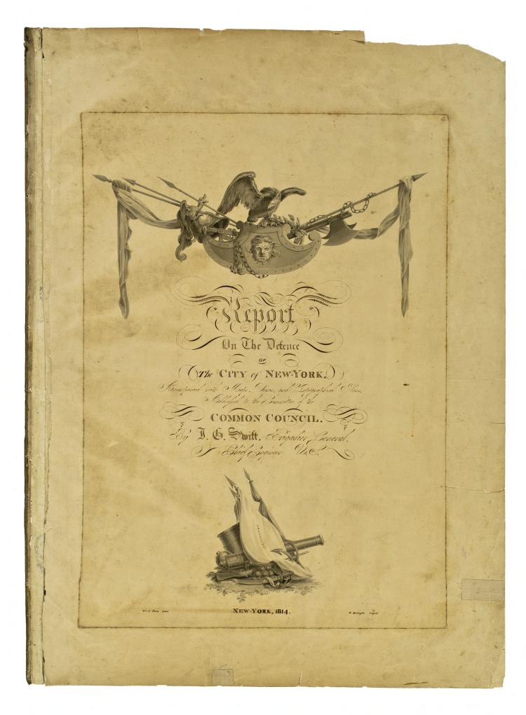
Image Still Image 4 Items Report on the defence of the City of New-York, accompanied with maps, views, and topographical plans, 1814 "A collection of thirty-three maps, plans, and views of the fortifications constructed on Manhattan Island during the War of 1812 originally bound up with a beautifully engrossed Report on the Defence of the City of New-York ... Addressed to the Committee of the Common Council by J.G. Swift, Brigadier General, Chief Engineer of the United States, New York, 1814 ... According to a statement at the end of the report, the 'Surveys, Maps & Small views were furnished by Capt. James Renwick & Lieut. James Gadsden; aided by Lieuts. Craig, Turner, De Russy, Kemble & Oothout. Mr. View Item
Image Collection 26 Items J.G. Swift's Report on the Defence of the City of New-York, Accompanied With Maps, Views, and Topographical Plans, 1814 "A collection of thirty-three maps, plans, and views of the fortifications constructed on Manhattan Island during the War of 1812 originally bound up with a beautifully engrossed Report on the Defence of the City of New-York ... Addressed to the Committee of the Common Council by J.G. Swift, Brigadier General, Chief Engineer of the United States, New York, 1814 ... According to a statement at the end of the report, the 'Surveys, Maps & Small views were furnished by Capt. James Renwick & Lieut. James Gadsden; aided by Lieuts. Craig, Turner, De Russy, Kemble & Oothout. Mr. View Collection