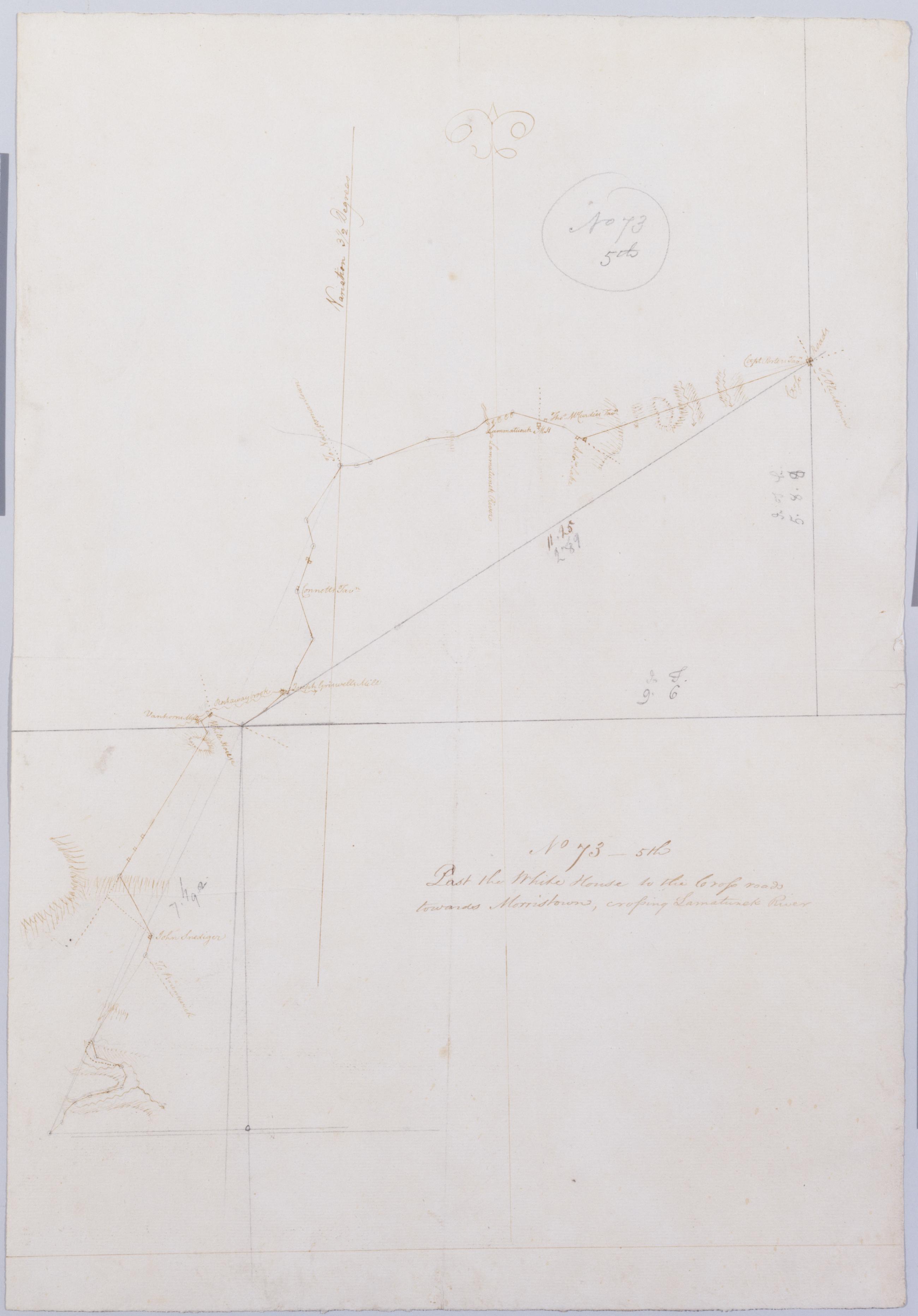
Cartographic Past the White House to the Cross roads towards Morristown crossing Lamatunck River. No 73 - 5th / by Robert Erskine F.R.S. Geogr. A. U.S. and Assistants. Foxed- creased and abraded. Mounted on cloth- bound and cropped- disbound and silked by subsequent owners. Cleaned after removal of backings 1999; some fill remains. Sheathed in mylar. In pencil on recto: "No 73 5th". Military topographic map. Covers the townships of Bedminster in Somerset County and of Readington and Tewksbury in Hunterdon County- New Jersey. Shows roads running through White House- Lamington and Greater Crossroads. Also shows buildings and owners' names- landforms and streams. Pen-and-ink- pencil on laid paper. Shows relief by hachures. View Item
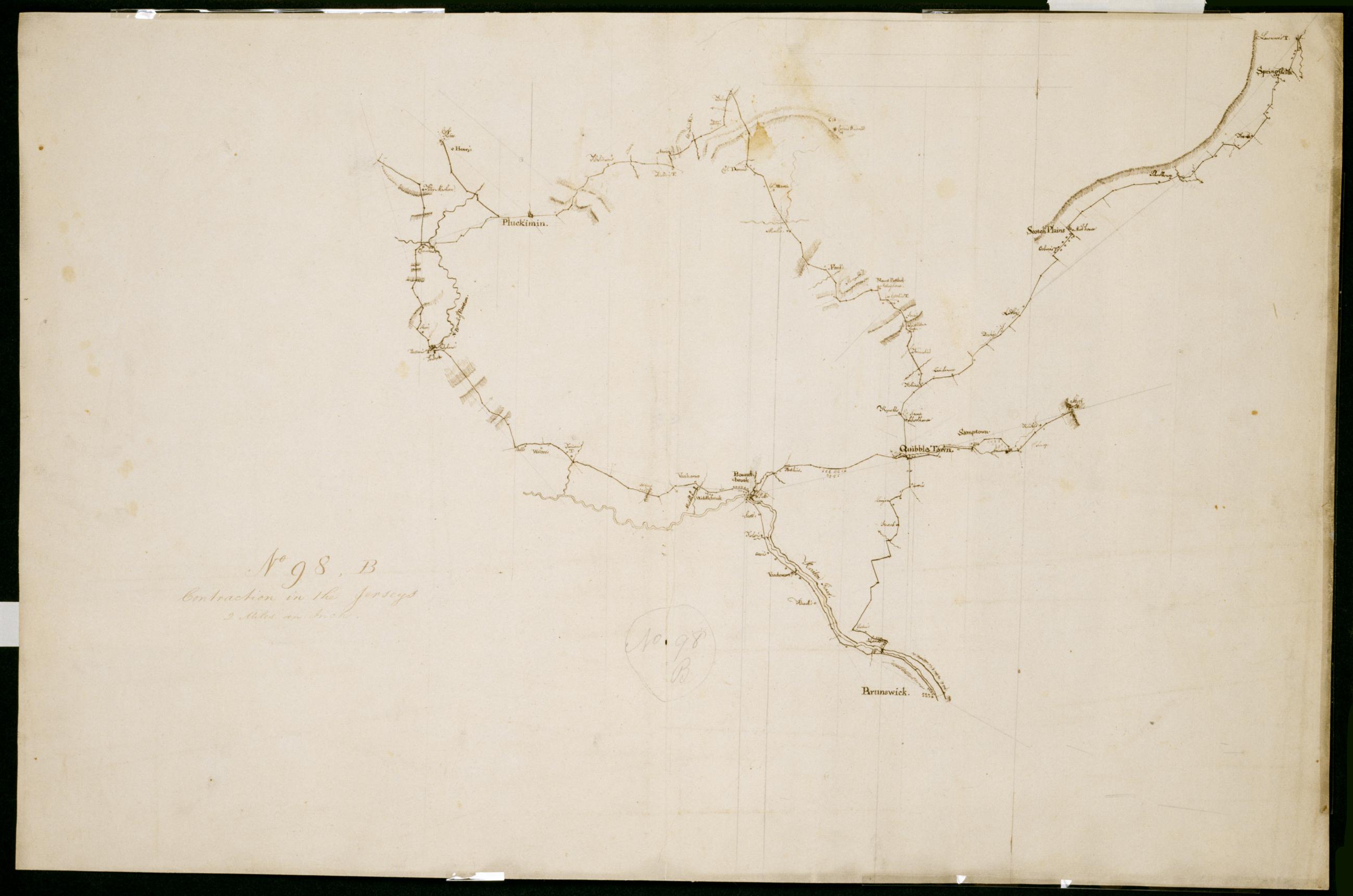
Cartographic Contraction in the Jerseys. No 98 B / Large Paper by Capt. Scull ; by Robert Erskine F.R.S. Geogr. A. U.S. and Assistants. Foxed- stained- soiled- creased- frayed and abraded. Mounted on cloth- bound and cropped- disbound and silked by subsequent owners. Cleaned after removal of backings 1999; some fill remains. Sheathed in mylar. In ink on verso "No. 98 B." In pencil on recto: "No. 98 B". Military topographic map. Covers parts of Middlesex- Somerset and Union counties in New Jersey. Also shows buildings and owners' names- landforms and streams. Pen-and-ink- pencil on laid paper. Scale as drawn 1 in. per mi. Shows relief by hachures. View Item
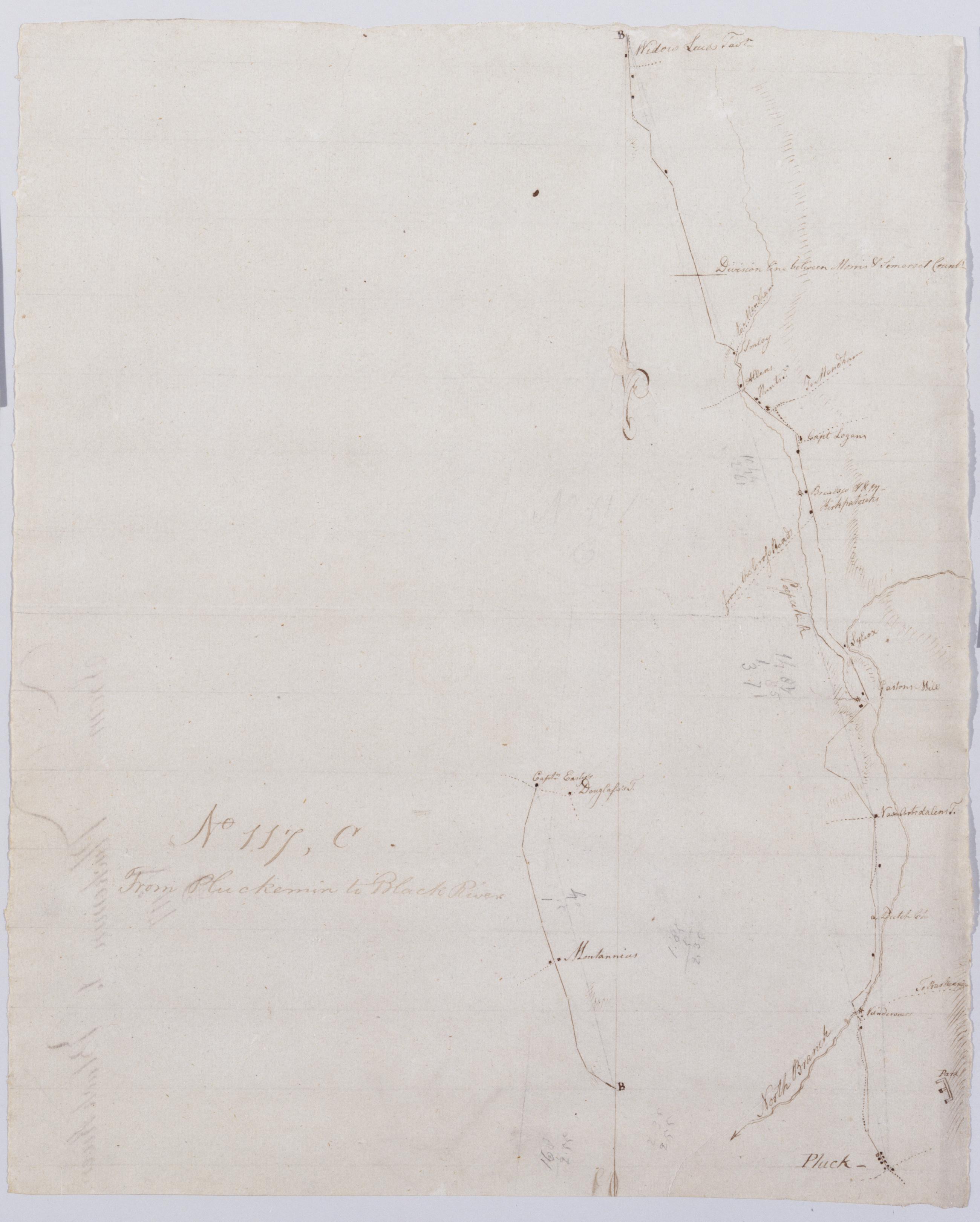
Cartographic From Pluckemin to Black River. No 117 C / by Robert Erskine F.R.S. Geogr. A. U.S. and Assistants. Drawing attributed to Simeon DeWitt- based on attribution made for sheet 117-A of series. In erased pencil on recto: "No 117 C". Military topographic map. Covers the townships of Chester in Morris County and of Bedminster in Somerset County- New Jersey. Shows roads running through Chester- Gladstone- Peapack- Bedminster and Pluckemin. Also shows buildings and owners' names- landforms and streams. Pen-and-ink- pencil on laid paper. Shows relief by hachures. Soiled- creased and abraded. Mounted on cloth- bound- disbound and silked by subsequent owners. View Item
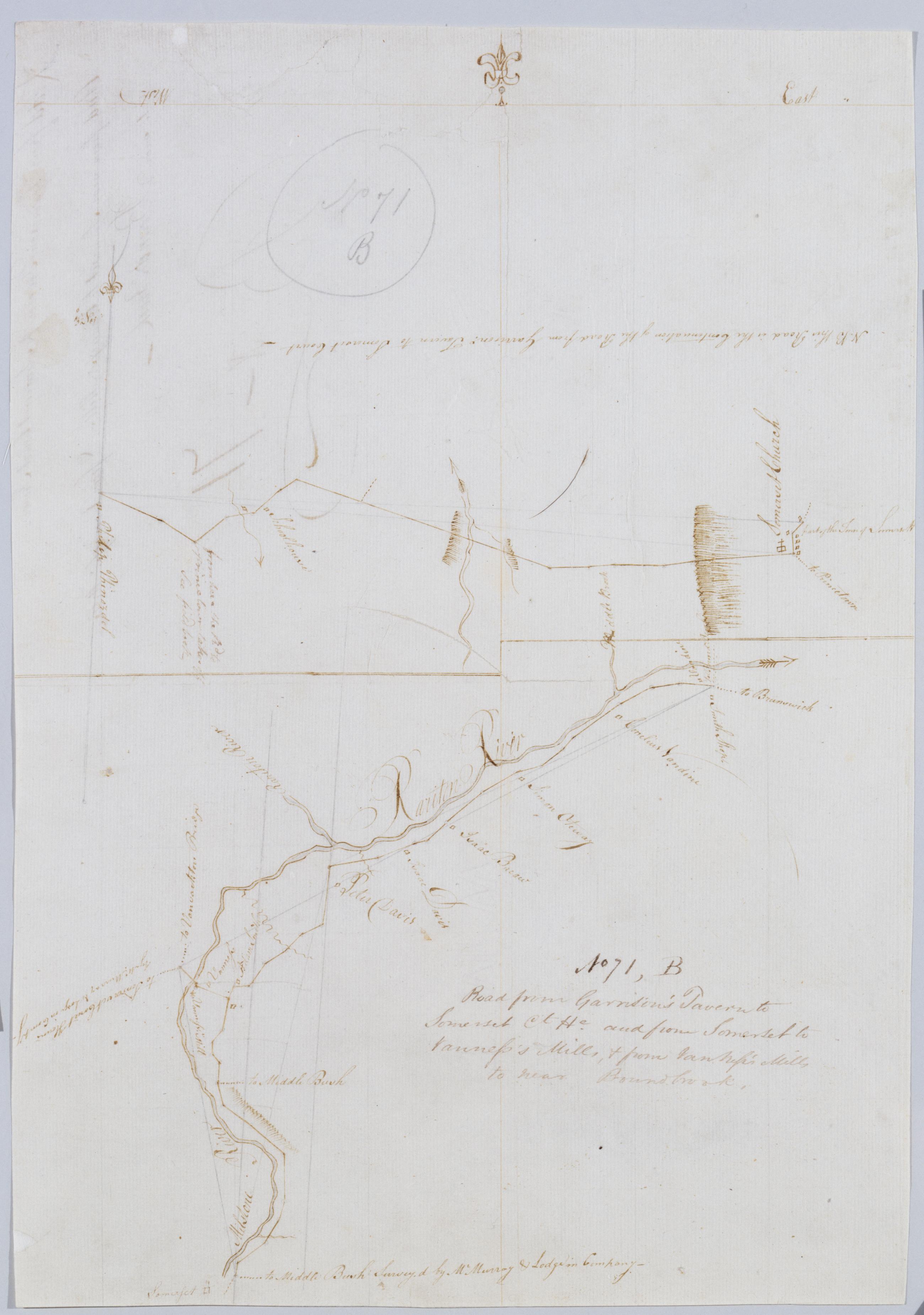
Cartographic Road from Garrison's Tavern to Somerset Ct He. and from Somerset to Vanness's Mills + from Van Vess's Mills to near Boundbrook. No. 71 B / by Robert Erskine F.R.S. Geogr. A. U.S. and Assistants. Creased- torn and abraded. Mounted on cloth- bound and cropped- disbound and silked by subsequent owners. Cleaned after removal of backings 1999; some fill remains. Sheathed in mylar. In pencil on recto "No 71 B". Military topographic maps. Upper map covers the township of Hillsboro in Somerset County- New Jersey; it shows roads running through Millstone (Someret). Lower map covers the townships of Hillsboro- Bridgewater and Franklin- also in Somerset County; it shows roads running through South Broundbrook and East Millstone. View Item
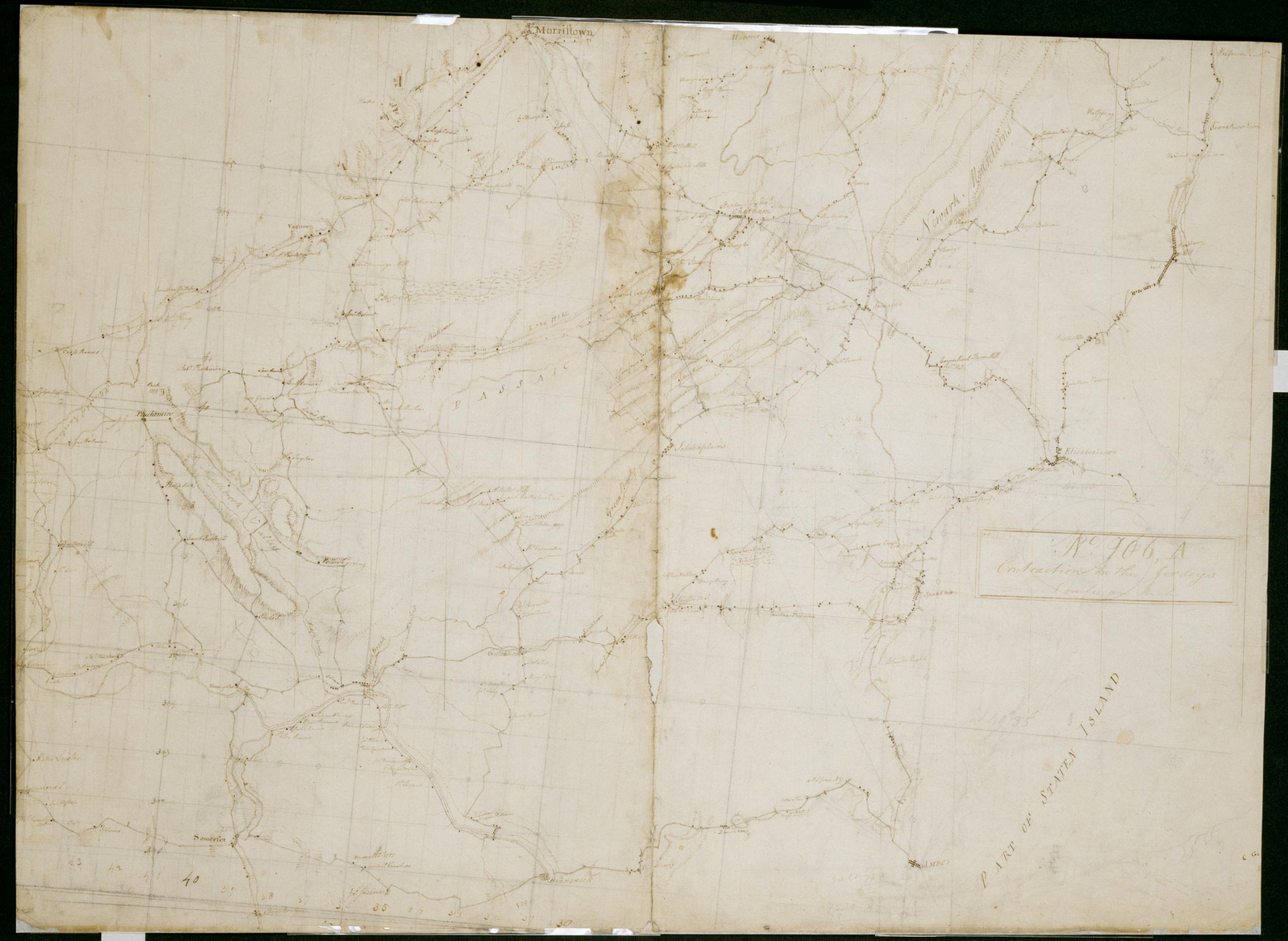
Cartographic Contraction in the Jerseys 1 mile an Inch. No. 106 A / by S. DeWitt A.B. ; by Robert Erskine F.R.S. Geogr. A. U.S. and Assistants. Imperfect: lacking 6 x 1 cm. at lower center of sheet. In ink on verso "No- 106- A". In pencil on recto: "No 106 A". Military topographic map. Covers the counties of Middlesex- Union- Essex- Somerset and Morris in New Jersey. Shows buildings and owners' names- landforms and streams. Pen-and-ink- pencil on laid paper. Shows relief by hachures. Stained- creased- frayed and abraded. Mounted on cloth- bound and cropped- disbound and silked by subsequent owners. Cleaned after removal of backings 1999; re-backed with China paper. Sheathed in mylar. View Item
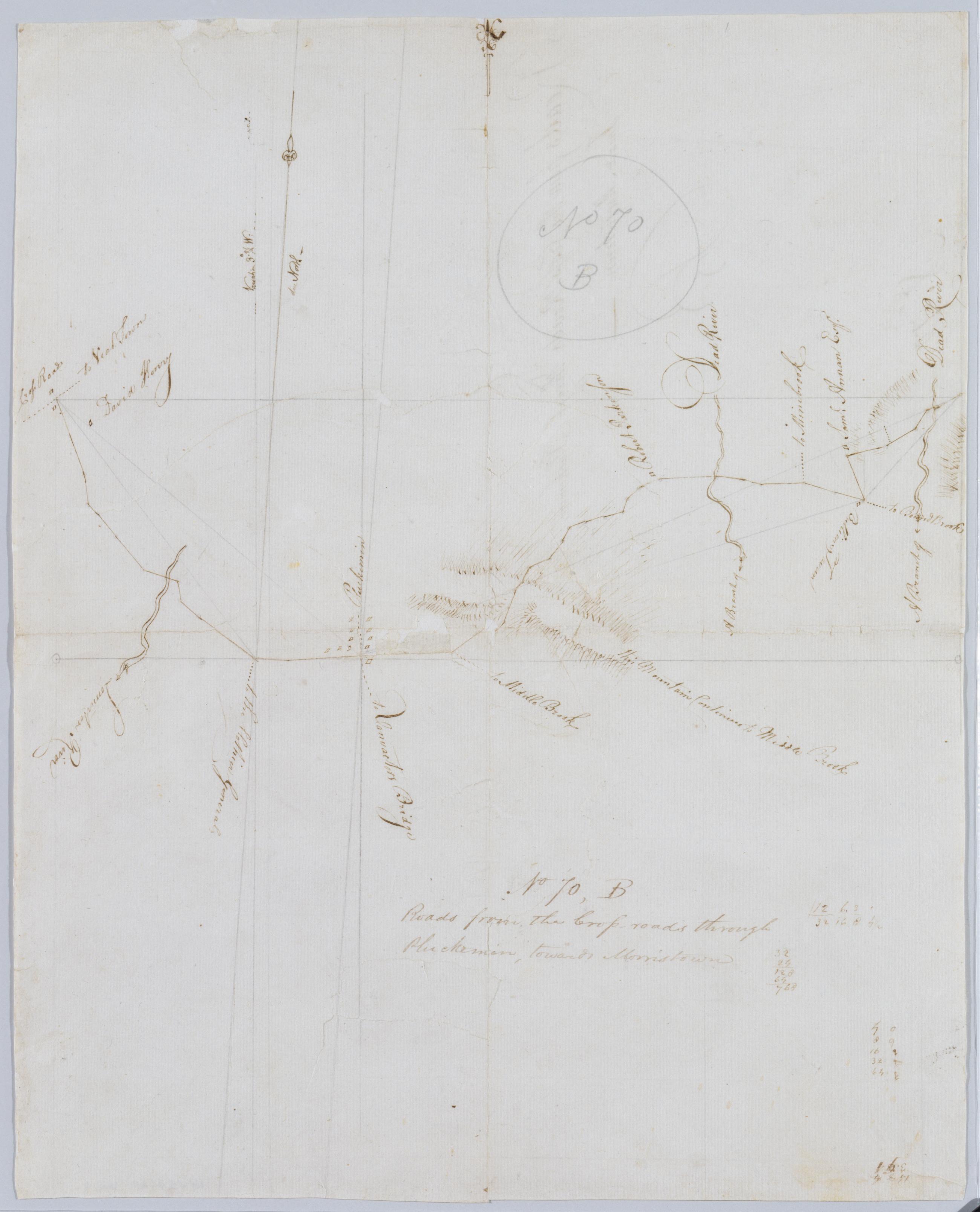
Cartographic Roads from the Cross-roads through Pluckemin towards Morristown. No 70 B / by Robert Erskine F.R.S. Geogr. A. U.S. and Assistants. Foxed- creased- torn- frayed and abraded. Mounted on cloth- bound and cropped- disbound and silked by subsequent owners. Cleaned after removal of backings 1999; some fill remains. Lined with China paper. Sheathed in mylar. Imperfect: lacking two small pieces at map center. In pencil on recto: "No 70 B". Military topographic map. Covers the townships of Bernard and Bedminster in Somerset County- New Jersey. Shows roads running through Greater Crossroads- Pluckemin and Liberty Corner. Also shows buildings and owners' names- landforms and streams. Pen-and-ink- pencil on laid paper. View Item
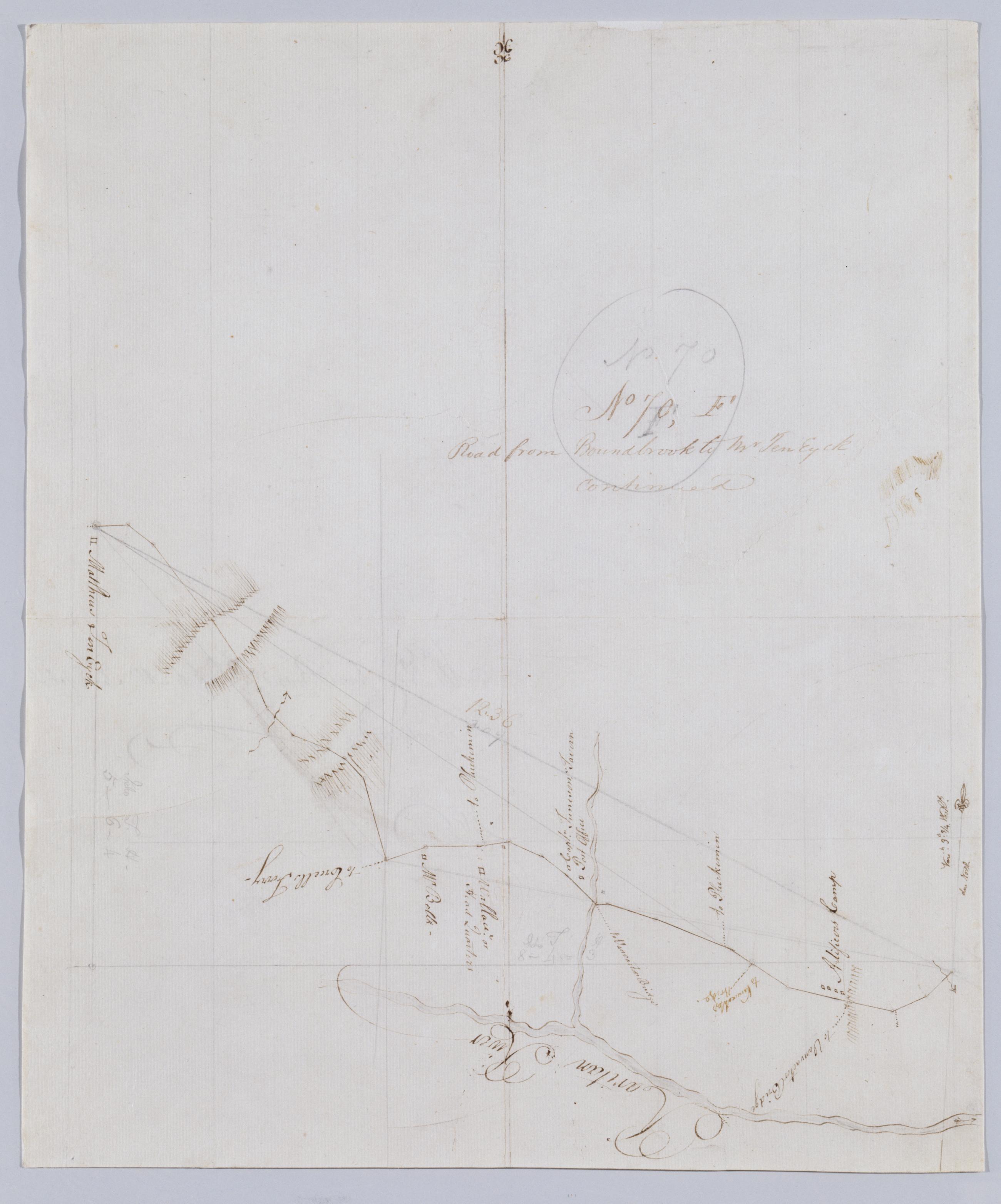
Cartographic Road from Boundbrook to Mr Ten Eyck continued. No 70 F / by Robert Erskine F.R.S. Geogr. A. U.S. and Assistants. In pencil on recto: "No 70 F". Military topographic map. Covers the township of Bridgewater in Somerset County- New Jersey. Shows roads running through Somerville. Also shows buildings and owners' names- landforms and streams. Pen-and-ink- pencil on laid paper. Scale distorted in parts; varies between ca. 1:30-000 and ca. 1:40-000. Shows relief by hachures. Stained- foxed- torn- creased and abraded. Mounted on cloth- bound and cropped- disbound and silked by subsequent owners. Cleaned after removal of backings 1999; some fill remains. Sheathed in mylar. View Item
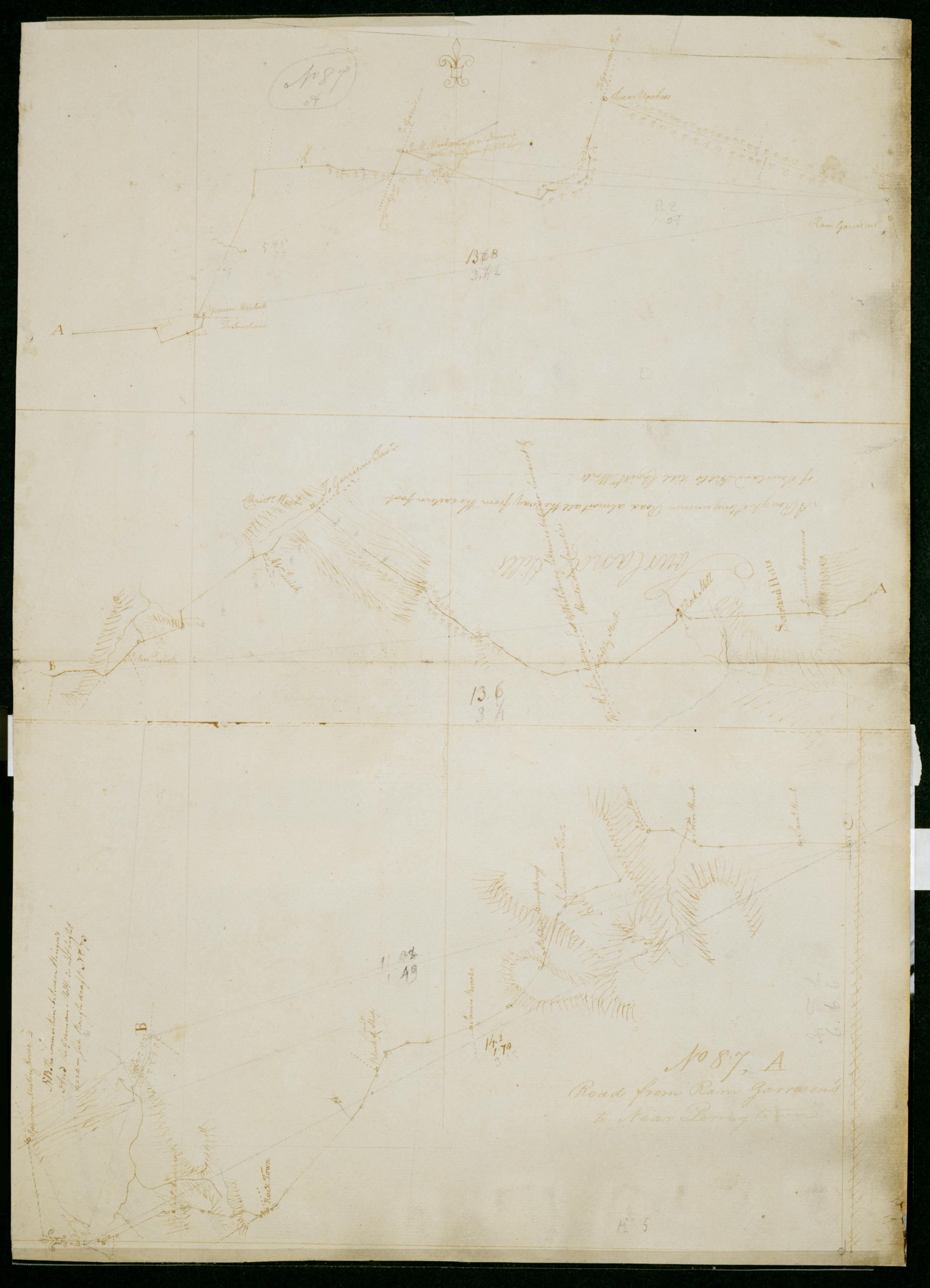
Cartographic Road from Ram Garrison's to Near Penny town. No 87 A / by Robert Erskine F.R.S. Geogr. A. U.S. and Assistants. In pencil on recto: "No 87 A". Military topographic map in three segments meant to be joined at points marked "A" and "B." Top and middle segments oriented with north to top of sheet; bottom segment oriented with north to left of sheet. Map covers the townships of Hillsboro and Montgomery in Somerset County- East Amwell and West Amwell in Hunterdon County and Hopewell in Mercer County- New Jersey. View Item
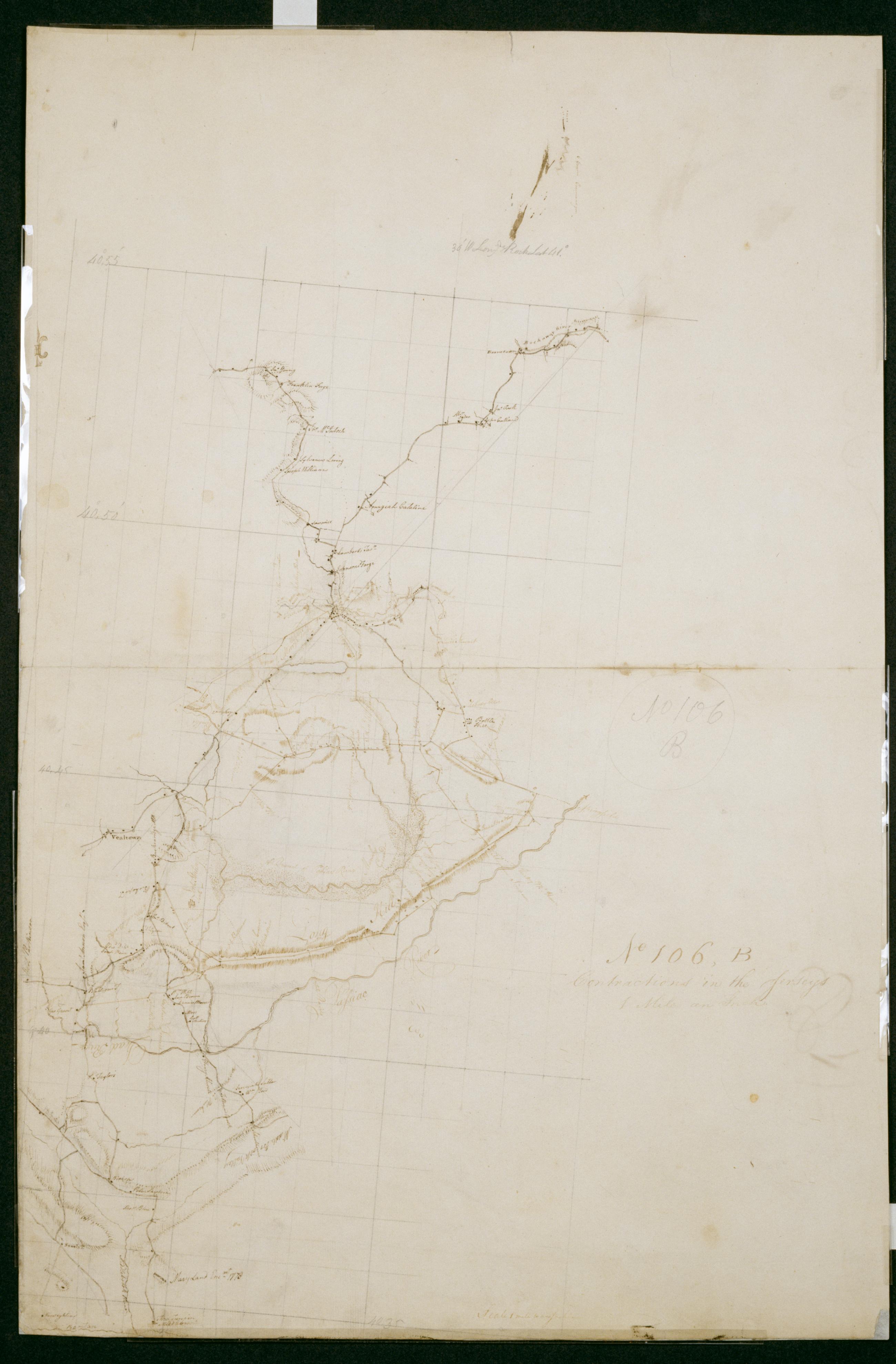
Cartographic Contractions in the Jerseys 1 Mile an Inch. No 106 B / by S. DeWitt A.B. ; by Robert Erskine F.R.S. Geogr. A. U.S. and Assistants. Imperfect: lacking 1 x 4 cm. at center of sheet. In ink on verso "No 106 B B B". In pencil on recto: "No 106 B". Military topographic map. Covers the counties of Union- Somerset and Morris in New Jersey. Shows buildings and owners' names- landforms and streams. Also shows position of "Maryland Enc[ampmen]t 1778." Pen-and-ink- pencil on laid paper. Shows relief by hachures. Stained- creased- frayed and abraded. Mounted on cloth- bound and cropped- disbound and silked by subsequent owners. Cleaned after removal of backings 1999; re-backed with China paper. Sheathed in mylar. View Item
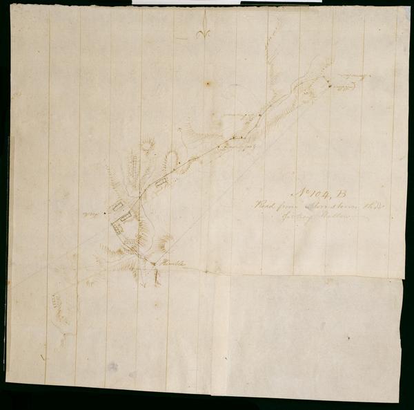
Cartographic Road from Morristown thro' Jockey Hollow. No 104 B / by Robert Erskine F.R.S. Geogr. A. U.S. and Assistants. Foxed- creased- frayed and abraded. Mounted on cloth- bound and cropped- disbound and silked by subsequent owners. Cleaned after removal of backings 1999; some fill remains. Sheathed in mylar. In erased pencil on recto: "No 104 B". Military topographic map. Covers the townships of Passaic and Morris in Morris County and of Bernard in Somerset County- New Jersey. Marks and lables troop positions at Morristown. Also shows roads- buildings and owners' names- landforms and streams. Pen-and-ink- pencil on laid paper. Patch at right corner is later- wove finish paper. Shows relief by hachures. View Item
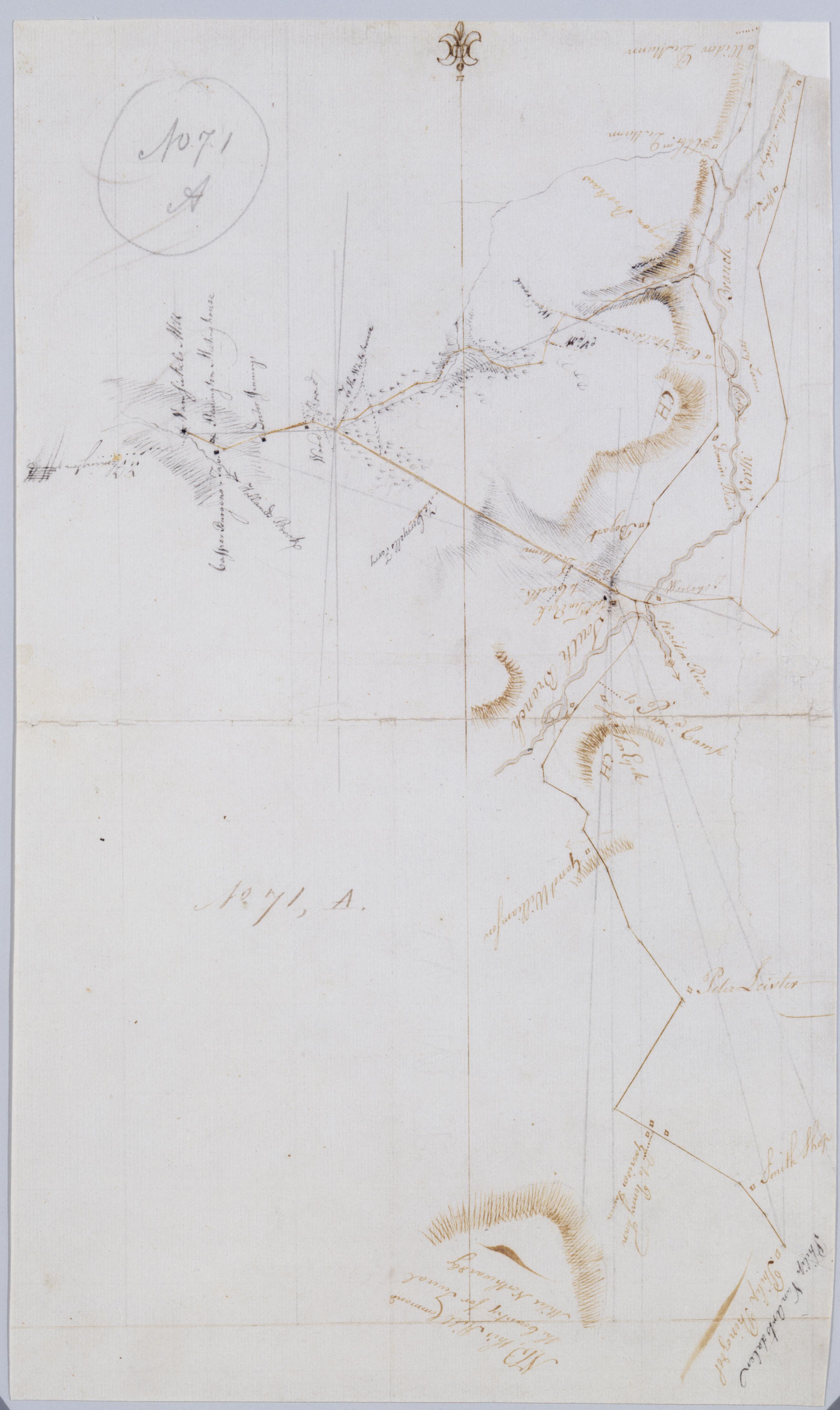
Cartographic [Garisons Somerset Boundbrook from South Branch to Reddington Brokaws] No. 71 A / by Robert Erskine F.R.S. Geogr. A. U.S. and Assistants. Foxed- creased- frayed and abraded. Mounted on cloth- bound and cropped- disbound and silked by subsequent owners. Cleaned after removal of backings 1999; some fill remains. Sheathed in mylar. In ink on verso: "A - 71". In pencil on recto "No 71 A". Military topographic map. Covers the townships of Readington and Branchburg in Hunterdon County and of Bridgewater and Hillsboro in Somerset County- New Jersey. Shows roads running through Readington- North Branch- Milltown- South Branch- Flagtown and Frankfort. Also shows buildings and owners' names- landforms and streams. View Item
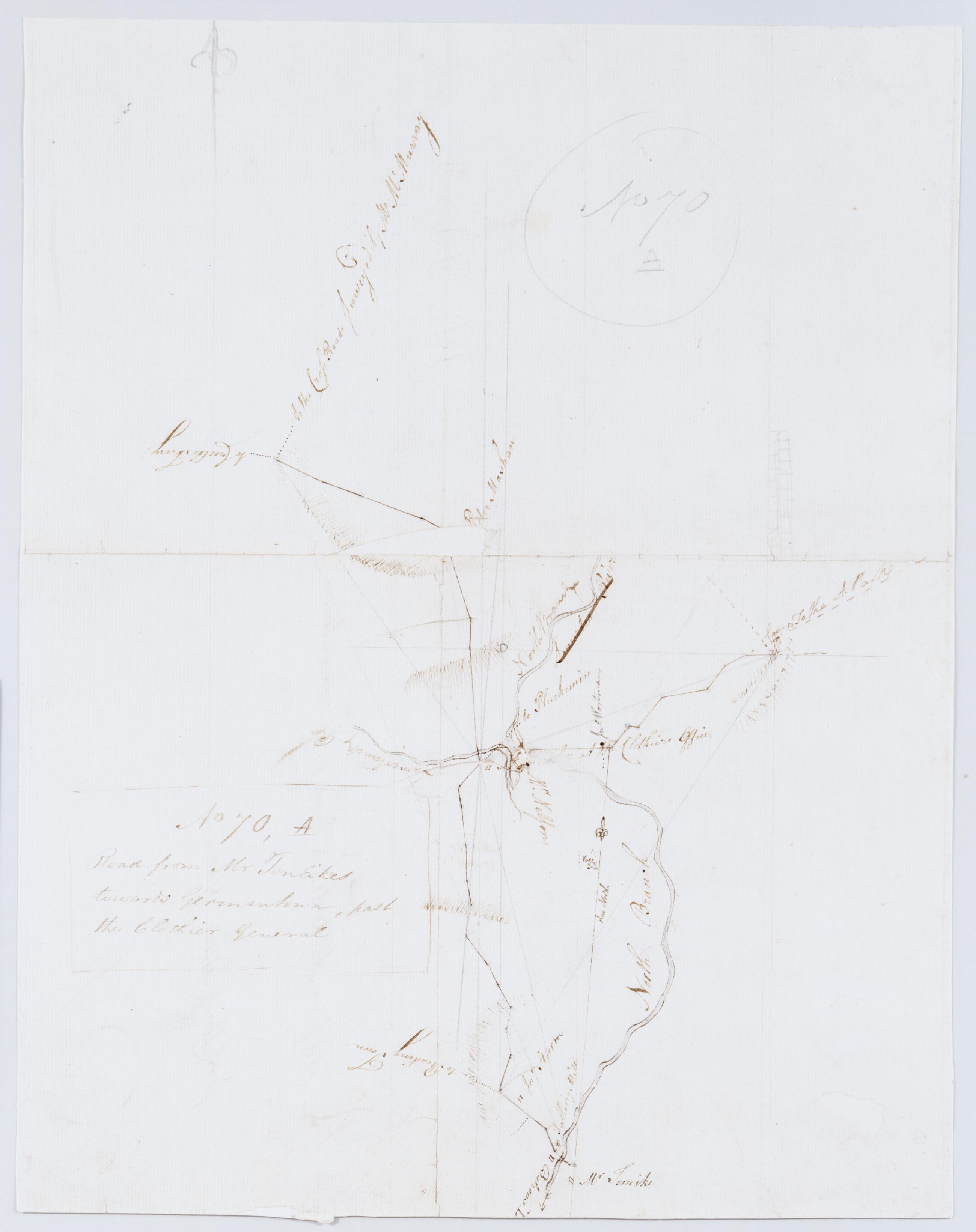
Cartographic Road from Mr TenEikes towards Germantown past the Clothier General. No 70 A / by Robert Erskine F.R.S. Geogr. A. U.S. and Assistants. Foxed- creased- torn- frayed and abraded. Mounted on cloth- bound and cropped- disbound and silked by subsequent owners. Cleaned after removal of backings 1999; some fill remains. Lined with China paper. Sheathed in mylar. Imperfect: lacking 5 x 1 cm. at map center- 1 x 1 at lower right. In pencil on recto: "No 70 A". Military topographic map. Covers the townships of Bedminster and Bridgewater in Somerset County and of Branchburg in Hunterdon County- New Jersey. Shows roads running through Lamington- Burnt Mill- North Branch and Pluckemin. View Item
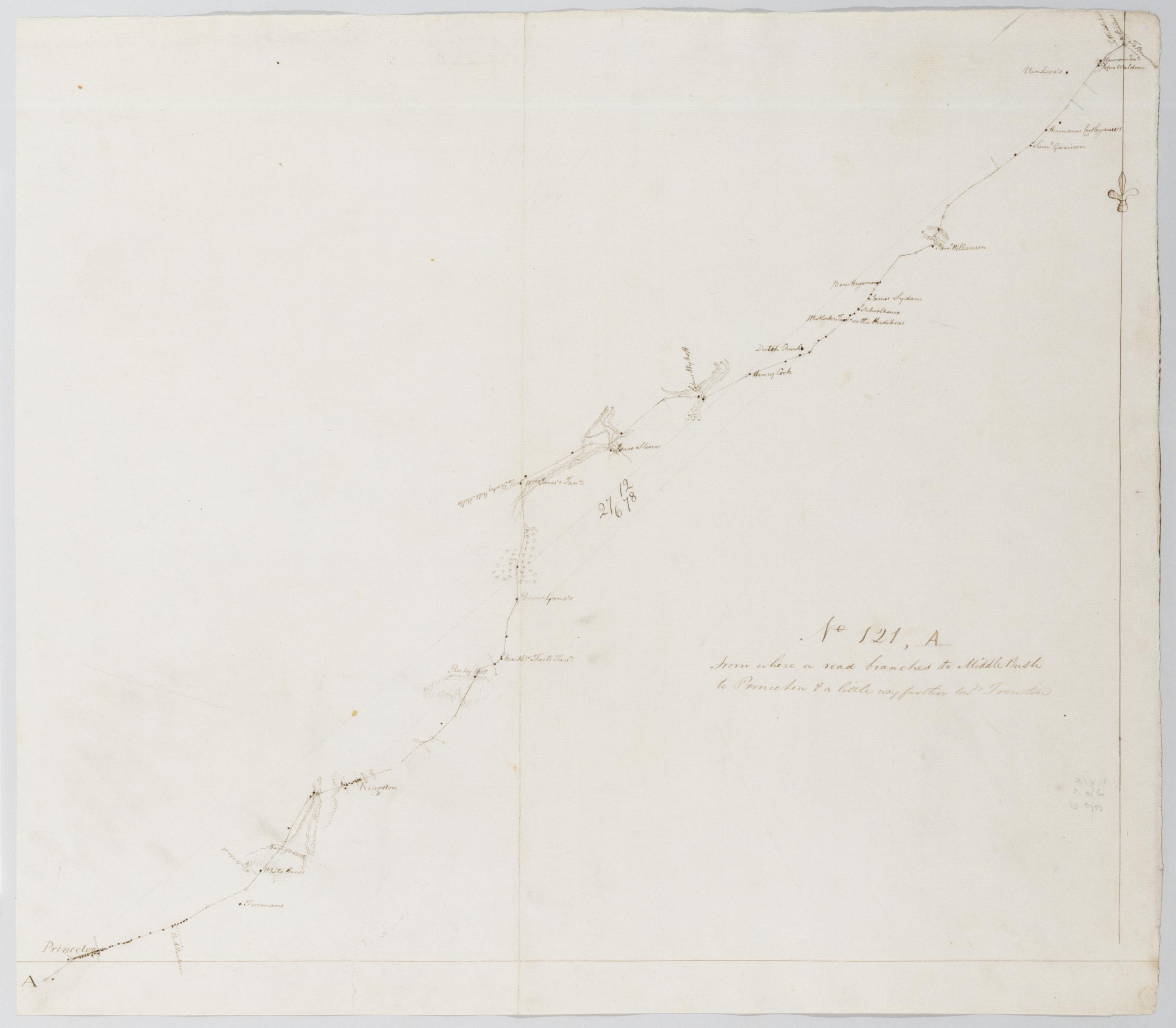
Cartographic From where a road branches to Middle Bush to Princeton + a little way farther towds Trenton. No 121 A / by Robert Erskine F.R.S. Geogr. A. U.S. and Assistants. Military topographic map. Covers the townships of Princeton in Mercer County- Franklin in Somerset County and South Brunswick in Middlesex County- New Jersey. Shows roads running through Princeton- Kingston- Tenmile Run and Franklin Park. Also shows buildings and owners' names- landforms and streams. Pen-and-ink- pencil on laid paper. Shows relief by hachures. Stained- soiled- creased and abraded. Mounted on cloth- bound and cropped- disbound and silked by subsequent owners. Cleaned after removal of backings 1999; some fill remains. Sheathed in mylar. View Item
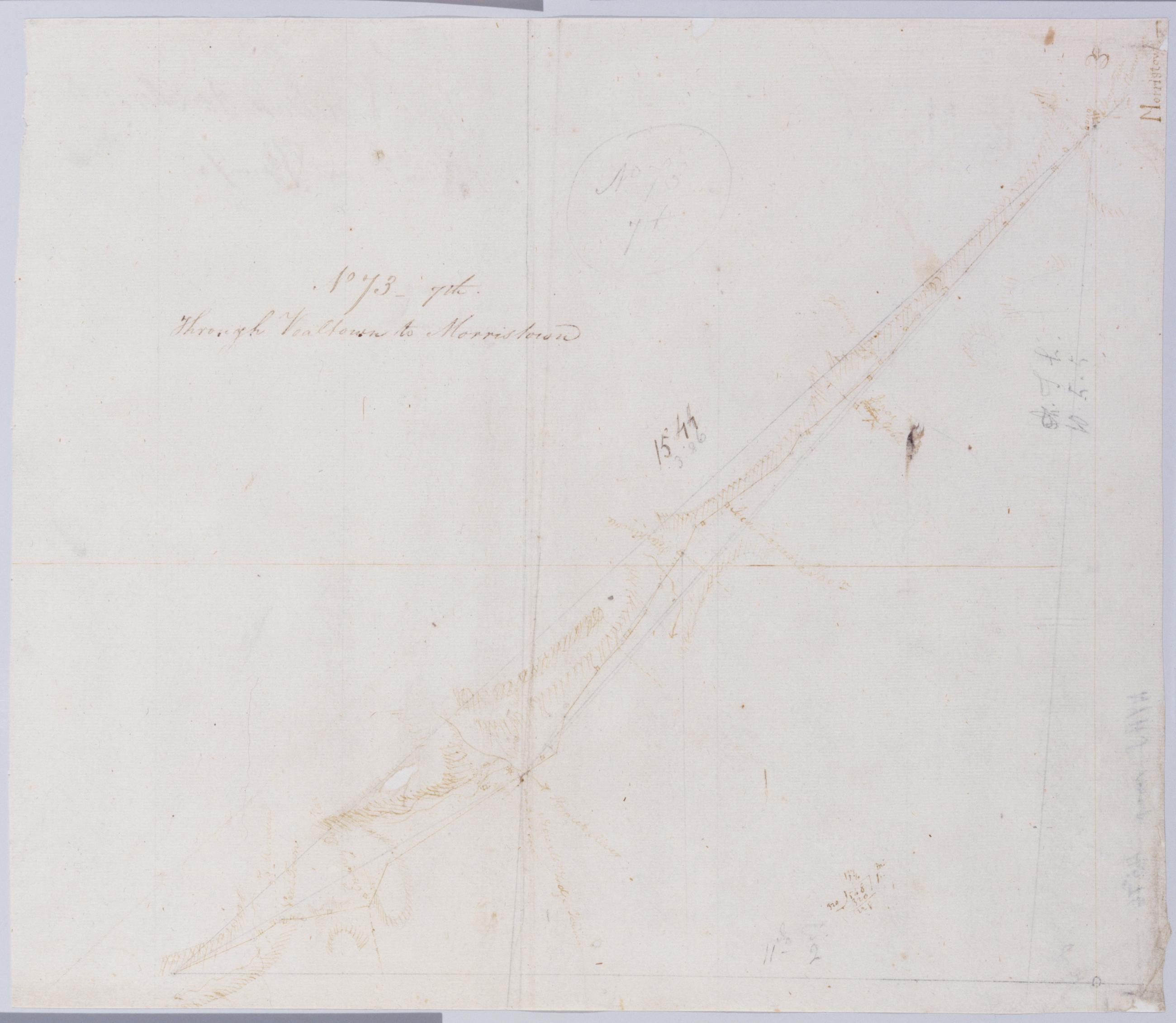
Cartographic Through Vealtown to Morristown. No 73 7th / by Robert Erskine F.R.S. Geogr. A. U.S. and Assistants. Foxed- creased- frayed and abraded. Mounted on cloth- bound and cropped- disbound and silked by subsequent owners. Cleaned after removal of backings 1999; some fill remains. Sheathed in mylar. In pencil on recto: "No 73 7th". Military topographic map. Covers the township of Bernard in Somerset County and that of Morris in Morris County- New Jersey. Shows roads running through Bernardsville and Morristown. Also shows buildings and owners' names- landforms and streams. Pen-and-ink- pencil on laid paper. Shows relief by hachures. View Item
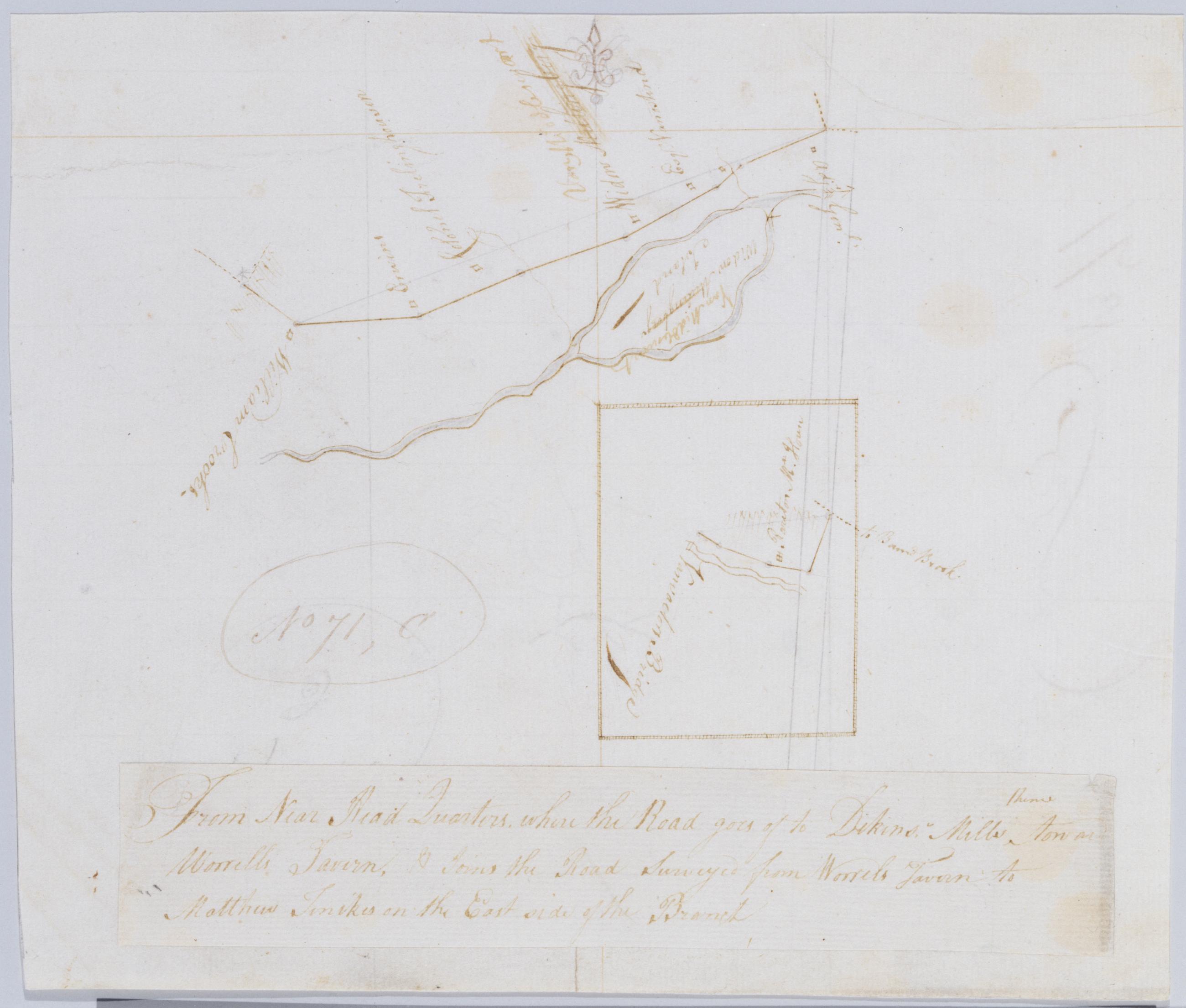
Cartographic From Near Head Quarters where the Road goes of thence to Dikins' Mills toward Worrells Tavern & Joins the Road Surveyed from Worrels Tavern to Matthew Tenikes on the East side of the Branch. No 71 C / by Robert Erskine F.R.S. Geogr. A. U.S. and Assistan In ink on verso: "C - N 71". Inset map apparently covers a small area two minutes east of that covered by the main map; Vanvactors Bridge seems to have been located on the Raritan River at W 74⁰35ʹ. Military topographic map. Covers the townships of Hillsboro and Bridgewater in Somerset County- New Jersey. Show roads running through Raritan village; also buildings and owners' names- landforms and streams. Pen-and-ink- pencil on laid paper. Title on a separate piece pasted atop sheet. Shows relief by hachures. Stained and abraded. View Item
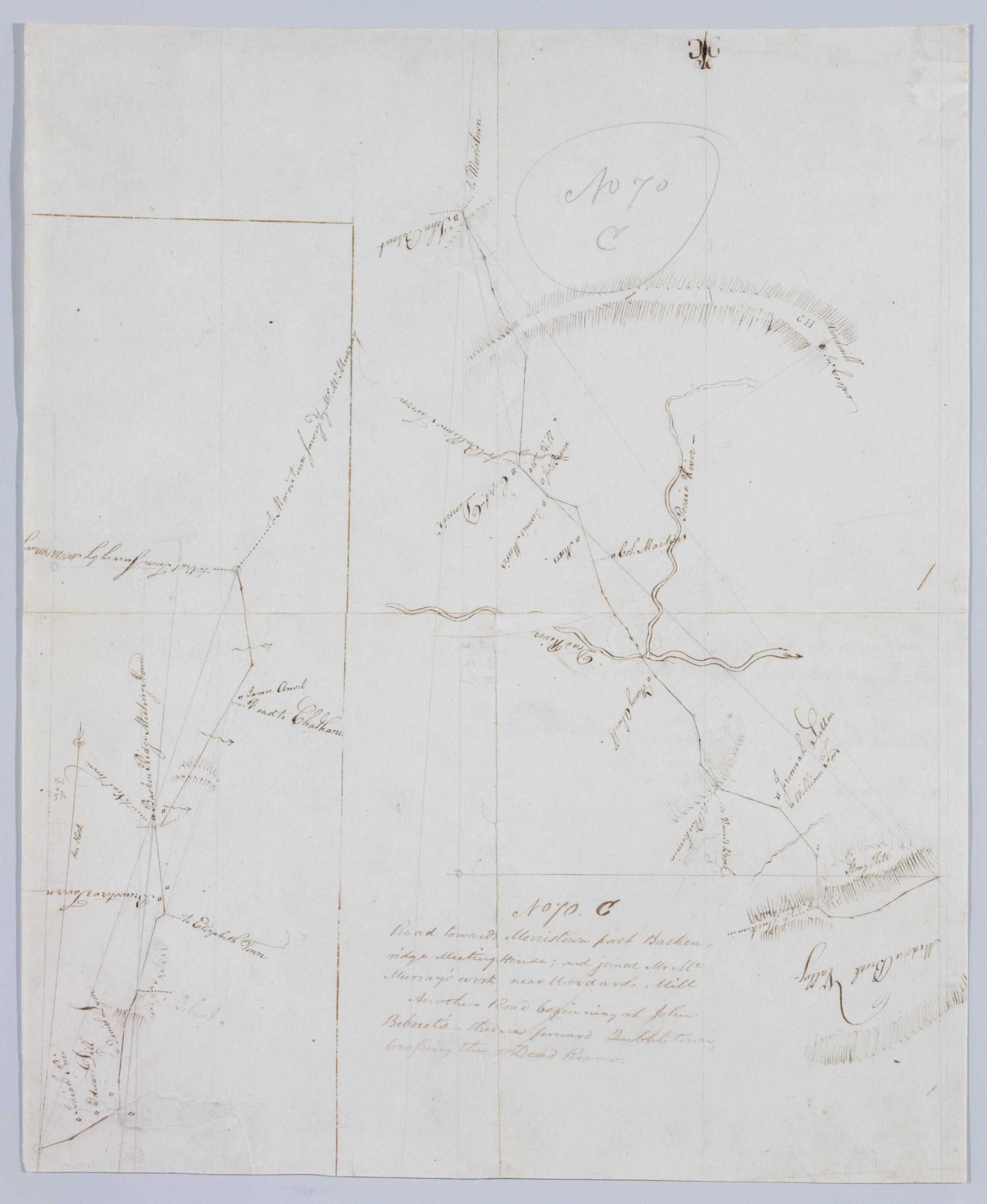
Cartographic Road towards Morristown past Baskenridge Meeting House; and joined Mr. McMurray's work near Woodard's Mill ; Another Road beginning at John Bebout's thence toward Quibbletown Crossing the Dead River. No 70. C by Robert Erskine F.R.S. Geogr. A. U.S. and Foxed- creased- torn- frayed and abraded. Mounted on cloth- bound and cropped- disbound and silked by subsequent owners. Cleaned after removal of backings 1999; some fill remains. Sheathed in mylar. Imperfect: lacking 1 x 2 cm. at map center. In pencil on recto: "No 70 C". Military topographic maps. The lefthand- smaller map covers the township of Bernard in Somerset County- New Jersey; it shows roads running through Madisonville and Basking Ridge. The larger map covers the townships of Bernard- Warren and North Plainfield in the same county; it shows roads running through Lyons and Mt. View Item