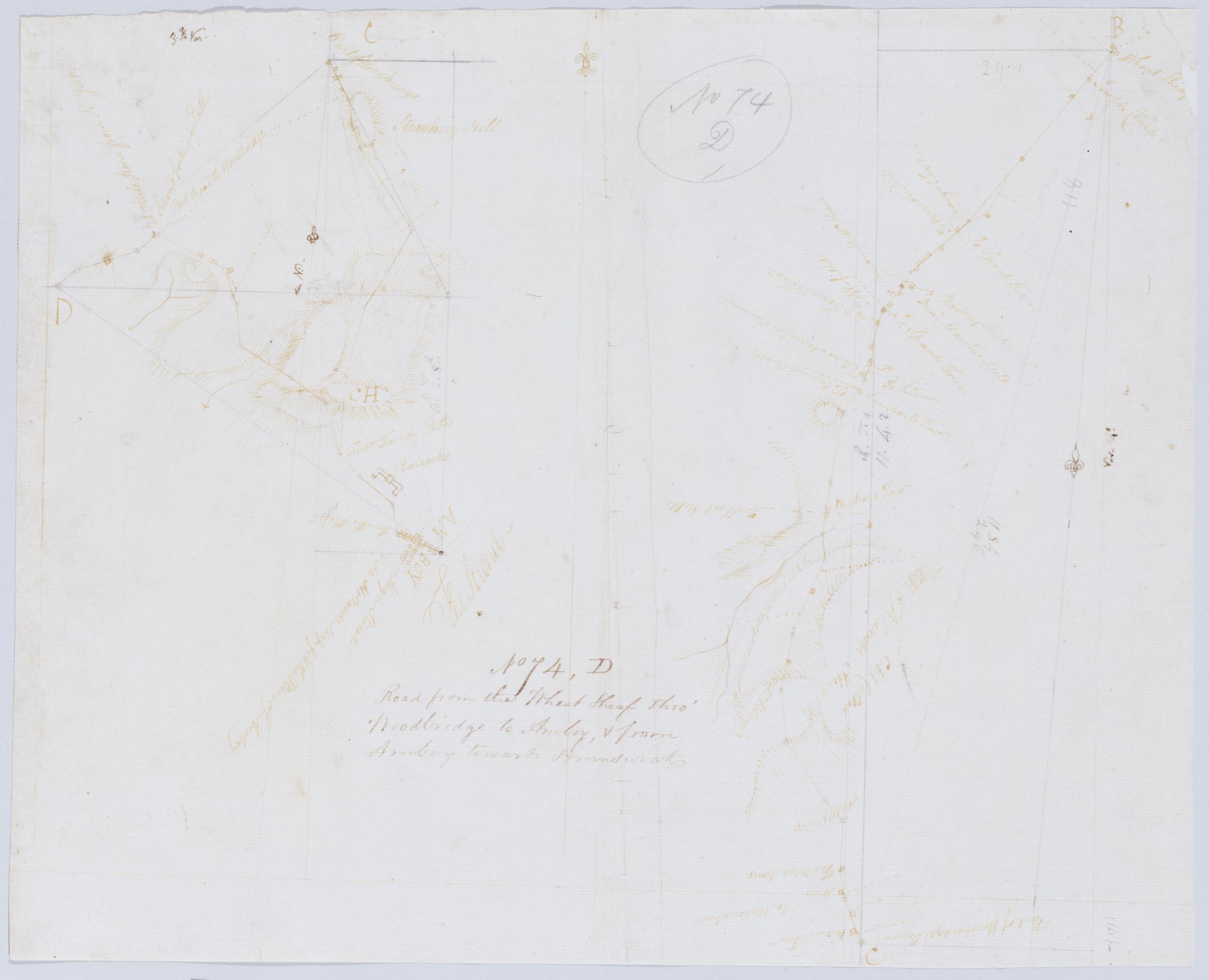
Cartographic Road from the Wheat Sheaf thro' Woodbridge to Amboy + from Amboy towards Brunswick. No 74 D / by Robert Erskine F.R.S. Geogr. A. U.S. and Assistants. Foxed- creased- frayed and abraded. Mounted on cloth- bound and cropped- disbound and silked by subsequent owners. Cleaned after removal of backings 1999; some fill remains. Sheathed in mylar. In pencil on recto: "No 74 D". Military topographic map; righthand segment fits north of the lefthand one. Map covers the townships of Rahway and Linden in Union County and of Woodbridge in Middlesex County- New Jersey. Shows roads running through Wheatsheaf- Rahway- Demorest- Woodbridge- Spa Spring- Amboy- Fairfield Union and Valentine Fords. View Item
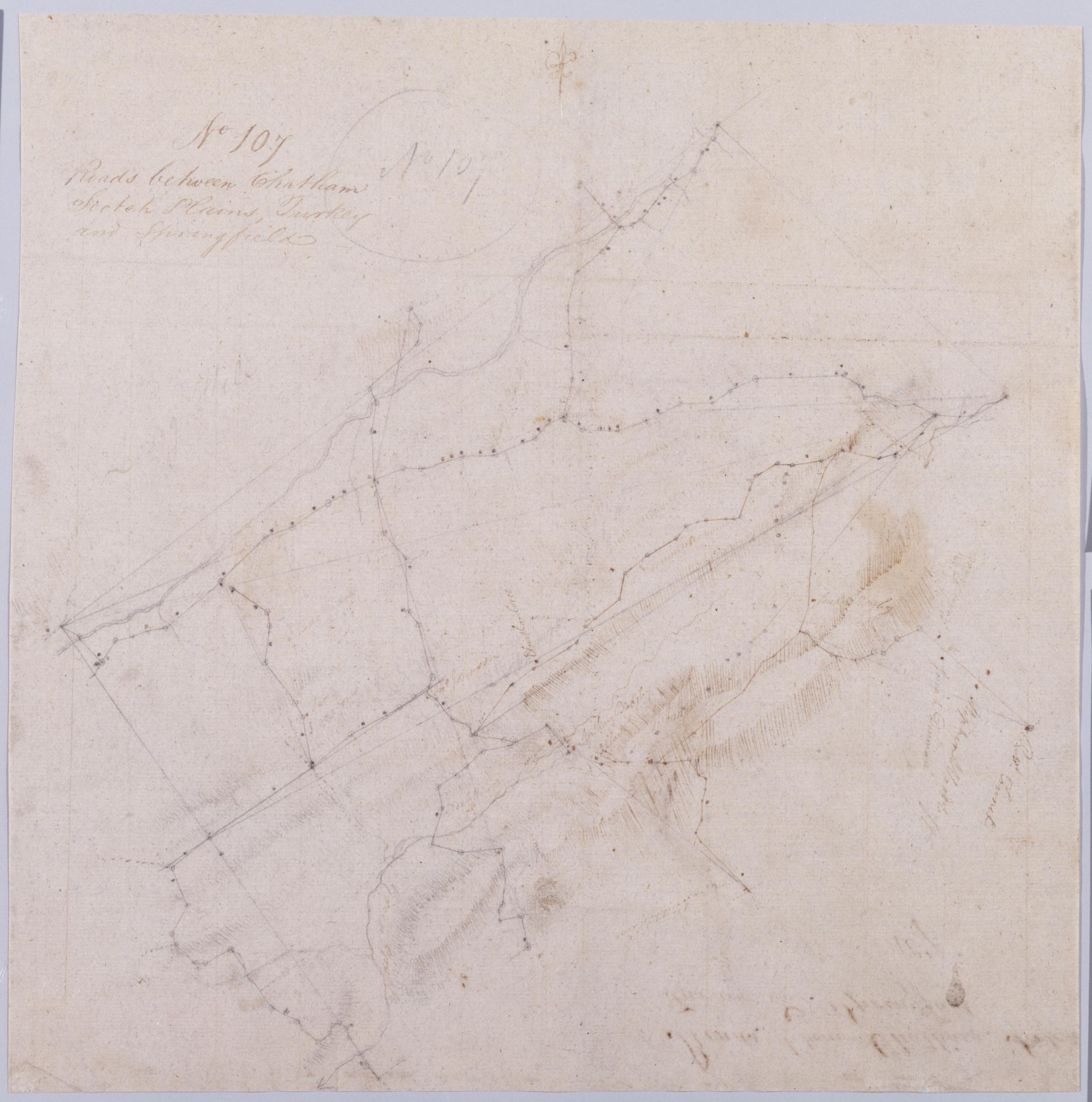
Cartographic Roads between Chatham Scotch Plains Turkey and Springfield. No 107 / by Robert Erskine F.R.S. Geogr. A. U.S. and Assistants. In pencil on recto: "No 107". Military topographic map. Covers the townships of Summit- Springfield- Providence- Westfield- Fanwood and North Plainfield in Union County- New Jersey. Shows buildings and owners' names- landforms and streams. Pen-and-ink- pencil on laid paper. Title proper from recto is the work of a later editor--Simeon DeWitt or his assign--subsequent to 1820. Title from verso is in Erskine's hand and may be cited as such. Index title- statement of responsibility- date- series title and series numbering also by Erskine- but on separate index sheet filed at head of series. View Item
Cartographic Spherical Projections. No 100 / by R.E. ; by Robert Erskine F.R.S. Geogr. A. U.S. and Assistants first sheet Collection of unfinished military topographic maps. The coordinates describe much of New Jersey but- aside from the coordinate grid itself- only small areas about Elizabethtown and Amboy- New Jersey- and about Warwick and Chester- New York- were ever mapped onto it. Title proper from recto of 1st sheet is the work of a later editor--Simeon DeWitt or his assign--subsequent to 1820. Index title- both statements of responsibility- date- scale statement- series title and series numbering by Erskine- but on separate index sheet filed at head of series. Pen-and-ink- pencil on laid paper. View Item
Cartographic A General Contraction 2 Miles to an Inch. No 37 / by R.E. ; by Robert Erskine F.R.S. Geogr. A. U.S. and Assistants. Military topographic map. Covers the lower Hudson River Valley in New York- New Jersey and Connecticut- from Warwick (N.Y.) and Pompton Plains (N.J.) to New Milford and Danbury (Conn.)- and from Newburgh (N.Y.) to Staten Island (N.Y.). Shows roads- buildings and owners' names- also landforms and streams. Shows relief by hachures. Title proper from recto is the work of a later editor--Simeon DeWitt or his assign--subsequent to 1820. Index title- both statements of responsibility- date- series title and series numbering by Erskine- but on separate index sheet filed at head of series. View Item