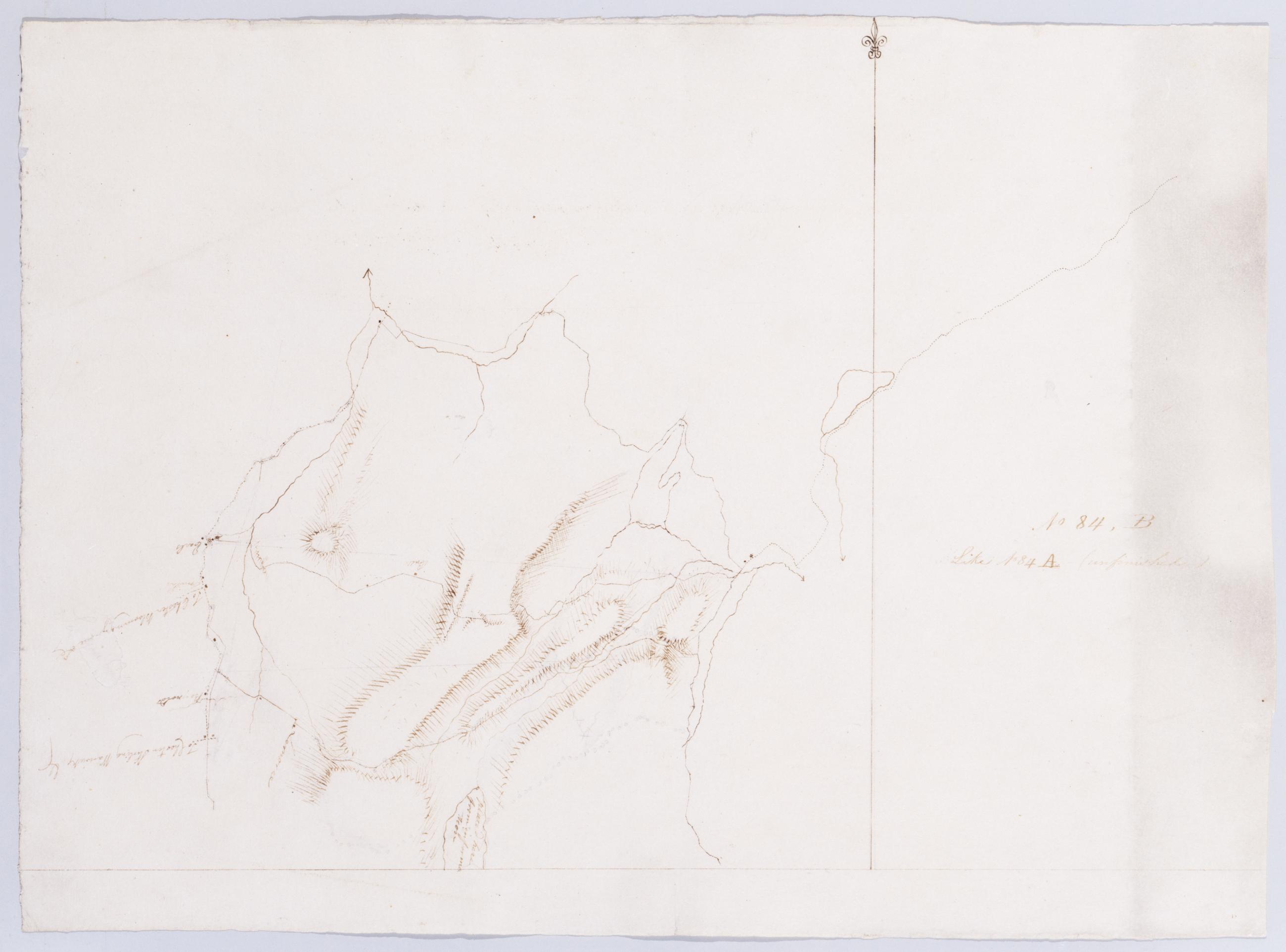
Cartographic Like No 84 A (unfinished) No 84, B / by Robert Erskine F.R.S. Geogr. A. U.S. and Assistants. In ink on verso: "No. 84. B." Military topographic map. Covers the townships of Highland and Woodbury in Orange County, New York. Shows more land to the west than does sheet 84,A. Also shows roads, buildings and owners' names, also landforms and streams. Pen-and-ink, pencil on laid paper. Shows relief by hachures. Soiled and abraded. Mounted on cloth, bound, disbound and silked by subsequent owners. Cleaned after removal of backings 1999; some fill remains. Sheathed in mylar. Title proper from recto is the work of a later editor--Simeon DeWitt or his assign--subsequent to 1820. View Item
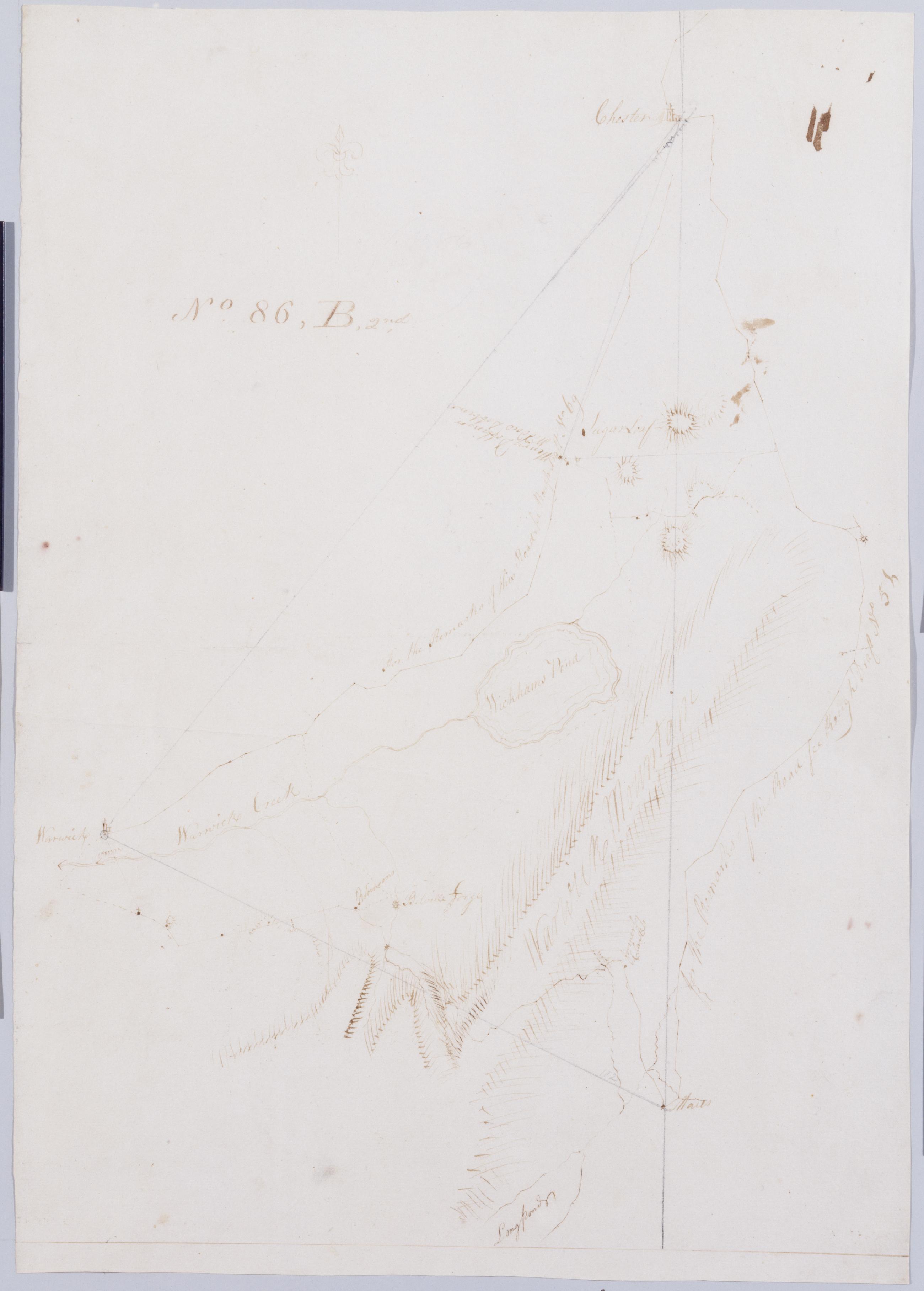
Cartographic From Junes to Arches & Warwich A. B & B2nd. No 86, B, 2nd by Robert Erskine F.R.S. Geogr. A. U.S. and Assistants [rev. ed.]. In ink on recto: "No. 86. B2d". Includes texts. To the east, "for the Remarks of the Road see Rough Draft No 5[1]." To the west, "For the Remarks of this Road See Rough Draft No 69." Military topographic map. Covers the townships of Chester and Warwick in Orange County, New York. Shows roads running through East Chester, Sugarloaf, Warwick, Bellvale, Mt. Peter and Dutch Hollow. Also shows buildings and owners' names, landforms and streams. No title on map recto or verso. View Item
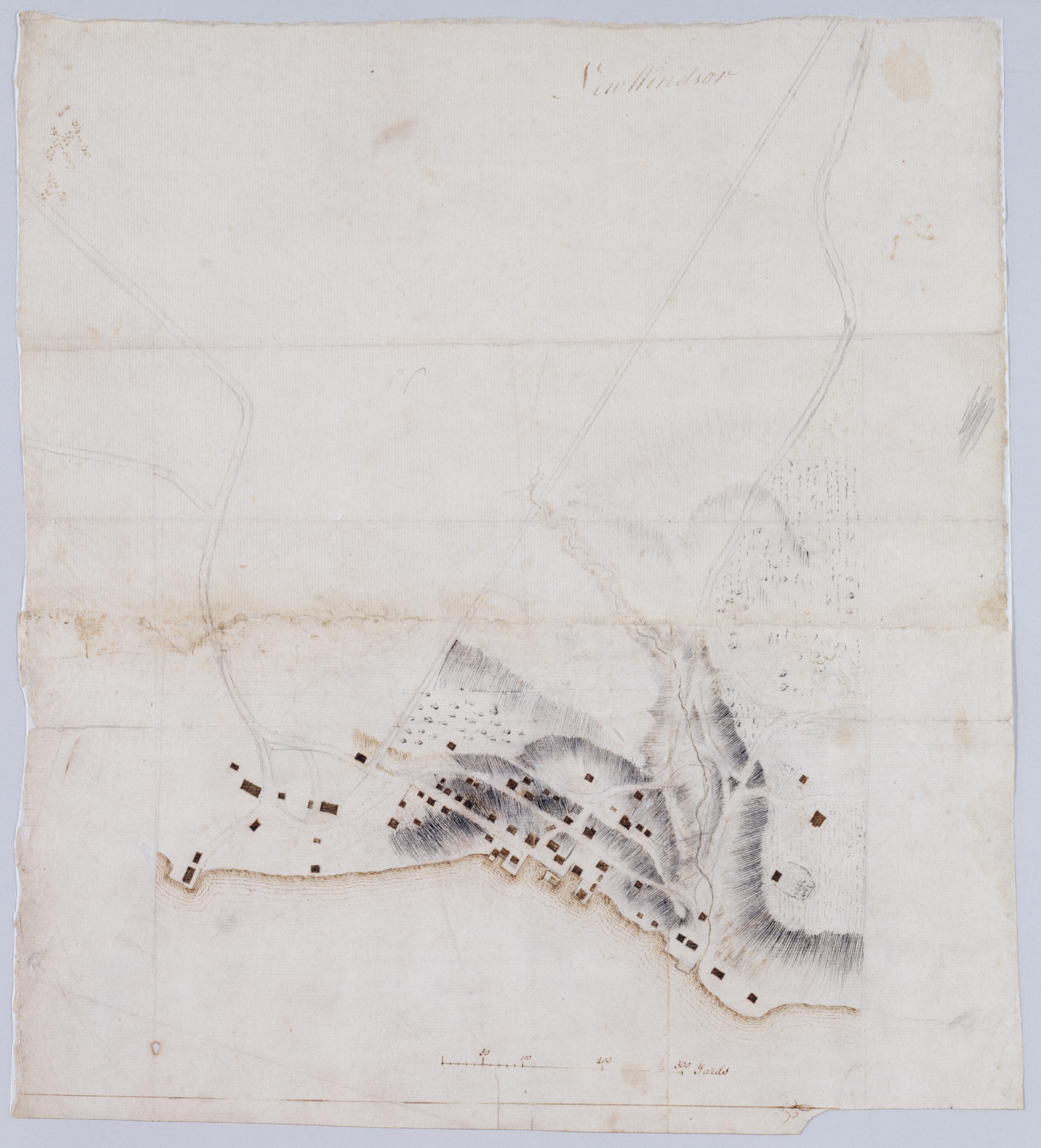
Cartographic New Windsor. In pencil on verso: "for F De Peyster Esq." DePeyster was a 19th century official of the New York Historical Society. Military topographic map. Covers the village of New Windsor and surrounding area in the town of New Windsor, Orange County, New York. Shows roads, buildings and landforms. Pen-and-ink, pencil on laid paper. Shows relief by hachures. Soiled and stained, creased, frayed and abraded. Mounted on cloth, bound and cropped, disbound and silked by subsequent owners. Cleaned after removal of backings 1999; some fill remains. Re-lined with China paper. Sheathed in mylar. View Item
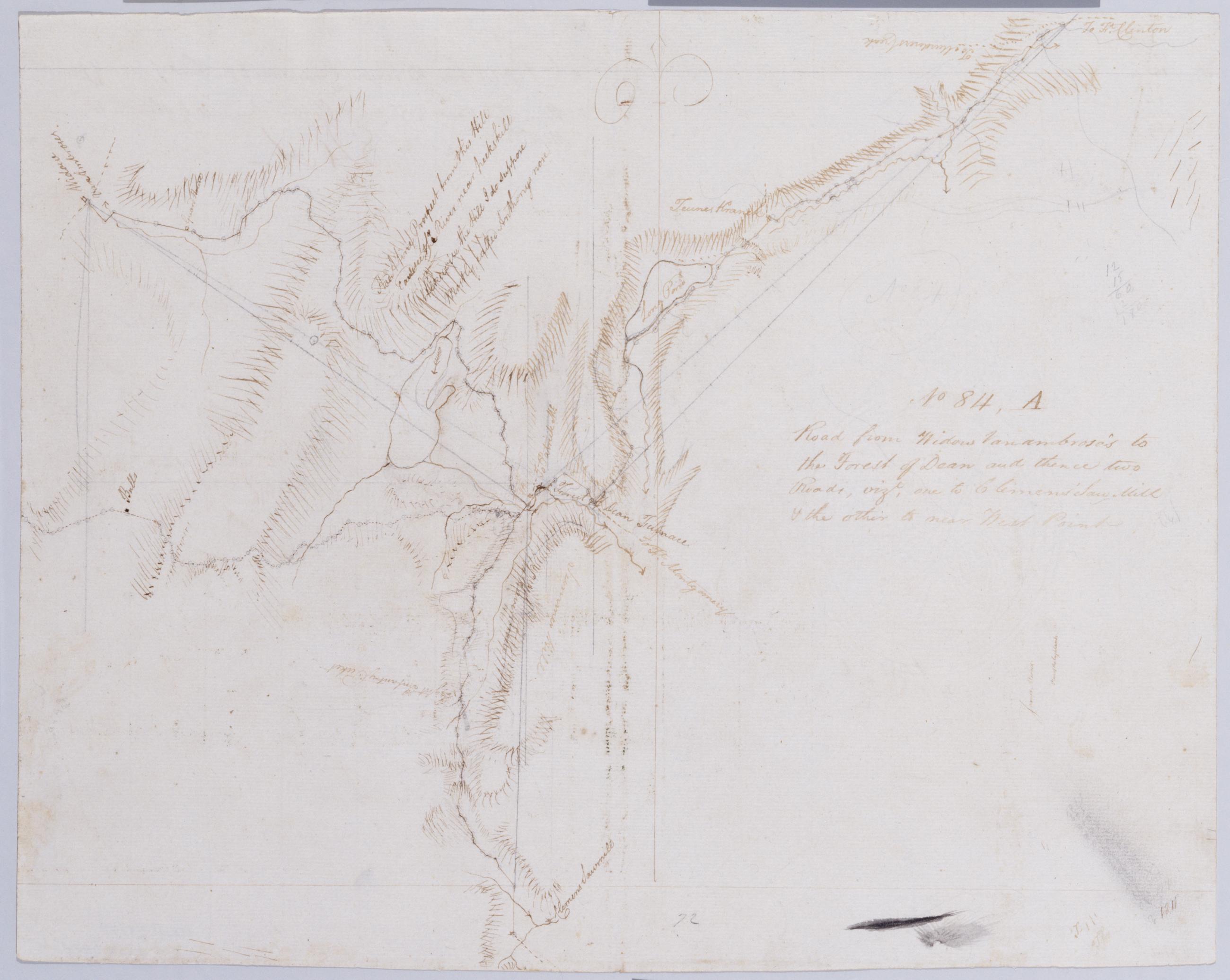
Cartographic Road from Widow Vanambrose's to the Forest of Dean and thence two Roads, vizt, one to Clemens' Saw-Mill + the other to near West Point. No 84, A / by Robert Erskine F.R.S. Geogr. A. U.S. and Assistants. In pencil on recto: "No [8]4". Includes brief text. Military topographic map. Covers the townships of Highland and Woodbury in Orange County, New York. Shows roads, buildings and owners' names, also landforms and streams. Pen-and-ink, pencil on laid paper. Shows relief by hachures. Stained, creased and abraded. Mounted on cloth, bound and cropped, disbound and silked by subsequent owners. Cleaned after removal of backings 1999; some fill remains. Sheathed in mylar. Title proper from recto is the work of a later editor--Simeon DeWitt or his assign--subsequent to 1820. View Item
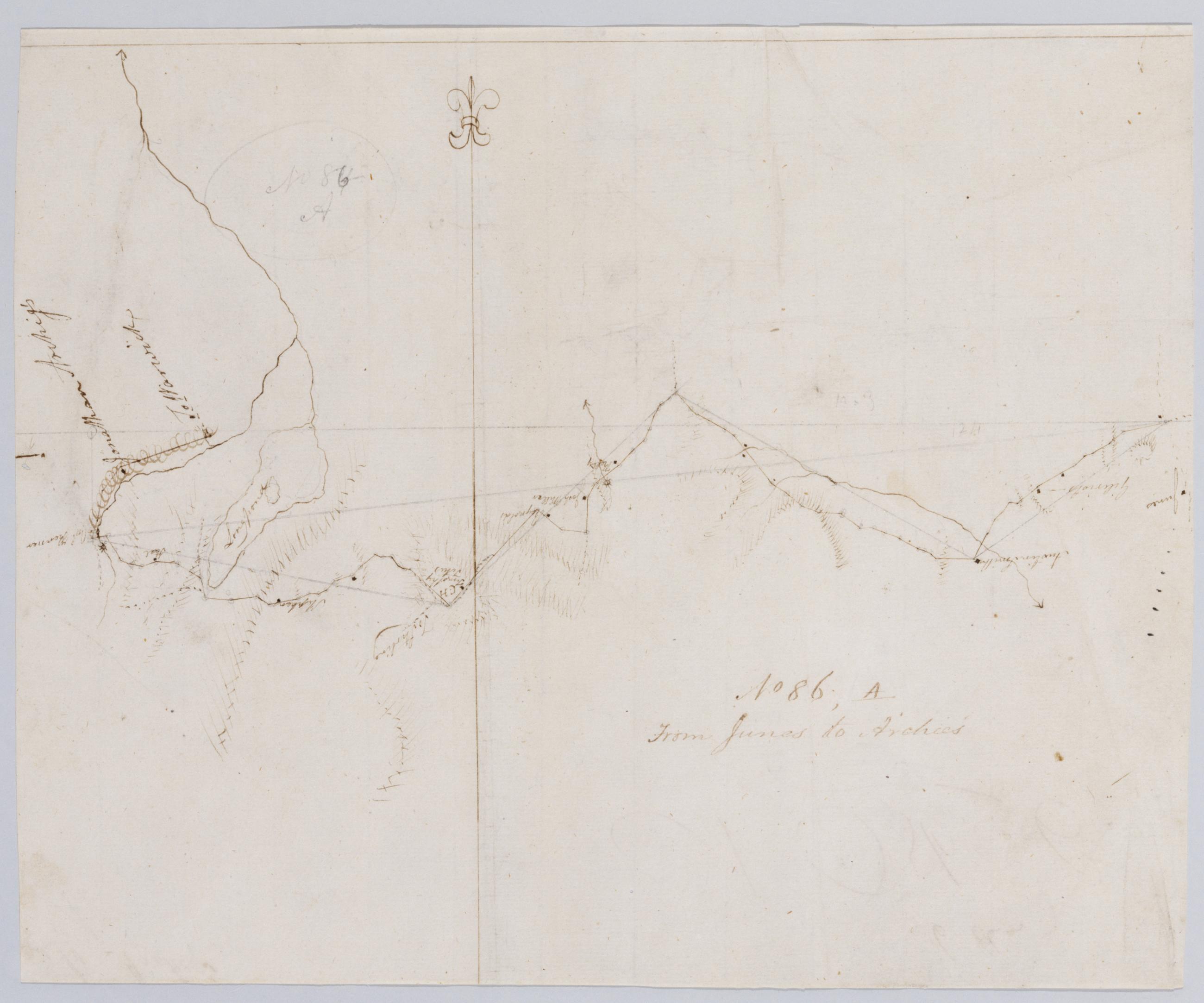
Cartographic From Junes to Archies. No 86, A / by Robert Erskine F.R.S. Geogr. A. U.S. and Assistants. In ink on verso: "es to Archie's A," "No. 86. A," "86 a". In pencil on recto: "No 86-A" was originally written "No 84-A". Military topographic map. Covers the townships of Chester, Monroe and Woodbury in Orange County, New York. Shows roads running through Turners. Also shows buildings and owners' names, landforms and streams. Pen-and-ink, pencil on laid paper. Shows relief by hachures. Soiled, stained and abraded. Mounted on cloth, bound and cropped, disbound and silked by subsequent owners. Cleaned after removal of backings 1999; some fill remains. Sheathed in mylar. View Item
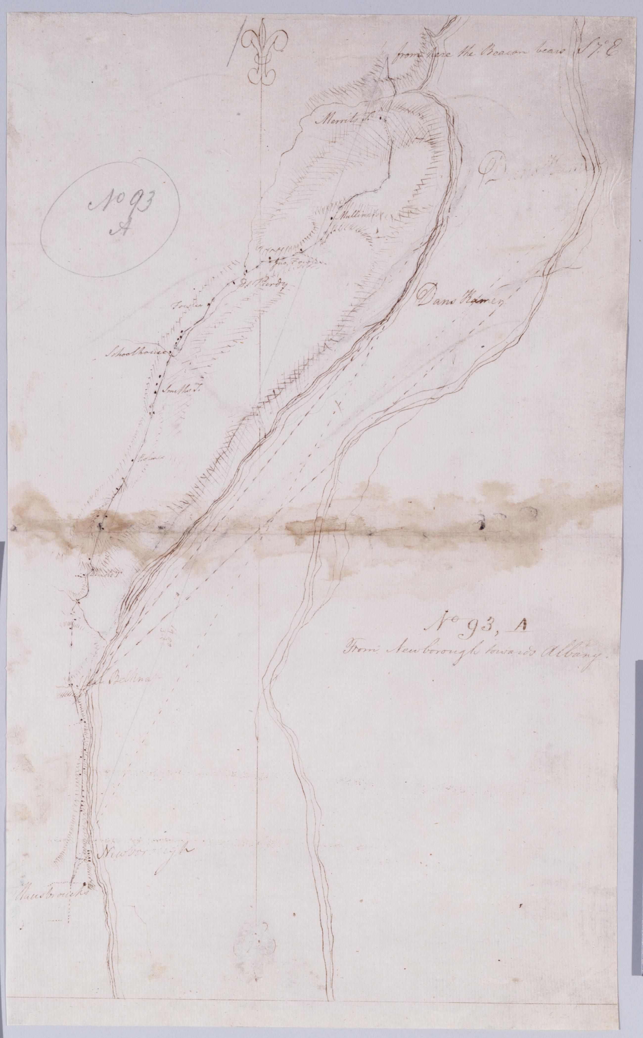
Cartographic From Newborough towards Albany. No 93, A / by Robert Erskine F.R.S. Geogr. A. U.S. and Assistants. In ink on verso: "A A A" "A No. 93". In pencil on recto: "No 93 A". Military topographic map. Covers the townships of Newburg in Orange County and Marlboro in Ulster County, New York. Shows roads running through Newburg and Marlboro. Also shows buildings and owners' names, landforms and streams. Pen-and-ink, pencil on laid paper. Shows relief by hachures. Stained, soiled, creased and abraded. Mounted on cloth, bound and cropped, disbound and silked by subsequent owners. Cleaned after removal of backings 1999; some fill remains. Sheathed in mylar. View Item
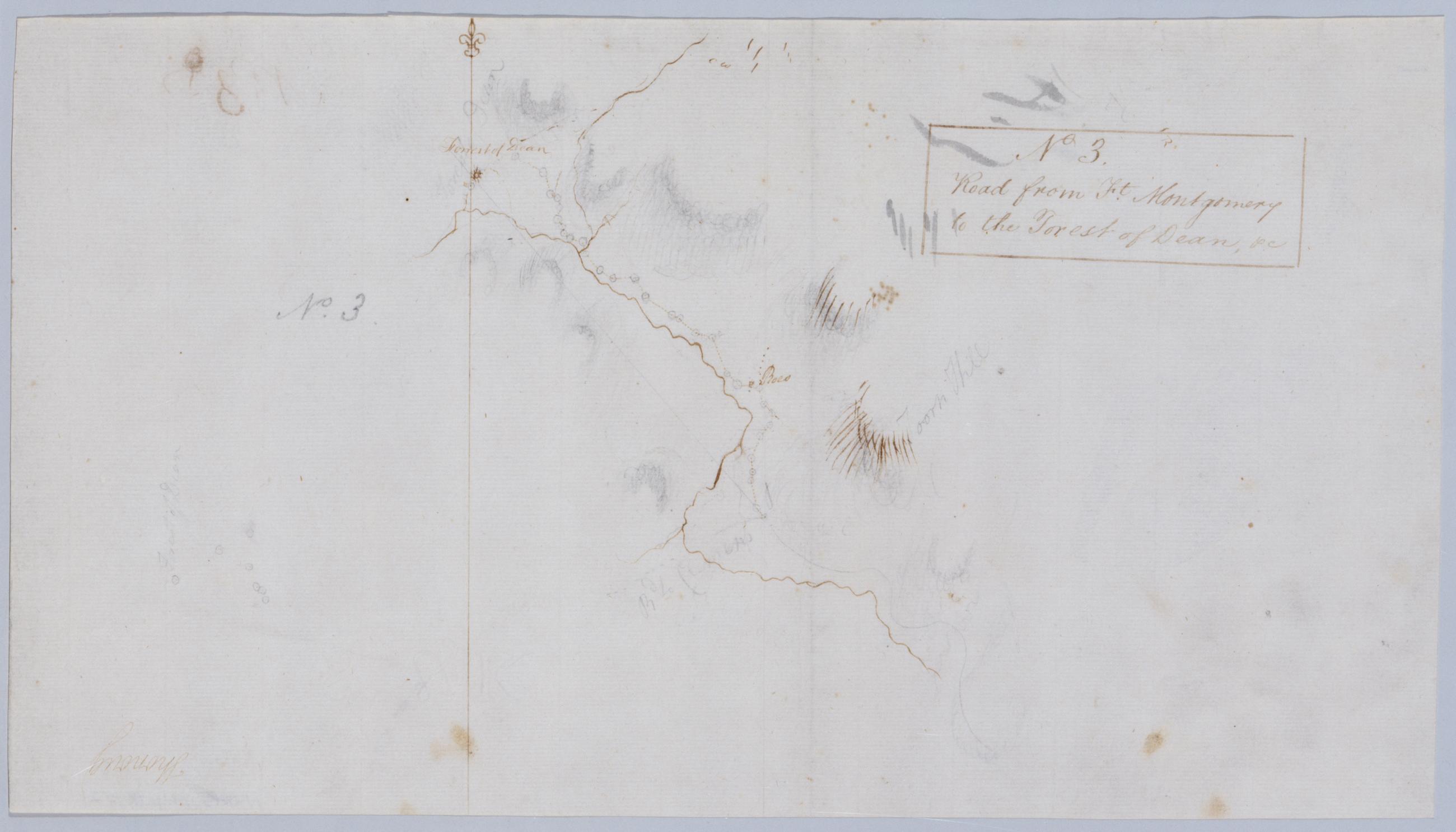
Cartographic Road from Ft. Montgomery to the Forest of Dean, +c. No 3 / by Robert Erskine F.R.S. Geogr. A. U.S. and Assistants. Frayed, foxed. Mounted on cloth, bound and cropped, disbound, silked by subsequent owners. Cleaned after removal of backings 1999. Sheathed in mylar. In ink on verso: "[Ben] Ringwood 14 November 1778," "No. 3D." In pencil on recto: "No. 3." Military topographic map. Covers an area north and east of Popolopen Creek, between modern Highland Falls and Bear Mountain State Park in the Town of Highland, Orange County, New York. Shows roads and owners' names; also landforms and streams. Pen-and-ink, graphite on laid paper. Shows relief by shading and hachures. View Item
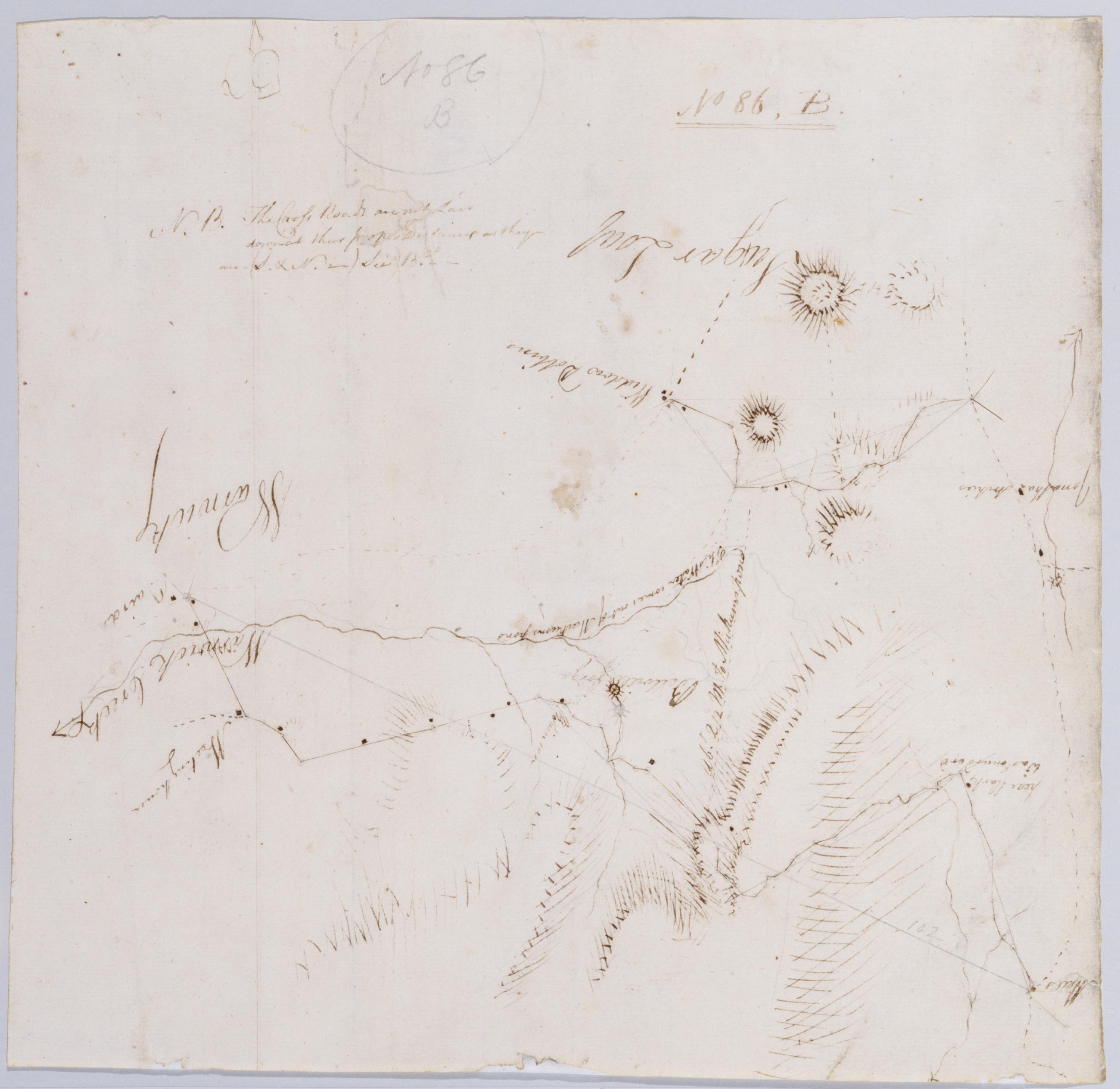
Cartographic From Junes to Arches & Warwich - A. B & B2d. No 86, B / by Robert Erskine F.R.S. Geogr. A. U.S. and Assistants [draft ed.]. In ink on recto and verso: "No 86 B." In pencil on recto: "No 86 B". Military topographic map. Covers the townships of Chester and Warwick in Orange County, New York. Shows roads running through Warwick, Bellvale, Mt. Peter and Dutch Hollow. Also shows buildings and owners' names, landforms and streams. No title on map recto or verso. Title as given, statement of responsibility, date, series title and series numbering by Erskine, but on separate index sheet filed at head of series. Title number from map recto. Pen-and-ink, pencil on laid paper. Shows relief by hachures. View Item
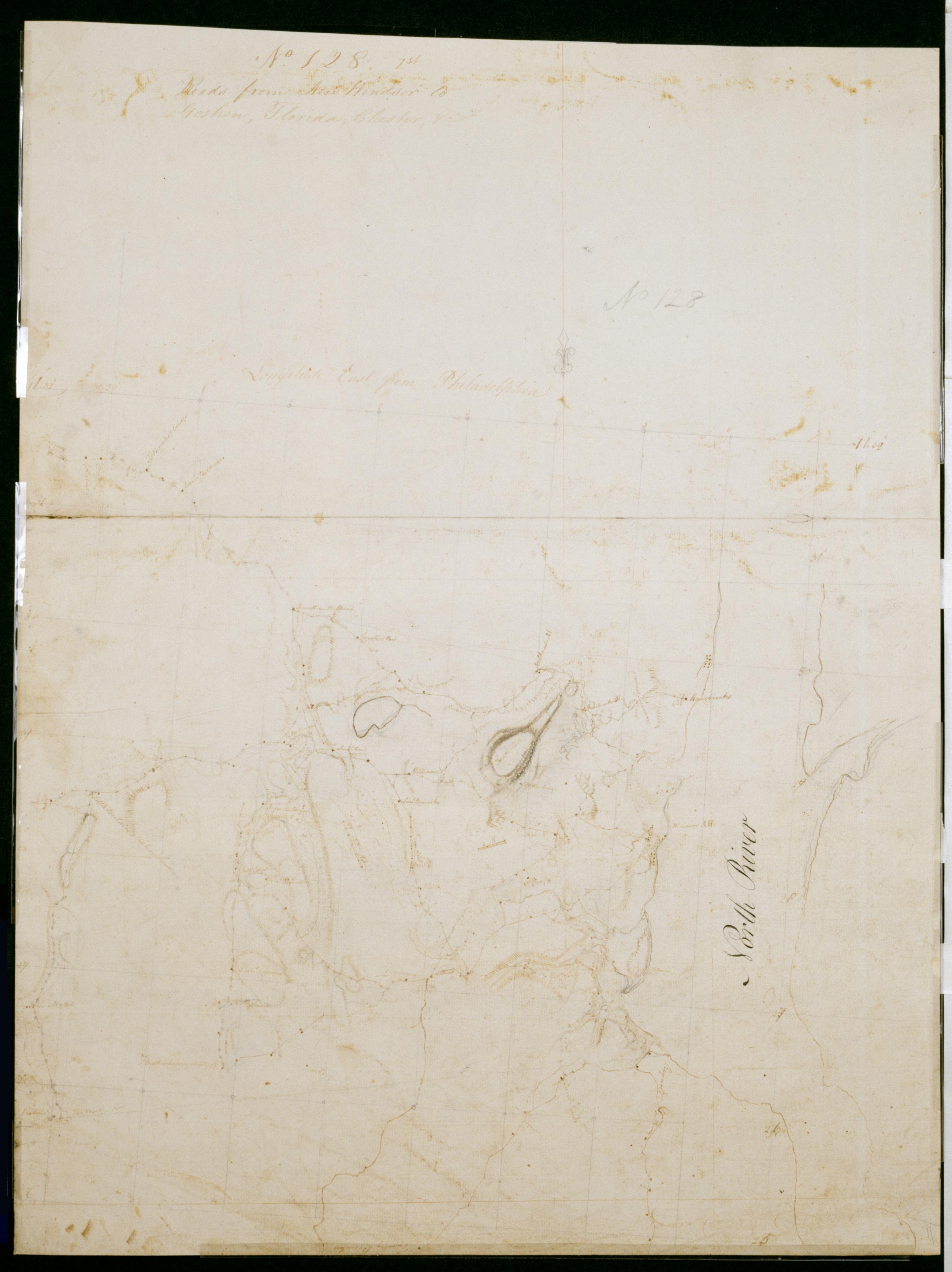
Cartographic Roads from New Windsor to Goshen, Florida, Chester, +c. No 128, 1st / by Robert Erskine F.R.S. Geogr. A. U.S. and Assistants. Date probably 1782, based on presence of a label for the Hasbrouck house at Newburgh, which was Washington's HQ from April of that year. In pencil on recto: "No 128". Military topographic map. Covers the townships of New Windsor, Cornwall and Montgomery in Orange County, New York. Also shows position of troops; also buildings and owners' names, landforms and streams. Pen-and-ink, pencil on laid paper. Shows relief by hachures. Stained, soiled, foxed, creased and abraded. Mounted on cloth, bound and cropped, disbound and silked by subsequent owners. View Item
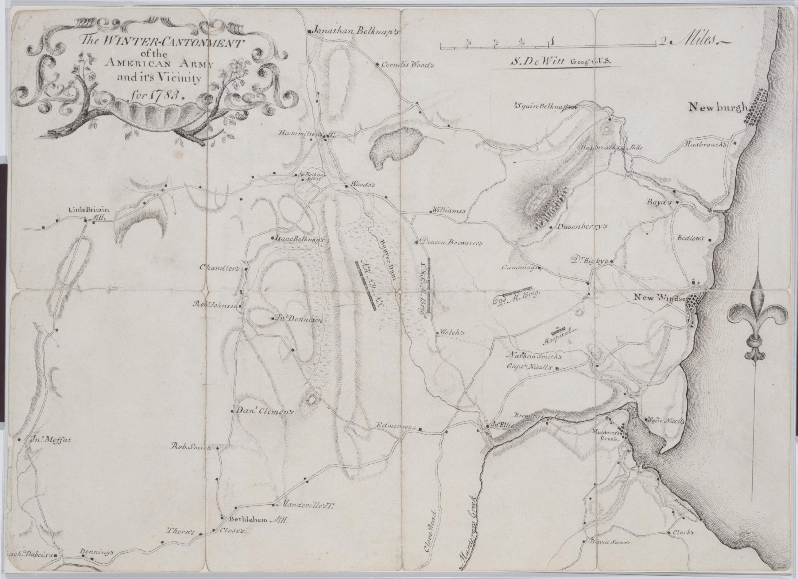
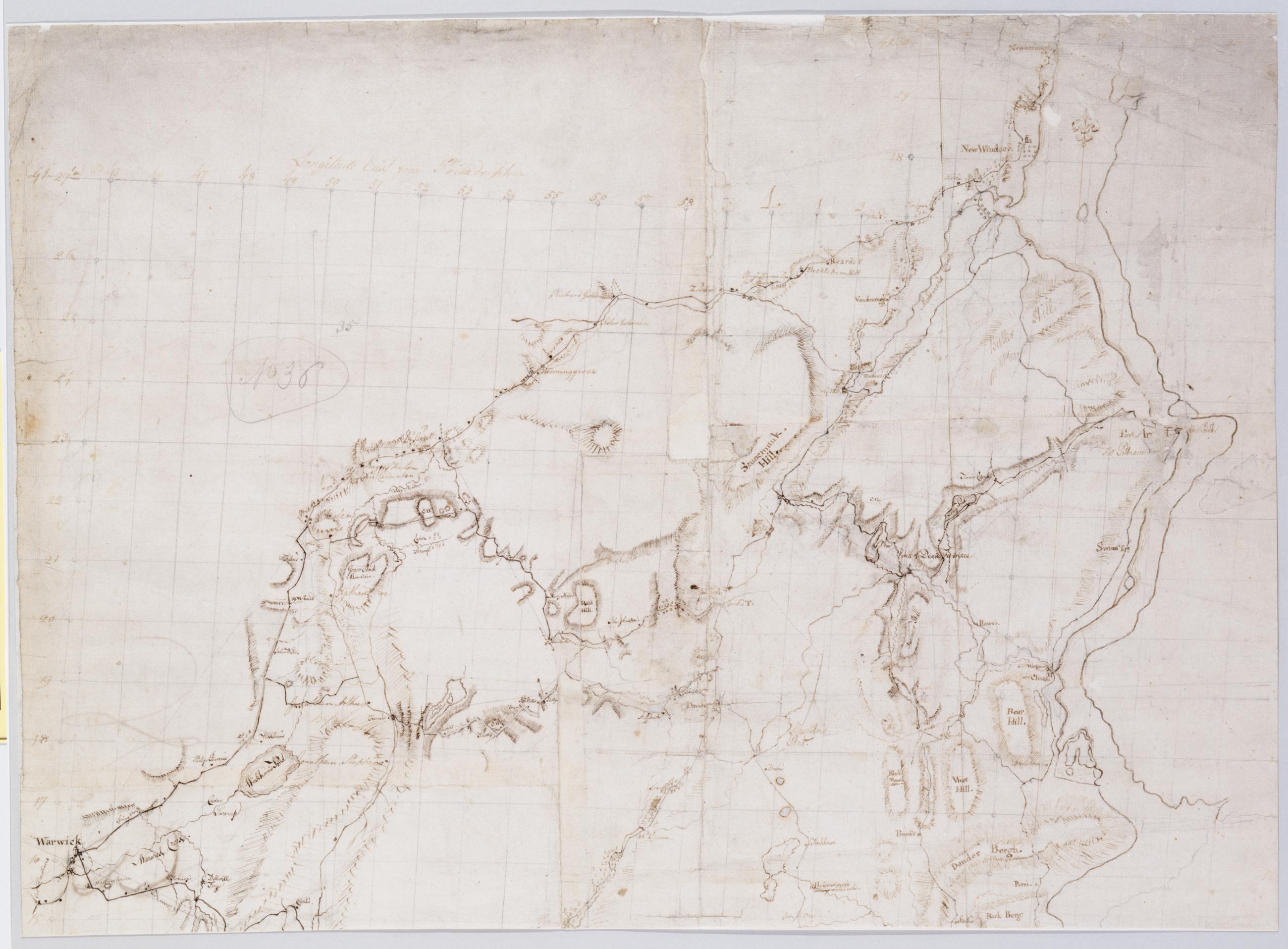
Cartographic The Winter-Cantonment of the American Army and it's Vicinity for 1783 / S. De Witt Geogr. to U.S. Military topographic map. Covers the townships of Newburg, New Windsor, Cornwall and Blooming Grove in Orange County, New York. Shows roads, streams, landforms, buildings and owners' names. Pen-and-ink on laid paper. Shows relief by hachures. Soiled, creased, frayed and abraded. Mounted on cloth, bound and cropped, disbound and silked by subsequent owners. Cleaned after removal of backings 1999; some fill remains. Re-lined with sturdy stock and China paper. Sheathed in mylar. View Item
Cartographic Nichol's Hill, North Rr. Butter Hill, +c No 1, D / by Robert Erskine F.R.S. Geogr. A. U.S. and Assistants ; Surveyed Decemr. 1777 by Robt Erskine F.R.S. Also on verso: "60.48 29.12," minor unfinished sketch. Foxed, creased, abraded and badly frayed. Mounted on cloth, bound and cropped, disbound and silked by subsequent owners. Cleaned after removal of backings 1999; some fill remains. Sheathed in mylar. In ink on verso: N.1.D. Military fortification map. Covers Fort Plum Point, near modern Cornwall-on-Hudson in the town of New Windsor, Orange County, New York. Butter Hill is now called Storm King Mountain; it overlooks the mapped area from the southeast. Nichol's Hill has not been identified. Neither peak is shown on the map. View Item
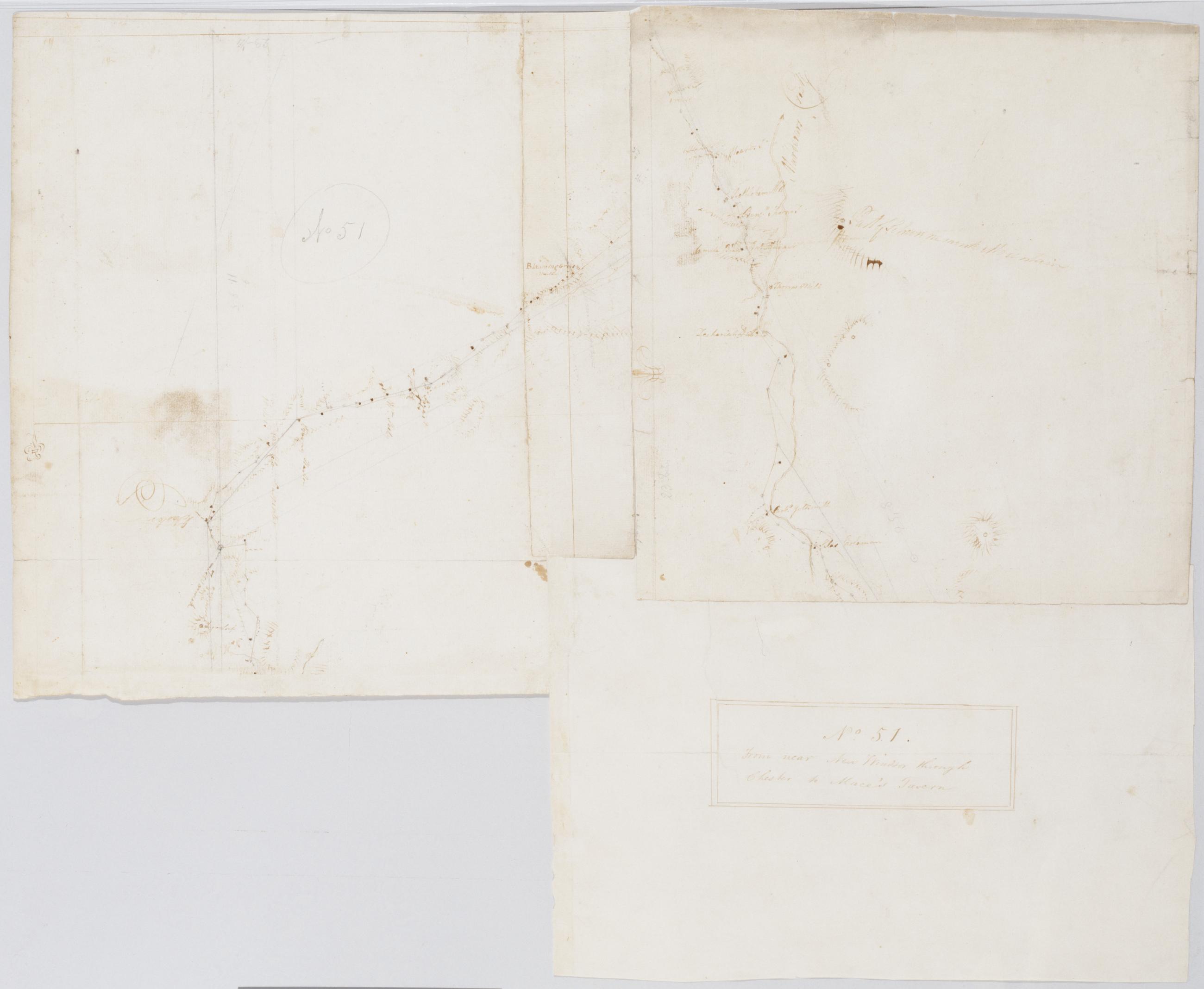
Cartographic From near New Windsor through Chester to Mace's Tavern. No. 51 / by Robert Erskine F.R.S. Geogr. A. U.S. and Assistants. Imperfect: separate piece of original (laid paper) lost from lower left corner; note evidence of pasting. In ink on verso: "No. 51." "Rough Draughts". In pencil on recto: "No 51". In pencil on verso: "Fort Washington." Military topographic map. Covers the towns of Chester, Blooming Grove, Cornwall and New Windsor in Orange County, New York. Shows roads running through Vailsgate, Meadowbrook, Salisbury Mills, Washingtonville, Blooming Grove, Craigsville, Chester and East Chester. Also shows buildings and owners' names, landforms and streams. No watermarks. View Item
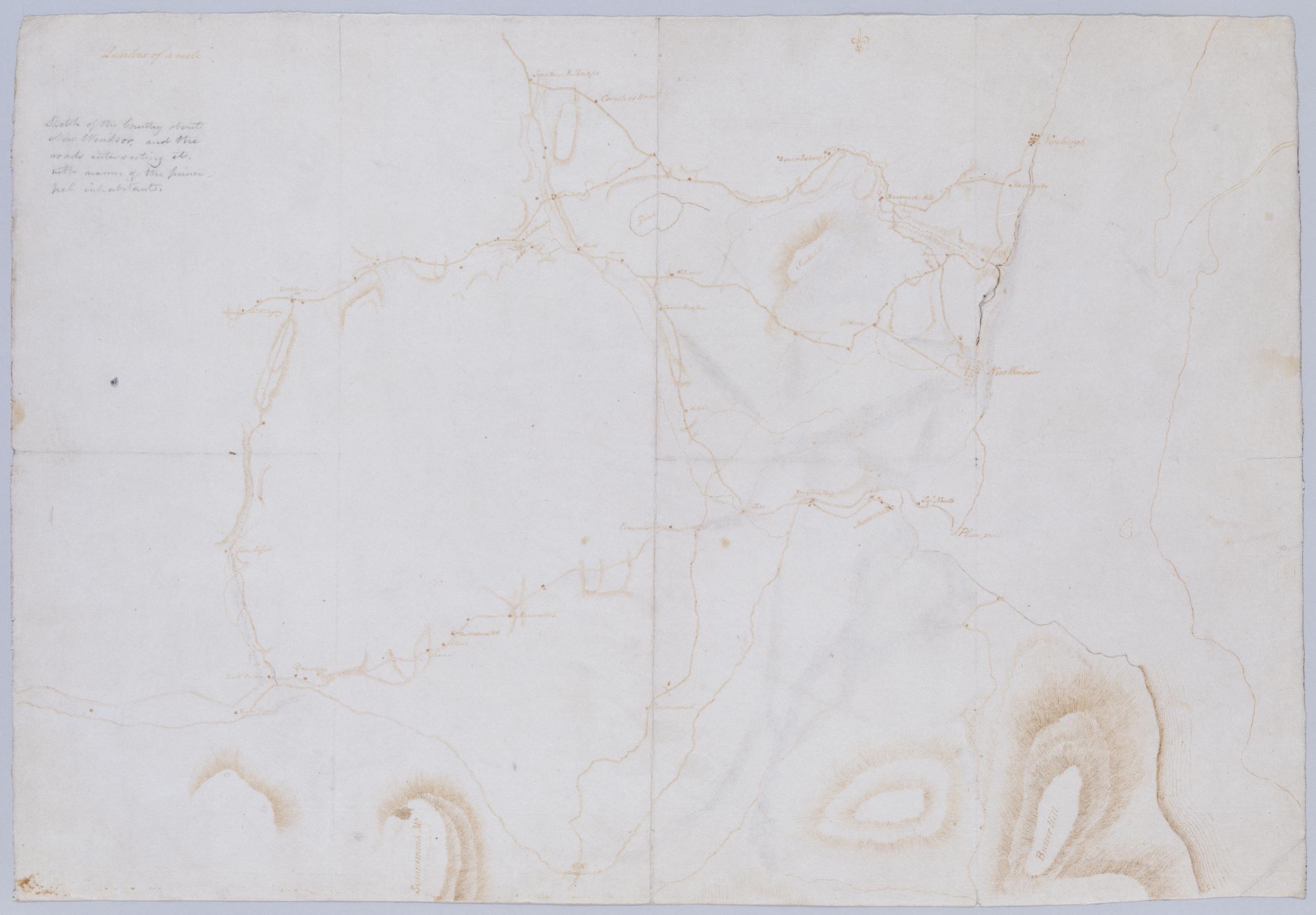
Cartographic Sktch of the Country about New Windsor, and the roads intersecting it, with names of the principal inhabitants. Foxed, soiled, creased and abraded. Mounted on cloth, bound and cropped, disbound and silked by subsequent owners. Cleaned after removal of backings 1999; some fill remains. Sheathed in mylar. In pencil on verso: "for F De Peyster Esq." DePeyster was a 19th century official of the New York Historical Society. Military topographic map. Covers the towns of New Windsor, Newburg, Cornwall and Blooming Grove in Orange County, New York. Shows roads, some buildings and owners' names, streams and landforms. Pen-and-ink, pencil on laid paper. Shows relief by hachures. View Item
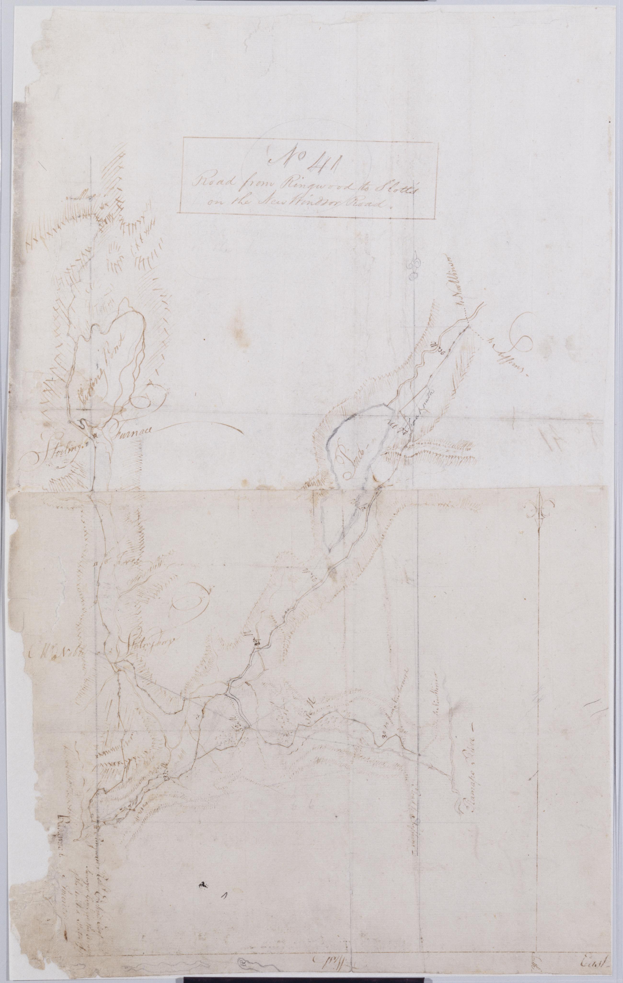
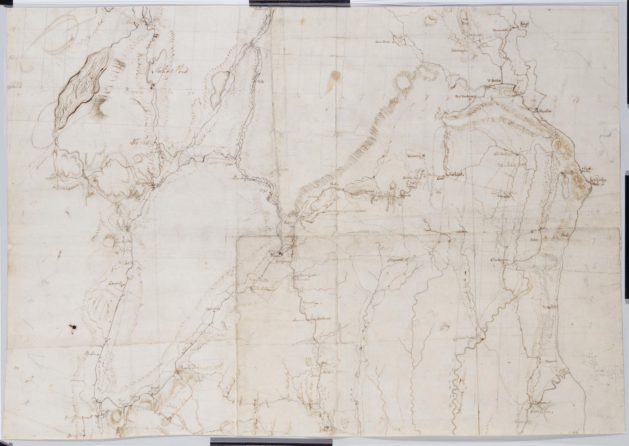
Cartographic Road from Ringwood to Slott's on the New Windsor Road. No 41 / by Robert Erskine F.R.S. Geogr. A. U.S. and Assistants. Foxed, creased, frayed, and abraded. Mounted on cloth, bound and cropped, disbound and silked by subsequent owners. Cleaned after removal of backings 1999; some fill remains. Sheathed in mylar. Map label at Ringwood: "Robt. Erskine Esqr. Surveyor Genl. for the Army of the United States of America--". Military topographic map. Covers the townships of Werwick and Tuxedo in Orange County, New York, Ramapo in Rockland County, New York, and Pompton in Passaic County, New Jersey. Shows roads running though Lakeville, Sterling Furnace, Ringwood, Eagle Valley, Sloatsburg and the Tuxedo Lake area. View Item
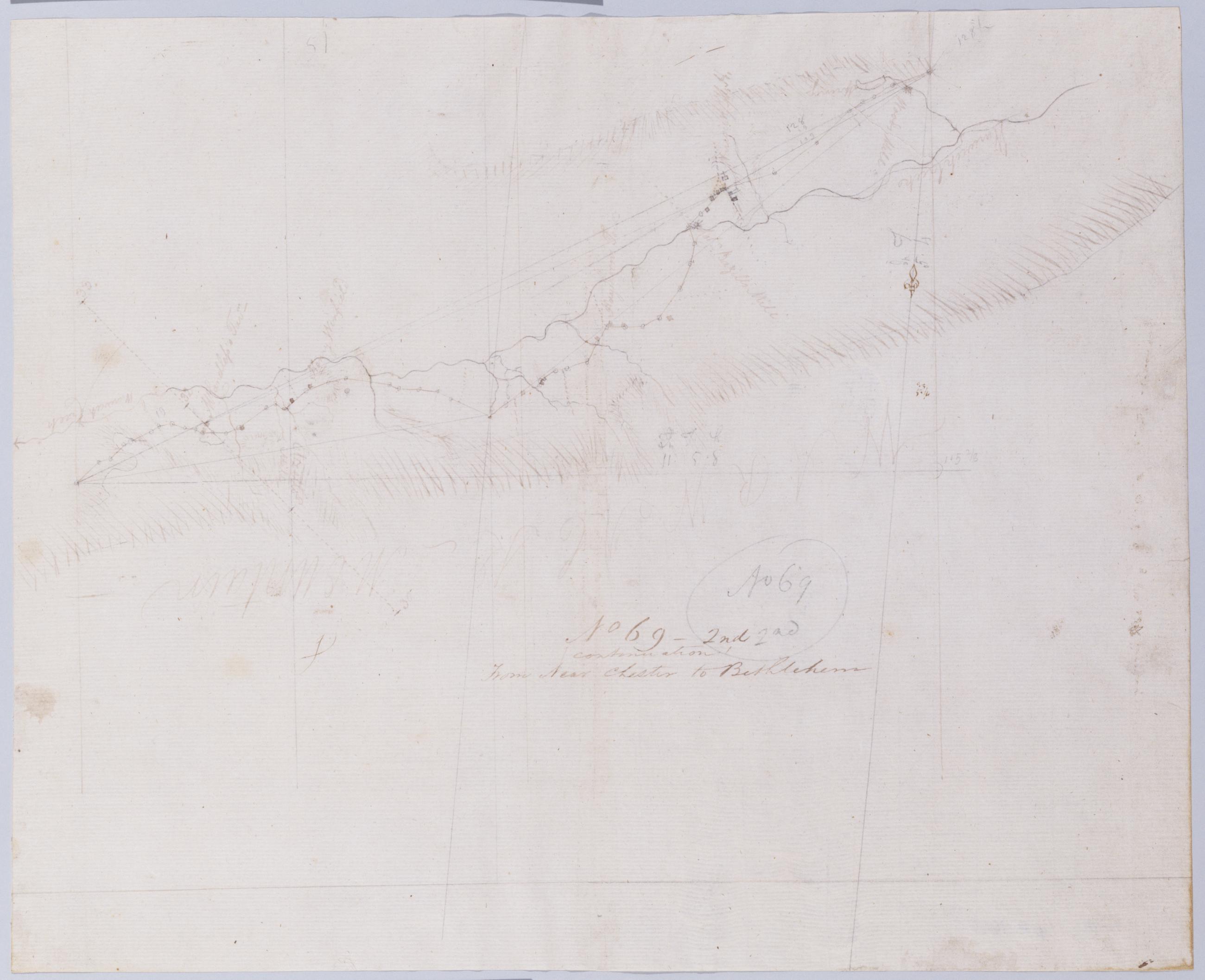
Cartographic (Continuation) From Near Chester to Bethlehem. No 69-2nd / by Robert Erskine F.R.S. Geogr. A. U.S. and Assistants. In pencil on recto: "No 69 2nd". Military topographic map. Covers the township of Warwick in Orange County, New York. Shows roads running through Warwick and New Milford. Also shows buildings and owners' names, landforms and streams. Pen-and-ink, pencil on laid paper. Shows relief by hachures. Stained, foxed, creased and abraded. Mounted on cloth, bound and cropped, disbound and silked by subsequent owners. Cleaned after removal of backings 1999; some fill remains. Sheathed in mylar. Title proper on recto is the work of a later editor--Simeon DeWitt or his assign--subsequent to 1820. View Item
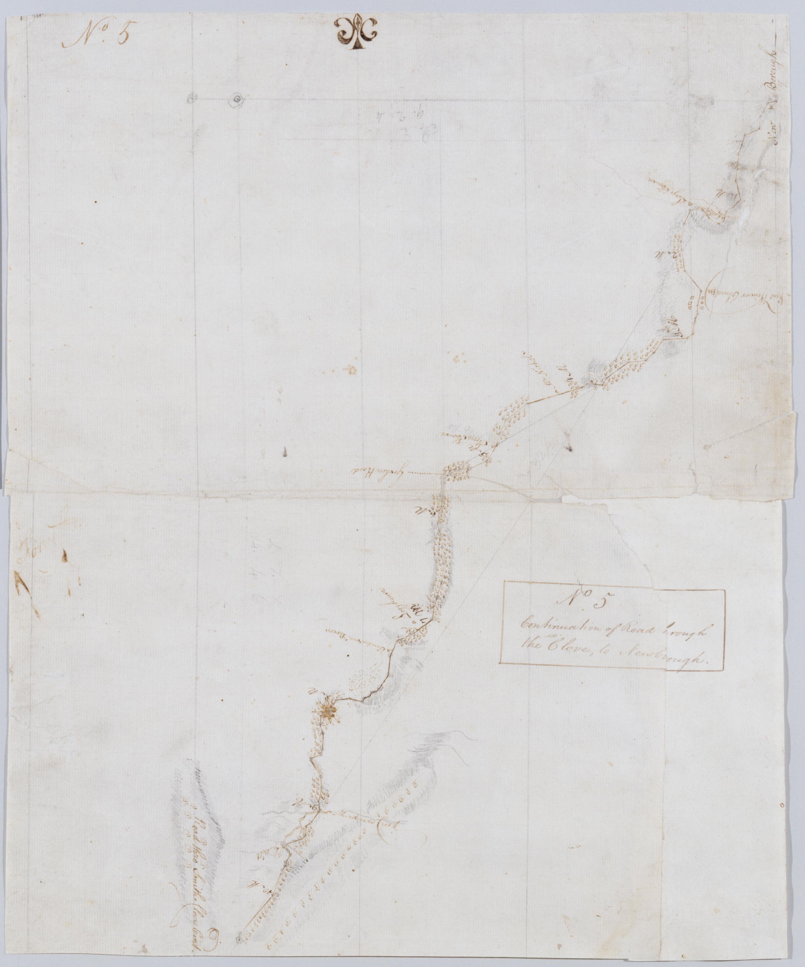
Cartographic Continuation of Road [t]hrough the Clove, to Newbo[r]ough No 5 / by Robert Erskine F.R.S. Geogr. A. U.S. and Assistants. In ink on both recto and verso: "No. 5". Military topographic map. Covers an area in the towns of New Windsor and Cornwall, Orange County, New York; "Murderers Creek" is now called Moodna Creek. Shows roads running through Newburg, New Windsor, Vailsgate, Idlewild and Houghton Farm. Also shows buildings and owners' names, landforms and streams. Pen-and-ink, pencil on laid paper. Lower corner uses paper of a different origin. Shows relief by hachures. Title proper from recto is the work of a later editor--Simeon DeWitt or his assign--subsequent to 1820. View Item
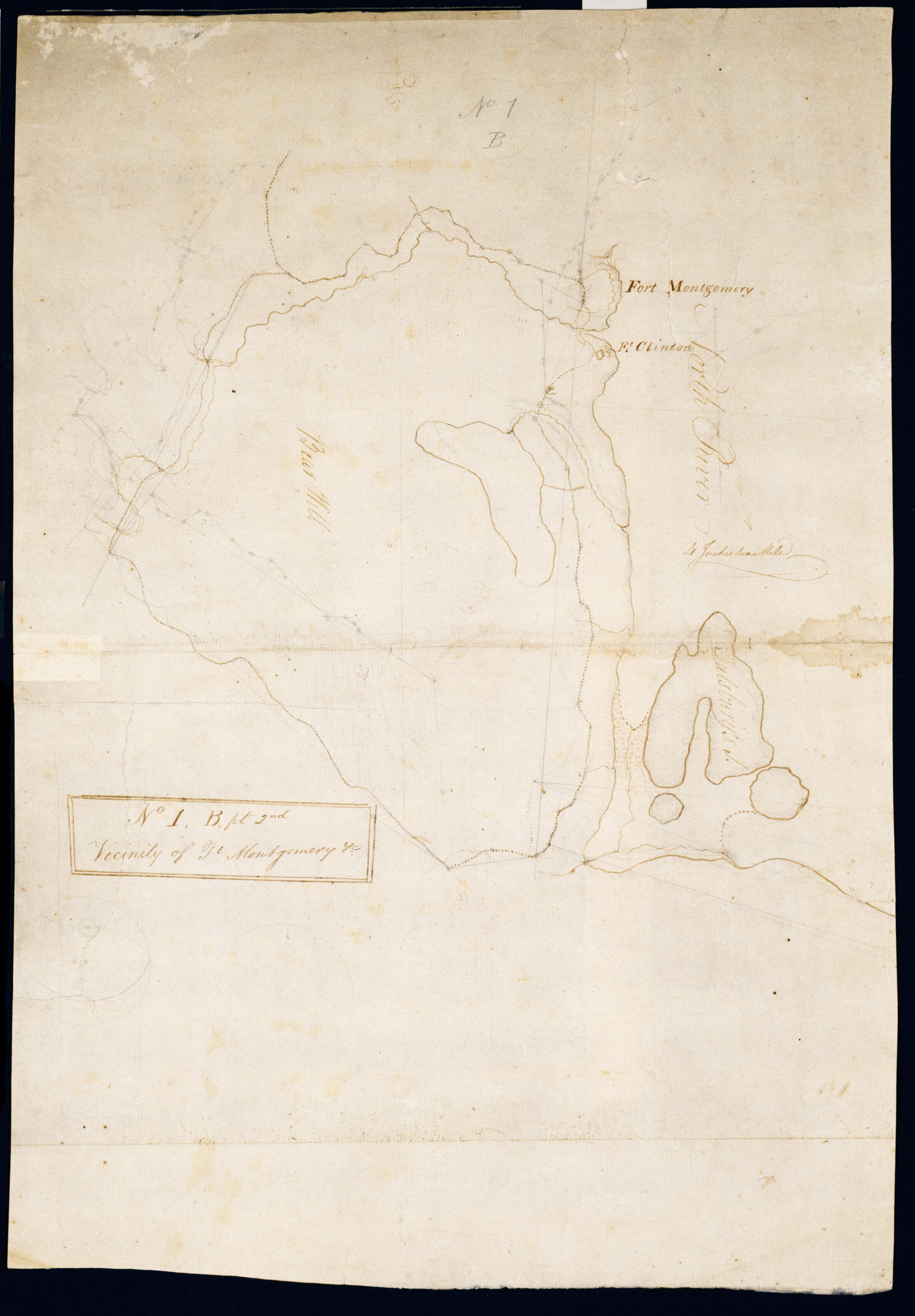
Cartographic Vicinity of Ft Montgomery +c. No 1, B, pt. 2nd / by Robert Erskine F.R.S. Geogr. A. U.S. and Assistants. Foxed, creased, frayed and abraded. Mounted on cloth, bound and cropped, disbound and silked by subsequent owners. Cleaned after removal of backings 1999; some fill remains. Sheathed in mylar. In ink on verso "Part of No. 1 Large Scale N.1.B". In pencil on recto: "No 1 B." Military topographic map. Covers the towns of Stony Point in Rockland County and of Highland and Woodbury in Orange County, New York. Shows roads, forts, landforms, streams and wetlands. Pen-and-ink, pencil on laid paper. Shows relief by hachures. View Item
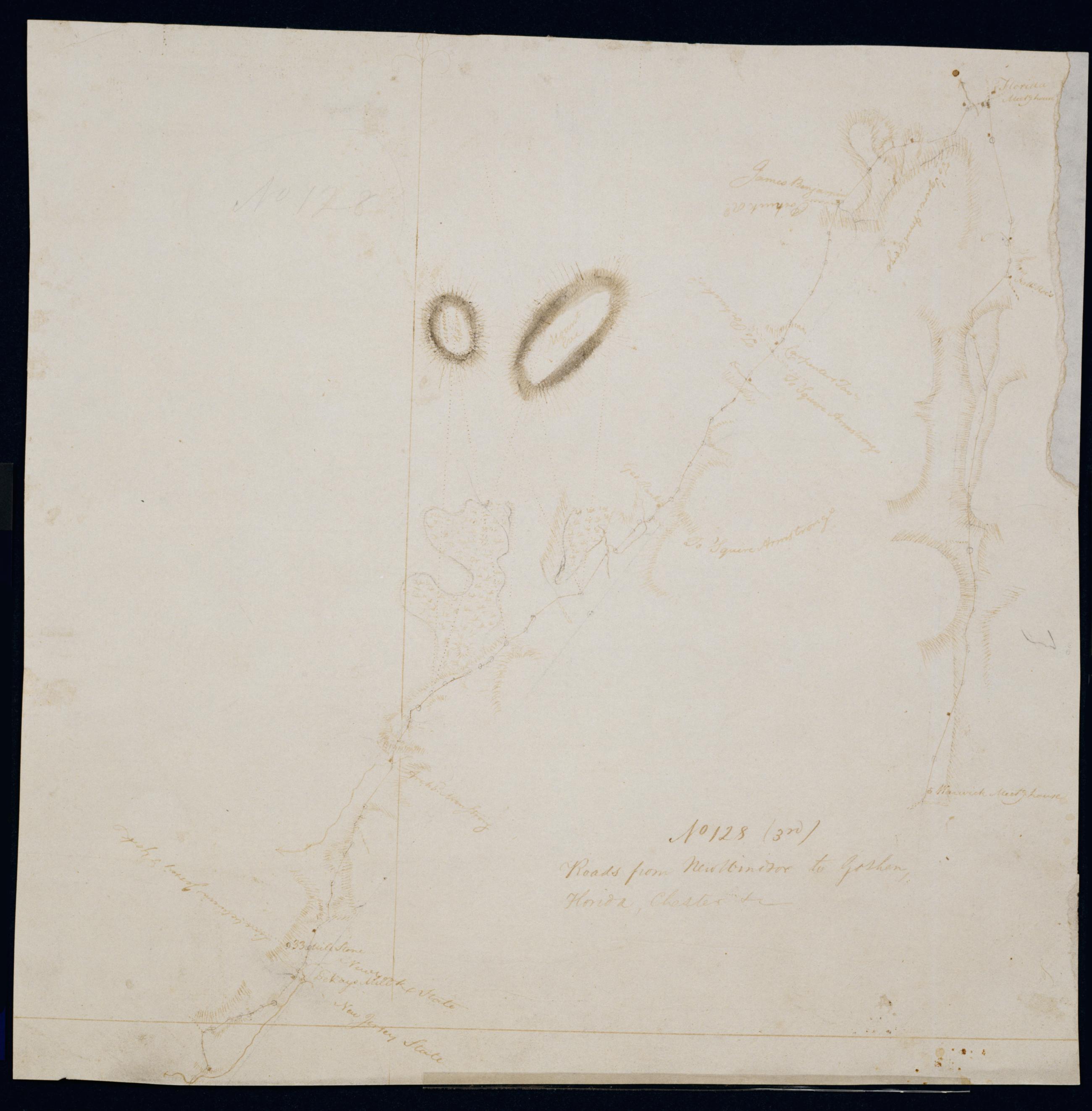
Cartographic Roads from New Windsor to Goshen, Florida, Chester, +c. No 128 (3rd) / by Robert Erskine F.R.S. Geogr. A. U.S. and Assistants. Date probably 1782, based on association with sheet 128,1st. Imperfect: lacking 16 x 1 cm. at upper right. In pencil on recto: "No 128". Military topographic map. Covers the townships of Warwick in Orange County, New York, and of Vernon in Sussex County, New Jersey. Shows roads running through Florida, Warwick, Edenville and Blooms Corners. Also shows buildings and owners' names, landforms and streams. Pen-and-ink, pencil on laid paper. Shows relief by hachures. Stained, soiled and abraded. Mounted on cloth, bound and cropped, disbound and silked by subsequent owners. View Item
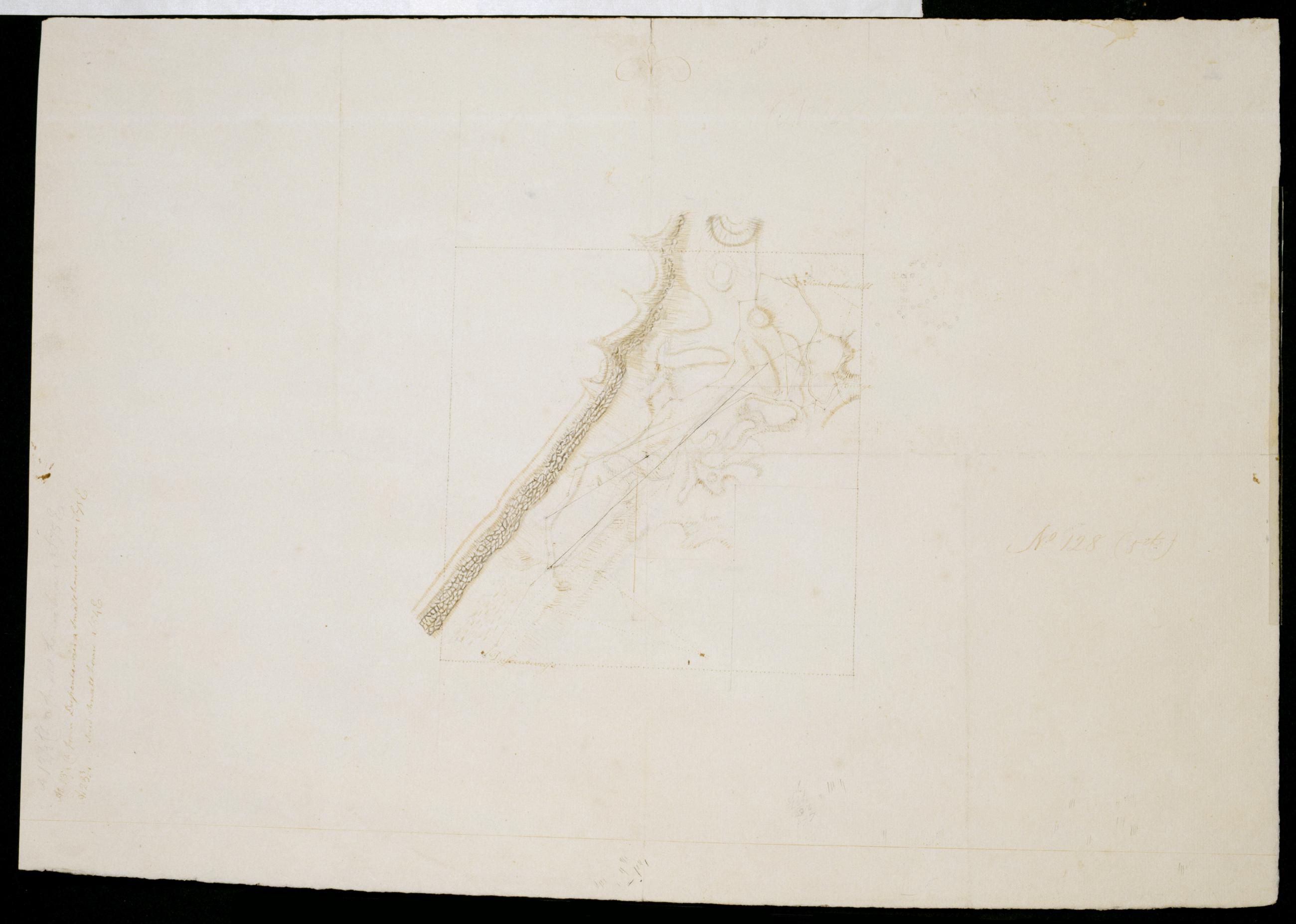
Cartographic [Map of Snake Hill between Dussenberries and Hasbrooks Mill, New York] No 128 (5th) / by Robert Erskine F.R.S. Geogr. A. U.S. and Assistants. Date probably 1782, based on association with sheet 128,1st. Drawing tentatively attributed to DeWitt by cataloger. Military topographic or fortification map. Covers the towns of New Windsor and Newburg in Orange County, New York. Shows buildings and owners' names, streams. Pen-and-ink, pencil on laid paper. Shows relief by hachures. Soiled, creased and abraded. Mounted on cloth, bound and cropped, disbound and silked by subsequent owners. Cleaned after removal of backings 1999; some fill remains. Sheathed in mylar. Title proper supplied by cataloger. View Item
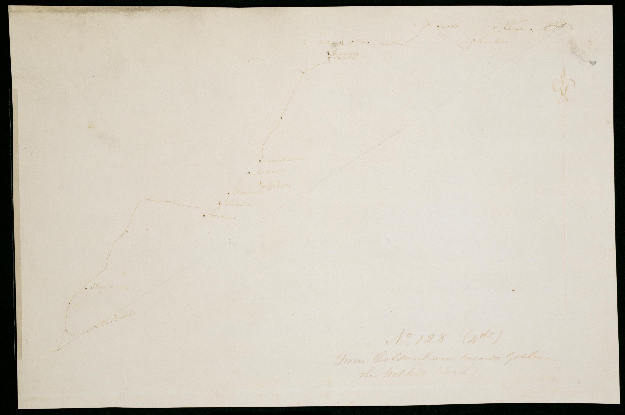
Cartographic From Coldenham towards Goshen the Walkill Road. No 128 (4th) / by Robert Erskine F.R.S. Geogr. A. U.S. and Assistants. Date probably 1782, based on association with sheet 128,1st. Military topographic map. Covers the townships of Montgomery and Hamptonburg in Orange County, New York. Shows roads running through Coldenham, Berea, Neelytown and Lagrange. Also shows buildings and owners' names. Pen-and-ink, pencil on laid paper. Soiled and abraded. Mounted on cloth, bound and cropped, disbound and silked by subsequent owners. Cleaned after removal of backings 1999; some fill remains. Sheathed in mylar. Title proper from recto is the work of a later editor--Simeon DeWitt or his assign--subsequent to 1820. View Item
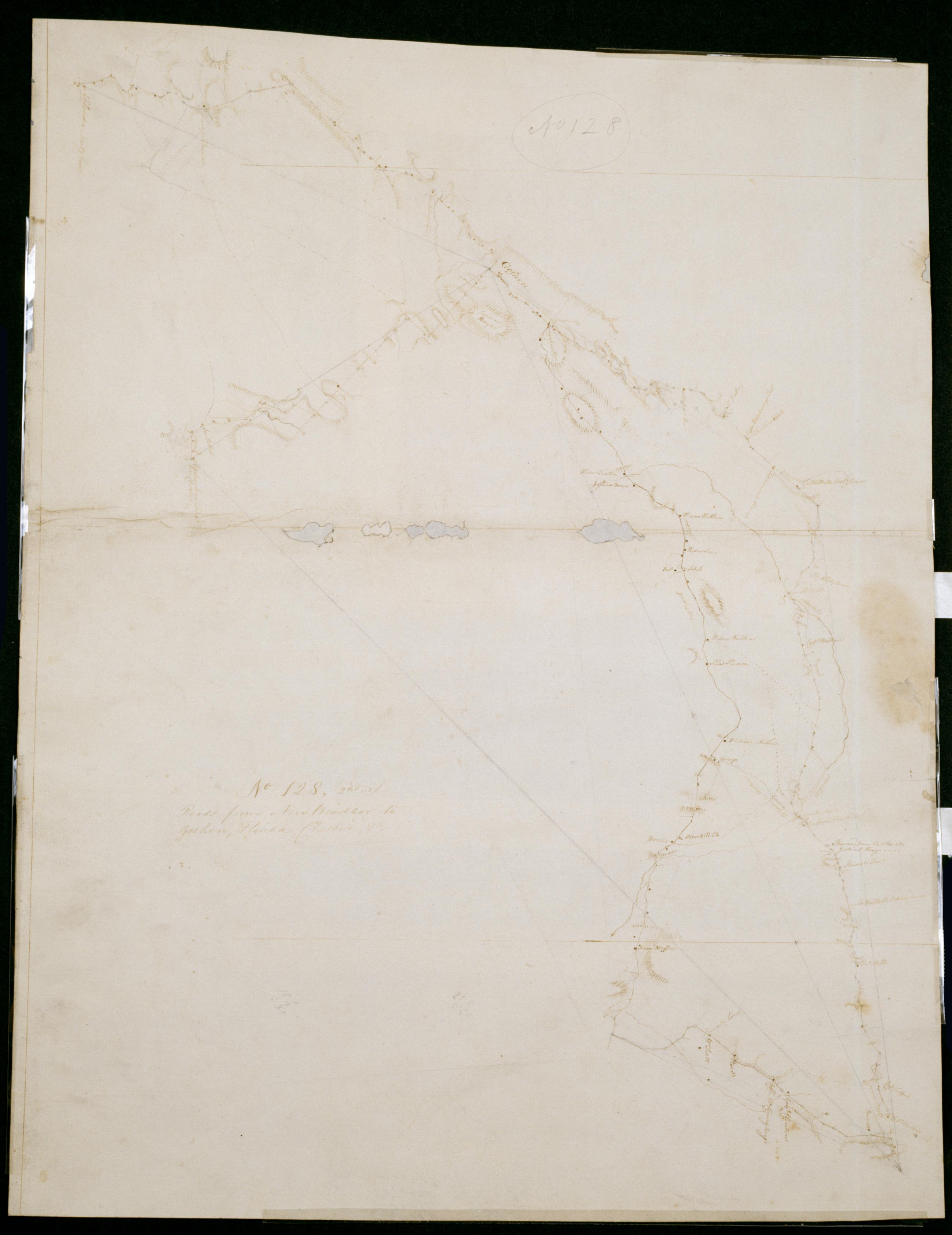
Cartographic Roads from New Windsor to Goshen, Florida, Chester, +c. No 128, (2nd) / by Robert Erskine F.R.S. Geogr. A. U.S. and Assistants. Date probably 1782, based on association with sheet 128,1st. Imperfect: lacking small fragments along crease line. In pencil on recto: "No 128". Military topographic map. Covers the townships of Hamptonburg, Blooming Grove, New Windsor and Goshen in Orange County, New York. Shows roads running thorugh Florida, Mapes Corners, Howell, Goshen, East Chester, Campbell Hall, Hamptonburg, Girard, Otterkill, Washingtonville and Little Britain. Also shows buildings and owners' names, landforms and streams. Oriented with north to right of sheet. Pen-and-ink, pencil on laid paper. View Item
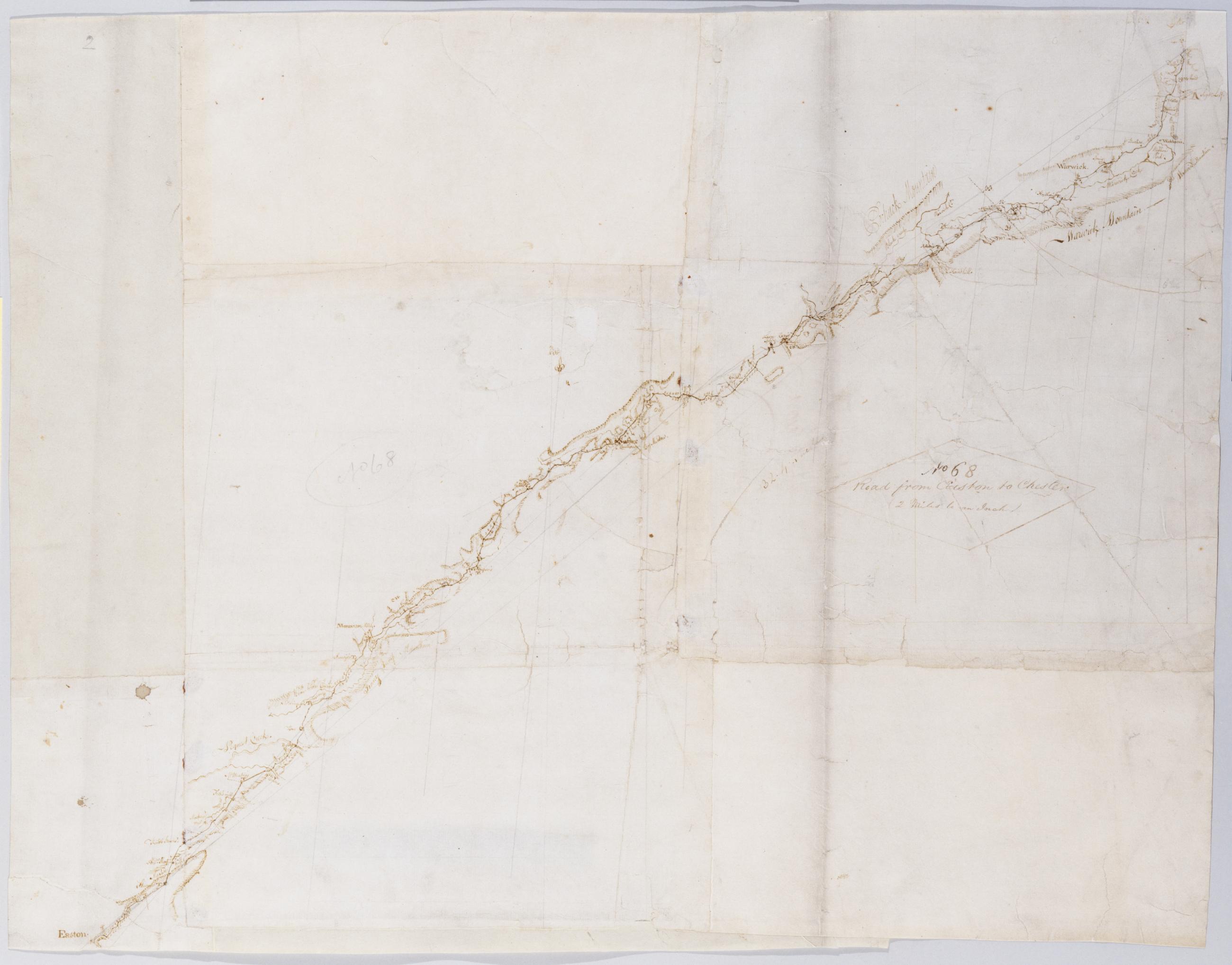
Cartographic Road from Easton to Chester (2 Miles to an Inch). No 68 / by Robert Erskine F.R.S. Geogr. A. U.S. and Assistants. Military topographic map. Covers Orange County in New York and Sussex and Warren counties in New Jersey. Shows roads running through East Chester, Sugarloaf, Warwick and New Milford in New York; and Maple Grange, Vernon, Hamburg, North Church, Newton (formerly Sussex), Hope, Swayze Mills, Oxford Church and Phillipsburg in New Jersey. Also shows buildings and owners' names, landforms and streams. Pen-and-ink, pencil on 3 assembled pieces laid paper; 4 pieces having a wove finish added later. Shows relief by hachures. Stained, foxed, creased, torn, frayed and abraded. View Item
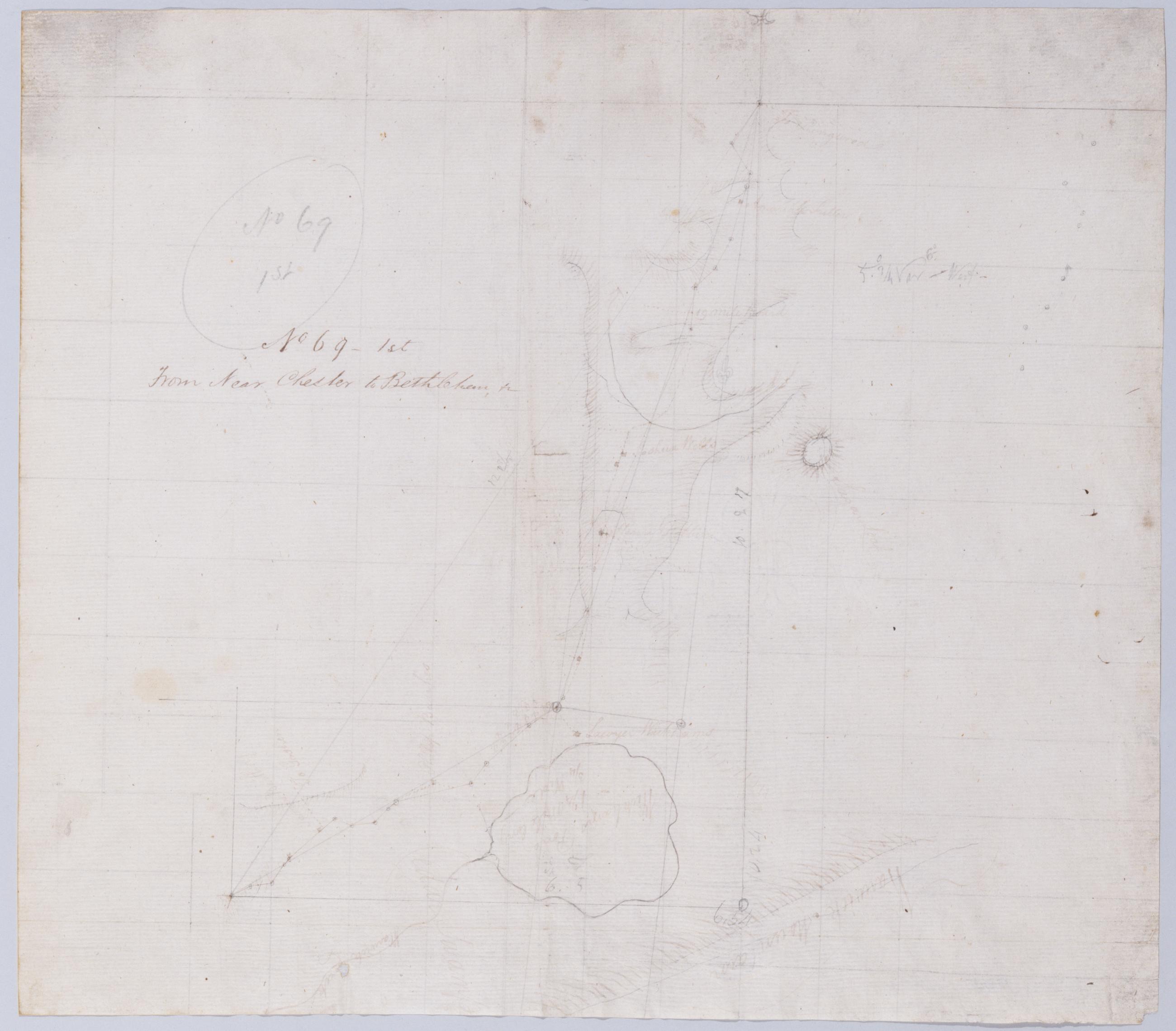
Cartographic From Near Chester to Bethlehem, +c. No 69-1st / by Robert Erskine F.R.S. Geogr. A. U.S. and Assistants. In pencil on recto: "No 69 1st". Military topographic map. Covers the townships of Chester and Warwick in Orange County, New York. Shows roads running through East Chester and Sugarloaf. Also shows buildings and owners' names, landforms and streams. Pen-and-ink, pencil on laid paper. Shows relief by hachures. Stained, foxed, creased and abraded. Mounted on cloth, bound and cropped, disbound and silked by subsequent owners. Cleaned after removal of backings 1999; some fill remains. Sheathed in mylar. View Item
Cartographic Projections for Closing, and trying the meeting of Surveys. No 99, D / Large paper by Capt. Scull ; by Robert Erskine F.R.S. Geogr. A. U.S. and Assistants. In ink on verso: "No. 99 D". In pencil on recto: "No 99 D". Military topographic map; an early draft. Covers Dutchess, Orange, Putnam, Rockland and Westchester counties in New York. Pen-and-ink, pencil on laid paper. Soiled, creased and abraded. Mounted on cloth, bound and cropped, disbound and silked by subsequent owners. Cleaned after removal of backings 1999; some fill remains. Sheathed in mylar. Title proper from recto is the work of a later editor--Simeon DeWitt or his assign--subsequent to 1820. View Item
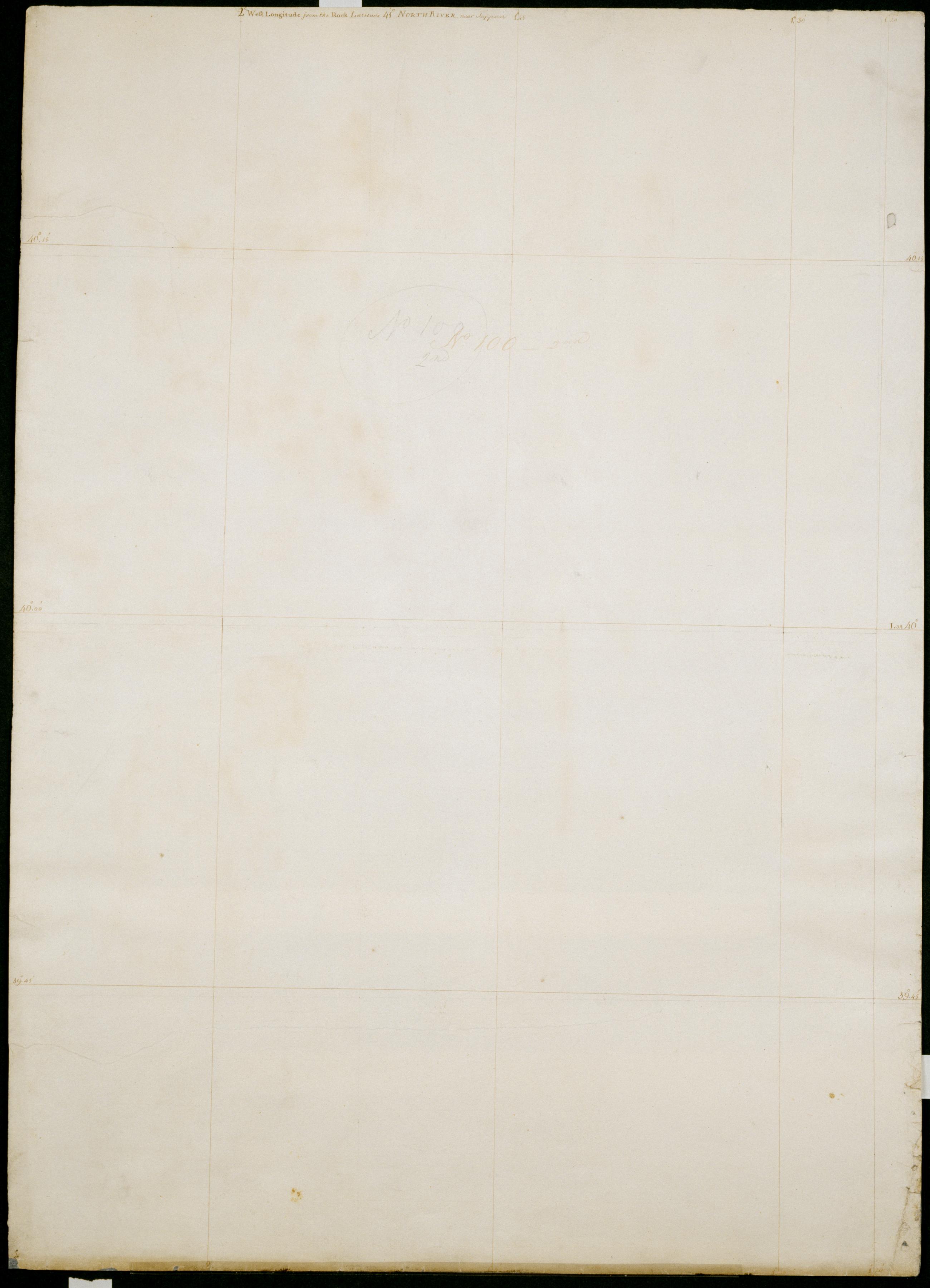
Cartographic Spherical Projections. No 100 / by R.E. ; by Robert Erskine F.R.S. Geogr. A. U.S. and Assistants, second sheet Collection of unfinished military topographic maps. The coordinates describe much of New Jersey but, aside from the coordinate grid itself, only small areas about Elizabethtown and Amboy, New Jersey, and about Warwick and Chester, New York, were ever mapped onto it. Title proper from recto of 1st sheet is the work of a later editor--Simeon DeWitt or his assign--subsequent to 1820. Index title, both statements of responsibility, date, scale statement, series title and series numbering by Erskine, but on separate index sheet filed at head of series. Pen-and-ink, pencil on laid paper. View Item
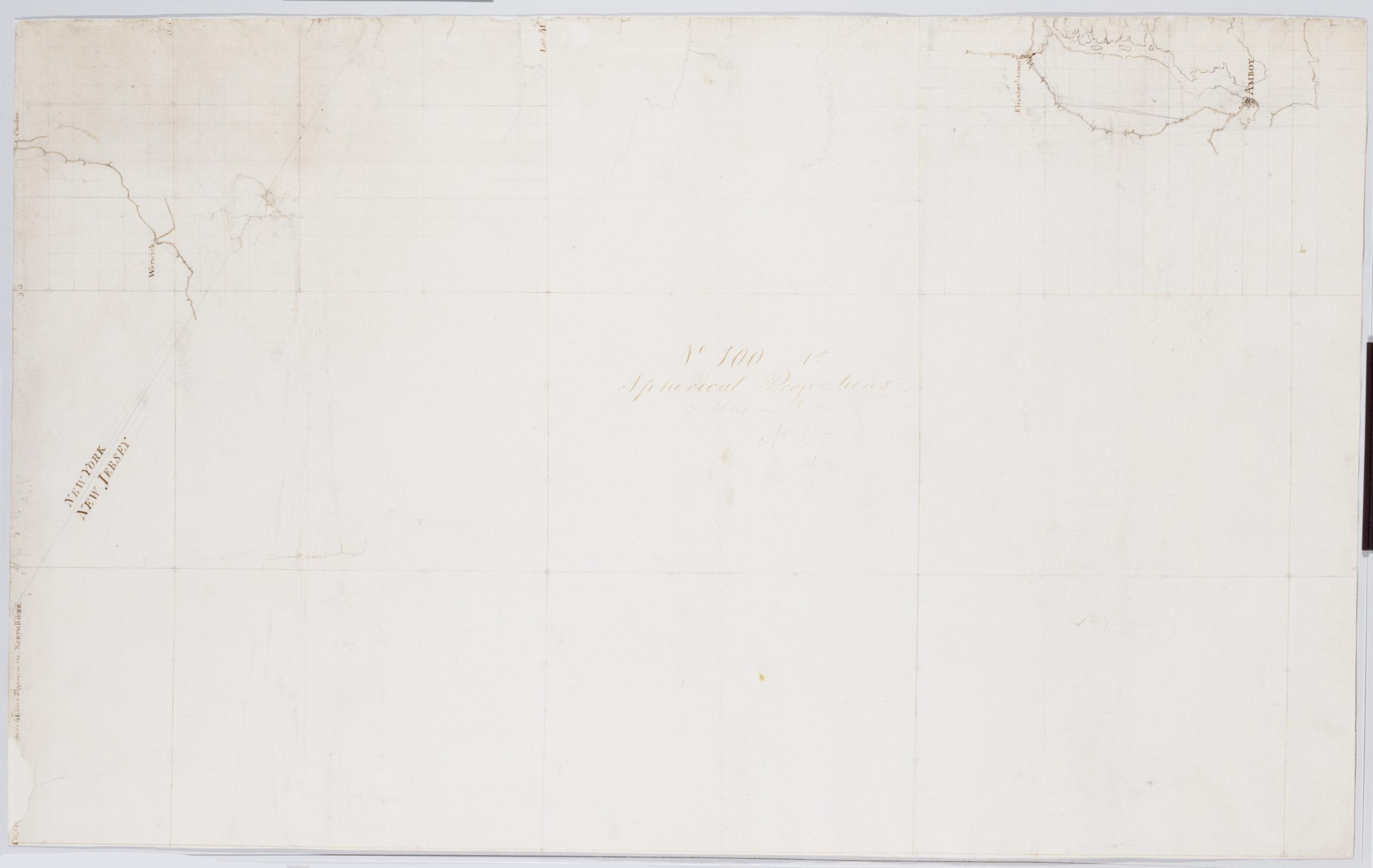
Cartographic Spherical Projections. No 100 / by R.E. ; by Robert Erskine F.R.S. Geogr. A. U.S. and Assistants, first sheet Collection of unfinished military topographic maps. The coordinates describe much of New Jersey but, aside from the coordinate grid itself, only small areas about Elizabethtown and Amboy, New Jersey, and about Warwick and Chester, New York, were ever mapped onto it. Title proper from recto of 1st sheet is the work of a later editor--Simeon DeWitt or his assign--subsequent to 1820. Index title, both statements of responsibility, date, scale statement, series title and series numbering by Erskine, but on separate index sheet filed at head of series. Pen-and-ink, pencil on laid paper. View Item
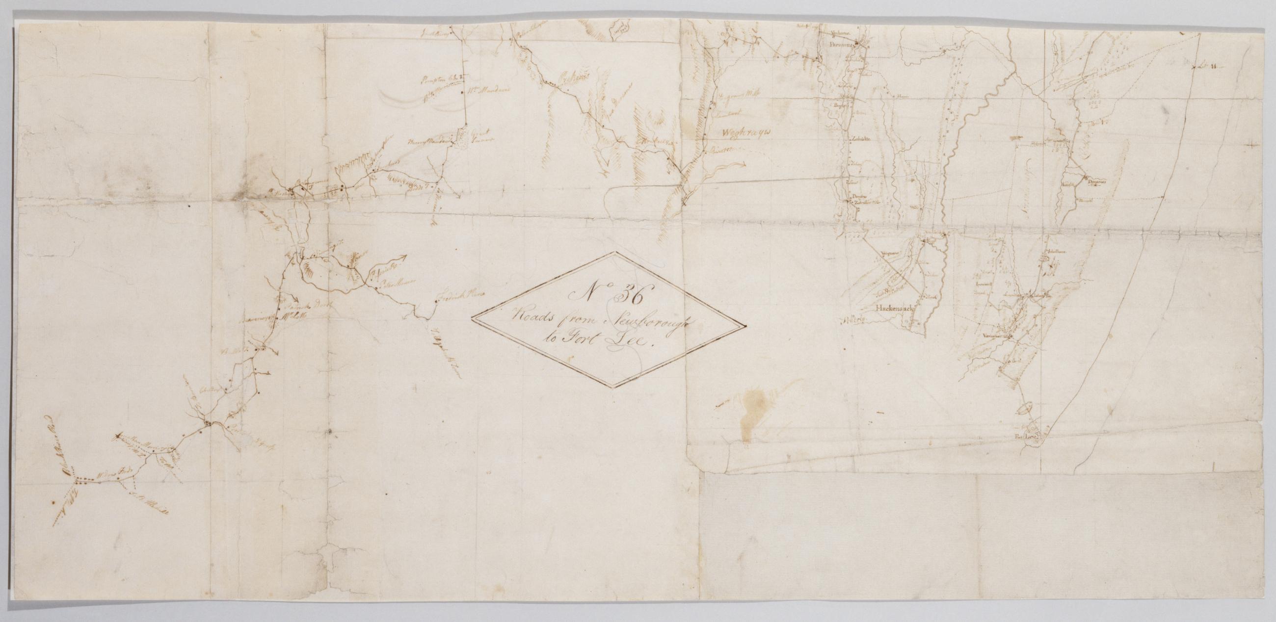
Cartographic Roads from Newborough to Fort Lee. No 36 / by Robert Erskine F.R.S. Geogr. A. U.S. and Assistants, bottom Military topographic map. Covers Orange and Rockland Counties in New York and Bergen, Passaic, Morris and Essex Counties in New Jersey. Shows roads, buildings and owners' names, also landforms, wetlands and streams. Shows relief by hachures. Title proper from recto is the work of a later editor--Simeon DeWitt or his assign--subsequent to 1820. Index title, statement of responsibility, date, series title and series numbering also by Erskine, but on separate index sheet filed at head of series. Pen-and-ink, pencil on laid paper. View Item
Cartographic Roads from Newborough to Fort Lee. No 36 / by Robert Erskine F.R.S. Geogr. A. U.S. and Assistants, top Military topographic map. Covers Orange and Rockland Counties in New York and Bergen, Passaic, Morris and Essex Counties in New Jersey. Shows roads, buildings and owners' names, also landforms, wetlands and streams. Shows relief by hachures. Title proper from recto is the work of a later editor--Simeon DeWitt or his assign--subsequent to 1820. Index title, statement of responsibility, date, series title and series numbering also by Erskine, but on separate index sheet filed at head of series. Pen-and-ink, pencil on laid paper. View Item
Cartographic Roads from Newborough to Fort Lee. No 36 / by Robert Erskine F.R.S. Geogr. A. U.S. and Assistants, center Military topographic map. Covers Orange and Rockland Counties in New York and Bergen, Passaic, Morris and Essex Counties in New Jersey. Shows roads, buildings and owners' names, also landforms, wetlands and streams. Shows relief by hachures. Title proper from recto is the work of a later editor--Simeon DeWitt or his assign--subsequent to 1820. Index title, statement of responsibility, date, series title and series numbering also by Erskine, but on separate index sheet filed at head of series. Pen-and-ink, pencil on laid paper. View Item
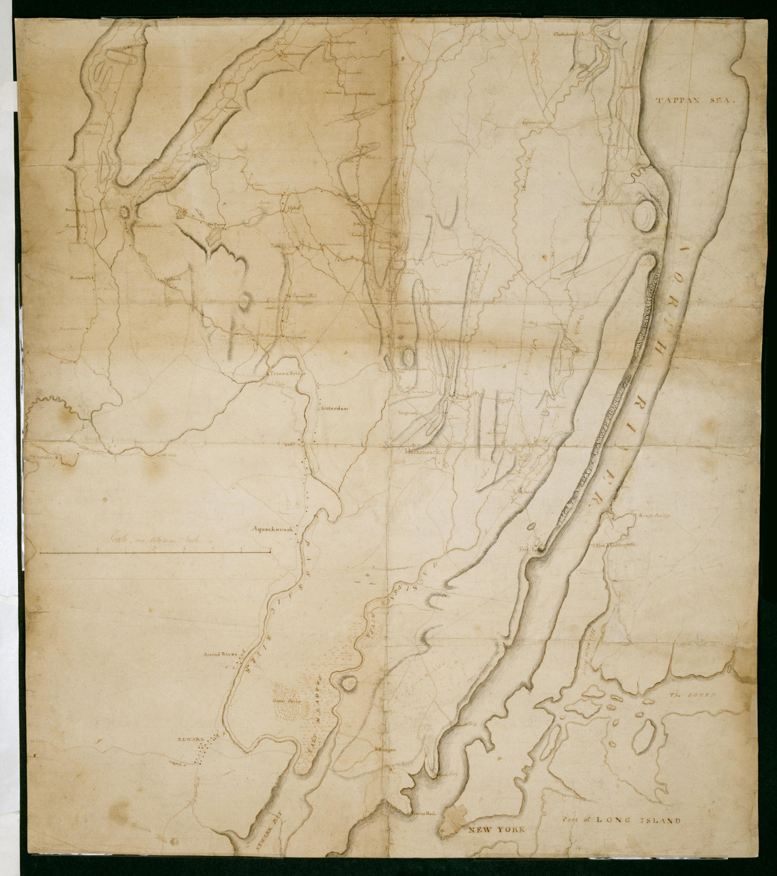
Cartographic Surveys Done for His Excy General Washington : 1778 & 1779 / by Robt Erskine F.R.S. Geogr to the Army & Assistants, second sheet Verso title: Map of North River made by Robt Erskine 1778 & 9. Second verso title: Map of part of the State of New York. Military topographic map; not listed in Heusser nor Guthorn. Covers the counties of Orange and Rockland in New York and of Passaic, Bergen, Hudson and Essex in New Jersey. Shows some roads; map appears to be incomplete in this respect as of date given. Also shows some buildings and owners' names, landforms and streams. Shows relief by hachures. Title proper and statement of responsibility from recto is original. Titles on verso are later. View Item