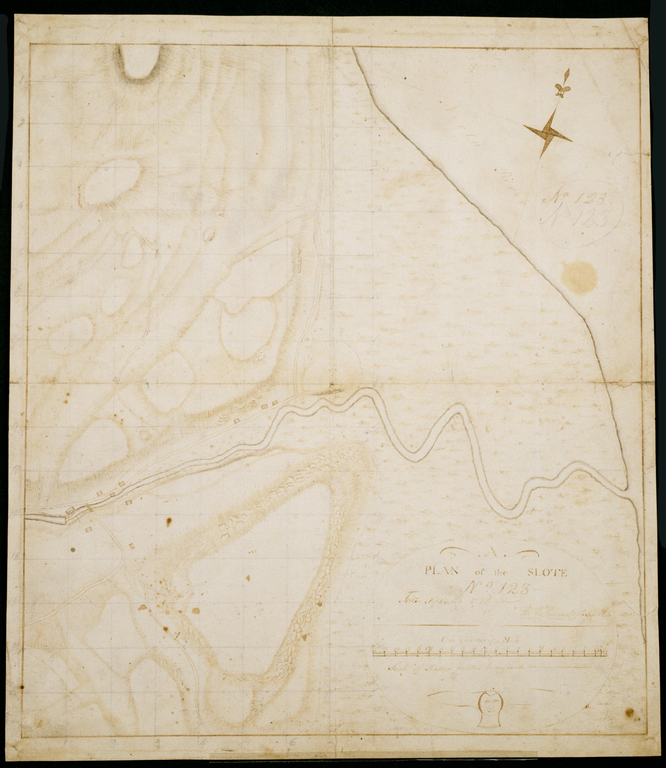
Cartographic Plan of the Slote No 123 / Taken September 1780 Wm. Mc'Murray Capt. P.M. ; by Robert Erskine F.R.S. Geogr. A. U.S. and Assistants. In both ink and pencil on recto: "No 123." Same text in ink on verso. Lengthy pencil text on verso illigible. Military topographic map. Covers the township of Orangetown in Rockland County, New York. Shows roads running through Piermont and Sparkill. Also shows buildings, landforms and streams. Original title proper and first statement of responsiblity from map recto. Index title, second statement of responsibility, series title and series numbering contemporaneous, but on separate index sheet filed at head of series. This sheet bears no title on map verso. Pen-and-ink, pencil on laid paper. View Item
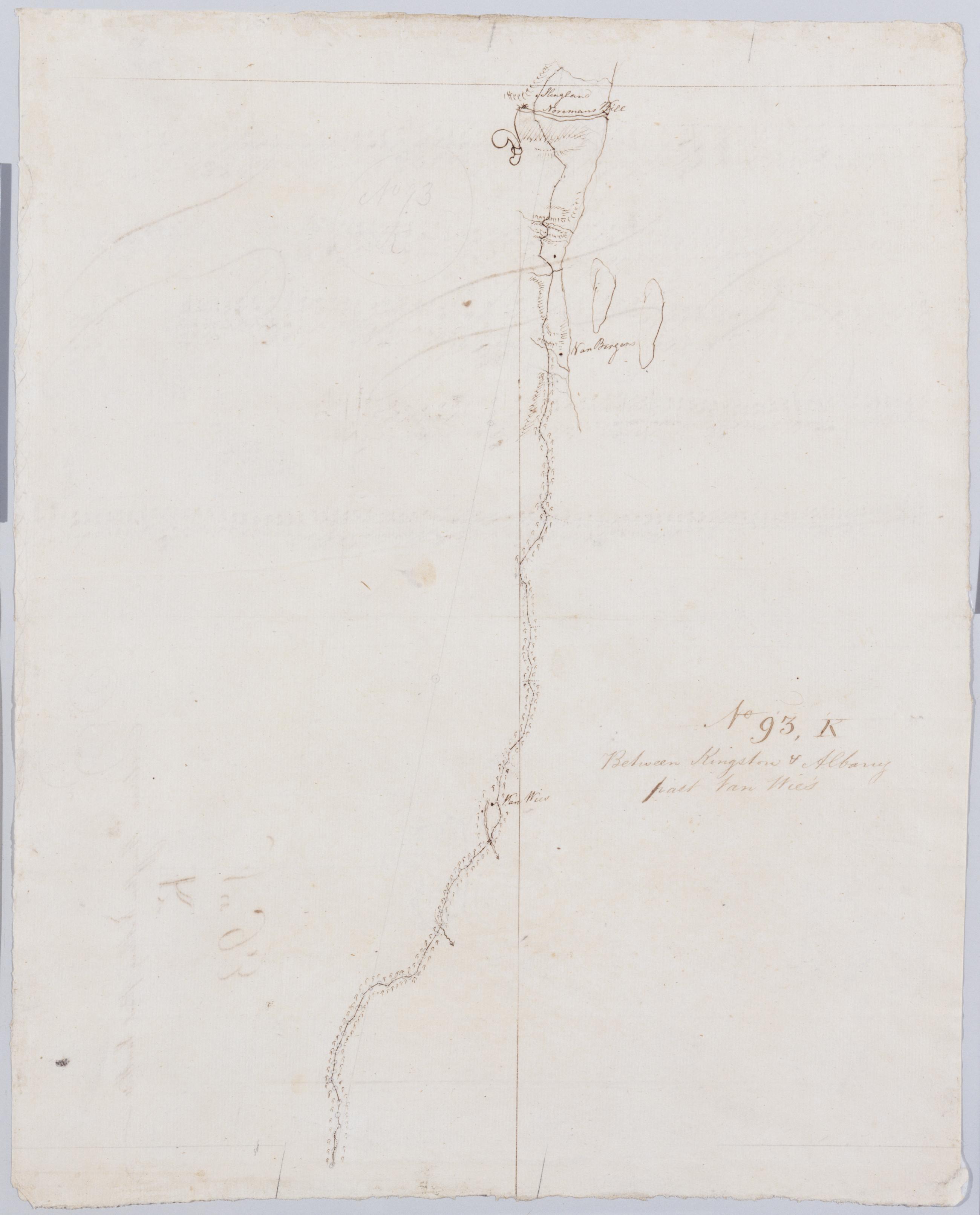
Cartographic Between Kingston + Albany past Van Wie's. No 93, K / by Robert Erskine F.R.S. Geogr. A. U.S. and Assistants. Foxed, stained, soiled, creased and abraded. Mounted on cloth, bound and cropped, disbound and silked by subsequent owners. Cleaned after removal of backings 1999; some fill remains. Sheathed in mylar. In ink on verso: "K K K". In pencil on recto: "No 93 K". Military topographic map. Covers the townships of Coeyman and Bethlehem in Albany County, New York. Shows roads running through Cedar Hill and Glenmont. Also shows buildings and owners' names, landforms and streams. Pen-and-ink, pencil on laid paper. Shows relief by hachures. View Item
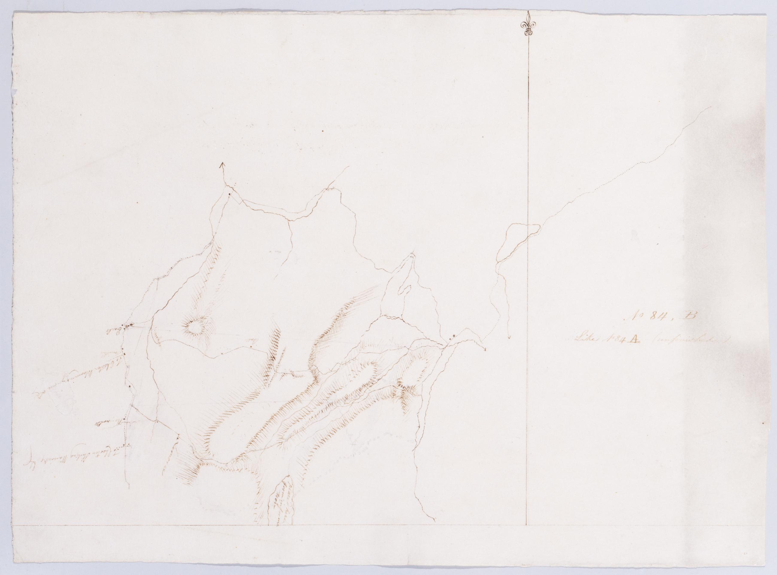
Cartographic Like No 84 A (unfinished) No 84, B / by Robert Erskine F.R.S. Geogr. A. U.S. and Assistants. In ink on verso: "No. 84. B." Military topographic map. Covers the townships of Highland and Woodbury in Orange County, New York. Shows more land to the west than does sheet 84,A. Also shows roads, buildings and owners' names, also landforms and streams. Pen-and-ink, pencil on laid paper. Shows relief by hachures. Soiled and abraded. Mounted on cloth, bound, disbound and silked by subsequent owners. Cleaned after removal of backings 1999; some fill remains. Sheathed in mylar. Title proper from recto is the work of a later editor--Simeon DeWitt or his assign--subsequent to 1820. View Item
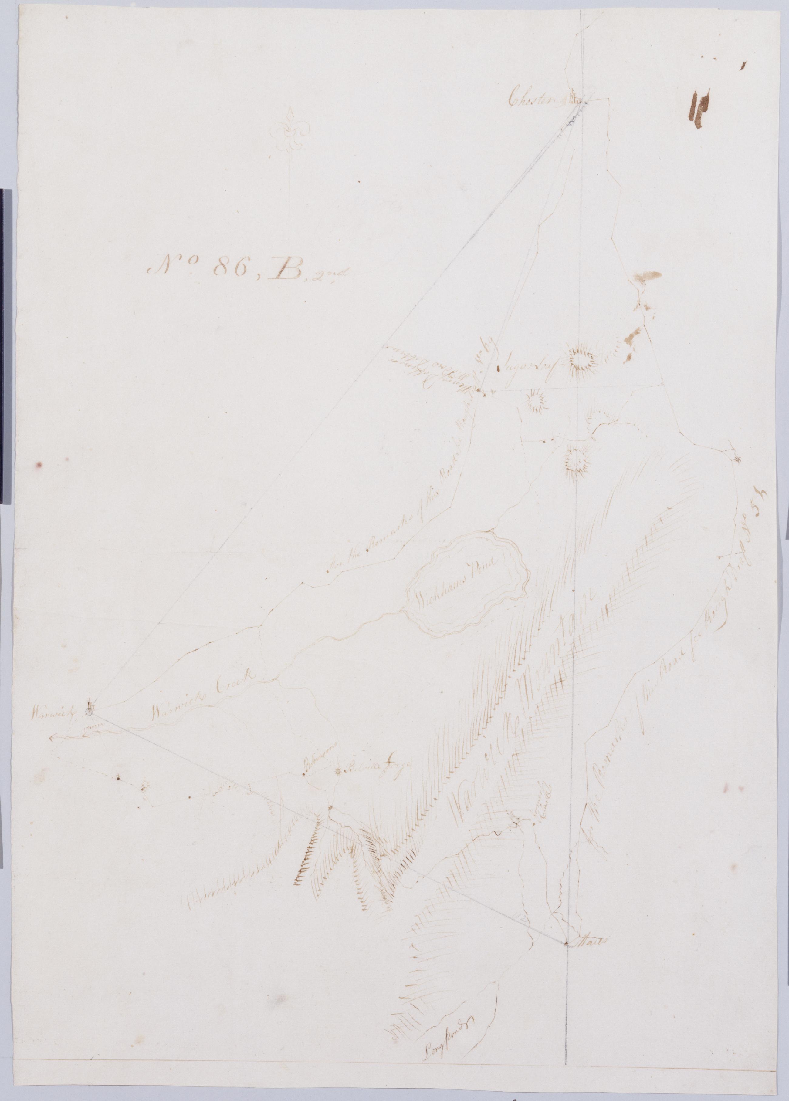
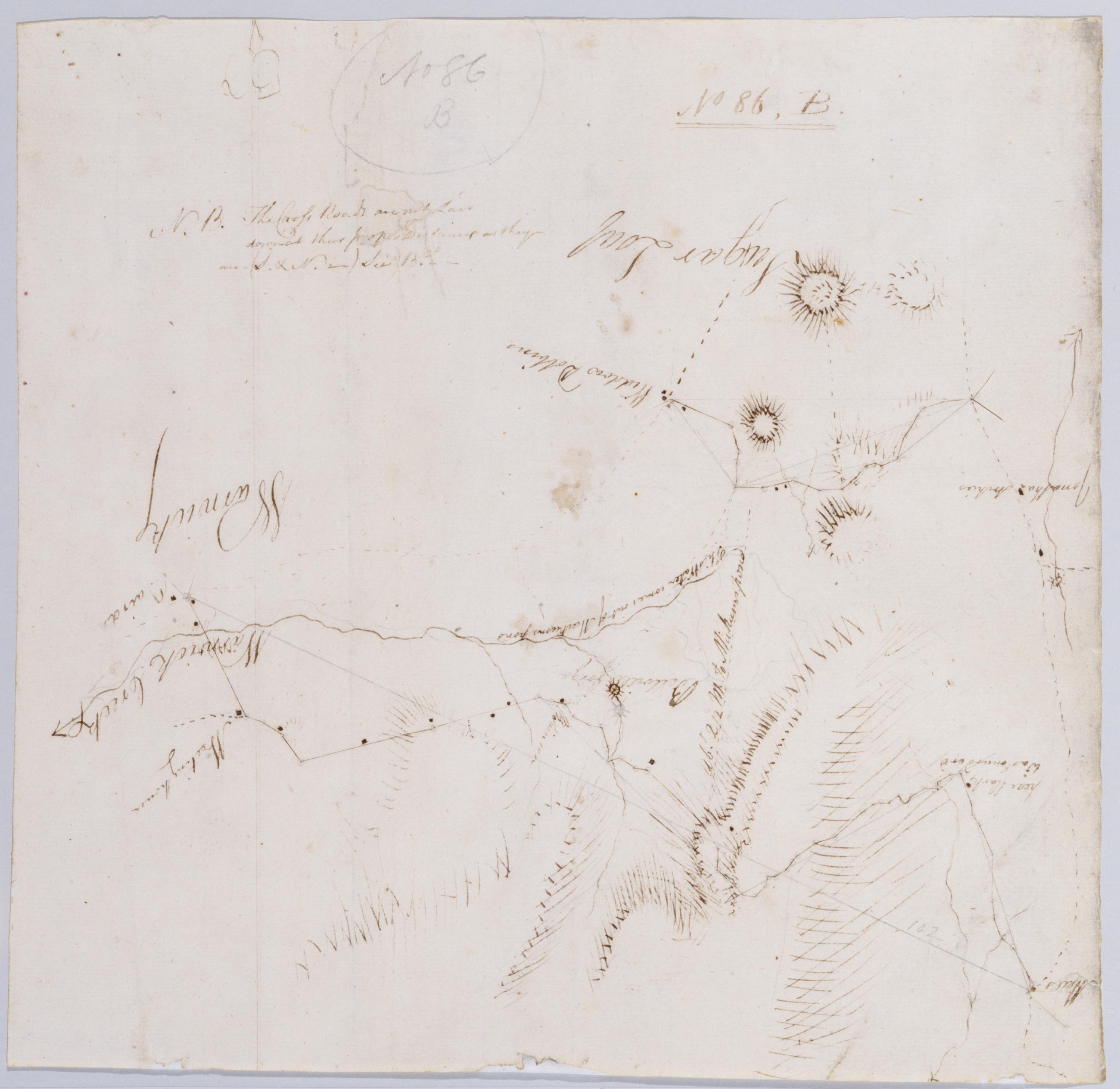
Cartographic From Junes to Arches & Warwich A. B & B2nd. No 86, B, 2nd by Robert Erskine F.R.S. Geogr. A. U.S. and Assistants [rev. ed.]. In ink on recto: "No. 86. B2d". Includes texts. To the east, "for the Remarks of the Road see Rough Draft No 5[1]." To the west, "For the Remarks of this Road See Rough Draft No 69." Military topographic map. Covers the townships of Chester and Warwick in Orange County, New York. Shows roads running through East Chester, Sugarloaf, Warwick, Bellvale, Mt. Peter and Dutch Hollow. Also shows buildings and owners' names, landforms and streams. No title on map recto or verso. View Item
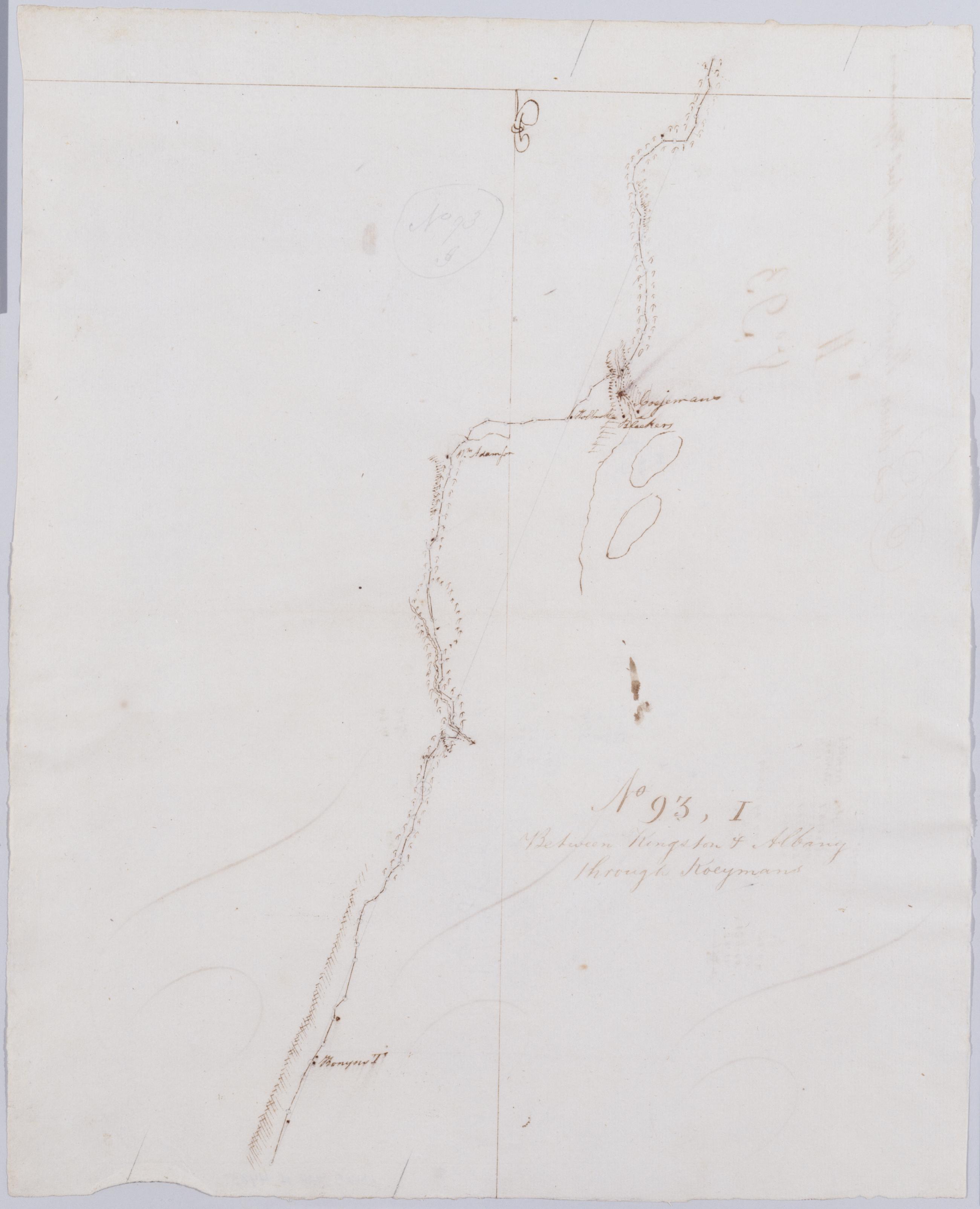
Cartographic Between Kingston + Albany thro' Koeymans. No 93, I / by Robert Erskine F.R.S. Geogr. A. U.S. and Assistants. Foxed, stained, creased and abraded. Mounted on cloth, bound and cropped, disbound and silked by subsequent owners. Cleaned after removal of backings 1999; some fill remains. Sheathed in mylar. In ink on verso: "I I I". In pencil on recto: "No 93 I". Military topographic map. Covers the townships of New Baltimore in Green County and of Coeyman in Albany County, New York. Shows roads running through Ravena and Coeyman. Also shows buildings and owners' names, landforms and streams. Pen-and-ink, pencil on laid paper. Shows relief by hachures. View Item
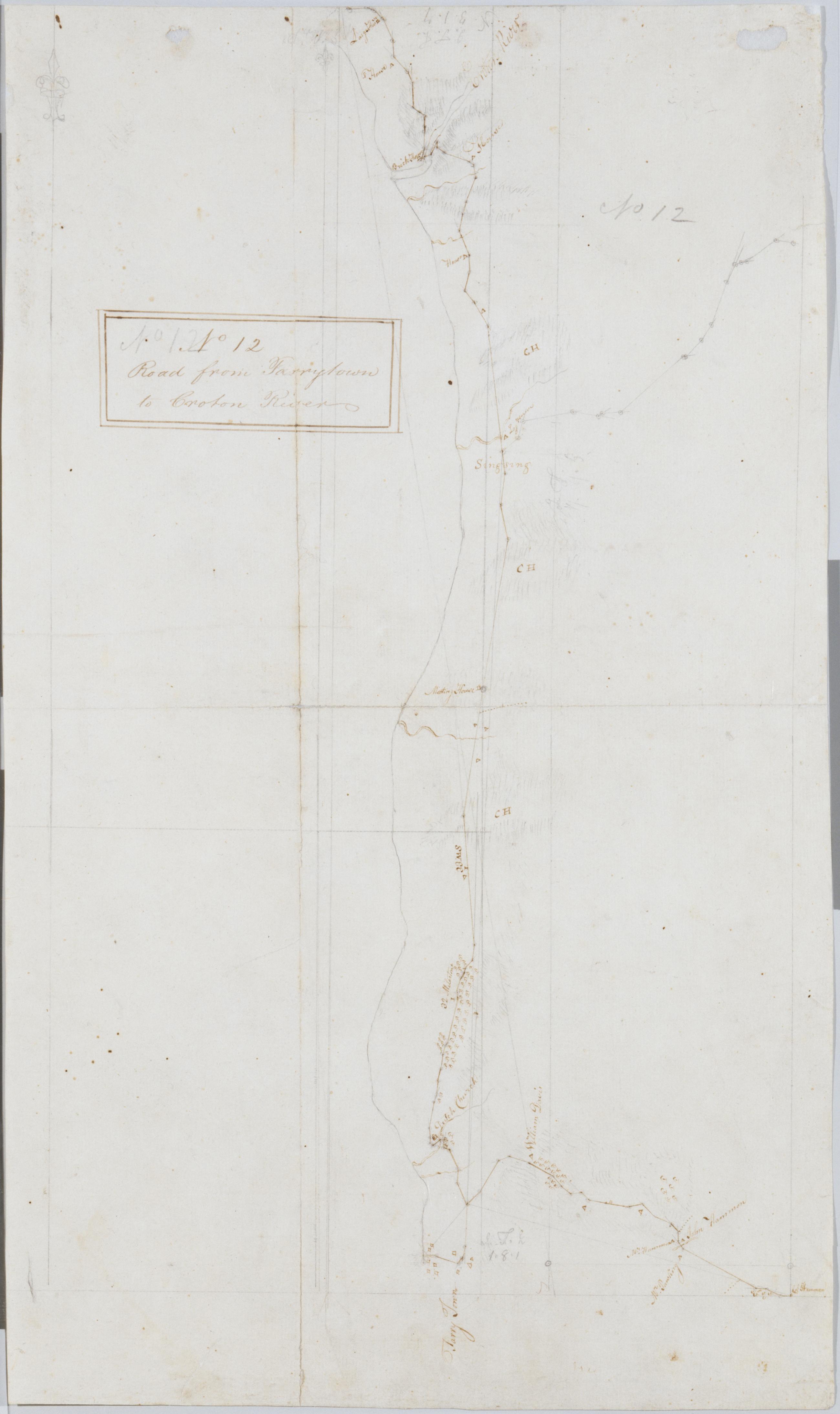
Cartographic Road from Tarrytown to Croton River. No 12 / by Robert Erskine F.R.S. Geogr. A. U.S. and Assistants. Foxed, creased, frayed and abraded. Mounted on cloth, bound and cropped, disbound and silked by subsequent owners. Cleaned after removal of backings 1999; some fill remains. Sheathed in mylar. Military topographic map. Covers the towns of Mt. Pleasant, Ossining and Cortlandt on the left bank of the Hudson River in Westchester County, New York. Shows roads running through Eastview, Tarrytown, Ossining and Croton. Also shows buildings and owners' names, landforms and streams. Pen-and-ink, pencil on laid paper. Shows relief by hachures. View Item
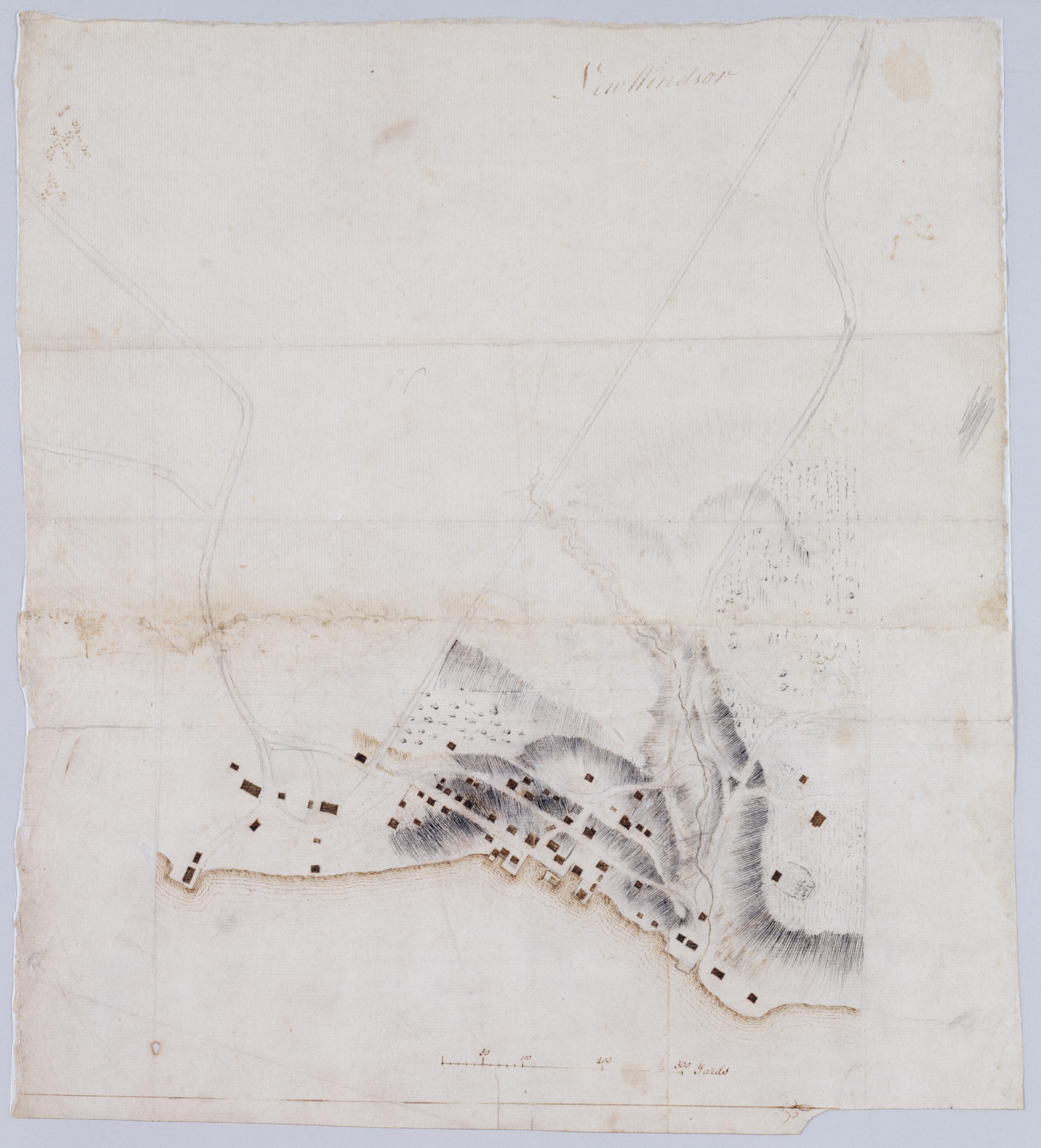
Cartographic New Windsor. In pencil on verso: "for F De Peyster Esq." DePeyster was a 19th century official of the New York Historical Society. Military topographic map. Covers the village of New Windsor and surrounding area in the town of New Windsor, Orange County, New York. Shows roads, buildings and landforms. Pen-and-ink, pencil on laid paper. Shows relief by hachures. Soiled and stained, creased, frayed and abraded. Mounted on cloth, bound and cropped, disbound and silked by subsequent owners. Cleaned after removal of backings 1999; some fill remains. Re-lined with China paper. Sheathed in mylar. View Item
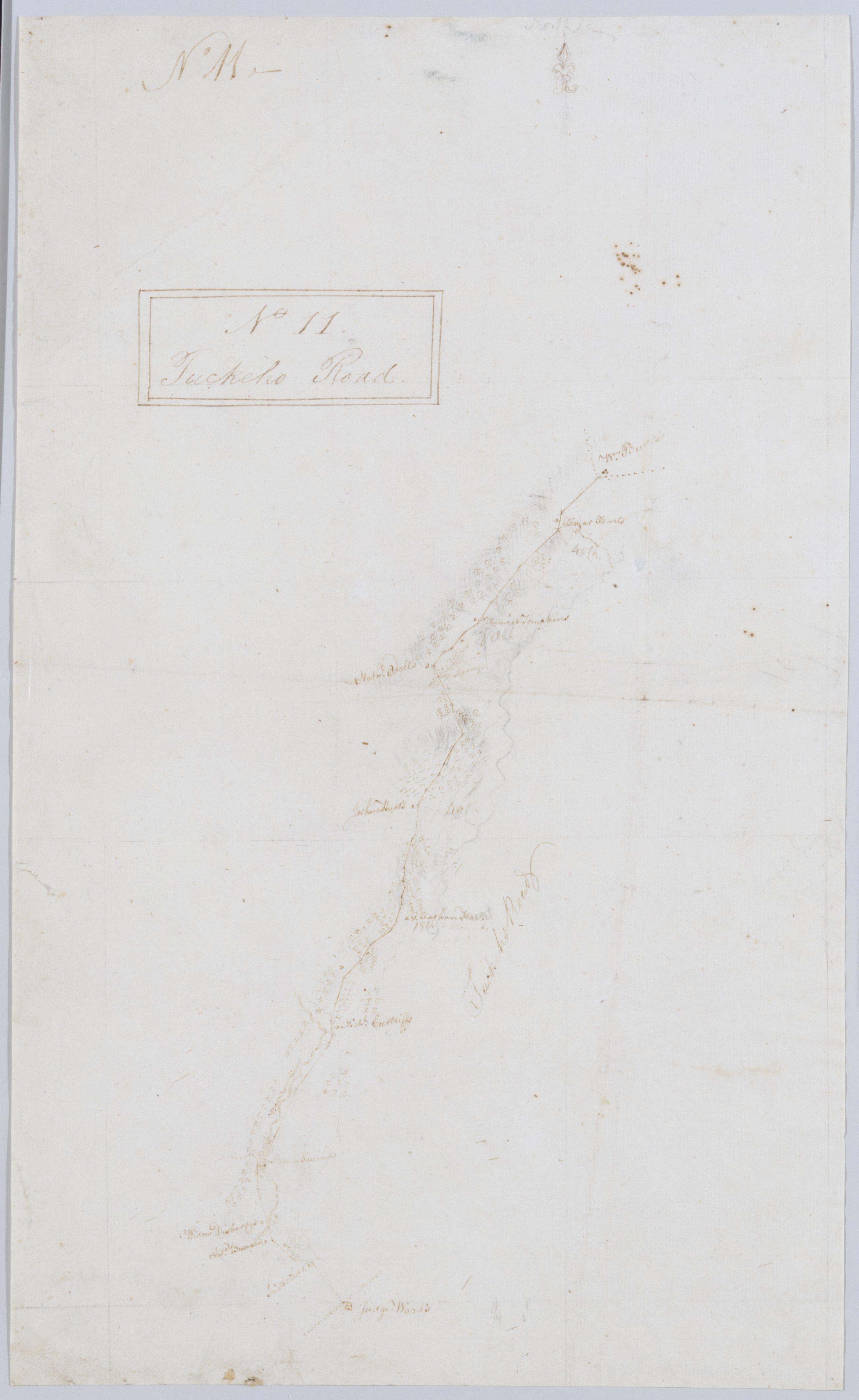
Cartographic Tuckeho Road. No 11 / by Robert Erskine F.R.S. Geogr. A. U.S. and Assistants. Coordinates approximate. Orientation of map unknown. Foxed, creased and abraded. Mounted on cloth, bound and cropped, disbound and silked by subsequent owners. Cleaned after removal of backings 1999; some fill remains. Sheathed in mylar. In ink on recto and verso: "No. 11" In pencil on verso: "No 11." Military topographic map. Covers a small area in southern Westchester County, New York; shows road running through White Plains, Scarsdale and Tuckahoe; the "Younkers River" was later Troublesome Brook. Map shows roads and owners' names; also landforms. Pen-and-ink, pencil on laid paper. View Item
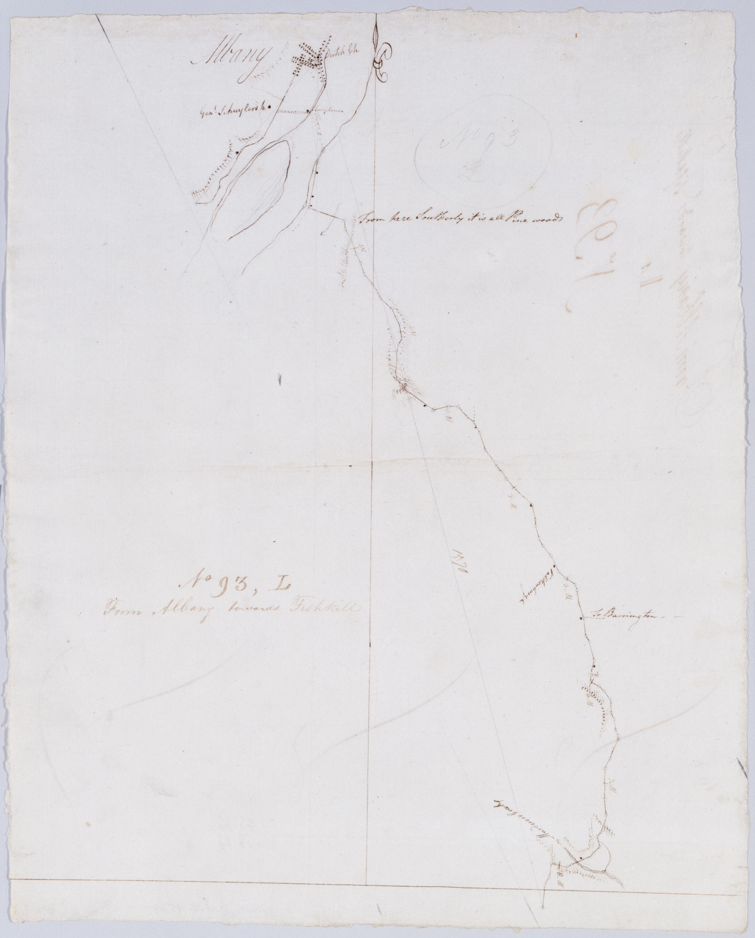
Cartographic From Albany towards Fishkill. No 93, L / by Robert Erskine F.R.S. Geogr. A. U.S. and Assistants. In ink on verso: "L L L". In pencil on recto: "No 93 L". Military topographic map. Covers the townships of Bethlehem in Albany County, East Greenbush and Schodack in Rensselaer County, New York. Shows roads running through Albany, East Greenbush and Schodack Center. Also shows buildings and owners names, landforms and streams. Pen-and-ink, pencil on laid paper. Shows relief by hachures. Stained, soiled, creased and abraded. Mounted on cloth, bound, disbound and silked by subsequent owners. Cleaned after removal of backings 1999; some fill remains. Sheathed in mylar. View Item
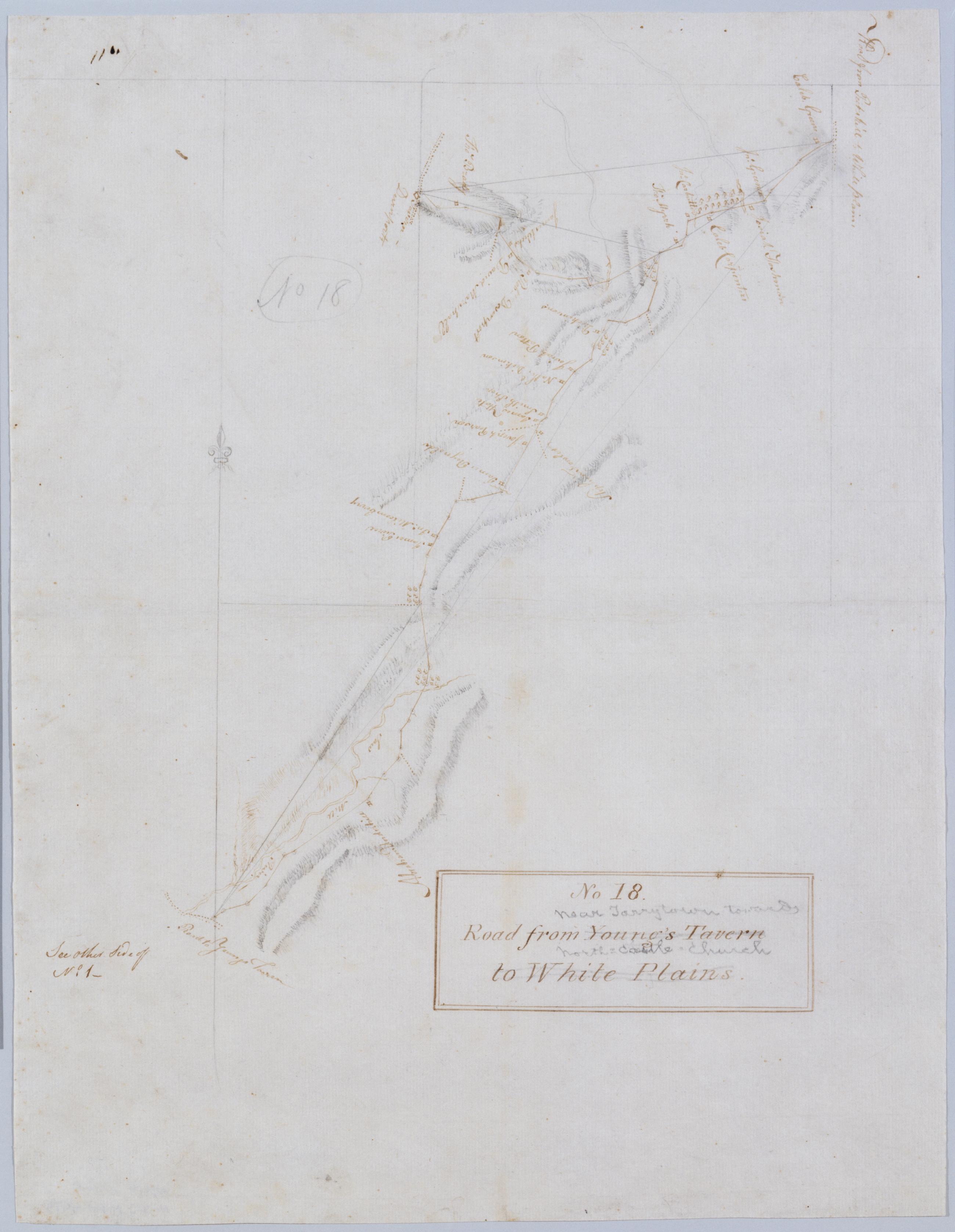
Cartographic Road from Young's Tavern to White Plains. No 18 / by Robert Erskine F.R.S. Geogr. A. U.S. and Assistants. Foxed, creased and abraded. Mounted on cloth, bound and cropped, disbound and silked by subsequent owners. Cleaned after removal of backings 1999; some fill remains. Sheathed in mylar. In ink on verso: "No. 18". In pencil on recto: "No 18". Includes text: "See other Side of No. 1--". Military topographic map. Covers an area in the town of Mount Pleasant, Westchester County, New York. Shows roads running through Neperan, Sherman Park, Pleasantville, Chappaqua and Newcastle. Also shows buildings and owners' names, landforms and streams. Pen-and-ink, pencil on laid paper. View Item
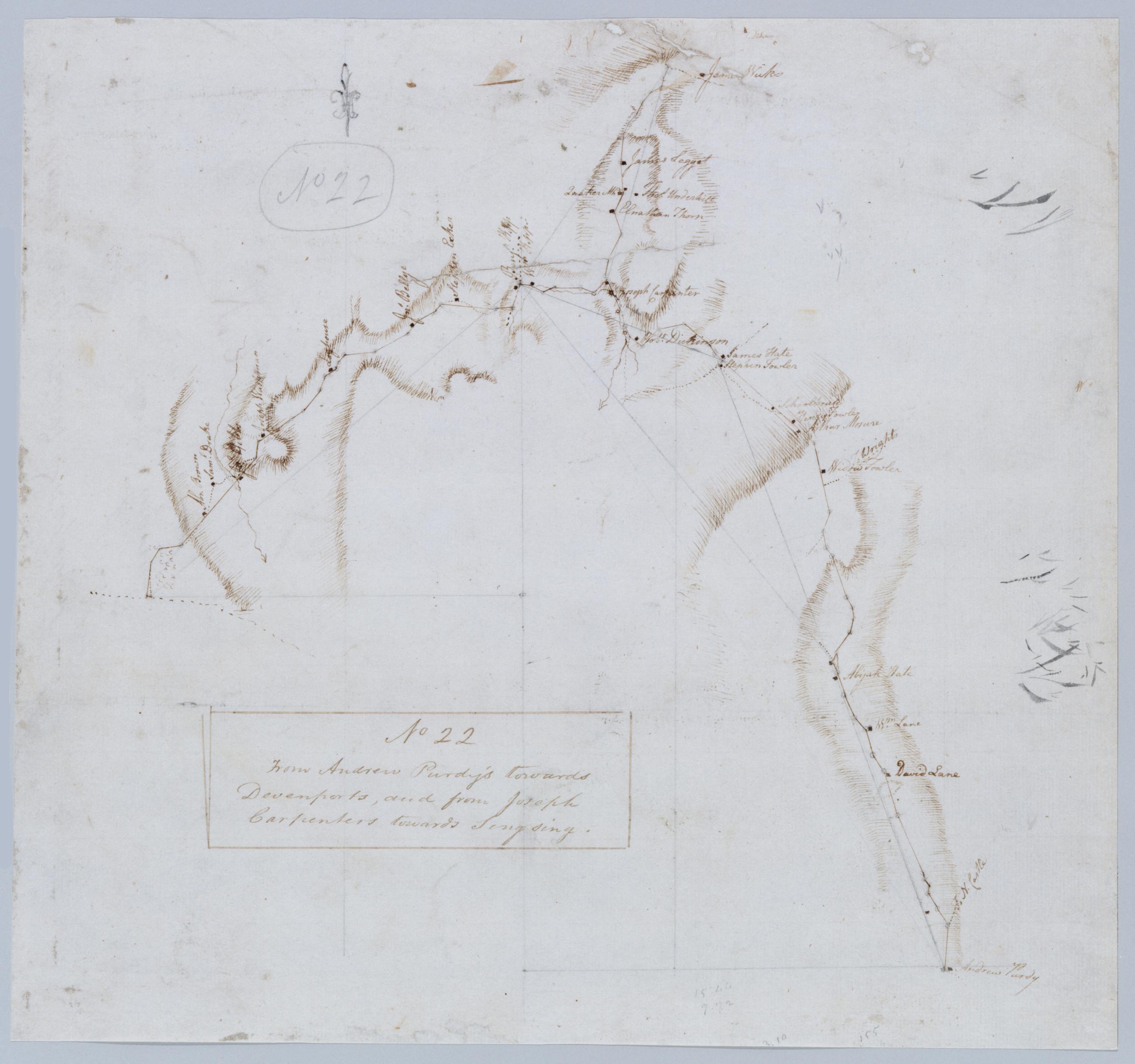
Cartographic From Andrew Purdy's towards Devenports, and from Joseph Carpenters towards Singsing. No 22 / by Robert Erskine F.R.S. Geogr. A. U.S. and Assistants. Foxed, creased, frayed, and abraded. Mounted on cloth, bound and cropped, disbound and silked by subsequent owners. Cleaned after removal of backings 1999; some fill remains. Sheathed in mylar. In pencil on recto, in ink on verso: "No 22". Military topographic map. Covers the towns of Ossining, Newcastle and North Castle in Westchester County, New York. Shows roads running through Briarcliff Manor and Chappaqua. Also shows buildings and owners' names, landforms and streams. Pen-and-ink, pencil on laid paper. Shows relief by hachures. View Item
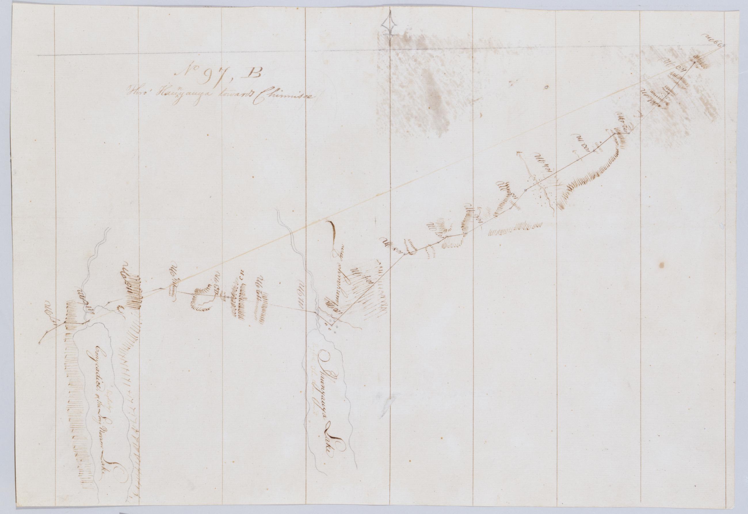
Cartographic Thro' Kaunyauya towards Chinnisee. No 97, B / by Robert Erskine F.R.S. Geogr. A. U.S. and Assistants. In erased pencil on recto, "No 97 B". Military topographic map. Covers the towns of Canandaigua, Bristol and Richmond in Ontario County and of Livonia in Livingston County, New York. Shows roads running through Canandaigua, Vicent, Honeoye and Glenville. Also shows landforms and streams. Hemlock formerly Conesus Lake is incorrectly labeled as Conycadice Lake. Pen-and-ink, pencil on laid paper. Shows relief by hachures. Stained, creased and abraded. Mounted on cloth, cropped, bound, disbound and silked by subsequent owners. Cleaned after removal of backings 1999; some fill remains. View Item
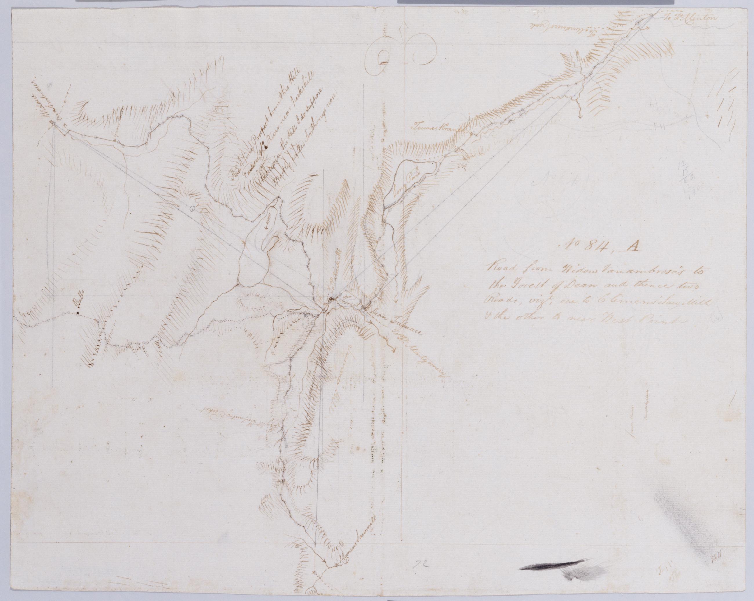
Cartographic Road from Widow Vanambrose's to the Forest of Dean and thence two Roads, vizt, one to Clemens' Saw-Mill + the other to near West Point. No 84, A / by Robert Erskine F.R.S. Geogr. A. U.S. and Assistants. In pencil on recto: "No [8]4". Includes brief text. Military topographic map. Covers the townships of Highland and Woodbury in Orange County, New York. Shows roads, buildings and owners' names, also landforms and streams. Pen-and-ink, pencil on laid paper. Shows relief by hachures. Stained, creased and abraded. Mounted on cloth, bound and cropped, disbound and silked by subsequent owners. Cleaned after removal of backings 1999; some fill remains. Sheathed in mylar. Title proper from recto is the work of a later editor--Simeon DeWitt or his assign--subsequent to 1820. View Item
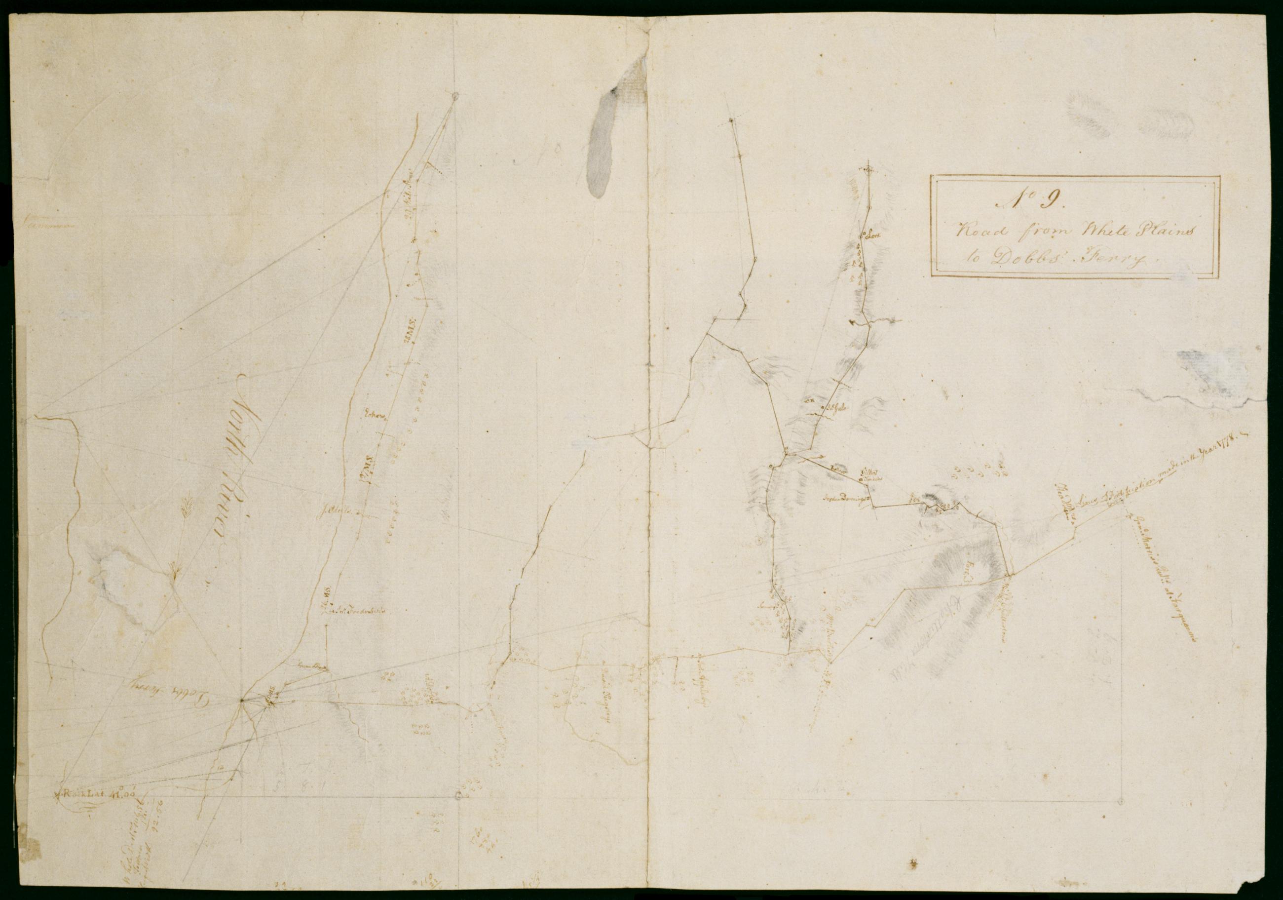
Cartographic Road from White Plains to Dobbs' Ferry. No 9 / by Robert Erskine F.R.S. Geogr. A. U.S. and Assistants ; F.R.S. & G.H.E.G.W & A.U.S W. Scull M.A.P.S. & A G H E G W & A U S Member of the American [P]hilosop[ical Society] & Assistant Geographer to his Exc[el In faint pencil on verso: "Capt Sc ..." The remainder of this text was lost in cropping. In ink on verso: "No. 9--". Includes text: "Lines of Fortification made in the year 1778," "Genl. Morriss Qutrs. at Farguoner's." Military topographic map. Covers an area in southern Westchester County, New York. Shows roads running through Tarrytown, Irvington, Abbotsford, Dobbs Ferry, Ardsley, Elmsford, Harts Corners and White Plains. Also show buildings and owners' names; landforms and streams. View Item
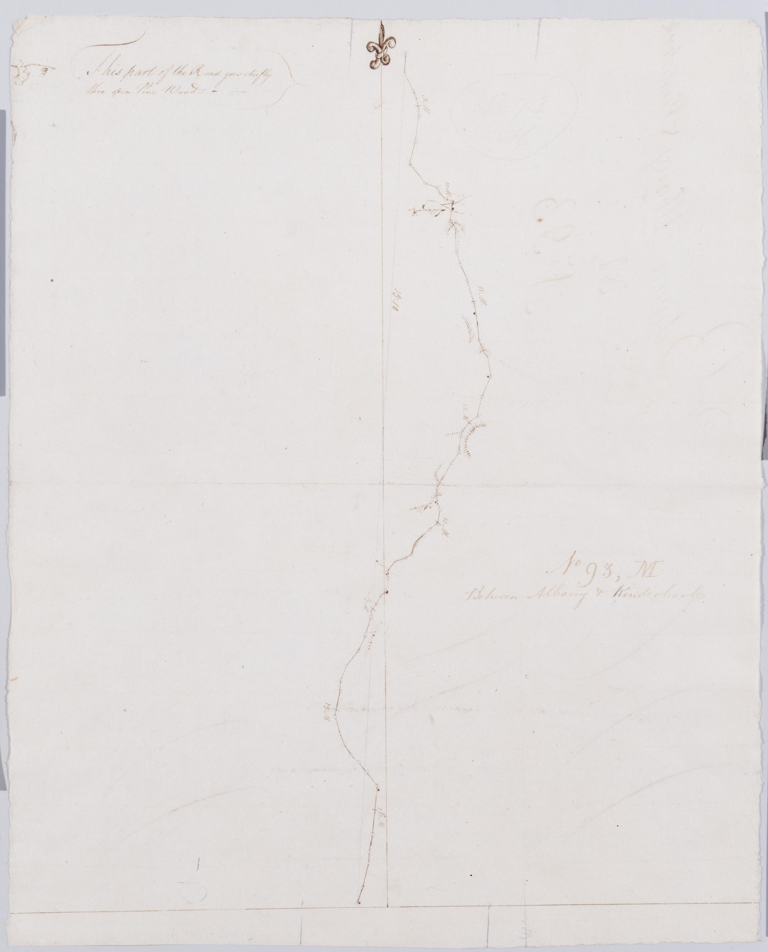
Cartographic Between Albany + Kinderhook. No 93, M / by Robert Erskine F.R.S. Geogr. A. U.S. and Assistants. Creased and abraded. Mounted on cloth, bound, disbound and silked by subsequent owners. Cleaned after removal of backings 1999; some fill remains. Sheathed in mylar. In ink on verso: "M M M". Note unusual but inconsistent letter formation. In pencil on recto: "No 93 M". Military topographic map. Covers the townships of Schodack in Rensselaer County and of Kinderhook in Columbia County, New York. Also shows buildings and owners names, landforms and streams. Pen-and-ink, pencil on laid paper. Shows relief by hachures. View Item
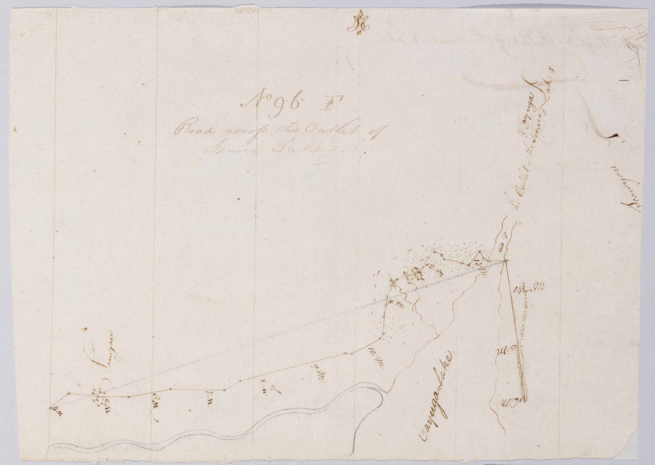
Cartographic Road across the Outlet of Seneca Lake. No 96 F / by Robert Erskine F.R.S. Geogr. A. U.S. and Assistants. In erased pencil on recto, "No 96 F". Military topographic map. Covers the towns of Springport and Aurelius in Cayuga County and of Seneca Falls in Seneca County, New York. Shows roads running through Waterloo, Seneca Falls and Cayuga. Also shows landforms and streams. Pen-and-ink, pencil on laid paper. Scale statement from verso of sheet 96,A. Shows relief by hachures. Soiled, creased and abraded. Mounted on cloth, cropped, bound, disbound and silked by subsequent owners. Cleaned after removal of backings 1999; some fill remains. Sheathed in mylar. View Item
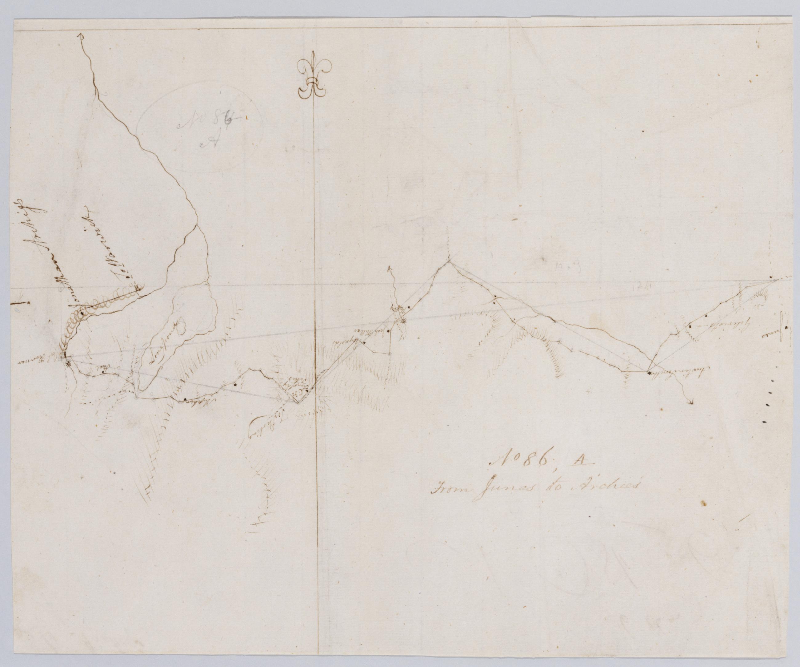
Cartographic From Junes to Archies. No 86, A / by Robert Erskine F.R.S. Geogr. A. U.S. and Assistants. In ink on verso: "es to Archie's A," "No. 86. A," "86 a". In pencil on recto: "No 86-A" was originally written "No 84-A". Military topographic map. Covers the townships of Chester, Monroe and Woodbury in Orange County, New York. Shows roads running through Turners. Also shows buildings and owners' names, landforms and streams. Pen-and-ink, pencil on laid paper. Shows relief by hachures. Soiled, stained and abraded. Mounted on cloth, bound and cropped, disbound and silked by subsequent owners. Cleaned after removal of backings 1999; some fill remains. Sheathed in mylar. View Item
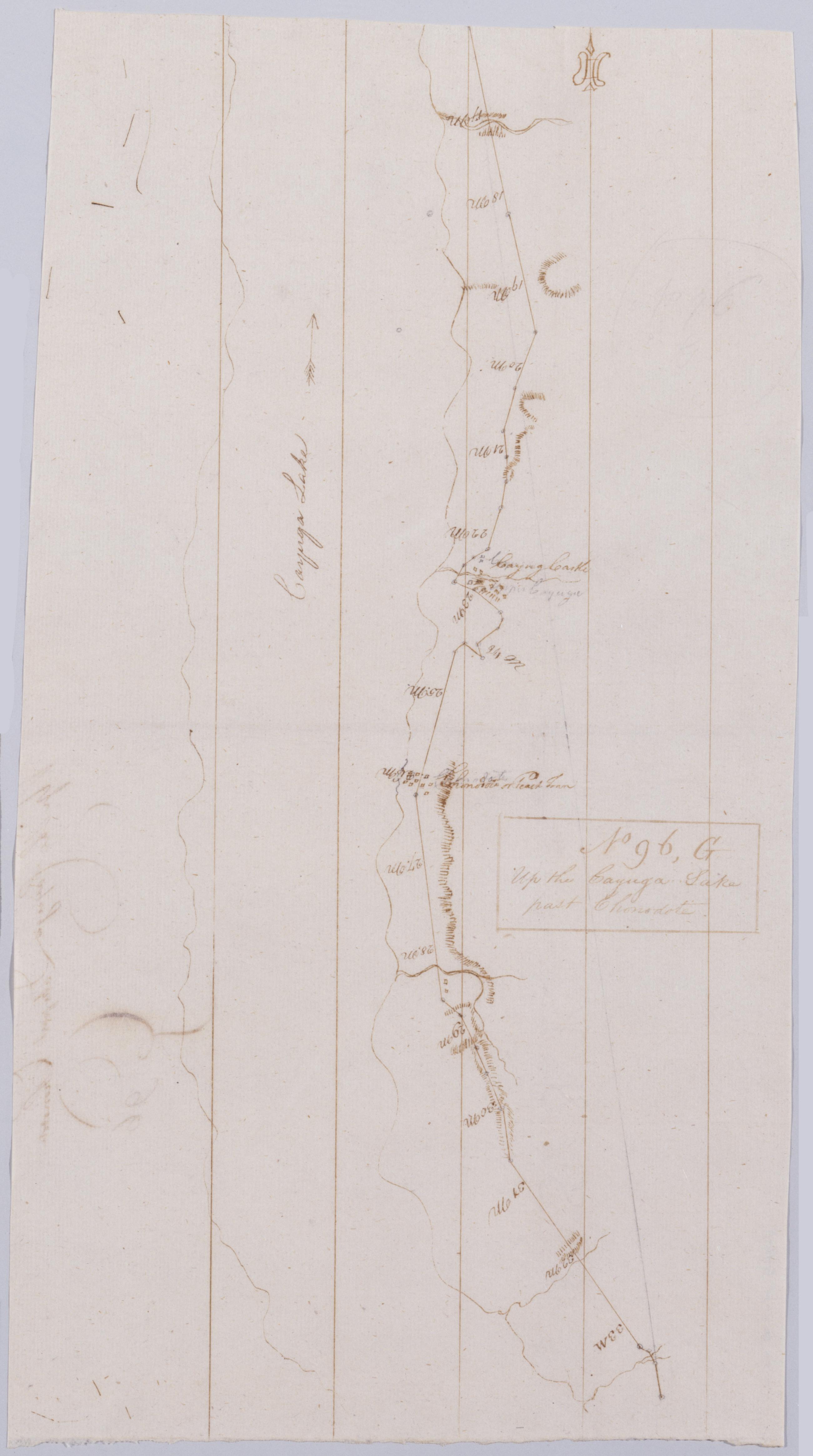
Cartographic Up the Cayuga Lake past Chnodote. No 96, G / by Robert Erskine F.R.S. Geogr. A. U.S. and Assistants. In erased pencil on recto, "No 96 G". Military topographic map. Covers the towns of Genoa, Ledyard and Springport in Cayuga County, New York. Shows roads running through Cayuga, Union Springs and Black Rock. Also shows landforms and streams. Pen-and-ink, pencil on laid paper. Scale statement from verso of sheet 96,A. Shows relief by hachures. Soiled, creased and abraded. Mounted on cloth, cropped, bound, disbound and silked by subsequent owners. Cleaned after removal of backings 1999; some fill remains. Sheathed in mylar. View Item
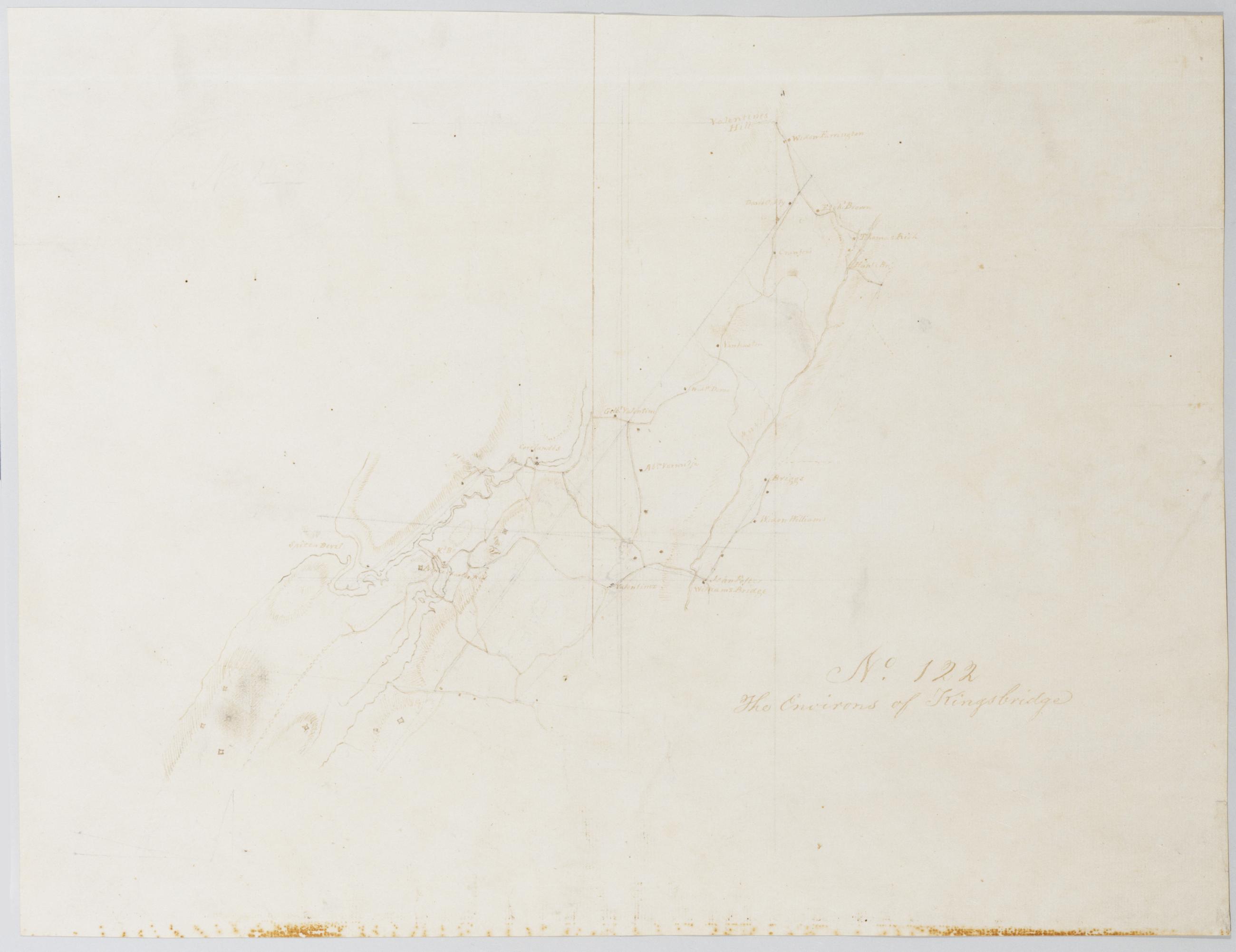
Cartographic The Environs of Kingsbridge. No. 122 / by Robert Erskine F.R.S. Geogr. A. U.S. and Assistants. Foxed, strongly stained, creased and abraded. Mounted on cloth, bound and cropped, disbound and silked by subsequent owners. Cleaned after removal of backings 1999; some fill remains. Sheathed in mylar. In pencil on recto: "No 122". Military topographic map. Covers an area now within New York City and Yonkers, New York. Shows buildings and owners' names, landforms and streams. Pen-and-ink, pencil on laid paper. Shows relief by hachures. Title proper from recto and pencilled title on verso the work of editors subsequent to 1820. View Item
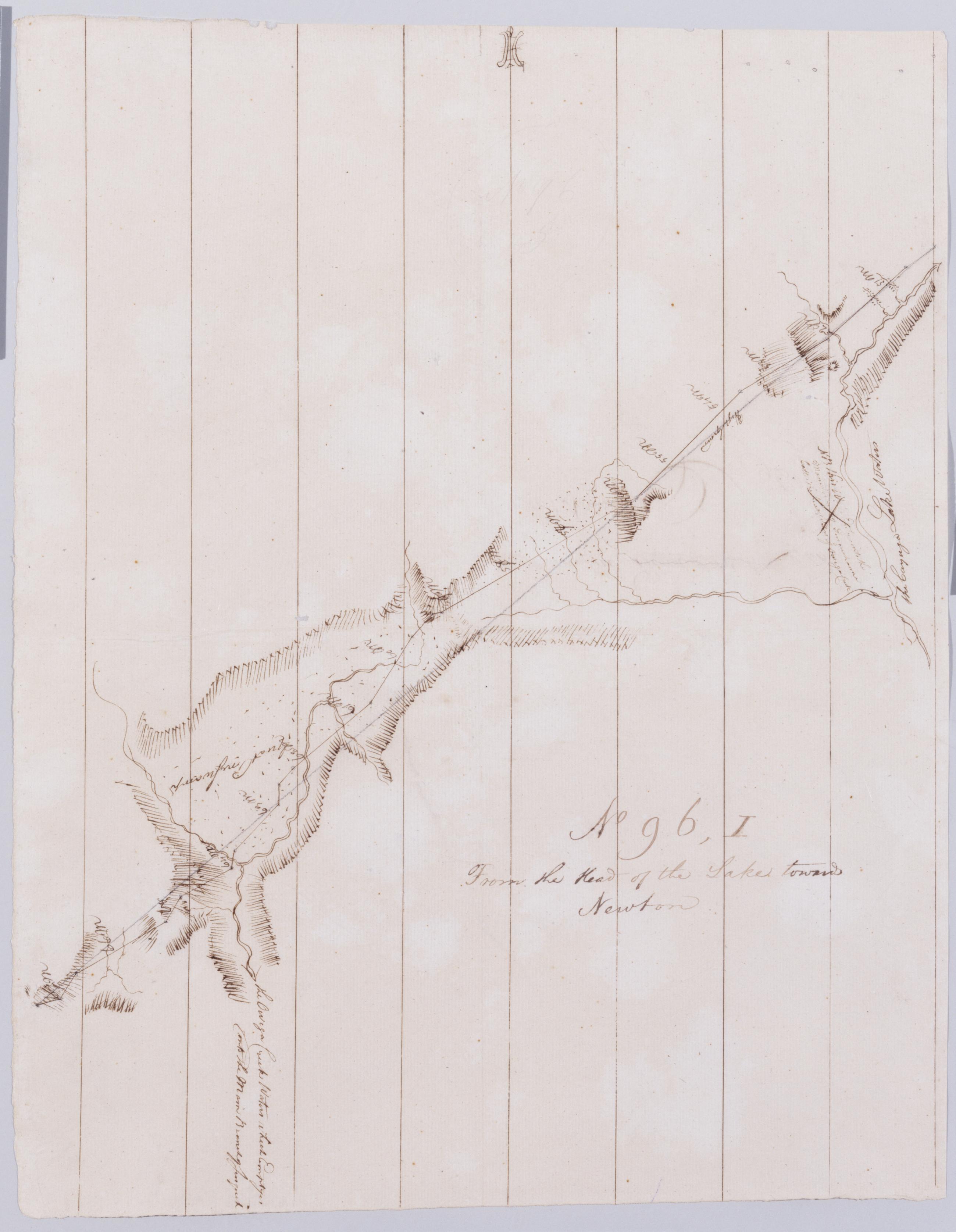
Cartographic From the Head of the Lake towards Newton. No 96, I / by Robert Erskine F.R.S. Geogr. A. U.S. and Assistants. Creased and abraded. Mounted on cloth, bound, disbound and silked by subsequent owners. Cleaned after removal of backings 1999; some fill remains. Sheathed in mylar. In erased pencil on recto, "No 96 [I]". Military topographic map. Covers the towns of Newfield and Ithaca in Tompkins County, Cayuta in Schuyler County and Veteran in Chemung County, New York. Shows roads running through Ithaca, Newfield and Cayuta. Also shows landforms and streams. Pen-and-ink, pencil on laid paper. Scale statement from verso of sheet 96,A. Shows relief by hachures. View Item
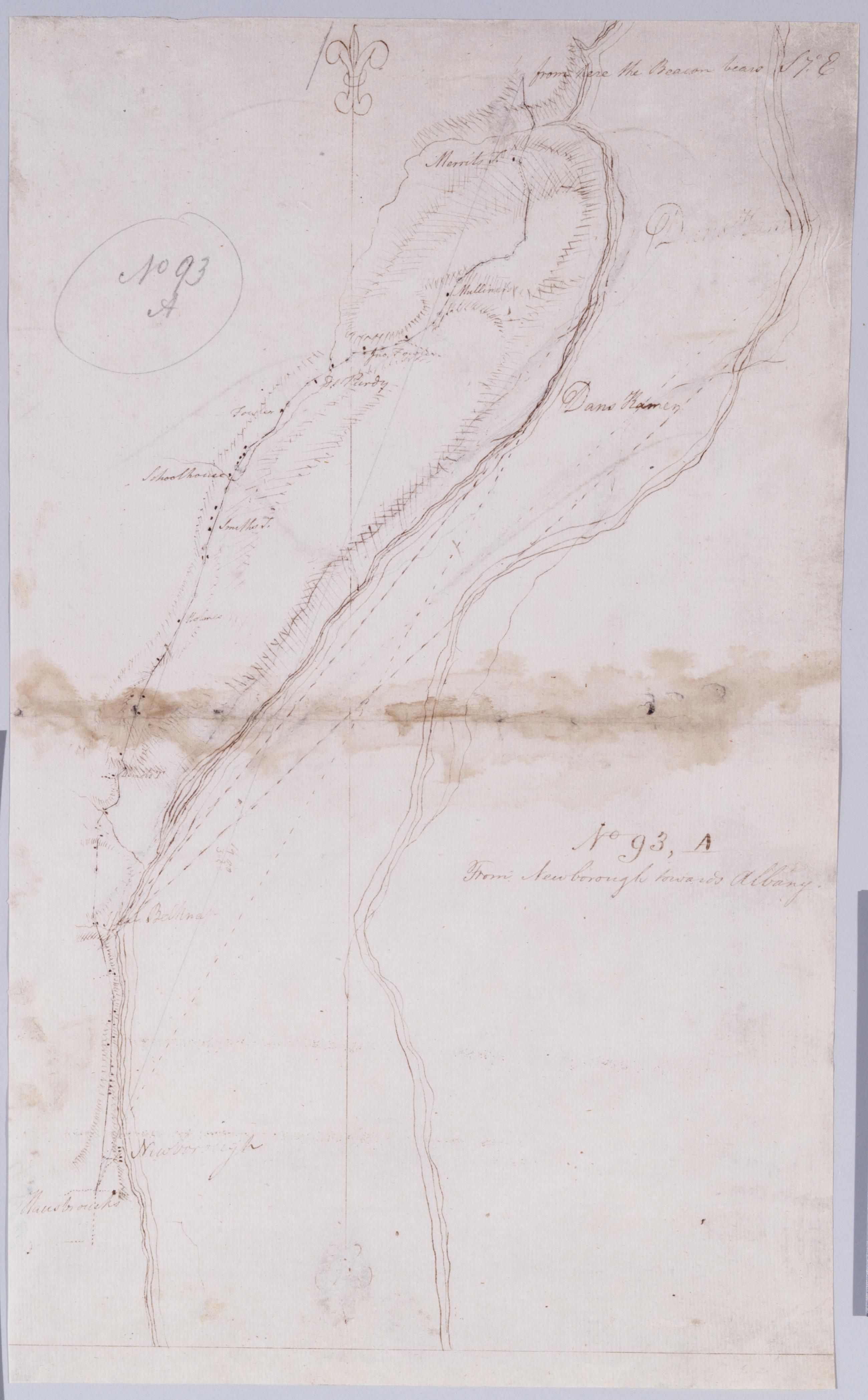
Cartographic From Newborough towards Albany. No 93, A / by Robert Erskine F.R.S. Geogr. A. U.S. and Assistants. In ink on verso: "A A A" "A No. 93". In pencil on recto: "No 93 A". Military topographic map. Covers the townships of Newburg in Orange County and Marlboro in Ulster County, New York. Shows roads running through Newburg and Marlboro. Also shows buildings and owners' names, landforms and streams. Pen-and-ink, pencil on laid paper. Shows relief by hachures. Stained, soiled, creased and abraded. Mounted on cloth, bound and cropped, disbound and silked by subsequent owners. Cleaned after removal of backings 1999; some fill remains. Sheathed in mylar. View Item
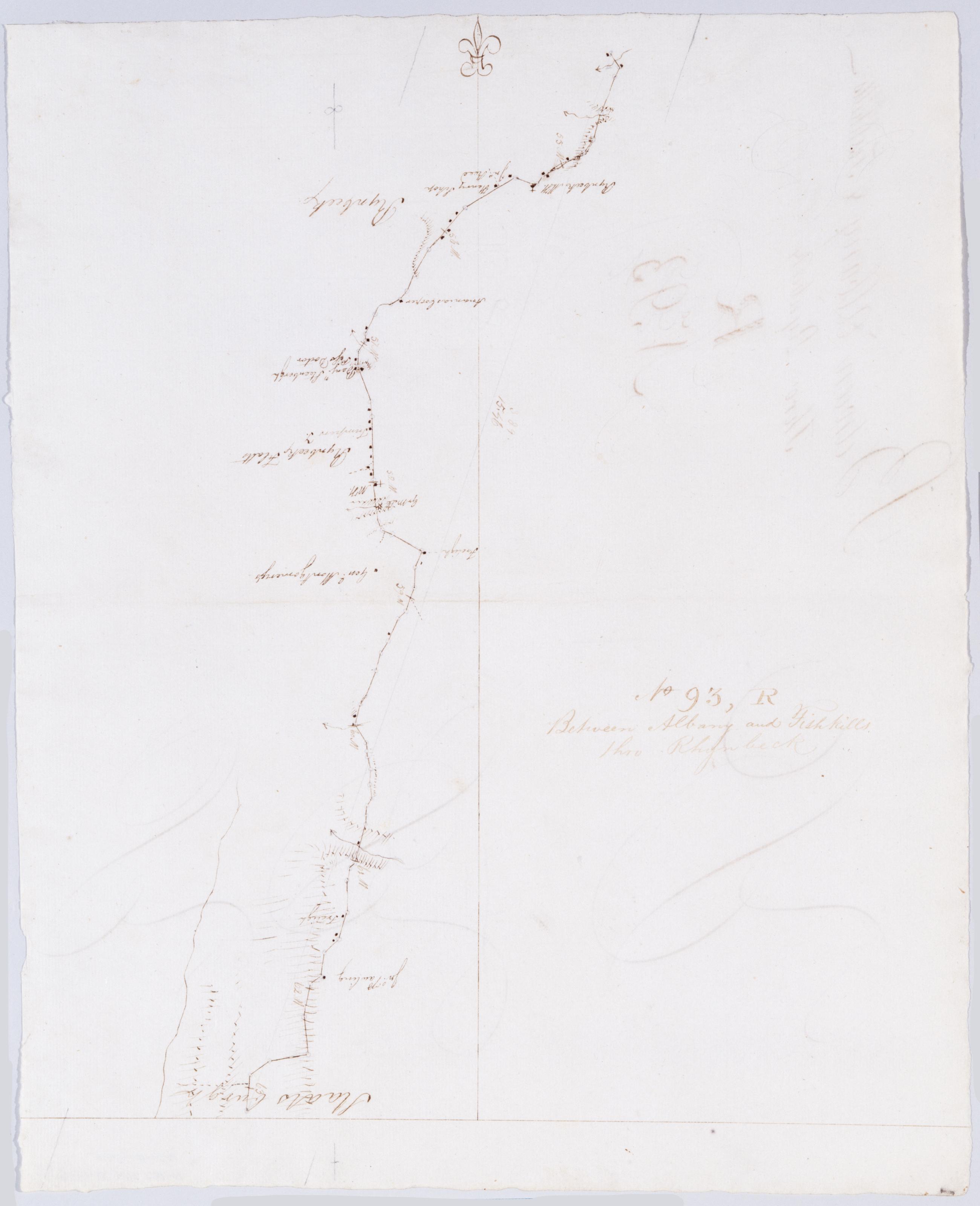
Cartographic Between Albany and Fishkills thro Rhynbeck. No 93, R / by Robert Erskine F.R.S. Geogr. A. U.S. and Assistants ; [P]r Simeon DeWitt. Foxed, creased and abraded. Mounted on cloth, bound, disbound and silked by subsequent owners. Cleaned after removal of backings 1999; some fill remains. Sheathed in mylar. In erased pencil on recto: "No 93 R". In ink on verso: "R R R". Military topographic map. Covers the townships of Red Hook, Rhinebeck and Hyde Park in Dutchess County, New York. Shows roads running through Rhinebeck and Staatsburg. Also shows buildings and owners' names, landforms and streams. Pen-and-ink, pencil on laid paper. Shows relief by hachures. View Item
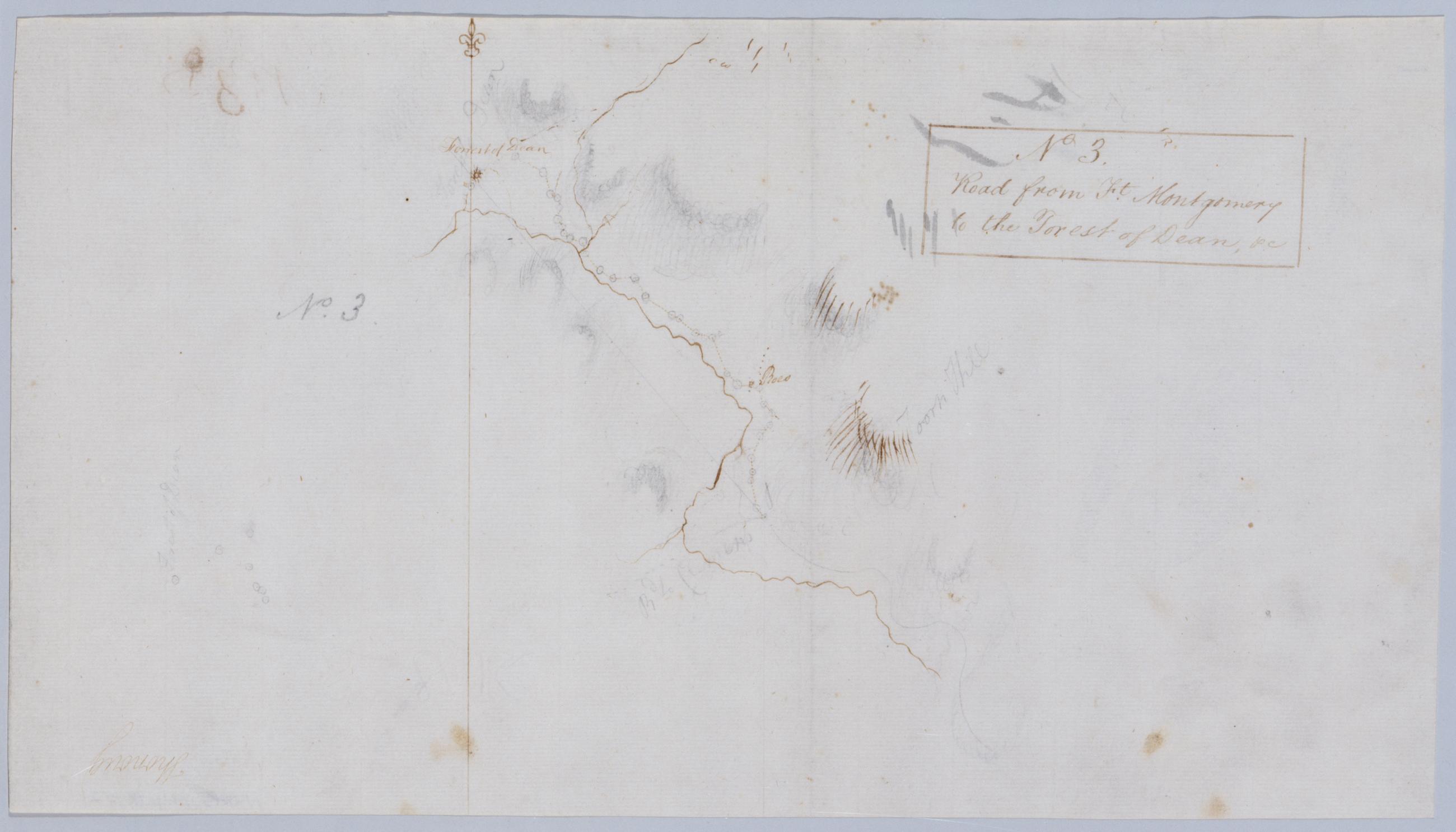
Cartographic Road from Ft. Montgomery to the Forest of Dean, +c. No 3 / by Robert Erskine F.R.S. Geogr. A. U.S. and Assistants. Frayed, foxed. Mounted on cloth, bound and cropped, disbound, silked by subsequent owners. Cleaned after removal of backings 1999. Sheathed in mylar. In ink on verso: "[Ben] Ringwood 14 November 1778," "No. 3D." In pencil on recto: "No. 3." Military topographic map. Covers an area north and east of Popolopen Creek, between modern Highland Falls and Bear Mountain State Park in the Town of Highland, Orange County, New York. Shows roads and owners' names; also landforms and streams. Pen-and-ink, graphite on laid paper. Shows relief by shading and hachures. View Item
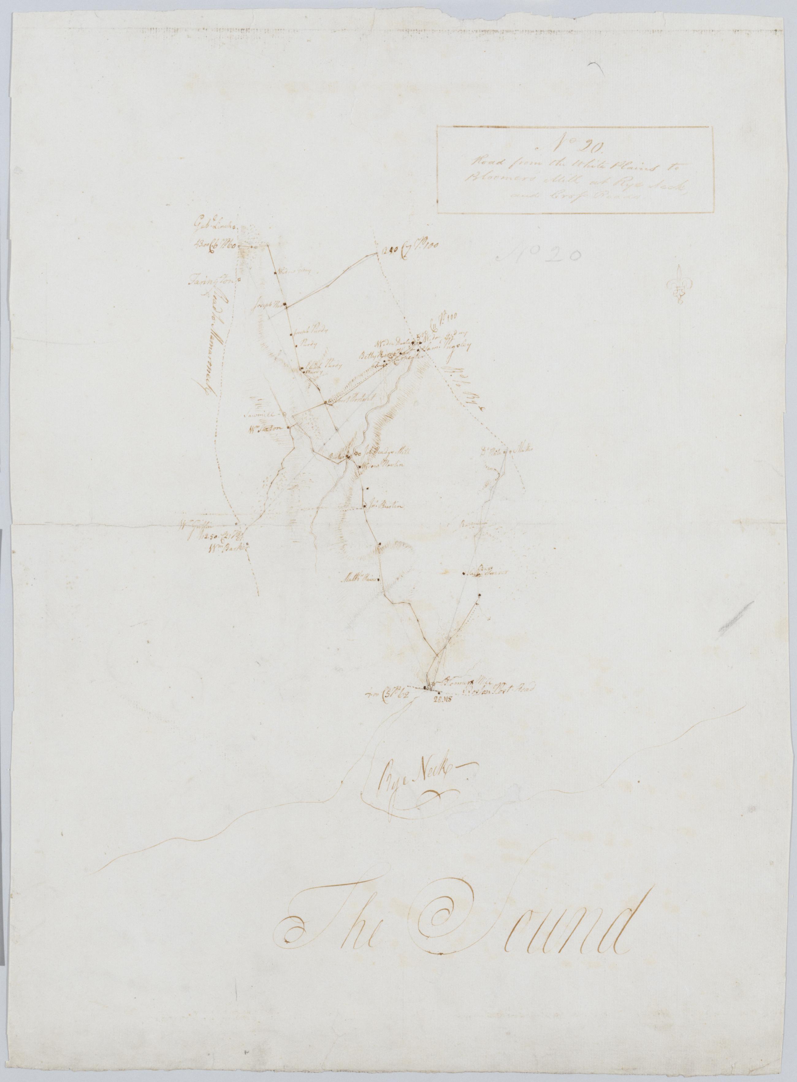
Cartographic Road from the White Plains to Bloomer's Mill at Rye Neck, and Cross Roads. No 20 / by Robert Erskine F.R.S. Geogr. A. U.S. and Assistants. Foxed, creased, frayed, and abraded. Mounted on cloth, bound and cropped, disbound and silked by subsequent owners. Cleaned after removal of backings 1999; some fill remains. Sheathed in mylar. In pencil on recto: "No 20". Military topographic map. Covers the southeastern corner of Westchester County, New York. Shows roads running through Mamaronek, Rye and White Plains. Also shows buildings and owners' names, landforms and streams. Pen-and-ink, pencil on laid paper. Scale roughly estimated. Shows relief by hachures. View Item
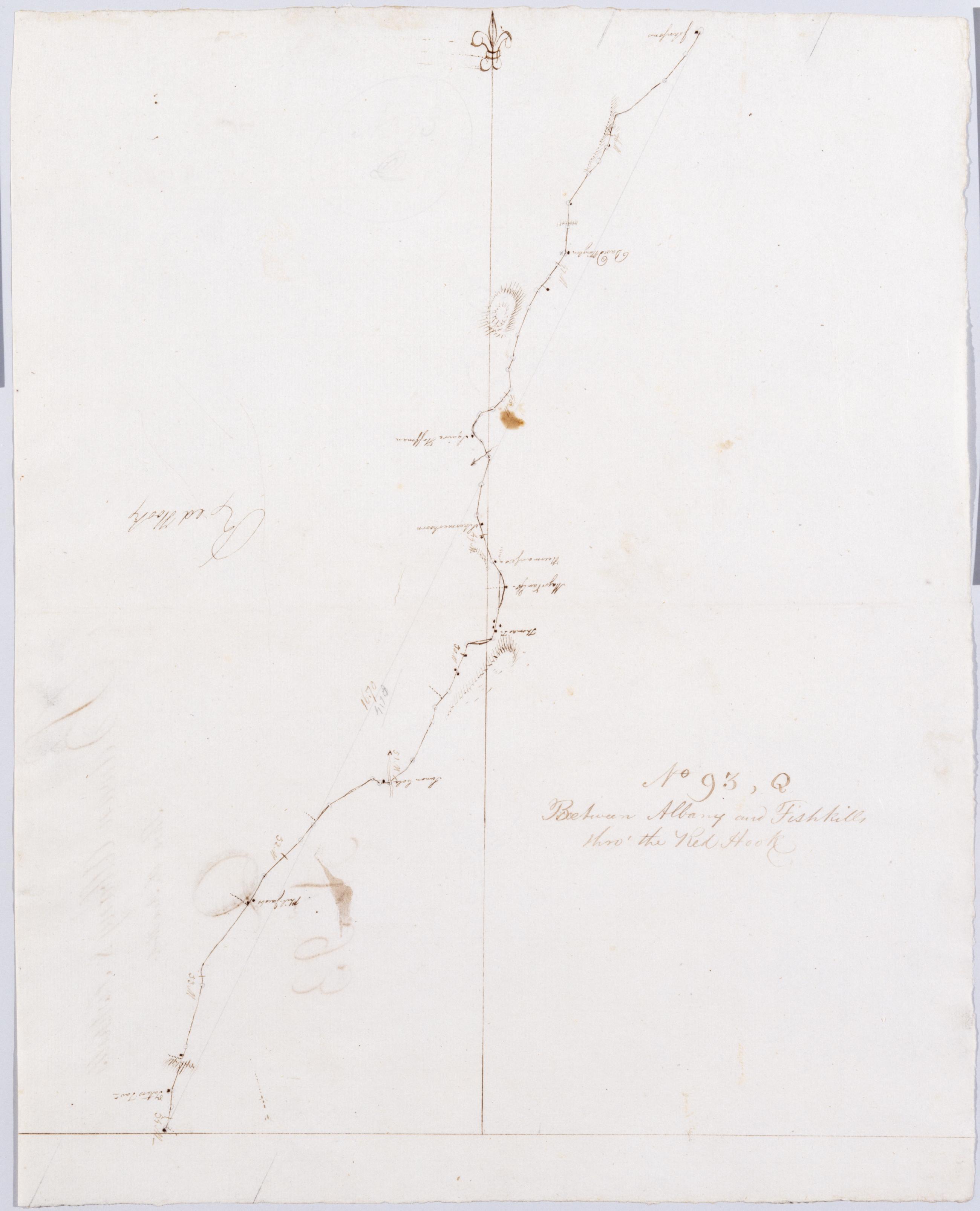
Cartographic Between Albany and Fishkills thro' the Red Hook. No 93, Q / by Robert Erskine F.R.S. Geogr. A. U.S. and Assistants. In erased pencil on recto: "No 93 Q". Military topographic map. Covers the townships of Clermont in Columbia County and Red Hook in Dutchess County, New York. Shows roads running through Clermont, Nevis, Upper Red Hook and Red Hook. Also shows buildings and owners' names, landforms and streams. Pen-and-ink, pencil on laid paper. Shows relief by hachures. Stained, soiled, creased and abraded. Mounted on cloth, bound, disbound and silked by subsequent owners. Cleaned after removal of backings 1999; some fill remains. Sheathed in mylar. View Item
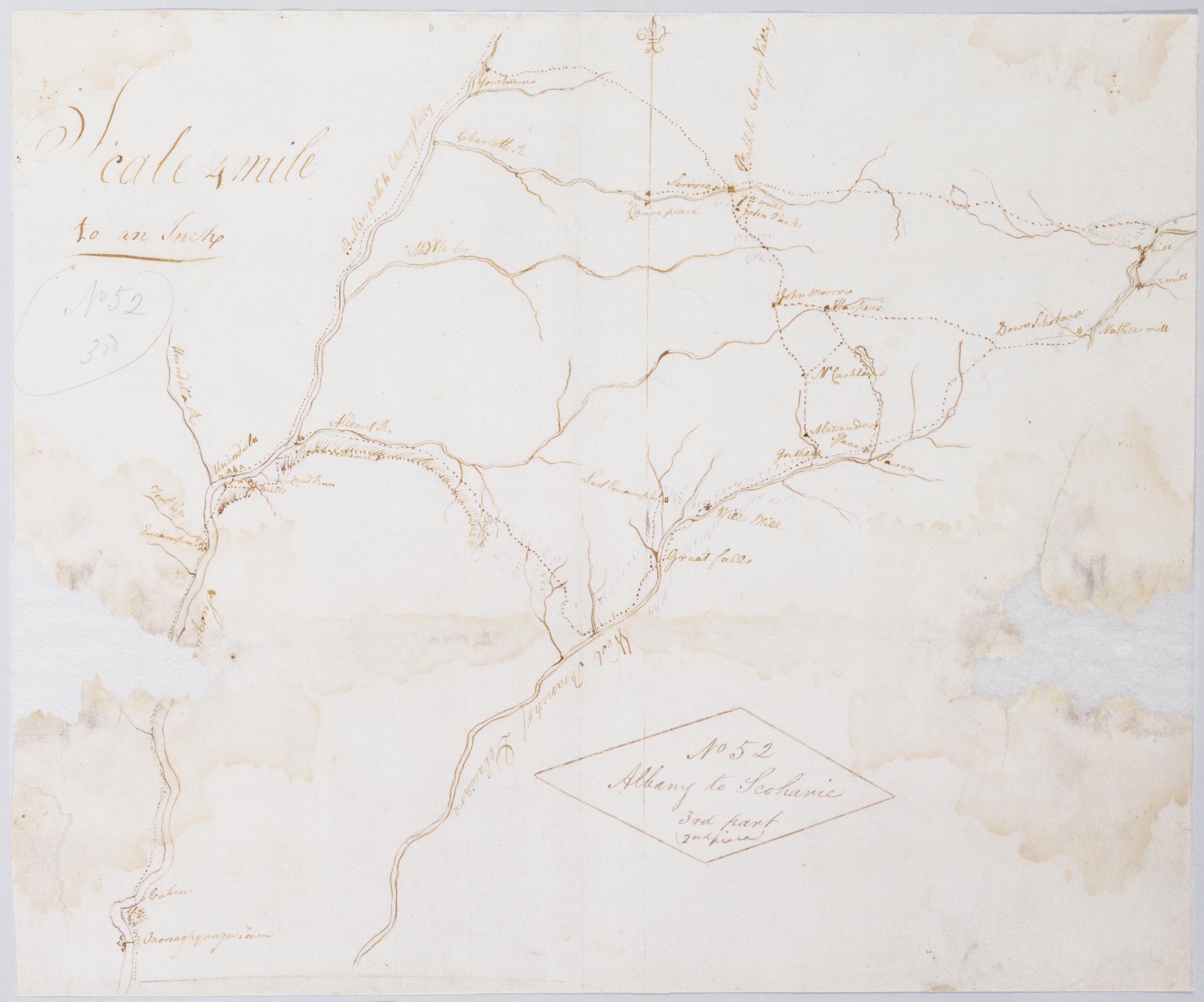
Cartographic Albany to Scoharie [sic] No 52 3rd Part (2nd piece) [sic] / by Robert Erskine F.R.S. Geogr. A. U.S. and Assistants. Index title by Erskine: Part of the Susquehanna & Delaware; Ononoughquago &c. 65. Drawing attributed to Gray based on comparison to another map in this series titled "Draught of Part of Schohara Part of the West Branch of Delaware & Part of Susquehanna Rivers...." That map includes the text, "N.B. Schohara is taken from Actual Survey the others only from Sight & Information." The sheet in hand appears to be the drawing made "only from Sight & Information." Imperfect: lacking 7 x 7 cm. at left margin, 6 x 8 cm. at right margin. View Item
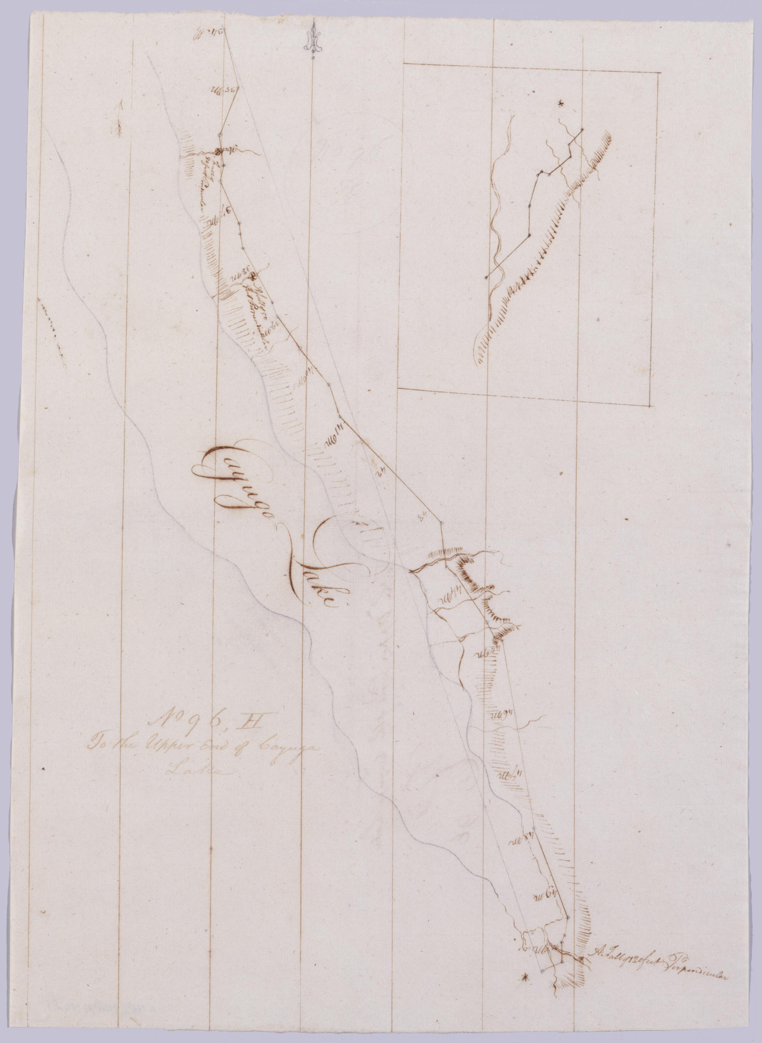
Cartographic To the Upper End of Cayuga Lake. No 96, H / by Robert Erskine F.R.S. Geogr. A. U.S. and Assistants. Creased and abraded. Mounted on cloth, bound, disbound and silked by subsequent owners. Cleaned after removal of backings 1999; some fill remains. Sheathed in mylar. In erased pencil on recto, "No 96 H". Inset is a southward extension of the main map. Military topographic map. Covers the towns of Genoa in Cayuga County and of Ithaca and Lansing in Tompkins County, New York. Shows roads running through Goodyears, Ludlowville and Ithaca. Also shows landforms and streams. Pen-and-ink, pencil on laid paper. Scale statement from verso of sheet 96,A. Shows relief by hachures. View Item
Cartographic From Junes to Arches & Warwich - A. B & B2d. No 86, B / by Robert Erskine F.R.S. Geogr. A. U.S. and Assistants [draft ed.]. In ink on recto and verso: "No 86 B." In pencil on recto: "No 86 B". Military topographic map. Covers the townships of Chester and Warwick in Orange County, New York. Shows roads running through Warwick, Bellvale, Mt. Peter and Dutch Hollow. Also shows buildings and owners' names, landforms and streams. No title on map recto or verso. Title as given, statement of responsibility, date, series title and series numbering by Erskine, but on separate index sheet filed at head of series. Title number from map recto. Pen-and-ink, pencil on laid paper. Shows relief by hachures. View Item
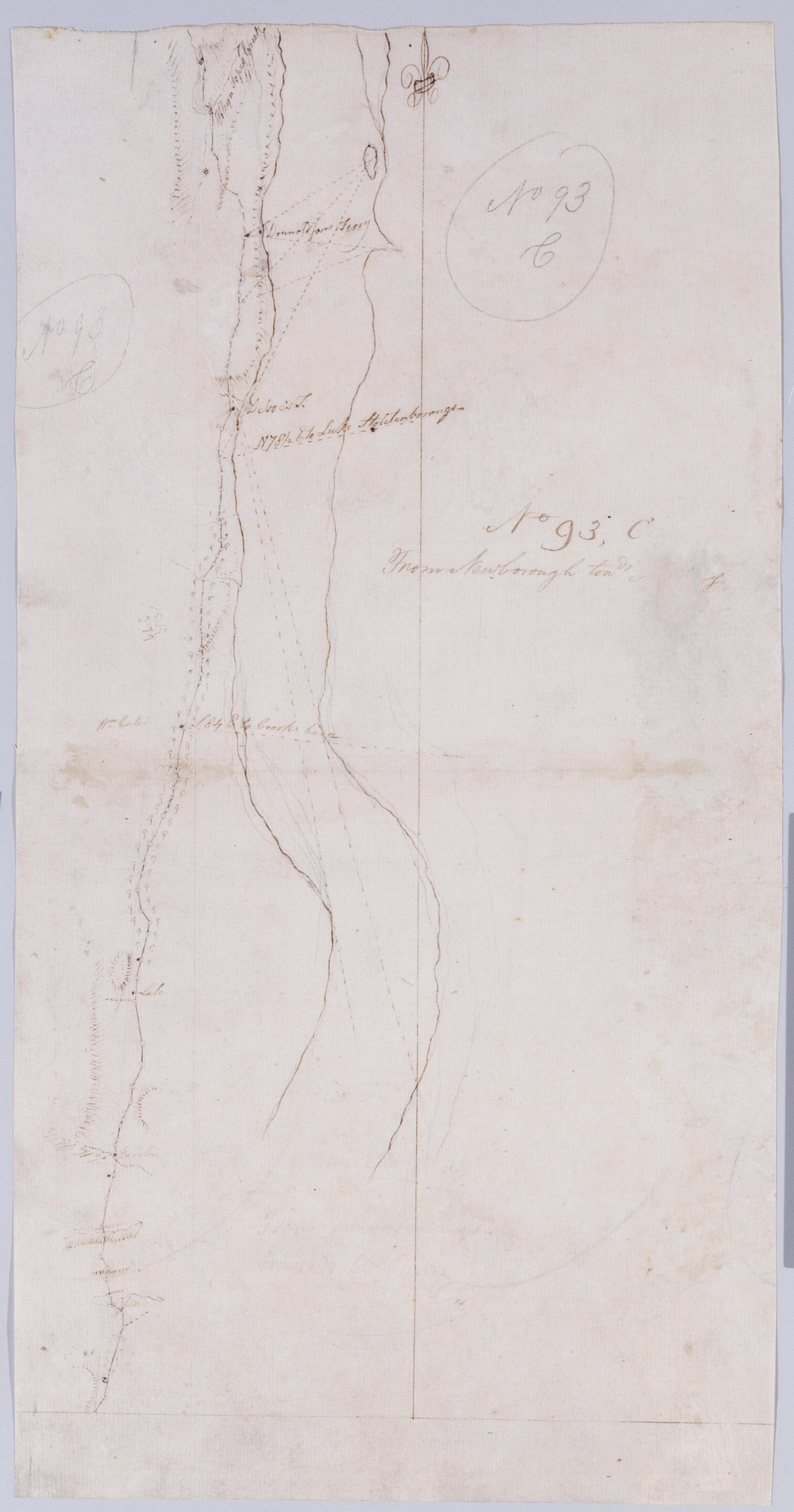
Cartographic From Newborough towds [Alban]y. No 93, C / by Robert Erskine F.R.S. Geogr. A. U.S. and Assistants. In ink on verso: "[C] C [C]". In pencil on recto: "No 93 C" (twice). Military topographic map. Covers the townships of Lloyd and Esopus in Ulster County, New York. Shows roads running through Highland and West Park. Also shows buildings and owners' names, landforms and streams. Pen-and-ink, pencil on laid paper. Shows relief by hachures. Stained, soiled, creased and abraded. Mounted on cloth, bound and cropped, disbound and silked by subsequent owners. Cleaned after removal of backings 1999; some fill remains. Sheathed in mylar. View Item
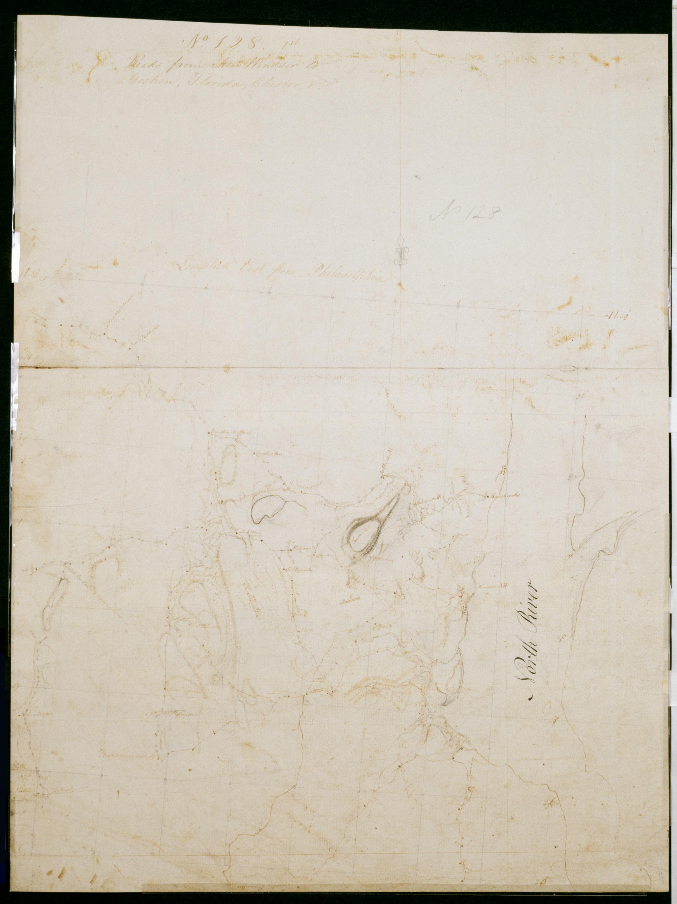
Cartographic Roads from New Windsor to Goshen, Florida, Chester, +c. No 128, 1st / by Robert Erskine F.R.S. Geogr. A. U.S. and Assistants. Date probably 1782, based on presence of a label for the Hasbrouck house at Newburgh, which was Washington's HQ from April of that year. In pencil on recto: "No 128". Military topographic map. Covers the townships of New Windsor, Cornwall and Montgomery in Orange County, New York. Also shows position of troops; also buildings and owners' names, landforms and streams. Pen-and-ink, pencil on laid paper. Shows relief by hachures. Stained, soiled, foxed, creased and abraded. Mounted on cloth, bound and cropped, disbound and silked by subsequent owners. View Item