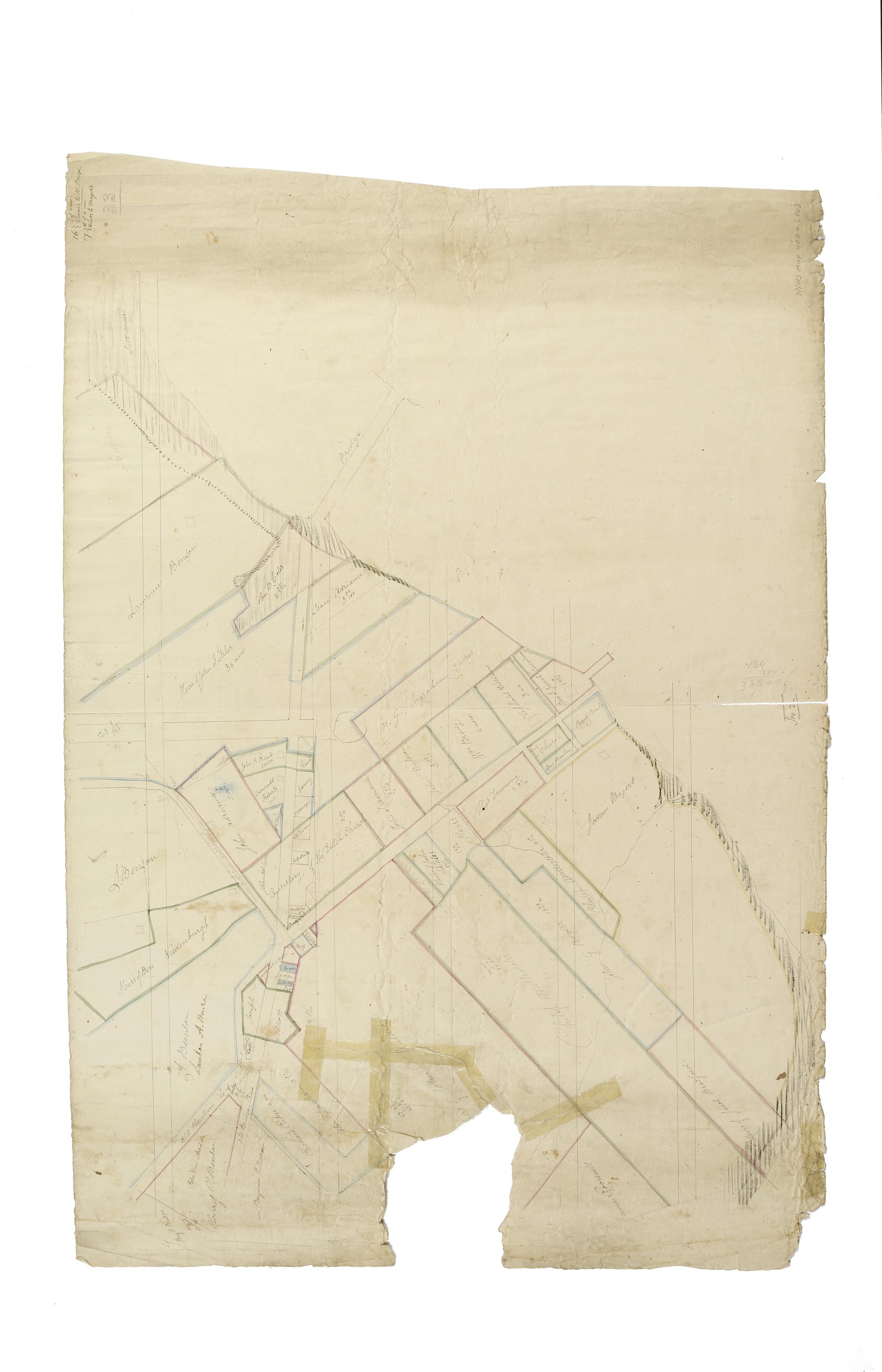
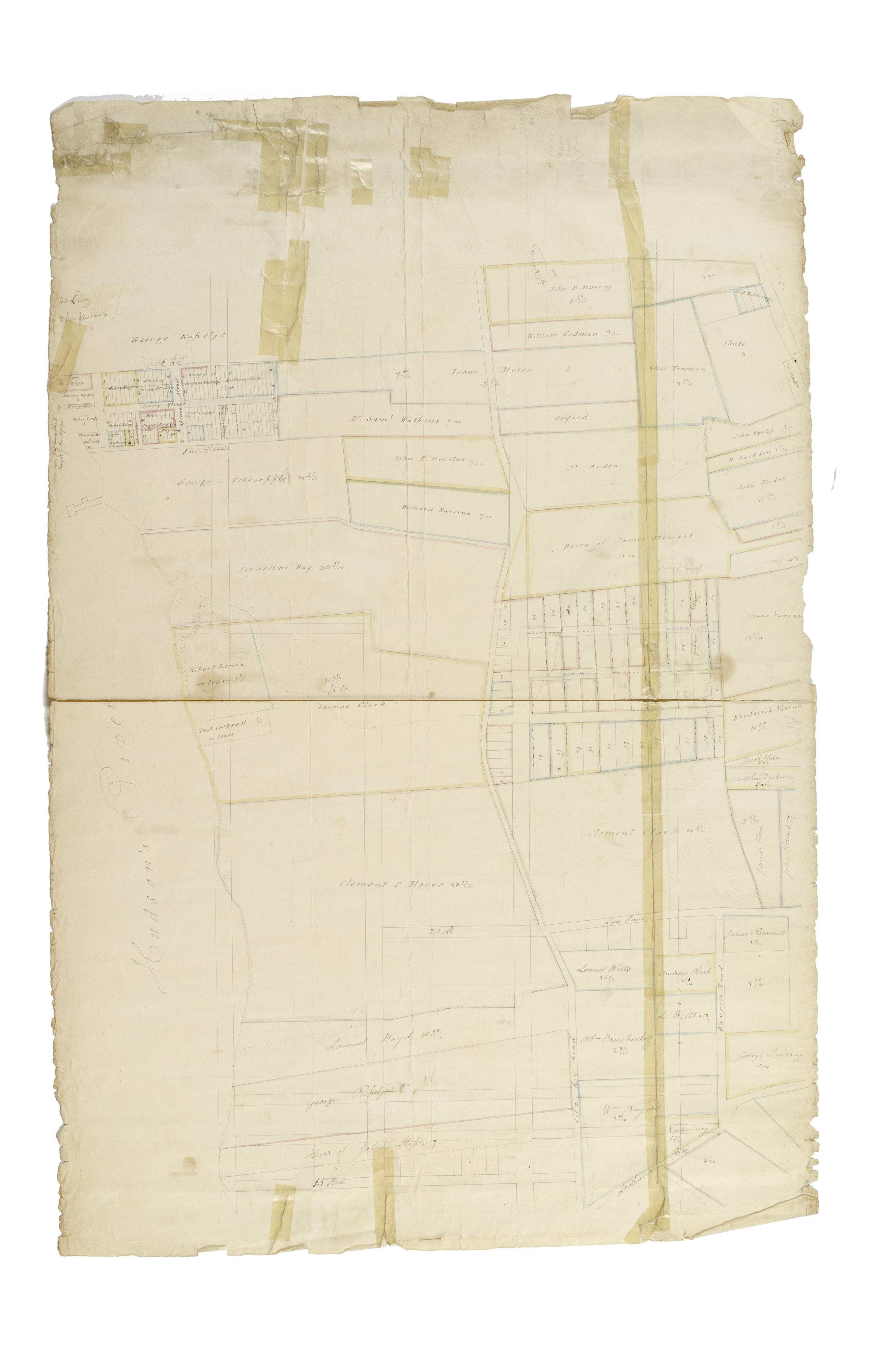
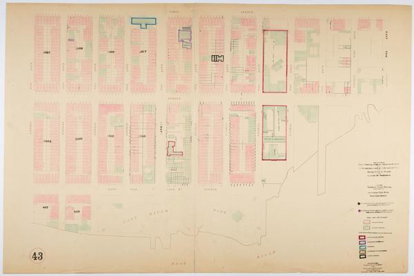
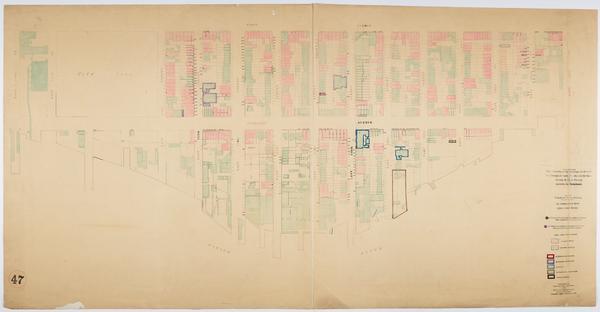
Still Image [Map of the area later bounded by 114th and 137th Streets, the Harlem River and 5th Avenue, Manhattan, New York, N.Y.]. Scale [ca. 1:2,450]. Cadastral map. Shows property lines and owners' names, some existing roads and projected streets. Shows relief by hachures. Pen-and-ink, watercolor on paper. Imperfect: lacking 15 cm. square at bottom center margin. Annotations in a later hand on the recto of this sheet give the number 16. The map on verso of this one belongs to the same series and is separately cataloged under the title, [Map of the area later bounded by 113th and 136th Streets, Park or Morningside and St. Nicholas Avenues, Manhattan, New York, N.Y.]. View Item
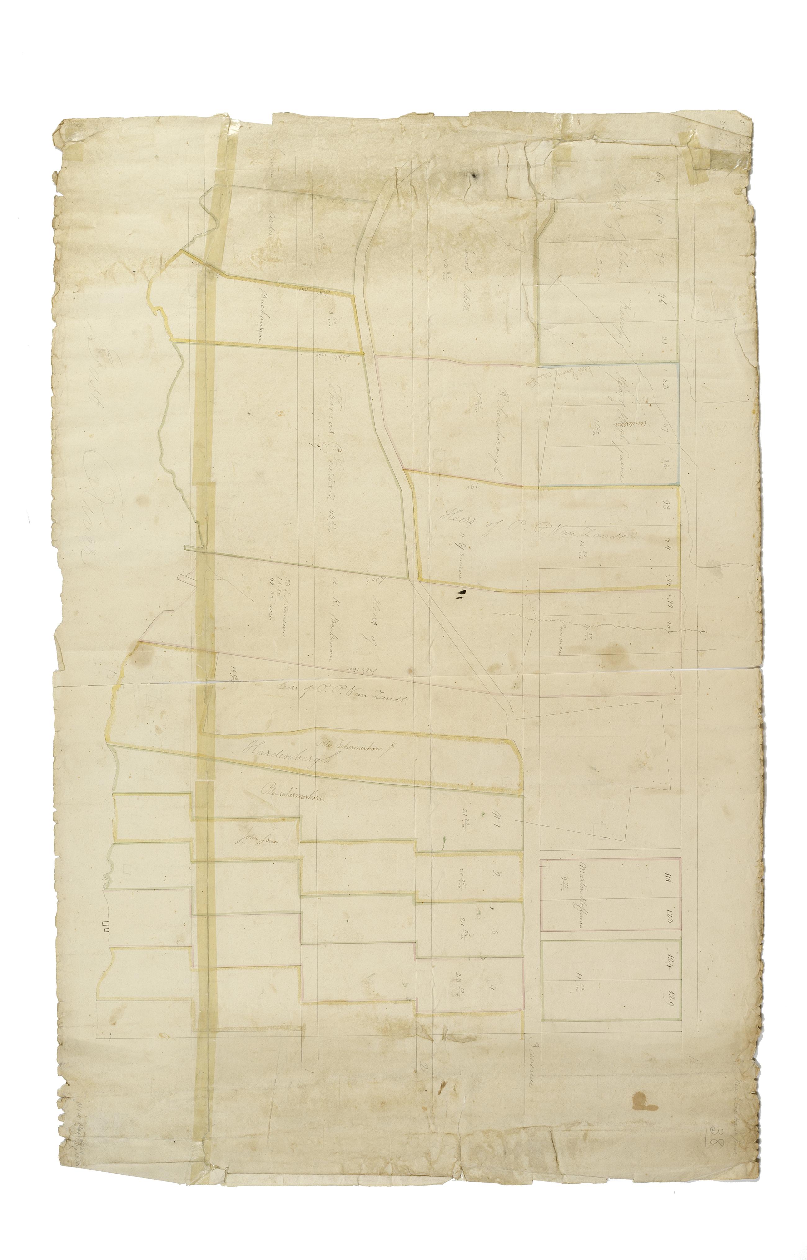
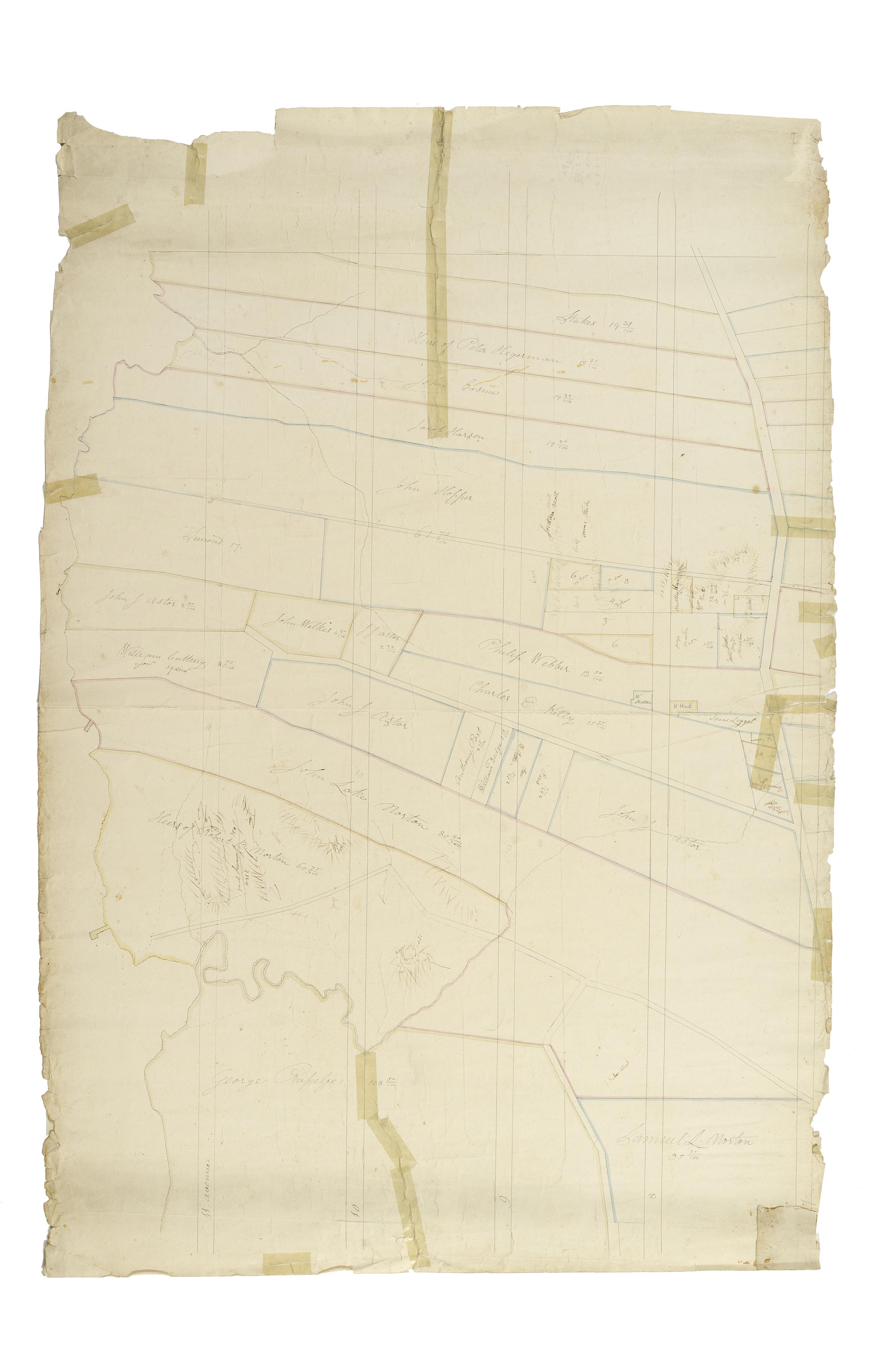
Still Image [Cadastral map of Manhattan]. Scale [ca. 1:2,450]. Digital composite of a cadastral map of Manhattan in 26 sections on 13 sheets which appears to be a draft for another map, owned by New York City and printed in Sackersdorff, Otto. Maps of farms, commonly called the Blue Book 1815 (New York: 1868). Shows property lines and owners' names, some existing roads and projected streets. Shows relief by hachures. Pen-and-ink, watercolor on paper. Sackersdorff gives the date of the manuscript map as circa 1815. Title and edition statement devised by cataloger. Attributed to Randel by cataloger; for provenance, see Stokes, I.N.P. View Item
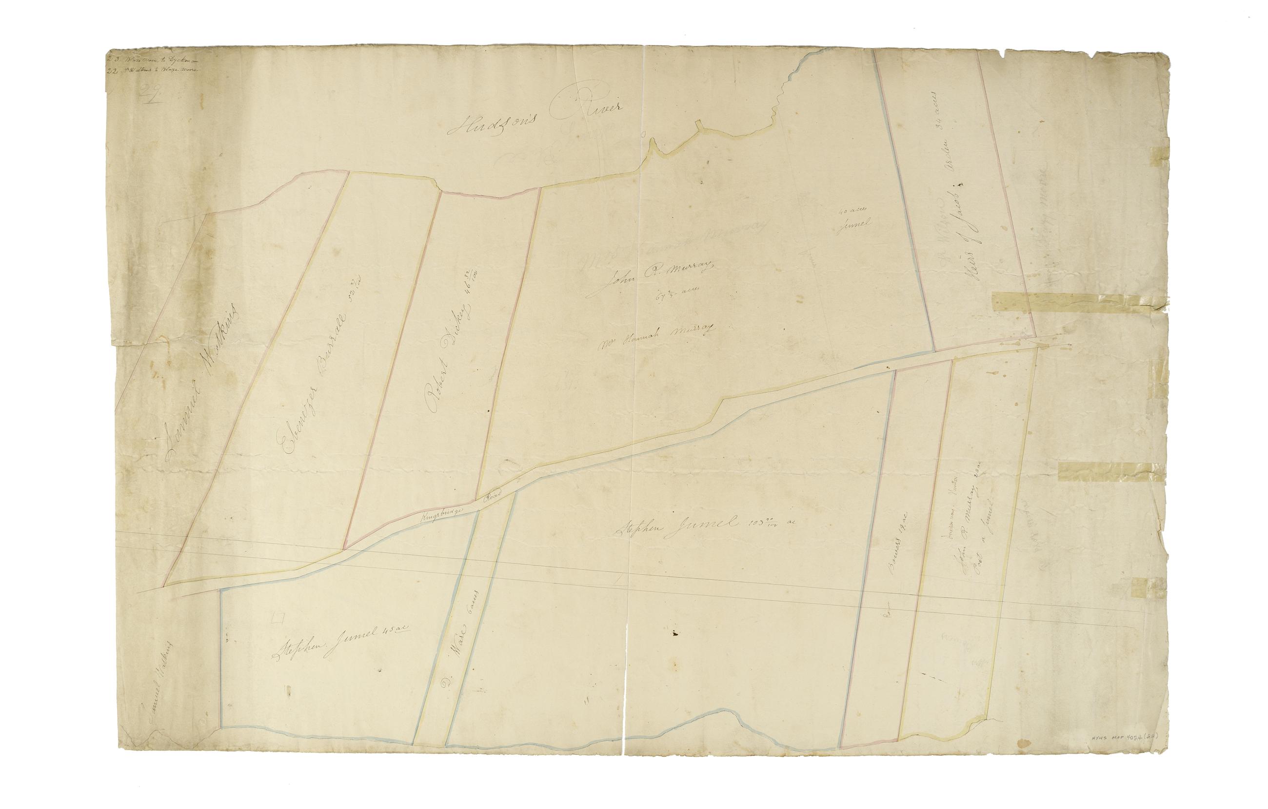
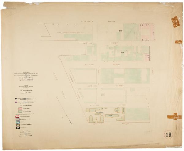
Still Image [Map of the area later bounded by 156th and 178th Streets, the Harlem and Hudson Rivers, Manhattan, New York, N.Y.]. Scale [ca. 1:2,450]. Cadastral map. Shows property lines and owners' names, some existing roads and projected streets. Shows relief by hachures. Pen-and-ink, watercolor on paper. Imperfect: lacking 15 cm. at bottom margin. Annotations in a later hand on the recto of this sheet give the number 22. The map on verso of this one belongs to the same series and is separately cataloged under the title, [Map of the area later bounded by 177th and 201st Streets, the Harlem and Hudson Rivers, Manhattan, New York, N.Y.]. View Item
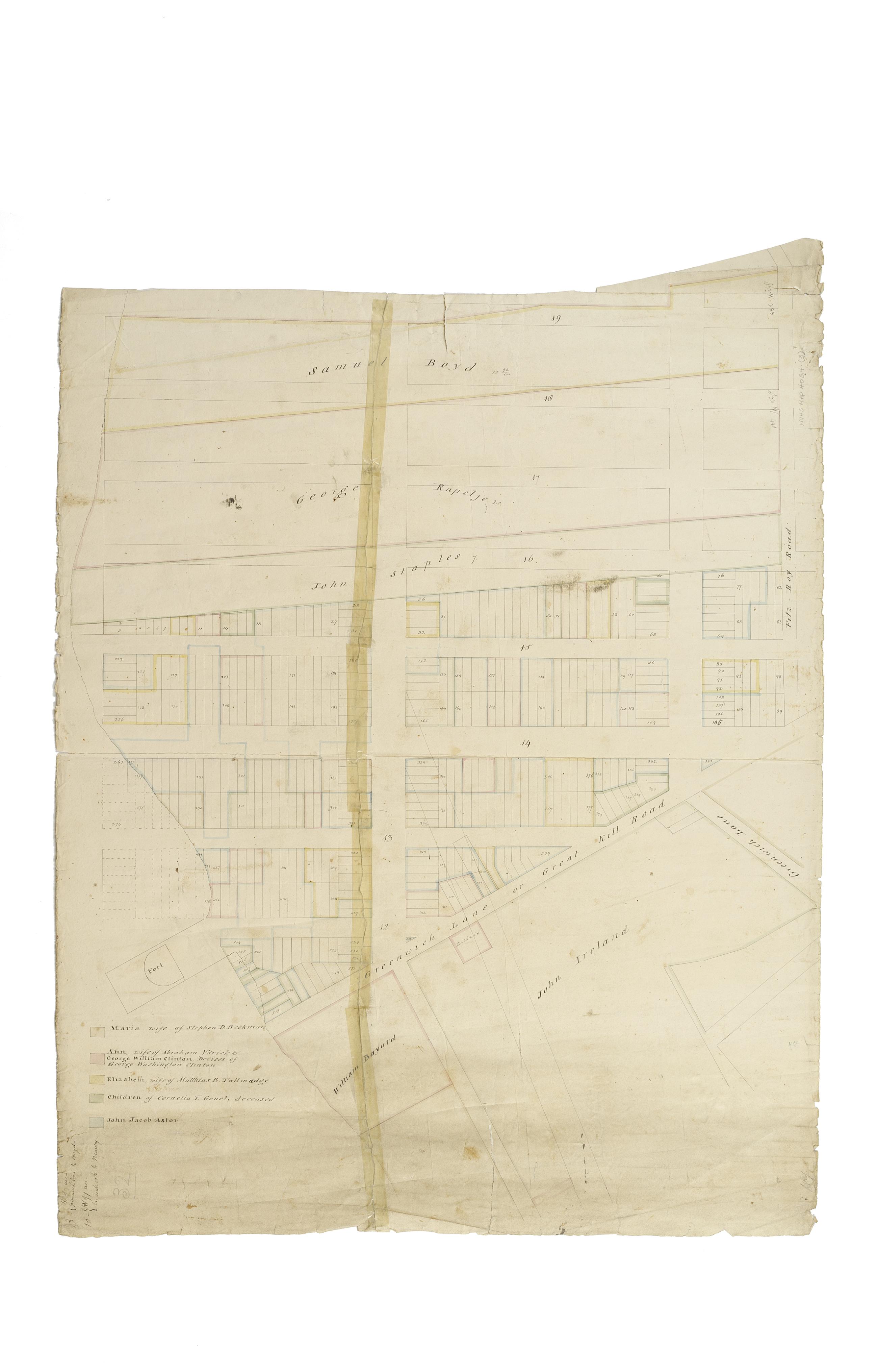
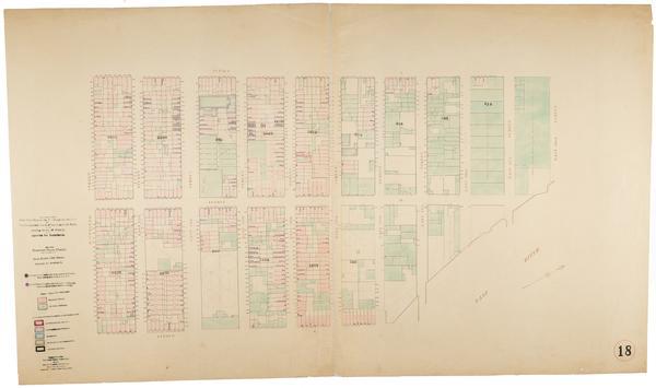
Still Image [Map of the area later bounded by 114th and 137th Streets, Douglass Boulevard and the Hudson River, Manhattan, New York, N.Y.]. Scale [ca. 1:2,450]. Cadastral map. Shows property lines and owners' names, some existing roads and projected streets. Shows relief by hachures. Pen-and-ink, watercolor on paper. Annotations in a later hand on the recto of this sheet also give the number 18. The map on verso of this one does not belong to the series and is separately cataloged--see Loss, Charles, surveyor. [Map of the area later bounded by 124th and 132nd Streets, 9th Avenue and the Hudson River, Manhattan, New York, N.Y.]. View Item
Still Image [Map of the area later bounded by 8th and 20th Streets, 7th Avenue and the Hudson River, Manhattan, New York, N.Y]. Scale [ca. 1:2,450]. Cadastral map. Shows property lines and owners' names, some existing roads and projected streets. Shows relief by hachures. Pen-and-ink, watercolor on paper. Annotations in a later hand on the recto of this sheet give the number 3. The map on verso of this one belongs to the same series and is separately cataloged under the title, [Map of the area later bounded by 56th and 78th Streets, 7th Avenue or Central Park, and the Hudson River, Manhattan, New York, N.Y.]. View Item
Still Image [Map of the area later bounded by 15th and 33rd Streets, 6th and 10th Avenues, Manhattan, New York, N.Y.]. Scale [ca. 1:2,450]. Cadastral map. Shows property lines and owners' names, some existing roads and projected streets. Shows relief by hachures. Pen-and-ink, watercolor on paper. Annotations in a later hand on the recto of this sheet also give the number 5. The map on recto of this sheet belongs to the same series and is separately cataloged under the title, [Map of the area later bounded by 52nd and 73rd Streets, the East River and Park Avenue, Manhattan, New York, N.Y.]. View Item
Still Image [Map of the area later bounded by 52nd and 73rd Streets, the East River and Park Avenue, Manhattan, New York, N.Y.]. Scale [ca. 1:2,450]. Cadastral map. Shows property lines and owners' names, some existing roads and projected streets. Shows relief by hachures. Pen-and-ink, watercolor on paper. Annotations in a later hand on the recto of this sheet give the number 5. The map on verso of this one belongs to the same series and is separately cataloged under the title, [Map of the area later bounded by 15th and 33rd Streets, 6th and 10th Avenues, Manhattan, New York, N.Y.]. View Item
Still Image [Map of the area later bounded by 35th and 57th Streets, 7th and 11th Avenues, Manhattan, New York, N.Y.]. Scale [ca. 1:2,450]. Cadastral map. Shows property lines and owners' names, some existing roads and projected streets. Shows relief by hachures. Pen-and-ink, watercolor on paper. Annotations in a later hand on the recto of this sheet give the number 7. The map on recto of this sheet belongs to the same series and is separately cataloged under the title, [Map of the area later bounded by 30th and 53rd Streets, the East River and 5th Avenue, Manhattan, New York, N.Y.]. View Item
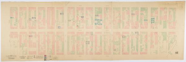
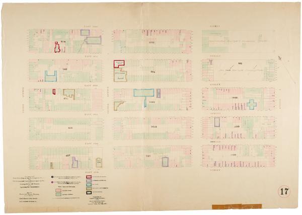
Still Image Map showing over-crowding of the buildings on the lots and the consequent lack of light and air space also strong-holds of poverty and agencies for betterment in the tenement house district bounded by 3rd Avenue, 1st Avenue, 130th, 110th Sts. / prepared f Scale [ca. 1:650]. Oriented with north to upper right of sheet. View Item
Still Image Map showing over-crowding of the buildings on the lots and the consequent lack of light and air space also strong-holds of poverty and agencies for betterment in the tenement house district bounded by 1st Avenue, East River, 93rd, 82nd Streets / prepared Scale [ca. 1:650]. Oriented with north to upper right of sheet. View Item
Still Image Map showing over-crowding of the buildings on the lots and the consequent lack of light and air space also strong-holds of poverty and agencies for betterment in the tenement house district bounded by 22nd Street, 17th Street, 3rd Avenue, Avenue A / prepa Scale [ca. 1:650]. View Item
Still Image Map showing over-crowding of the buildings on the lots and the consequent lack of light and air space also strong-holds of poverty and agencies for betterment in the tenement house district bounded by 1st Avenue, East River, 125th, 110th Streets / prepare Scale [ca. 1:650]. Oriented with north to upper right of sheet. View Item
Still Image Map showing over-crowding of the buildings on the lots and the consequent lack of light and air space also strong-holds of poverty and agencies for betterment in the tenement house district bounded by 22nd Street, 12th Street, Avenue A, Avenue C / prepare Scale [ca. 1:650]. Oriented with north to the upper right of sheet. View Item
Still Image Map showing over-crowding of the buildings on the lots and the consequent lack of light and air space also strong-holds of poverty and agencies for betterment in the tenement house district bounded by 17th Street, 12th Street, Avenue C, East River / prepa Scale [ca. 1:650]. Oriented with north to bottom of sheet. View Item
Still Image Map showing over-crowding of the buildings on the lots and the consequent lack of light and air space also strong-holds of poverty and agencies for betterment in the tenement house district bounded by 1st Avenue, East River, 82nd, 72nd Streets / prepared Scale [ca. 1:650]. View Item
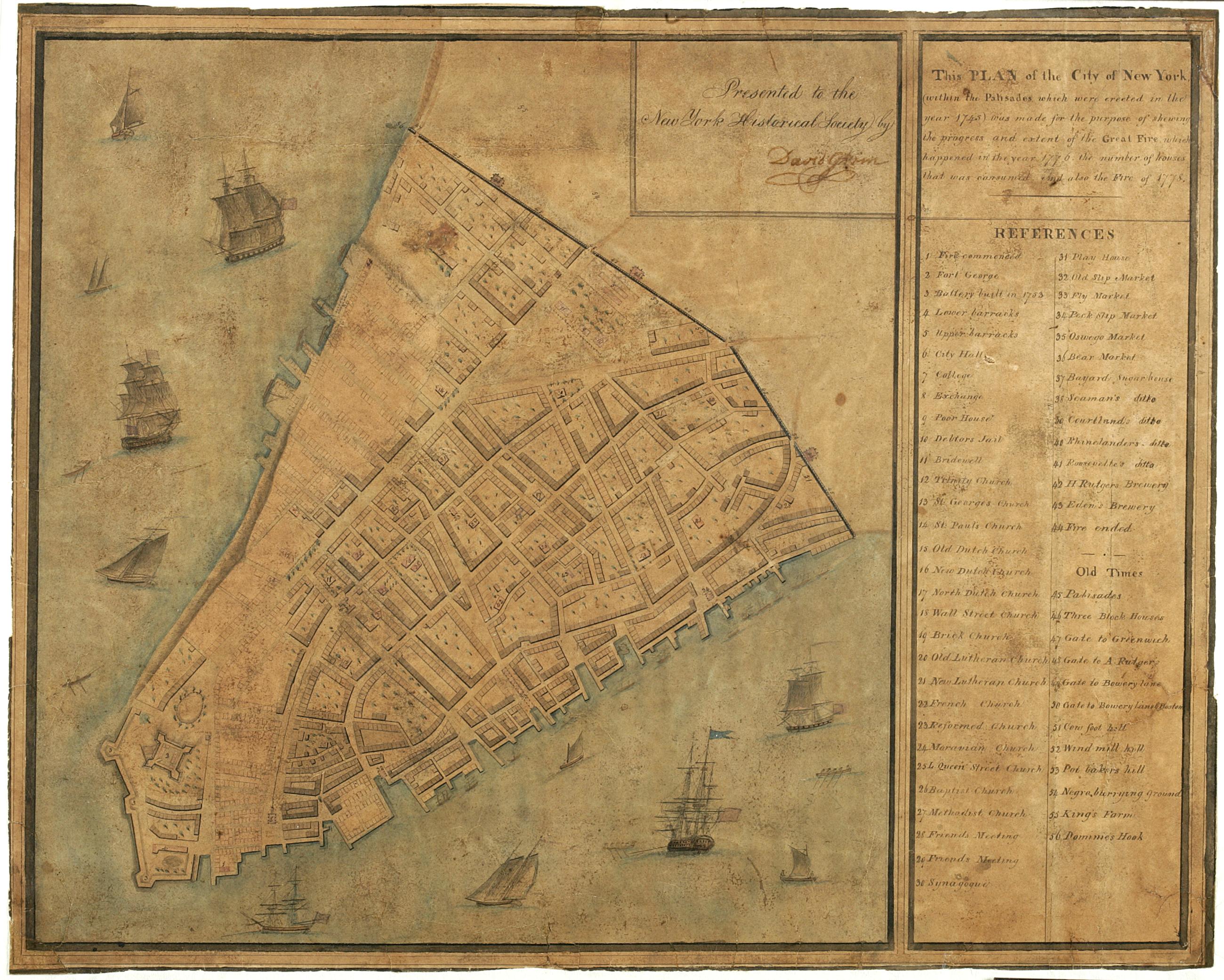
Still Image This plan of the City of New York (within the palisades which were erected in the year 1743) was made for the purpose of shewing the progress and extent of the great fire which happened in the year 1776, the number of houses that was consumed, and also th "Presented to the New York Historical Society by David Grim." Attributed by cataloger to Grim. Brittle, varnished, cracked and frayed. ; mounted on paper in turn backed by cloth. Date of ms. after 1804 foundation of the N-YHS. Date before Grim's death 1826. Historical map. Covers Manhattan Island south of modern Chambers Street, New York (N.Y.) Shows buildings and other urban features. Includes index. Pen-and-ink, watercolor on paper. Ships shown pictorially. View Item
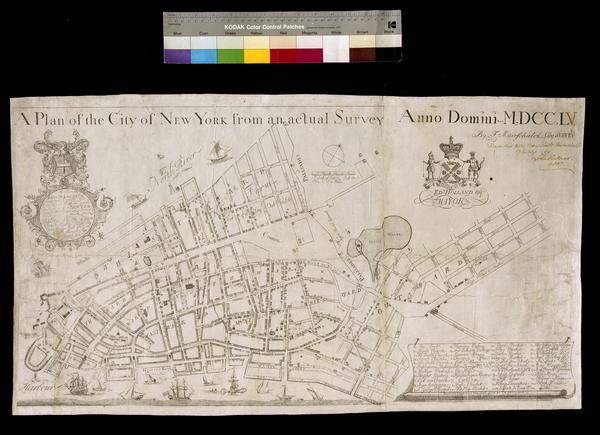
Still Image A plan of the City of New York from an actual survey anno domini MDCCLV Covers Manhattan, New York (N.Y.) below Delancey Street. Shows political divisions, fortifications, some buildings and natural features. The map also locates churches, markets, and public squares. Dedication: "To the Honourable JAMES DE LANCEY, Esqr, Lieutenant Governor and Commander In Chief In and over the Province of NEW YORK and territories depending thereon In America This Plan of the City of NEW YORK Is Humbly dedicd. By your Honours Most Obet. & Humble Servent G. View Item
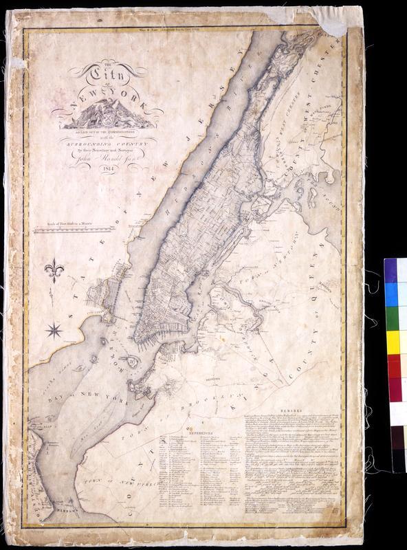
Still Image The City of New York as laid out by the Commissioners with the surrounding country / by their secretary and surveyor John Randel, Junr. Street planning map. Covers all of Manhattan Island (New York, N.Y.) and substantial parts of adjacent counties in New York and New Jersey. Shows existing and proposed streets; also buildings and other structures, streams and other wetlands, political boundaries. Includes extensive "REMARKS," also a key to New York City buildings. Pen-and-ink, watercolor on paper. Shows relief by hachures. Imperfect: lacking 4 x 9 and 2 x 5 cm. upper right corner, 2 x 2 cm. upper left side. References: Cohen, Paul E. and Robert T. Augustyn. Manhattan in Maps. NY: Rizzoli, 1997, p. 106ff; Stokes, I.N. Phelps. View Item
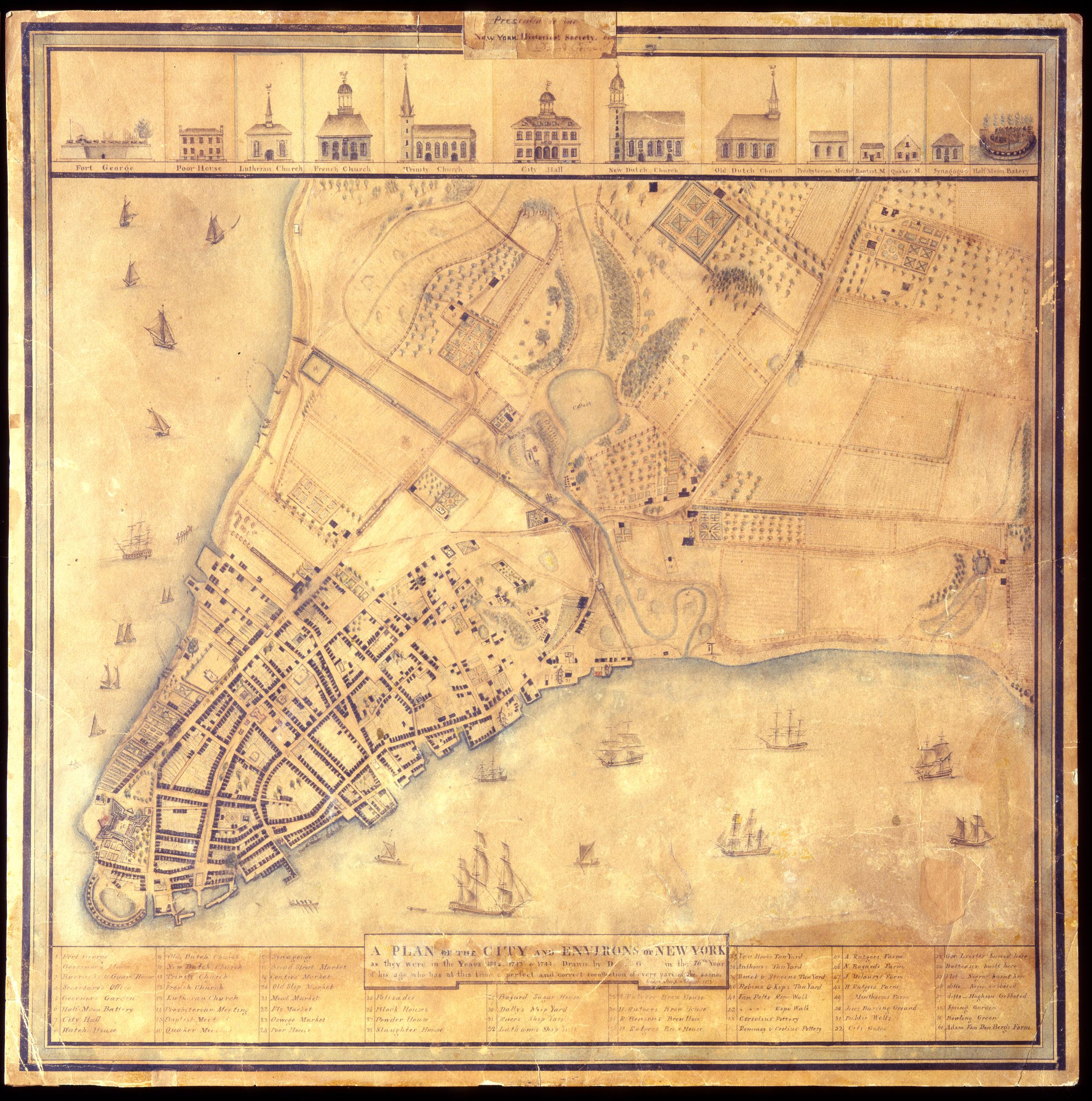
Still Image A Plan of the city and environs of New York as they were in the years 1742. 1743. & 1744. / drawn by D--- G--- in the 76th year of his age, who has at this time a perfect and correct recollection of every part of the same. Cedar Street. August 1813. David Grim's map of prerevolutionary Manhattan. Historical map. Covers Manhattan Island south of modern 14th Street, New York (N.Y.). Shows buildings and many other urban features; also shows natural and agricultural features. Date of ms. 1813 Aug. Date of situation between 1742 and 1744. On label pasted at top center: "Presented to the New York Historical Society by David Grim". Pen-and-ink (black and color), watercolor, pencil on paper. Selected material shown pictorially. Includes index. References: Cohen, Paul E. and Robert T. Augustyn. Manhattan in Maps, p. 62-63; Stokes, I.N. Phelps. View Item
Image Collection 29 Items John Randel's Cadastral map of Manhattan, approximately 1815 This cadastral map of Manhattan in 26 sections on 13 sheets appears to be a draft of another map printed in Sackersdorff, Otto. Maps of farms, commonly called the Blue Book 1815 (New York: 1868). The map shows property lines and owners' names, some existing roads and projected streets, and shows relief by hachures. Pen-and-ink, watercolor on paper. Sackersdorff gives the date of the manuscript map as circa 1815. Attributed to Randel by the cataloger; for provenance, see Stokes, I.N.P. Iconography of Manhattan Island, v. 3, p. 565. View Collection