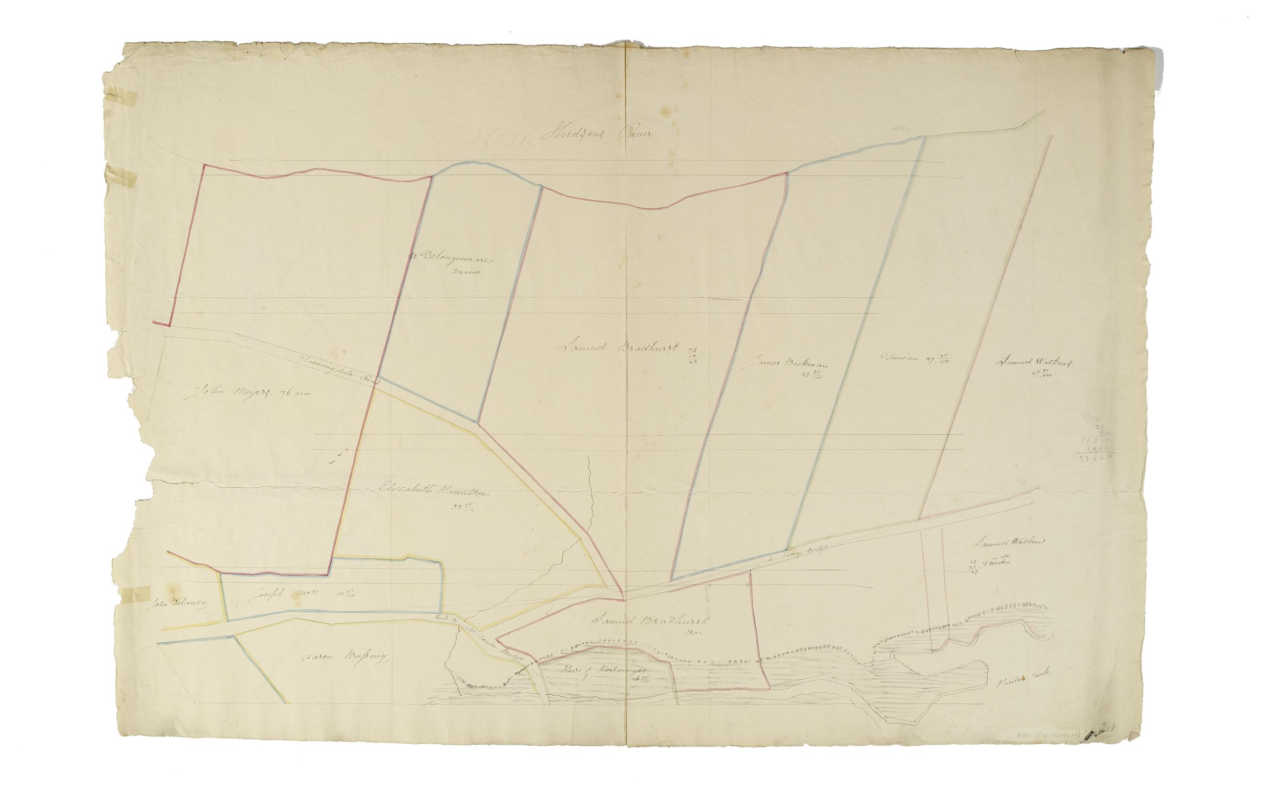
Still Image [Map of the area later bounded by 135th and 157th Streets, the Harlem River and Douglas Boulevard, Manhattan, New York, N.Y.]. Scale [ca. 1:2,450]. Cadastral map. Shows property lines and owners' names, some existing roads and projected streets. Shows relief by hachures. Pen-and-ink, watercolor on paper. Annotations in a later hand on the recto of this sheet give the number 20. The map on verso of this one belongs to the same series and is separately cataloged under the title, [Map of the area later bounded by 129th and 158th Streets, Douglass Boulevard and the Hudson River, Manhattan, New York, N.Y.]. View Item
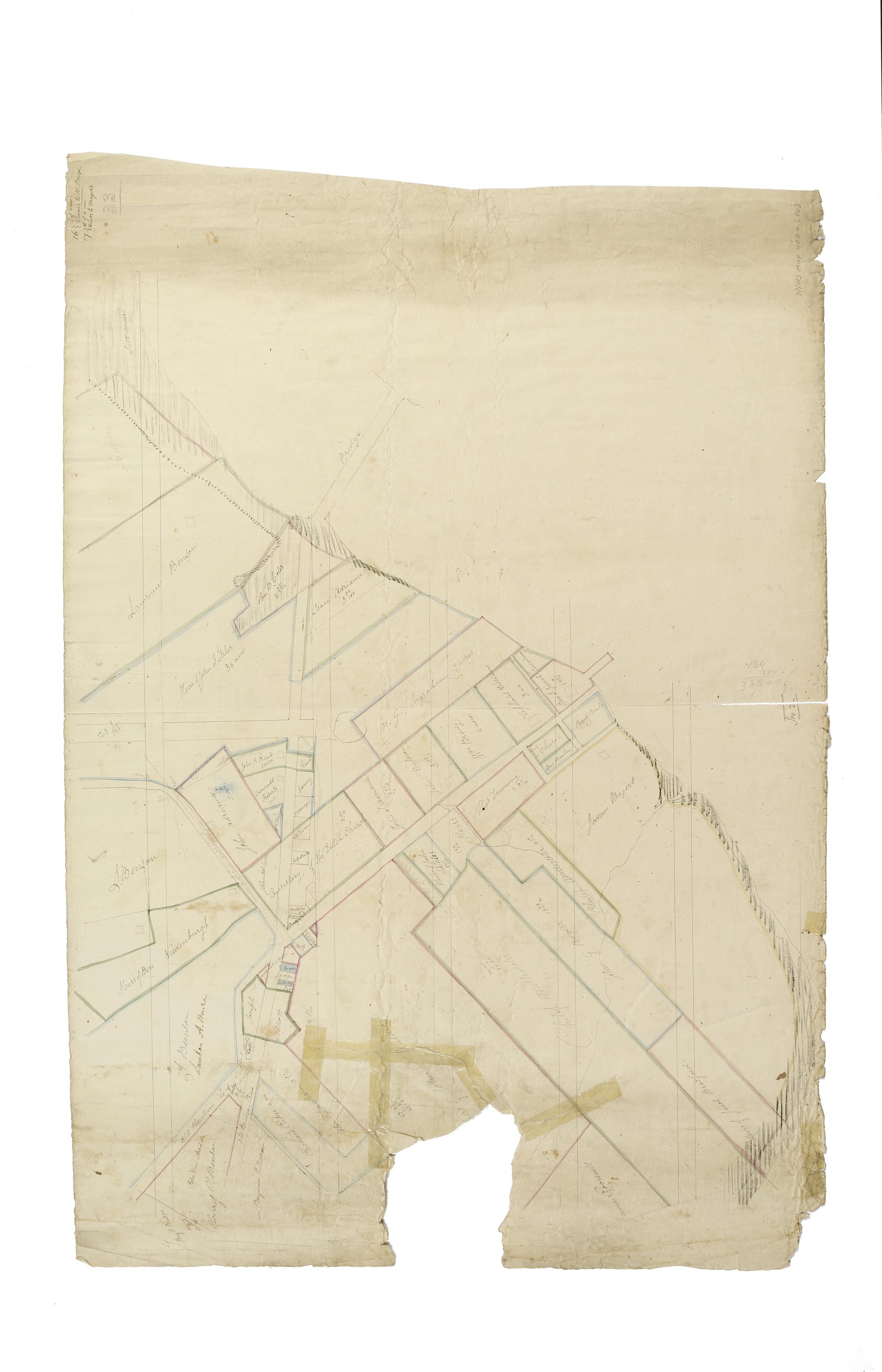
Still Image [Map of the area later bounded by 114th and 137th Streets, the Harlem River and 5th Avenue, Manhattan, New York, N.Y.]. Scale [ca. 1:2,450]. Cadastral map. Shows property lines and owners' names, some existing roads and projected streets. Shows relief by hachures. Pen-and-ink, watercolor on paper. Imperfect: lacking 15 cm. square at bottom center margin. Annotations in a later hand on the recto of this sheet give the number 16. The map on verso of this one belongs to the same series and is separately cataloged under the title, [Map of the area later bounded by 113th and 136th Streets, Park or Morningside and St. Nicholas Avenues, Manhattan, New York, N.Y.]. View Item
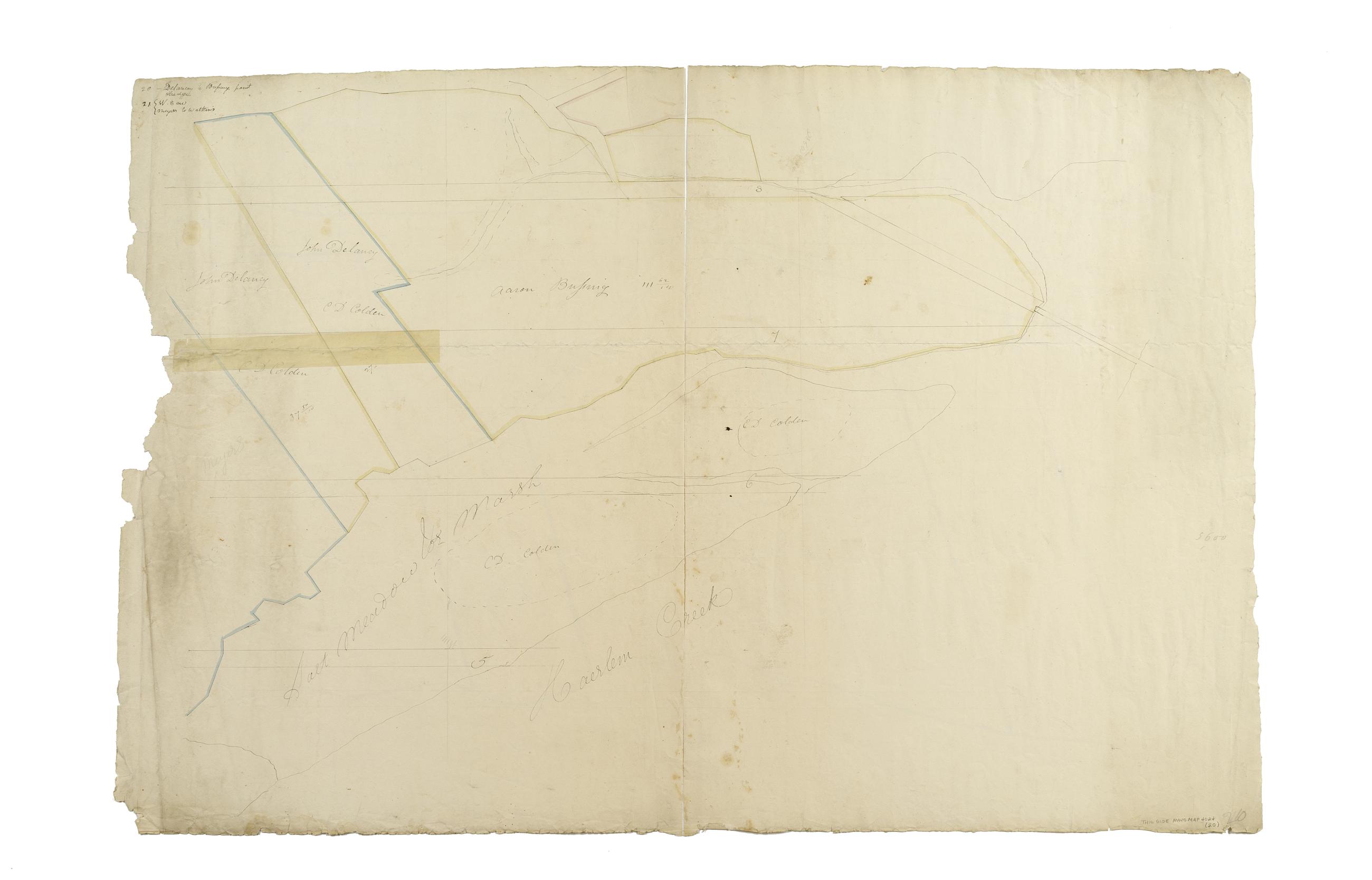
Still Image [Map of the area later bounded by 129th and 158th Streets, Douglass Boulevard and the Hudson River, Manhattan, New York, N.Y.]. Scale [ca. 1:2,450]. Cadastral map. Shows property lines and owners' names, some existing roads and projected streets. Shows relief by hachures. Pen-and-ink, watercolor on paper. Annotations in a later hand on the recto of this sheet also give the number 21. The map on recto of this sheet belongs to the same series and is separately cataloged under the title, [Map of the area later bounded by 135th and 157th Streets, the Harlem River and Convent Avenue, Manhattan, New York, N.Y.]. View Item
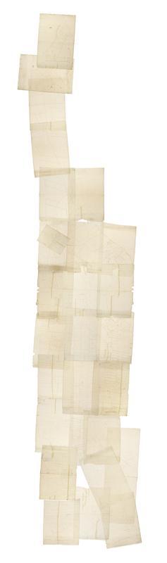
Still Image [Cadastral map of Manhattan]. Scale [ca. 1:2,450]. Digital composite of a cadastral map of Manhattan in 26 sections on 13 sheets which appears to be a draft for another map, owned by New York City and printed in Sackersdorff, Otto. Maps of farms, commonly called the Blue Book 1815 (New York: 1868). Shows property lines and owners' names, some existing roads and projected streets. Shows relief by hachures. Pen-and-ink, watercolor on paper. Sackersdorff gives the date of the manuscript map as circa 1815. Title and edition statement devised by cataloger. Attributed to Randel by cataloger; for provenance, see Stokes, I.N.P. View Item
Still Image [Map of the area later bounded by 93rd and 116th Streets, Park and Columbus Avenues, Manhattan, New York, N.Y.]. Scale [ca. 1:2,450]. Cadastral map. Shows property lines and owners' names, some existing roads and projected streets. Shows relief by hachures. Pen-and-ink, watercolor on paper. Annotations in a later hand on the recto of this sheet give the number 14. The map on recto of this sheet belongs to the same series and is separately cataloged under the title, [Map of the area later bounded by 73rd and 95th Streets, 7th Avenue or Central Park, and the Hudson River, Manhattan, New York, N.Y.]. View Item
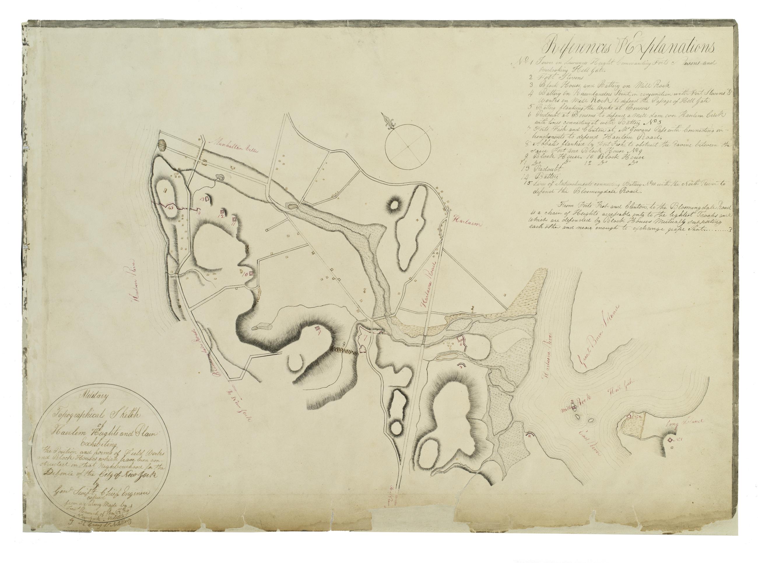
Still Image Military topographical sketch of Haerlem Heights and plain, exhibiting the position and forms of field works and block houses which have been constructed in that neghbourhood for the defence of the City of New York by Gen'l Swift, Chief Engineer / copied This manuscript map of Harlem is thought to have been drawn under the direction of James Renwick, whose son and namesake became a famous architect, for the Committee of Defense during the War of 1812. It includes a view of the Hudson River in the inset at the upper right. Military map. Covers the area later bounded by 85th and 135th Streets, Hell Gate and the Hudson River, Manhattan, New York (N.Y.). Shows fortifications, including batteries and redoubts. Also shows buildings, roads, streams and bridges. Relief shown by hachures, depths shown by form lines. View Item
Image Collection 29 Items John Randel's Cadastral map of Manhattan, approximately 1815 This cadastral map of Manhattan in 26 sections on 13 sheets appears to be a draft of another map printed in Sackersdorff, Otto. Maps of farms, commonly called the Blue Book 1815 (New York: 1868). The map shows property lines and owners' names, some existing roads and projected streets, and shows relief by hachures. Pen-and-ink, watercolor on paper. Sackersdorff gives the date of the manuscript map as circa 1815. Attributed to Randel by the cataloger; for provenance, see Stokes, I.N.P. Iconography of Manhattan Island, v. 3, p. 565. View Collection