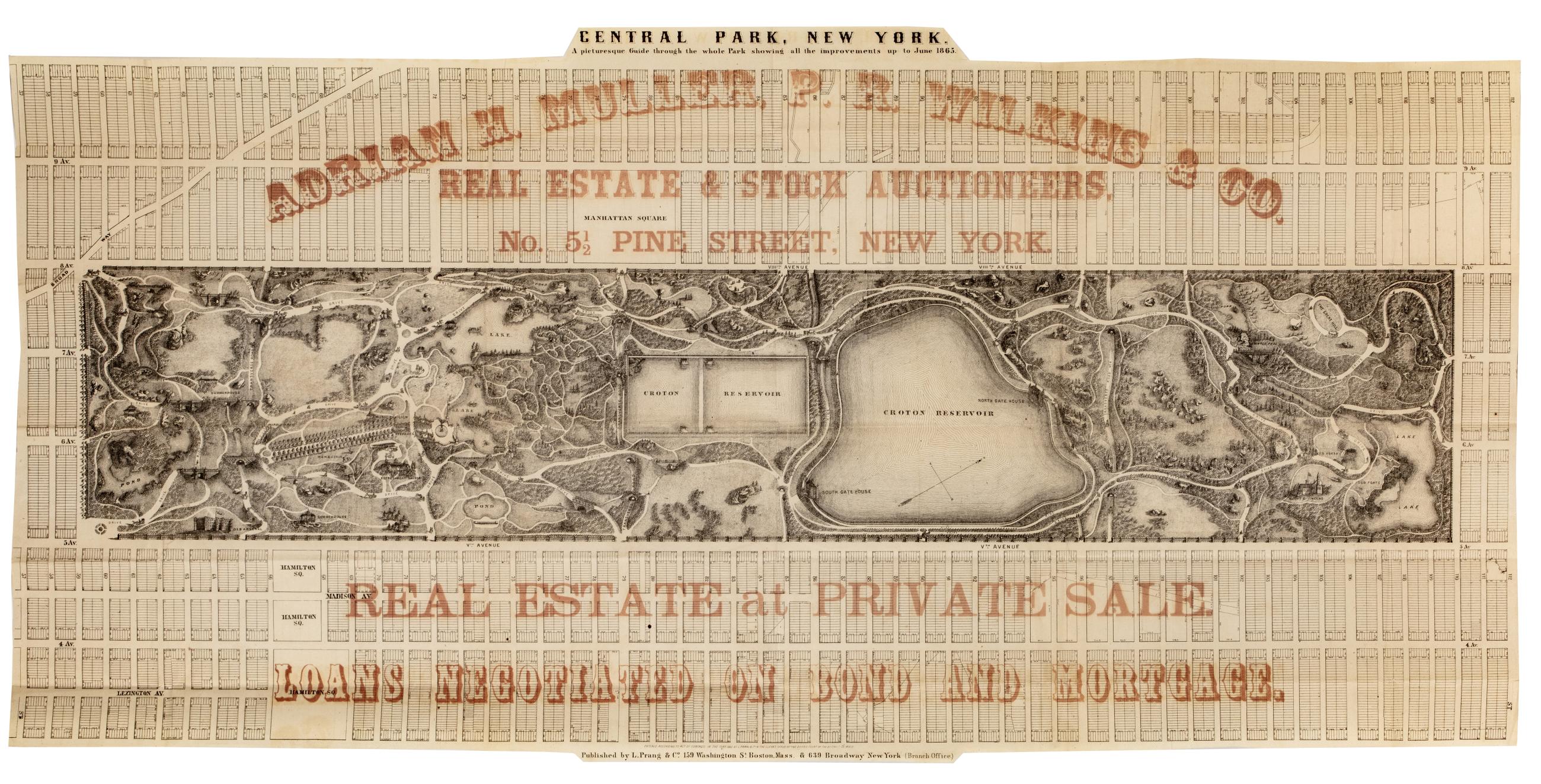
Cartographic Central Park, New York : a picturesque guide through the whole park showing all the improvements up to June 1865 Park map. Covers the area later bounded by 57th and 112th Streets, Third and Amsterdam Avenues, Manhattan, New York (N.Y.). Shows roads, trails, bridges, buildings, reservoir, gardens and plantings pictorially. Also shows landforms and streams. Oriented with north to right of sheet. "Entered according to act of Congress in the year 1865, by L. Prang & Co, in the Clerk's Office of the District Court of the District of Mass." Overprinted in red ink with: "Adrian H. Muller, P.R. Wilkins & Co., real estate and stock auctioneers, No. 5 1/2 Pine Street, New York. View Item
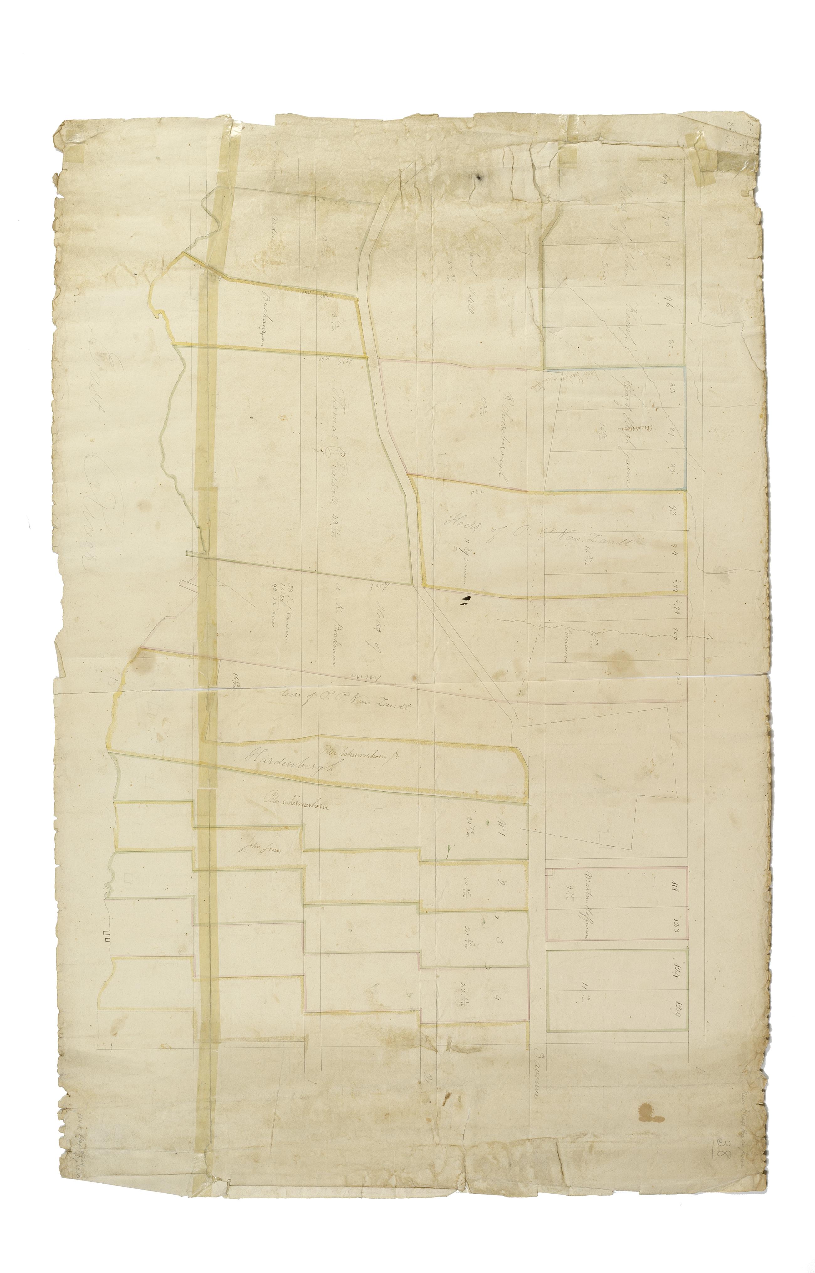
Still Image [Map of the area later bounded by 52nd and 74th Streets, Park Avenue, and 8th Avenue or Central Park West, Manhattan, New York, N.Y.]. Scale [ca. 1:2,450]. Cadastral map. Shows property lines and owners' names, some existing roads and projected streets. Pen-and-ink, watercolor on paper. Annotations in a later hand on this recto of this sheet give the number 34. The map on recto of this sheet belongs to the same series and is separately cataloged under the title, [Map of the area later bounded by 8th and 34th Streets, the East River and 5th Avenue, Manhattan, New York, N.Y.]. View Item
Still Image [Map of the area later bounded by 93rd and 115th Streets, the East or Harlem River and Park Avenue, Manhattan, New York, N.Y.]. Scale [ca. 1:2,450]. Cadastral map. Shows property lines and owners' names, some existing roads and projected streets. Shows relief by hachures. Pen-and-ink, watercolor on paper. Annotations in a later hand on the recto of this sheet give the number 15. The map on recto of this sheet belongs to the same series and is separately cataloged under the title, [Map of the area later bounded by 93rd and 118th Streets, 8th Avenue and the Hudson River, Manhattan, New York, N.Y.]. View Item
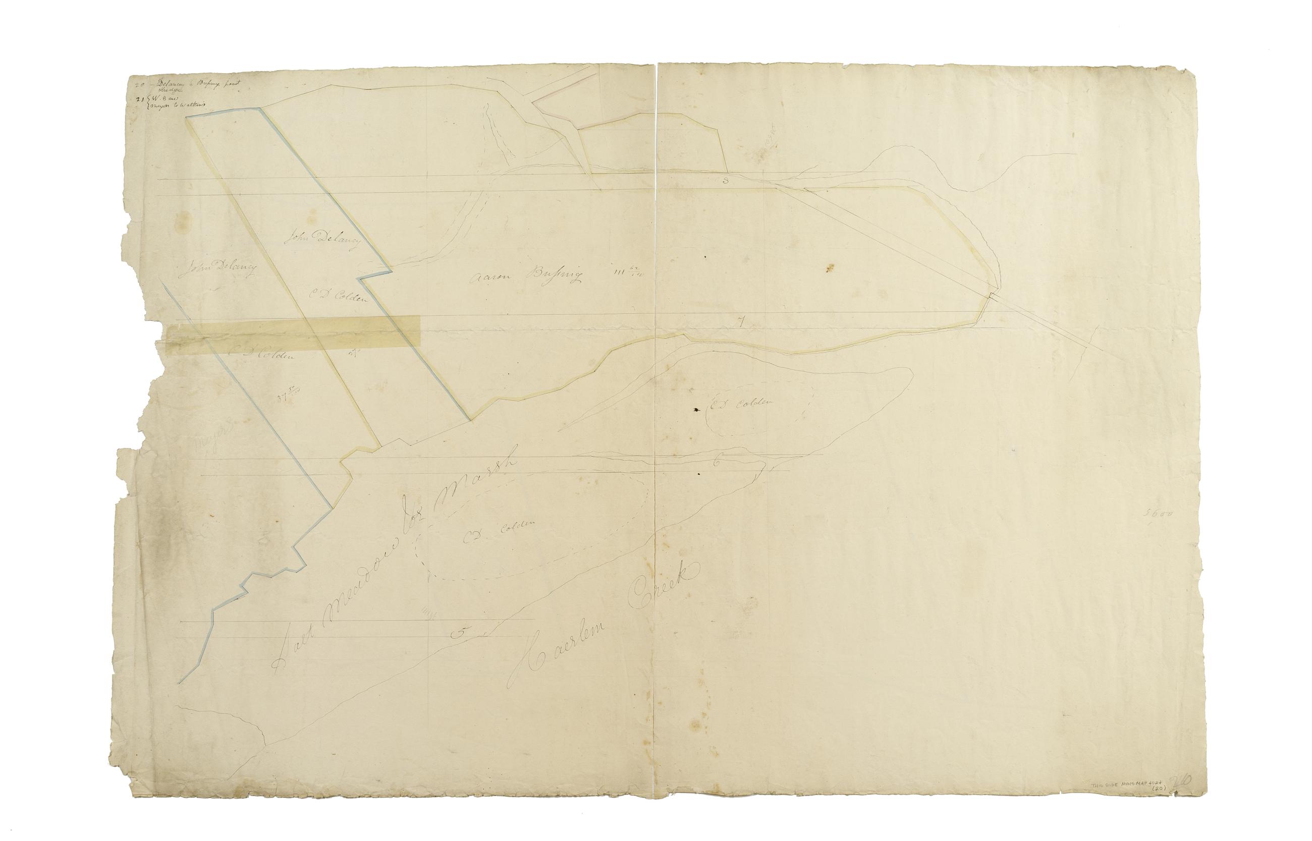
Still Image [Map of the area later bounded by 135th and 157th Streets, the Harlem River and Douglas Boulevard, Manhattan, New York, N.Y.]. Scale [ca. 1:2,450]. Cadastral map. Shows property lines and owners' names, some existing roads and projected streets. Shows relief by hachures. Pen-and-ink, watercolor on paper. Annotations in a later hand on the recto of this sheet give the number 20. The map on verso of this one belongs to the same series and is separately cataloged under the title, [Map of the area later bounded by 129th and 158th Streets, Douglass Boulevard and the Hudson River, Manhattan, New York, N.Y.]. View Item
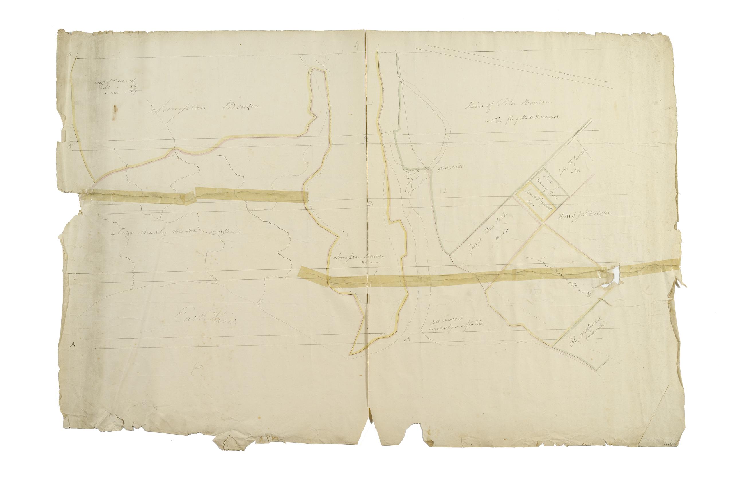
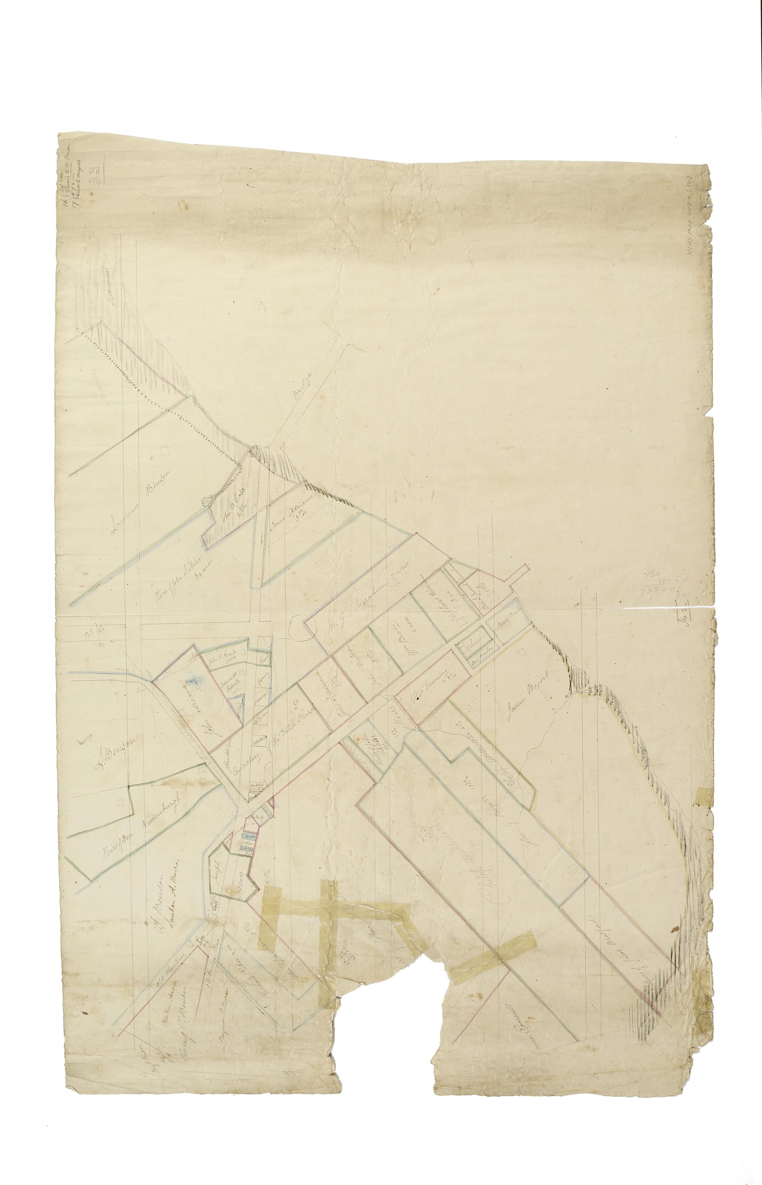
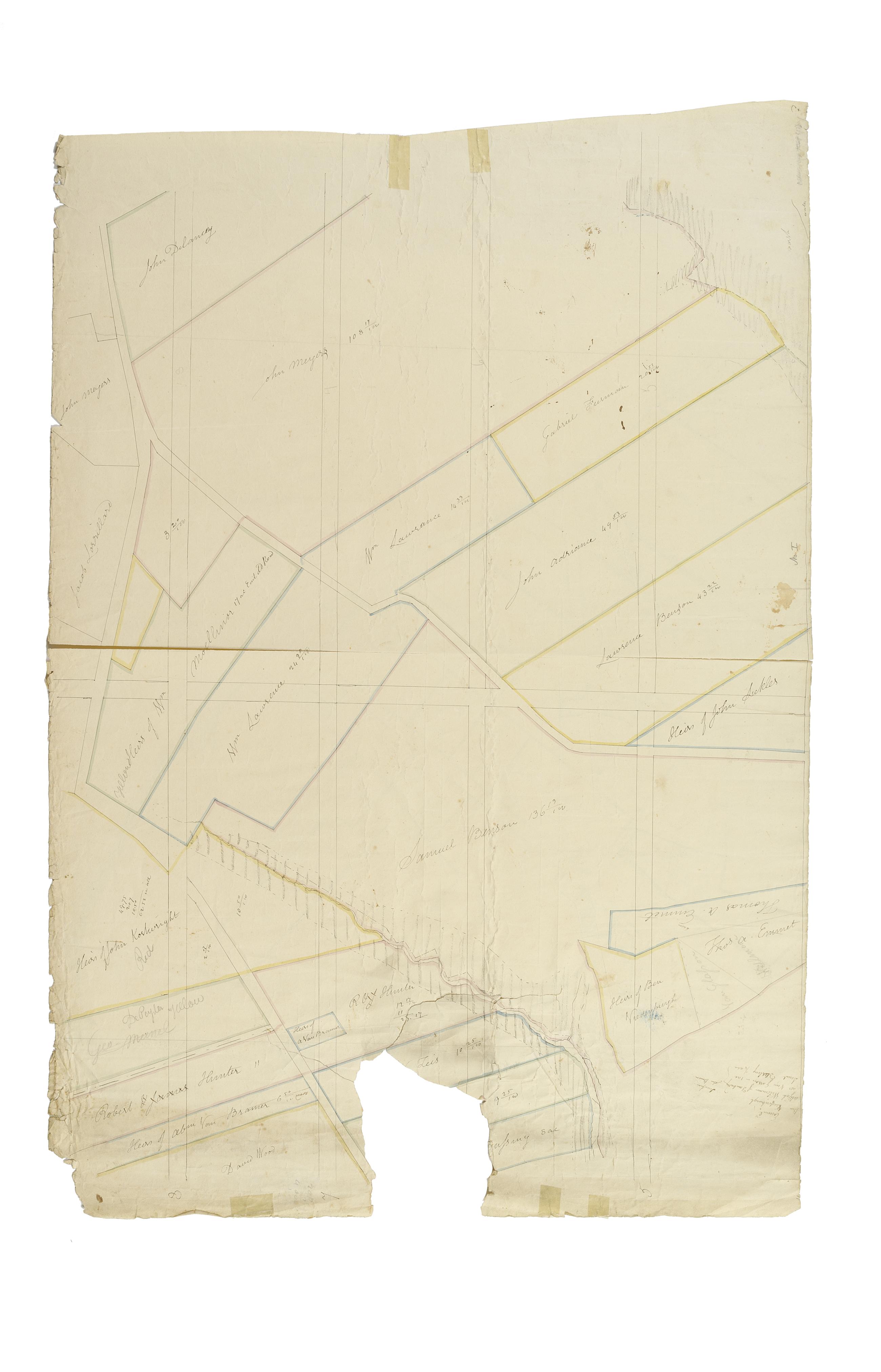
Still Image [Map of the area later bounded by 114th and 137th Streets, the Harlem River and 5th Avenue, Manhattan, New York, N.Y.]. Scale [ca. 1:2,450]. Cadastral map. Shows property lines and owners' names, some existing roads and projected streets. Shows relief by hachures. Pen-and-ink, watercolor on paper. Imperfect: lacking 15 cm. square at bottom center margin. Annotations in a later hand on the recto of this sheet give the number 16. The map on verso of this one belongs to the same series and is separately cataloged under the title, [Map of the area later bounded by 113th and 136th Streets, Park or Morningside and St. Nicholas Avenues, Manhattan, New York, N.Y.]. View Item
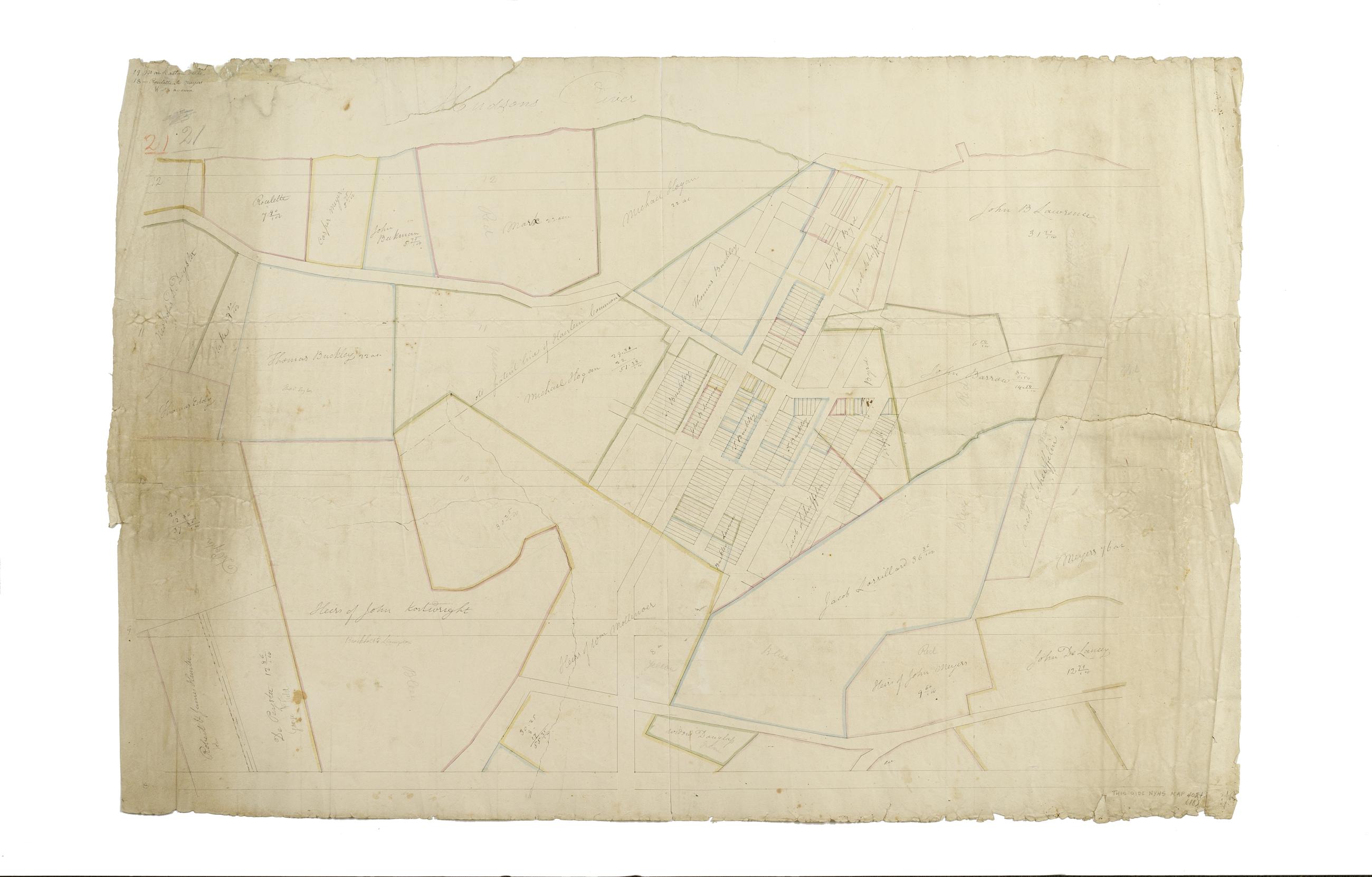
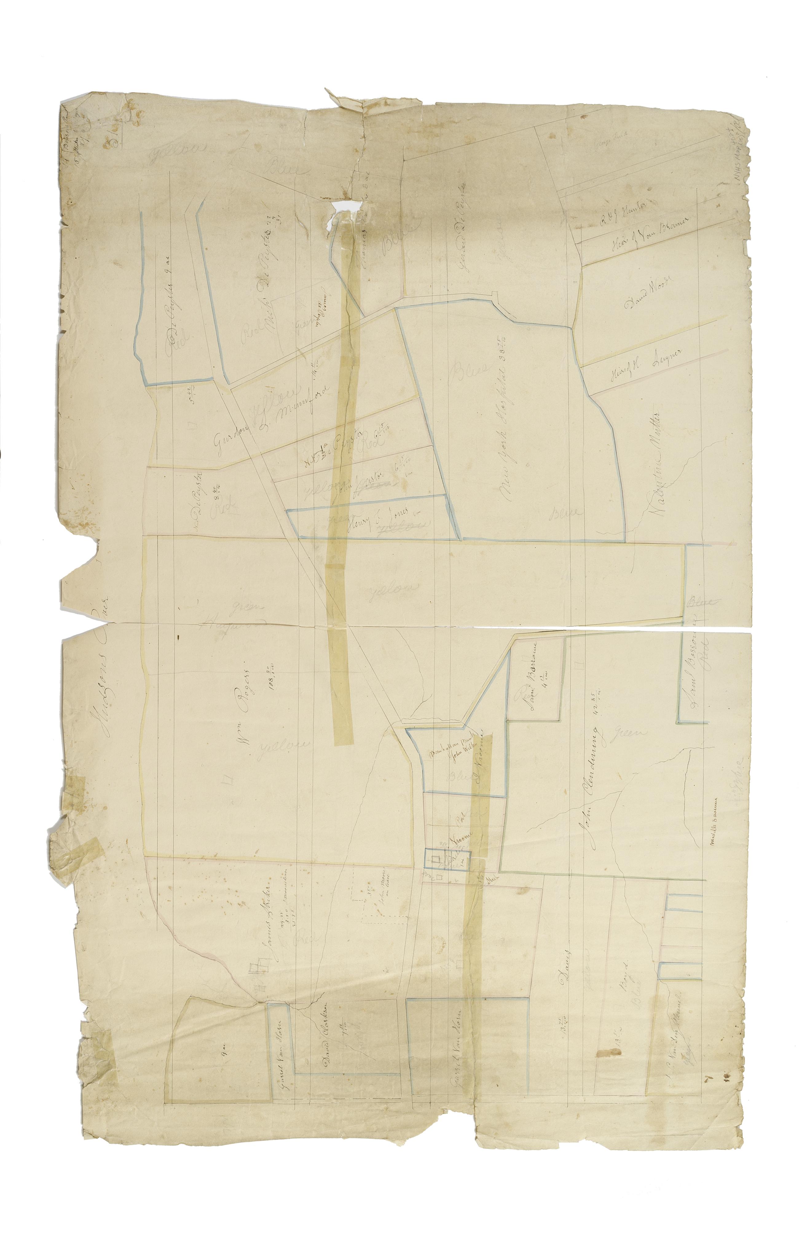
Still Image [Map of the area later bounded by 129th and 158th Streets, Douglass Boulevard and the Hudson River, Manhattan, New York, N.Y.]. Scale [ca. 1:2,450]. Cadastral map. Shows property lines and owners' names, some existing roads and projected streets. Shows relief by hachures. Pen-and-ink, watercolor on paper. Annotations in a later hand on the recto of this sheet also give the number 21. The map on recto of this sheet belongs to the same series and is separately cataloged under the title, [Map of the area later bounded by 135th and 157th Streets, the Harlem River and Convent Avenue, Manhattan, New York, N.Y.]. View Item
Still Image [Cadastral map of Manhattan]. Scale [ca. 1:2,450]. Digital composite of a cadastral map of Manhattan in 26 sections on 13 sheets which appears to be a draft for another map, owned by New York City and printed in Sackersdorff, Otto. Maps of farms, commonly called the Blue Book 1815 (New York: 1868). Shows property lines and owners' names, some existing roads and projected streets. Shows relief by hachures. Pen-and-ink, watercolor on paper. Sackersdorff gives the date of the manuscript map as circa 1815. Title and edition statement devised by cataloger. Attributed to Randel by cataloger; for provenance, see Stokes, I.N.P. View Item
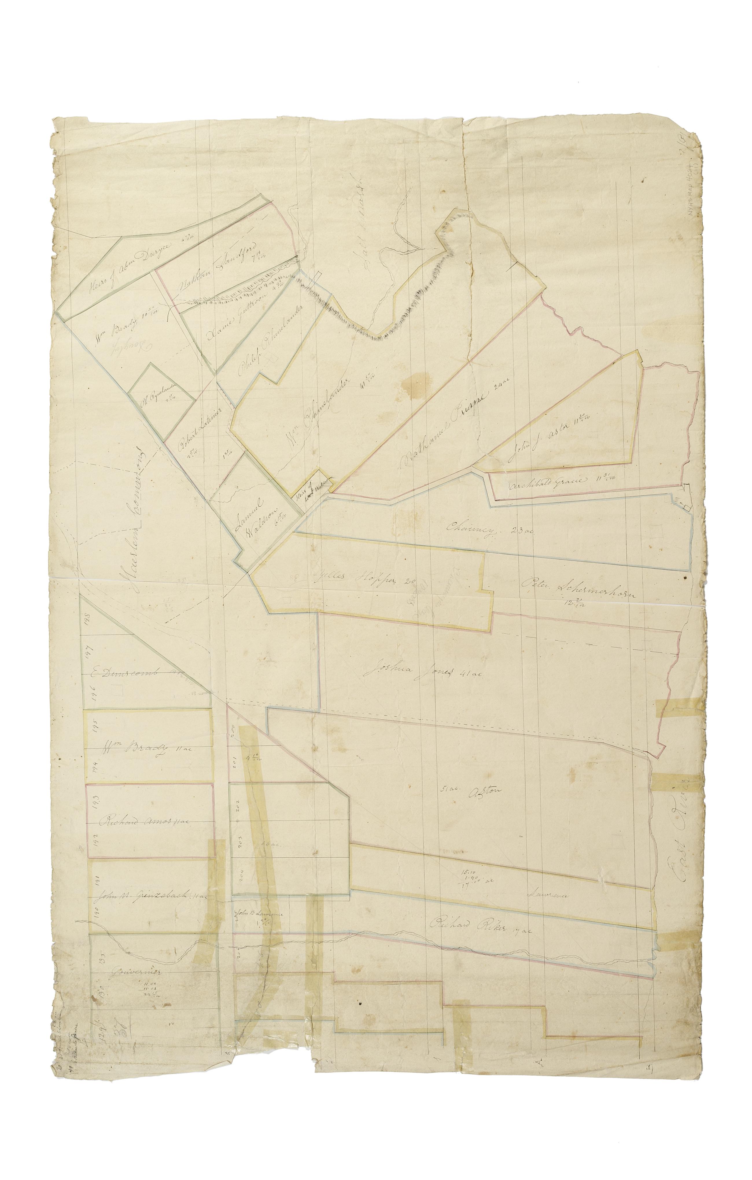
Still Image [Map of the area later bounded by 8th and 34th Streets, the East River and 5th Avenue, Manhattan, New York, N.Y.]. Scale [ca. 1:2,450]. Cadastral map. Shows property lines and owners' names, some existing roads and projected streets. Pen-and-ink, watercolor on paper. The map on verso of this one belongs to the same series and is separately cataloged under the title, [Map of the area later bounded by 52nd and 74th Streets, Park Avenue, and 8th Avenue or Central Park West, Manhattan, New York, N.Y.]. View Item
Still Image [Map of the area later bounded by 93rd and 116th Streets, Park and Columbus Avenues, Manhattan, New York, N.Y.]. Scale [ca. 1:2,450]. Cadastral map. Shows property lines and owners' names, some existing roads and projected streets. Shows relief by hachures. Pen-and-ink, watercolor on paper. Annotations in a later hand on the recto of this sheet give the number 14. The map on recto of this sheet belongs to the same series and is separately cataloged under the title, [Map of the area later bounded by 73rd and 95th Streets, 7th Avenue or Central Park, and the Hudson River, Manhattan, New York, N.Y.]. View Item
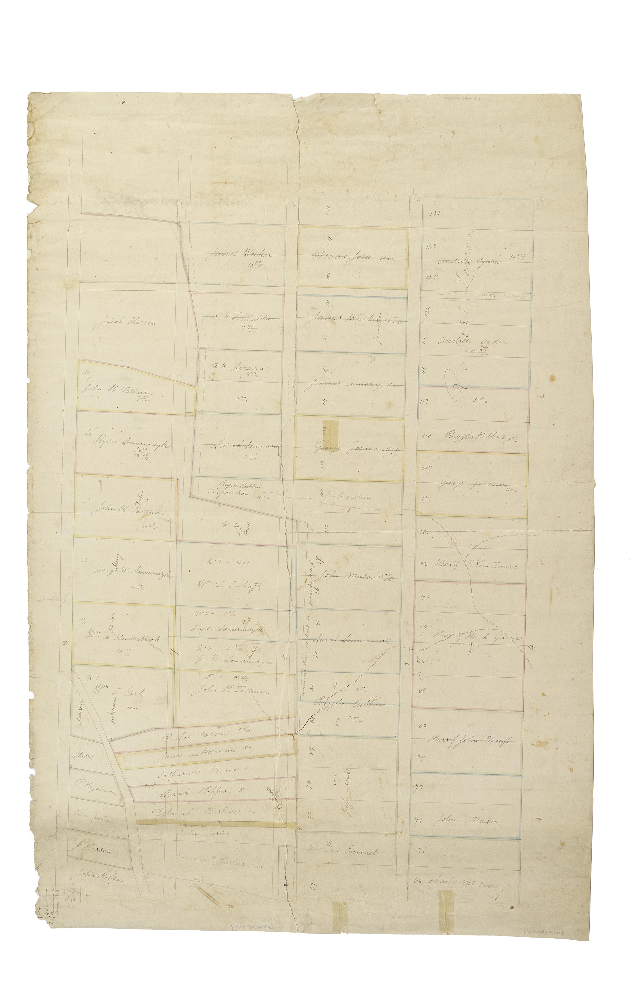
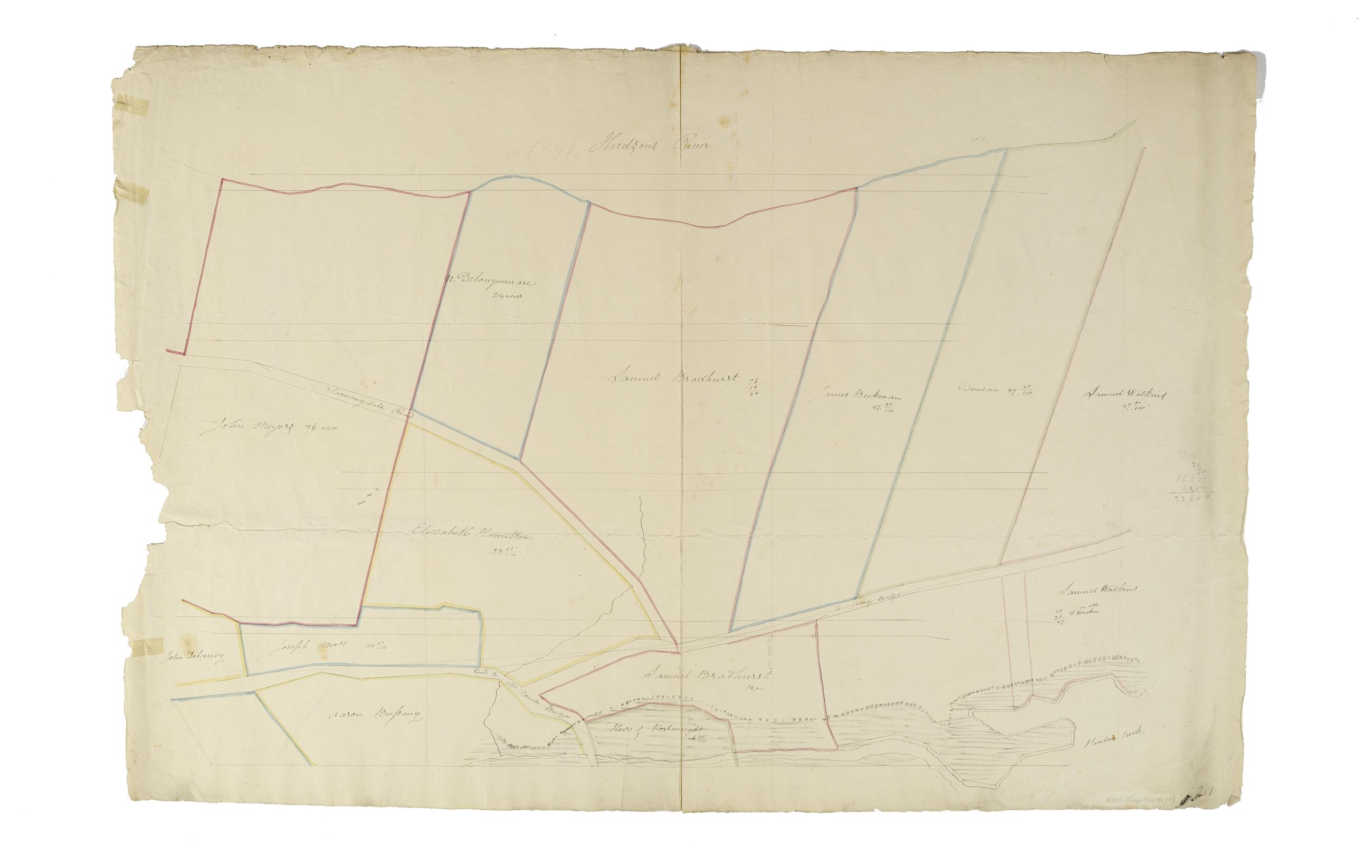
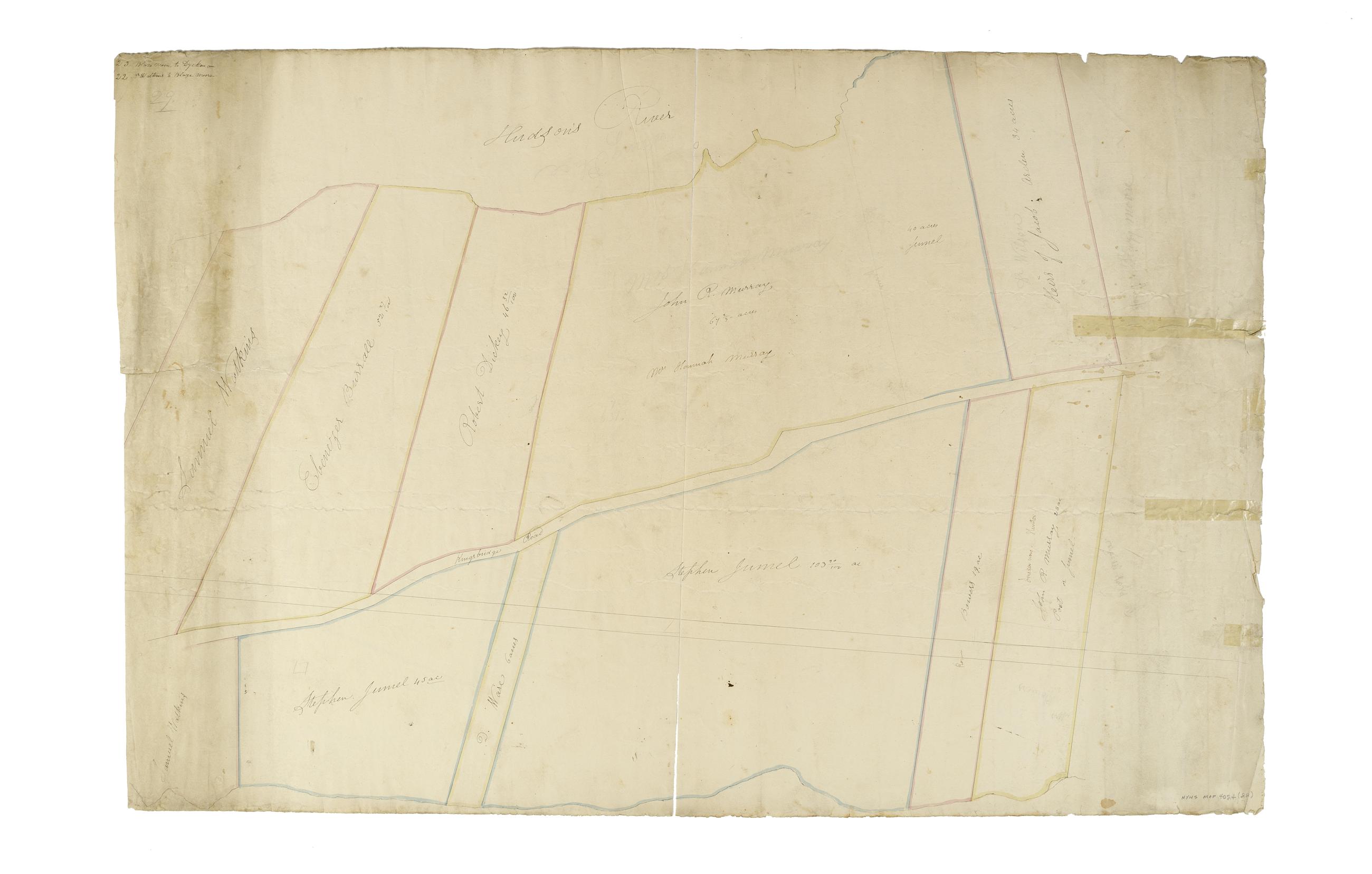
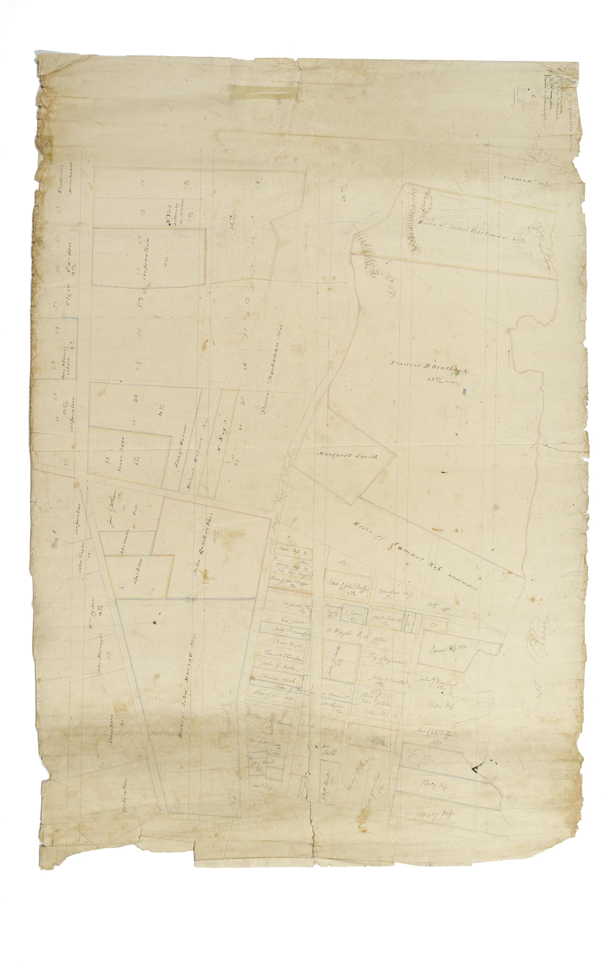
Still Image [Map of the area later bounded by 113th and 136th Streets, Park Avenue and Douglas Boulevard, Manhattan, New York, N.Y.]. Scale [ca. 1:2,450]. Cadastral map. Shows property lines and owners' names, some existing roads and projected streets. Shows relief by hachures. Pen-and-ink, watercolor on paper. Imperfect: lacking 15 cm. square at bottom center. Annotations in a later hand on the recto of this sheet give the number 17. The map on recto of this sheet belongs to the same series and is separately cataloged under the title, [Map of the area later bounded by 114th and 137th Streets, the Harlem River and 5th Avenue, Manhattan, New York, N.Y.]. View Item
Still Image [Map of the area later bounded by 177th and 201st Streets, the Harlem and Hudson Rivers, Manhattan, New York, N.Y.]. Scale [ca. 1:2,450]. Cadastral map. Shows property lines and owners' names, some existing roads and projected streets. Shows relief by hachures. Pen-and-ink, watercolor on paper. Annotations in a later hand on the recto of this sheet give the number 23. The map on recto of this sheet belongs to the same series and is separately cataloged under the title, [Map of the area later bounded by 156th and 178th Streets, the Harlem and Hudson Rivers, Manhattan, New York, N.Y.]. View Item
Still Image [Map of the area later bounded by 156th and 178th Streets, the Harlem and Hudson Rivers, Manhattan, New York, N.Y.]. Scale [ca. 1:2,450]. Cadastral map. Shows property lines and owners' names, some existing roads and projected streets. Shows relief by hachures. Pen-and-ink, watercolor on paper. Imperfect: lacking 15 cm. at bottom margin. Annotations in a later hand on the recto of this sheet give the number 22. The map on verso of this one belongs to the same series and is separately cataloged under the title, [Map of the area later bounded by 177th and 201st Streets, the Harlem and Hudson Rivers, Manhattan, New York, N.Y.]. View Item
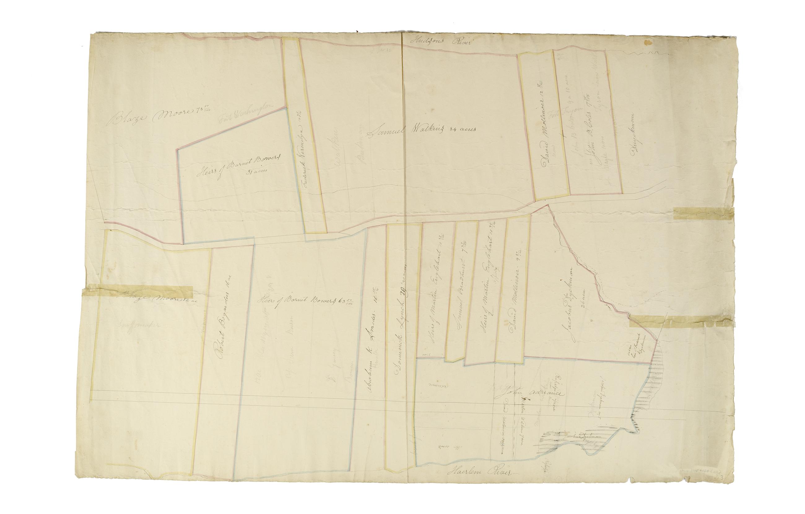
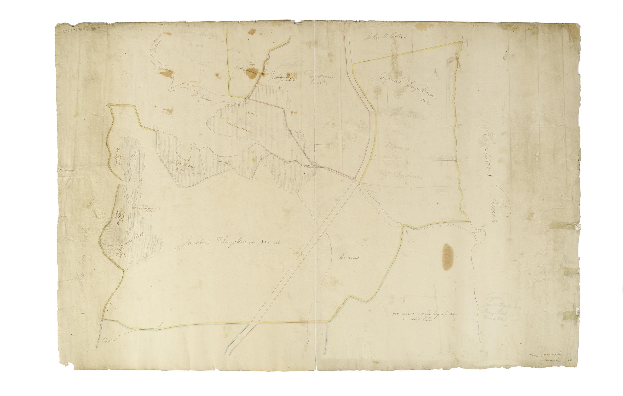
Still Image [Map of the area later bounded by 114th and 137th Streets, Douglass Boulevard and the Hudson River, Manhattan, New York, N.Y.]. Scale [ca. 1:2,450]. Cadastral map. Shows property lines and owners' names, some existing roads and projected streets. Shows relief by hachures. Pen-and-ink, watercolor on paper. Annotations in a later hand on the recto of this sheet also give the number 18. The map on verso of this one does not belong to the series and is separately cataloged--see Loss, Charles, surveyor. [Map of the area later bounded by 124th and 132nd Streets, 9th Avenue and the Hudson River, Manhattan, New York, N.Y.]. View Item
Still Image [Map of the area later bounded by 196th and 212th Streets, the Harlem and Hudson Rivers, Manhattan, New York, N.Y.]. Scale [ca. 1:2,450]. Cadastral map. Shows property lines and owners' names, some existing roads and projected streets. Shows relief by hachures. Pen-and-ink, watercolor on paper. Annotations in a later hand on the recto of this sheet give the number 24. The map on verso of this one belongs to the same series and is separately cataloged under the title, [Map of the area later bounded by 208th and 228th Streets, Manhattan, New York, N.Y.]. View Item
Still Image [Map of the area later bounded by 30th and 53rd Streets, the East River and 5th Avenue, Manhattan, New York, N.Y.]. Scale [ca. 1:2,450]. Cadastral map. Shows property lines and owners' names, some existing roads and projected streets. Shows relief by hachures. Pen-and-ink, watercolor on paper. Annotations in a later hand on the recto of this sheet give the number 6. The map on verso of this one belongs to the same series and is separately cataloged under the title, [Map of the area later bounded by 35th and 57th Streets, 7th and 11th Avenues, Manhattan, New York, N.Y.]. View Item
Still Image [Map of the area later bounded by 93rd and 118th Streets, Central Park West or Douglass Boulevard, and the Hudson River, Manhattan, New York, N.Y.]. Scale [ca. 1:2,450]. Cadastral map. Shows property lines and owners' names, some existing roads and projected streets. Pen-and-ink, watercolor on paper. Annotations in a later hand on the recto of this sheet give the number 15. The map on verso of this one belongs to the same series and is separately cataloged under the title, [Map of the area later bounded by 93rd and 115th Streets, the East or Harlem River and Park Avenue, Manhattan, New York, N.Y.]. View Item
Still Image [Map of the area later bounded by 15th and 33rd Streets, 6th and 10th Avenues, Manhattan, New York, N.Y.]. Scale [ca. 1:2,450]. Cadastral map. Shows property lines and owners' names, some existing roads and projected streets. Shows relief by hachures. Pen-and-ink, watercolor on paper. Annotations in a later hand on the recto of this sheet also give the number 5. The map on recto of this sheet belongs to the same series and is separately cataloged under the title, [Map of the area later bounded by 52nd and 73rd Streets, the East River and Park Avenue, Manhattan, New York, N.Y.]. View Item
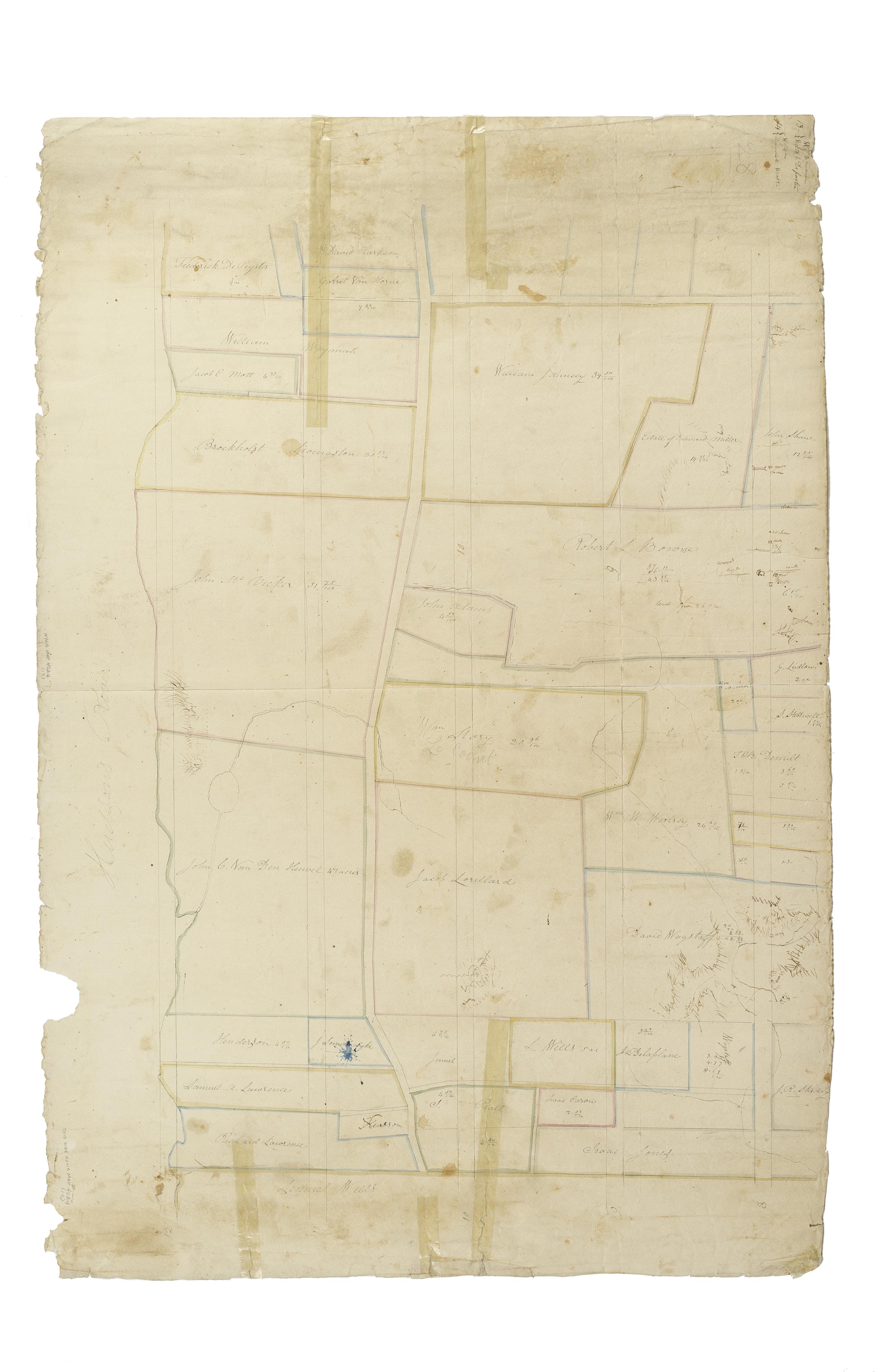
Still Image [Map of the area later bounded by 72nd and 95th Streets, the East River and Park Avenue, Manhattan, New York, N.Y.]. Scale [ca. 1:2,450]. Cadastral map. Shows property lines and owners' names, some existing roads and projected streets. Shows relief by hachures. Pen-and-ink, watercolor on paper. Annotations in a later hand on the recto of this sheet give the number 11. The map on verso of this one belongs to the same series and is separately cataloged under the title, [Map of the area later bounded by 10th and 22nd Streets, 5th and 8th Avenues, Manhattan, New York, N.Y.]. View Item
Still Image [Map of the area later bounded by 52nd and 73rd Streets, the East River and Park Avenue, Manhattan, New York, N.Y.]. Scale [ca. 1:2,450]. Cadastral map. Shows property lines and owners' names, some existing roads and projected streets. Shows relief by hachures. Pen-and-ink, watercolor on paper. Annotations in a later hand on the recto of this sheet give the number 5. The map on verso of this one belongs to the same series and is separately cataloged under the title, [Map of the area later bounded by 15th and 33rd Streets, 6th and 10th Avenues, Manhattan, New York, N.Y.]. View Item
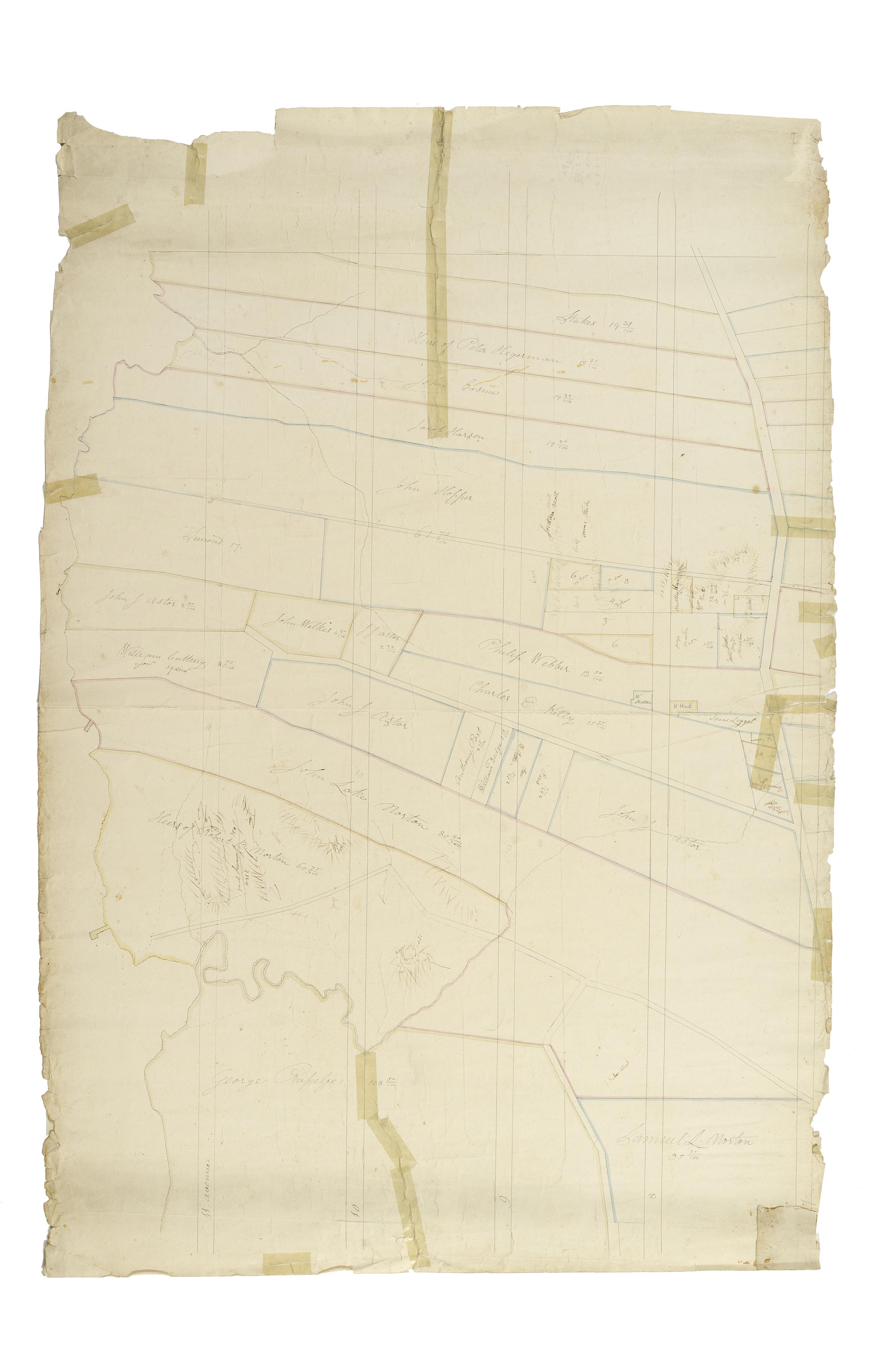
Still Image [Map of the area later bounded by 73rd and 95th Streets, 7th Avenue or Central Park, and the Hudson River, Manhattan, New York, N.Y.]. Scale [ca. 1:2,450]. Cadastral map. Shows property lines and owners' names, some existing roads and projected streets. Shows relief by hachures. Pen-and-ink, watercolor on paper. Annotations in a later hand on the recto of this sheet give the number 13. The map on verso of this one belongs to the same series and is separately cataloged under the title, [Map of the area later bounded by 93rd and 116th Streets, Park and Columbus Avenues, Manhattan, New York, N.Y.]. View Item
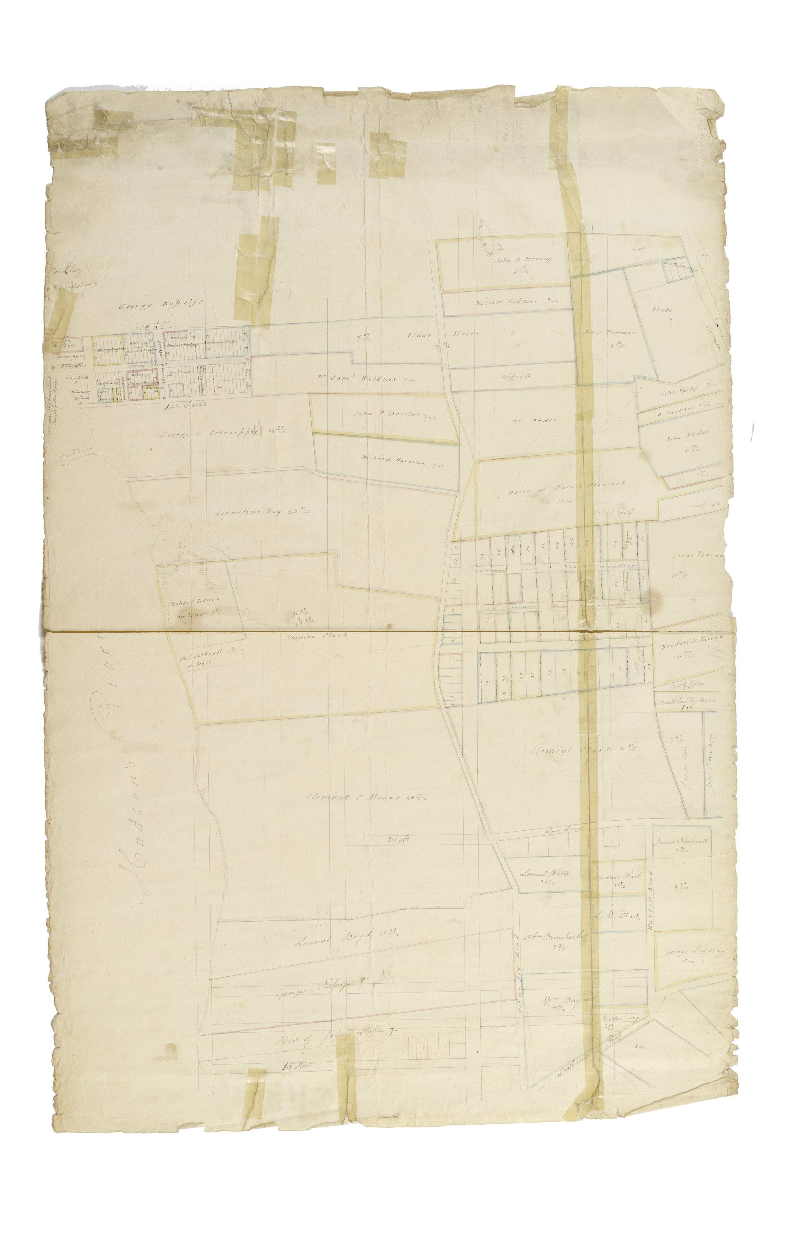
Still Image [Map of the area later bounded by 35th and 57th Streets, 7th and 11th Avenues, Manhattan, New York, N.Y.]. Scale [ca. 1:2,450]. Cadastral map. Shows property lines and owners' names, some existing roads and projected streets. Shows relief by hachures. Pen-and-ink, watercolor on paper. Annotations in a later hand on the recto of this sheet give the number 7. The map on recto of this sheet belongs to the same series and is separately cataloged under the title, [Map of the area later bounded by 30th and 53rd Streets, the East River and 5th Avenue, Manhattan, New York, N.Y.]. View Item
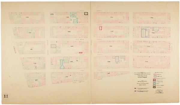
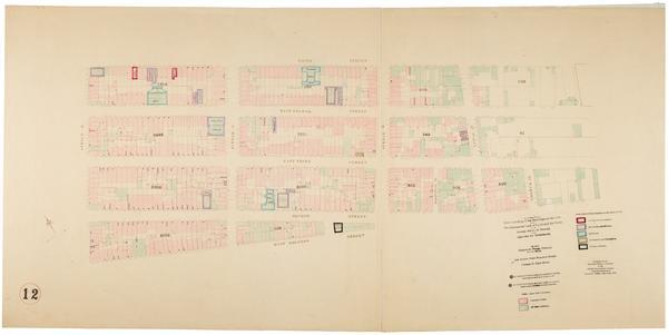
Still Image Map showing over-crowding of the buildings on the lots and the consequent lack of light and air space also strong-holds of poverty and agencies for betterment in the tenement house district bounded by 3rd Ave., East River, 28th, 22nd Streets / prepared fo Scale [ca. 1:650]. View Item
Still Image Map showing over-crowding of the buildings on the lots and the consequent lack of light and air space also strong-holds of poverty and agencies for betterment in the tenement house district bounded by East Houston, Rivington Streets, Willett Street, East Scale [ca. 1:650]. View Item
Still Image Map showing over-crowding of the buildings on the lots and the consequent lack of light and air space also strong-holds of poverty and agencies for betterment in the tenement house district bounded by 17th Street, 12th Street, 3rd Avenue, Avenue A / prepa Scale [ca. 1:650]. View Item
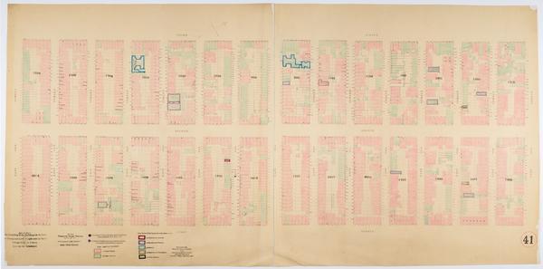
Still Image Map showing over-crowding of the buildings on the lots and the consequent lack of light and air space also strong-holds of poverty and agencies for betterment in the tenement house district bounded by 12th & 13th Ave., 7th Avenue, 38th, 30th Streets / pre Scale [ca. 1:650]. View Item
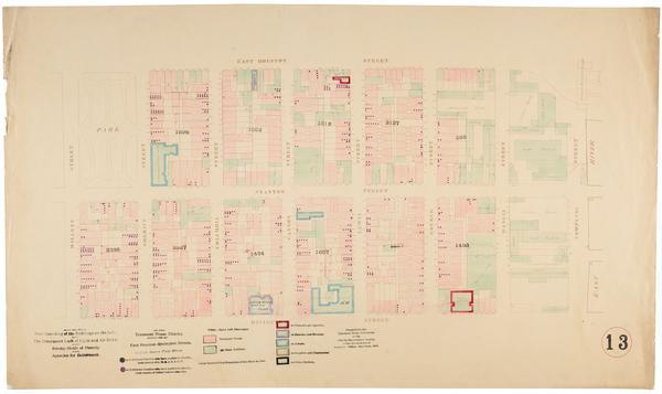
Still Image Map showing over-crowding of the buildings on the lots and the consequent lack of light and air space also strong-holds of poverty and agencies for betterment in the tenement house district bounded by 5th Street, East Houston Street, Bowery, Avenue B / pr Scale [ca. 1:650]. View Item
Still Image Map showing over-crowding of the buildings on the lots and the consequent lack of light and air space also strong-holds of poverty and agencies for betterment in the tenement house district bounded by 3rd Avenue, 1st Avenue, 86th, 72nd Streets / prepared Scale [ca. 1:650]. Oriented with north to upper right of sheet. View Item
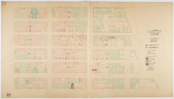
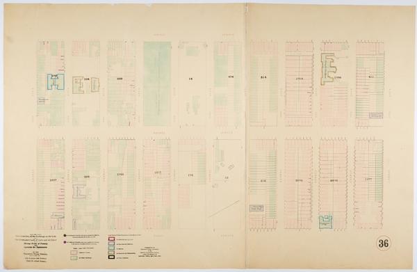
Still Image Map showing over-crowding of the buildings on the lots and the consequent lack of light and air space also strong-holds of poverty and agencies for betterment in the tenement house district bounded by West 12th & Bank Streets, W. 10th Street, West Street, Scale [ca. 1:650]. View Item
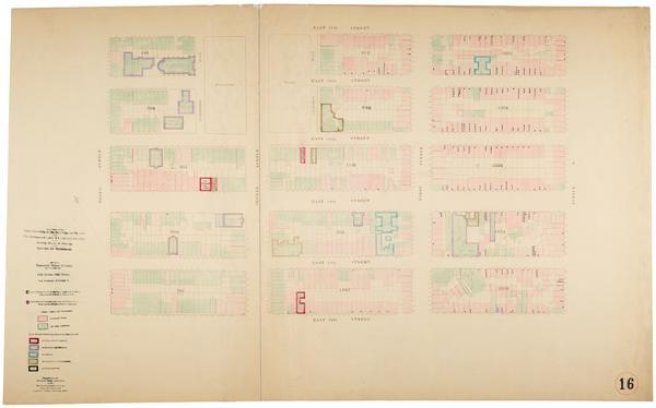
Still Image Map showing over-crowding of the buildings on the lots and the consequent lack of light and air space also strong-holds of poverty and agencies for betterment in the tenement house district bounded by 3rd Avenue, 1st Avenue, 72nd, 62nd Streets / prepared Scale [ca. 1:650]. Oriented with north to the upper right of sheet. View Item
Still Image Map showing over-crowding of the buildings on the lots and the consequent lack of light and air space also strong-holds of poverty and agencies for betterment in the tenement house district bounded by 5th Street, East Houston Street, Avenue B, East River Scale [ca. 1:650]. View Item