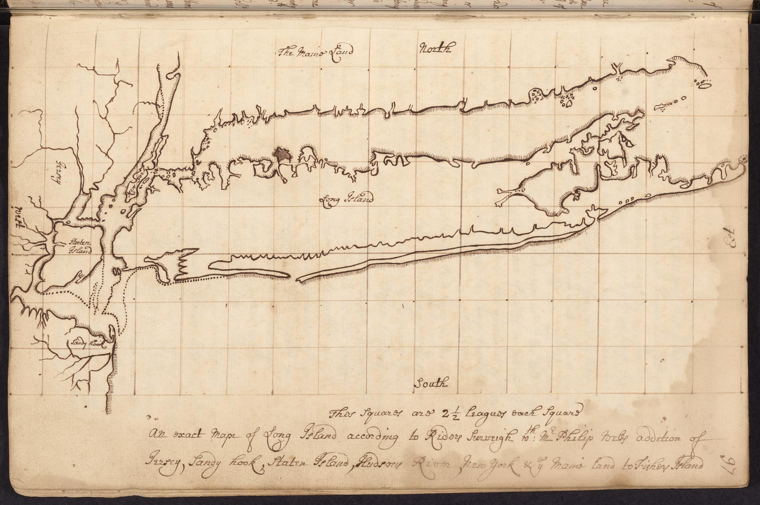
Text Map of Long Island with adjacent areas of New Jersey, New York and Connecticut, [1687?], page 97. Manuscript map copied by James Lloyd of "An exact map of Long Island according to Riders surveigh w[i]th: Mr. Philip Wells addition of Jersey, Sandy Hook, Staten Island, Hudsons River, New York & the maine land to Fishers Island." View Item
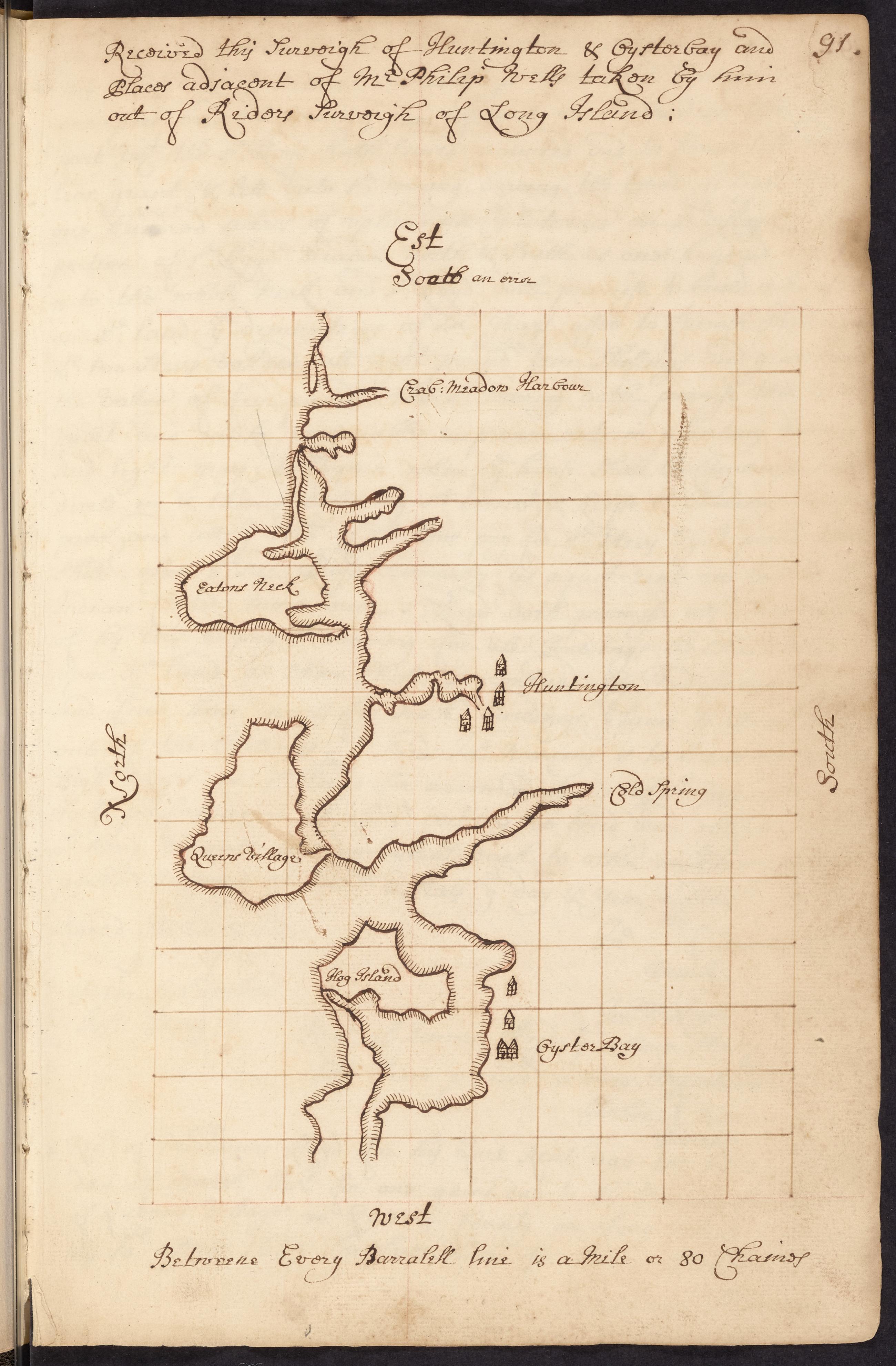
Text Lloyd family record book, 1654-1894, page 91, Map of the northern coast of central Long Island, [1687?] Manuscript map copied by James Lloyd from a "surveigh of Huntington & Oysterbay and places adjacent" by Philip Wells taken from Robert Ryder's survey of Long Island; map shows the coast of Long Island from the Town of Oyster Bay east to Crab Meadow including Queen's Village, Lloyd Neck. View Item
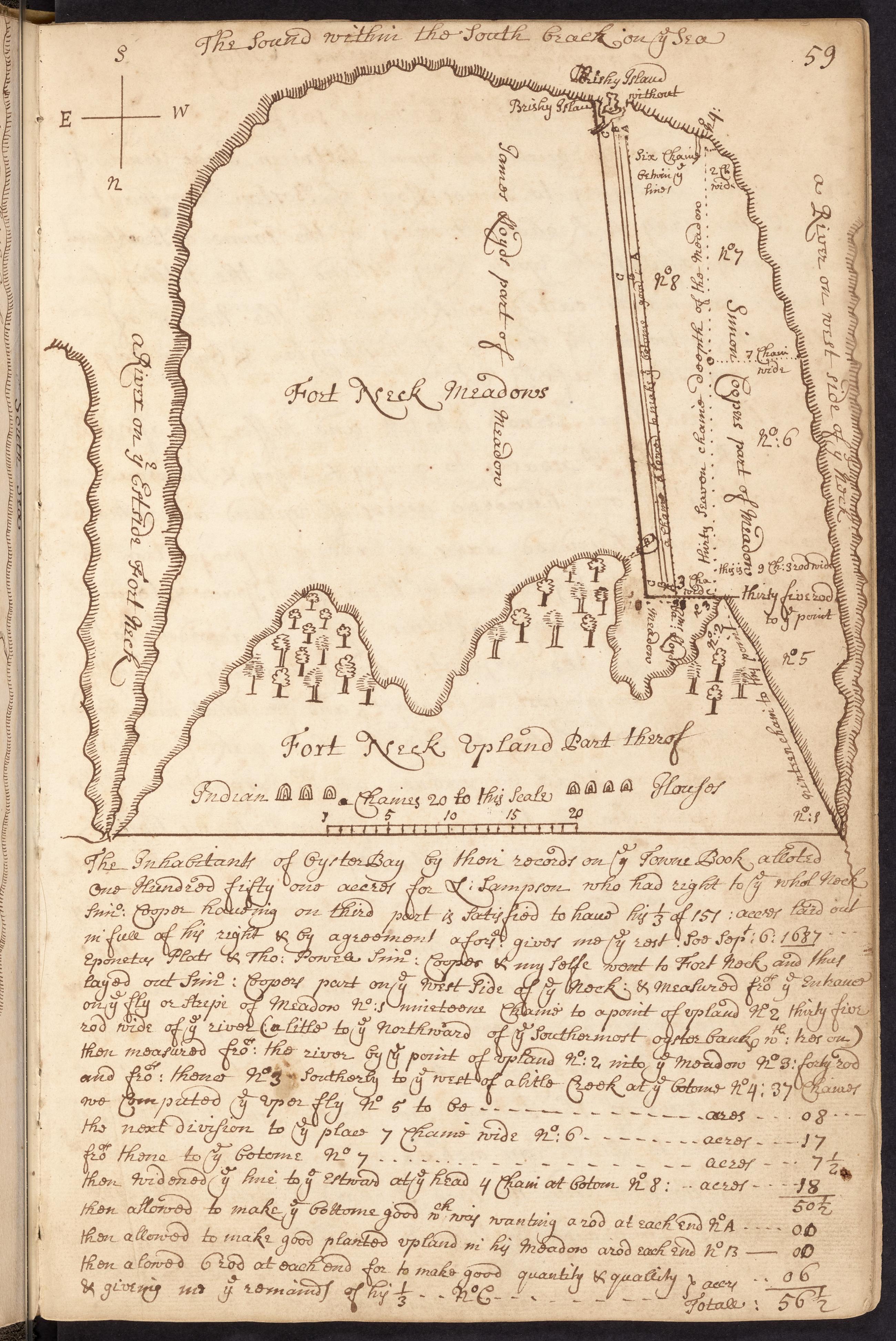
Text Lloyd family record book, 1654-1894, page 59, Map of Fort Neck, [1687?] Manuscript map drawn by James Lloyd of Fort Neck showing the division between his and Simon Cooper's shares with the measurements of Cooper's part and showing "Indian houses" on the upland north of the meadow; with an explanation of the division and measurements. View Item
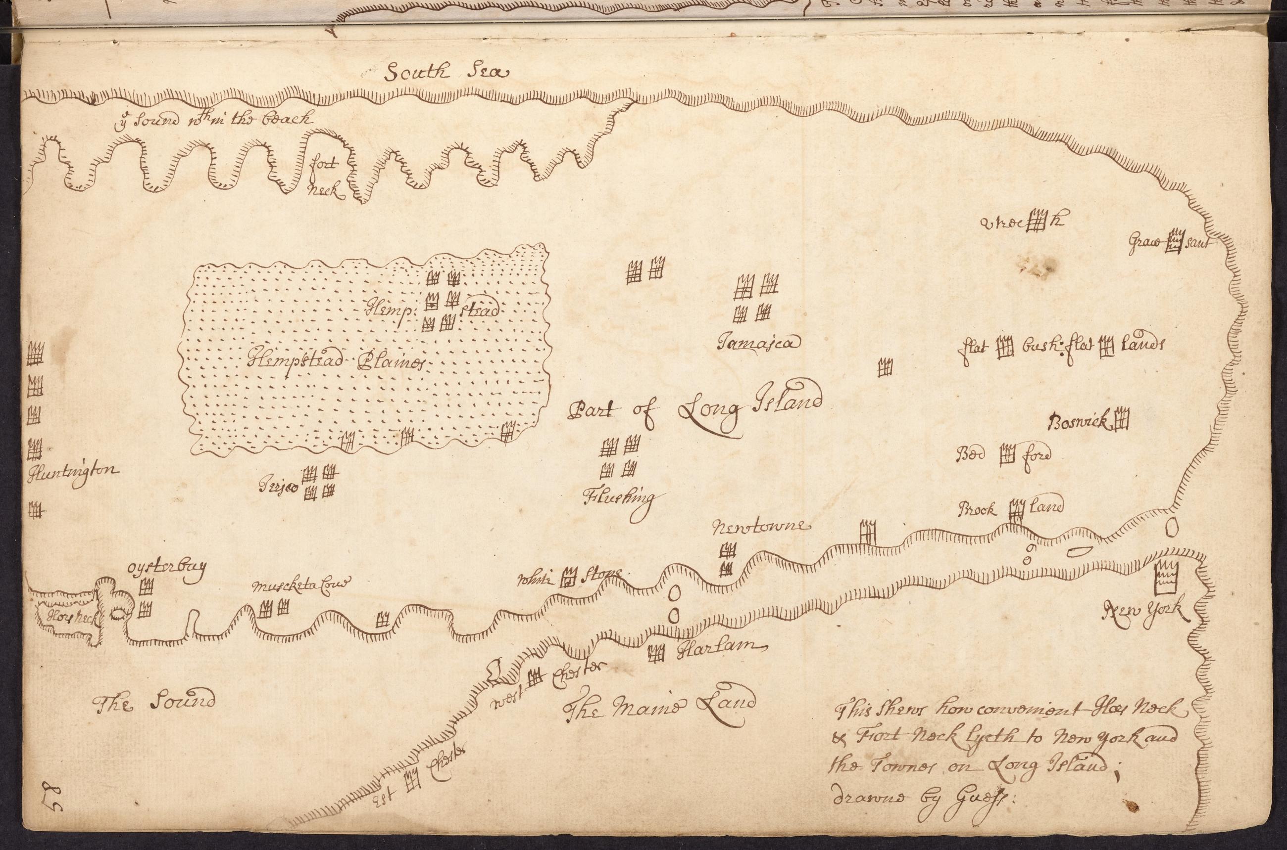
Text Lloyd family record book, 1654-1894, page 58, Map of western Long Island, [1687?] Manuscript map drawn by James Lloyd of western Long Island and adjacent parts of Manhattan and Westchester County to show the relative distance of Lloyd Neck and Fort Neck from New York City and various towns on Long Island; not drawn to scale. View Item