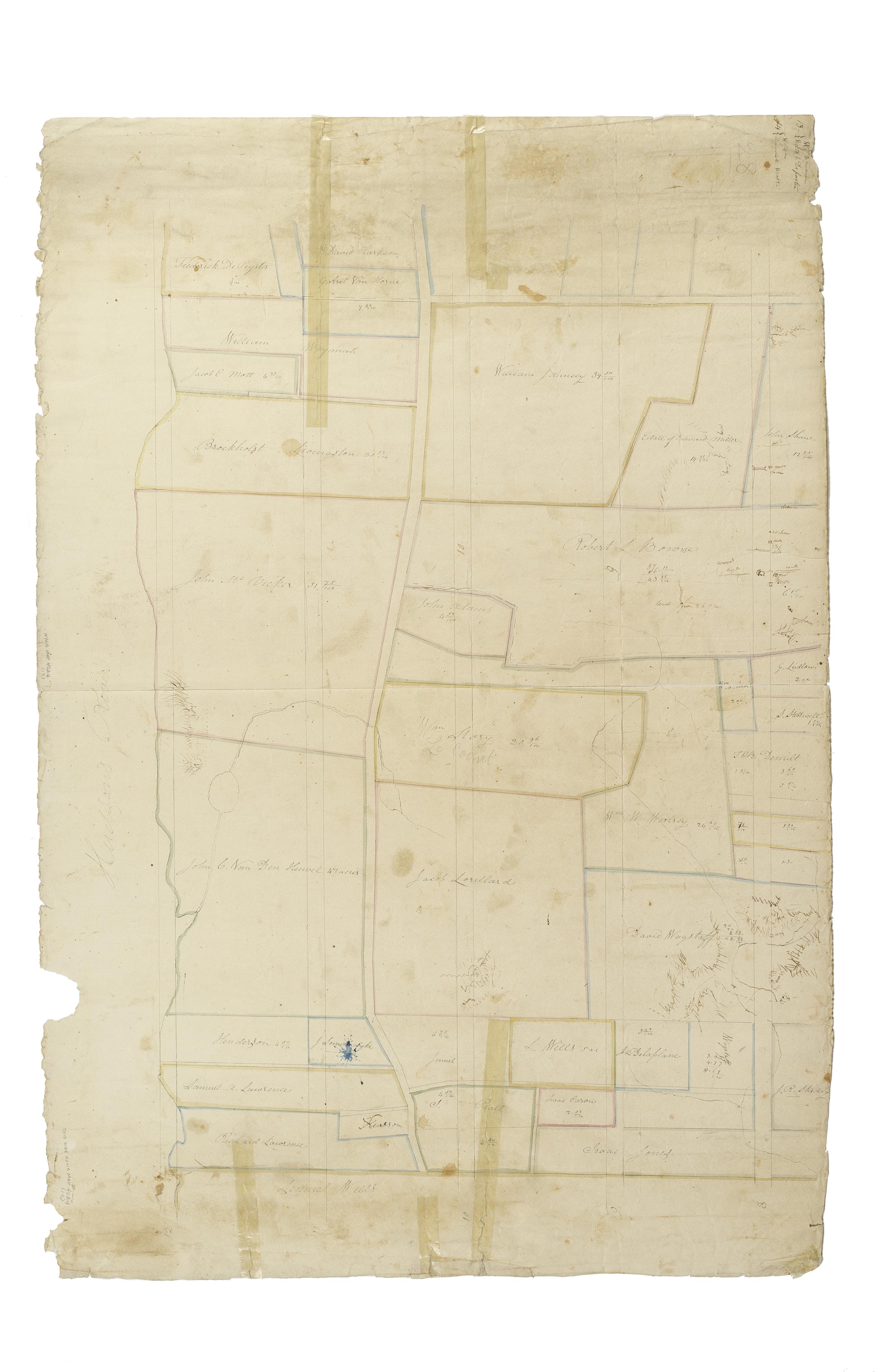
Still Image [Map of the area later bounded by 93rd and 116th Streets, Park and Columbus Avenues, Manhattan, New York, N.Y.]. Scale [ca. 1:2,450]. Cadastral map. Shows property lines and owners' names, some existing roads and projected streets. Shows relief by hachures. Pen-and-ink, watercolor on paper. Annotations in a later hand on the recto of this sheet give the number 14. The map on recto of this sheet belongs to the same series and is separately cataloged under the title, [Map of the area later bounded by 73rd and 95th Streets, 7th Avenue or Central Park, and the Hudson River, Manhattan, New York, N.Y.]. View Item
Still Image [Map of the area later bounded by 56th and 78th Streets, 7th Avenue or Central Park, and the Hudson River, Manhattan, New York, N.Y.]. Scale [ca. 1:2,450]. Cadastral map. Shows property lines and owners' names, some existing roads and projected streets. Shows relief by hachures. Pen-and-ink, watercolor on paper. Imperfect: lacking 15 cm. at bottom margin. Annotations in a later hand on the recto of this sheet give the number 10. The map on recto of this sheet belongs to the same series and is separately cataloged under the title, [Map of the area later bounded by 8th and 20th Streets, 7th Avenue and the Hudson River, Manhattan, New York, N.Y.]. View Item
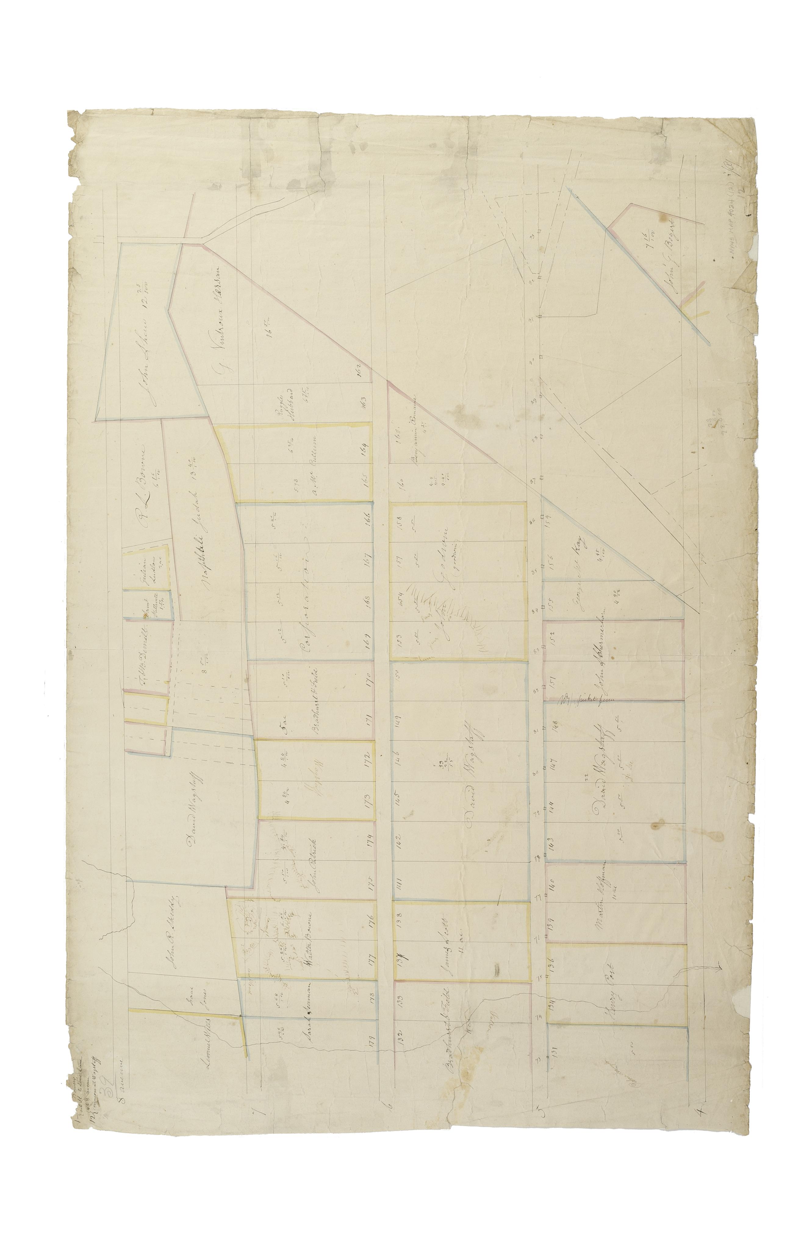
Still Image [Map of the area later bounded by 73rd and 94th Streets, Park Avenue and Central Park West, Manhattan, New York, N.Y.]. Scale [ca. 1:2,450]. Cadastral map. Shows property lines and owners' names, some existing roads and projected streets. Shows relief by hachures. Pen-and-ink, watercolor on paper. Annotations in a later hand on the recto of this sheet give the number 12. The map on verso of this one belongs to the same series and is separately cataloged under the title, [Map of the area later bounded by 10th and 21st Streets, 3rd and 6th Avenues, Manhattan, New York, N.Y.]. View Item
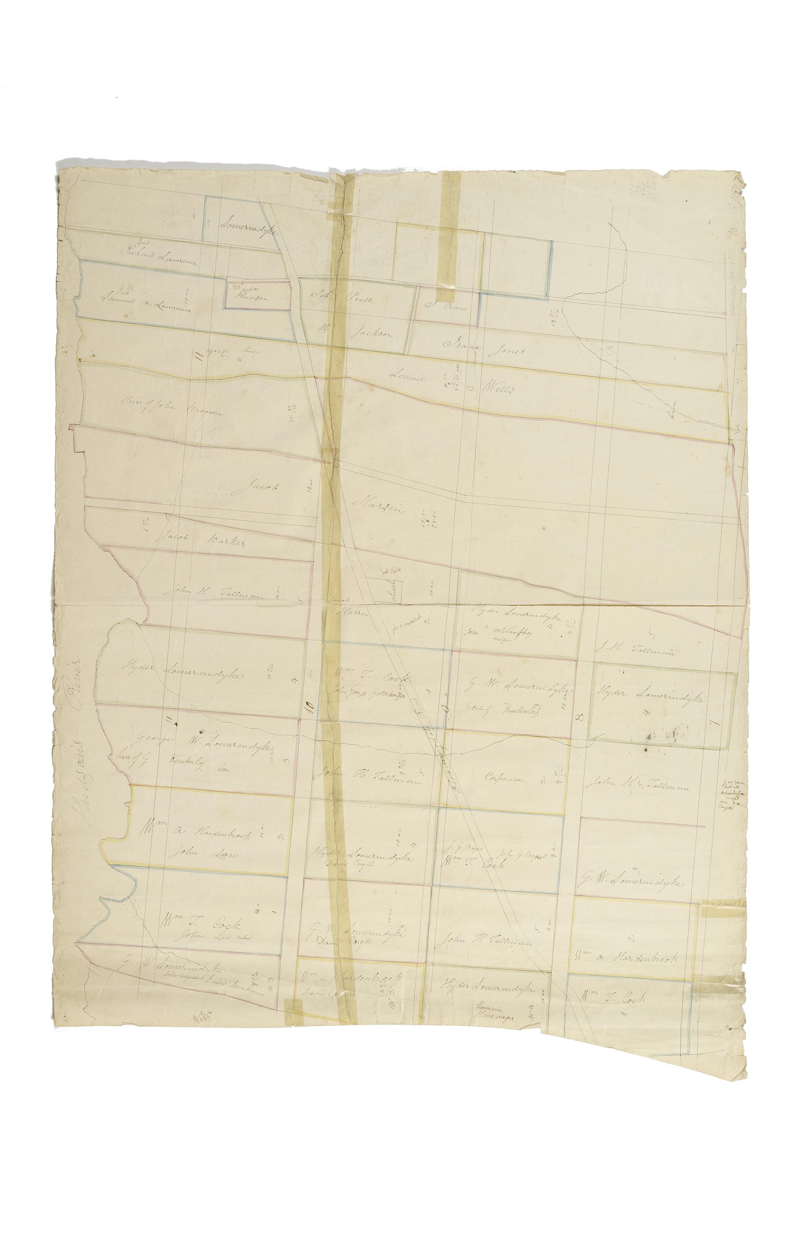
Still Image [Map of the area later bounded by 73rd and 95th Streets, 7th Avenue or Central Park, and the Hudson River, Manhattan, New York, N.Y.]. Scale [ca. 1:2,450]. Cadastral map. Shows property lines and owners' names, some existing roads and projected streets. Shows relief by hachures. Pen-and-ink, watercolor on paper. Annotations in a later hand on the recto of this sheet give the number 13. The map on verso of this one belongs to the same series and is separately cataloged under the title, [Map of the area later bounded by 93rd and 116th Streets, Park and Columbus Avenues, Manhattan, New York, N.Y.]. View Item
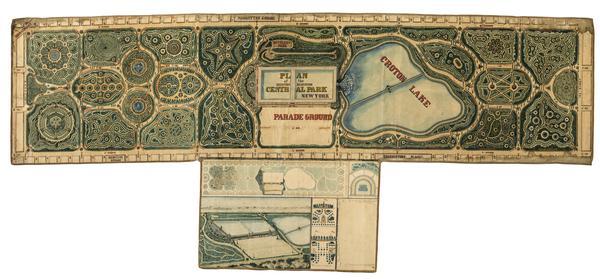
Still Image Plan of the Central Park, New York : entry no. 4 in the competition. March 20, 1858 The John Rink plan of Central Park. Number 4 of thirty-three submissions for the design competition for Central Park in Manhattan. It shows reservoirs, a parade ground, roads, plantings, and a monumental museum building (precursor of the Metropolitan Museum of Art) proposed for the south and east flanks of the Yorkville Reservoir. The plan is oriented with north to right of sheet. Ink and colored washes. References: Heckscher, M.H. Creating Central Park, p. 22. Rink was probably an engineer in the employ of the parks commissioners. View Item