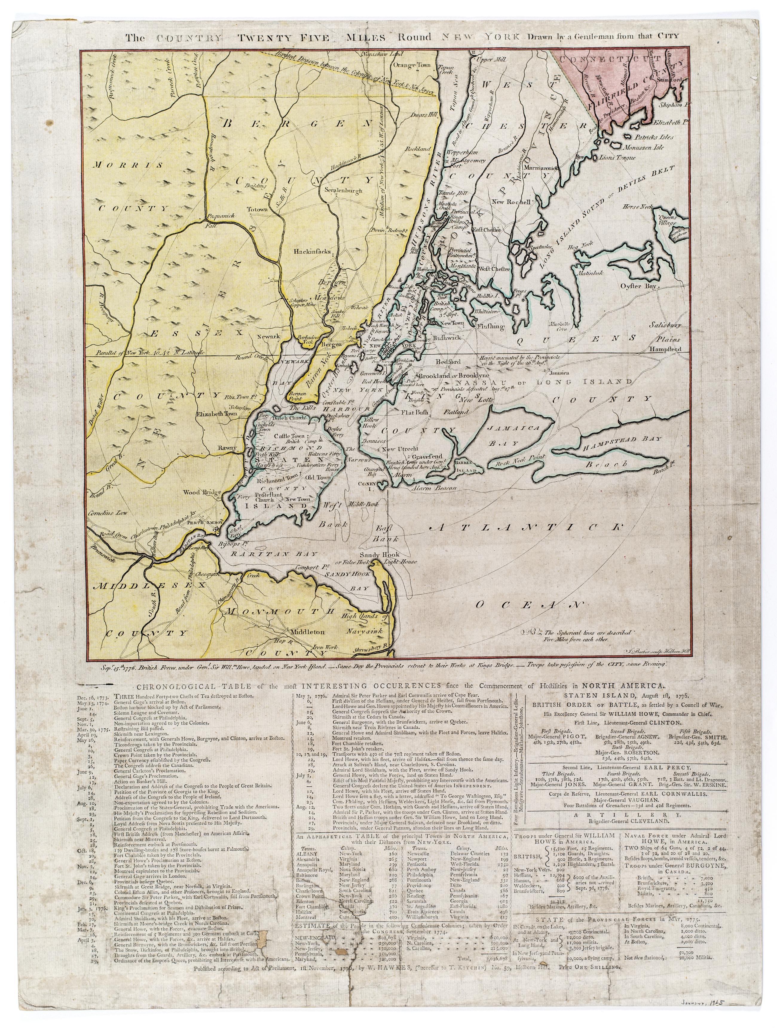
Still Image The Country twenty five miles round New York Hand colored. Relief shown pictorially. Shows radial distances. Engraved by: J. Barber, Holborn Hill. Includes letterpress below map entitled: Chronological table of the most interesting occurrences since the commencement of hostilities in North America. Letterpress includes chronology of events from Boston Tea Party through Battle of Long Island and provides notes on British military strength. View Item
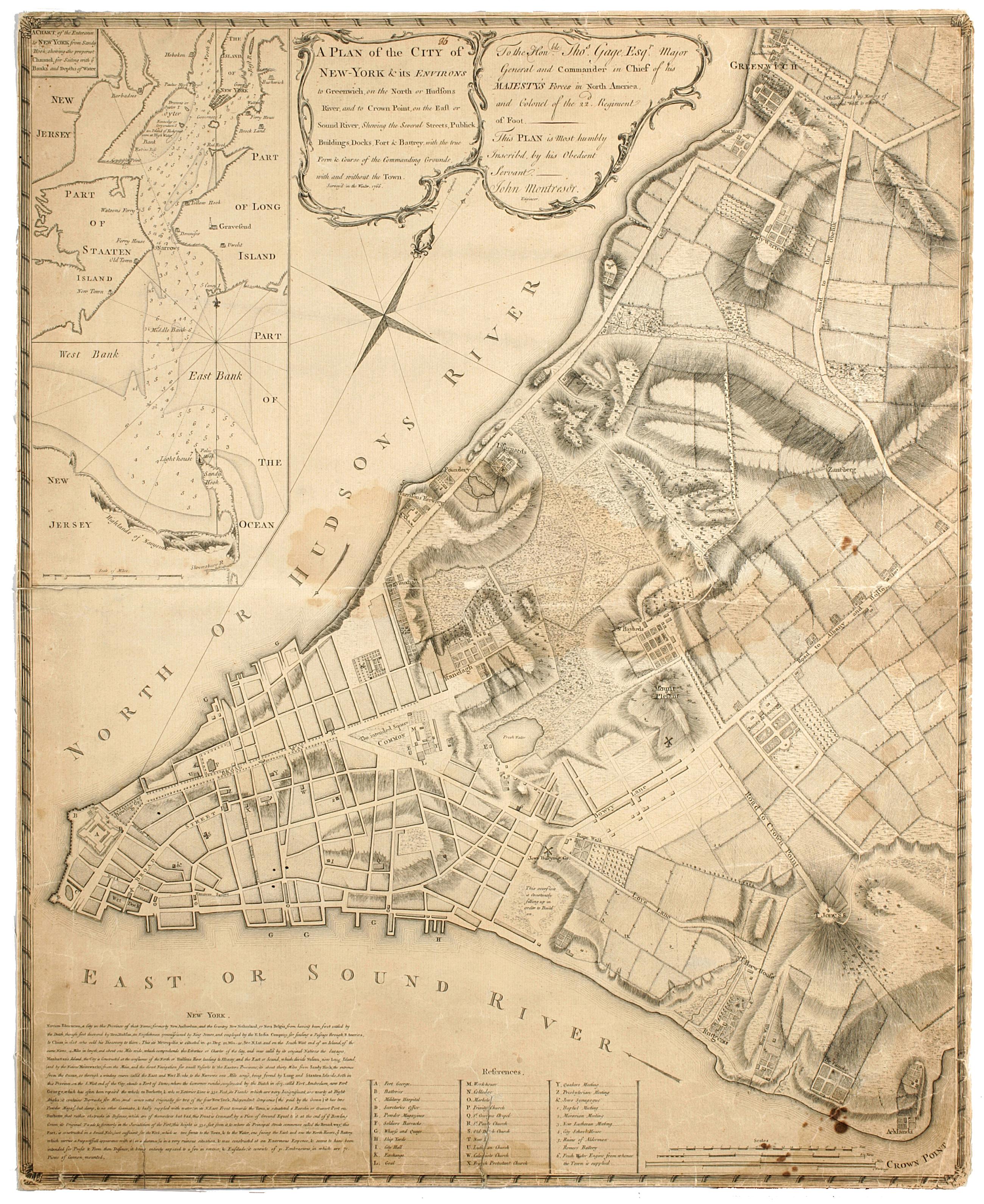
Still Image A plan of the city of New-York & its environs to Greenwich, : on the North or Hudsons River, and to Crown Point, on the East or Sound River, shewing the several streets, publick buildings, docks, fort & battery, with the true form & course of the commandi Cadastral map. Covers Manhattan, New York (N.Y.) south of the later Houston Street. Shows existing streets, some buildings, farms, docks, and names of property owners and natural landmarks. Relief shown by hachures. Black ink on paper backed with cloth. Includes text, index to points of interest, and inset "A chart of the entrance to New York from Sandy Hook, shewing the properest channel for sailing, with ye banks and depths of water," ca. 1:128,000. References: Stokes, Issac Newton Phelps. Iconography of Manhattan Island. View Item