Still Image [Map of the area later bounded by 93rd and 115th Streets, the East or Harlem River and Park Avenue, Manhattan, New York, N.Y.]. Scale [ca. 1:2,450]. Cadastral map. Shows property lines and owners' names, some existing roads and projected streets. Shows relief by hachures. Pen-and-ink, watercolor on paper. Annotations in a later hand on the recto of this sheet give the number 15. The map on recto of this sheet belongs to the same series and is separately cataloged under the title, [Map of the area later bounded by 93rd and 118th Streets, 8th Avenue and the Hudson River, Manhattan, New York, N.Y.]. View Item
Still Image [Map of the area later bounded by 135th and 157th Streets, the Harlem River and Douglas Boulevard, Manhattan, New York, N.Y.]. Scale [ca. 1:2,450]. Cadastral map. Shows property lines and owners' names, some existing roads and projected streets. Shows relief by hachures. Pen-and-ink, watercolor on paper. Annotations in a later hand on the recto of this sheet give the number 20. The map on verso of this one belongs to the same series and is separately cataloged under the title, [Map of the area later bounded by 129th and 158th Streets, Douglass Boulevard and the Hudson River, Manhattan, New York, N.Y.]. View Item
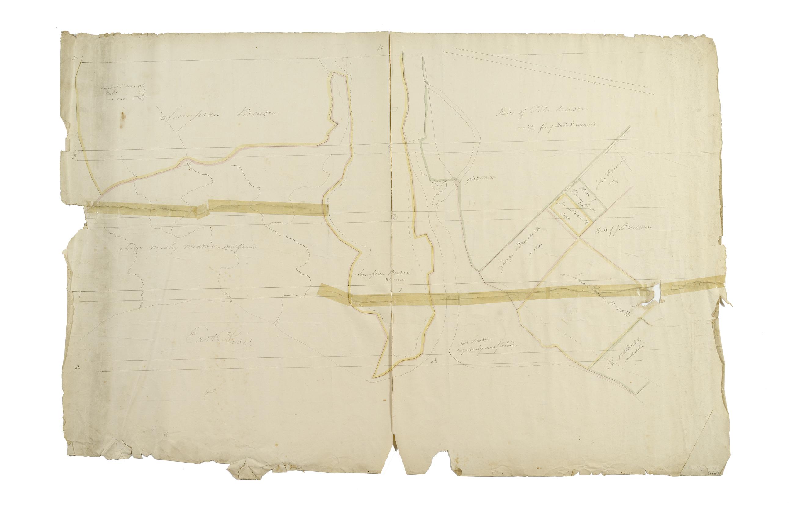
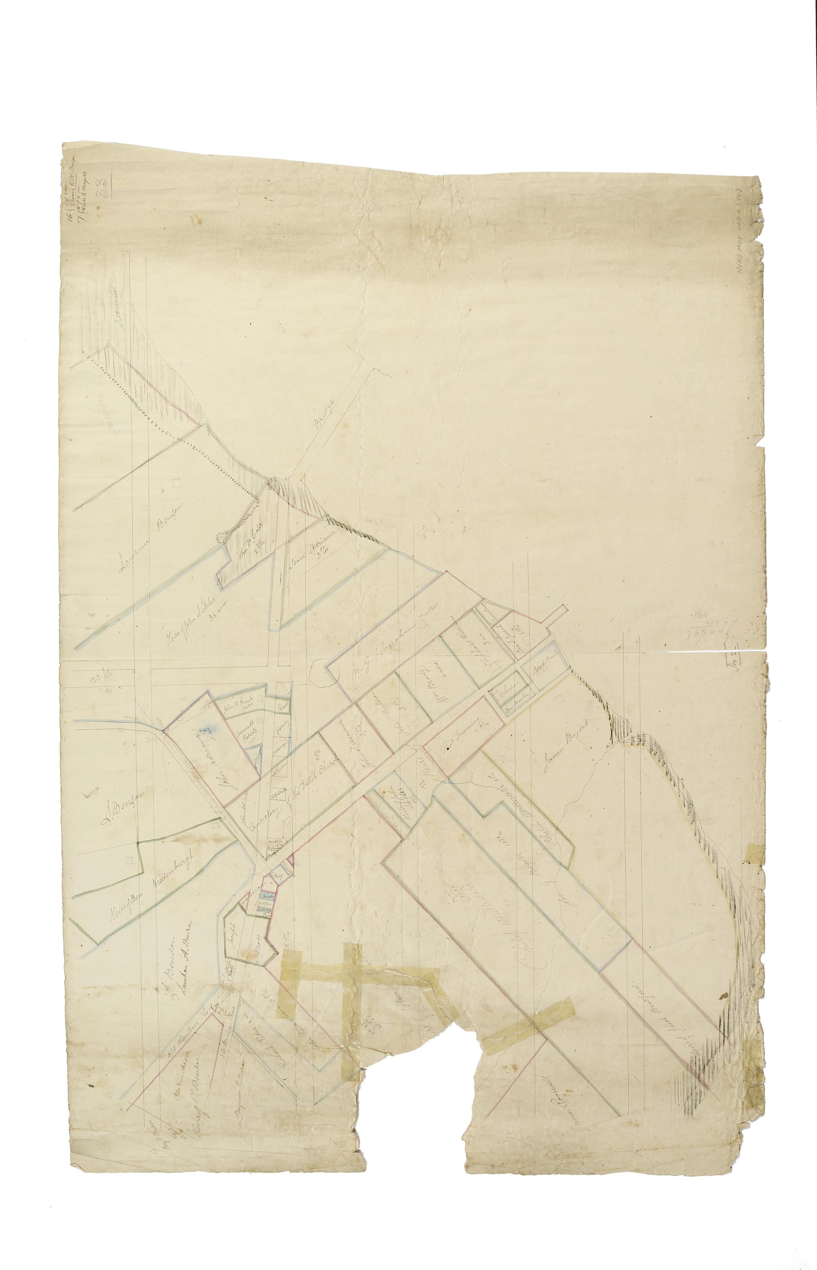
Still Image [Map of the area later bounded by 114th and 137th Streets, the Harlem River and 5th Avenue, Manhattan, New York, N.Y.]. Scale [ca. 1:2,450]. Cadastral map. Shows property lines and owners' names, some existing roads and projected streets. Shows relief by hachures. Pen-and-ink, watercolor on paper. Imperfect: lacking 15 cm. square at bottom center margin. Annotations in a later hand on the recto of this sheet give the number 16. The map on verso of this one belongs to the same series and is separately cataloged under the title, [Map of the area later bounded by 113th and 136th Streets, Park or Morningside and St. Nicholas Avenues, Manhattan, New York, N.Y.]. View Item
Still Image [Map of the area later bounded by 129th and 158th Streets, Douglass Boulevard and the Hudson River, Manhattan, New York, N.Y.]. Scale [ca. 1:2,450]. Cadastral map. Shows property lines and owners' names, some existing roads and projected streets. Shows relief by hachures. Pen-and-ink, watercolor on paper. Annotations in a later hand on the recto of this sheet also give the number 21. The map on recto of this sheet belongs to the same series and is separately cataloged under the title, [Map of the area later bounded by 135th and 157th Streets, the Harlem River and Convent Avenue, Manhattan, New York, N.Y.]. View Item
Still Image [Map of the area later bounded by 93rd and 116th Streets, Park and Columbus Avenues, Manhattan, New York, N.Y.]. Scale [ca. 1:2,450]. Cadastral map. Shows property lines and owners' names, some existing roads and projected streets. Shows relief by hachures. Pen-and-ink, watercolor on paper. Annotations in a later hand on the recto of this sheet give the number 14. The map on recto of this sheet belongs to the same series and is separately cataloged under the title, [Map of the area later bounded by 73rd and 95th Streets, 7th Avenue or Central Park, and the Hudson River, Manhattan, New York, N.Y.]. View Item
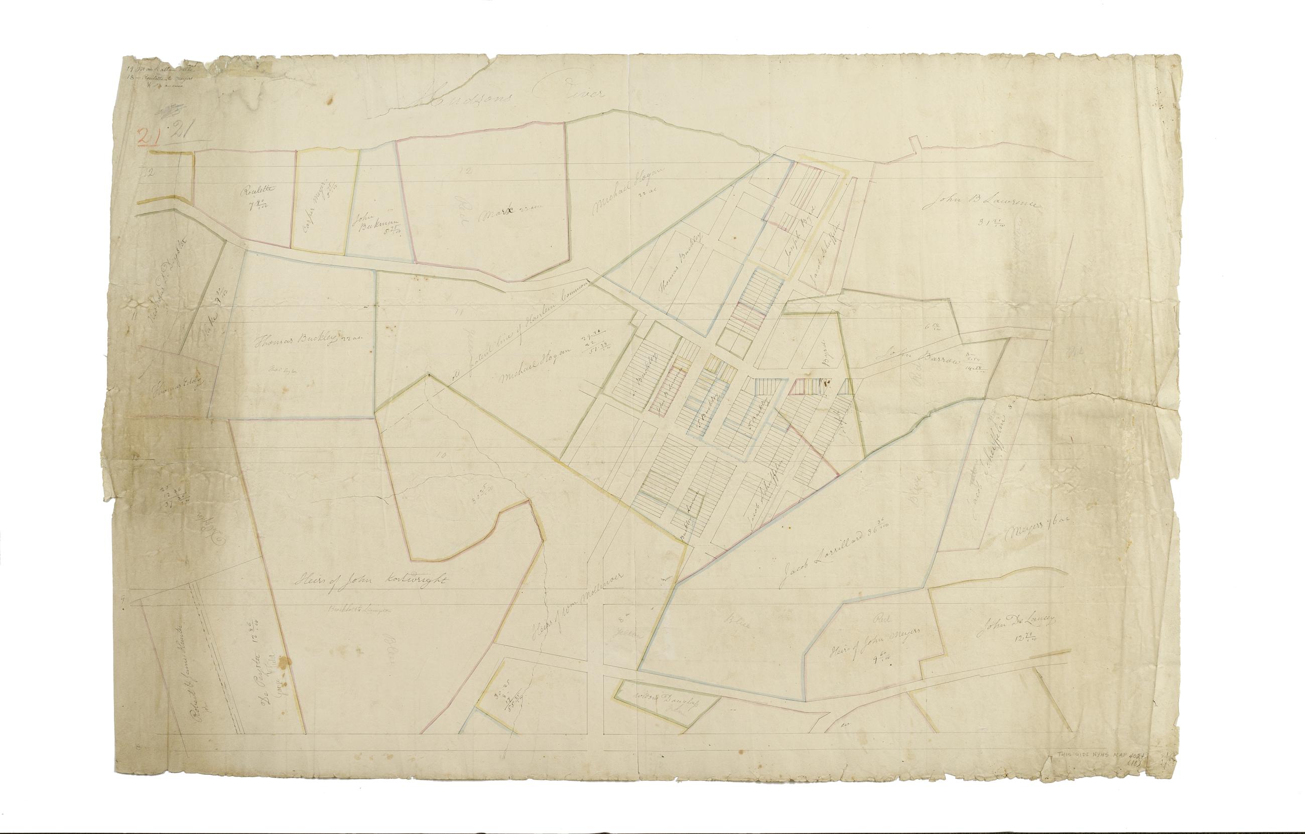
Still Image [Map of the area later bounded by 123rd and 132th Streets, St. Nicholas Park and the Hudson River, Manhattan, New York, N.Y.] / surveyed and laid into lots by Adolphus Loss. Scale not given. Alternate title: Manhattanville. Cadastral map. Shows property lines and owners' names, some existing roads and projected streets. Date of ms. ca. 1815, based on comparison with map on recto of this sheet. Shows relief by hachures. Attributed to Randel's supervision by cataloger, based on map appearing on recto of this sheet. Pen-and-ink, watercolor on paper. The map on recto of this sheet is separately cataloged--see Randel, John. Map of the area later bounded by 114th and 137th Streets, Douglass Boulevard and the Hudson River, Manhattan, New York, N.Y. View Item
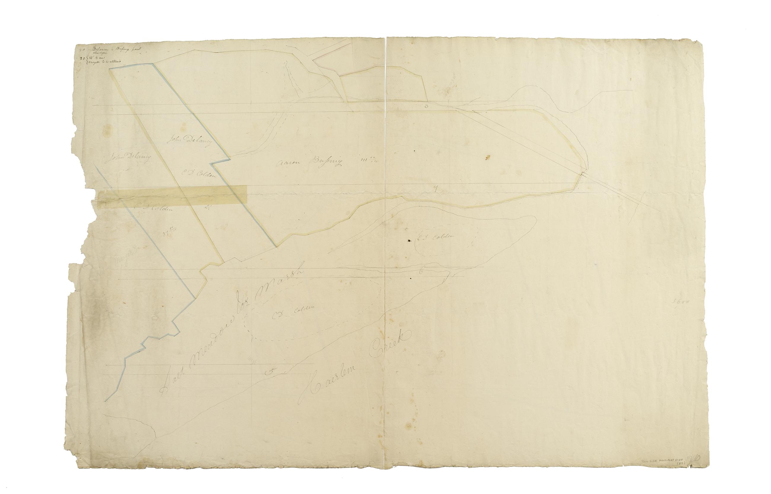
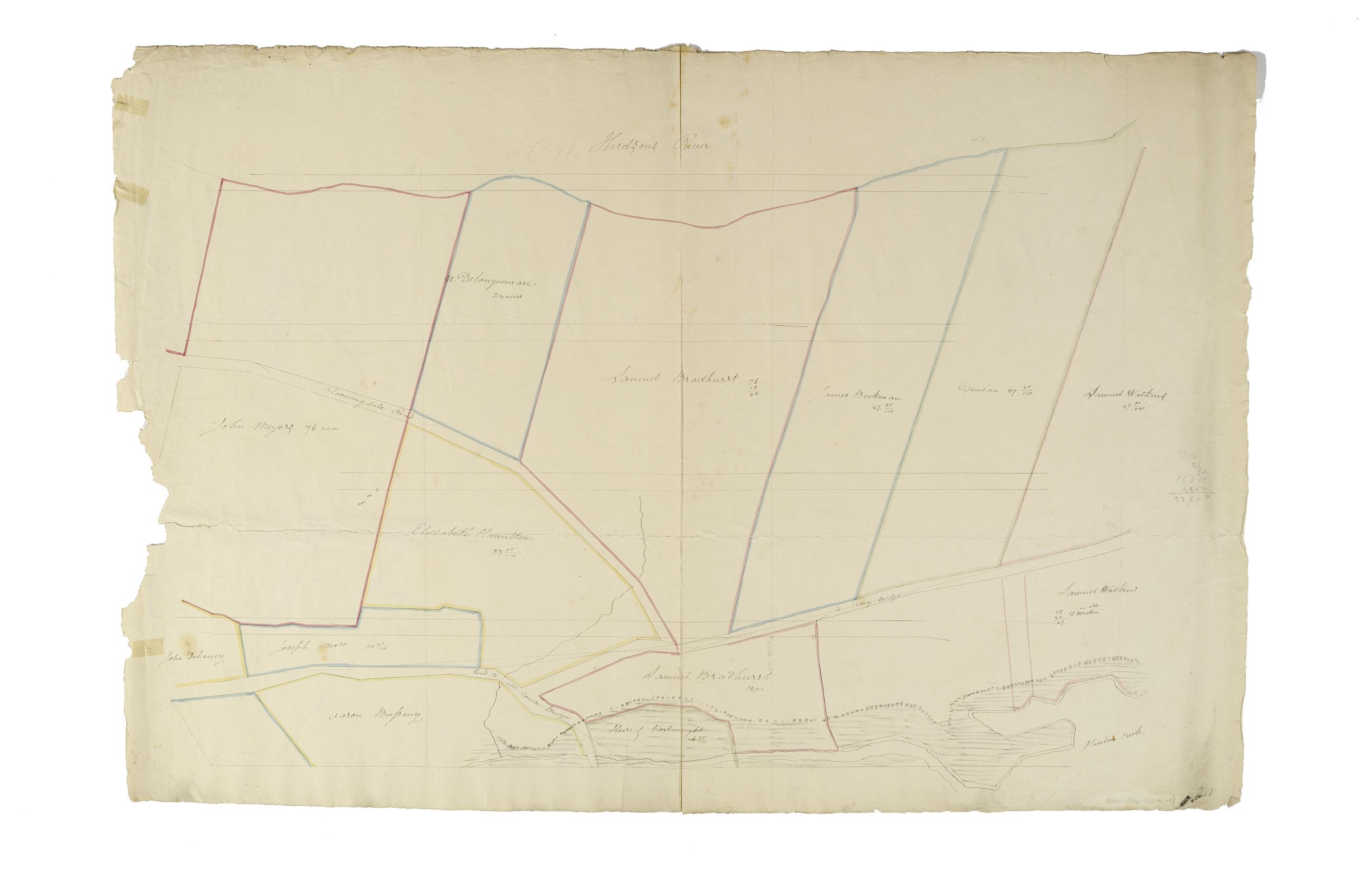
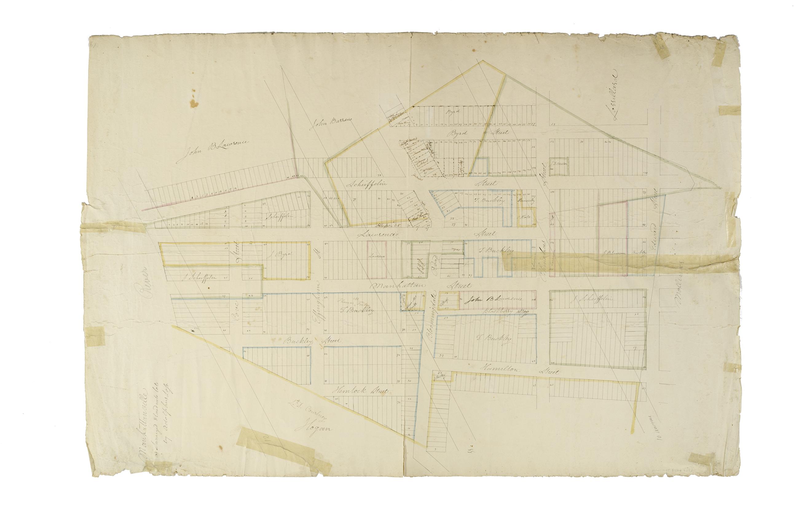
Still Image [Map of the area later bounded by 114th and 137th Streets, Douglass Boulevard and the Hudson River, Manhattan, New York, N.Y.]. Scale [ca. 1:2,450]. Cadastral map. Shows property lines and owners' names, some existing roads and projected streets. Shows relief by hachures. Pen-and-ink, watercolor on paper. Annotations in a later hand on the recto of this sheet also give the number 18. The map on verso of this one does not belong to the series and is separately cataloged--see Loss, Charles, surveyor. [Map of the area later bounded by 124th and 132nd Streets, 9th Avenue and the Hudson River, Manhattan, New York, N.Y.]. View Item
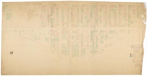
Still Image Map showing over-crowding of the buildings on the lots and the consequent lack of light and air space also strong-holds of poverty and agencies for betterment in the tenement house district bounded by 3rd Avenue, 1st Avenue, 130th, 110th Sts. / prepared f Scale [ca. 1:650]. Oriented with north to upper right of sheet. View Item
Still Image Map showing over-crowding of the buildings on the lots and the consequent lack of light and air space also strong-holds of poverty and agencies for betterment in the tenement house district bounded by 3rd Ave., East River, 110th, 98th Streets / prepared f Scale [ca. 1:650]. Oriented with north to the upper right of sheet. View Item
Still Image Map showing over-crowding of the buildings on the lots and the consequent lack of light and air space also strong-holds of poverty and agencies for betterment in the tenement house district bounded by 1st Avenue, East River, 125th, 110th Streets / prepare Scale [ca. 1:650]. Oriented with north to upper right of sheet. View Item
Still Image Map showing over-crowding of the buildings on the lots and the consequent lack of light and air space also strong-holds of poverty and agencies for betterment in the tenement house district bounded by 3rd Avenue, 1st Avenue, 98th, 86th Streets / prepared Scale [ca. 1:650]. Oriented with north to the upper right of sheet. View Item
Still Image Map showing over-crowding of buildings on lots and consequent lack of light and air space also the prevalence of tuberculosis, typhoid fever, scarlet fever and diphtheria in the tenement house district bounded by 3rd Avenue, 1st Avenue, 98th, 86th Streets Scale [ca. 1:650]. Oriented with north to the upper right of sheet. View Item
Still Image Map showing over-crowding of buildings on lots and consequent lack of light and air space also the prevalence of tuberculosis, typhoid fever, scarlet fever and diphtheria in the tenement house district bounded by 3rd Avenue, 1st Avenue, 130th, 110th Sts. Scale [ca. 1:650]. Oriented with north to the upper right of sheet. View Item
Still Image Map showing over-crowding of buildings on lots and consequent lack of light and air space also the prevalence of tuberculosis, typhoid fever, scarlet fever and diphtheria in the tenement house district bounded by 1st Avenue, East River, 125th, 110th Stree Scale [ca. 1:650]. Oriented with north to upper right of sheet. View Item
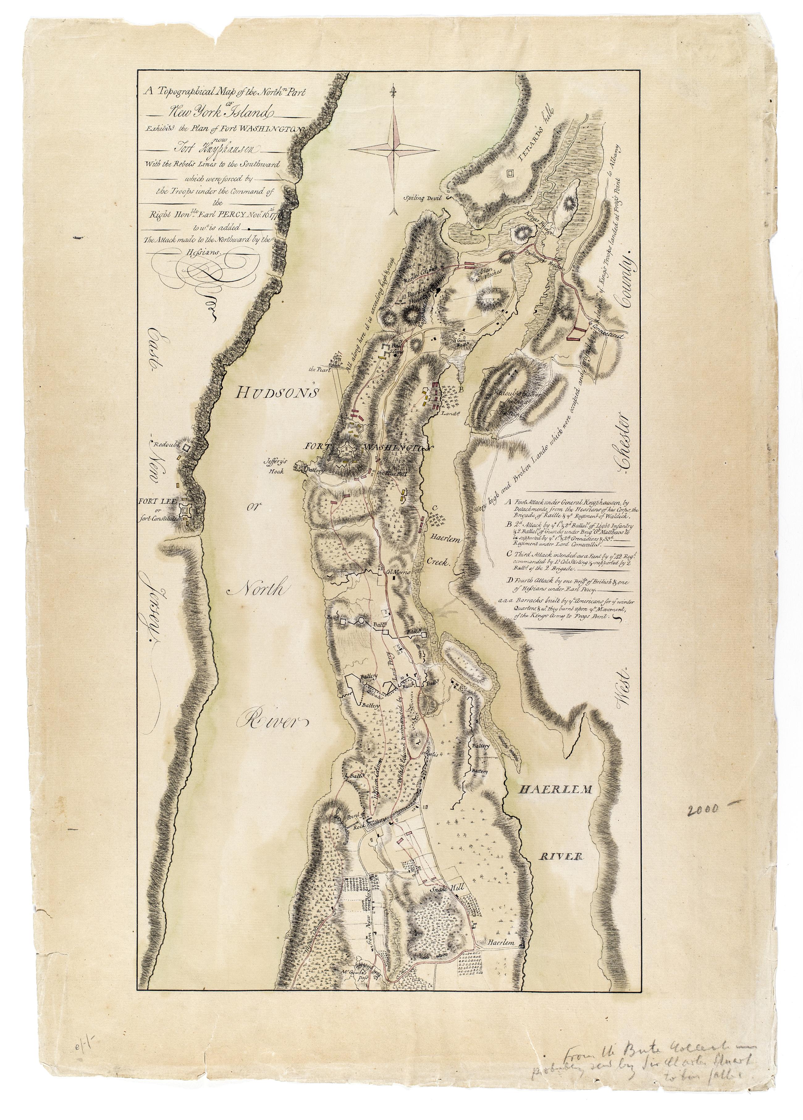
Still Image A Topographical map of the northn. part of New York Island, exhibitg. the plan of Fort Washington now Fort Knyphausen, with the rebel's lines to the southward, which were forced by the troops under the command of the Right Honble. Earl Percy Novr. 16th. 1 Annotated by library on recto: "From the Bute collection probably sent by Sir Charles Stuart to his father." Date of ms. ca. 1777. This ms. appears to be a copy of Sauthier's printed map of that date--compare Maps and charts of North America and the West Indies. Washington: Library of Congress, 1981, p. 250. Also Stokes, I.N. Phelps. Iconography of Manhattan Island, v. 6, p. 355. Date of situation 1776 Nov. Includes descriptive key. Library label on verso. Military topographical map. Covers Manhattan north of modern 105th Street and also the coast of New Jersey and the Bronx. View Item
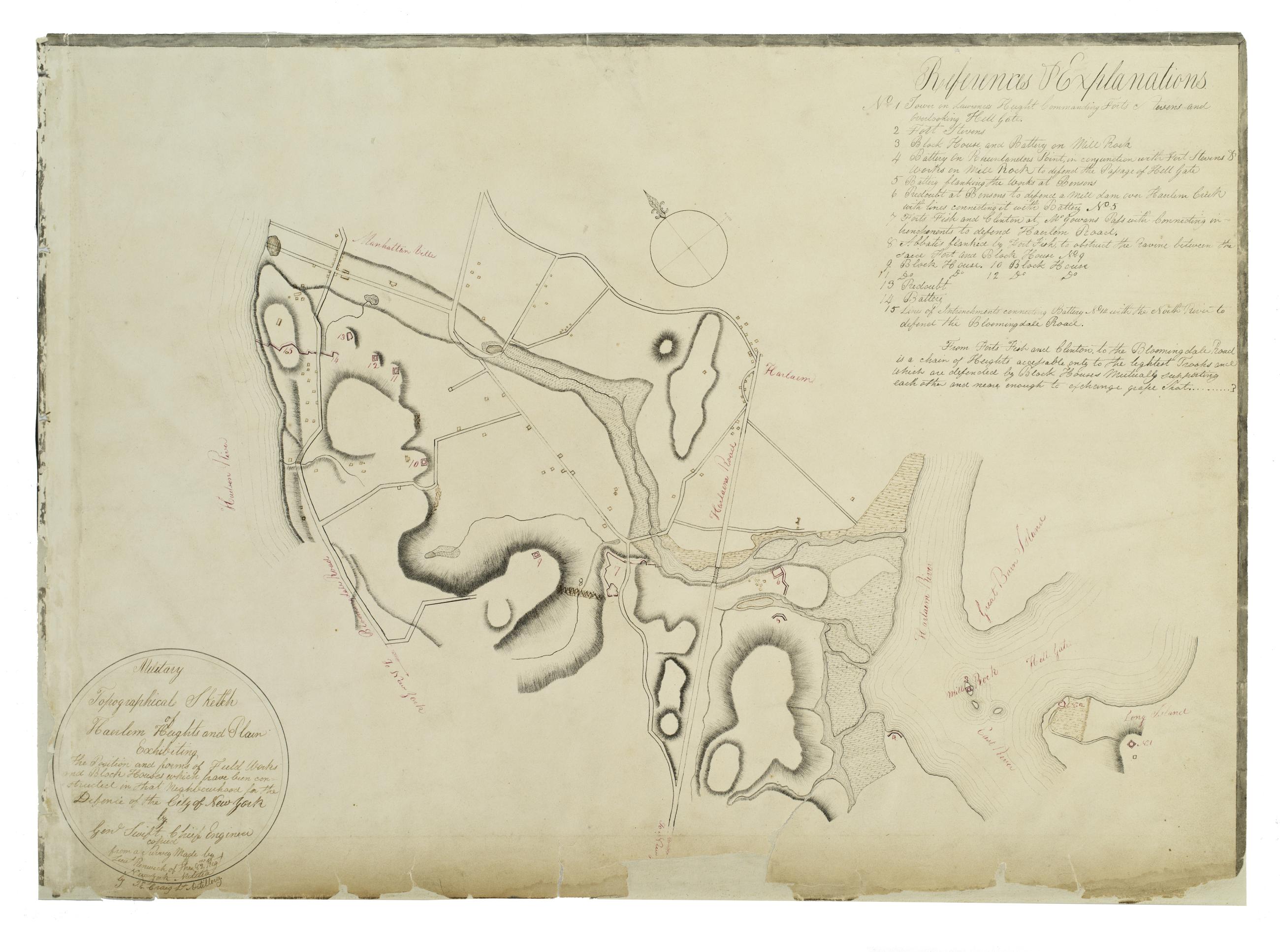
Still Image Military topographical sketch of Haerlem Heights and plain, exhibiting the position and forms of field works and block houses which have been constructed in that neghbourhood for the defence of the City of New York by Gen'l Swift, Chief Engineer / copied This manuscript map of Harlem is thought to have been drawn under the direction of James Renwick, whose son and namesake became a famous architect, for the Committee of Defense during the War of 1812. It includes a view of the Hudson River in the inset at the upper right. Military map. Covers the area later bounded by 85th and 135th Streets, Hell Gate and the Hudson River, Manhattan, New York (N.Y.). Shows fortifications, including batteries and redoubts. Also shows buildings, roads, streams and bridges. Relief shown by hachures, depths shown by form lines. View Item