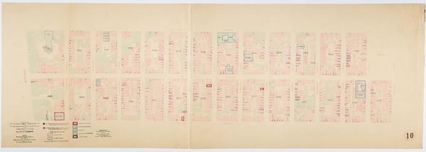
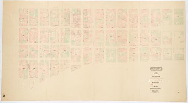
Still Image Map showing over-crowding of the buildings on the lots and the consequent lack of light and air space also strong-holds of poverty and agencies for betterment in the tenement house district bounded by East Houston, Rivington Streets, Willett Street, East Scale [ca. 1:650]. View Item
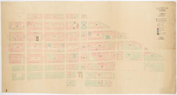
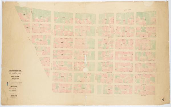
Still Image Map showing over-crowding of the buildings on the lots and the consequent lack of light and air space also strong-holds of poverty and agencies for betterment in the tenement house district bounded by Division Street, East River, Rutgers, Corlears Street Scale [ca. 1:650]. View Item
Still Image Map showing over-crowding of the buildings on the lots and the consequent lack of light and air space also strong-holds of poverty and agencies for betterment in the tenement house district bounded by Division, Rivington Streets, Essex Street, East River Scale [ca. 1:650]. Oriented with north to the upper right of sheet. View Item
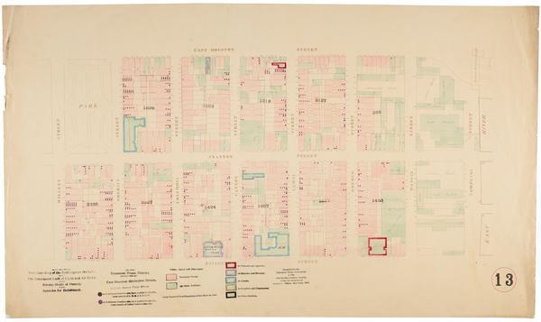
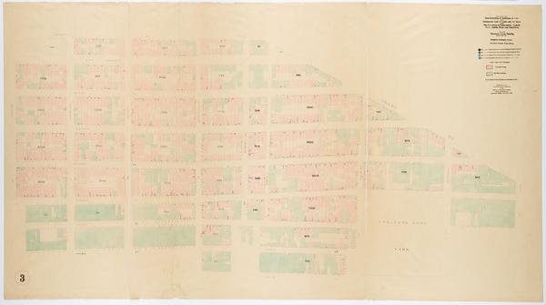
Still Image Map showing over-crowding of the buildings on the lots and the consequent lack of light and air space also strong-holds of poverty and agencies for betterment in the tenement house district bounded by East Houston Street, Park Row, Centre Street, Bowery / Scale [ca. 1:650]. View Item
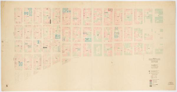
Still Image Map showing over-crowding of the buildings on the lots and the consequent lack of light and air space also strong-holds of poverty and agencies for betterment in the tenement house district bounded by East Houston, Rivington Streets, Bowery, Willett Stree Scale [ca. 1:650]. View Item
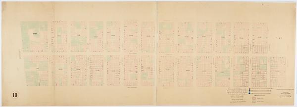
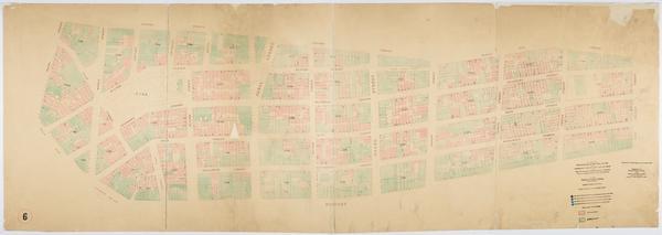
Still Image Map showing over-crowding of buildings on lots and consequent lack of light and air space also the prevalence of tuberculosis, typhoid fever, scarlet fever and diphtheria in the tenement house district bounded by Bowery, Willett Street, East Houston, Rivi Scale [ca. 1:650] View Item
Still Image Map showing over-crowding of buildings on lots and consequent lack of light and air space also the prevalence of tuberculosis, typhoid fever, scarlet fever and diphtheria in the tenement house district bounded by Rutgers, Corlears Street, Division Street, Scale [ca. 1:650] View Item
Still Image Map showing over-crowding of buildings on lots and consequent lack of light and air space also the prevalence of tuberculosis, typhoid fever, scarlet fever and diphtheria in the tenement house district bounded by Bowery, Essex Streets, Division, Rivington Scale [ca. 1:650]. Oriented with north to the upper right of sheet. View Item
Still Image Map showing over-crowding of buildings on lots and consequent lack of light and air space also the prevalence of tuberculosis, typhoid fever, scarlet fever and diphtheria in the tenement house district bounded by Essex Street, East River, Division, Riving Scale [ca. 1:650] View Item
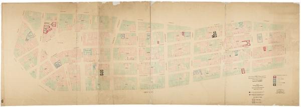
Still Image Map showing over-crowding of buildings on lots and consequent lack of light and air space also the prevalence of tuberculosis, typhoid fever, scarlet fever and diphtheria in the tenement house district bounded by Centre Street, Bowery, East Houston Street Scale [ca. 1:650]. Oriented with north to upper right of sheet. View Item
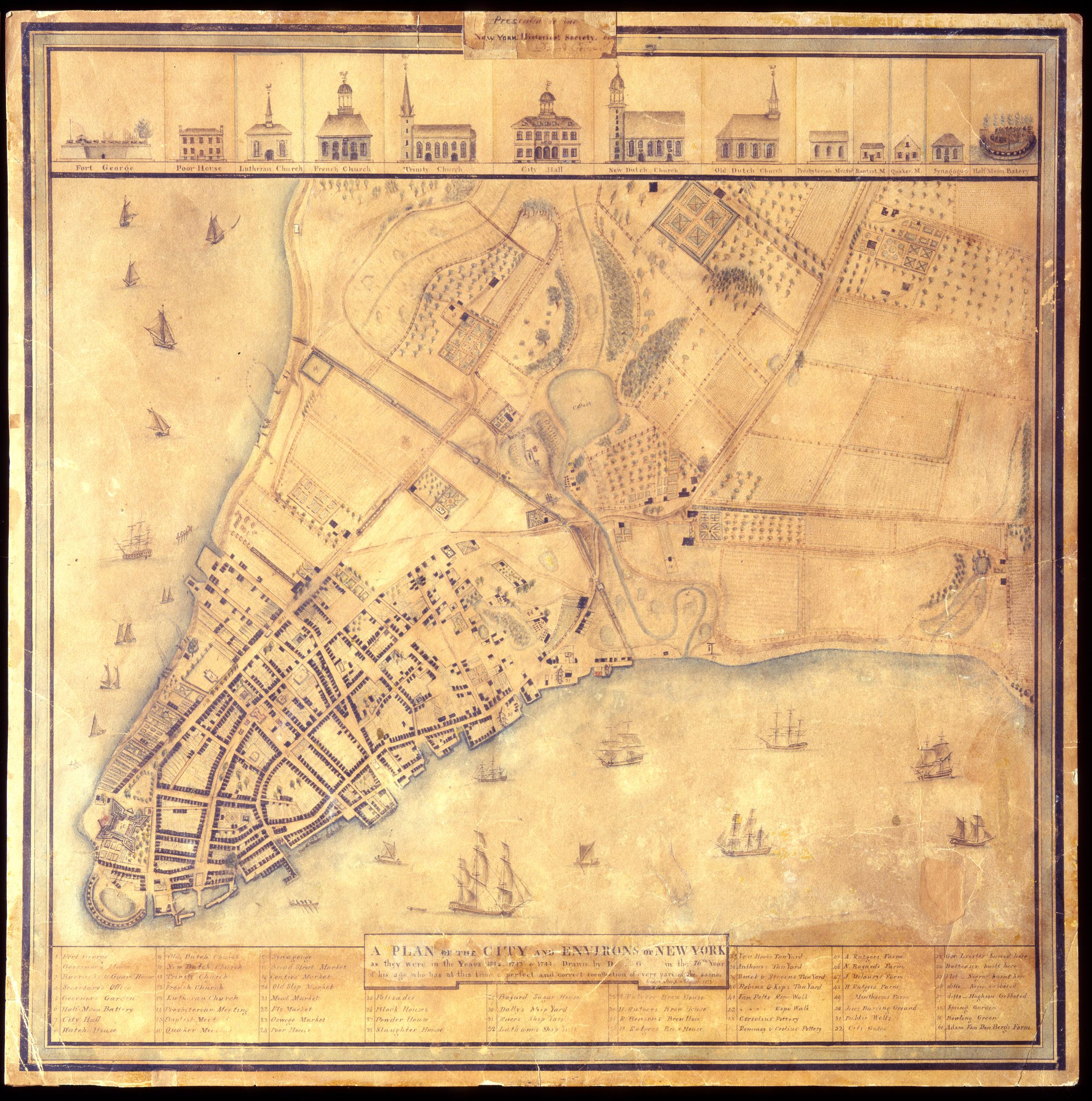
Still Image A Plan of the city and environs of New York as they were in the years 1742. 1743. & 1744. / drawn by D--- G--- in the 76th year of his age, who has at this time a perfect and correct recollection of every part of the same. Cedar Street. August 1813. David Grim's map of prerevolutionary Manhattan. Historical map. Covers Manhattan Island south of modern 14th Street, New York (N.Y.). Shows buildings and many other urban features; also shows natural and agricultural features. Date of ms. 1813 Aug. Date of situation between 1742 and 1744. On label pasted at top center: "Presented to the New York Historical Society by David Grim". Pen-and-ink (black and color), watercolor, pencil on paper. Selected material shown pictorially. Includes index. References: Cohen, Paul E. and Robert T. Augustyn. Manhattan in Maps, p. 62-63; Stokes, I.N. Phelps. View Item