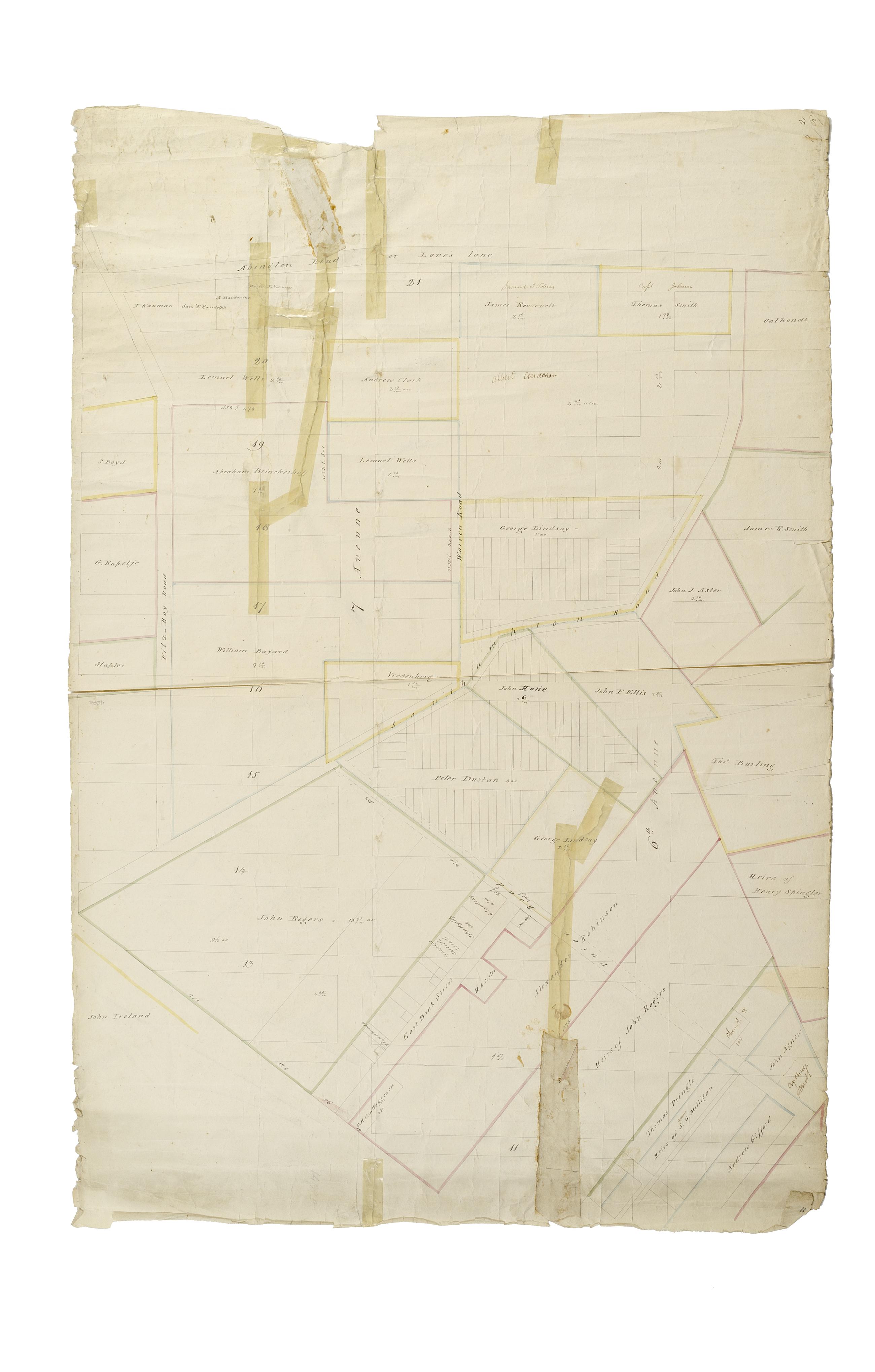
Still Image [Map of the area later bounded by 10th and 22nd Streets, 5th and 8th Avenues, Manhattan, New York, N.Y.]. Scale [ca. 1:2,450]. Cadastral map. Shows property lines and owners' names, some existing roads and projected streets. Shows relief by hachures. Pen-and-ink, watercolor on paper. Annotations in a later hand on the recto of this sheet give the number 2. The map on recto of this sheet belongs to the same series and is separately cataloged under the title, [Map of the area later bounded by 72nd and 95th Streets, the East River and Park Avenue, Manhattan, New York, N.Y.]. View Item
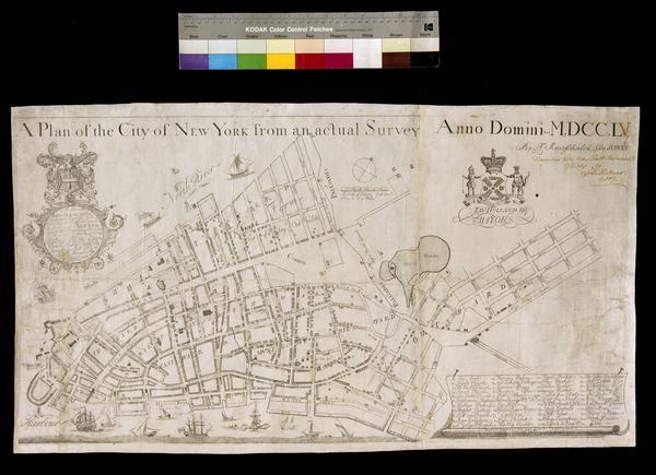
Still Image A plan of the City of New York from an actual survey anno domini MDCCLV Covers Manhattan, New York (N.Y.) below Delancey Street. Shows political divisions, fortifications, some buildings and natural features. The map also locates churches, markets, and public squares. Dedication: "To the Honourable JAMES DE LANCEY, Esqr, Lieutenant Governor and Commander In Chief In and over the Province of NEW YORK and territories depending thereon In America This Plan of the City of NEW YORK Is Humbly dedicd. By your Honours Most Obet. & Humble Servent G. View Item
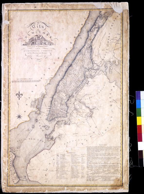
Still Image The City of New York as laid out by the Commissioners with the surrounding country / by their secretary and surveyor John Randel, Junr. Street planning map. Covers all of Manhattan Island (New York, N.Y.) and substantial parts of adjacent counties in New York and New Jersey. Shows existing and proposed streets; also buildings and other structures, streams and other wetlands, political boundaries. Includes extensive "REMARKS," also a key to New York City buildings. Pen-and-ink, watercolor on paper. Shows relief by hachures. Imperfect: lacking 4 x 9 and 2 x 5 cm. upper right corner, 2 x 2 cm. upper left side. References: Cohen, Paul E. and Robert T. Augustyn. Manhattan in Maps. NY: Rizzoli, 1997, p. 106ff; Stokes, I.N. Phelps. View Item
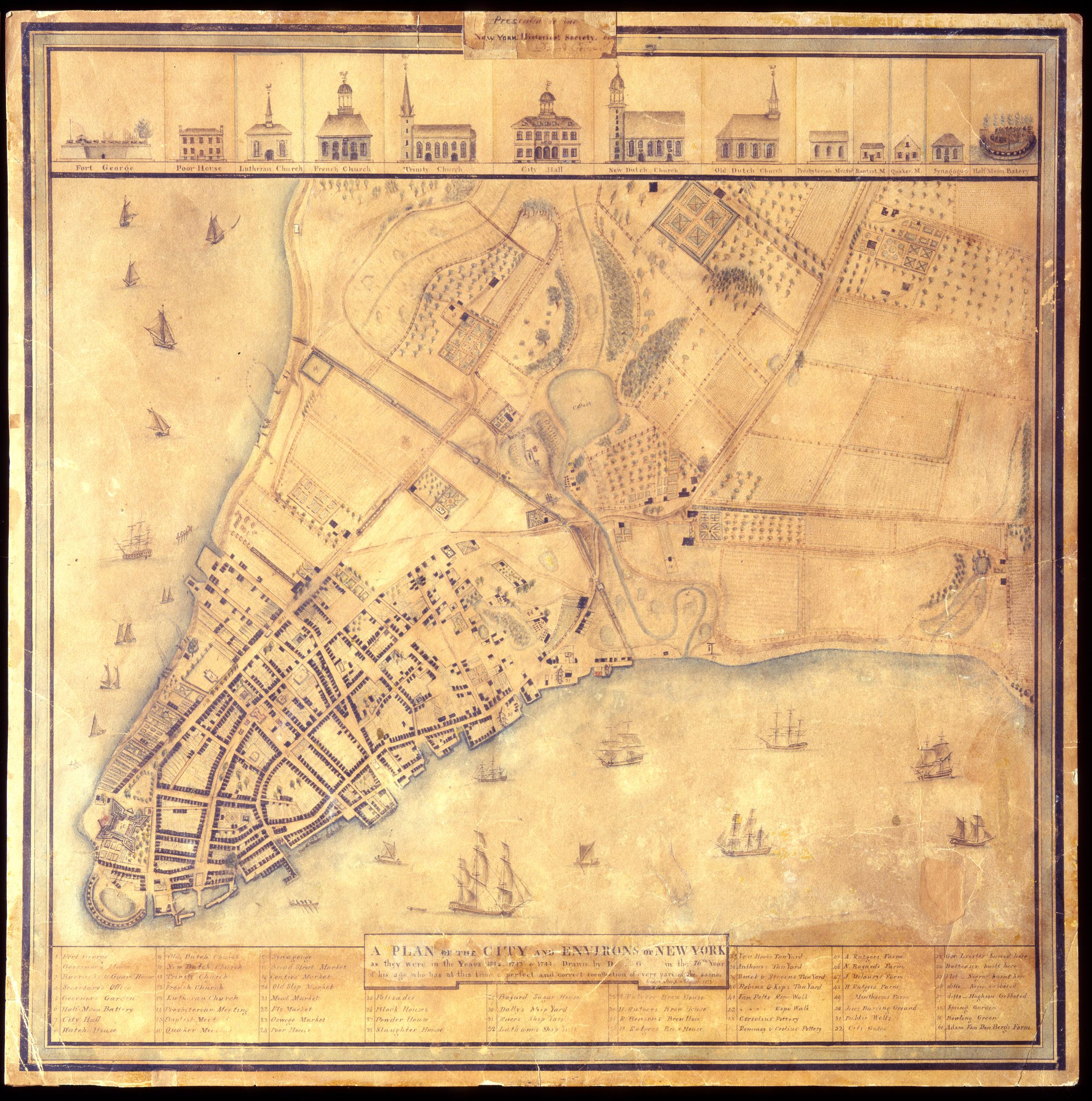
Still Image A Plan of the city and environs of New York as they were in the years 1742. 1743. & 1744. / drawn by D--- G--- in the 76th year of his age, who has at this time a perfect and correct recollection of every part of the same. Cedar Street. August 1813. David Grim's map of prerevolutionary Manhattan. Historical map. Covers Manhattan Island south of modern 14th Street, New York (N.Y.). Shows buildings and many other urban features; also shows natural and agricultural features. Date of ms. 1813 Aug. Date of situation between 1742 and 1744. On label pasted at top center: "Presented to the New York Historical Society by David Grim". Pen-and-ink (black and color), watercolor, pencil on paper. Selected material shown pictorially. Includes index. References: Cohen, Paul E. and Robert T. Augustyn. Manhattan in Maps, p. 62-63; Stokes, I.N. Phelps. View Item