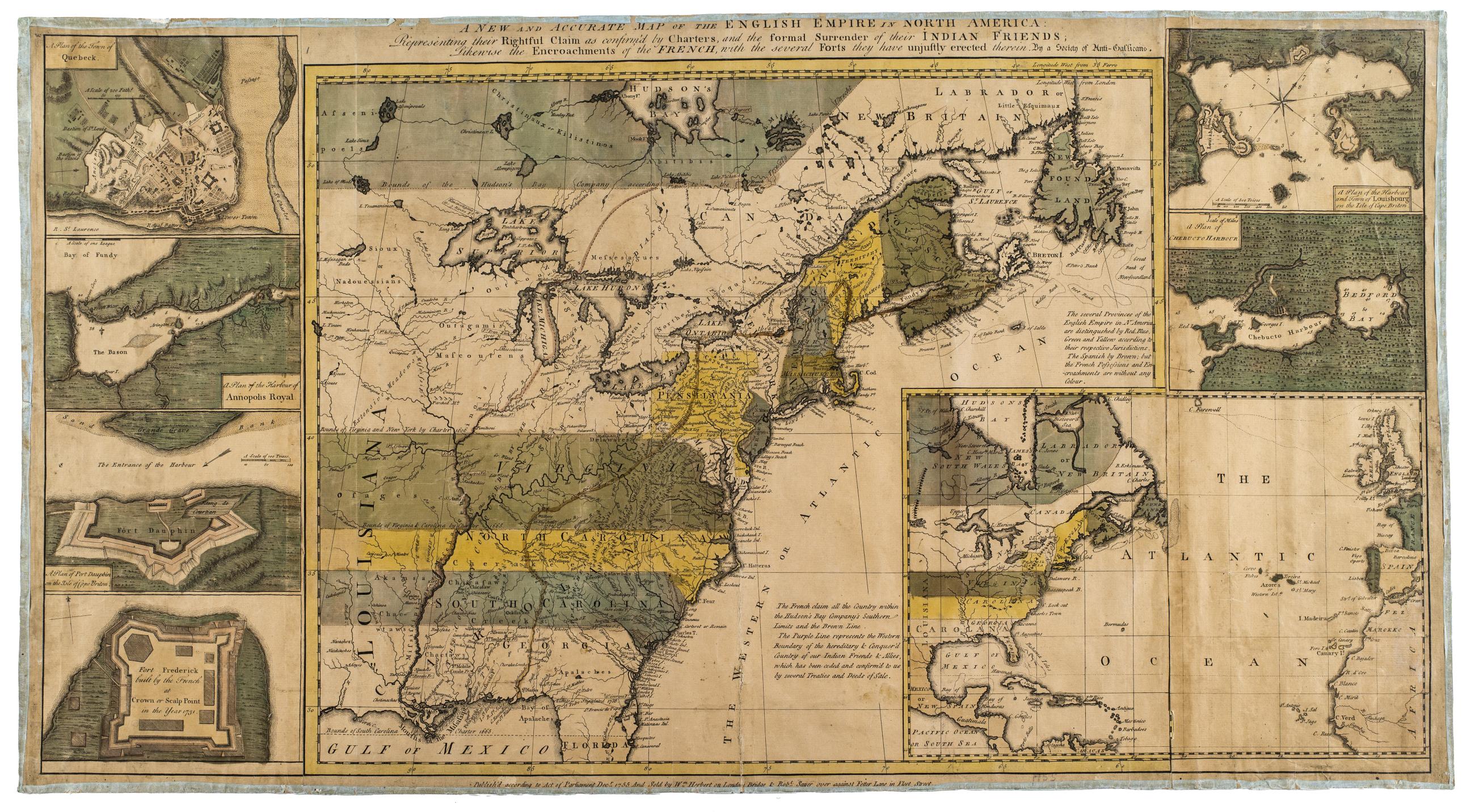
Still Image A new and accurate map of the English empire in North America : Representing their rightful claim as confirm'd by charters, and the formal surrender of their Indian friends : likewise the encroachments of the French, with the several forts they have unjus Relief shown pictorially. Designed to be colored. Shows English claims across North America. Untitled inset shows North America in relation to Europe. View Item
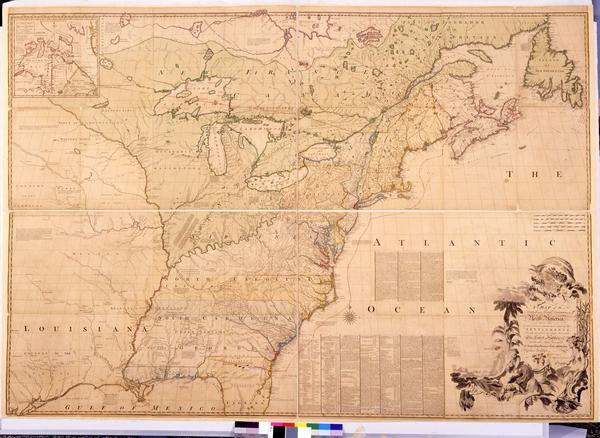
Still Image A map of the British and French dominions in North America : with the roads, distances, limits, and extent of the settlements, humbly inscribed to the Right Honourable the Earl of Halifax, and the other Right Honourable the Lords Commissioners for Trade & First impression of third edition, 1773, with hand-drawn red lines. Engraving, hand-colored. First published in 1755, John Mitchell's map was the most impressive and accurate cartographic description of Britain's territorial holdings in North America at the time. The historical significance of the map increased exponentially when it was used to demarcate potential boundaries during the negotiations of the Treaty of Paris, 1782–1783. Representatives from Britain, the United States of America, and Spain each brought a copy of the Mitchell map to the negotiations. View Item
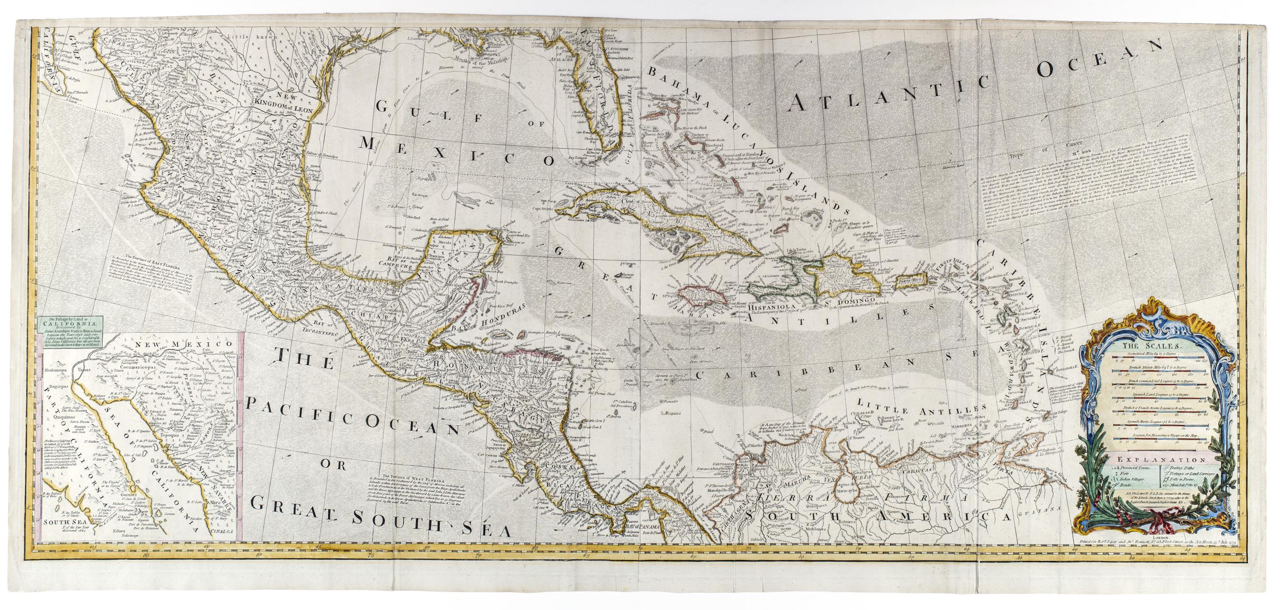
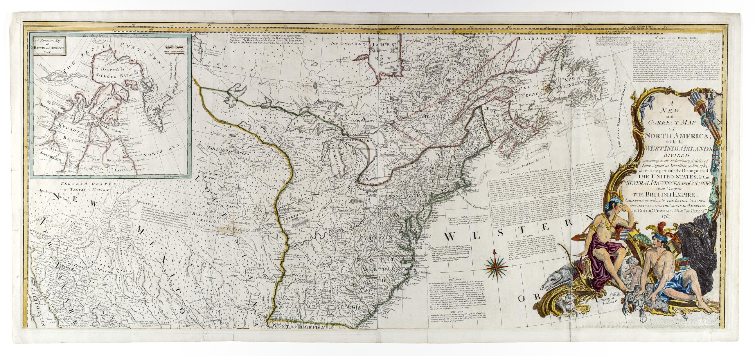
Still Image A new and correct map of North America, with the West India islands, divided according to the preliminary articles of peace, signed at Versailles, 20 Jan. 1783, wherein are particularly distinguished the United States, & the several provinces and colonies New state of 1779 issue showing 1783 boundaries and with changes to the title but retaining the 1779 date in imprint; The map includes articles 4, 5, 7, 9, 17, 18, and 20 of the Treaty of Versailles View Item
Still Image A new and correct map of North America, with the West India islands, divided according to the preliminary articles of peace, signed at Versailles, 20 Jan. 1783, wherein are particularly distinguished the United States, & the several provinces and colonies New state of 1779 issue showing 1783 boundaries and with changes to the title but retaining the 1779 date in imprint; The map includes articles 4, 5, 7, 9, 17, 18, and 20 of the Treaty of Versailles View Item
Image Still Image 2 Items A new and correct map of North America, with the West India islands, divided according to the preliminary articles of peace, signed at Versailles, 20 Jan. 1783, wherein are particularly distinguished the United States, & the several provinces and colonies New state of 1779 issue showing 1783 boundaries and with changes to the title but retaining the 1779 date in imprint; The map includes articles 4, 5, 7, 9, 17, 18, and 20 of the Treaty of Versailles View Item