


Still Image
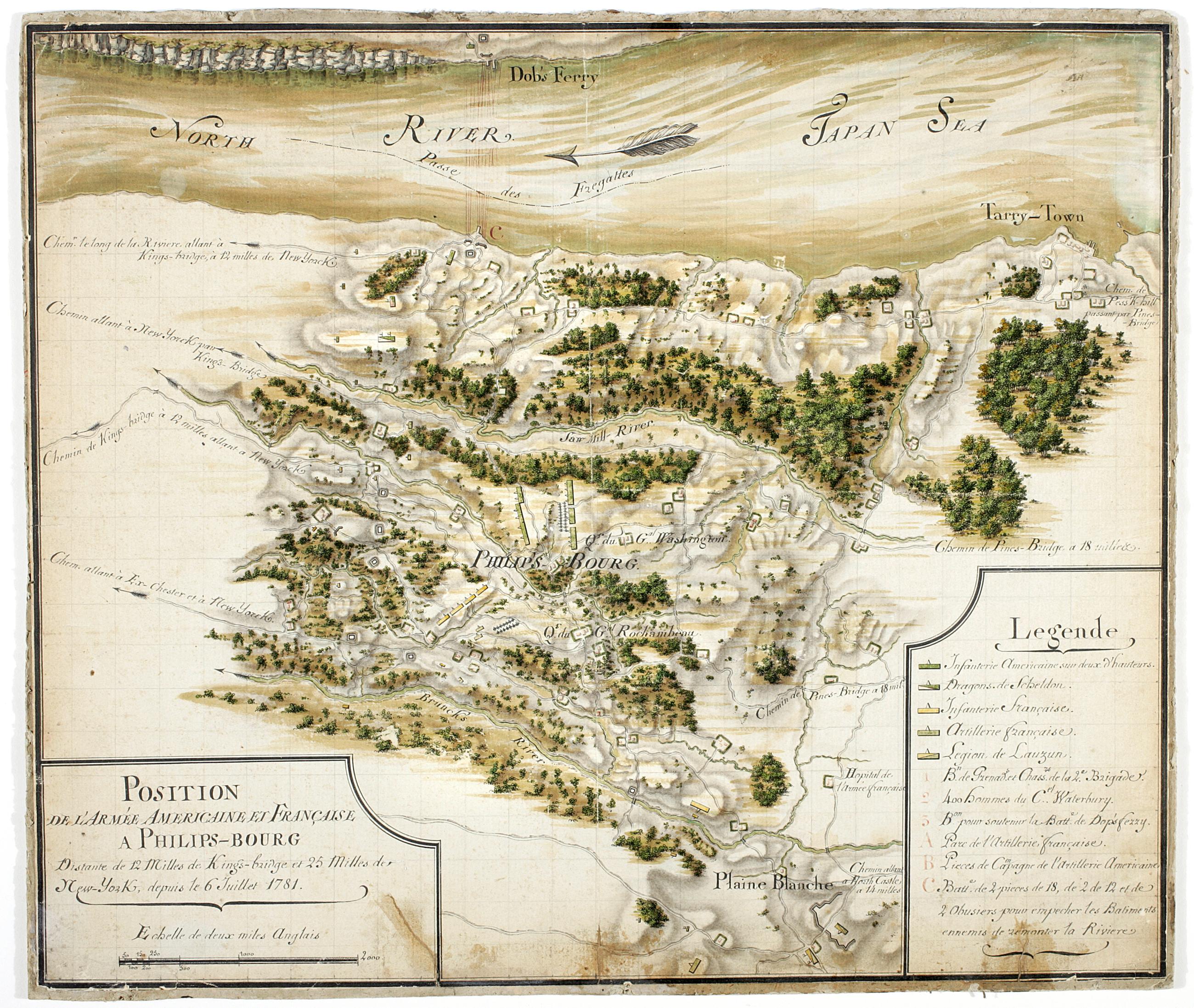
Position de 'larmee Américane et Française a Philips-bourg : distante de 12 milles de Kings-bridge et 25 milles de New-York, depuis le 6 Juillet 1781
Includes key. Military battlefield map. Covers the town of Greenburgh in Westchester County, New York: Shows disposition of troops, cavalry and artillery. Also shows roads running through Tarrytown, Dobbs Ferry and White Plains. Also shows buildings, landforms, streams and vegetative cover. On verso: "[?]aris Dessins topographiques" Pen-and-ink, watercolor on laid paper. Shows relief by shading. Stained, lightly soiled. Mounted on (probably contemporaneous) hardboard.
View Item