


Still Image
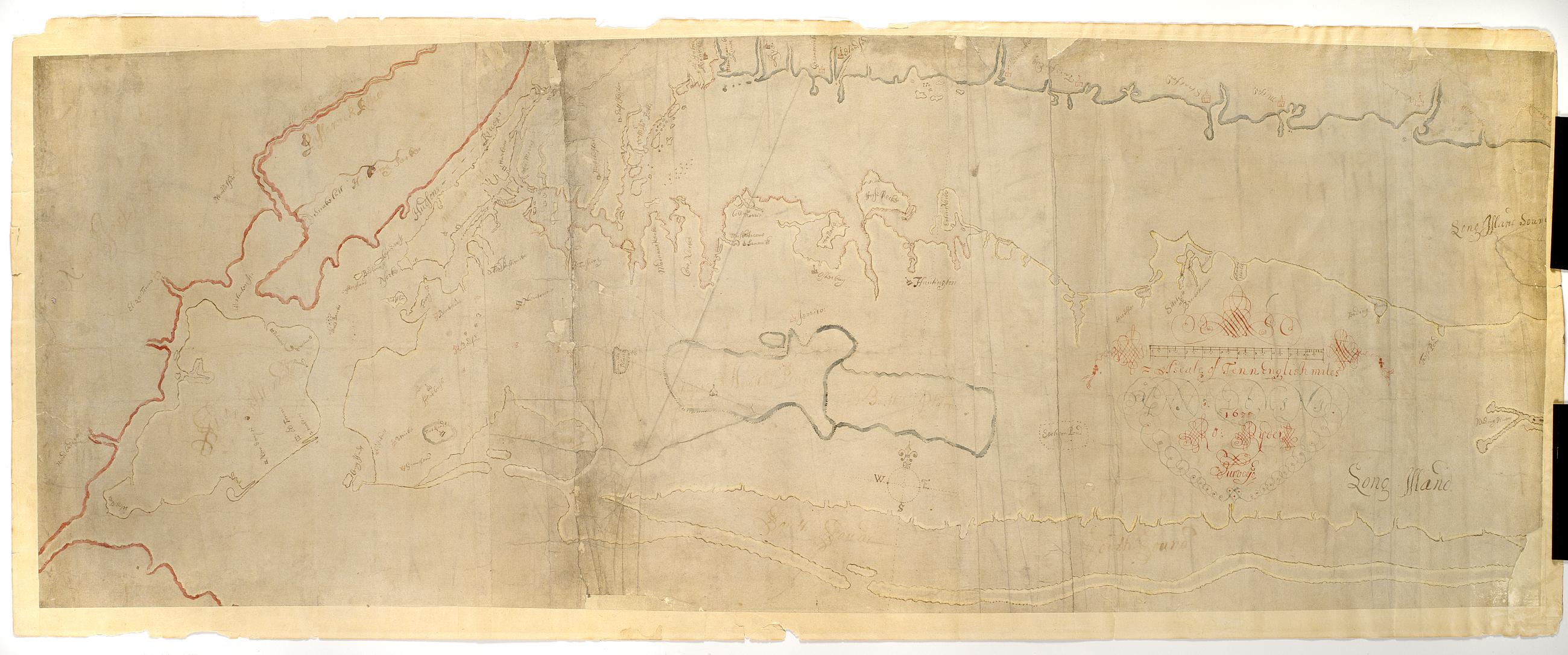
[Map of Long Island and adjacent areas of Connecticut, New York and New Jersey] / Ro. Ryder surveyed
Pen-and-ink (black and color), color wash on laid paper. This is the manuscript of the earliest survey known of Long Island as far east as Riverhead. "ANNO DOMINI 1670" embedded in cartouche decoration. A shoreline map, it shows most of Long Island, all of modern New York City and the shorelines of Connecticut and New Jersey, marks the rocky coast in red, gives placenames, and outlines the various colonies in different colors.
View Item