


Still Image
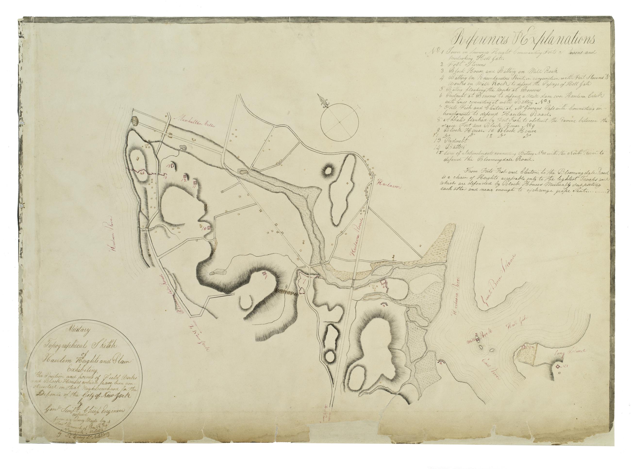
Military topographical sketch of Haerlem Heights and plain, exhibiting the position and forms of field works and block houses which have been constructed in that neghbourhood for the defence of the City of New York by Gen'l Swift, Chief Engineer / copied
This manuscript map of Harlem is thought to have been drawn under the direction of James Renwick, whose son and namesake became a famous architect, for the Committee of Defense during the War of 1812. It includes a view of the Hudson River in the inset at the upper right. Military map. Covers the area later bounded by 85th and 135th Streets, Hell Gate and the Hudson River, Manhattan, New York (N.Y.). Shows fortifications, including batteries and redoubts. Also shows buildings, roads, streams and bridges. Relief shown by hachures, depths shown by form lines.
View Item