


Still Image
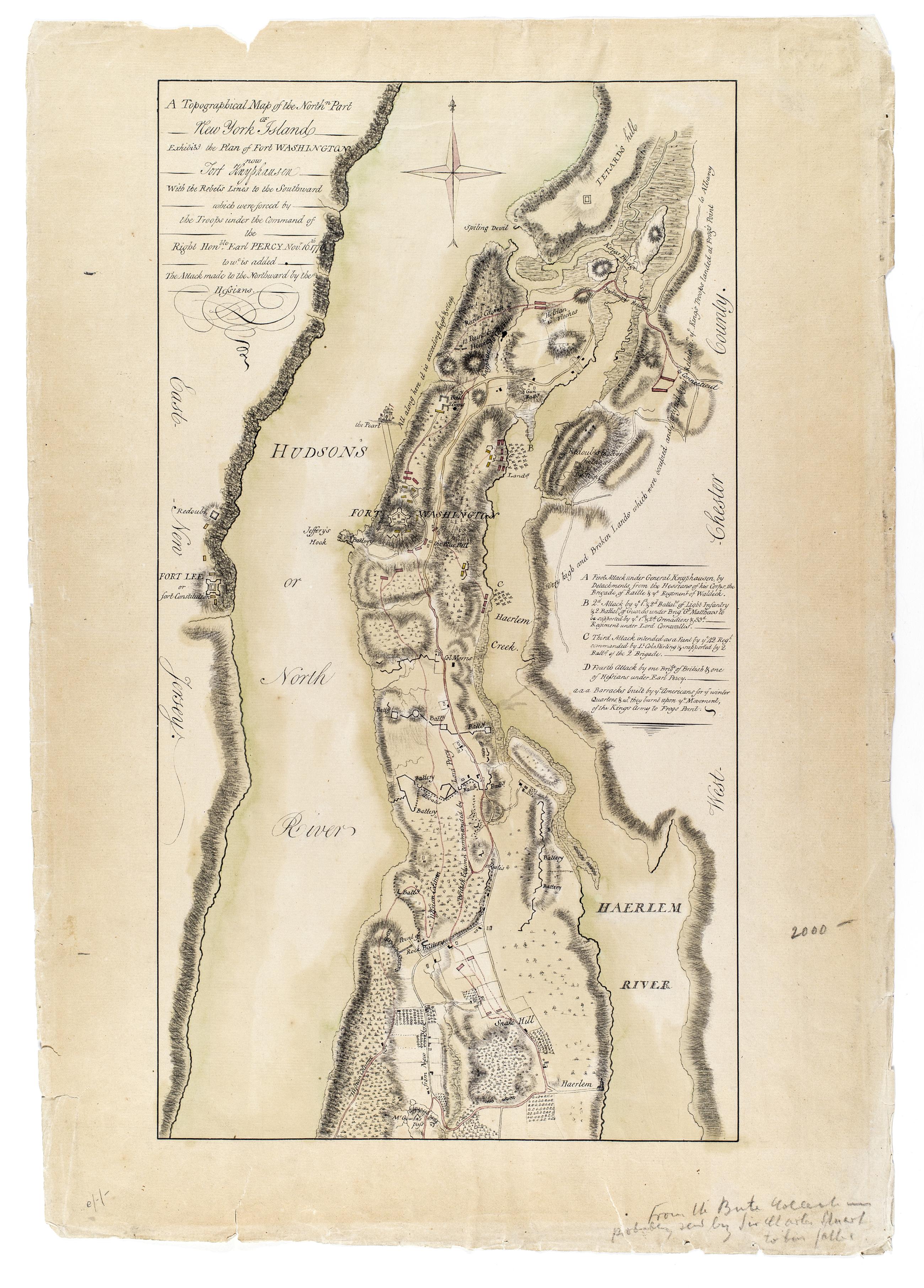
A Topographical map of the northn. part of New York Island, exhibitg. the plan of Fort Washington now Fort Knyphausen, with the rebel's lines to the southward, which were forced by the troops under the command of the Right Honble. Earl Percy Novr. 16th. 1
Annotated by library on recto: "From the Bute collection probably sent by Sir Charles Stuart to his father." Date of ms. ca. 1777. This ms. appears to be a copy of Sauthier's printed map of that date--compare Maps and charts of North America and the West Indies. Washington: Library of Congress, 1981, p. 250. Also Stokes, I.N. Phelps. Iconography of Manhattan Island, v. 6, p. 355. Date of situation 1776 Nov. Includes descriptive key. Library label on verso. Military topographical map. Covers Manhattan north of modern 105th Street and also the coast of New Jersey and the Bronx.
View Item