


Still Image
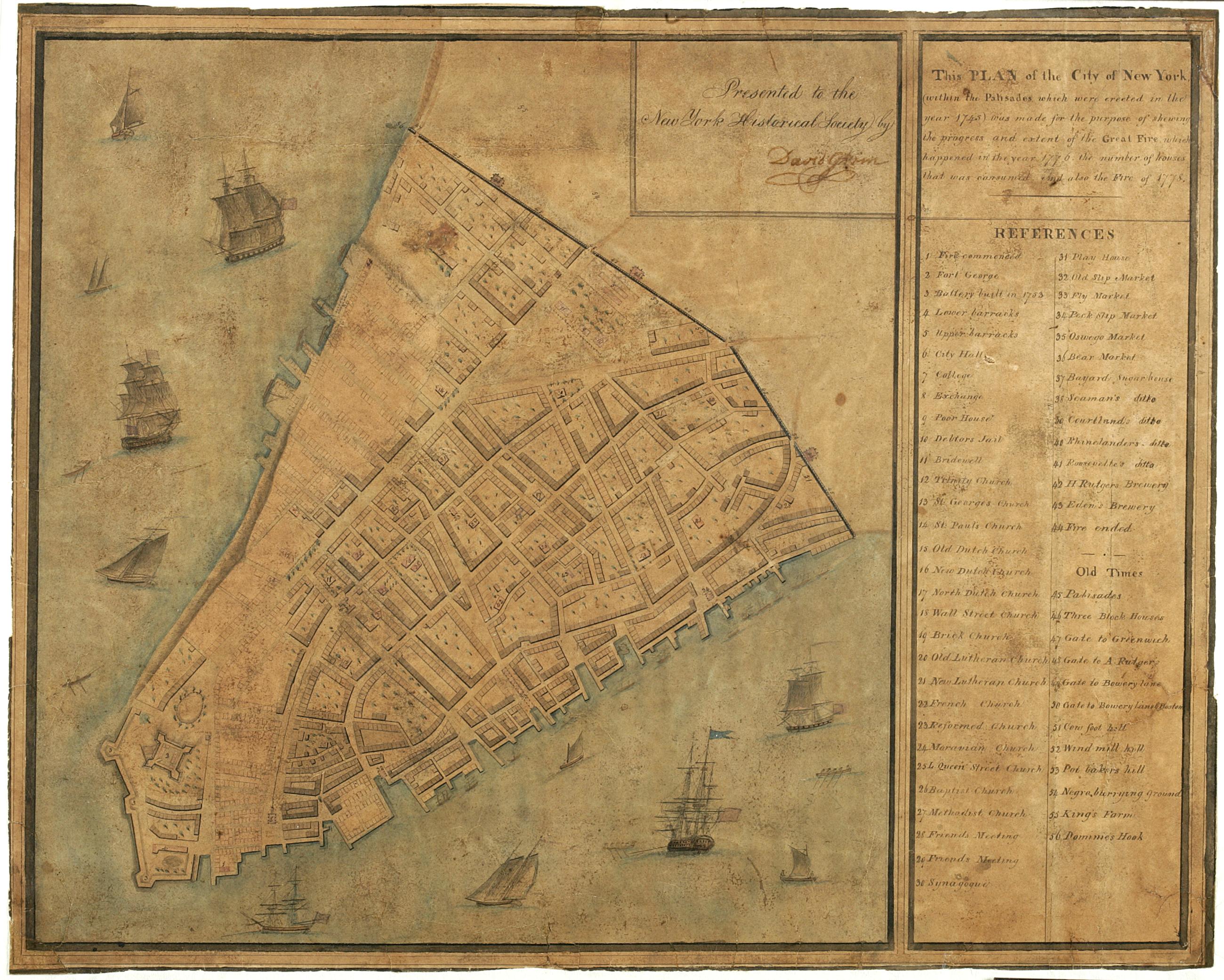
This plan of the City of New York (within the palisades which were erected in the year 1743) was made for the purpose of shewing the progress and extent of the great fire which happened in the year 1776, the number of houses that was consumed, and also th
"Presented to the New York Historical Society by David Grim." Attributed by cataloger to Grim. Brittle, varnished, cracked and frayed. ; mounted on paper in turn backed by cloth. Date of ms. after 1804 foundation of the N-YHS. Date before Grim's death 1826. Historical map. Covers Manhattan Island south of modern Chambers Street, New York (N.Y.) Shows buildings and other urban features. Includes index. Pen-and-ink, watercolor on paper. Ships shown pictorially.
View Item