


Still Image
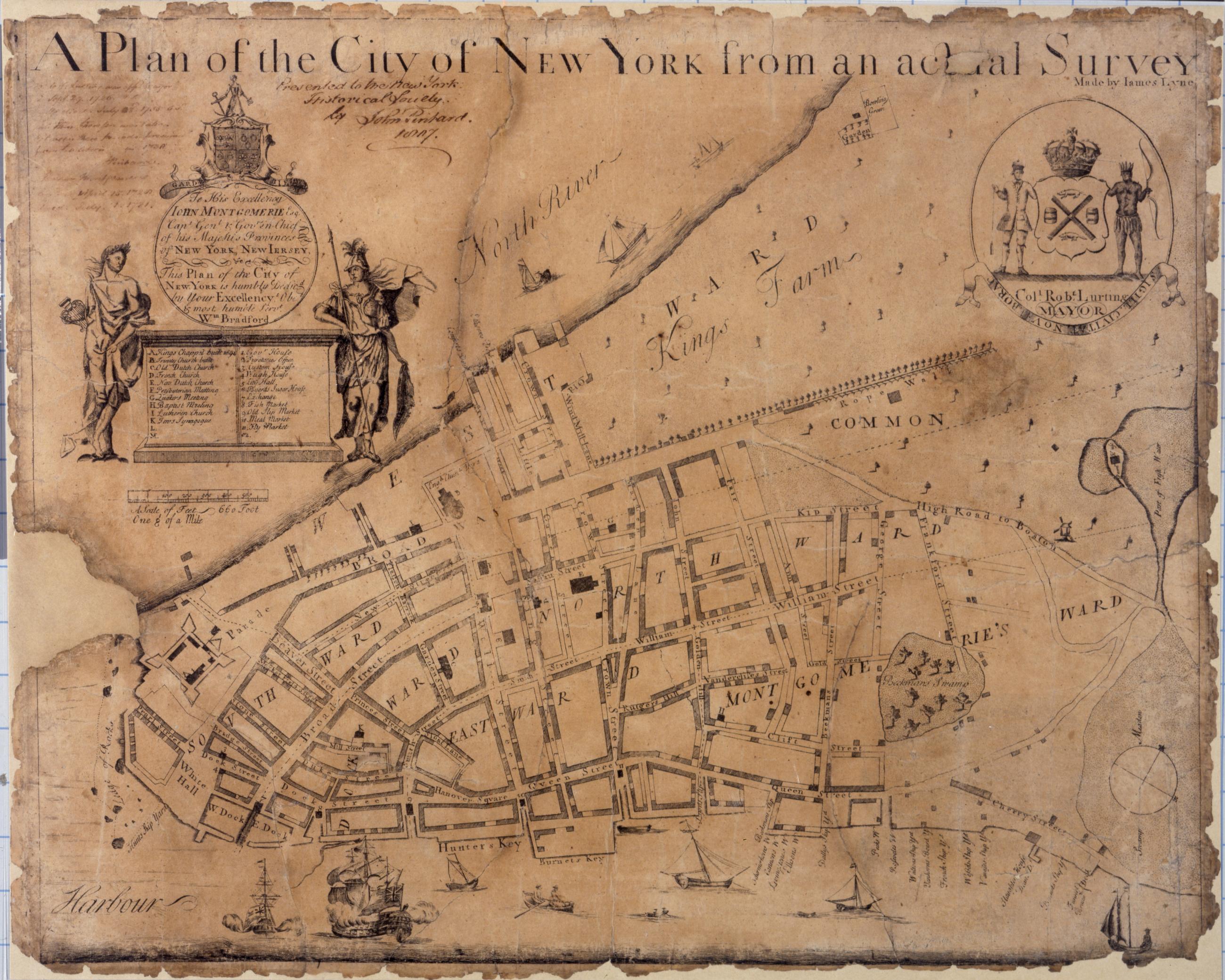
A plan of the city of New York from an actual survey, made by James Lyne
Known as the Bradford map, this is the first map of New York printed in the city itself. It is dated to 1731 on the basis of an advertisement in the New York Gazette, August 30-September 6, 1731. Covers lower Manhattan. Shows wards, streets, and public buildings. Oriented with north toward the upper right. Includes index to points of interest. In cartouche at upper left: "To his excellency John Montgomerie, Esq. Capt. Genl. & Gov.
View Item