


Still Image
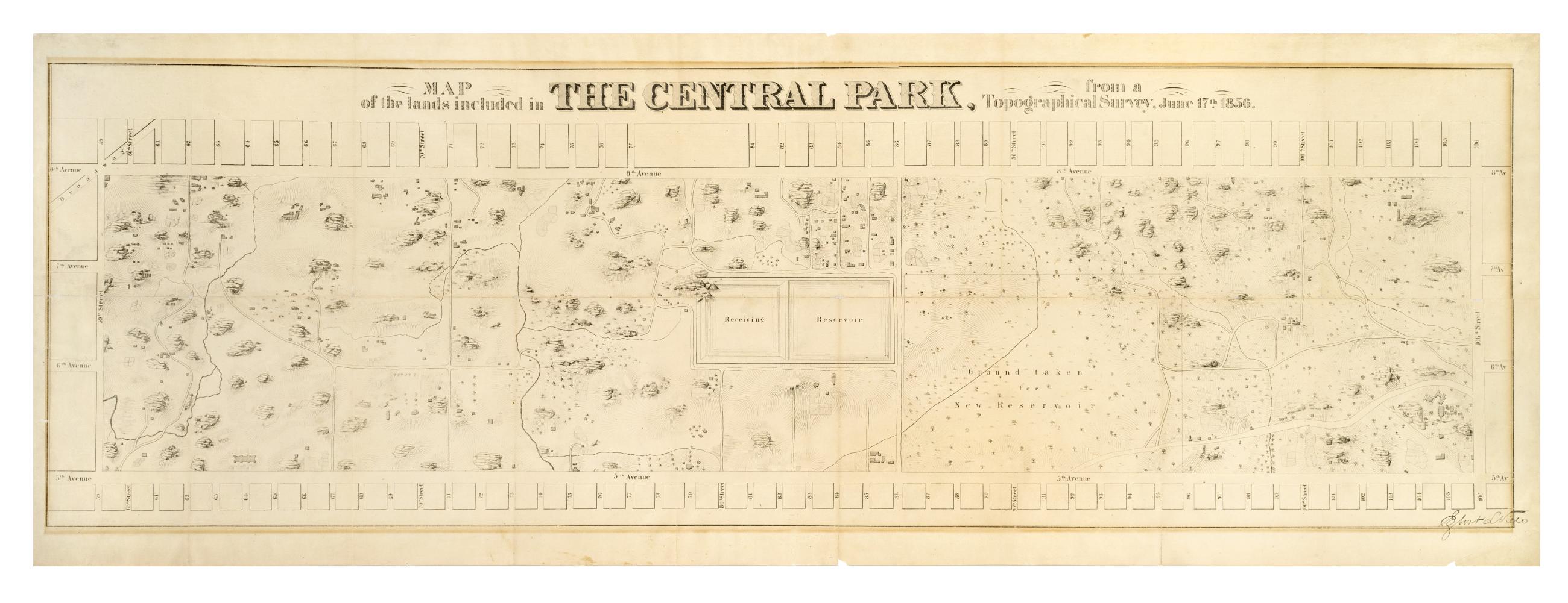
Map of the lands included in the Central Park, from a topographical survey, June 17th 1856
The Egbert L. Viele map of Central Park. Covers the area later bounded by 59th and 106th Streets, 5th Avenue and Central Park West, Manhattan, New York (N.Y.). Shows rock outcrops, buildings, reservoir, existing roads. Also shows landforms and streams. Shows relief by hachures. Oriented with north to right of sheet. "Engr. by Ferd. Mayer & Co." on companion map. From First Annual Report of the Board of Commissioners of the Central Park, January 1857.
View Item