Image

Still Image
2 Items
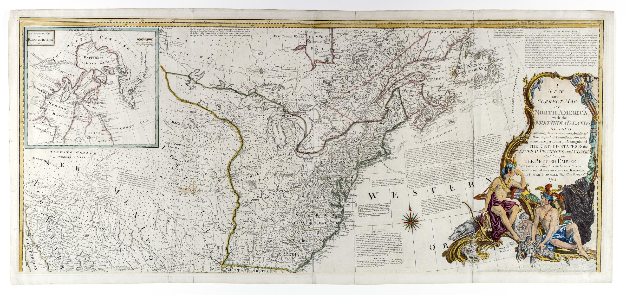
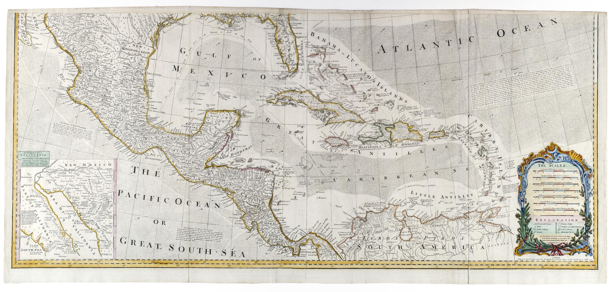
A new and correct map of North America, with the West India islands, divided according to the preliminary articles of peace, signed at Versailles, 20 Jan. 1783, wherein are particularly distinguished the United States, & the several provinces and colonies
New state of 1779 issue showing 1783 boundaries and with changes to the title but retaining the 1779 date in imprint; The map includes articles 4, 5, 7, 9, 17, 18, and 20 of the Treaty of Versailles
View Item