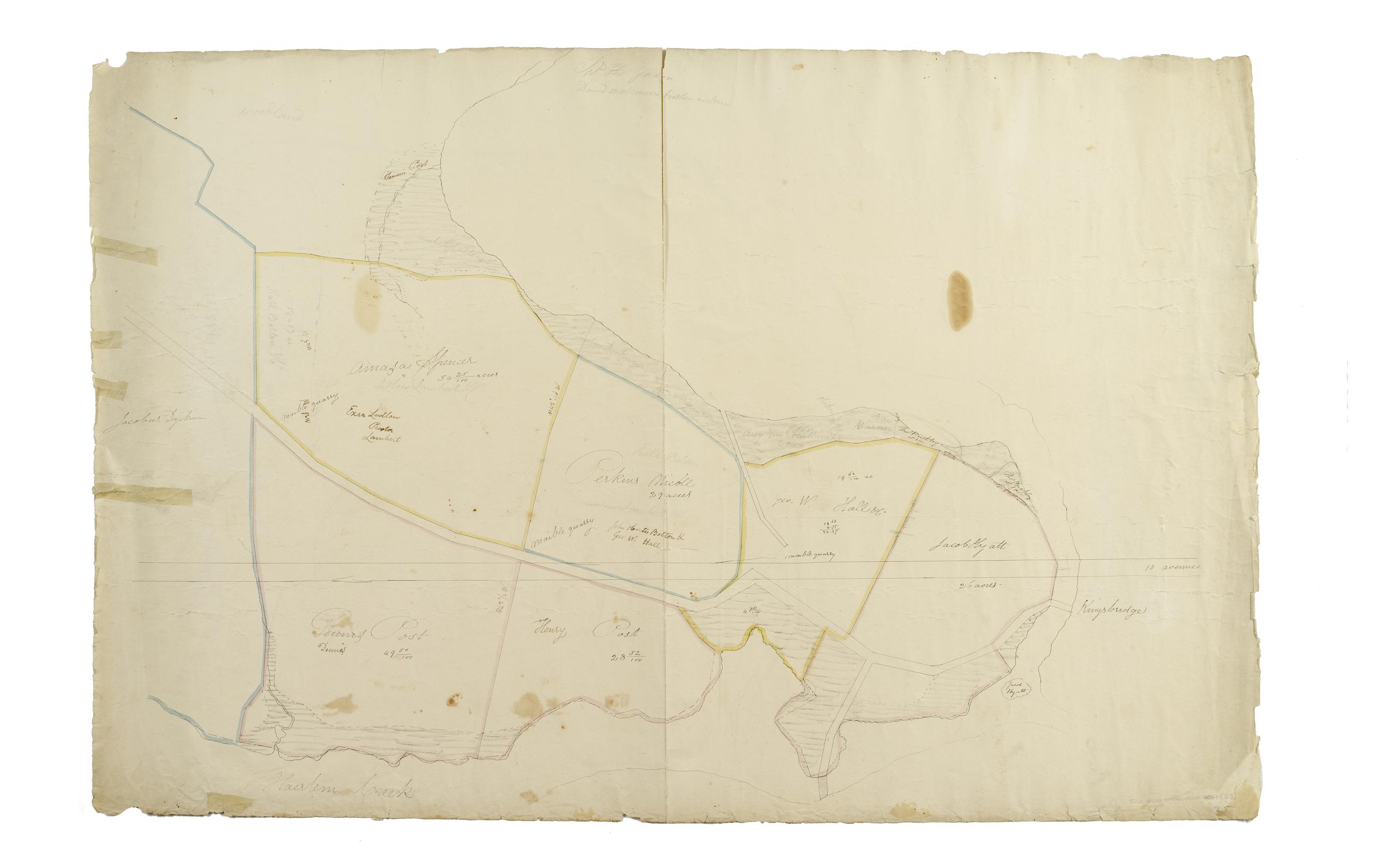
Still Image [Map of the area later bounded by 208th and 228th Streets, the Harlem and Hudson Rivers, Manhattan, New York, N.Y.]. Scale [ca. 1:2,450]. Cadastral map. Shows property lines and owners' names, some existing roads and projected streets. Shows relief by hachures. Pen-and-ink, watercolor on paper. Annotations in a later hand on the recto of this sheet give the number 25. The map on recto of this sheet belongs to the same series and is separately cataloged under the title, [Map of the area later bounded by 196th and 212th Streets, the Harlem and Hudson Rivers, Manhattan, New York, N.Y.]. View Item
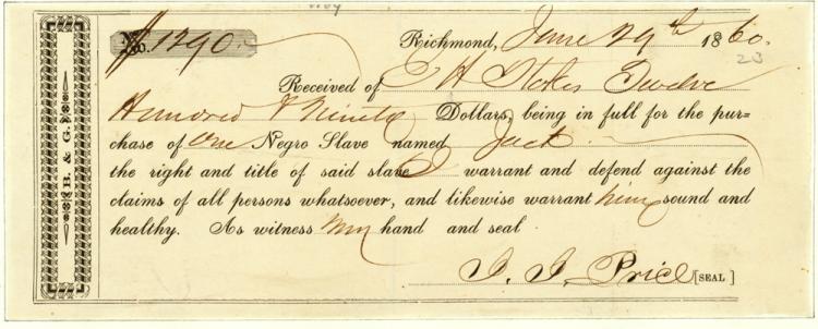
Image Text 9 Items [Nine receipts for the slave of slaves by E. H. Stokes] Nine printed receipts for the sale of slaves by E. H. Stokes between June 29, 1860 and August 15, 1860. View Item