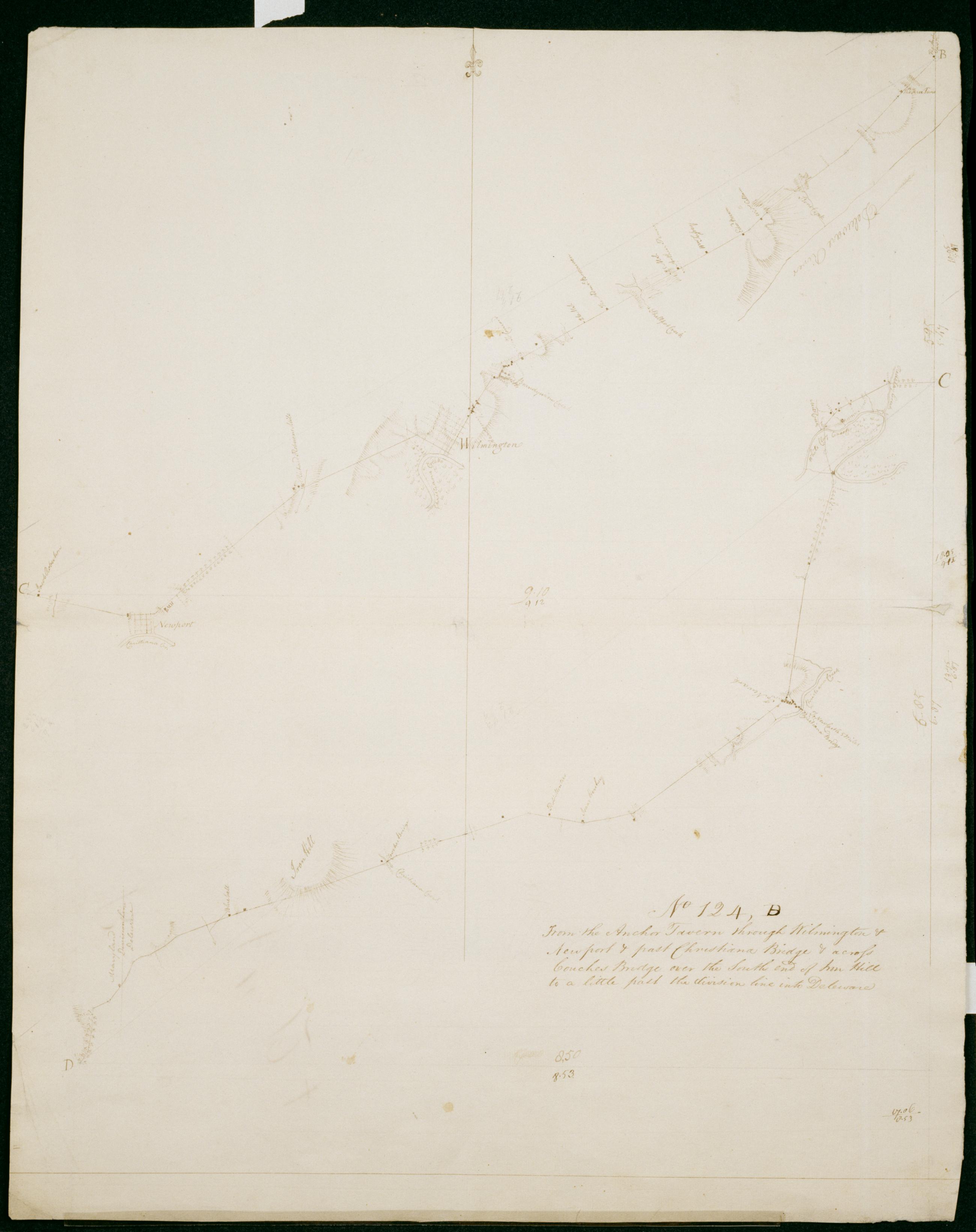
Cartographic From the Anchor Tavern through Wilmington + Newport + past Christiana Bridge + across Couches Bridge over the South end of Iron Hill to a little past the division line into Deleware. No 124, B / by Robert Erskine F.R.S. Geogr. A. U.S. and Assistants. Date 1781 inferred by cataloger. Military topographic map. Covers the counties of New Castle in Delaware and of Cecil in Maryland. Shows roads running through Bellevue State Park, Wilmington, Silview, Newport, Stanton, Christiana and Cooches Bridge. Also shows buildings and owners' names, landforms and streams. Pen-and-ink, pencil on laid paper. Shows relief by hachures. Stained, soiled, creased, frayed and abraded. Mounted on cloth, bound and cropped, disbound and silked by subsequent owners. Cleaned after removal of backings 1999; some fill remains. Sheathed in mylar. View Item
Cartographic From the Anchor Tavern through Wilmington + Newport + past Christiana Bridge + across Couches Bridge over the South end of Iron Hill to a little past the division line into Deleware. No 124 B / by Robert Erskine F.R.S. Geogr. A. U.S. and Assistants. Date 1781 inferred by cataloger. Military topographic map. Covers the counties of New Castle in Delaware and of Cecil in Maryland. Shows roads running through Bellevue State Park- Wilmington- Silview- Newport- Stanton- Christiana and Cooches Bridge. Also shows buildings and owners' names- landforms and streams. Pen-and-ink- pencil on laid paper. Shows relief by hachures. Stained- soiled- creased- frayed and abraded. Mounted on cloth- bound and cropped- disbound and silked by subsequent owners. Cleaned after removal of backings 1999; some fill remains. Sheathed in mylar. View Item