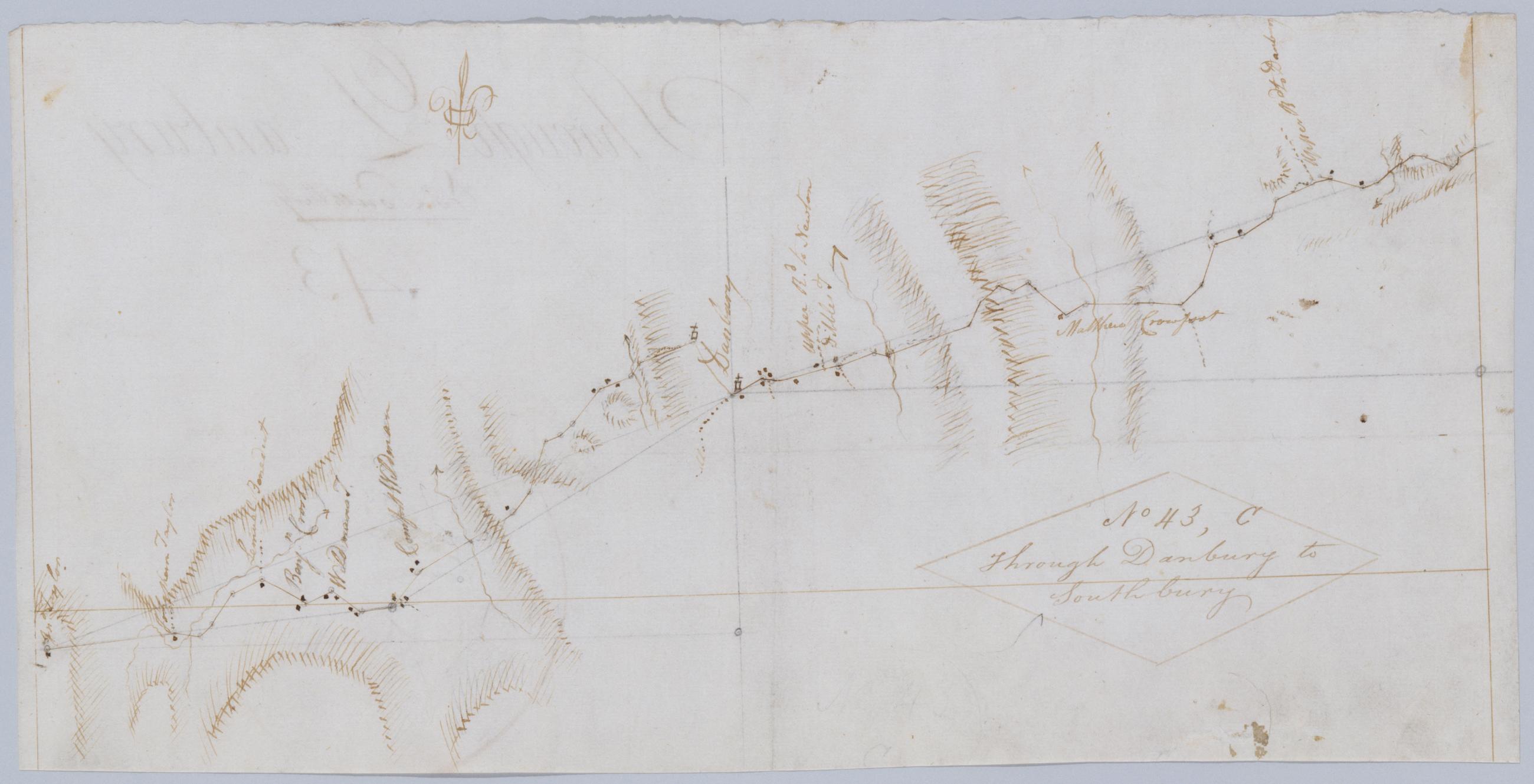
Cartographic Through Danbury to Southbury. No 43, C / by Robert Erskine F.R.S. Geogr. A. U.S. and Assistants. Foxed, creased, frayed, and abraded. Mounted on cloth, bound and cropped, disbound and silked by subsequent owners. Cleaned after removal of backings 1999; some fill remains. Sheathed in mylar. Military topographic map. Covers the townships of Bethel, Danbury and Ridgefield in Fairfield County, Connecticut. Shows roads running through East Danbury and Danbury. Also shows buildings and owners' names, landforms and streams. Pen-and-ink, pencil on laid paper. Shows relief by hachures. Title proper from recto is the work of a later editor--Simeon DeWitt or his assign--subsequent to 1820. View Item
Cartographic Through Danbury to Southbury. No 43 C / by Robert Erskine F.R.S. Geogr. A. U.S. and Assistants. Foxed- creased- frayed- and abraded. Mounted on cloth- bound and cropped- disbound and silked by subsequent owners. Cleaned after removal of backings 1999; some fill remains. Sheathed in mylar. Military topographic map. Covers the townships of Bethel- Danbury and Ridgefield in Fairfield County- Connecticut. Shows roads running through East Danbury and Danbury. Also shows buildings and owners' names- landforms and streams. Pen-and-ink- pencil on laid paper. Shows relief by hachures. Title proper from recto is the work of a later editor--Simeon DeWitt or his assign--subsequent to 1820. View Item