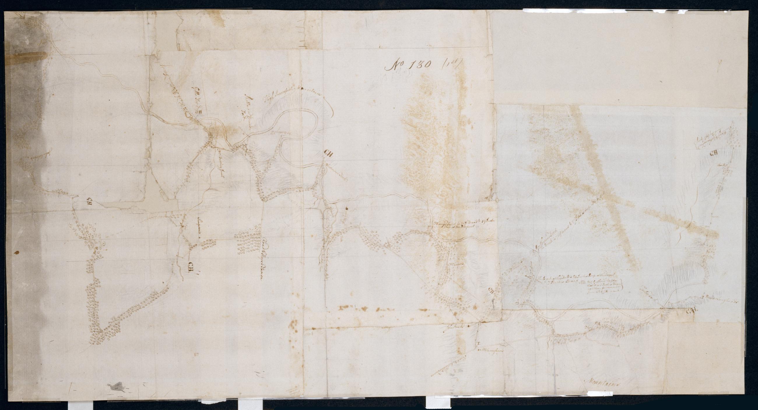
Cartographic From McPherson ford to Taylors Ford on Octorara. No 130 (1st) / by Robert Erskine F.R.S. Geogr. A. U.S. and Assistants. Badly stained and foxed, creased, split, frayed and abraded. Mounted on cloth, bound and cropped, disbound and silked by subsequent owners. Cleaned after removal of backings 1999; some fill remains. Newly backed with China paper. Sheathed in mylar. In pencil on recto, roughly, and not encircled: "No. 130". Military topographic map. Covers the townships of Little Britain, Colerain and Sudsbury in Lancaster County, Pennsylvania. Also shows buildings and owners' names, landforms and streams. Oriented with north to left of sheet. View Item
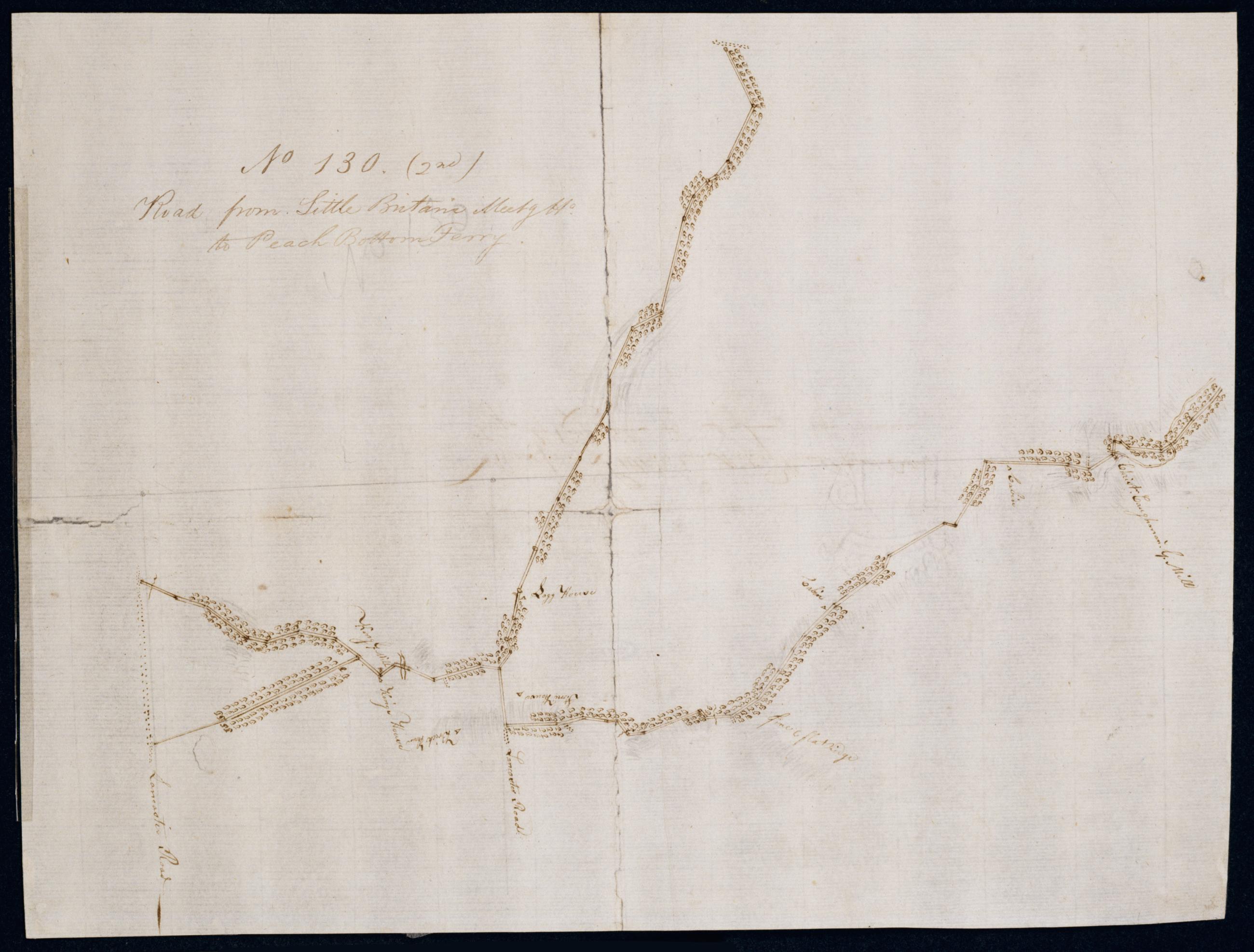
Cartographic Road from Little Britan's Meetg Ho. to Peach Bottom Ferry. No 130 (2nd) / by Robert Erskine F.R.S. Geogr. A. U.S. and Assistants. In pencil on recto, roughly, and not encircled: "No. 130". Military topographic map. Covers the townships of Fulton, Drumore and Little Britain in Lancaster County, Pennsylvania. Also shows buildings and owners' names, landforms and streams. Oriented with north to bottom of sheet. Pen-and-ink, pencil laid paper. Shows relief by hachures. Soiled, foxed, creased, split, frayed and abraded. Mounted on cloth, bound and cropped, disbound and silked by subsequent owners. Cleaned after removal of backings 1999; some fill remains. Newly backed with China paper. Sheathed in mylar. View Item
Cartographic From McPherson ford to Taylors Ford on Octorara. No 130 (1st) / by Robert Erskine F.R.S. Geogr. A. U.S. and Assistants. Badly stained and foxed- creased- split- frayed and abraded. Mounted on cloth- bound and cropped- disbound and silked by subsequent owners. Cleaned after removal of backings 1999; some fill remains. Newly backed with China paper. Sheathed in mylar. In pencil on recto- roughly- and not encircled: "No. 130". Military topographic map. Covers the townships of Little Britain- Colerain and Sudsbury in Lancaster County- Pennsylvania. Also shows buildings and owners' names- landforms and streams. Oriented with north to left of sheet. View Item
Cartographic Road from Little Britan's Meetg Ho. to Peach Bottom Ferry. No 130 (2nd) / by Robert Erskine F.R.S. Geogr. A. U.S. and Assistants. In pencil on recto- roughly- and not encircled: "No. 130". Military topographic map. Covers the townships of Fulton- Drumore and Little Britain in Lancaster County- Pennsylvania. Also shows buildings and owners' names- landforms and streams. Oriented with north to bottom of sheet. Pen-and-ink- pencil laid paper. Shows relief by hachures. Soiled- foxed- creased- split- frayed and abraded. Mounted on cloth- bound and cropped- disbound and silked by subsequent owners. Cleaned after removal of backings 1999; some fill remains. Newly backed with China paper. Sheathed in mylar. View Item