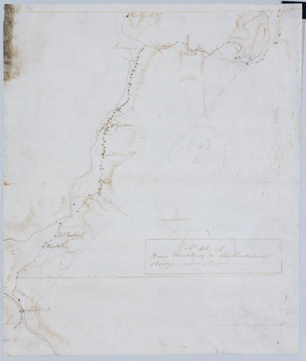
Cartographic From Woodbury to the Continental Bridge, near Newtown. No 43, A / by Robert Erskine F.R.S. Geogr. A. U.S. and Assistants. In pencil on recto: "No 43 A". Military topographic map. Covers the townships of Southbury, Woodbury and Middlebury in New Haven County and of Newtown in Fairfield County, Connecticut. Shows roads running through Woodbury, White Oaks, Southbury, Pomperaug Valley and Bennetts Bridge. Also shows buildings and owners' names, landforms and streams. Pen-and-ink, pencil on laid paper. Shows relief by hachures. Soiled, foxed, creased, frayed, and abraded. Mounted on cloth, bound and cropped, disbound and silked by subsequent owners. Cleaned after removal of backings 1999; some fill remains. View Item
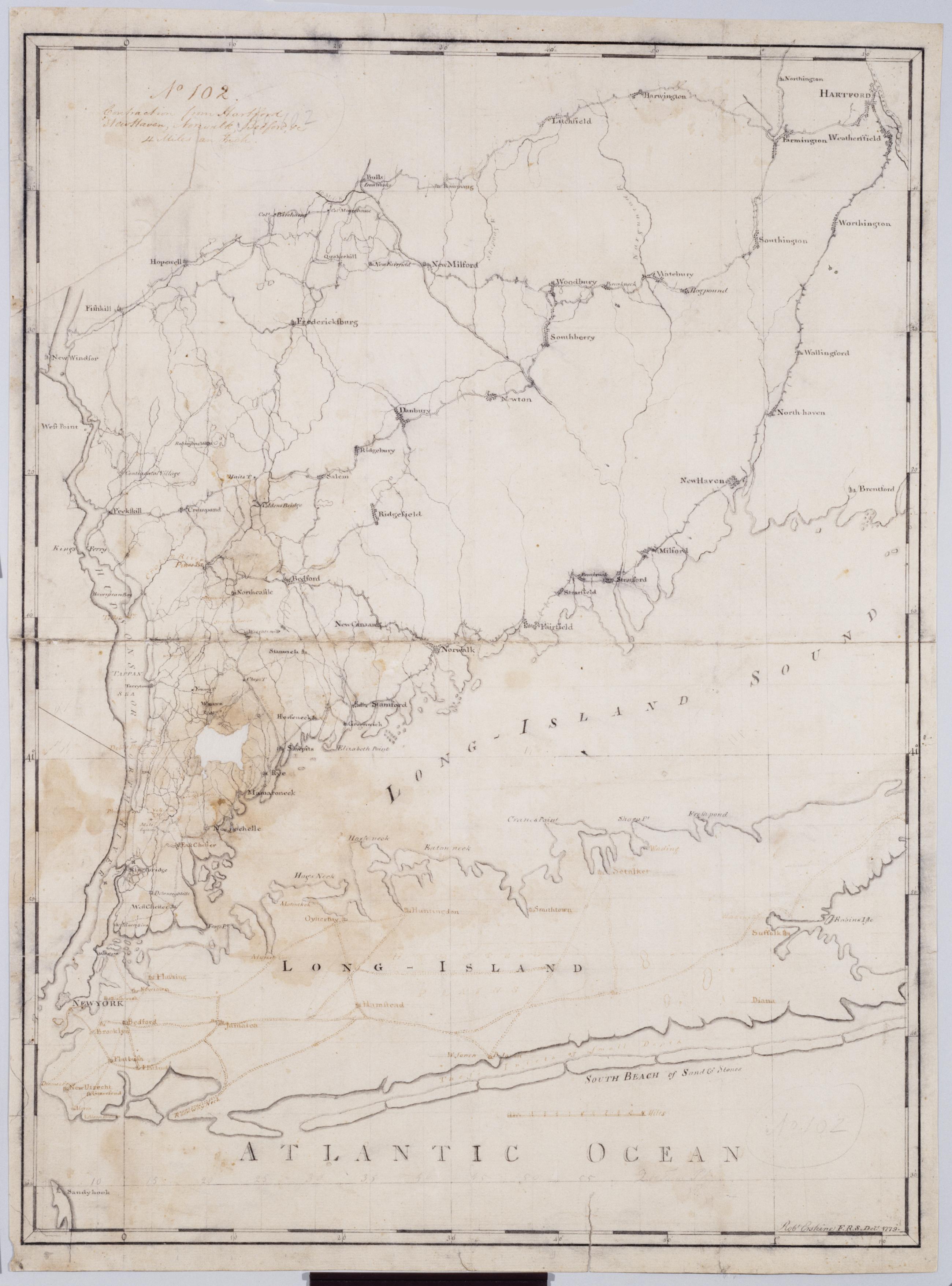
Cartographic Contraction from Hartford New Haven, Norwalk, Bedford +c. No 102 / Robt Erskine F.R.S. Delt. 1779 ; by RE ; by Robert Erskine F.R.S. Geogr. A. U.S. and Assistants. Imperfect: lacking 2 x 3 cm. at left center. In ink on verso: "No. 102". In pencil on recto: "No 102". Military topographic map. Covers Westchester, Putnam, Nassau and Suffolk counties in New York, and also New York City; and Fairfield, Litchfield, New Haven and Hartford Counties in Connecticut. Pen-and-ink, pencil on laid paper. Planar projection. Soiled, stained, mildewed creased, frayed and abraded. Mounted on cloth, bound, disbound and silked by subsequent owners. Cleaned after removal of backings 1999; relined with China paper. Sheathed in mylar. View Item
Cartographic From Woodbury to the Continental Bridge near Newtown. No 43 A / by Robert Erskine F.R.S. Geogr. A. U.S. and Assistants. In pencil on recto: "No 43 A". Military topographic map. Covers the townships of Southbury- Woodbury and Middlebury in New Haven County and of Newtown in Fairfield County- Connecticut. Shows roads running through Woodbury- White Oaks- Southbury- Pomperaug Valley and Bennetts Bridge. Also shows buildings and owners' names- landforms and streams. Pen-and-ink- pencil on laid paper. Shows relief by hachures. Soiled- foxed- creased- frayed- and abraded. Mounted on cloth- bound and cropped- disbound and silked by subsequent owners. Cleaned after removal of backings 1999; some fill remains. View Item
Cartographic Contraction from Hartford New Haven Norwalk Bedford +c. No 102 / Robt Erskine F.R.S. Delt. 1779 ; by RE ; by Robert Erskine F.R.S. Geogr. A. U.S. and Assistants. Imperfect: lacking 2 x 3 cm. at left center. In ink on verso: "No. 102". In pencil on recto: "No 102". Military topographic map. Covers Westchester- Putnam- Nassau and Suffolk counties in New York- and also New York City; and Fairfield- Litchfield- New Haven and Hartford Counties in Connecticut. Pen-and-ink- pencil on laid paper. Planar projection. Soiled- stained- mildewed creased- frayed and abraded. Mounted on cloth- bound- disbound and silked by subsequent owners. Cleaned after removal of backings 1999; relined with China paper. Sheathed in mylar. View Item