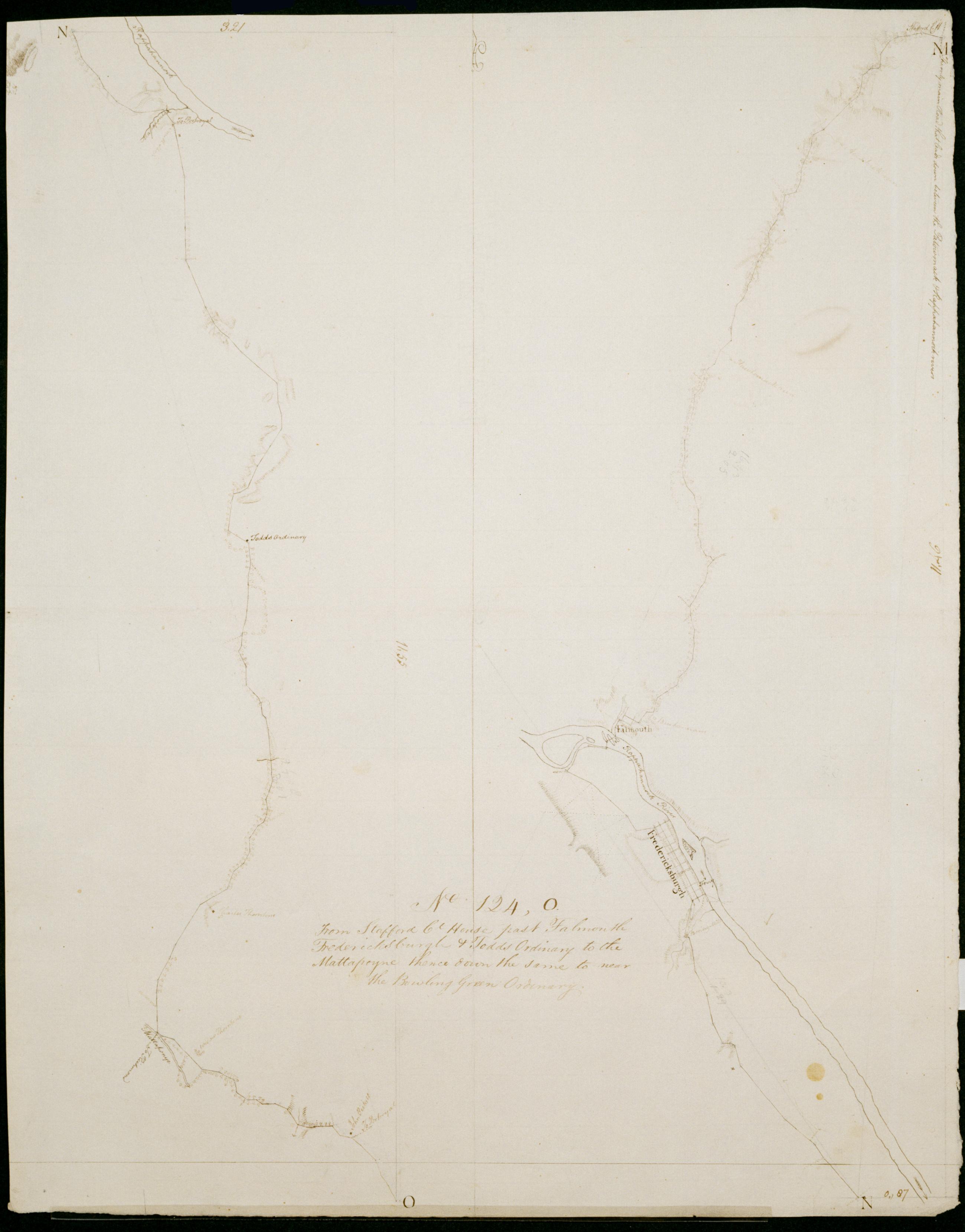
Cartographic From Stafford Ct House past Falmouth Fredericksburgh + Todds Oridnary to the Mattapoyne thence down the same to near the Bowling Green Ordinary. No 124, O / by Robert Erskine F.R.S. Geogr. A. U.S. and Assistants. Date 1781 inferred by cataloger. Military topographic map; right segment is north of the left one. Covers the counties of Stafford, Spotsylvania and Caroline in Virginia. Shows roads running through Stafford, Cranes Corner, Falmouth, Fredericksburg, New Post, Corbin, Villboro, Woodford and Farmers. Also shows buildings, landforms and streams. Pen-and-ink, pencil on laid paper. Shows relief by hachures. Stained, soiled, creased and abraded. Mounted on cloth, bound and cropped, disbound and silked by subsequent owners. Cleaned after removal of backings 1999; some fill remains. View Item
Cartographic From Stafford Ct House past Falmouth Fredericksburgh + Todds Oridnary to the Mattapoyne thence down the same to near the Bowling Green Ordinary. No 124 O / by Robert Erskine F.R.S. Geogr. A. U.S. and Assistants. Date 1781 inferred by cataloger. Military topographic map; right segment is north of the left one. Covers the counties of Stafford- Spotsylvania and Caroline in Virginia. Shows roads running through Stafford- Cranes Corner- Falmouth- Fredericksburg- New Post- Corbin- Villboro- Woodford and Farmers. Also shows buildings- landforms and streams. Pen-and-ink- pencil on laid paper. Shows relief by hachures. Stained- soiled- creased and abraded. Mounted on cloth- bound and cropped- disbound and silked by subsequent owners. Cleaned after removal of backings 1999; some fill remains. View Item