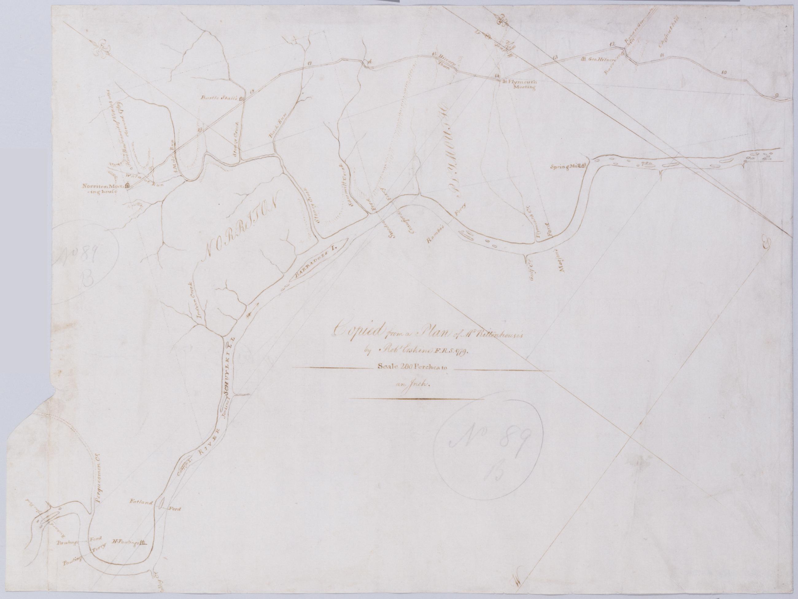
Cartographic [A Contraction of Do.] No. 89 B. / Copied from a Plan of Mr Rittenhouse's by Robt Erskine F.R.S. 1779 ; by Robert Erskine F.R.S. Geogr. A. U.S. and Assistants. Foxed, soiled, frayed. Sheathed in mylar. In ink on verso: "No. 89 B." In pencil on recto: "No 89 B". Military topographic map. Covers the counties of Chester, Montgomery and Delaware, Pennsylvania. Shows roads running through Norristown and Philadelphia. Also shows buildings and owners' names, landforms and streams. No title on recto or verso; title proper supplied by cataloger. Title number from map verso. First statement of responsibility from map recto. View Item
Cartographic [A Contraction of Do.] No. 89 B. / Copied from a Plan of Mr Rittenhouse's by Robt Erskine F.R.S. 1779 ; by Robert Erskine F.R.S. Geogr. A. U.S. and Assistants. Foxed- soiled- frayed. Sheathed in mylar. In ink on verso: "No. 89 B." In pencil on recto: "No 89 B". Military topographic map. Covers the counties of Chester- Montgomery and Delaware- Pennsylvania. Shows roads running through Norristown and Philadelphia. Also shows buildings and owners' names- landforms and streams. No title on recto or verso; title proper supplied by cataloger. Title number from map verso. First statement of responsibility from map recto. View Item