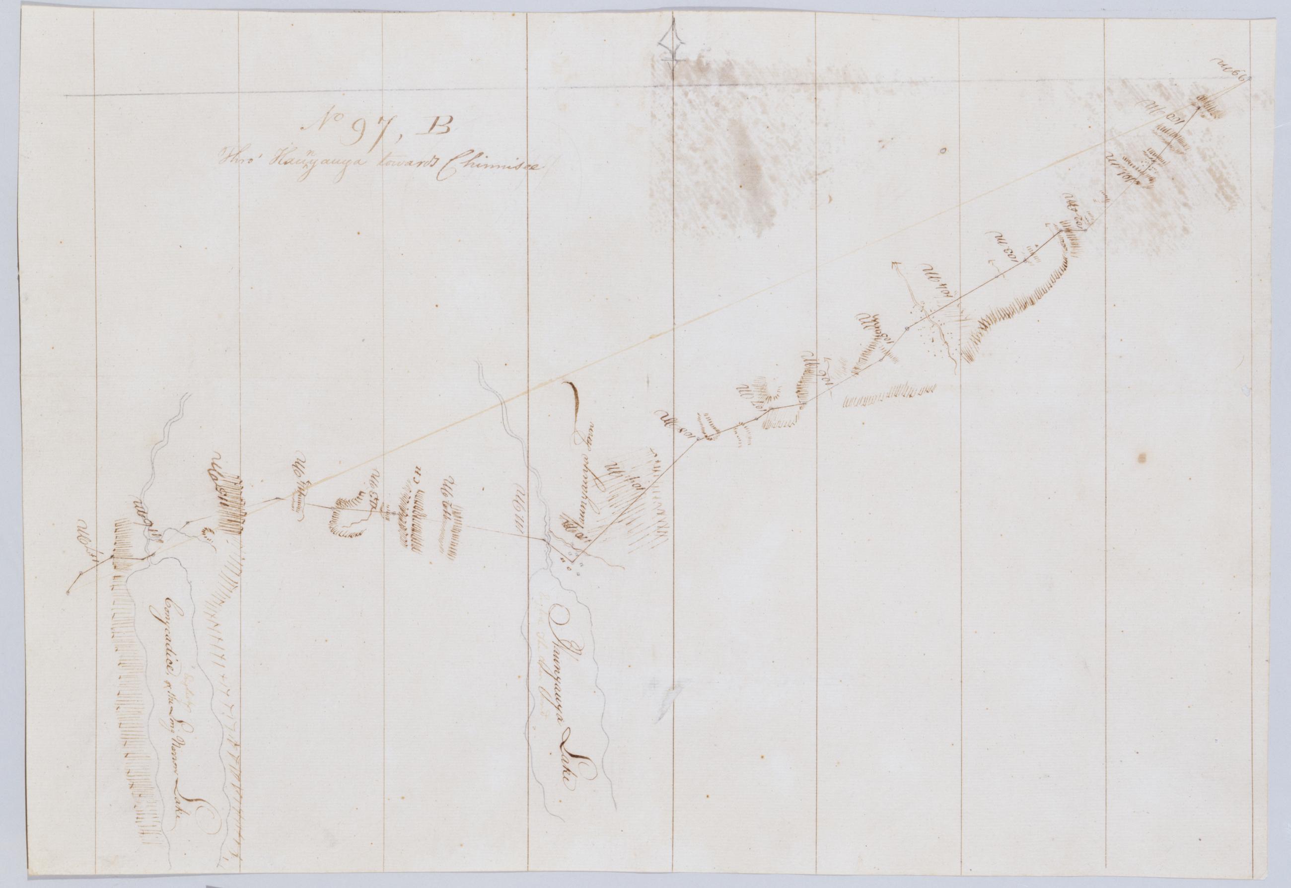
Cartographic Thro' Kaunyauya towards Chinnisee. No 97, B / by Robert Erskine F.R.S. Geogr. A. U.S. and Assistants. In erased pencil on recto, "No 97 B". Military topographic map. Covers the towns of Canandaigua, Bristol and Richmond in Ontario County and of Livonia in Livingston County, New York. Shows roads running through Canandaigua, Vicent, Honeoye and Glenville. Also shows landforms and streams. Hemlock formerly Conesus Lake is incorrectly labeled as Conycadice Lake. Pen-and-ink, pencil on laid paper. Shows relief by hachures. Stained, creased and abraded. Mounted on cloth, cropped, bound, disbound and silked by subsequent owners. Cleaned after removal of backings 1999; some fill remains. View Item
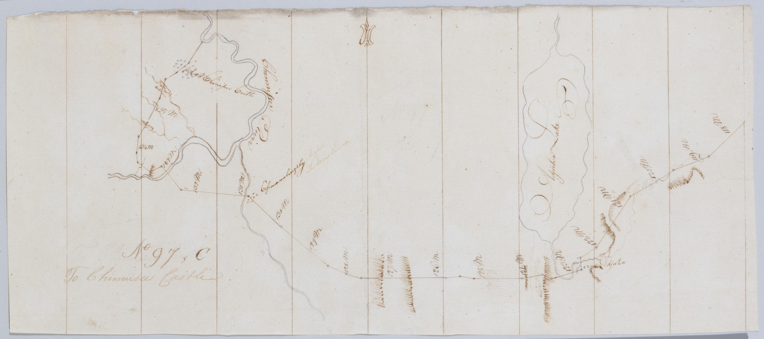
Cartographic To Chinnisee castle. No 97, C / by Robert Erskine F.R.S. Geogr. A. U.S. and Assistants. In erased pencil on recto, "No 97 C". Military topographic map. Covers the towns of Livonia in Livingston County and of Conesus, Groveland and Leicester in Ontario County, New York. Shows roads running through Cemetery Hill, Foots Corners and Mount Morris. Also shows landforms and streams. Adjusta Lake is now called Consesus Lake. Pen-and-ink, pencil on laid paper. Shows relief by hachures. Stained, creased and abraded. Mounted on cloth, cropped, bound, disbound and silked by subsequent owners. Cleaned after removal of backings 1999; some fill remains. Sheathed in mylar. View Item
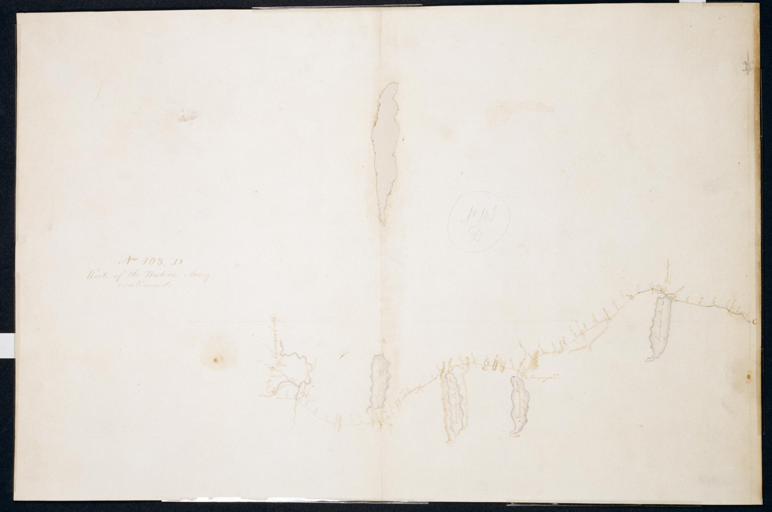
Cartographic Route of the Western Army continued. No. 103, D / by Lt. Lodge ; by Robert Erskine F.R.S. Geogr. A. U.S. and Assistants. Creased, soiled, stained, frayed and abraded. Mounted on cloth, bound and cropped, disbound and silked by subsequent owners. Cleaned after removal of backings 1999; some fill remains. Sheathed in mylar. Imperfect: lacking 3 x 14 cm. at upper center of map. In ink on verso "D No. 103". In pencil on recto: "No 103 D". Military topographic map. Covers the counties of Ontario and Livingston in New York. Also shows landforms and streams. Pen-and-ink, pencil on laid paper. Shows relief by hachures. View Item
Cartographic Thro' Kaunyauya towards Chinnisee. No 97 B / by Robert Erskine F.R.S. Geogr. A. U.S. and Assistants. In erased pencil on recto- "No 97 B". Military topographic map. Covers the towns of Canandaigua- Bristol and Richmond in Ontario County and of Livonia in Livingston County- New York. Shows roads running through Canandaigua- Vicent- Honeoye and Glenville. Also shows landforms and streams. Hemlock formerly Conesus Lake is incorrectly labeled as Conycadice Lake. Pen-and-ink- pencil on laid paper. Shows relief by hachures. Stained- creased and abraded. Mounted on cloth- cropped- bound- disbound and silked by subsequent owners. Cleaned after removal of backings 1999; some fill remains. View Item
Cartographic To Chinnisee castle. No 97 C / by Robert Erskine F.R.S. Geogr. A. U.S. and Assistants. In erased pencil on recto- "No 97 C". Military topographic map. Covers the towns of Livonia in Livingston County and of Conesus- Groveland and Leicester in Ontario County- New York. Shows roads running through Cemetery Hill- Foots Corners and Mount Morris. Also shows landforms and streams. Adjusta Lake is now called Consesus Lake. Pen-and-ink- pencil on laid paper. Shows relief by hachures. Stained- creased and abraded. Mounted on cloth- cropped- bound- disbound and silked by subsequent owners. Cleaned after removal of backings 1999; some fill remains. Sheathed in mylar. View Item
Cartographic Route of the Western Army continued. No. 103 D / by Lt. Lodge ; by Robert Erskine F.R.S. Geogr. A. U.S. and Assistants. Creased- soiled- stained- frayed and abraded. Mounted on cloth- bound and cropped- disbound and silked by subsequent owners. Cleaned after removal of backings 1999; some fill remains. Sheathed in mylar. Imperfect: lacking 3 x 14 cm. at upper center of map. In ink on verso "D No. 103". In pencil on recto: "No 103 D". Military topographic map. Covers the counties of Ontario and Livingston in New York. Also shows landforms and streams. Pen-and-ink- pencil on laid paper. Shows relief by hachures. View Item