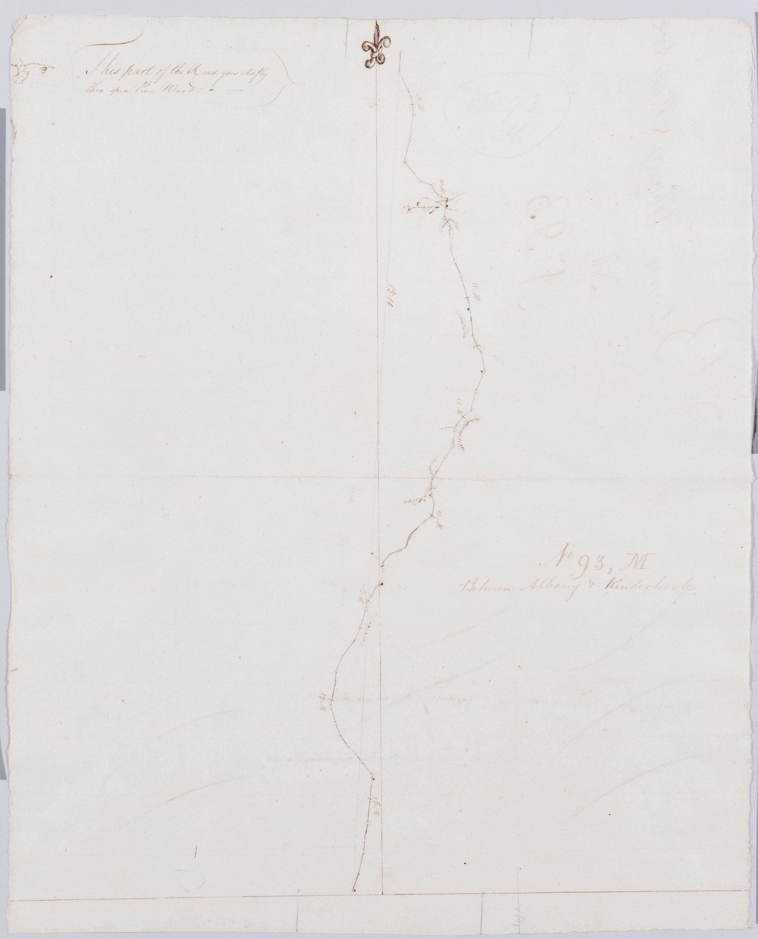
Cartographic Between Albany + Kinderhook. No 93, M / by Robert Erskine F.R.S. Geogr. A. U.S. and Assistants. Creased and abraded. Mounted on cloth, bound, disbound and silked by subsequent owners. Cleaned after removal of backings 1999; some fill remains. Sheathed in mylar. In ink on verso: "M M M". Note unusual but inconsistent letter formation. In pencil on recto: "No 93 M". Military topographic map. Covers the townships of Schodack in Rensselaer County and of Kinderhook in Columbia County, New York. Also shows buildings and owners names, landforms and streams. Pen-and-ink, pencil on laid paper. Shows relief by hachures. View Item
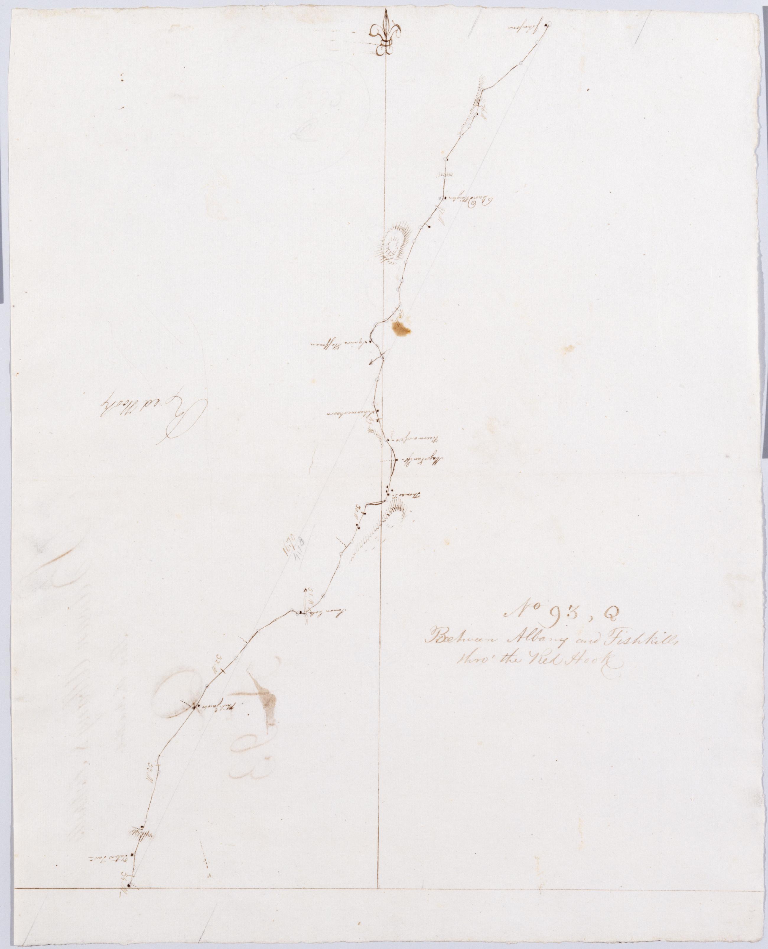
Cartographic Between Albany and Fishkills thro' the Red Hook. No 93, Q / by Robert Erskine F.R.S. Geogr. A. U.S. and Assistants. In erased pencil on recto: "No 93 Q". Military topographic map. Covers the townships of Clermont in Columbia County and Red Hook in Dutchess County, New York. Shows roads running through Clermont, Nevis, Upper Red Hook and Red Hook. Also shows buildings and owners' names, landforms and streams. Pen-and-ink, pencil on laid paper. Shows relief by hachures. Stained, soiled, creased and abraded. Mounted on cloth, bound, disbound and silked by subsequent owners. Cleaned after removal of backings 1999; some fill remains. Sheathed in mylar. View Item
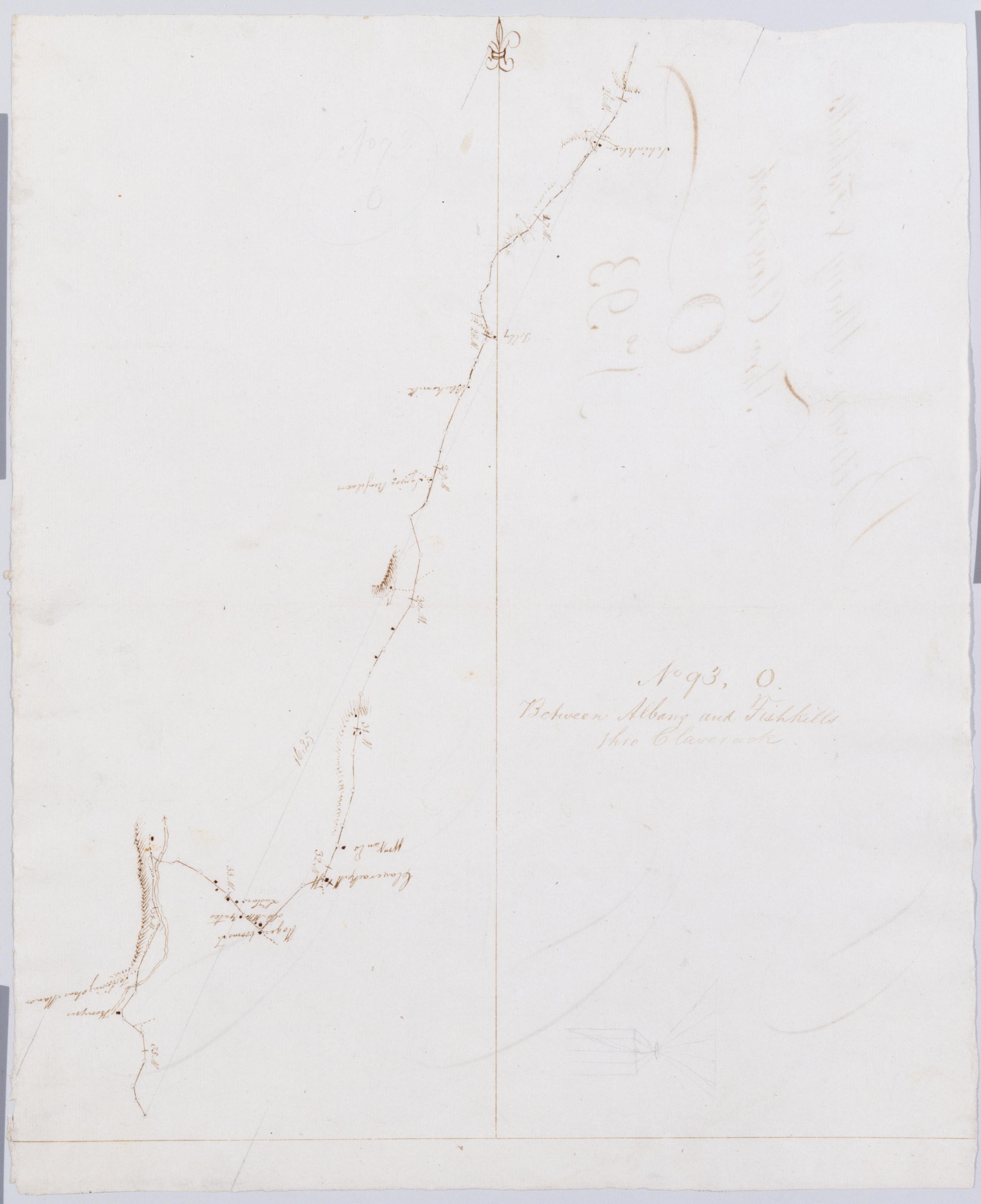
Cartographic Between Albany and Fishkills thro Claverack. No 93, O / by Robert Erskine F.R.S. Geogr. A. U.S. and Assistants. In erased pencil on recto: "No 93 O". In ink on verso: "O Oo Oo". Military topographic map. Covers the townships of Ghent, Claverack and Greenport in Columbia County, New York. Shows roads running through Claverack. Also shows buildings and owners' names, landforms and streams. Pen-and-ink, pencil on laid paper. Shows relief by hachures. Stained, soiled, creased and abraded. Mounted on cloth, bound, disbound and silked by subsequent owners. Cleaned after removal of backings 1999; some fill remains. Sheathed in mylar. View Item
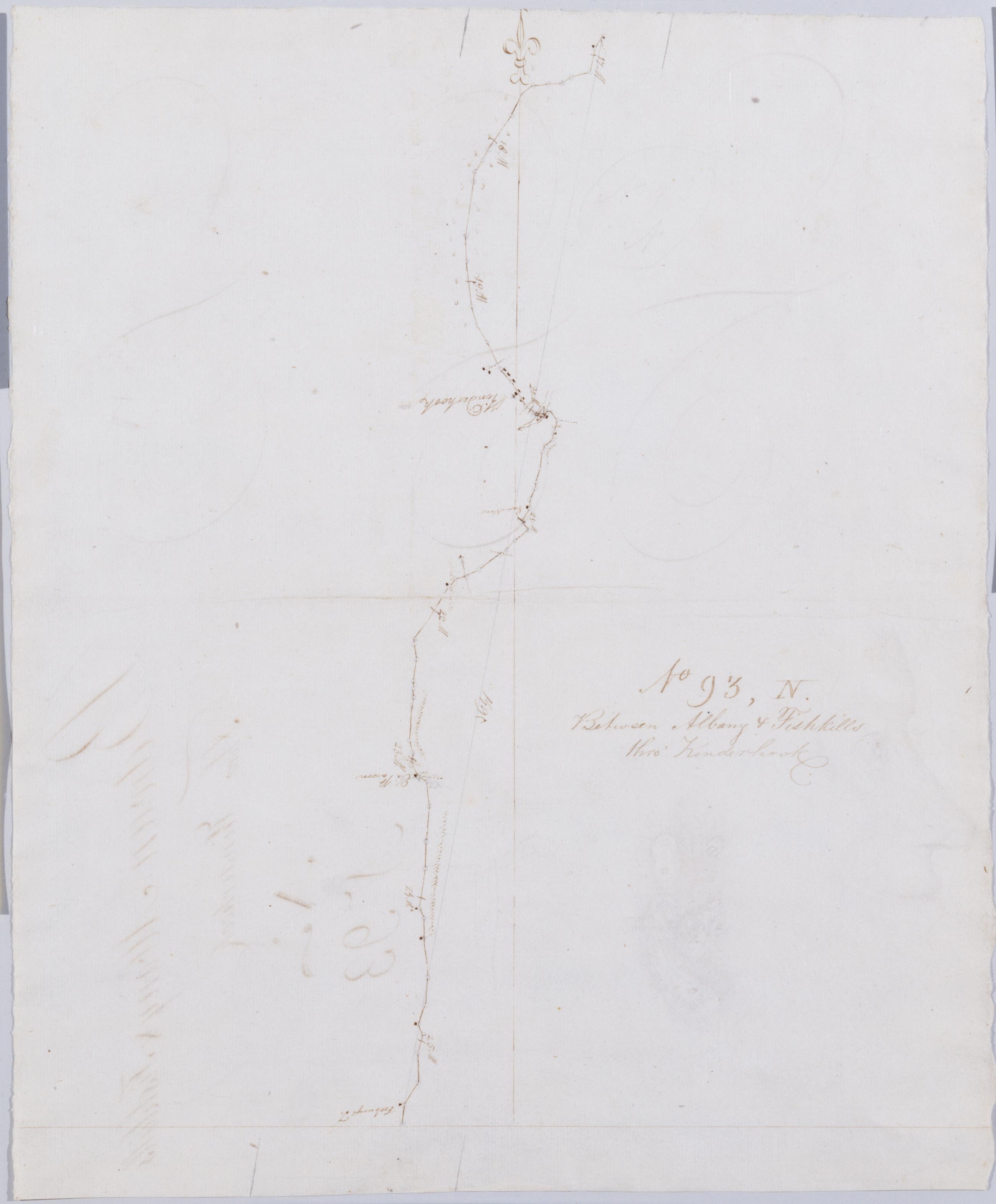
Cartographic Between Albany + Fishkills thro' Kinderhook No 93, N / by Robert Erskine F.R.S. Geogr. A. U.S. and Assistants. Also on verso: fully developed hatchures of unidentified mountains and the profile portrait of a youthful man, both in Erskine's hand. It is possible that the portrait is of Erskine himself; no other portrait is known. In erased pencil on recto: "No 93 N". In ink on verso: "N N N". Military topographic map. Covers the townships of Kinderhook and Ghent in Columbia County, New York. Shows roads running through Kinderhook and West Ghent. Also shows buildings and owners' names, landforms and streams. Pen-and-ink, pencil on laid paper. Shows relief by hachures. Soiled, creased and abraded. View Item
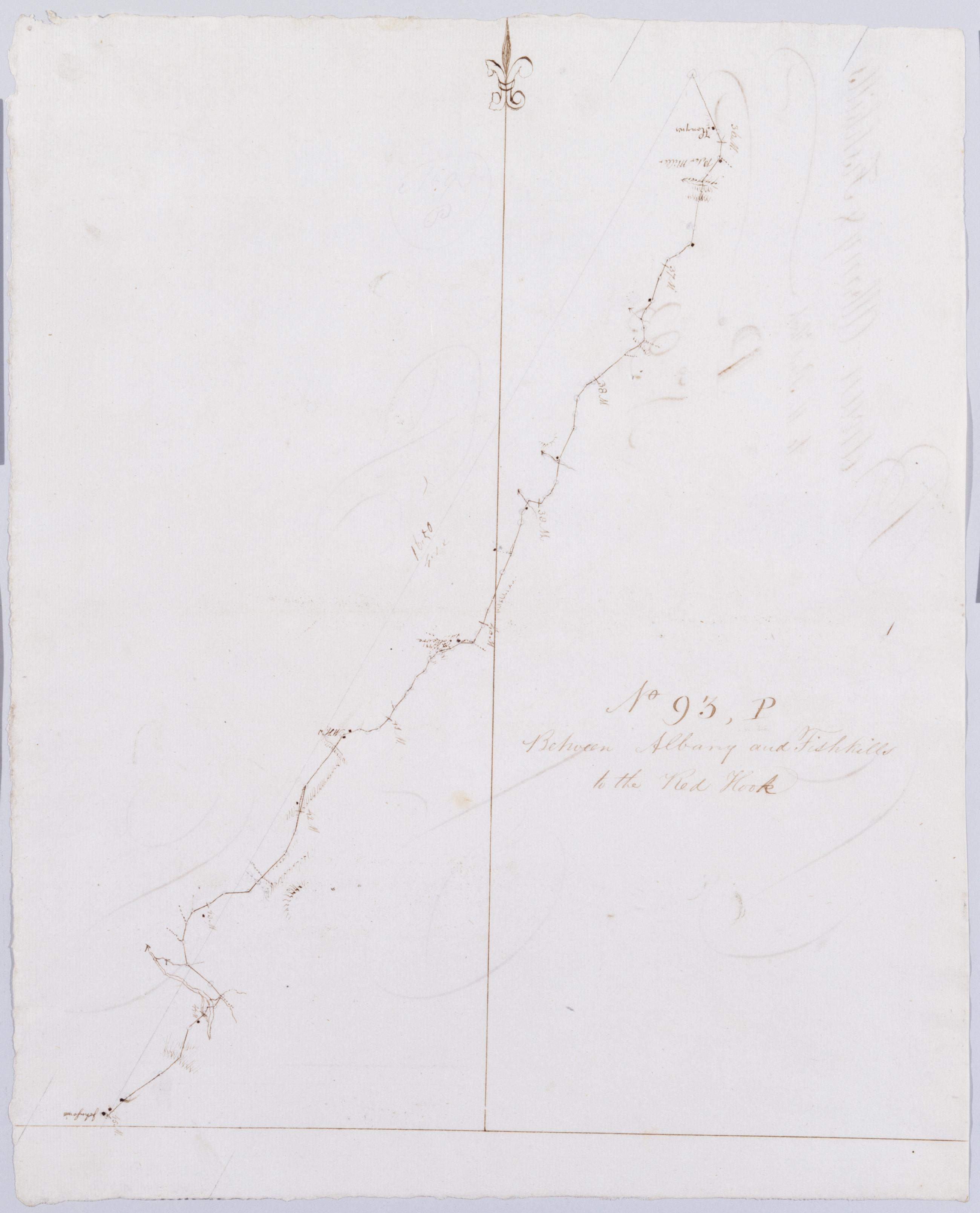
Cartographic Between Albany and Fishkills to the Red Hook. No 93, P / by Robert Erskine F.R.S. Geogr. A. U.S. and Assistants. Foxed, soiled, creased and abraded. Mounted on cloth, bound, disbound and silked by subsequent owners. Cleaned after removal of backings 1999; some fill remains. Sheathed in mylar. In erased pencil on recto: "No 93 P". In ink on verso: "P P P p". Military topographic map. Covers the townships of Claverack, Livingston and Clermont in Columbia County, New York. Shows roads running through Humphreysville, Livingston, Blue Store and Clermont. Also shows buildings and owners' names, landforms and streams. Pen-and-ink, pencil on laid paper. Shows relief by hachures. View Item
Cartographic Between Albany + Kinderhook. No 93 M / by Robert Erskine F.R.S. Geogr. A. U.S. and Assistants. Creased and abraded. Mounted on cloth- bound- disbound and silked by subsequent owners. Cleaned after removal of backings 1999; some fill remains. Sheathed in mylar. In ink on verso: "M M M". Note unusual but inconsistent letter formation. In pencil on recto: "No 93 M". Military topographic map. Covers the townships of Schodack in Rensselaer County and of Kinderhook in Columbia County- New York. Also shows buildings and owners names- landforms and streams. Pen-and-ink- pencil on laid paper. Shows relief by hachures. View Item
Cartographic Between Albany and Fishkills thro' the Red Hook. No 93 Q / by Robert Erskine F.R.S. Geogr. A. U.S. and Assistants. In erased pencil on recto: "No 93 Q". Military topographic map. Covers the townships of Clermont in Columbia County and Red Hook in Dutchess County- New York. Shows roads running through Clermont- Nevis- Upper Red Hook and Red Hook. Also shows buildings and owners' names- landforms and streams. Pen-and-ink- pencil on laid paper. Shows relief by hachures. Stained- soiled- creased and abraded. Mounted on cloth- bound- disbound and silked by subsequent owners. Cleaned after removal of backings 1999; some fill remains. Sheathed in mylar. View Item
Cartographic Between Albany and Fishkills thro Claverack. No 93 O / by Robert Erskine F.R.S. Geogr. A. U.S. and Assistants. In erased pencil on recto: "No 93 O". In ink on verso: "O Oo Oo". Military topographic map. Covers the townships of Ghent- Claverack and Greenport in Columbia County- New York. Shows roads running through Claverack. Also shows buildings and owners' names- landforms and streams. Pen-and-ink- pencil on laid paper. Shows relief by hachures. Stained- soiled- creased and abraded. Mounted on cloth- bound- disbound and silked by subsequent owners. Cleaned after removal of backings 1999; some fill remains. Sheathed in mylar. View Item
Cartographic Between Albany + Fishkills thro' Kinderhook No 93 N / by Robert Erskine F.R.S. Geogr. A. U.S. and Assistants. Also on verso: fully developed hatchures of unidentified mountains and the profile portrait of a youthful man- both in Erskine's hand. It is possible that the portrait is of Erskine himself; no other portrait is known. In erased pencil on recto: "No 93 N". In ink on verso: "N N N". Military topographic map. Covers the townships of Kinderhook and Ghent in Columbia County- New York. Shows roads running through Kinderhook and West Ghent. Also shows buildings and owners' names- landforms and streams. Pen-and-ink- pencil on laid paper. Shows relief by hachures. Soiled- creased and abraded. View Item
Cartographic Between Albany and Fishkills to the Red Hook. No 93 P / by Robert Erskine F.R.S. Geogr. A. U.S. and Assistants. Foxed- soiled- creased and abraded. Mounted on cloth- bound- disbound and silked by subsequent owners. Cleaned after removal of backings 1999; some fill remains. Sheathed in mylar. In erased pencil on recto: "No 93 P". In ink on verso: "P P P p". Military topographic map. Covers the townships of Claverack- Livingston and Clermont in Columbia County- New York. Shows roads running through Humphreysville- Livingston- Blue Store and Clermont. Also shows buildings and owners' names- landforms and streams. Pen-and-ink- pencil on laid paper. Shows relief by hachures. View Item