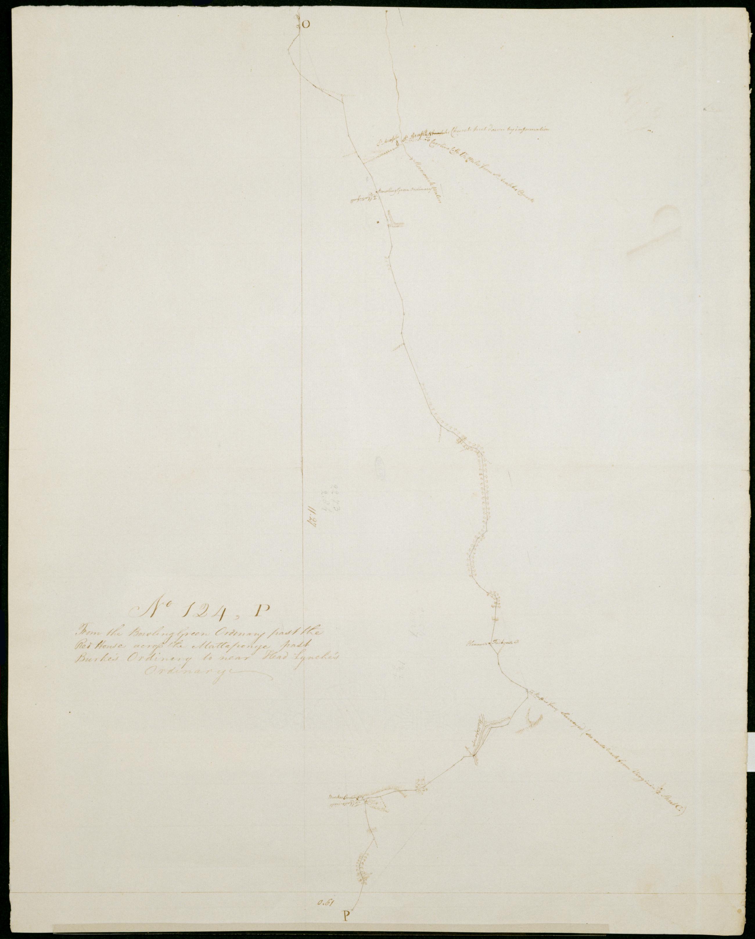
Cartographic From the Bowling Green Ordinary past the Red House across the Mattaponye past Burke's Ordinary to near Head Lynche's Ordinary. No 124, P / by Robert Erskine F.R.S. Geogr. A. U.S. and Assistants. Date 1781 inferred by cataloger. Military topographic map. Covers Caroline County in Virginia. Shows roads running through Farmers, Bowling Green, Antioch Fork, DeJarnette, Wrights Fork and Campbells Corner. Also shows buildings, landforms and streams. Pen-and-ink, pencil on laid paper. Shows relief by hachures. Soiled, creased and abraded. Mounted on cloth, bound and cropped, disbound and silked by subsequent owners. Cleaned after removal of backings 1999; some fill remains. Sheathed in mylar. View Item
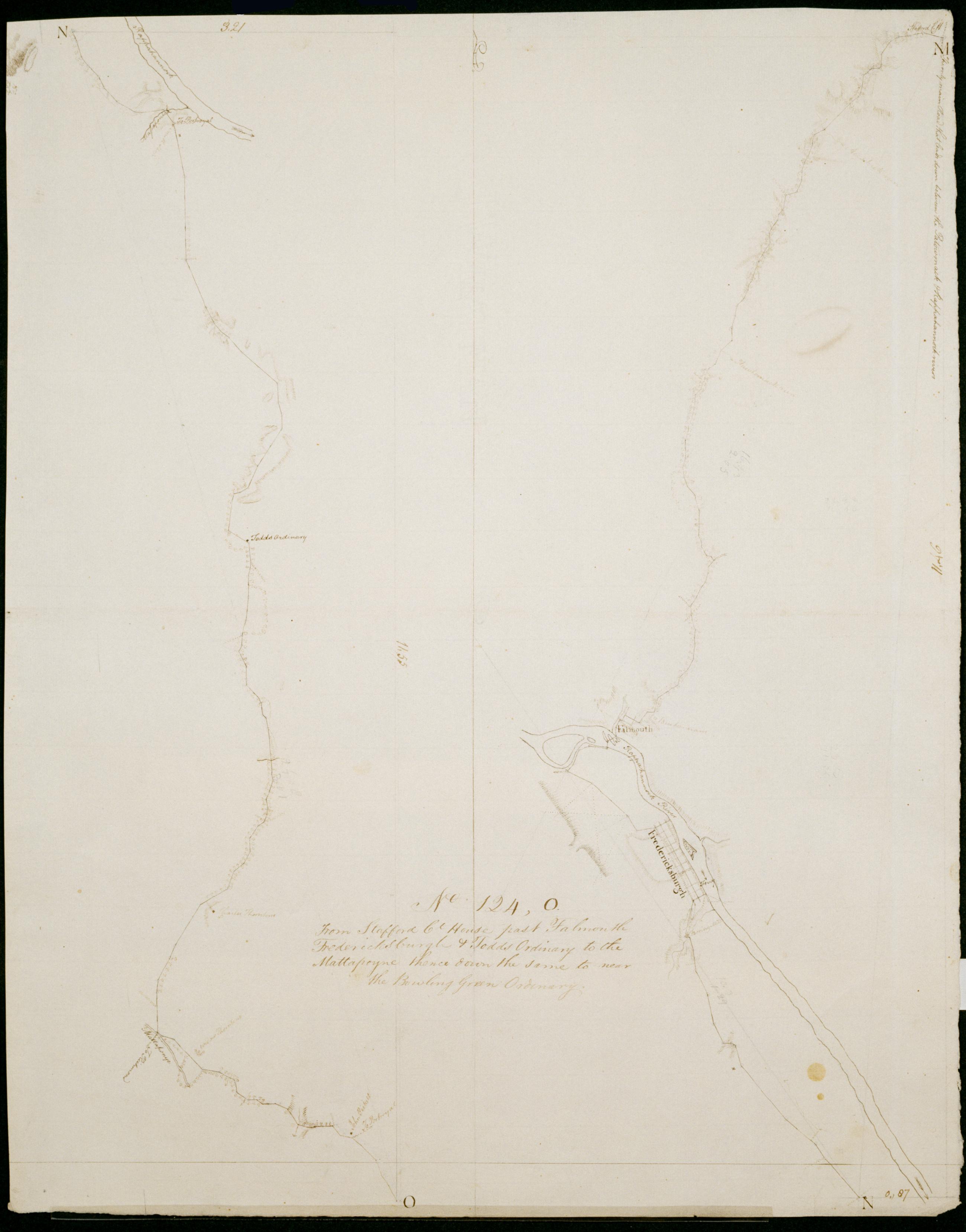
Cartographic From Stafford Ct House past Falmouth Fredericksburgh + Todds Oridnary to the Mattapoyne thence down the same to near the Bowling Green Ordinary. No 124, O / by Robert Erskine F.R.S. Geogr. A. U.S. and Assistants. Date 1781 inferred by cataloger. Military topographic map; right segment is north of the left one. Covers the counties of Stafford, Spotsylvania and Caroline in Virginia. Shows roads running through Stafford, Cranes Corner, Falmouth, Fredericksburg, New Post, Corbin, Villboro, Woodford and Farmers. Also shows buildings, landforms and streams. Pen-and-ink, pencil on laid paper. Shows relief by hachures. Stained, soiled, creased and abraded. Mounted on cloth, bound and cropped, disbound and silked by subsequent owners. Cleaned after removal of backings 1999; some fill remains. View Item
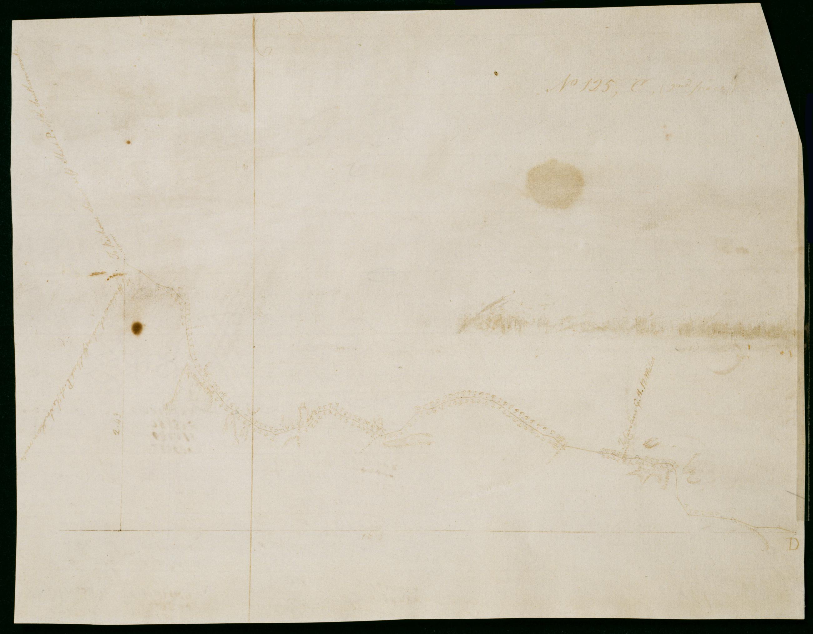
Cartographic The Route back from VIRGA. No 125, C. / by Robert Erskine F.R.S. Geogr. A. U.S. and Assistants. Calculations on verso. Date inferred by cataloger. Military topographic map. Covers Caroline County, Virginia. Shows roads running through Gether, Bagby, Shumansville, Kidds Fork and Wrights Fork. Also shows landforms and streams. Pen-and-ink, pencil on laid paper. Shows relief by hachures. Stained, foxed, creased and abraded. Cropped, mounted on recto of sheet 125,C,[1st piece] and silked by subsequent owners. Separated from first piece and cleaned after removal of backings 1999; some fill remains. Sheathed in mylar. View Item
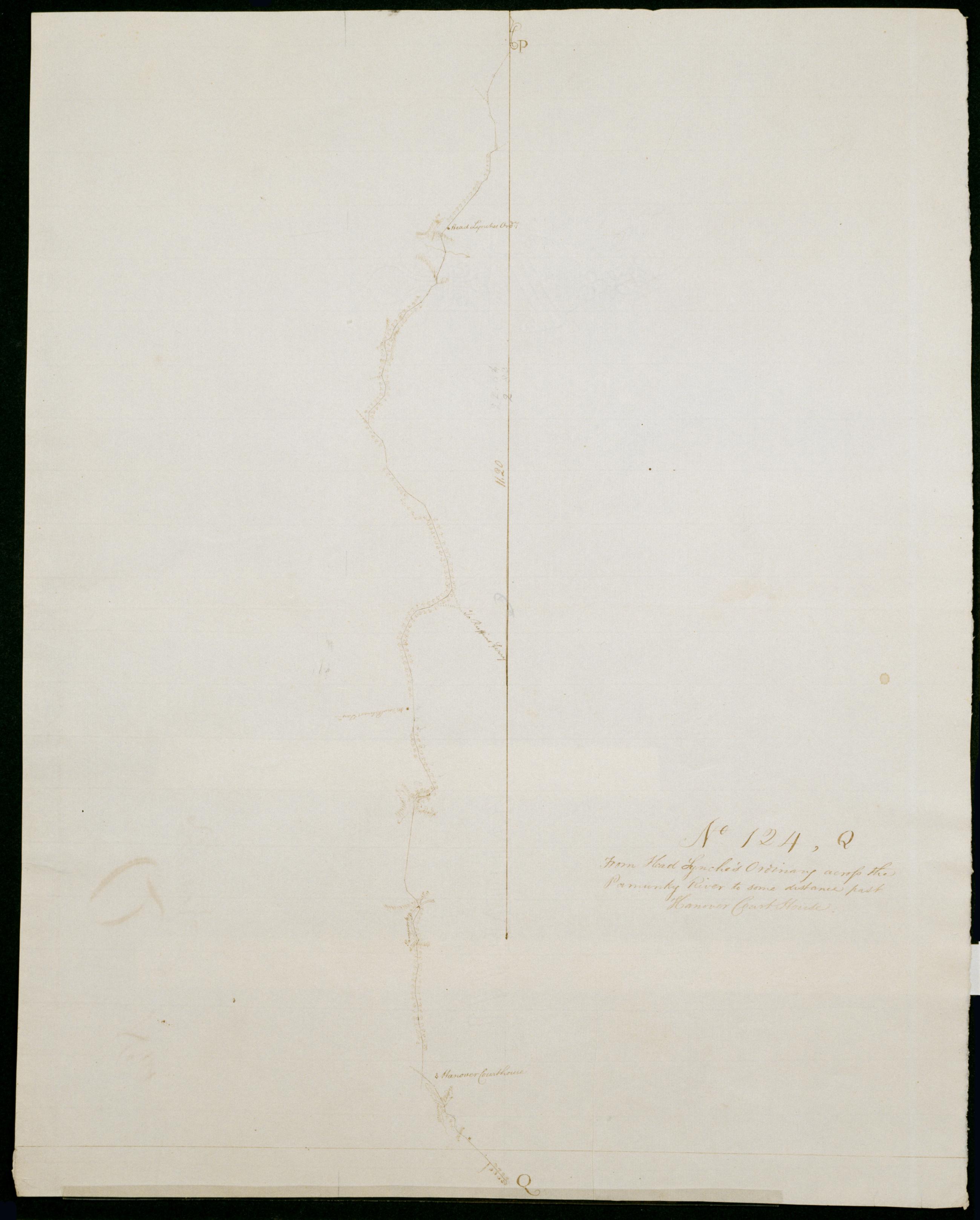
Cartographic From Head Lynche's Ordinary across the Pamunky River to some distance past Hanover Court House. No 124, Q / by Robert Erskine F.R.S. Geogr. A. U.S. and Assistants. Date 1781 inferred by cataloger. Military topographic map. Covers the counties of Caroline and Hanover in Virginia. Shows roads running through Covingston Corner, Haleys Corner, Dawn and Hanover. Also shows buildings, landforms and streams. Pen-and-ink, pencil on laid paper. Shows relief by hachures. Soiled, creased and abraded. Mounted on cloth, bound and cropped, disbound and silked by subsequent owners. Cleaned after removal of backings 1999; some fill remains. Sheathed in mylar. Title proper from recto is the work of a later editor--Simeon DeWitt or his assign--subsequent to 1820. View Item
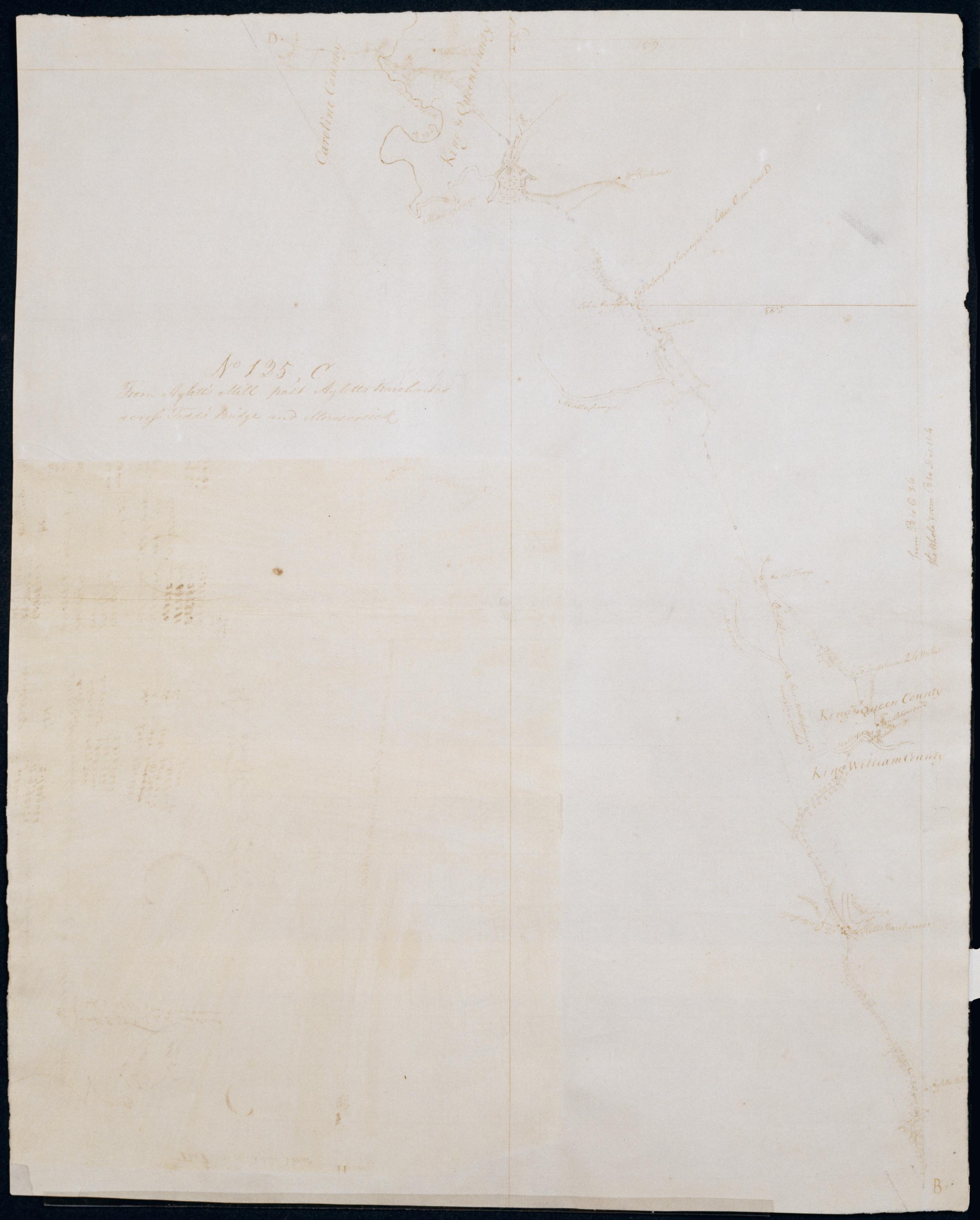
Cartographic From Aylett's Mill past Ayletts Warehouses across Todd's Bridge and Moroscosick No 125, C / by Robert Erskine F.R.S. Geogr. A. U.S. and Assistants. Date inferred by cataloger. Foxed, creased and abraded. Mounted on cloth, bound and cropped, disbound and silked by subsequent owners. Cleaned after removal of backings 1999; some fill remains. Sheathed in mylar. Military topographic map. Covers King William County, King and Queen County, and Caroline County in Virginia. Shows roads running through Aylett Mill, Aylett and Gether. Also shows buildings, landforms and streams. Pen-and-ink, pencil on laid paper. Sheet No 125, C, (2nd piece) was once incorrectly pasted to recto of this sheet. Shows relief by hachures. View Item
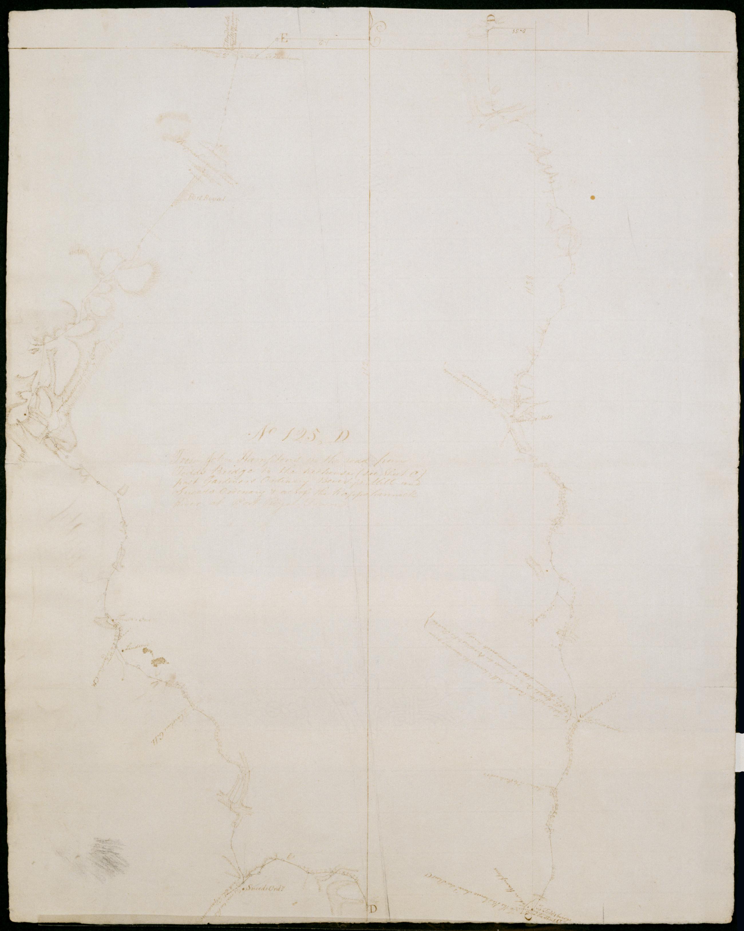
Cartographic From John Hampton's on the road from Todd's Bridge to the Redhouse (see Sheet C) past Gardiners Ordinary Beverly's Mill and Sneeds Ordinary + across the Rappahannock River at Port Royal Town. No 125, D / by Robert Erskine F.R.S. Geogr. A. U.S. and Assista Date inferred by cataloger. Military topographic map. Covers King and Queen County, Caroline County and King George County in Virginia. Shows roads running through Newton, Salvia, Central Point, Passing, Daniel Corner, Martins Corner, Goldmans Corner, Rollins Fork, Port Royal and Port Conway. Also shows buildings, landforms and streams. Pen-and-ink, pencil on laid paper. Shows relief by hachures. Soiled, creased and abraded. Mounted on cloth, bound and cropped, disbound and silked by subsequent owners. Cleaned after removal of backings 1999; some fill remains. Sheathed in mylar. View Item
Cartographic From the Bowling Green Ordinary past the Red House across the Mattaponye past Burke's Ordinary to near Head Lynche's Ordinary. No 124 P / by Robert Erskine F.R.S. Geogr. A. U.S. and Assistants. Date 1781 inferred by cataloger. Military topographic map. Covers Caroline County in Virginia. Shows roads running through Farmers- Bowling Green- Antioch Fork- DeJarnette- Wrights Fork and Campbells Corner. Also shows buildings- landforms and streams. Pen-and-ink- pencil on laid paper. Shows relief by hachures. Soiled- creased and abraded. Mounted on cloth- bound and cropped- disbound and silked by subsequent owners. Cleaned after removal of backings 1999; some fill remains. Sheathed in mylar. View Item
Cartographic From Stafford Ct House past Falmouth Fredericksburgh + Todds Oridnary to the Mattapoyne thence down the same to near the Bowling Green Ordinary. No 124 O / by Robert Erskine F.R.S. Geogr. A. U.S. and Assistants. Date 1781 inferred by cataloger. Military topographic map; right segment is north of the left one. Covers the counties of Stafford- Spotsylvania and Caroline in Virginia. Shows roads running through Stafford- Cranes Corner- Falmouth- Fredericksburg- New Post- Corbin- Villboro- Woodford and Farmers. Also shows buildings- landforms and streams. Pen-and-ink- pencil on laid paper. Shows relief by hachures. Stained- soiled- creased and abraded. Mounted on cloth- bound and cropped- disbound and silked by subsequent owners. Cleaned after removal of backings 1999; some fill remains. View Item
Cartographic The Route back from VIRGA. No 125 C. / by Robert Erskine F.R.S. Geogr. A. U.S. and Assistants. Calculations on verso. Date inferred by cataloger. Military topographic map. Covers Caroline County- Virginia. Shows roads running through Gether- Bagby- Shumansville- Kidds Fork and Wrights Fork. Also shows landforms and streams. Pen-and-ink- pencil on laid paper. Shows relief by hachures. Stained- foxed- creased and abraded. Cropped- mounted on recto of sheet 125-C-[1st piece] and silked by subsequent owners. Separated from first piece and cleaned after removal of backings 1999; some fill remains. Sheathed in mylar. View Item
Cartographic From Head Lynche's Ordinary across the Pamunky River to some distance past Hanover Court House. No 124 Q / by Robert Erskine F.R.S. Geogr. A. U.S. and Assistants. Date 1781 inferred by cataloger. Military topographic map. Covers the counties of Caroline and Hanover in Virginia. Shows roads running through Covingston Corner- Haleys Corner- Dawn and Hanover. Also shows buildings- landforms and streams. Pen-and-ink- pencil on laid paper. Shows relief by hachures. Soiled- creased and abraded. Mounted on cloth- bound and cropped- disbound and silked by subsequent owners. Cleaned after removal of backings 1999; some fill remains. Sheathed in mylar. Title proper from recto is the work of a later editor--Simeon DeWitt or his assign--subsequent to 1820. View Item
Cartographic From Aylett's Mill past Ayletts Warehouses across Todd's Bridge and Moroscosick No 125 C / by Robert Erskine F.R.S. Geogr. A. U.S. and Assistants. Date inferred by cataloger. Foxed- creased and abraded. Mounted on cloth- bound and cropped- disbound and silked by subsequent owners. Cleaned after removal of backings 1999; some fill remains. Sheathed in mylar. Military topographic map. Covers King William County- King and Queen County- and Caroline County in Virginia. Shows roads running through Aylett Mill- Aylett and Gether. Also shows buildings- landforms and streams. Pen-and-ink- pencil on laid paper. Sheet No 125- C- (2nd piece) was once incorrectly pasted to recto of this sheet. Shows relief by hachures. View Item
Cartographic From John Hampton's on the road from Todd's Bridge to the Redhouse (see Sheet C) past Gardiners Ordinary Beverly's Mill and Sneeds Ordinary + across the Rappahannock River at Port Royal Town. No 125 D / by Robert Erskine F.R.S. Geogr. A. U.S. and Assista Date inferred by cataloger. Military topographic map. Covers King and Queen County- Caroline County and King George County in Virginia. Shows roads running through Newton- Salvia- Central Point- Passing- Daniel Corner- Martins Corner- Goldmans Corner- Rollins Fork- Port Royal and Port Conway. Also shows buildings- landforms and streams. Pen-and-ink- pencil on laid paper. Shows relief by hachures. Soiled- creased and abraded. Mounted on cloth- bound and cropped- disbound and silked by subsequent owners. Cleaned after removal of backings 1999; some fill remains. Sheathed in mylar. View Item