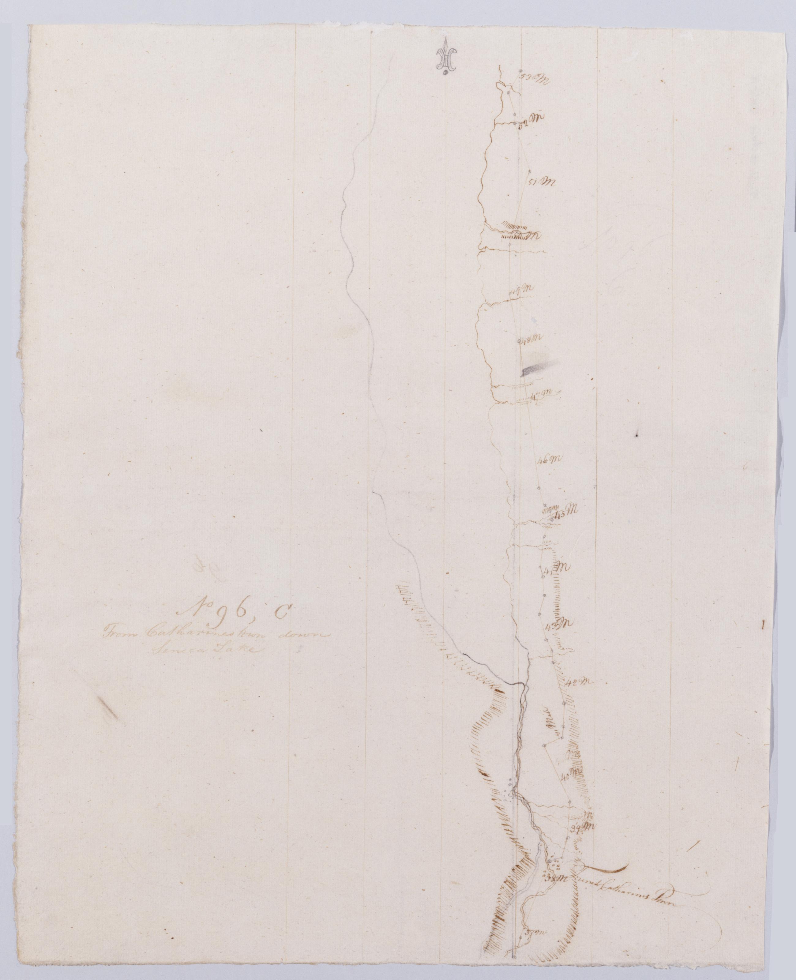
Cartographic From Catharines town down Seneca Lake. No 96, C / by Robert Erskine F.R.S. Geogr. A. U.S. and Assistants. Creased and abraded. Mounted on cloth, bound, disbound and silked by subsequent owners. Cleaned after removal of backings 1999; some fill remains. Sheathed in mylar. In erased pencil on recto, "No 96 C". Military topographic map. Covers the towns of Hecter, Montour and Dix in Schuyler County, New York. Shows roads running through Montour Falls, Watkins, Peach Orchard and North Hector. Also shows landforms and streams. Pen-and-ink, pencil on laid paper. Scale statement from verso of sheet 96,A. Shows relief by hachures. View Item
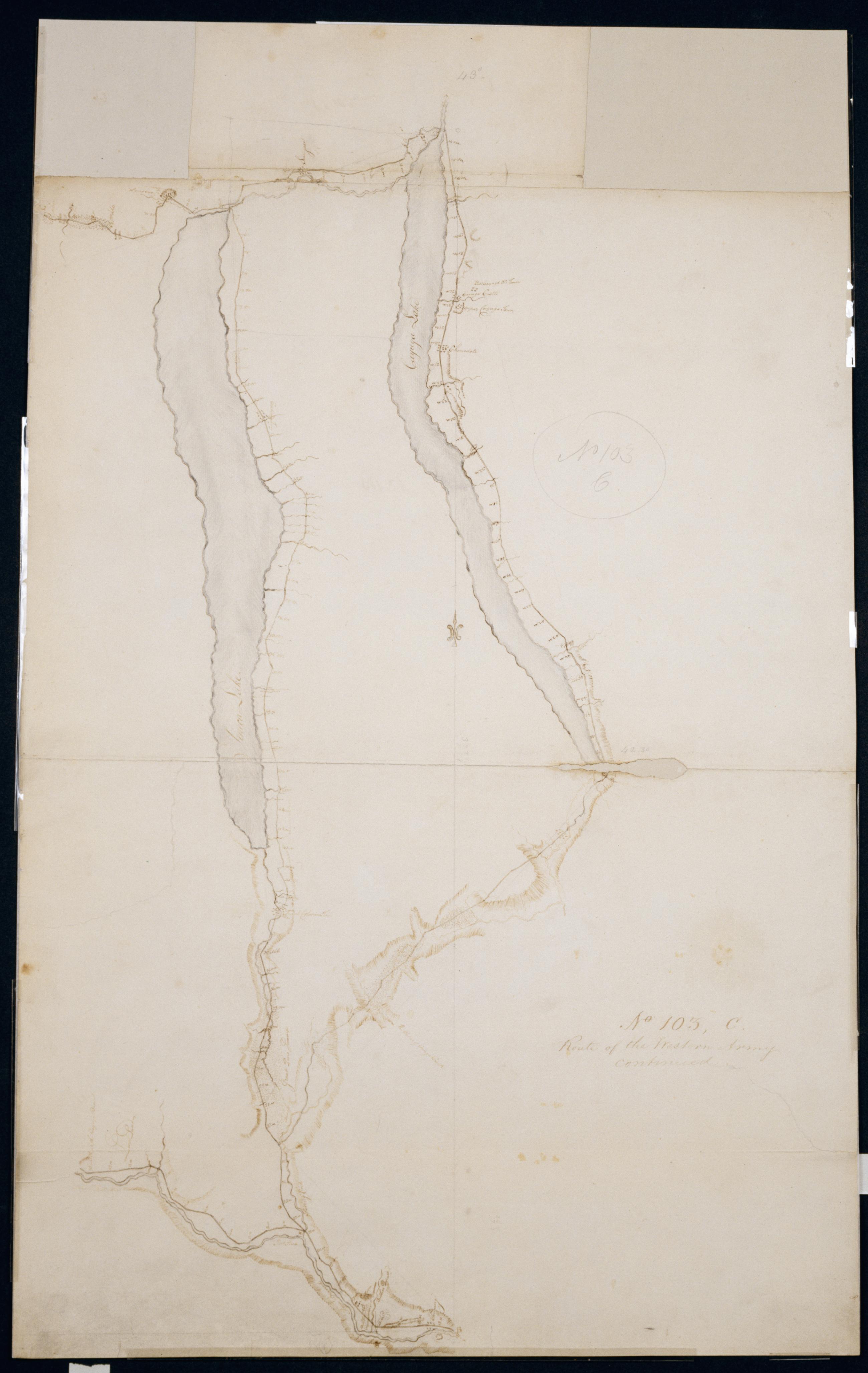
Cartographic Route of the Western Army continued. No. 103, C / by Lt. Lodge ; by Robert Erskine F.R.S. Geogr. A. U.S. and Assistants. Creased, soiled, stained, frayed and abraded. Mounted on cloth, bound and cropped, disbound and silked by subsequent owners. Cleaned after removal of cloth backings 1999; paper backing remains. Sheathed in mylar. Imperfect: lacking 2 x 8 cm. at center left of map. In ink on verso "C No. 103" "No. 103". In pencil on recto: "No 103 C". Military topographic map. Covers the counties of Chemung, Schuyler, Yates, Ontario, Tompkins, Cayuga and Seneca in New York. Also shows landforms and streams. Pen-and-ink, pencil on laid paper. Shows relief by hachures. View Item
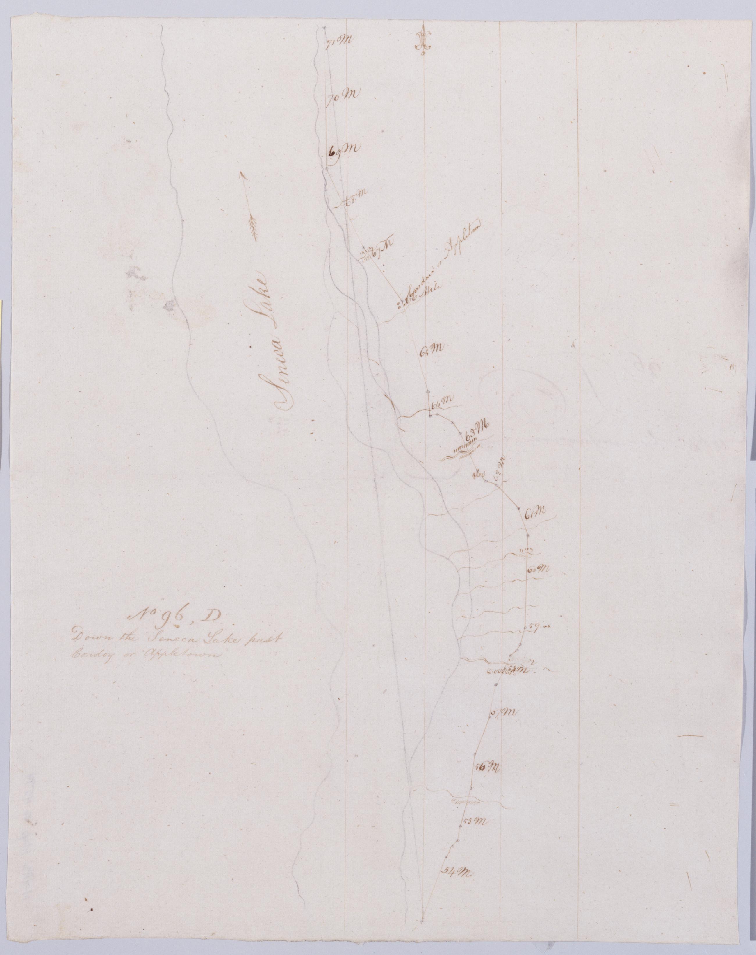
Cartographic Down the Seneca Lake past Cowdoy or Appletown. No 96, D / by Robert Erskine F.R.S. Geogr. A. U.S. and Assistants. In erased pencil on recto, "No 96 D". Military topographic map. Covers the towns of Varick, Romulus, Ovid and Lodi in Seneca County, New York. Shows roads running through Caywood and Willard. Also shows landforms and streams. Pen-and-ink, pencil on laid paper. Scale statement from verso of sheet 96,A. Shows relief by hachures. Soiled, creased and abraded. Mounted on cloth, bound, disbound and silked by subsequent owners. Cleaned after removal of backings 1999; some fill remains. Sheathed in mylar. View Item
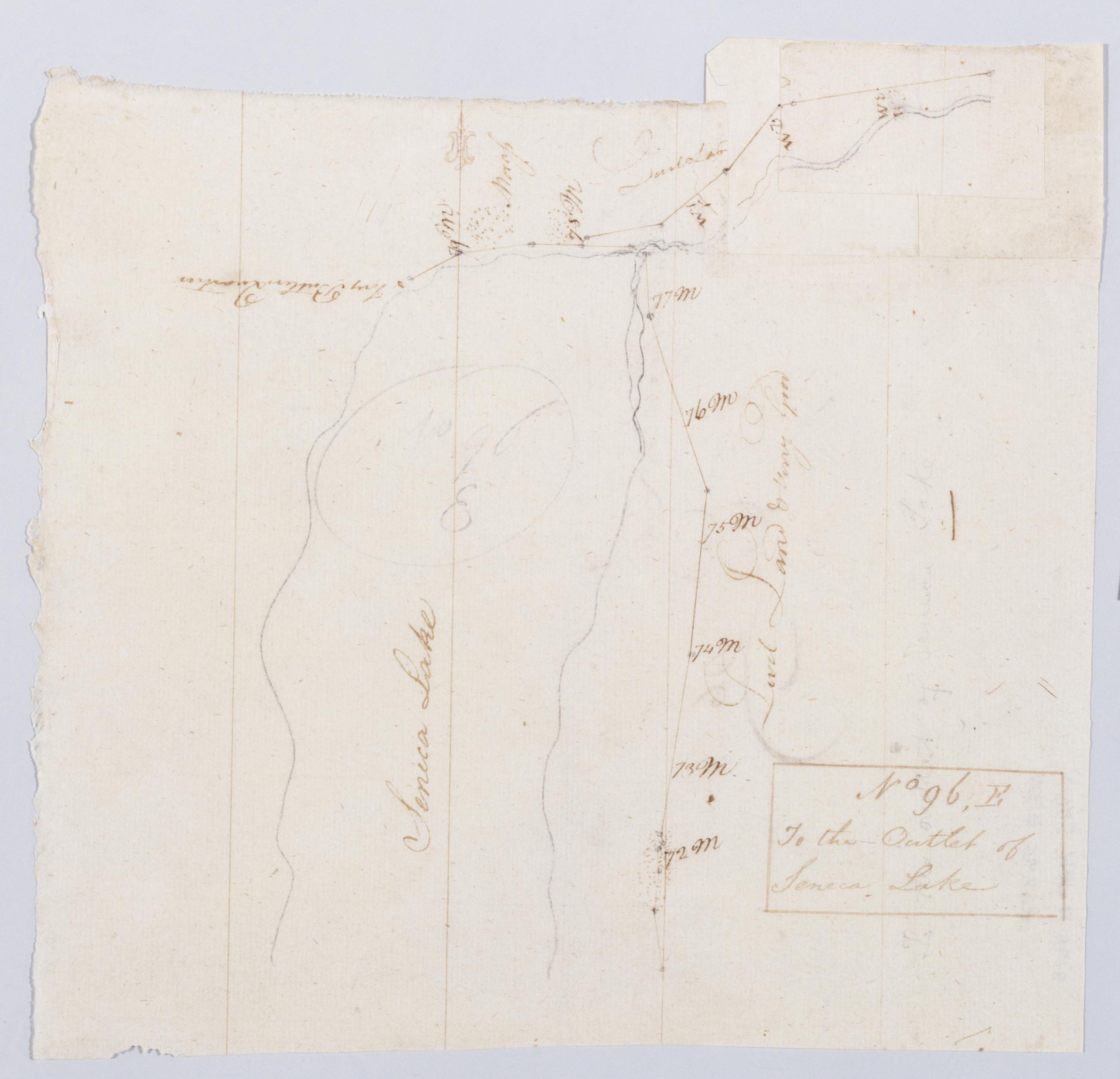
Cartographic To the Outlet of Seneca Lake. No 96, E / by Robert Erskine F.R.S. Geogr. A. U.S. and Assistants. In erased pencil on recto, "No 96 E". Military topographic map. Covers the towns of Waterloo and Fayette in Seneca County and of Geneva in Ontario County, New York. Shows roads running through Geneva. Also shows landforms and streams. Pen-and-ink, pencil on laid paper. Paper extended at upper right. Scale statement from verso of sheet 96,A. Shows relief by hachures. Soiled, stained, creased and abraded. Mounted on cloth, bound, disbound and silked by subsequent owners. Cleaned after removal of backings 1999; some fill remains. Sheathed in mylar. View Item
Cartographic From Catharines town down Seneca Lake. No 96 C / by Robert Erskine F.R.S. Geogr. A. U.S. and Assistants. Creased and abraded. Mounted on cloth- bound- disbound and silked by subsequent owners. Cleaned after removal of backings 1999; some fill remains. Sheathed in mylar. In erased pencil on recto- "No 96 C". Military topographic map. Covers the towns of Hecter- Montour and Dix in Schuyler County- New York. Shows roads running through Montour Falls- Watkins- Peach Orchard and North Hector. Also shows landforms and streams. Pen-and-ink- pencil on laid paper. Scale statement from verso of sheet 96-A. Shows relief by hachures. View Item
Cartographic Route of the Western Army continued. No. 103 C / by Lt. Lodge ; by Robert Erskine F.R.S. Geogr. A. U.S. and Assistants. Creased- soiled- stained- frayed and abraded. Mounted on cloth- bound and cropped- disbound and silked by subsequent owners. Cleaned after removal of cloth backings 1999; paper backing remains. Sheathed in mylar. Imperfect: lacking 2 x 8 cm. at center left of map. In ink on verso "C No. 103" "No. 103". In pencil on recto: "No 103 C". Military topographic map. Covers the counties of Chemung- Schuyler- Yates- Ontario- Tompkins- Cayuga and Seneca in New York. Also shows landforms and streams. Pen-and-ink- pencil on laid paper. Shows relief by hachures. View Item
Cartographic Down the Seneca Lake past Cowdoy or Appletown. No 96 D / by Robert Erskine F.R.S. Geogr. A. U.S. and Assistants. In erased pencil on recto- "No 96 D". Military topographic map. Covers the towns of Varick- Romulus- Ovid and Lodi in Seneca County- New York. Shows roads running through Caywood and Willard. Also shows landforms and streams. Pen-and-ink- pencil on laid paper. Scale statement from verso of sheet 96-A. Shows relief by hachures. Soiled- creased and abraded. Mounted on cloth- bound- disbound and silked by subsequent owners. Cleaned after removal of backings 1999; some fill remains. Sheathed in mylar. View Item
Cartographic To the Outlet of Seneca Lake. No 96 E / by Robert Erskine F.R.S. Geogr. A. U.S. and Assistants. In erased pencil on recto- "No 96 E". Military topographic map. Covers the towns of Waterloo and Fayette in Seneca County and of Geneva in Ontario County- New York. Shows roads running through Geneva. Also shows landforms and streams. Pen-and-ink- pencil on laid paper. Paper extended at upper right. Scale statement from verso of sheet 96-A. Shows relief by hachures. Soiled- stained- creased and abraded. Mounted on cloth- bound- disbound and silked by subsequent owners. Cleaned after removal of backings 1999; some fill remains. Sheathed in mylar. View Item