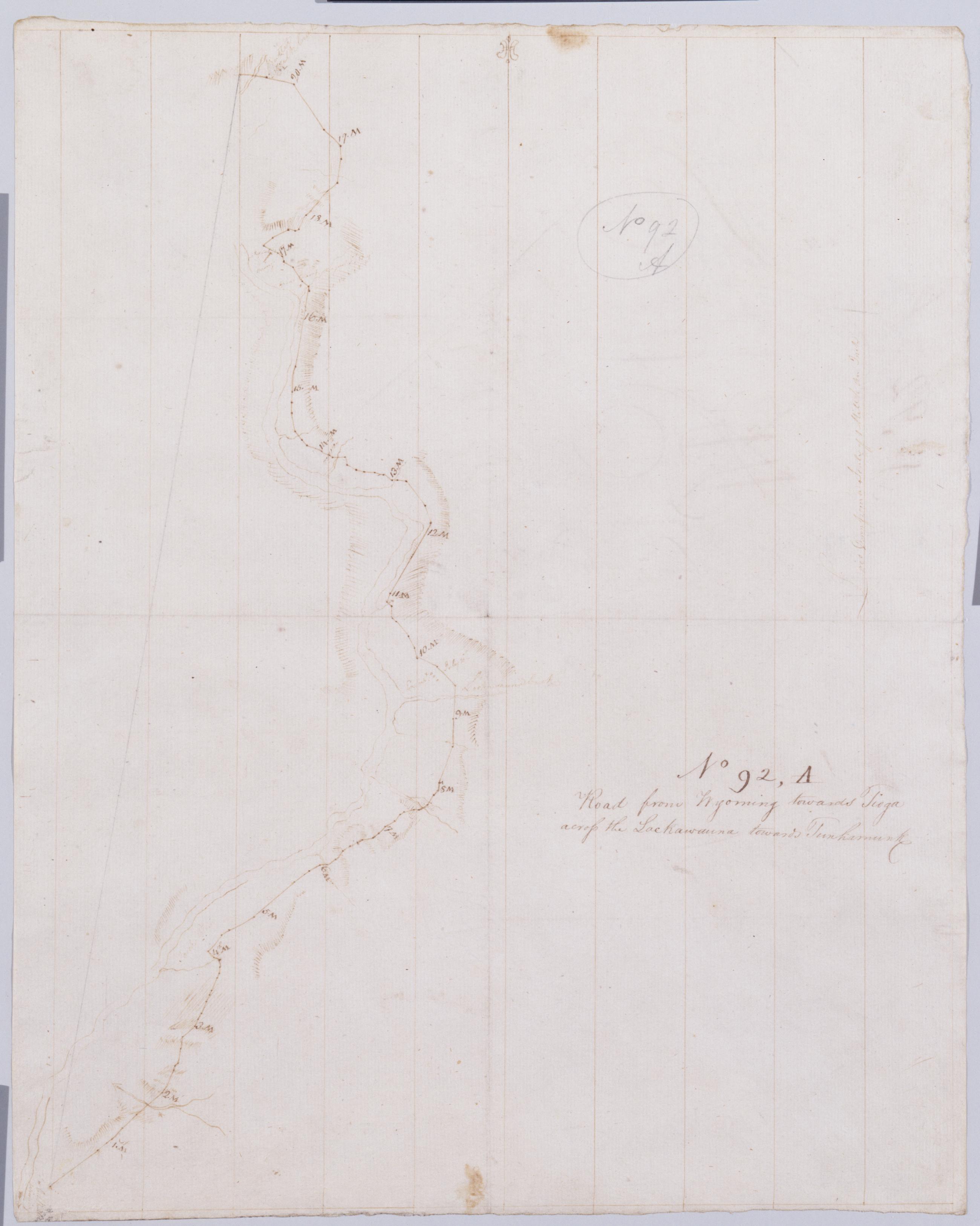
Cartographic Road from Wyoming towards Tioga across the Lackawauna towards Tunhamunk. No 92, A [sic]/ by Robert Erskine F.R.S. Geogr. A. U.S. and Assistants. Creased, foxed stained, soiled and abraded. Mounted on cloth, bound and cropped, disbound and silked by subsequent owners. Cleaned after removal of backings 1999; some fill remains. Sheathed in mylar. In pencil on recto and verso: "No 92 A". Military topographic map. Covers the counties of Lackawanna, Luzerne and Wyoming, Pennsylvania. Shows roads running through Wyoming Valley and Pittston. Also shows landforms and streams. Number accompanying verso title written in different ink. View Item
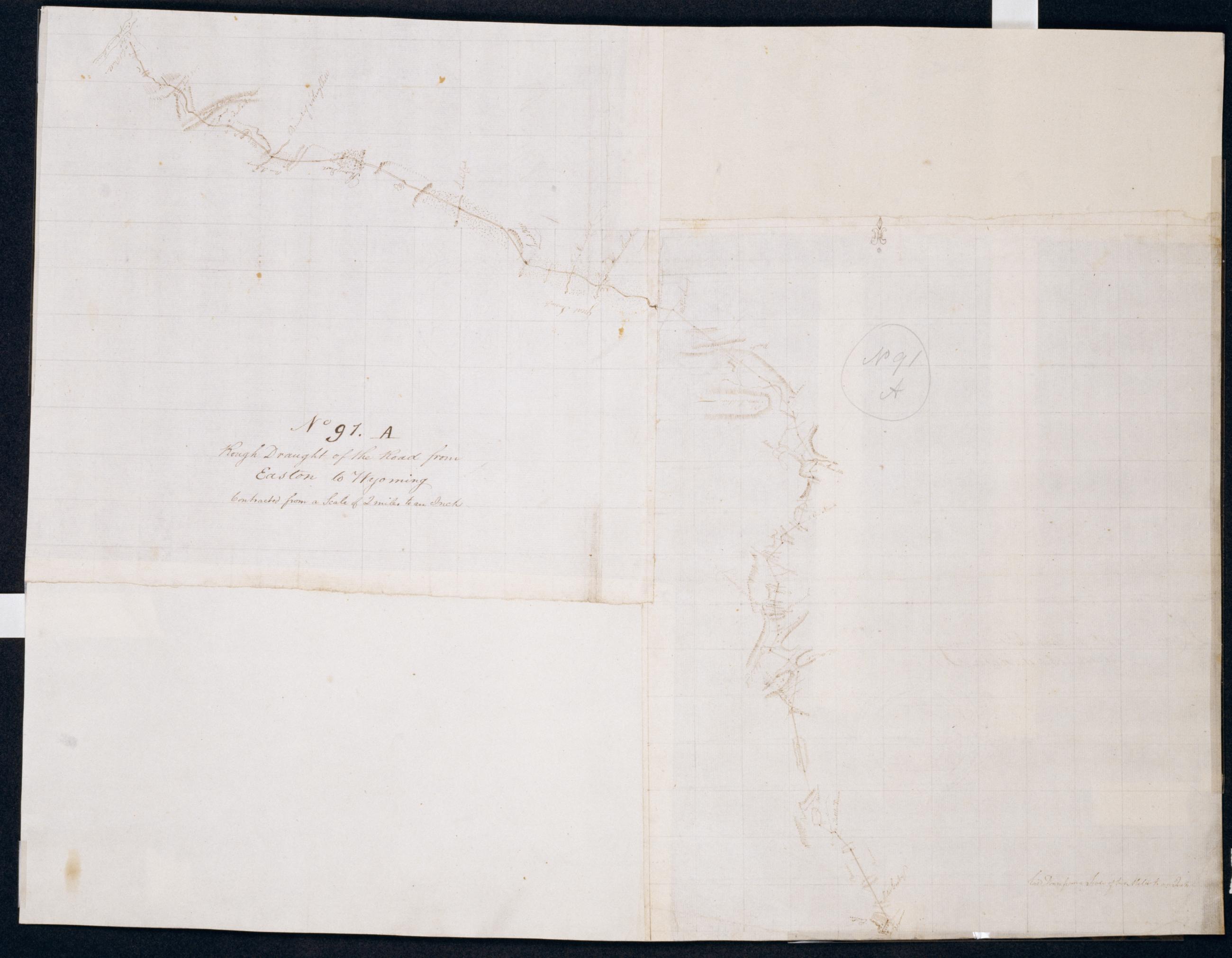
Cartographic Rough Draught of the Road from Easton to Wyoming : Contracted from a Scale of 2 miles to an inch. No 91. A / by Robert Erskine F.R.S. Geogr. A. U.S. and Assistants. Foxed, soiled, stained and abraded. Mounted on cloth, bound and cropped, disbound and silked by subsequent owners. Cleaned after removal of backings 1999; some fill remains. Lined with China paper. Sheathed in mylar. In pencil on recto: "No 91 A". Military topographic map. Covers parts of the counties of Luzerne, Monroe and Northampton in Pennsylvania. Shows roads between Easton and Wyoming. Also shows buildings and owners' names, landforms and streams. Pen-and-ink, pencil on 2 peieces laid paper. One additional piece of laid, another of wove finish paper added later at corners. View Item
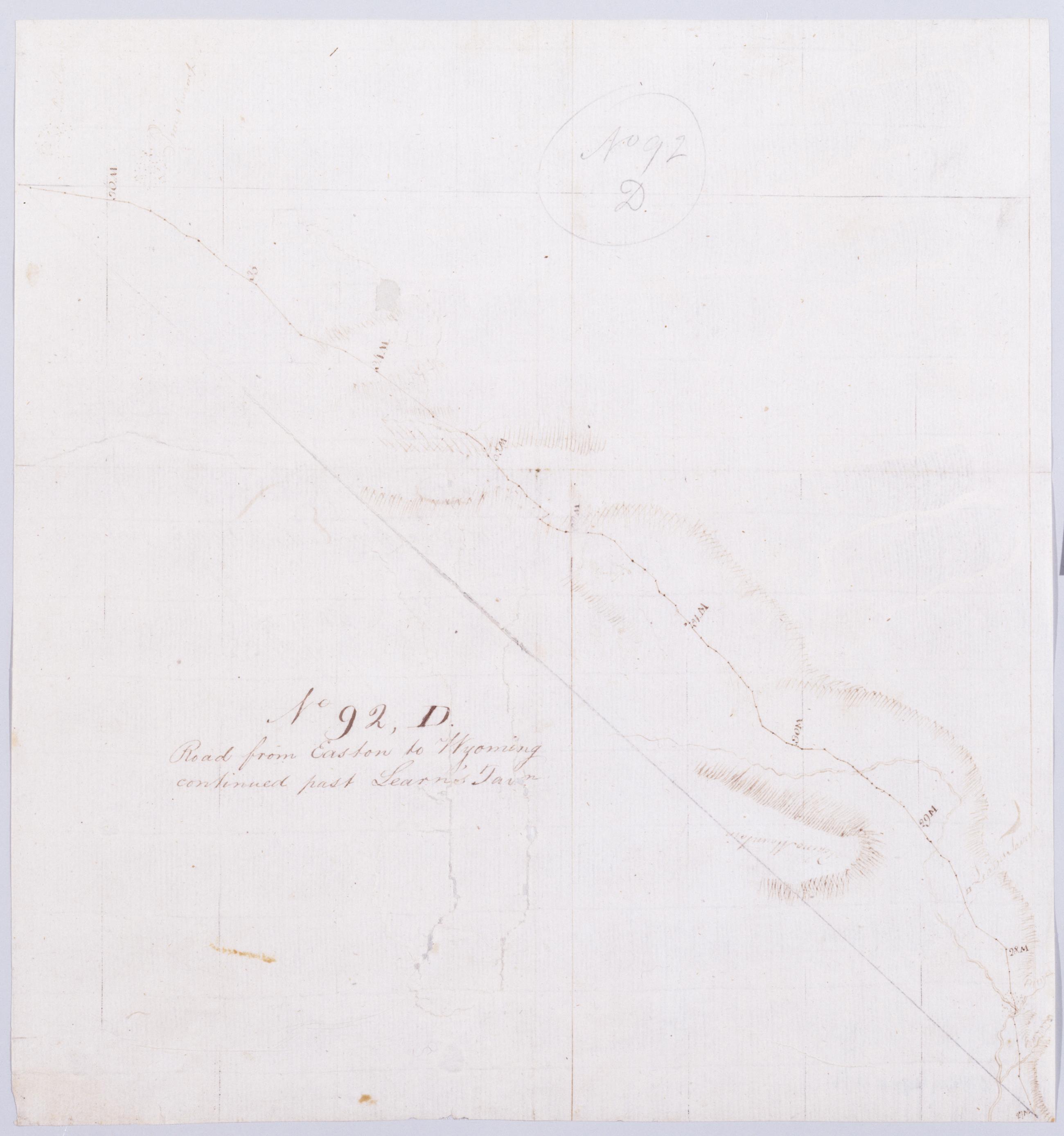
Cartographic Road from Easton to Wyoming continued past Learn's Tavn. No 92, D / by Robert Erskine F.R.S. Geogr. A. U.S. and Assistants. Creased, stained, soiled, torn and severly abraded. Mounted on cloth, bound and cropped, disbound and silked by subsequent owners. Cleaned after removal of backings 1999; some fill remains. Sheathed in mylar. In pencil on recto: "No 92 D". Military topographic map. Covers Monroe County, Pennsylvania. Shows roads running through Mount Pocono. Also shows buildings and owners' names, landforms and streams. Pen-and-ink, pencil on laid paper. Paper itself highly imperfect. Scale from index title; confirmed by measuring the map itself. Shows relief by hachures. View Item
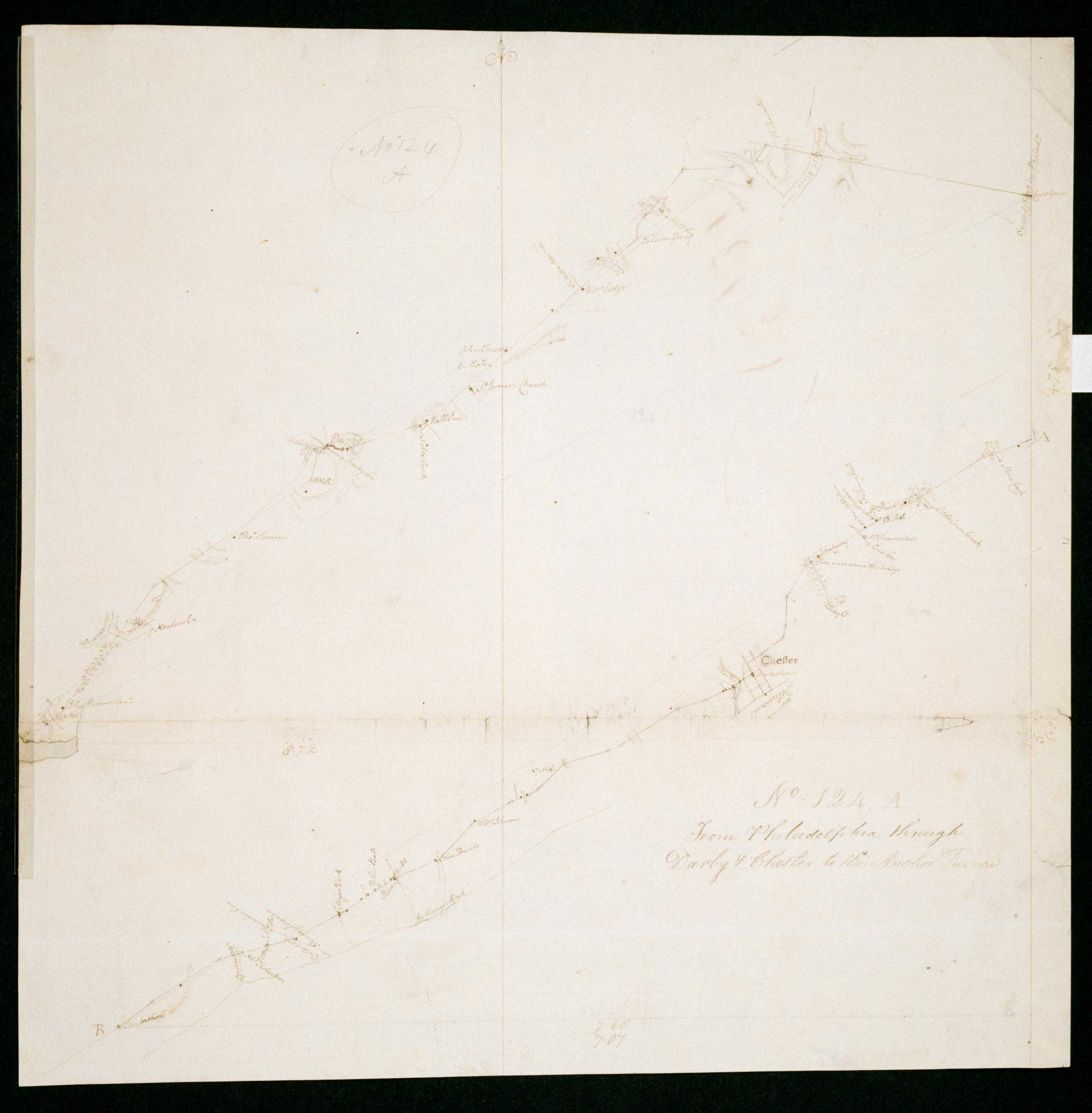
Cartographic From Philadelphia through Darby + Chester to the Anchor Tavern. No 124, A / by Robert Erskine F.R.S. Geogr. A. U.S. and Assistants. Date 1781 inferred by cataloger. Imperfect: lacking 1 x 3 cm. at left margin. In pencil on recto: "No 124 A". Military topographic map. Covers the counties of Philadelphia and Delaware in Pennsylvania and of New Castle in Delaware. Shows roads running through Philadelphia, Norwood, Chester and Linwood. Also shows buildings and owners' names, landforms and streams. Pen-and-ink, pencil on laid paper. Shows relief by hachures. Soiled, creased, frayed and abraded. Mounted on cloth, bound and cropped, disbound and silked by subsequent owners. View Item
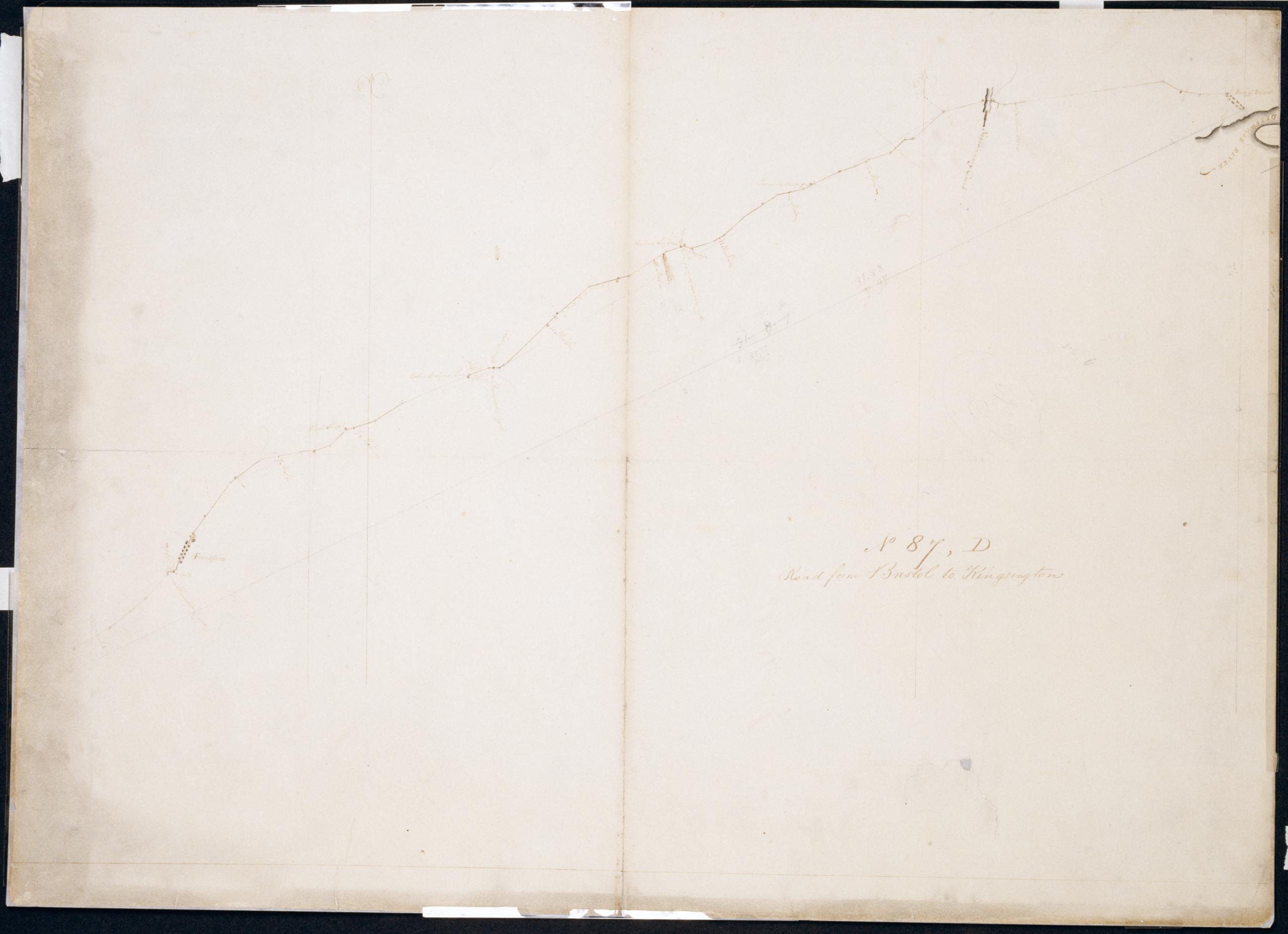
Cartographic Road from Bristol to Kingsington. No 87, D / by Robert Erskine F.R.S. Geogr. A. U.S. and Assistants. In pencil on recto: "No 87 D". Military topographic map. Covers the city of Philadelphia and the townships of Bristol and Bensalem in Bucks County, Pennsylvania. Shows roads running through Bristol, Eddington, Maud, Andalusia, Holmesburg and Frankford, now in Philadelphia. Also shows buildings and owners' names, landforms and streams. Pen-and-ink, pencil on laid paper. Shows relief by hachures. Soiled, creased, torn, frayed and abraded. Mounted on cloth, cropped, bound, disbound and silked by subsequent owners. Cleaned after removal of backings 1999; some fill remains. Lined with China paper. View Item
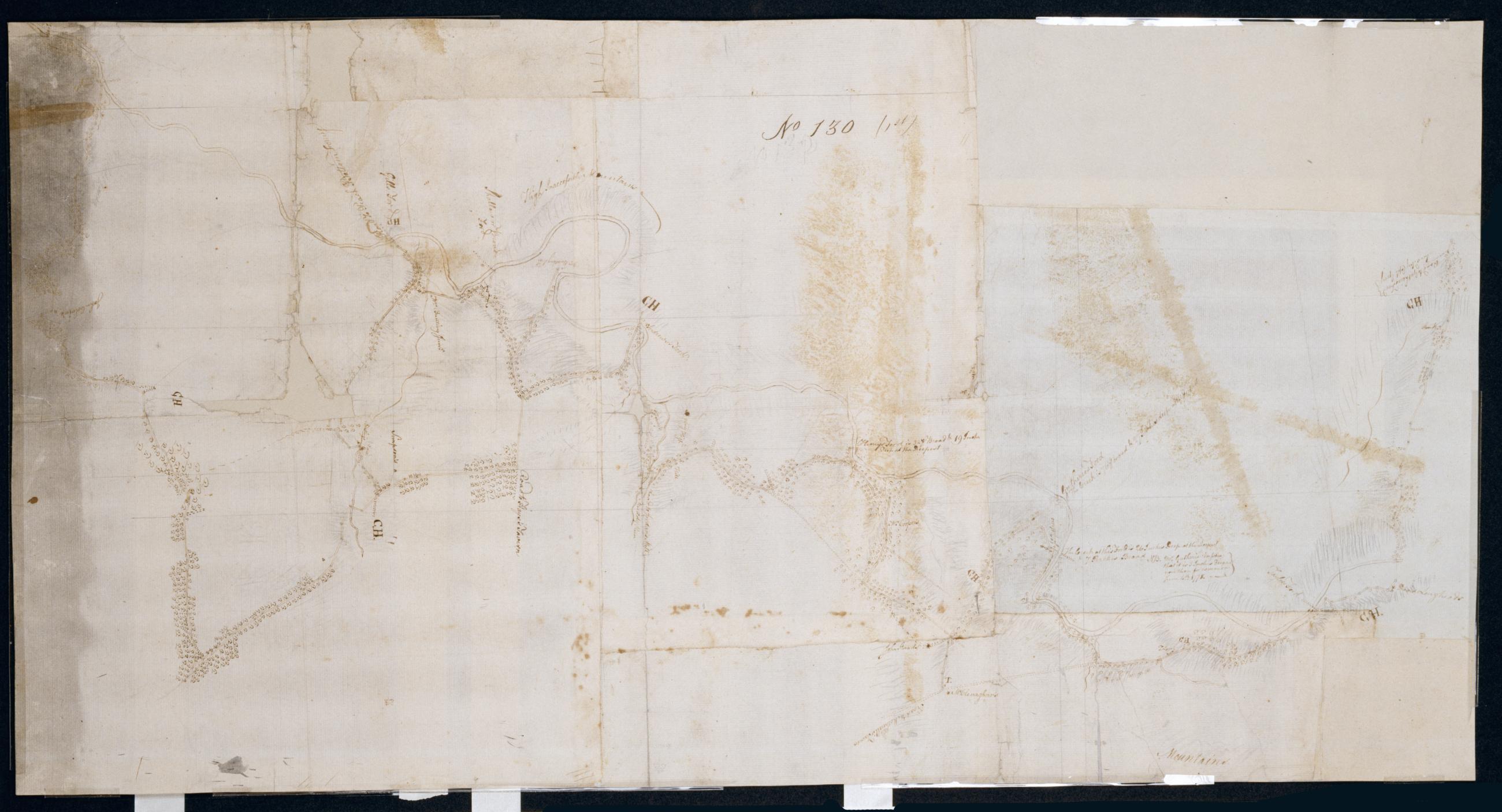
Cartographic From McPherson ford to Taylors Ford on Octorara. No 130 (1st) / by Robert Erskine F.R.S. Geogr. A. U.S. and Assistants. Badly stained and foxed, creased, split, frayed and abraded. Mounted on cloth, bound and cropped, disbound and silked by subsequent owners. Cleaned after removal of backings 1999; some fill remains. Newly backed with China paper. Sheathed in mylar. In pencil on recto, roughly, and not encircled: "No. 130". Military topographic map. Covers the townships of Little Britain, Colerain and Sudsbury in Lancaster County, Pennsylvania. Also shows buildings and owners' names, landforms and streams. Oriented with north to left of sheet. View Item
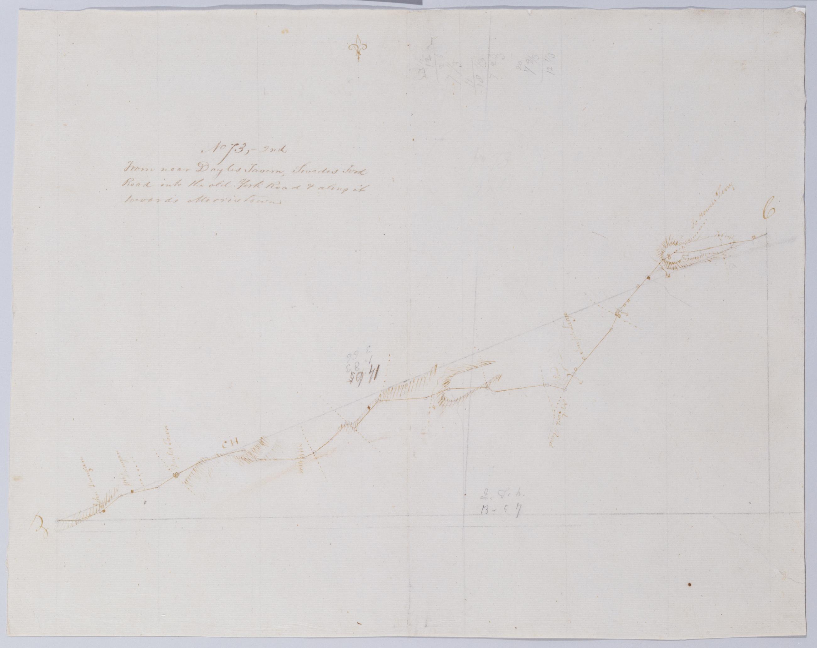
Cartographic From near Doyles Tavern, Swedes Ford Road into the old York Road + along it towards Morristown. No 73, 2nd / by Robert Erskine F.R.S. Geogr. A. U.S. and Assistants. Creased, torn, frayed and abraded. Mounted on cloth, bound and cropped, disbound and silked by subsequent owners. Cleaned after removal of backings 1999; some fill remains. Sheathed in mylar. Military topographic map. Covers Bucks County, Pennsylvania. Shows roads running through Doylestown, Buckingham and Lahaska. Also shows buildings and owners' names, landforms and streams. Pen-and-ink, pencil on laid paper. Shows relief by hachures. Title proper from recto is the work of a later editor--Simeon DeWitt or his assign--subsequent to 1820. View Item
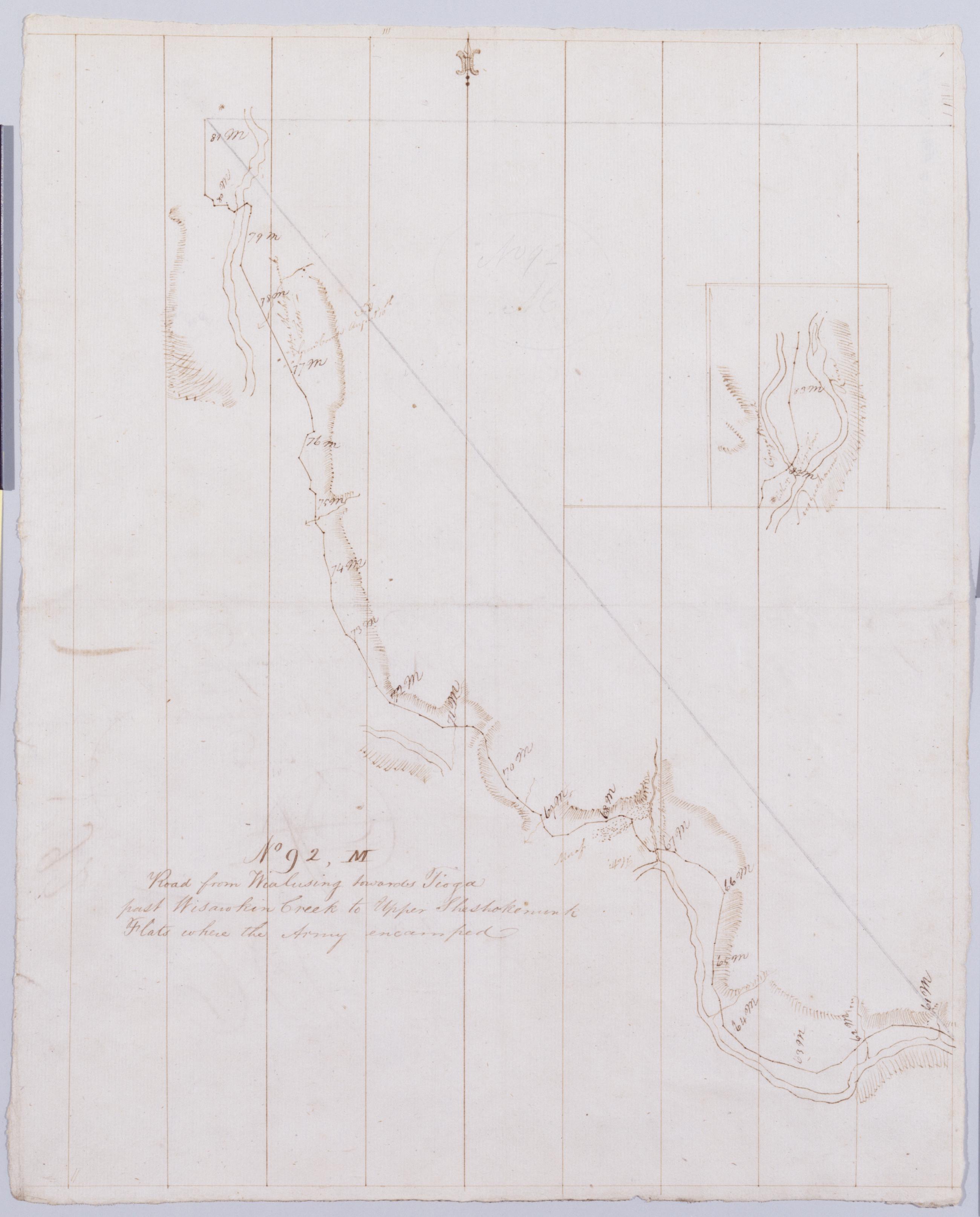
Cartographic Road from Wialusing towards Tioga past Wisawkin Creek to Upper Sheshokenunk Flats where the Army encamped. No 92, M / by Robert Erskine F.R.S. Geogr. A. U.S. and Assistants. Creased, soiled and abraded. Mounted on cloth, bound, disbound and silked by subsequent owners. Cleaned after removal of backings 1999; some fill remains. Sheathed in mylar. In erased pencil on recto: "No 92 M". Inset is northernmost extension of main map. Military topographic map. Covers Bradford County, Pennsylvania. Shows roads running through Sayre and East Athens. Also shows buildings and owners' names, landforms and streams. Number accompanying verso title written in different ink. Letter D accompanying verso title crossed out using ink and replaced by M. View Item
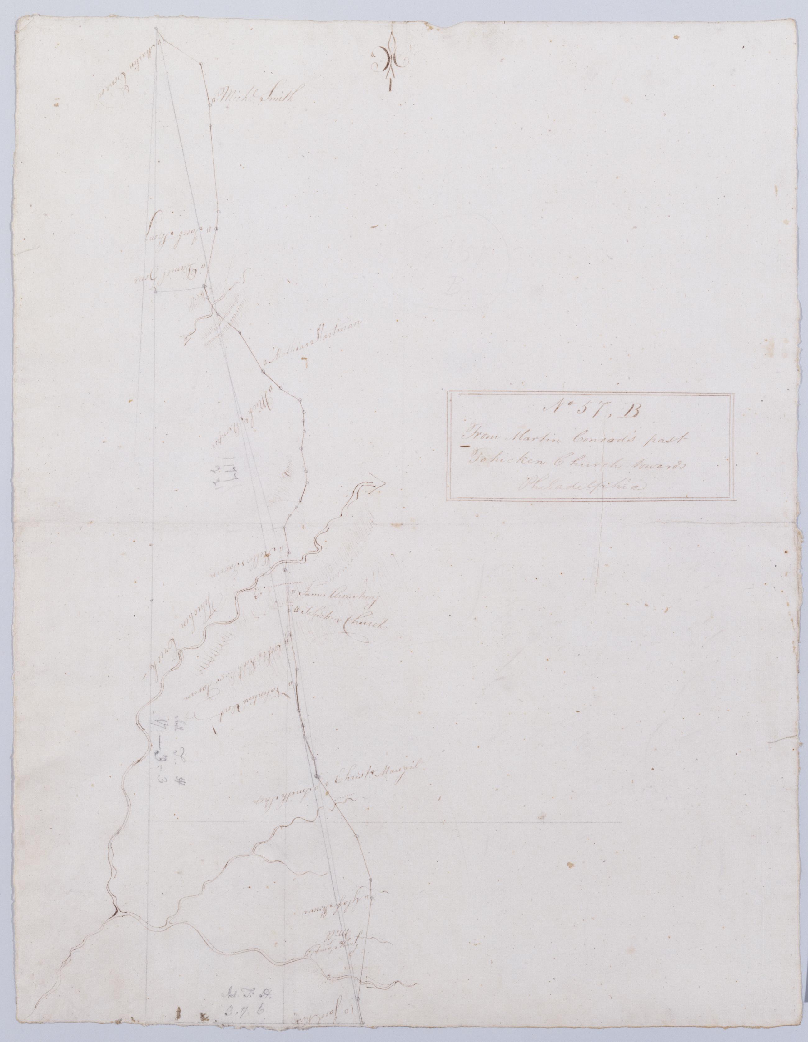
Cartographic From Martin Conrod's past Tohicken Church towards Philadelphia. No 57, B / by Robert Erskine F.R.S. Geogr. A. U.S. and Assistants. Foxed, creased and abraded. Mounted on cloth, bound and cropped, disbound and silked by subsequent owners. Cleaned after removal of backings 1999; some fill remains. Sheathed in mylar. In pencil on recto: "57 B". In pencil on verso: "B". Military topographic map. Covers Bucks County, Pennsylvania. Shows roads running through Strawntown, Keelersville and Hagersville. Also shows buildings and owners' names, landforms and streams. Pen-and-ink, pencil on laid paper. Shows relief by hachures. Title proper from recto is the work of a later editor--Simeon DeWitt or his assign--subsequent to 1820. View Item
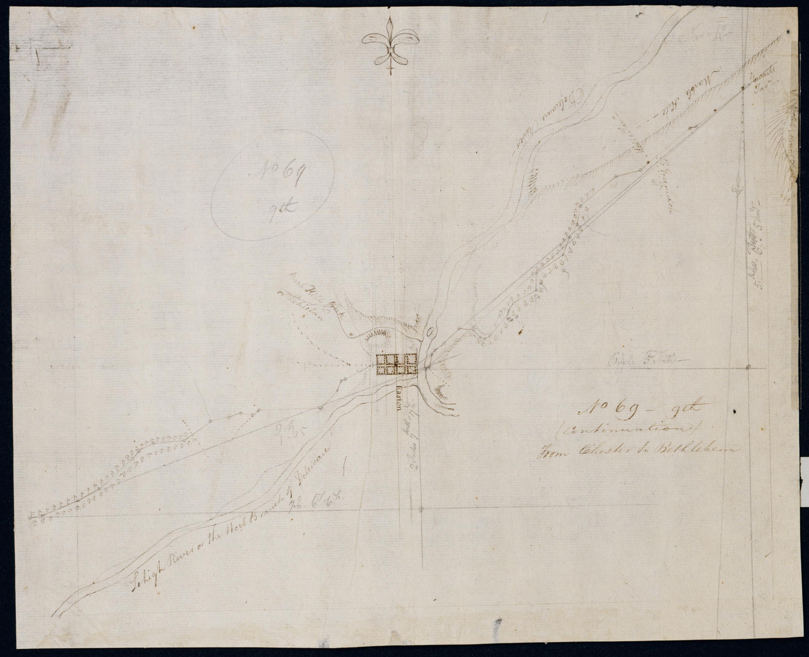
Cartographic (Continuation) From Chester to Bethlehem. No 69-9th / by Robert Erskine F.R.S. Geogr. A. U.S. and Assistants. In pencil on recto: "No 69 9th". Military topographic map. Covers the townships of Harmony and Lopatcong in Warren County, New Jersey, and of Easton and Bethlehem in Northampton County, Pennsylvania. Shows roads running through Phillipsburg, N.J., Easton and Farmersville, Pennsylvania. Also shows buildings and owners' names, landforms and streams. Pen-and-ink, pencil on laid paper. Shows relief by hachures. Stained, creased and abraded. Mounted on cloth, bound and cropped, disbound and silked by subsequent owners. Cleaned after removal of backings 1999; some fill remains. Sheathed in mylar. View Item
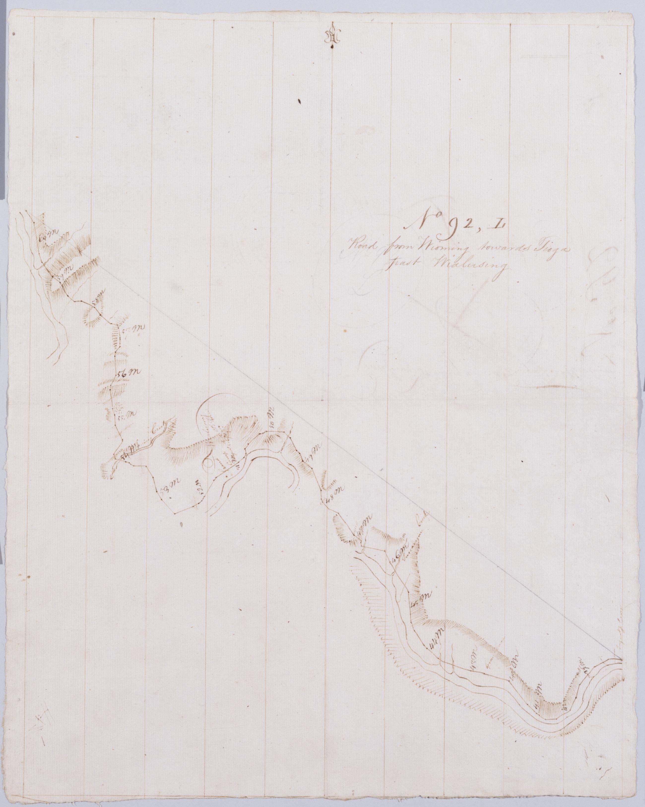
Cartographic Road from Wioming towards Tioga past Wialusing. No 92, L / by Robert Erskine F.R.S. Geogr. A. U.S. and Assistants. Creased, foxed, soiled and abraded. Mounted on cloth, bound, disbound and silked by subsequent owners. Cleaned after removal of backings 1999; some fill remains. Sheathed in mylar. In erased pencil on recto: "No 92 L". Military topographic map. Covers the counties of Wyoming and Bradford, Pennsylvania. Shows roads running through Wyalusing and Rummerfield. Also shows buildings and owners' names, landforms and streams. Number accompanying verso title written in different ink. Letter C accompanying verso title crossed out using ink and replaced by L. View Item
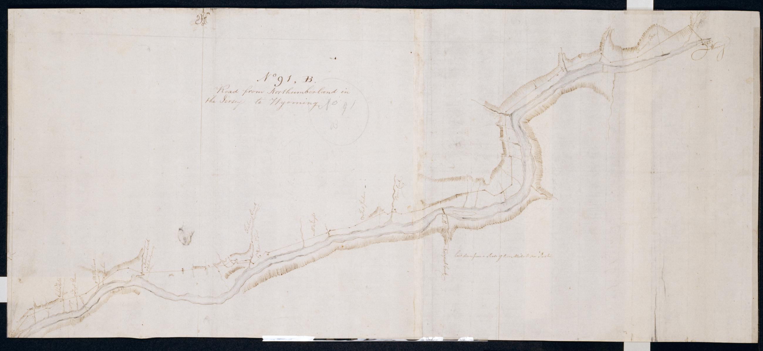
Cartographic Road from Northumberland in the Jerseys to Wyoming. No 91, B / by Robert Erskine F.R.S. Geogr. A. U.S. and Assistants. Foxed, soiled, stained, torn and abraded. Mounted on cloth, bound and cropped, disbound and silked by subsequent owners. Cleaned after removal of backings 1999; some fill remains. Sheathed in mylar. In pencil on recto: "No 91 B". Military topographic map. Covers the counties of Luzerne, Columbia, Montour and Northumberland in Pennsylvania. Shows roads running through Wyoming, Wilkes Barre, Berwick, Bloomsburg, Danville and Northumberland. Also shows buildings and owners' names, landforms and streams. Pen-and-ink, pencil on laid paper. Shows relief by hachures. View Item
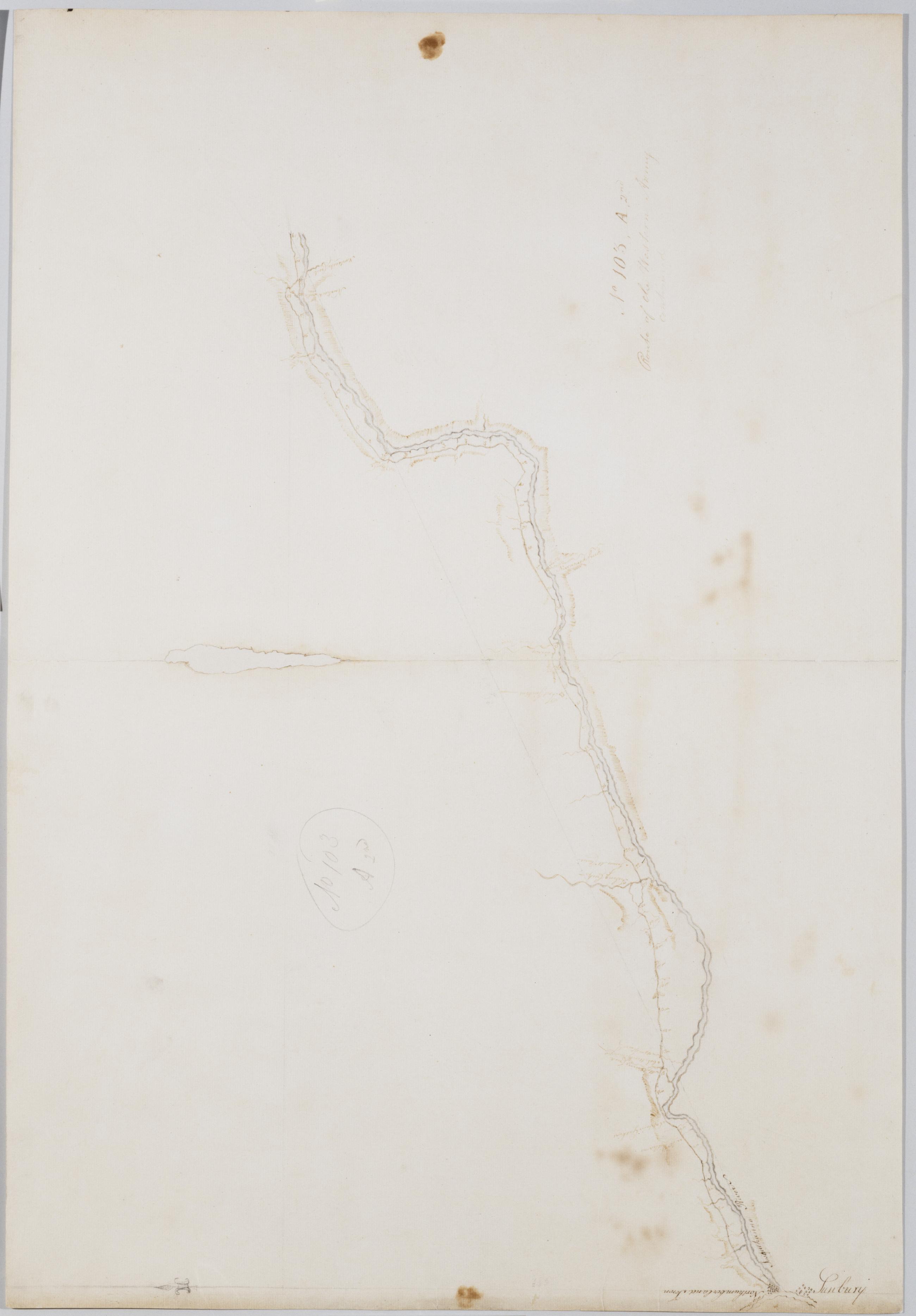
Cartographic Route of the Western Army continued. No 103, A, 2nd. by Lt. Lodge ; by Robert Erskine F.R.S. Geogr. A. U.S. and Assistants. Creased, soiled, stained, frayed and abraded. Mounted on cloth, bound and cropped, disbound and silked by subsequent owners. Cleaned after removal of backings 1999; some fill remains. Sheathed in mylar. Imperfect: lacking 2 x 11 cm. at upper center of sheet. In ink on verso "A 2d N. 103". In pencil on recto: "No 103 A 2nd". Military topographic map. Covers the counties of Luzerne, Columbia, Montour and Northumberland in Pennsylvania. Also shows buildings and owners' names, landforms and streams. Pen-and-ink, pencil on laid paper. Shows relief by hachures. View Item
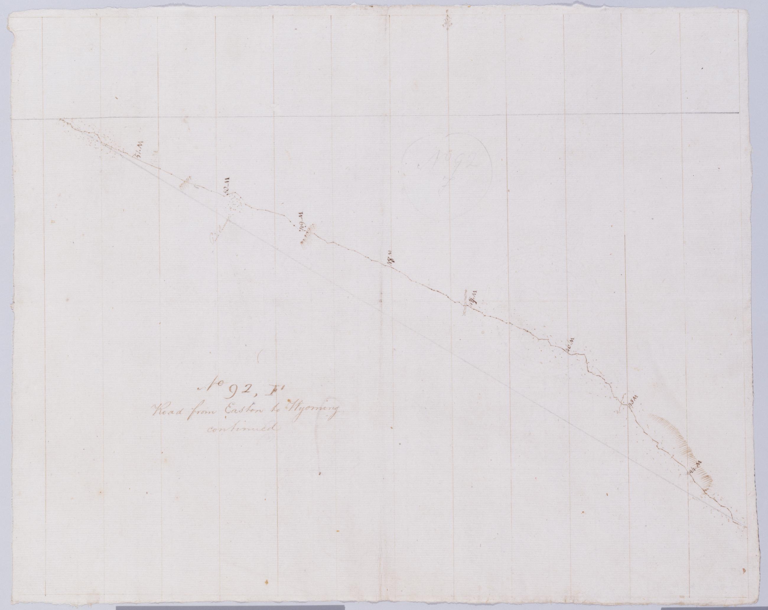
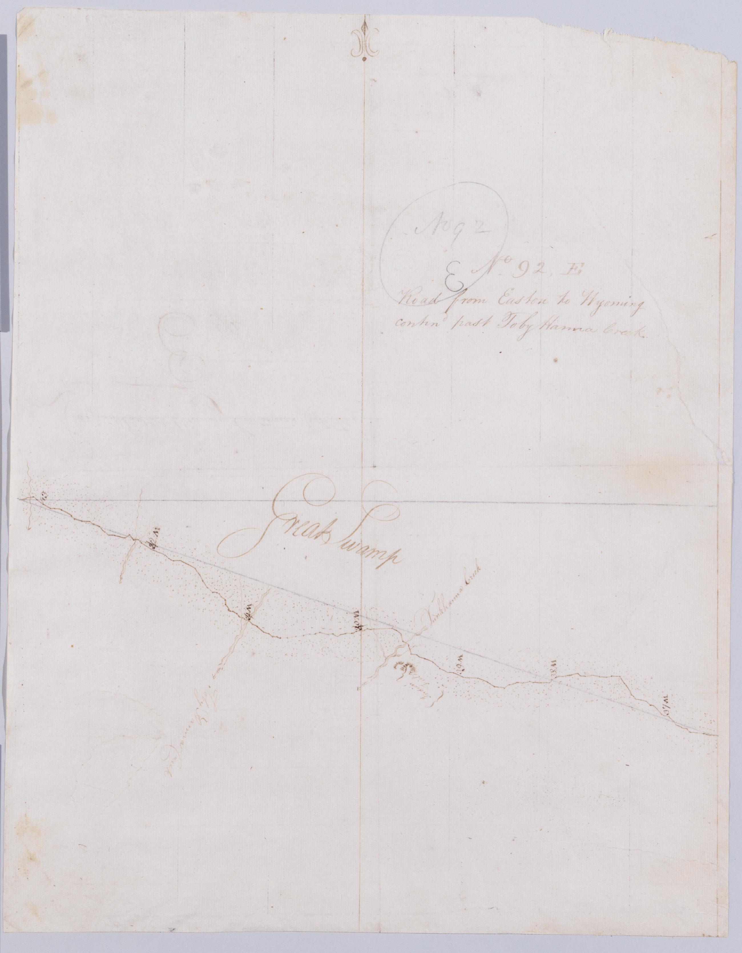
Cartographic Road from Easton to Wyoming continued No 92, F / by Robert Erskine F.R.S. Geogr. A. U.S. and Assistants. Creased, stained, soiled and abraded. Mounted on cloth, bound, disbound and silked by subsequent owners. Cleaned after removal of backings 1999; some fill remains. Sheathed in mylar.In pencil on recto: "No 92 F". Military topographic map. Covers the counties of Lackawanna and Monore, Pennsylvania. Shows roads. Also shows buildings and owners' names, landforms and streams. Pen-and-ink, pencil on laid paper. Scale from index title; confirmed by measuring the map itself. Shows relief by hachures. View Item
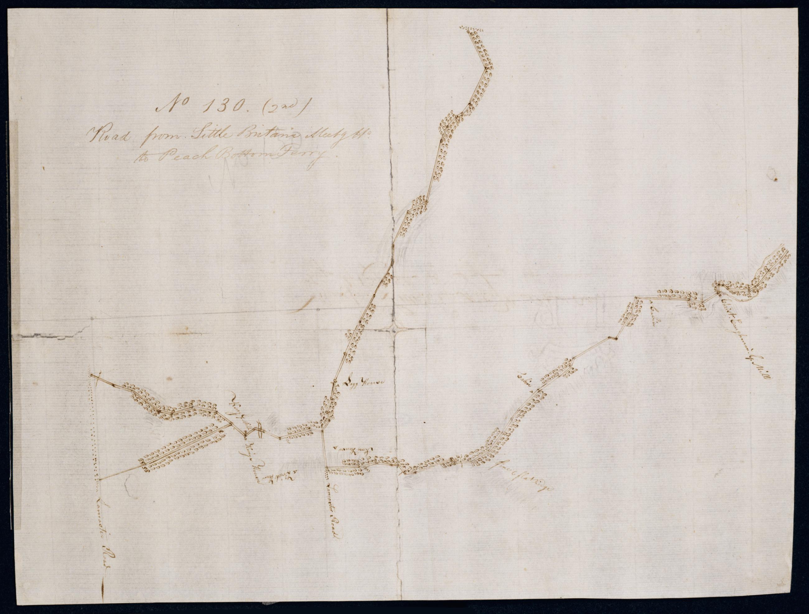
Cartographic Road from Little Britan's Meetg Ho. to Peach Bottom Ferry. No 130 (2nd) / by Robert Erskine F.R.S. Geogr. A. U.S. and Assistants. In pencil on recto, roughly, and not encircled: "No. 130". Military topographic map. Covers the townships of Fulton, Drumore and Little Britain in Lancaster County, Pennsylvania. Also shows buildings and owners' names, landforms and streams. Oriented with north to bottom of sheet. Pen-and-ink, pencil laid paper. Shows relief by hachures. Soiled, foxed, creased, split, frayed and abraded. Mounted on cloth, bound and cropped, disbound and silked by subsequent owners. Cleaned after removal of backings 1999; some fill remains. Newly backed with China paper. Sheathed in mylar. View Item
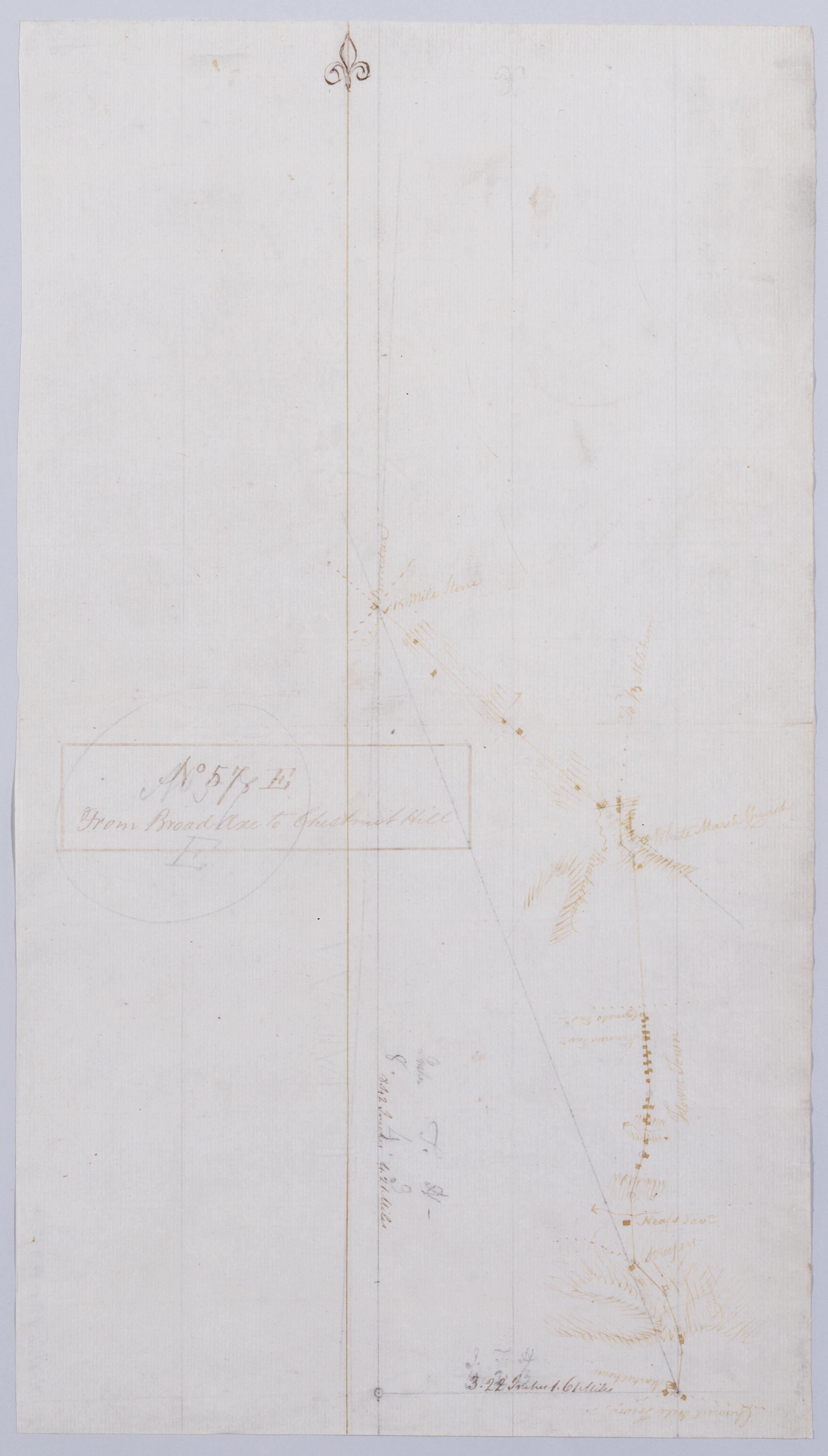
Cartographic From Broad Axe to Chestnut Hill. No 57, E / by Robert Erskine F.R.S. Geogr. A. U.S. and Assistants. In ink on verso: "No 57 E". In pencil on recto: "57 E". Military topographic map. Covers Montgomery County, Pennsylvania. Shows roads running through Whitemarsh and Springfield toward Chestnut Hill. Also shows buildings and owners' names, landforms and streams. Pen-and-ink, pencil on laid paper. Shows relief by hachures. Soiled, creased and abraded. Ink faded. Mounted on cloth, bound and cropped, disbound and silked by subsequent owners. Cleaned after removal of backings 1999; some fill remains. Sheathed in mylar. View Item
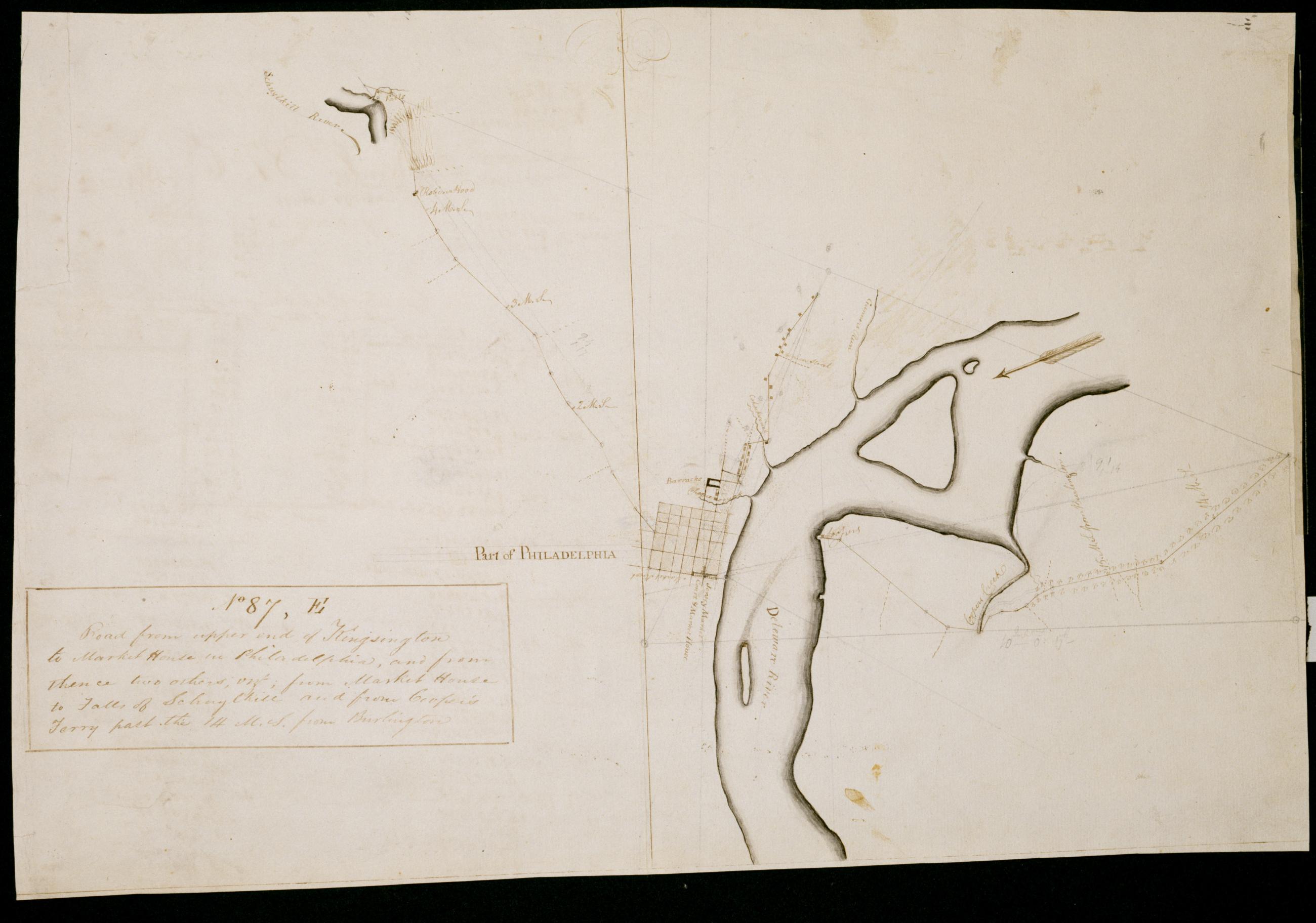
Cartographic Road from upper end of Kingsington to Market House in Philadelphia, and from thence two others, vizt.; from Market House to Falls of Schuylkill and from Cooper's Ferry past the 14 M. S. from Burlington. No 87, E / by Robert Erskine F.R.S. Geogr. A. U.S. a Military topographic map. Covers roads within the city of Philadelphia, Pennsylvania. Also shows buildings and owners' names, landforms and streams. On verso: calculations headed by text beginning, "Agreement of the Pole Star at its greatest elongation from the Pole...." Pen-and-ink, pencil on laid paper. Shows relief by hachures. Soiled, stained, creased, and abraded. Mounted on cloth, cropped, bound, disbound and silked by subsequent owners. Cleaned after removal of backings 1999; some fill remains. Sheathed in mylar. View Item
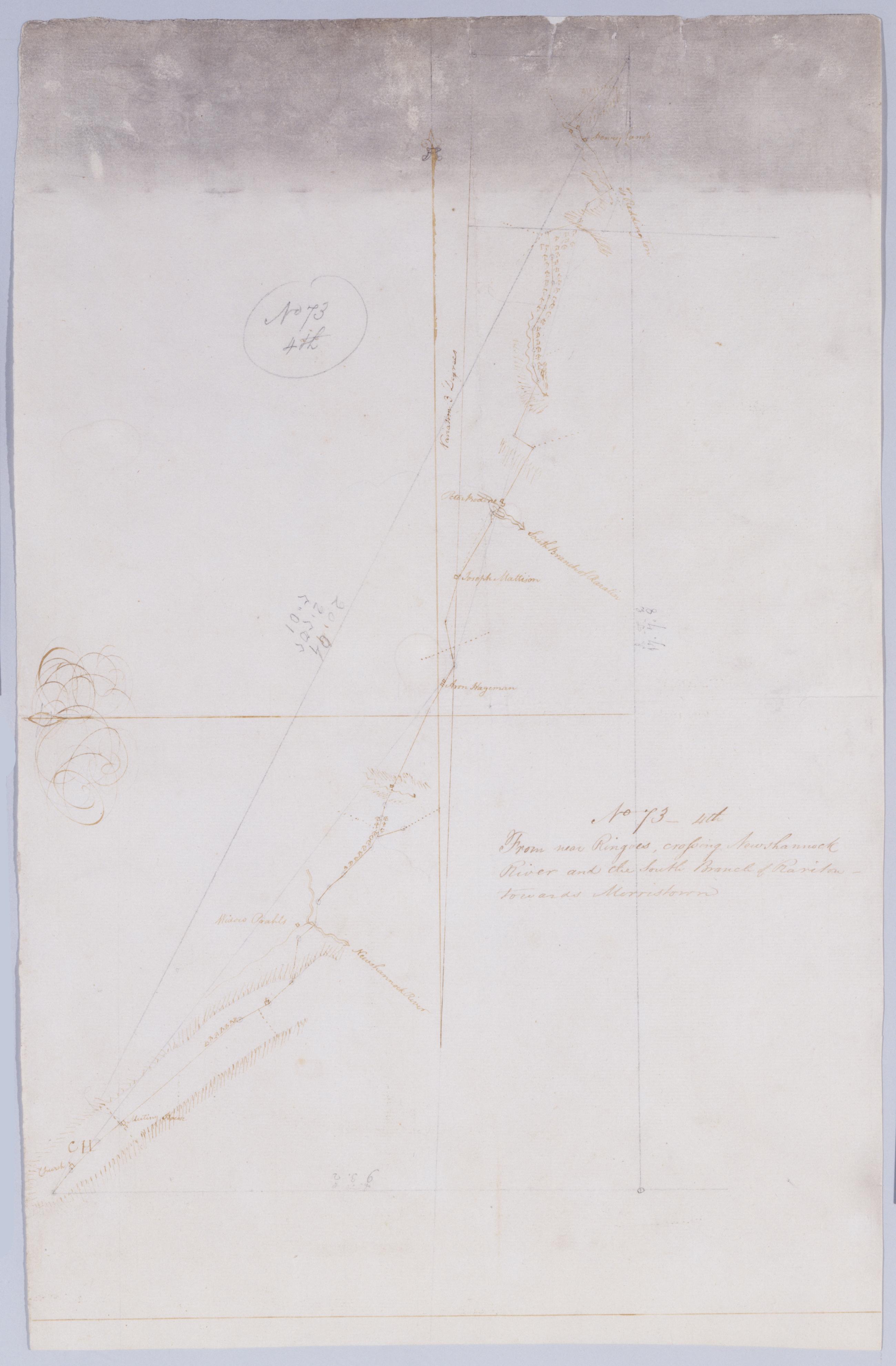
Cartographic From near Ringoes, crossing Newshannock River and the South Branch of Rariton - towards Morristown. No 73 - 4th / by Robert Erskine F.R.S. Geogr. A. U.S. and Assistants. Heavily soiled, frayed, creased and abraded. Mounted on cloth, bound and cropped, disbound and silked by subsequent owners. Cleaned after removal of backings 1999; some fill remains. Sheathed in mylar. In pencil on recto: "No 73 4th". Military topographic map. Covers the townships of East Amwell, Raritan and Readington in Hunterdon County, New Jersey. Shows roads running through Larison Corner, Reaville, Three Bridges and Pleasant Run. Also shows buildings and owners' names, landforms and streams. Pen-and-ink, pencil on laid paper. Shows relief by hachures. View Item
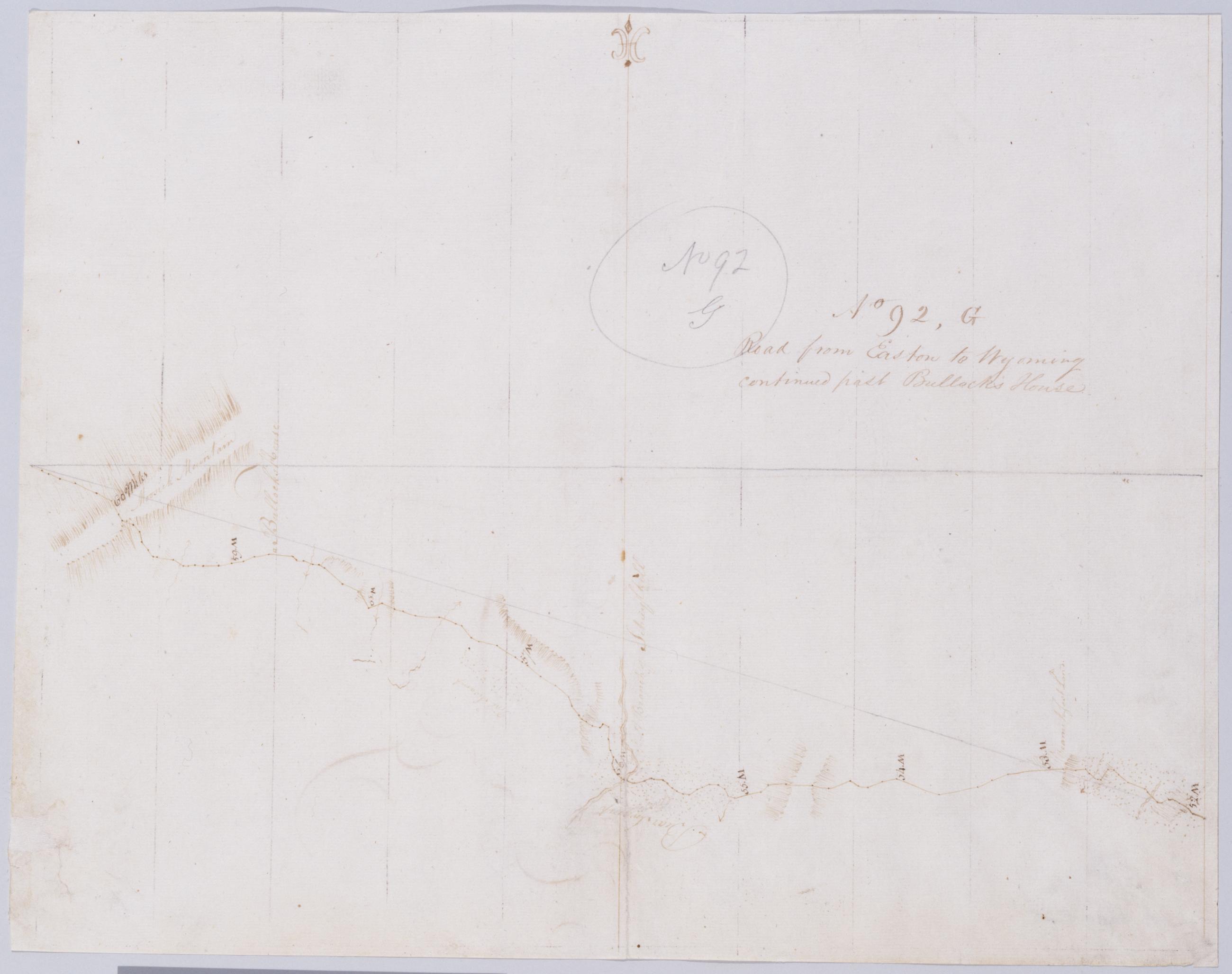
Cartographic Road from Easton to Wyoming continued past Bullock's House. No 92, G / by Robert Erskine F.R.S. Geogr. A. U.S. and Assistants. Creased, foxed, stained, soiled and abraded. Mounted on cloth, bound and cropped, disbound and silked by subsequent owners. Cleaned after removal of backings 1999; some fill remains. Sheathed in mylar. In pencil on recto: "No 92 G". Military topographic map. Covers the counties of Lackawanna and Luzerne, Pennsylvania. Shows roads. Also shows buildings and owners' names, landforms and streams. Pen-and-ink, pencil on laid paper. Scale from index title; confirmed by measuring the map itself. Shows relief by hachures. View Item
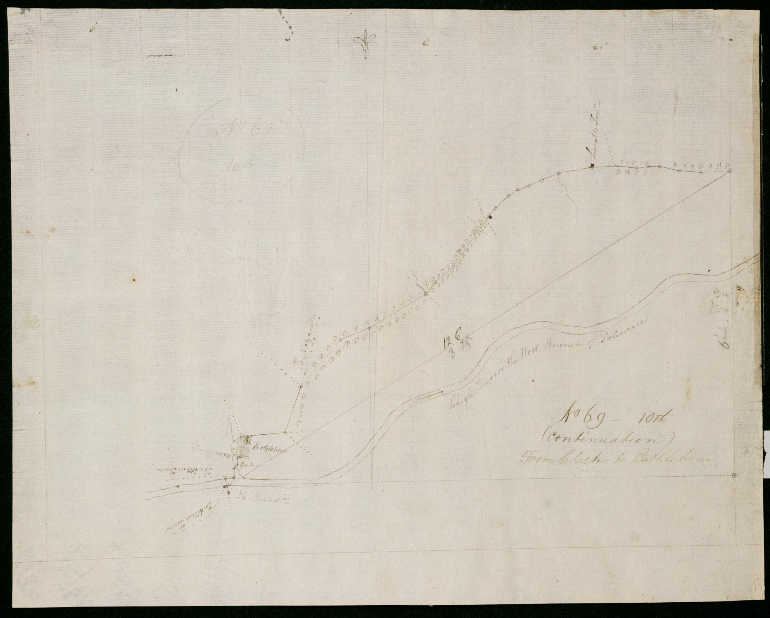
Cartographic (Continuation) From Chester to Bethlehem. No 69-10th / by Robert Erskine F.R.S. Geogr. A. U.S. and Assistants. In pencil on recto: "No 69 10th". Military topographic map. Covers Northampton County, Pennsylvania. Shows roads running through Bethlehem. Also shows buildings and owners' names, landforms and streams. Pen-and-ink, pencil on laid paper. Shows relief by hachures. Stained, creased and abraded. Mounted on cloth, bound and cropped, disbound and silked by subsequent owners. Cleaned after removal of backings 1999; some fill remains. Sheathed in mylar. Title proper on recto is the work of a later editor--Simeon DeWitt or his assign--subsequent to 1820. View Item
Cartographic Road from Easton to Wyoming contind past Toby Hanna Creek. No 92, E / by Robert Erskine F.R.S. Geogr. A. U.S. and Assistants. In pencil on recto: "No 92 E". Military topographic map. Covers Monroe County, Pennsylvania. Shows roads. Also shows buildings and owners' names, landforms and streams. Pen-and-ink, pencil on laid paper. Paper itself imperfect. Scale from index title; confirmed by measuring the map itself. Shows relief by hachures. Stained, soiled, torn and abraded. Mounted on cloth, bound and cropped, disbound and silked by subsequent owners. Cleaned after removal of backings 1999; some fill remains. Sheathed in mylar. View Item
Cartographic From Bethlehem to Broad Axe. No 58 / by Robert Erskine F.R.S. Geogr. A. U.S. and Assistants. In ink on verso: "No 58" (partly damaged by cropping). In pencil on recto: "58". Military topographic map. Covers Northhampton, Bucks and Montgomery counties, Pennsylvania. Shows roads running through Bethlehem, Hellertown, Pleasant Valley, Strawntown, Keelersville, Hagersville, Doyles Corner, Trewigtown, Montgomeryville, Spring House, Ambler and Fort Washington. Also shows buildings and owners' names, landforms and streams. Pen-and-ink, pencil on laid paper. Shows relief by hachures. Stained, foxed and abraded. Mounted on cloth, bound and cropped, disbound and silked by subsequent owners. View Item
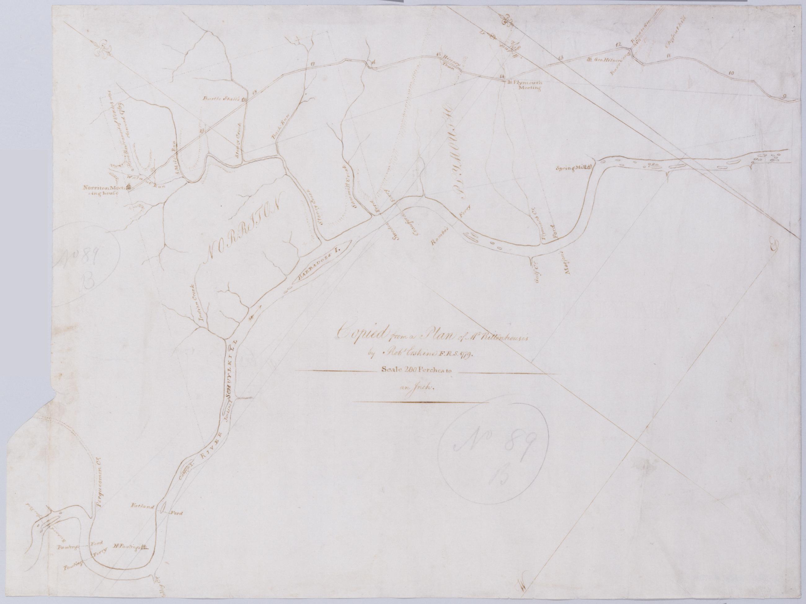
Cartographic [A Contraction of Do.] No. 89 B. / Copied from a Plan of Mr Rittenhouse's by Robt Erskine F.R.S. 1779 ; by Robert Erskine F.R.S. Geogr. A. U.S. and Assistants. Foxed, soiled, frayed. Sheathed in mylar. In ink on verso: "No. 89 B." In pencil on recto: "No 89 B". Military topographic map. Covers the counties of Chester, Montgomery and Delaware, Pennsylvania. Shows roads running through Norristown and Philadelphia. Also shows buildings and owners' names, landforms and streams. No title on recto or verso; title proper supplied by cataloger. Title number from map verso. First statement of responsibility from map recto. View Item
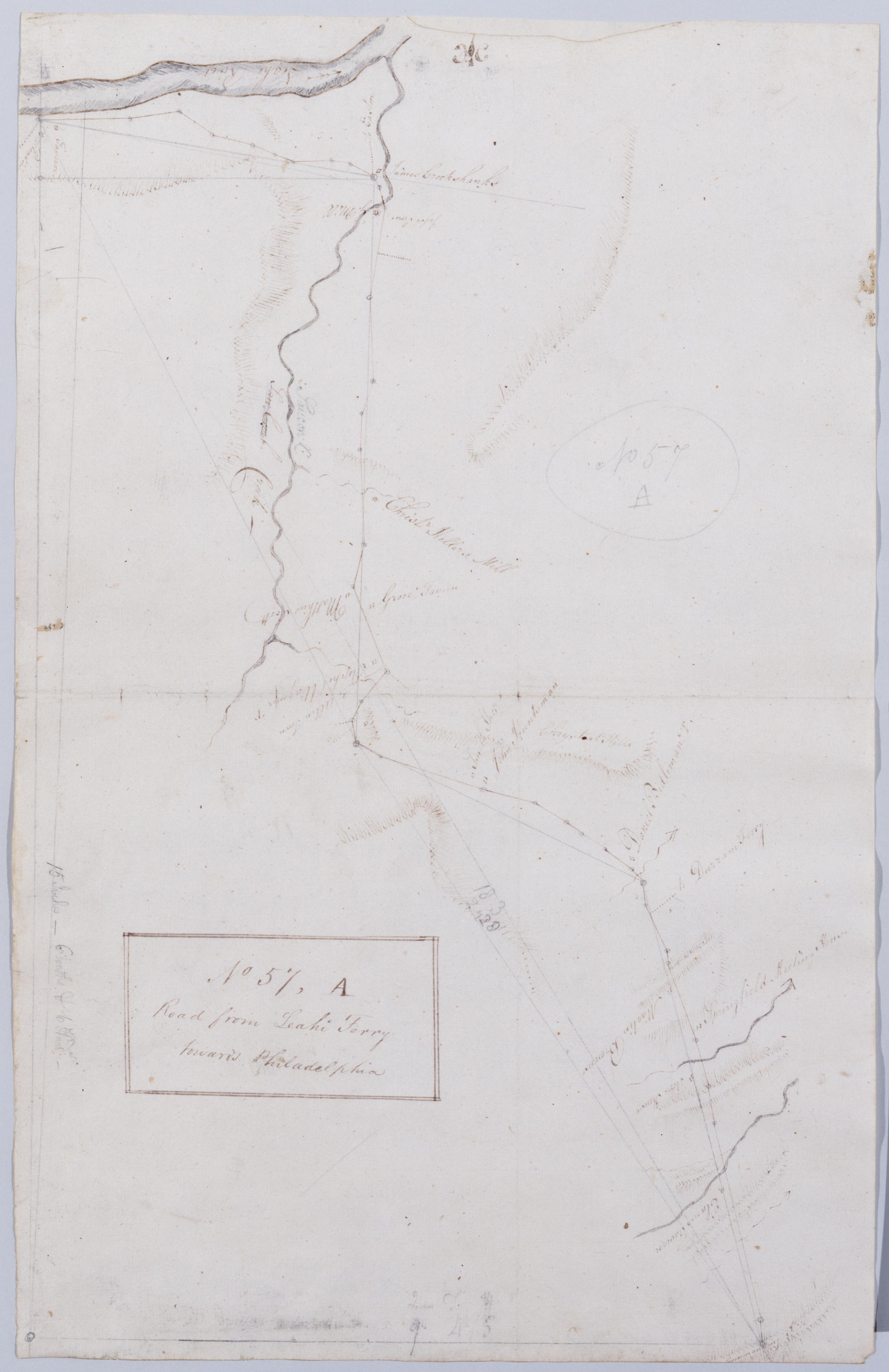
Cartographic Road from Leahi Ferry towards Philadelphia. No 57, A / by Robert Erskine F.R.S. Geogr. A. U.S. and Assistants. In pencil on recto: "57 A". Military topographic map. Covers Northhampton and Bucks counties, Pennsylvania. Shows roads running through Bethlehem, Hellertown and Pleasant Valley. Also shows buildings and owners' names, landforms and streams. Pen-and-ink, pencil on laid paper. Shows relief by hachures. Soiled, creased and abraded. Mounted on cloth, bound and cropped, disbound and silked by subsequent owners. Cleaned after removal of backings 1999; some fill remains. Sheathed in mylar. Title proper from recto is the work of a later editor--Simeon DeWitt or his assign--subsequent to 1820. View Item
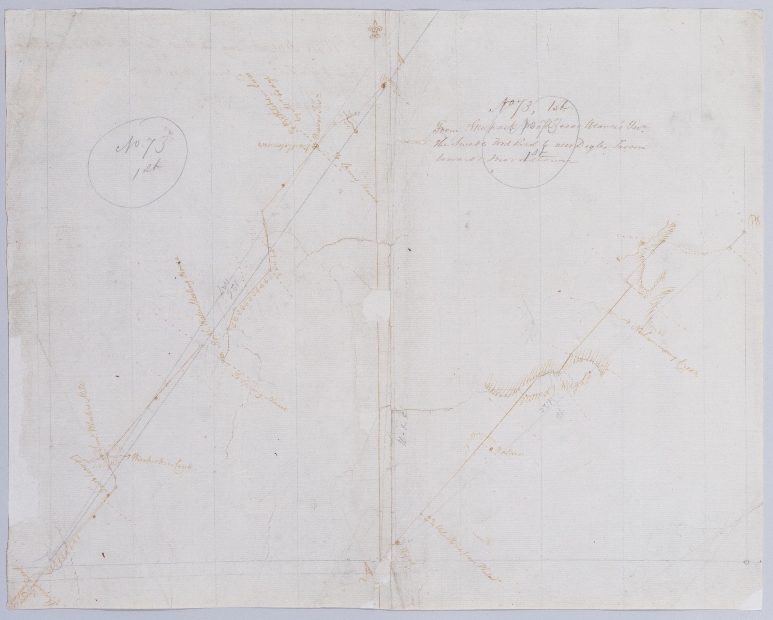
Cartographic From Skeepack Road near Weaver's Tavn. the Swede Ford Road to near Doyles Tavern towards Morristown. No 73, 1st / by Robert Erskine F.R.S. Geogr. A. U.S. and Assistants. Creased, torn, frayed and abraded. Mounted on cloth, bound and cropped, disbound and silked by subsequent owners. Cleaned after removal of backings 1999; some fill remains. Sheathed in mylar. Imperfect: lacking 2 x 2 cm. at center. In pencil on recto: "No 73 1st" (twice). Military topographic map. Covers Bucks and Montgomery counties, Pennsylvania. Shows roads running through Norristown, North Wales, New Britain and Doylestown. Also shows buildings and owners' names, landforms and streams. Pen-and-ink, pencil on laid paper. Shows relief by hachures. View Item
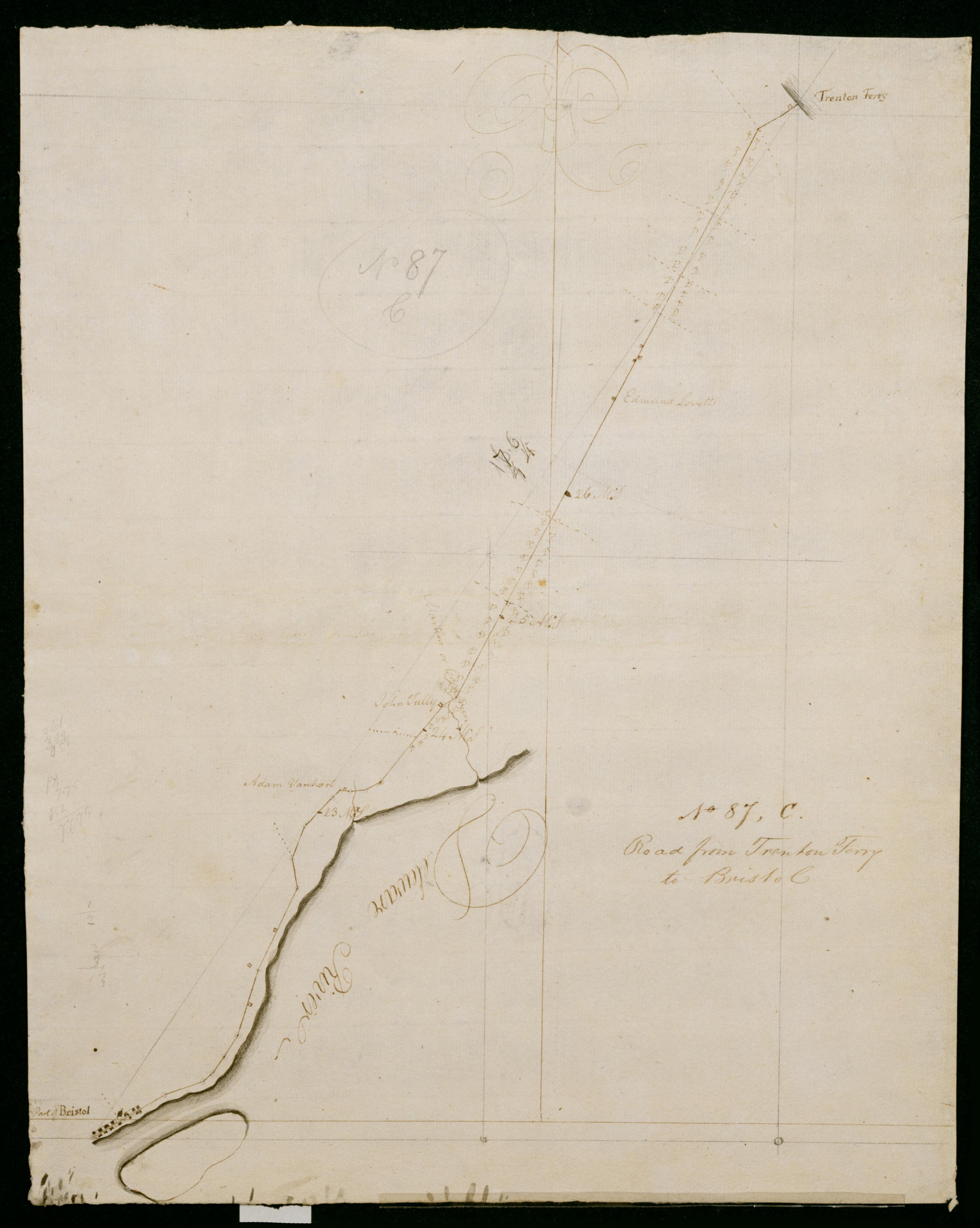
Cartographic Road from Trenton Ferry to Bristol. No 87, C / by Robert Erskine F.R.S. Geogr. A. U.S. and Assistants. In pencil on recto: "No 87 C". Military topographic map. Covers the townships of Falls and Bristol in Bucks County, Pennsylvania. Shows roads running from Trenton, New Jersey, through Morrisville, Wheat Sheaf, Tullytown and Bristol, Pennsylvania. Also shows buildings and owners' names, landforms and streams. Pen-and-ink, pencil on laid paper. Shows relief by hachures. Soiled, foxed, creased, frayed and abraded. Mounted on cloth, bound, disbound and silked by subsequent owners. Cleaned after removal of backings 1999; some fill remains. Sheathed in mylar. Title proper also in ink on verso. View Item
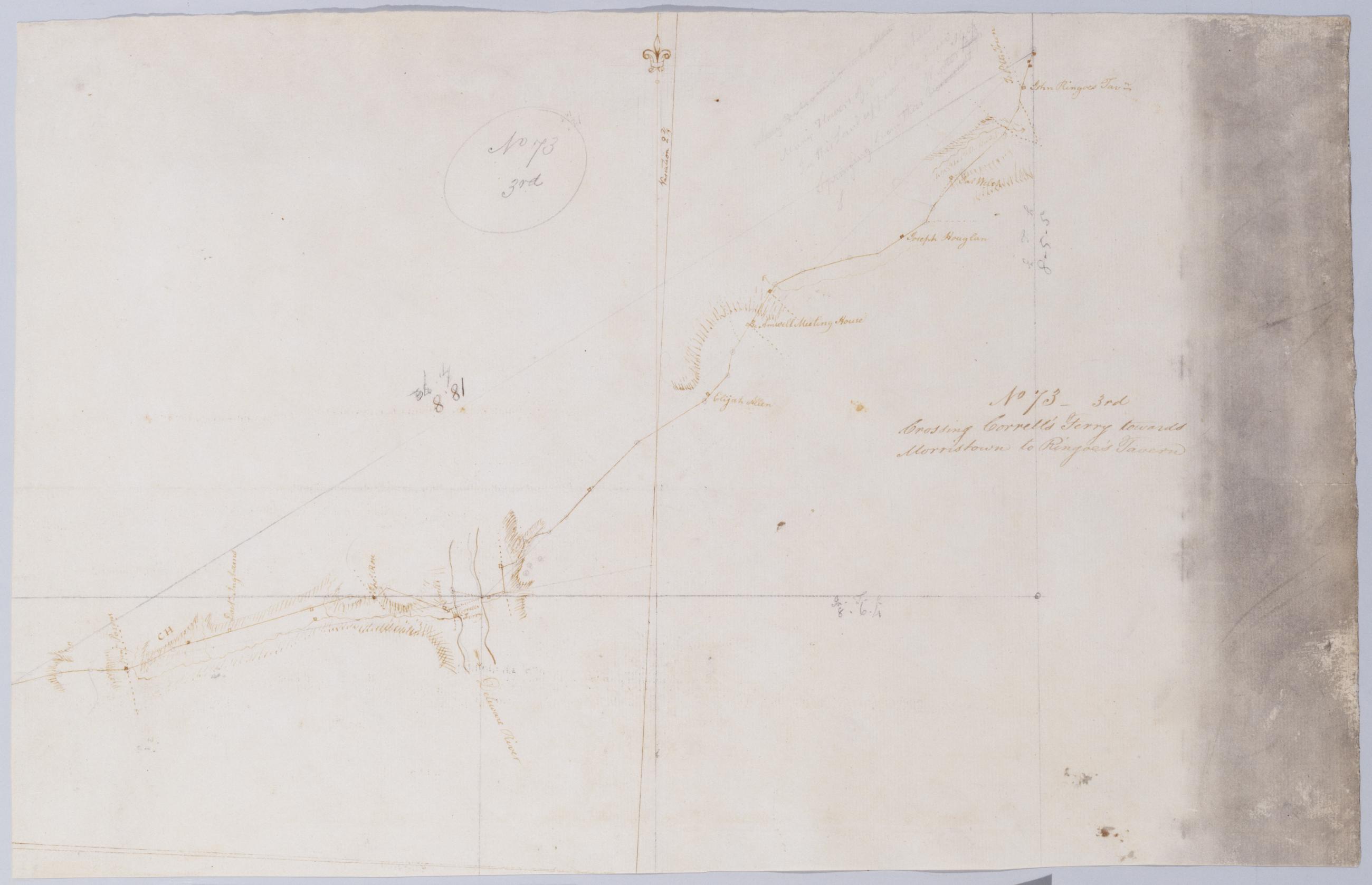
Cartographic Crossing Correll's Ferry towards Morristown to Ringoe's Tavern. No 73 - 3rd / by Robert Erskine F.R.S. Geogr. A. U.S. and Assistants. Heavily soiled, creased and abraded. Mounted on cloth, bound and cropped, disbound and silked by subsequent owners. Cleaned after removal of backings 1999; some fill remains. Sheathed in mylar. In pencil on recto: "No 73 3rd". Military topographic map. Covers the townships of Solebury in Bucks County, Pennsylvania, and of Delaware and West Amwell in Hunterdon County, New Jersey. Shows roads running through Deer Park and New Hope in Pennsylvania; Lambertville, Mount Airy and Ringoes in New Jersey. Also shows buildings and owners' names, landforms and streams. Pen-and-ink, pencil on laid paper. View Item
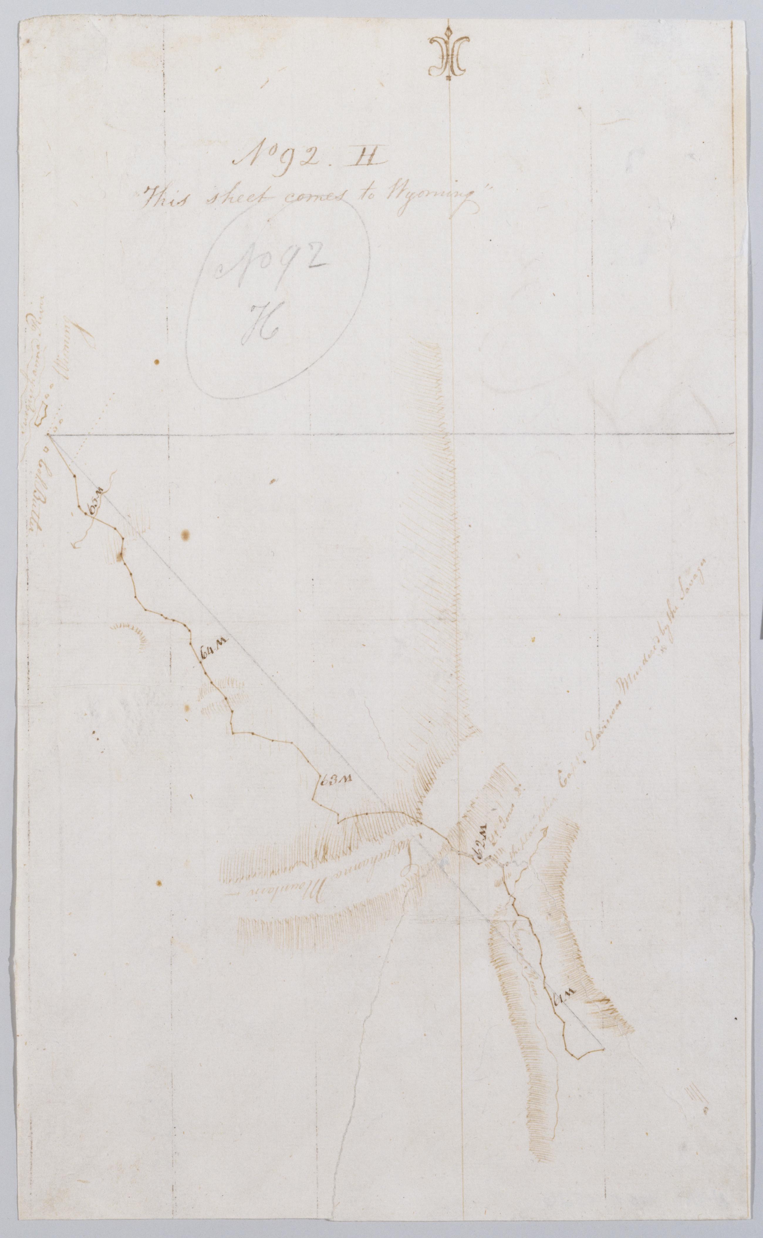
Cartographic This sheet comes to Wyoming. No 92, H / by Robert Erskine F.R.S. Geogr. A. U.S. and Assistants. Creased, foxed, stained, soiled, torn and abraded. Mounted on cloth, bound and cropped, disbound and silked by subsequent owners. Cleaned after removal of backings 1999; some fill remains. Sheathed in mylar. In pencil on recto: "No 92 H". Includes map label: "Capt. Davison Murdered by the Savages". Military topographic map. Covers Luzerne County, Pennsylvania. Shows roads running through Wyoming Valley and Ridgewood. Also shows buildings and owners' names, landforms and streams.Pen-and-ink, pencil on laid paper. Paper itself is imperfect. View Item
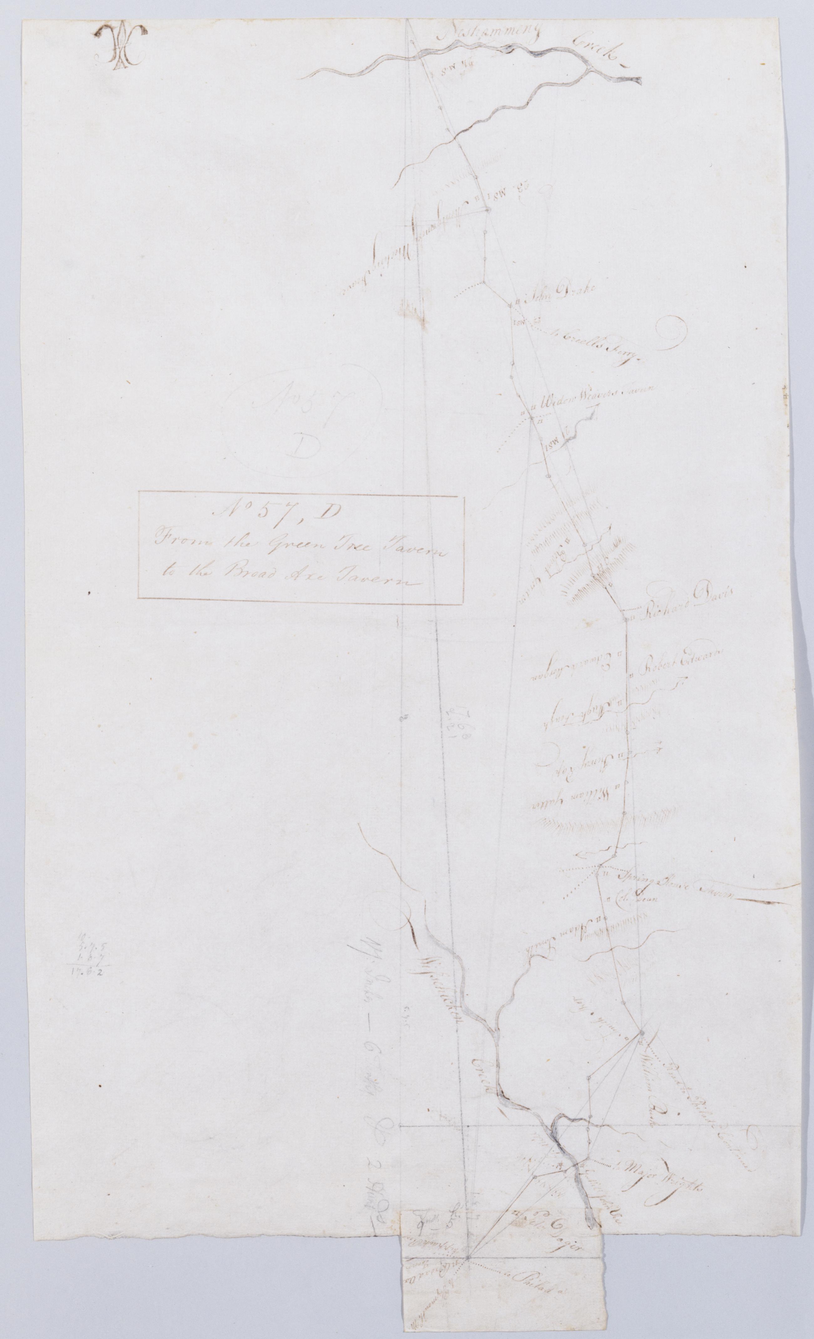
Cartographic From the Green Tree Tavern to the Broad Axe Tavern. No 57, D / by Robert Erskine F.R.S. Geogr. A. U.S. and Assistants. Foxed, creased and abraded. Mounted on cloth, bound and cropped, disbound and silked by subsequent owners. Cleaned after removal of backings 1999; some fill remains. Sheathed in mylar. In pencil on recto: "57 D". Military topographic map. Covers Montgomery County, Pennsylvania. Shows roads running through Trewigtown, Colmar, Montgomeryville, Spring House, Ambler and Fort Washington. Also shows buildings and owners' names, landforms and streams. Pen-and-ink, pencil on laid paper. Second sheet is a mere 5 x 8 cm. tab at lower margin of main sheet. Shows relief by hachures. View Item
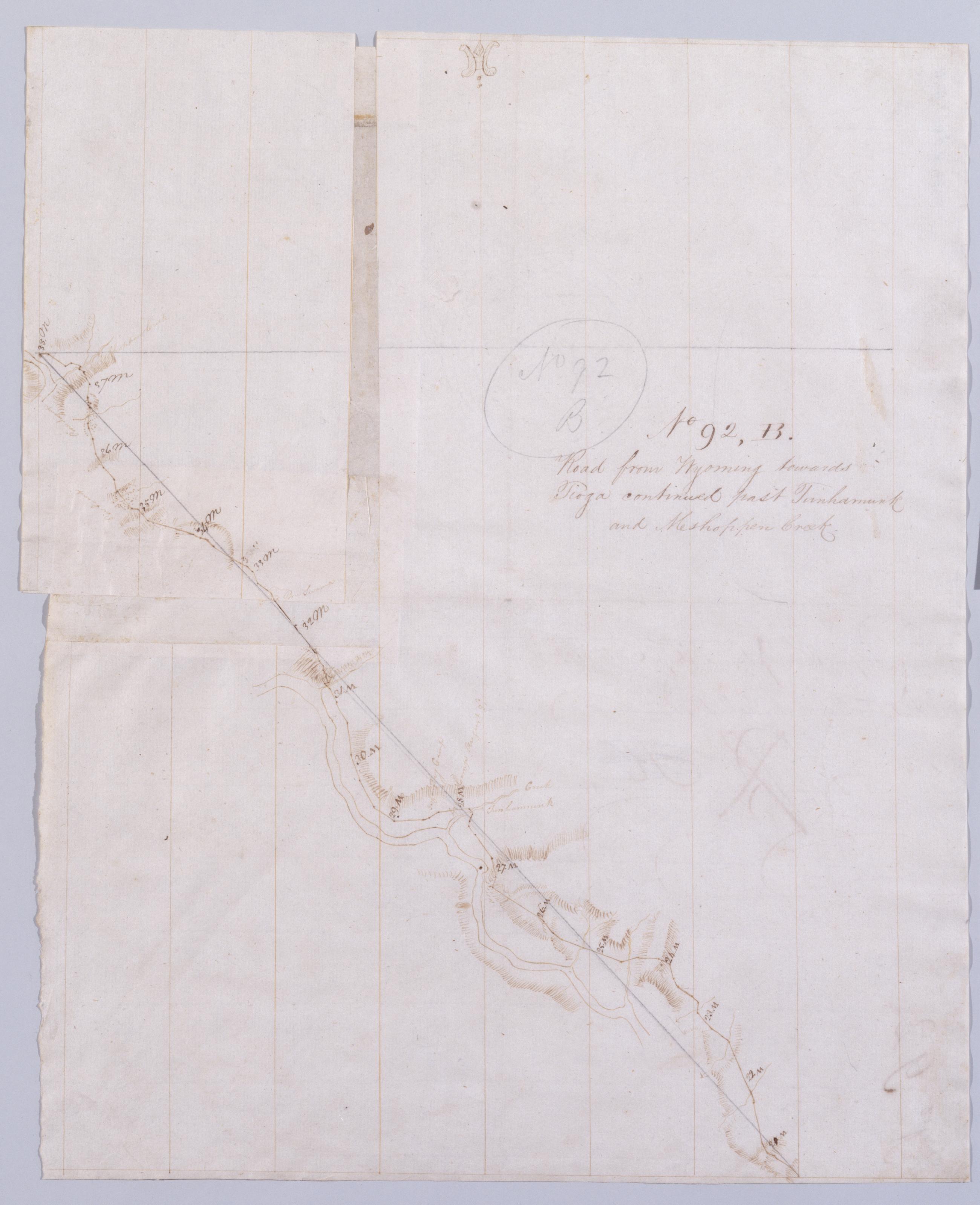
Cartographic Road from Wyoming towards Tioga continued past Tunhamunk and Meshoppen Creek. No 92, B [sic] / by Robert Erskine F.R.S. Geogr. A. U.S. and Assistants. In pencil on recto: "No 92 B". Military topographic map. Covers Wyoming County, Pennsylvania. Shows roads running through Tunkhannock and Meshoppen. Also shows buildings and owners' names, landforms and streams. Number accompanying verso title written in different ink. Letter B crossed out using ink and replaced by K, which in turn is crossed out using pencil and replaced by B. Based on scale and situation, K is the correct letter. Pen-and-ink, pencil on laid paper--one sheet cut and reassembled using two scraps for backing. Scale from index title; confirmed by measuring the map itself. View Item