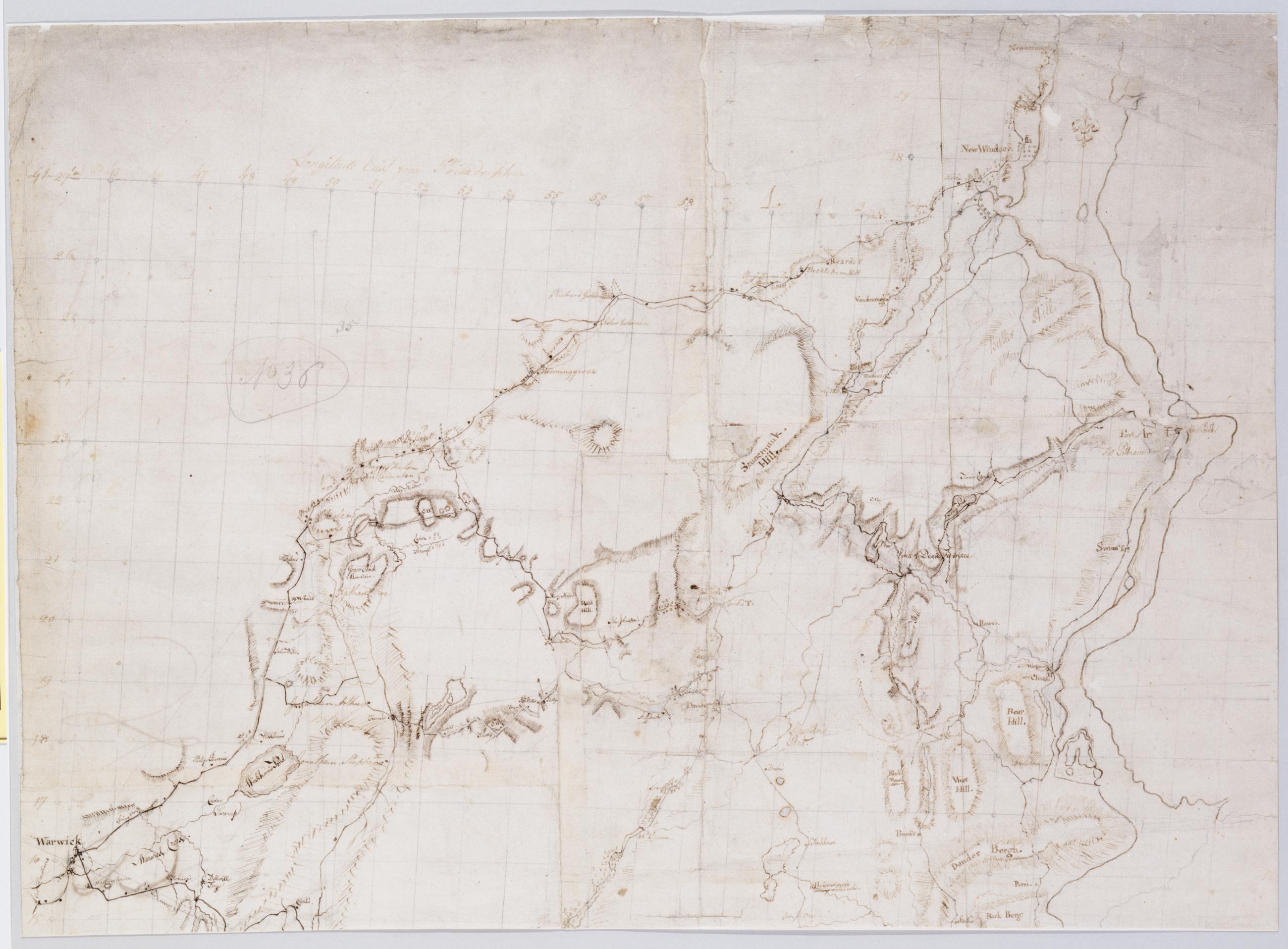
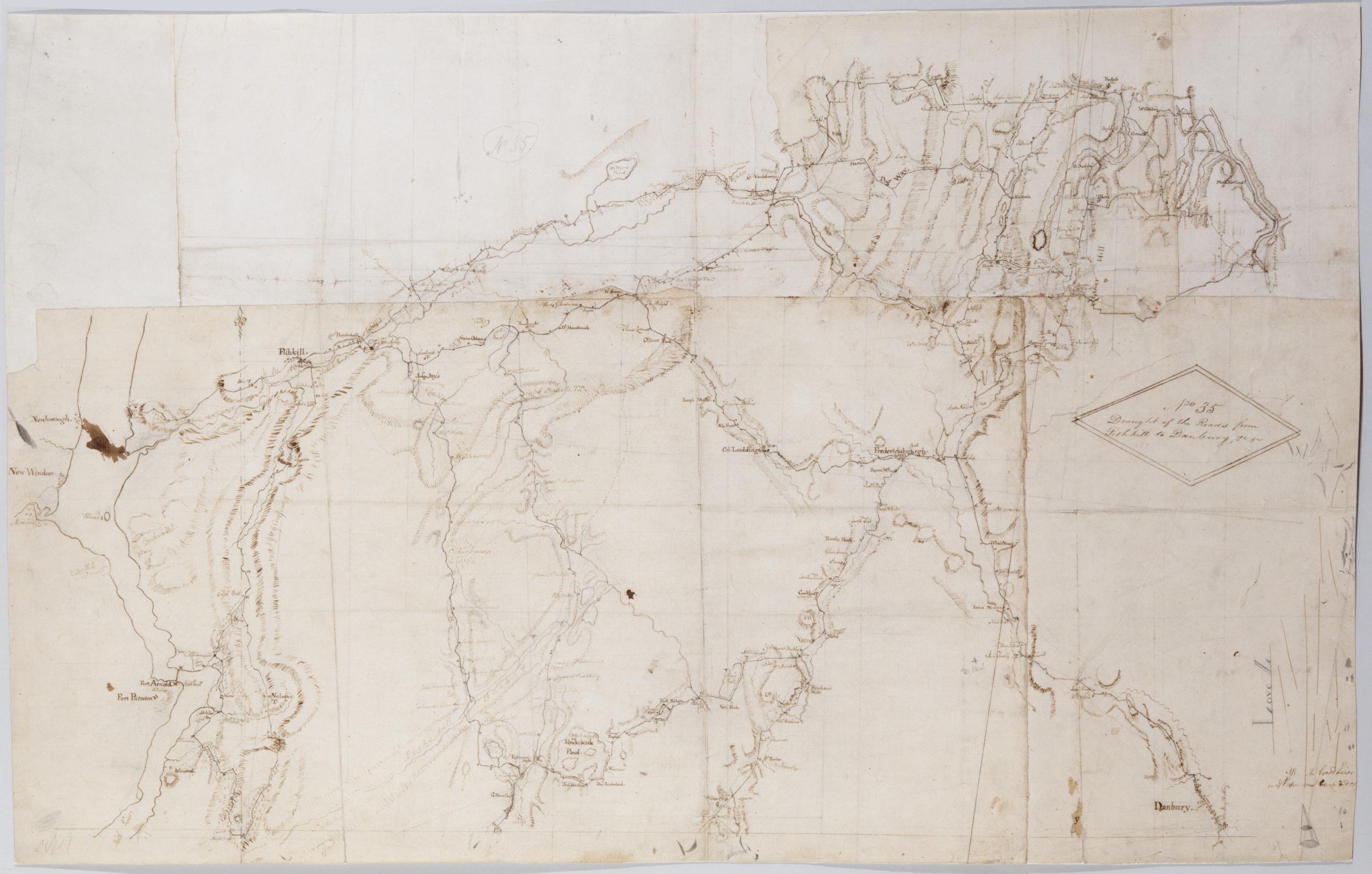
Cartographic Draught of the Roads from Fishkill to Danbury &c. &c. No 35 / by Robert Erskine F.R.S. Geogr. A. U.S. and Assistants. In pencil on recto: "No 35," "Love L". Military topographic map. Covers an area between the Hudson and Houstonic Rivers; i.e., most of Putnam and Dutchess Counties in New York, northern Fairfield County and part of Litchfield County in Connecticut. Shows roads, buildings and owners' names, also landforms and streams. Pen-and-ink, pencil on five pieces laid paper, assembled. Sixth piece at upper left has wove finish. Shows relief by hachures. Title proper from recto is the work of a later editor--Simeon DeWitt or his assign--subsequent to 1820. View Item
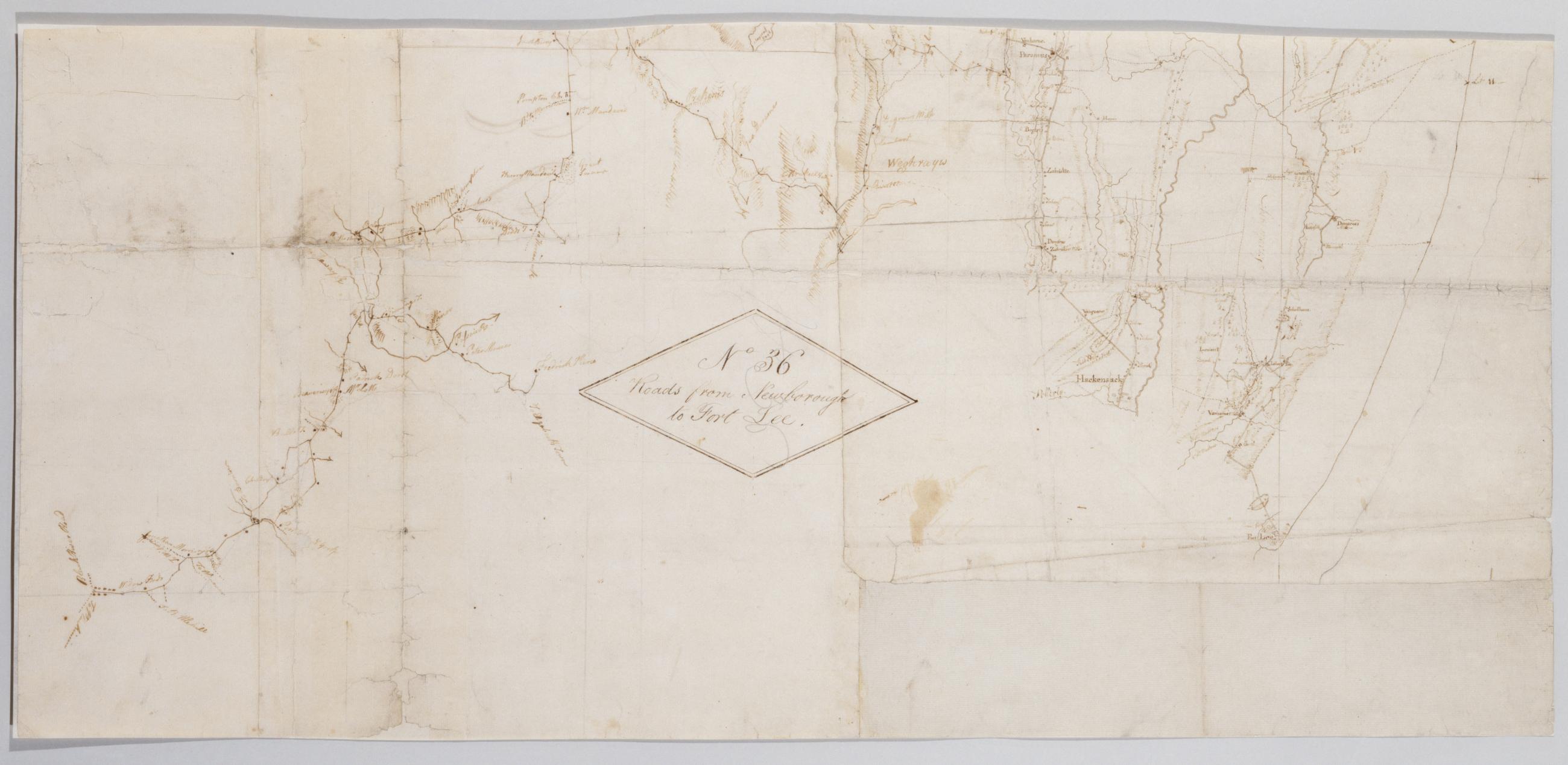
Cartographic Roads from Newborough to Fort Lee. No 36 / by Robert Erskine F.R.S. Geogr. A. U.S. and Assistants, bottom Military topographic map. Covers Orange and Rockland Counties in New York and Bergen, Passaic, Morris and Essex Counties in New Jersey. Shows roads, buildings and owners' names, also landforms, wetlands and streams. Shows relief by hachures. Title proper from recto is the work of a later editor--Simeon DeWitt or his assign--subsequent to 1820. Index title, statement of responsibility, date, series title and series numbering also by Erskine, but on separate index sheet filed at head of series. Pen-and-ink, pencil on laid paper. View Item
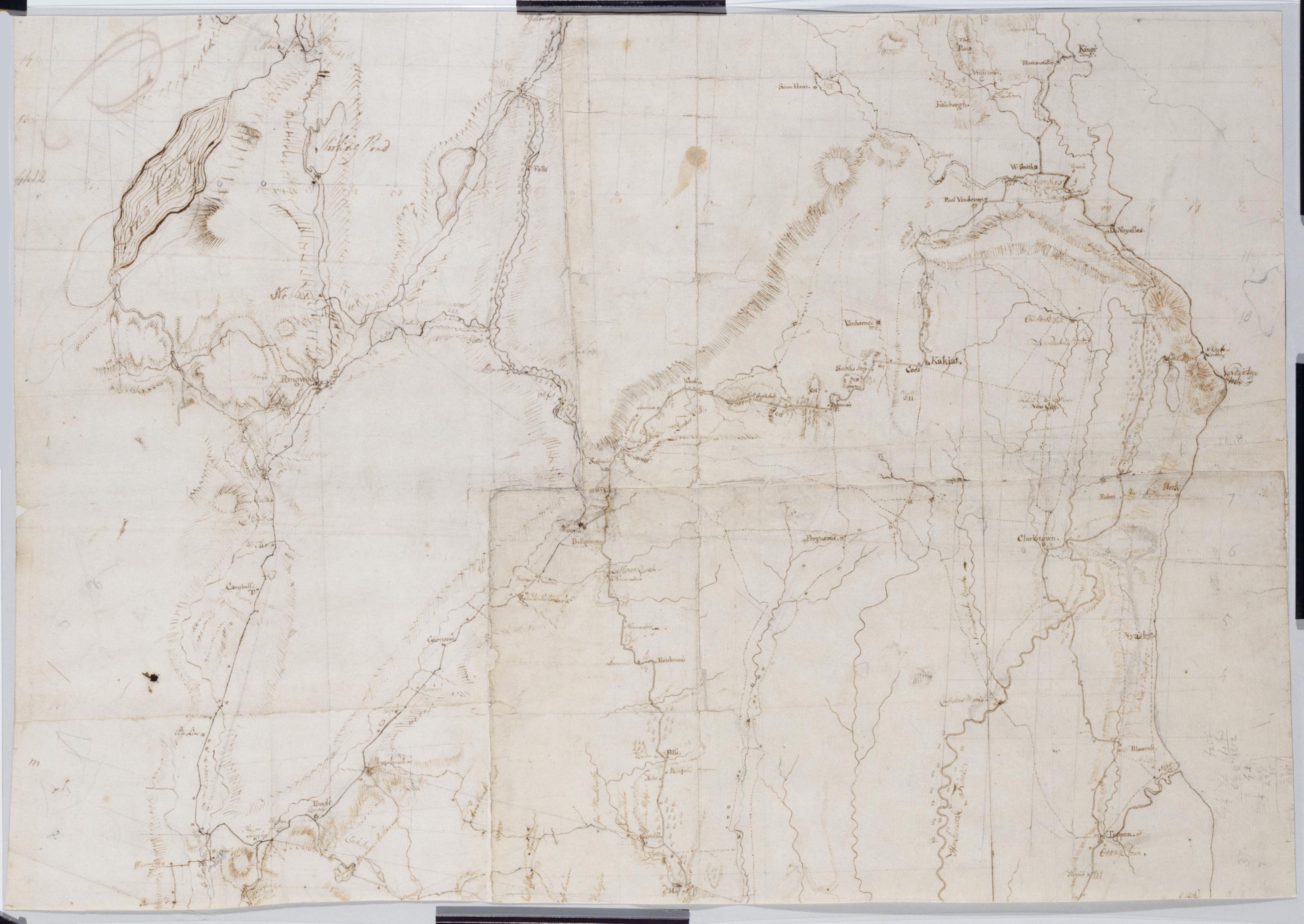
Cartographic Roads from Newborough to Fort Lee. No 36 / by Robert Erskine F.R.S. Geogr. A. U.S. and Assistants, top Military topographic map. Covers Orange and Rockland Counties in New York and Bergen, Passaic, Morris and Essex Counties in New Jersey. Shows roads, buildings and owners' names, also landforms, wetlands and streams. Shows relief by hachures. Title proper from recto is the work of a later editor--Simeon DeWitt or his assign--subsequent to 1820. Index title, statement of responsibility, date, series title and series numbering also by Erskine, but on separate index sheet filed at head of series. Pen-and-ink, pencil on laid paper. View Item
Cartographic Roads from Newborough to Fort Lee. No 36 / by Robert Erskine F.R.S. Geogr. A. U.S. and Assistants, center Military topographic map. Covers Orange and Rockland Counties in New York and Bergen, Passaic, Morris and Essex Counties in New Jersey. Shows roads, buildings and owners' names, also landforms, wetlands and streams. Shows relief by hachures. Title proper from recto is the work of a later editor--Simeon DeWitt or his assign--subsequent to 1820. Index title, statement of responsibility, date, series title and series numbering also by Erskine, but on separate index sheet filed at head of series. Pen-and-ink, pencil on laid paper. View Item
Image Cartographic 3 Items Roads from Newborough to Fort Lee. No 36 / by Robert Erskine F.R.S. Geogr. A. U.S. and Assistants. Military topographic map. Covers Orange and Rockland Counties in New York and Bergen, Passaic, Morris and Essex Counties in New Jersey. Shows roads, buildings and owners' names, also landforms, wetlands and streams. Shows relief by hachures. Title proper from recto is the work of a later editor--Simeon DeWitt or his assign--subsequent to 1820. Index title, statement of responsibility, date, series title and series numbering also by Erskine, but on separate index sheet filed at head of series. Pen-and-ink, pencil on laid paper. View Item
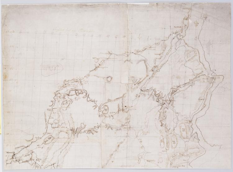
Cartographic Draught of the Roads from Fishkill to Danbury &c. &c. No 35 / by Robert Erskine F.R.S. Geogr. A. U.S. and Assistants. In pencil on recto: "No 35-" "Love L". Military topographic map. Covers an area between the Hudson and Houstonic Rivers; i.e.- most of Putnam and Dutchess Counties in New York- northern Fairfield County and part of Litchfield County in Connecticut. Shows roads- buildings and owners' names- also landforms and streams. Pen-and-ink- pencil on five pieces laid paper- assembled. Sixth piece at upper left has wove finish. Shows relief by hachures. Title proper from recto is the work of a later editor--Simeon DeWitt or his assign--subsequent to 1820. View Item
Cartographic Roads from Newborough to Fort Lee. No 36 / by Robert Erskine F.R.S. Geogr. A. U.S. and Assistants. Military topographic map. Covers Orange and Rockland Counties in New York and Bergen- Passaic- Morris and Essex Counties in New Jersey. Shows roads- buildings and owners' names- also landforms- wetlands and streams. Shows relief by hachures. Title proper from recto is the work of a later editor--Simeon DeWitt or his assign--subsequent to 1820. Index title- statement of responsibility- date- series title and series numbering also by Erskine- but on separate index sheet filed at head of series. Pen-and-ink- pencil on laid paper. View Item