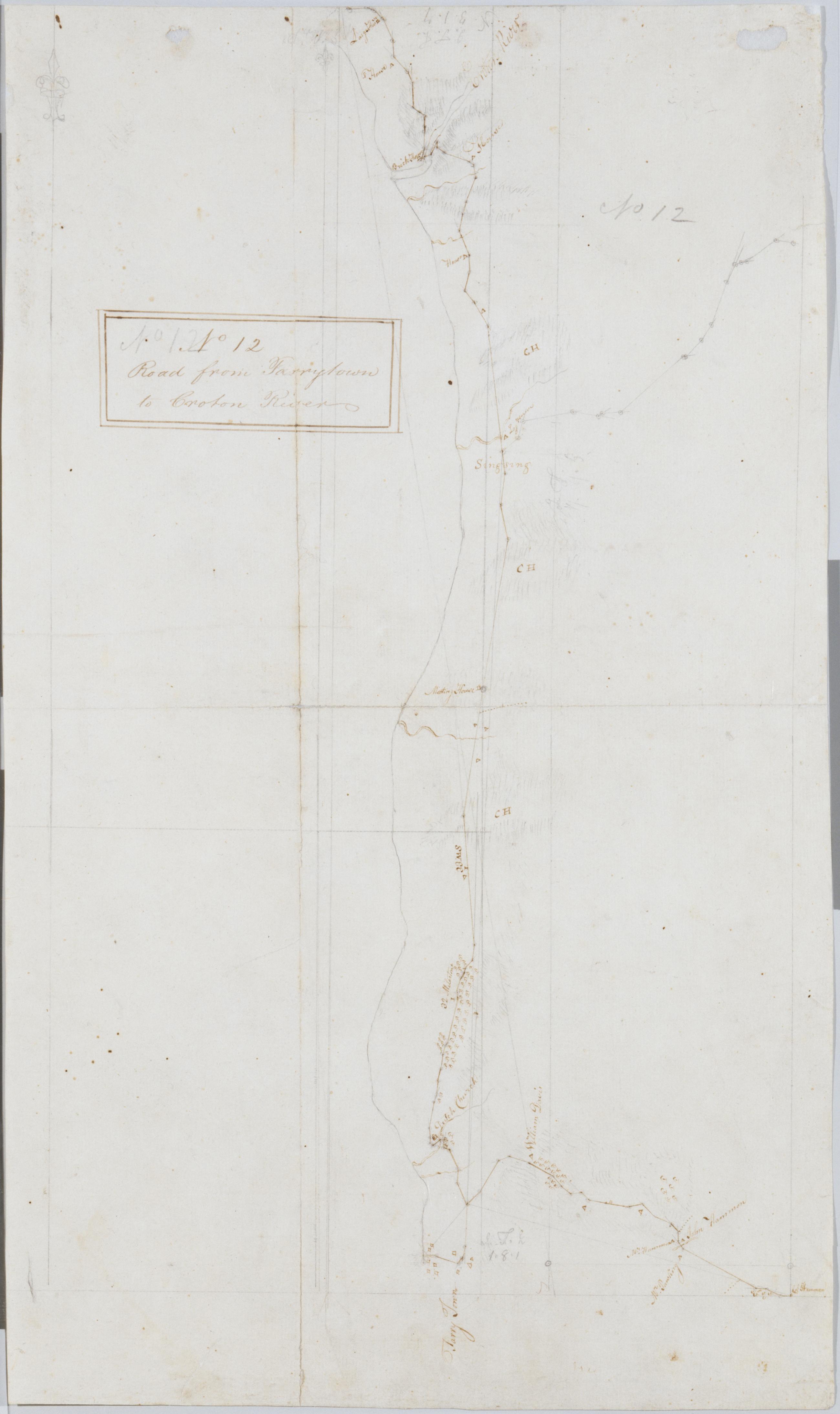
Cartographic Road from Tarrytown to Croton River. No 12 / by Robert Erskine F.R.S. Geogr. A. U.S. and Assistants. Foxed, creased, frayed and abraded. Mounted on cloth, bound and cropped, disbound and silked by subsequent owners. Cleaned after removal of backings 1999; some fill remains. Sheathed in mylar. Military topographic map. Covers the towns of Mt. Pleasant, Ossining and Cortlandt on the left bank of the Hudson River in Westchester County, New York. Shows roads running through Eastview, Tarrytown, Ossining and Croton. Also shows buildings and owners' names, landforms and streams. Pen-and-ink, pencil on laid paper. Shows relief by hachures. View Item
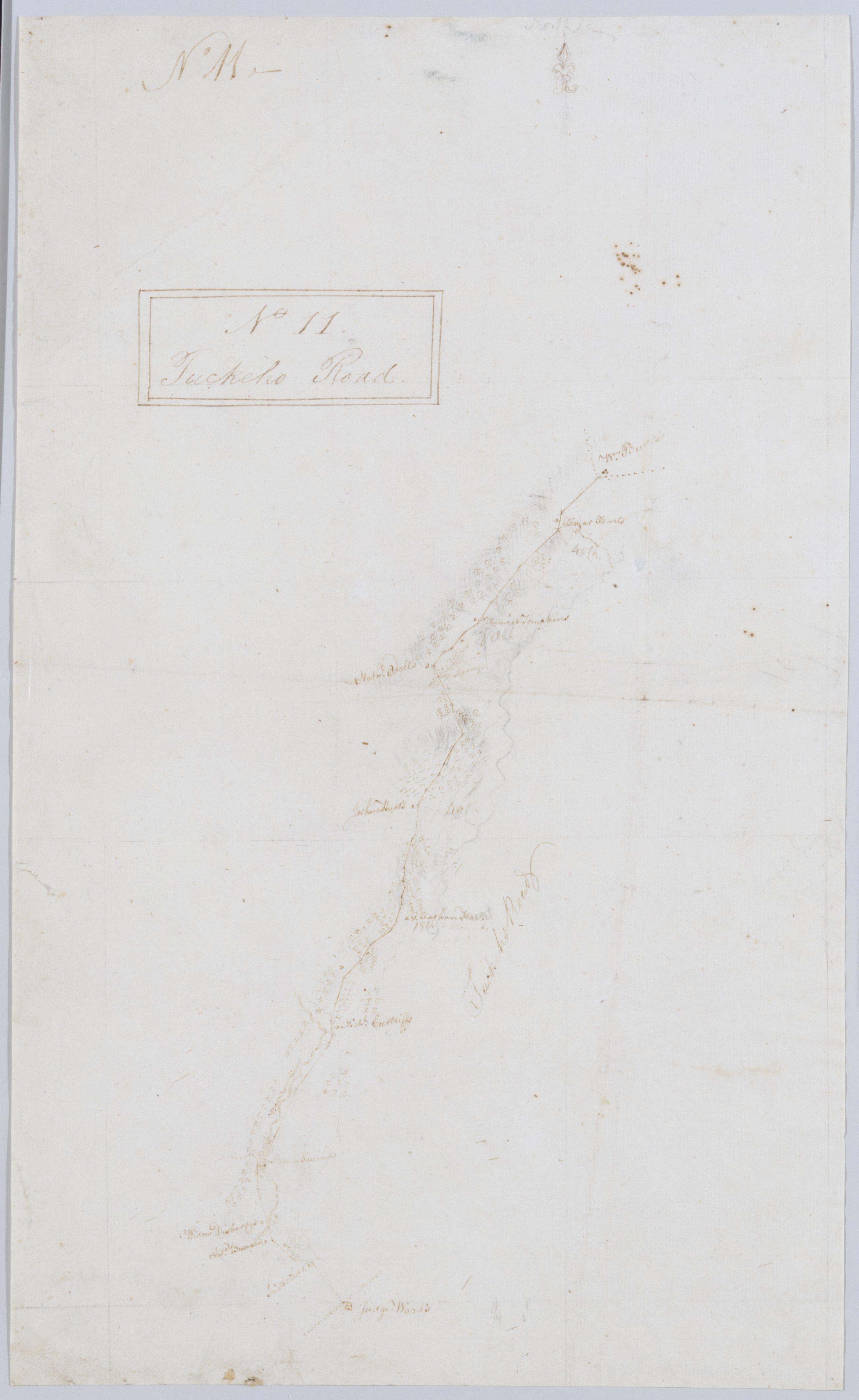
Cartographic Tuckeho Road. No 11 / by Robert Erskine F.R.S. Geogr. A. U.S. and Assistants. Coordinates approximate. Orientation of map unknown. Foxed, creased and abraded. Mounted on cloth, bound and cropped, disbound and silked by subsequent owners. Cleaned after removal of backings 1999; some fill remains. Sheathed in mylar. In ink on recto and verso: "No. 11" In pencil on verso: "No 11." Military topographic map. Covers a small area in southern Westchester County, New York; shows road running through White Plains, Scarsdale and Tuckahoe; the "Younkers River" was later Troublesome Brook. Map shows roads and owners' names; also landforms. Pen-and-ink, pencil on laid paper. View Item
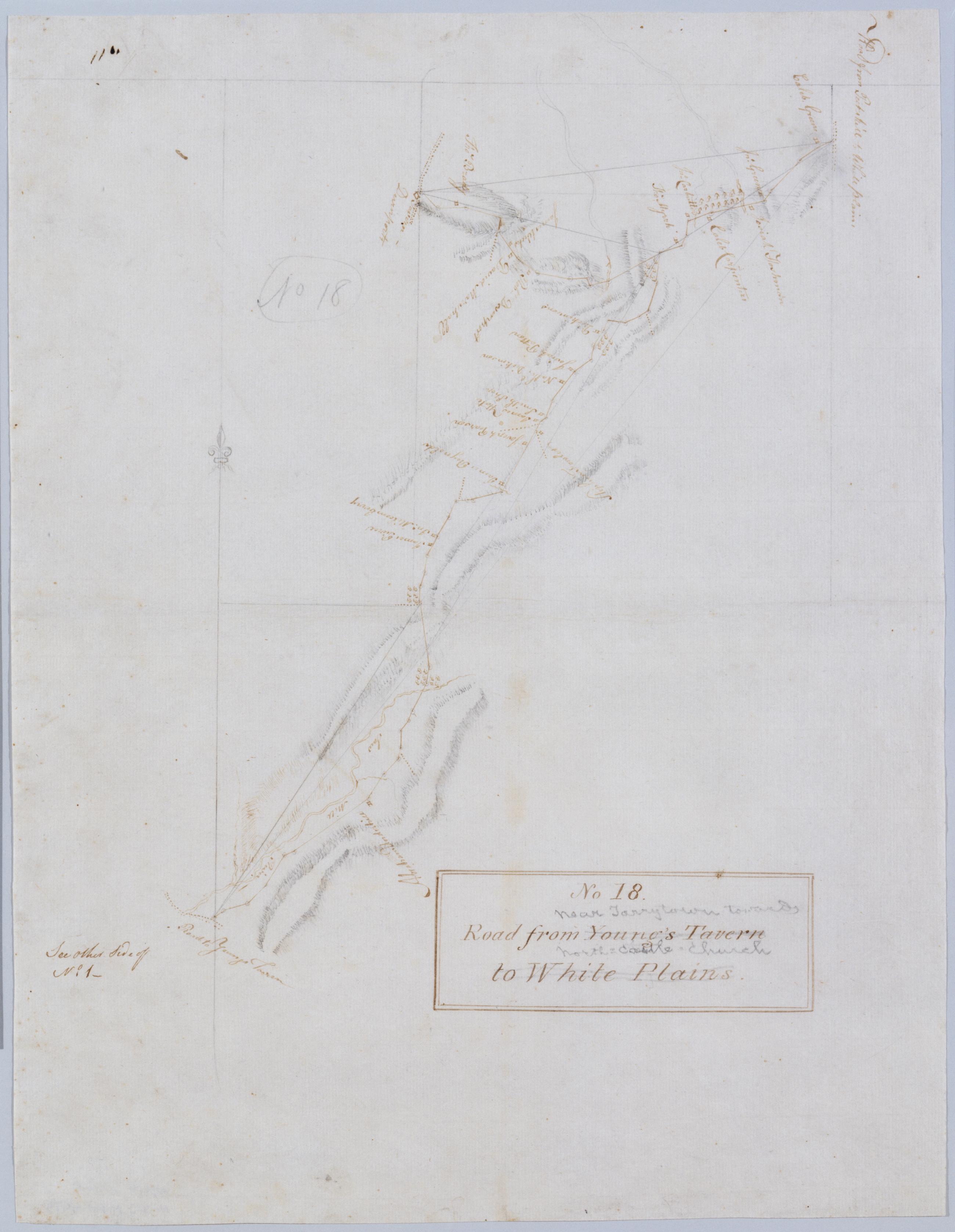
Cartographic Road from Young's Tavern to White Plains. No 18 / by Robert Erskine F.R.S. Geogr. A. U.S. and Assistants. Foxed, creased and abraded. Mounted on cloth, bound and cropped, disbound and silked by subsequent owners. Cleaned after removal of backings 1999; some fill remains. Sheathed in mylar. In ink on verso: "No. 18". In pencil on recto: "No 18". Includes text: "See other Side of No. 1--". Military topographic map. Covers an area in the town of Mount Pleasant, Westchester County, New York. Shows roads running through Neperan, Sherman Park, Pleasantville, Chappaqua and Newcastle. Also shows buildings and owners' names, landforms and streams. Pen-and-ink, pencil on laid paper. View Item
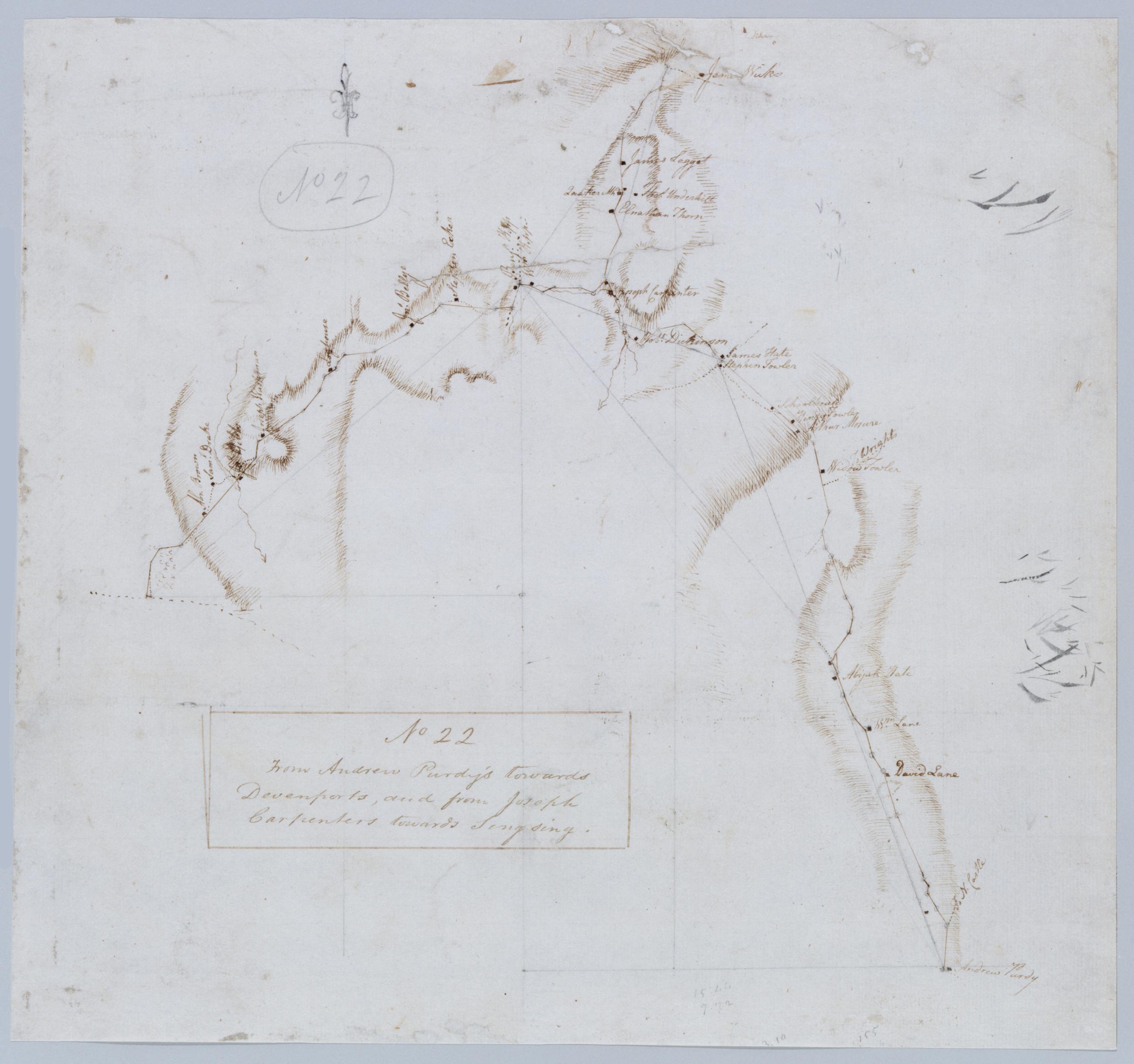
Cartographic From Andrew Purdy's towards Devenports, and from Joseph Carpenters towards Singsing. No 22 / by Robert Erskine F.R.S. Geogr. A. U.S. and Assistants. Foxed, creased, frayed, and abraded. Mounted on cloth, bound and cropped, disbound and silked by subsequent owners. Cleaned after removal of backings 1999; some fill remains. Sheathed in mylar. In pencil on recto, in ink on verso: "No 22". Military topographic map. Covers the towns of Ossining, Newcastle and North Castle in Westchester County, New York. Shows roads running through Briarcliff Manor and Chappaqua. Also shows buildings and owners' names, landforms and streams. Pen-and-ink, pencil on laid paper. Shows relief by hachures. View Item
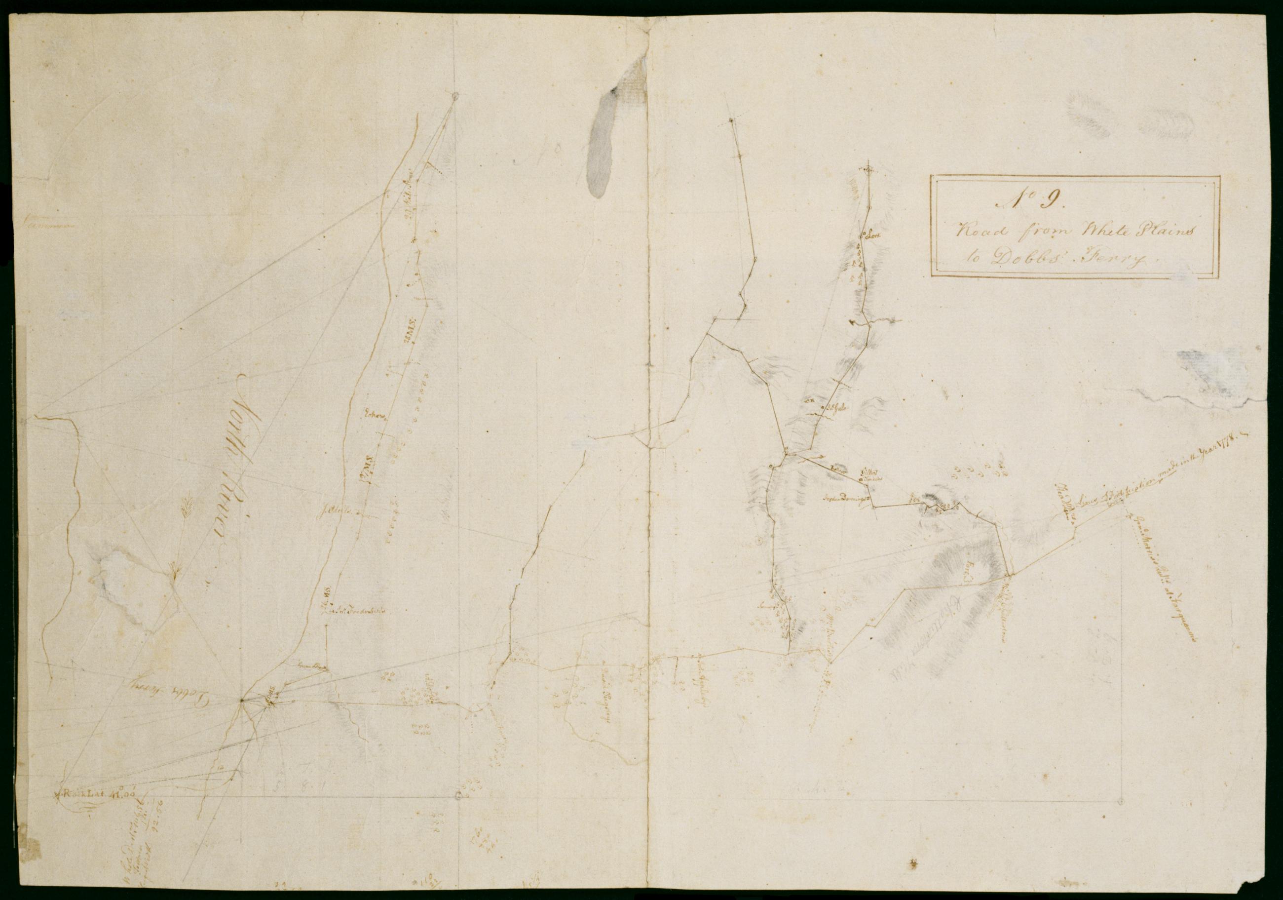
Cartographic Road from White Plains to Dobbs' Ferry. No 9 / by Robert Erskine F.R.S. Geogr. A. U.S. and Assistants ; F.R.S. & G.H.E.G.W & A.U.S W. Scull M.A.P.S. & A G H E G W & A U S Member of the American [P]hilosop[ical Society] & Assistant Geographer to his Exc[el In faint pencil on verso: "Capt Sc ..." The remainder of this text was lost in cropping. In ink on verso: "No. 9--". Includes text: "Lines of Fortification made in the year 1778," "Genl. Morriss Qutrs. at Farguoner's." Military topographic map. Covers an area in southern Westchester County, New York. Shows roads running through Tarrytown, Irvington, Abbotsford, Dobbs Ferry, Ardsley, Elmsford, Harts Corners and White Plains. Also show buildings and owners' names; landforms and streams. View Item
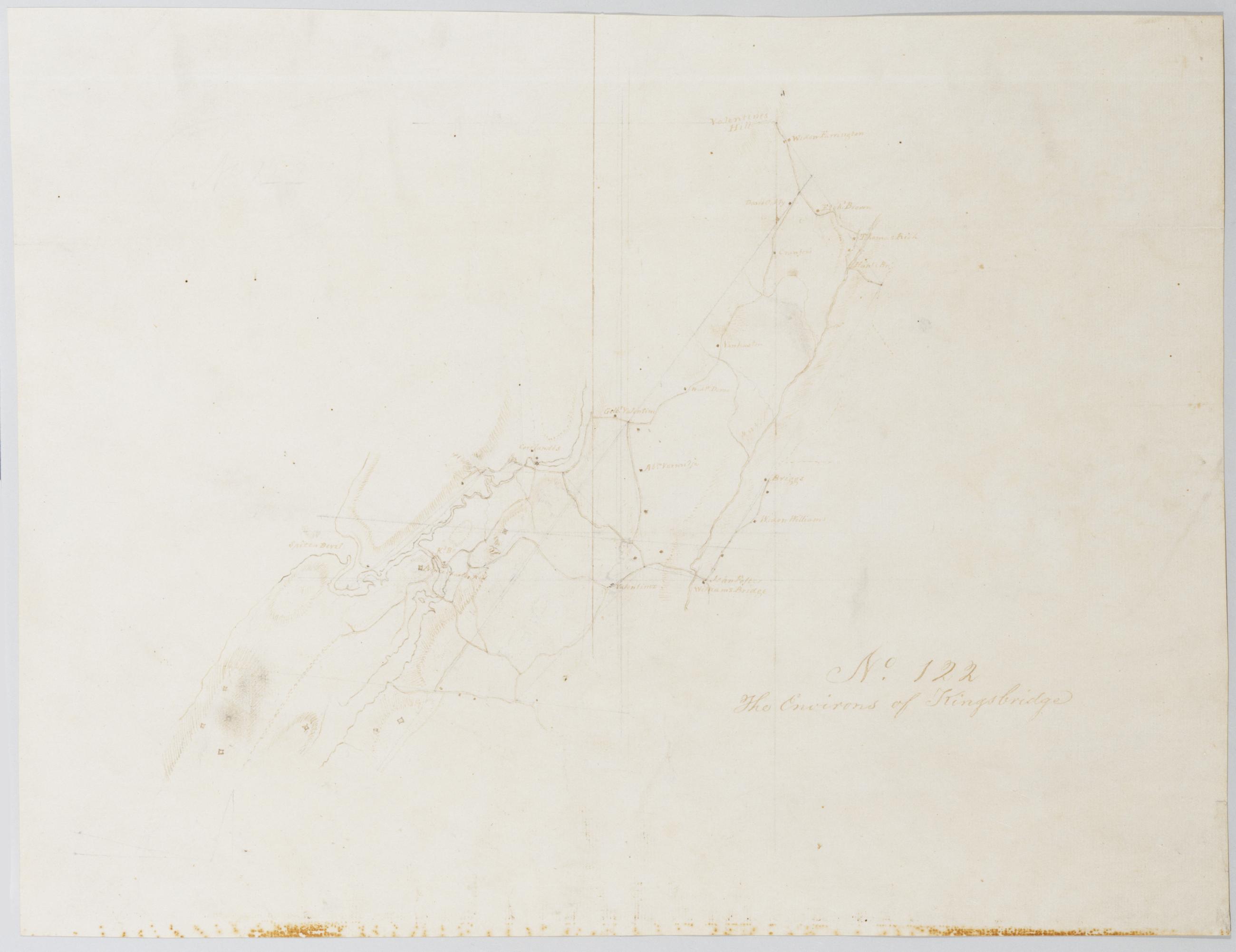
Cartographic The Environs of Kingsbridge. No. 122 / by Robert Erskine F.R.S. Geogr. A. U.S. and Assistants. Foxed, strongly stained, creased and abraded. Mounted on cloth, bound and cropped, disbound and silked by subsequent owners. Cleaned after removal of backings 1999; some fill remains. Sheathed in mylar. In pencil on recto: "No 122". Military topographic map. Covers an area now within New York City and Yonkers, New York. Shows buildings and owners' names, landforms and streams. Pen-and-ink, pencil on laid paper. Shows relief by hachures. Title proper from recto and pencilled title on verso the work of editors subsequent to 1820. View Item
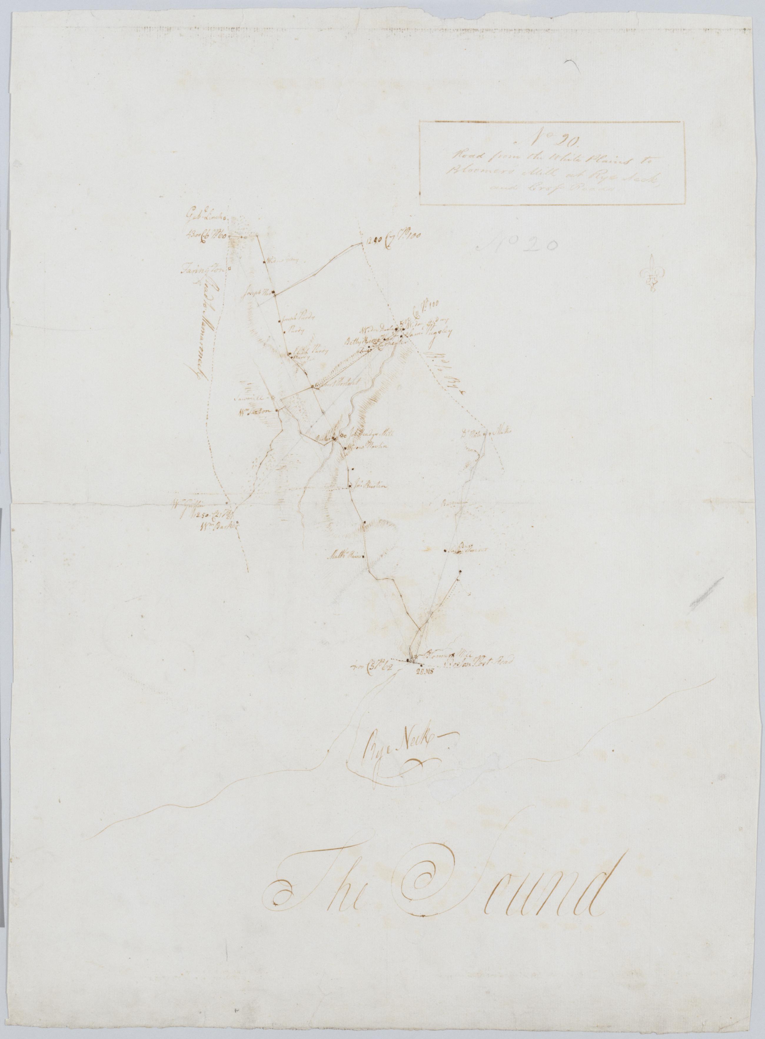
Cartographic Road from the White Plains to Bloomer's Mill at Rye Neck, and Cross Roads. No 20 / by Robert Erskine F.R.S. Geogr. A. U.S. and Assistants. Foxed, creased, frayed, and abraded. Mounted on cloth, bound and cropped, disbound and silked by subsequent owners. Cleaned after removal of backings 1999; some fill remains. Sheathed in mylar. In pencil on recto: "No 20". Military topographic map. Covers the southeastern corner of Westchester County, New York. Shows roads running through Mamaronek, Rye and White Plains. Also shows buildings and owners' names, landforms and streams. Pen-and-ink, pencil on laid paper. Scale roughly estimated. Shows relief by hachures. View Item
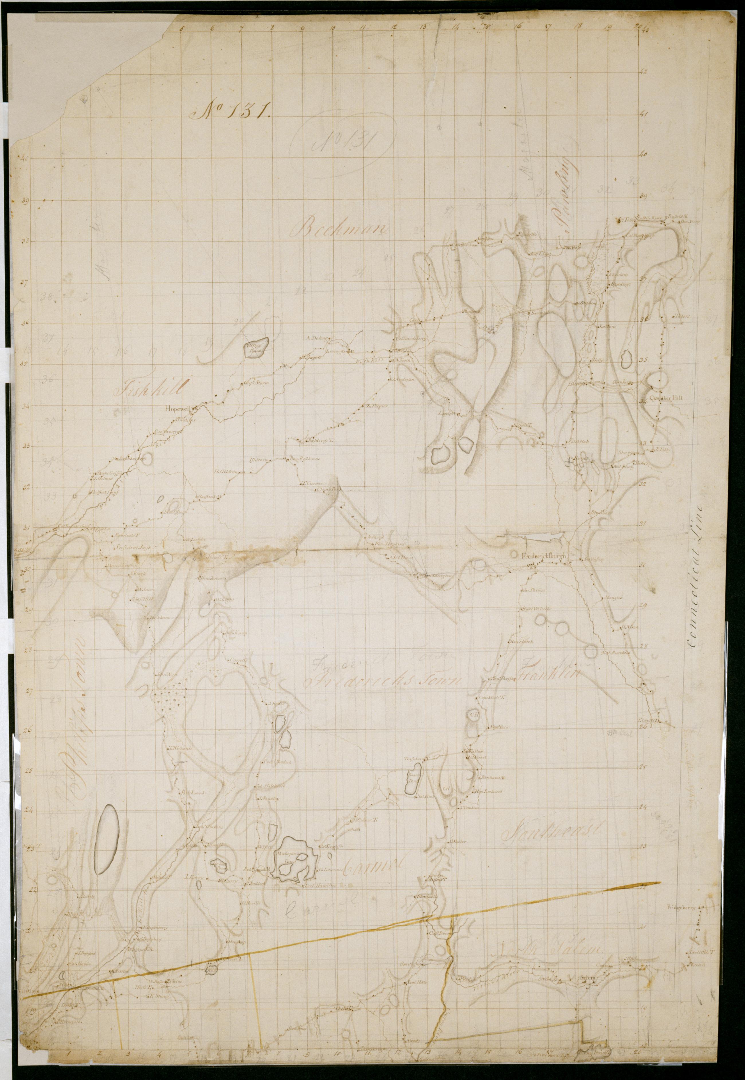
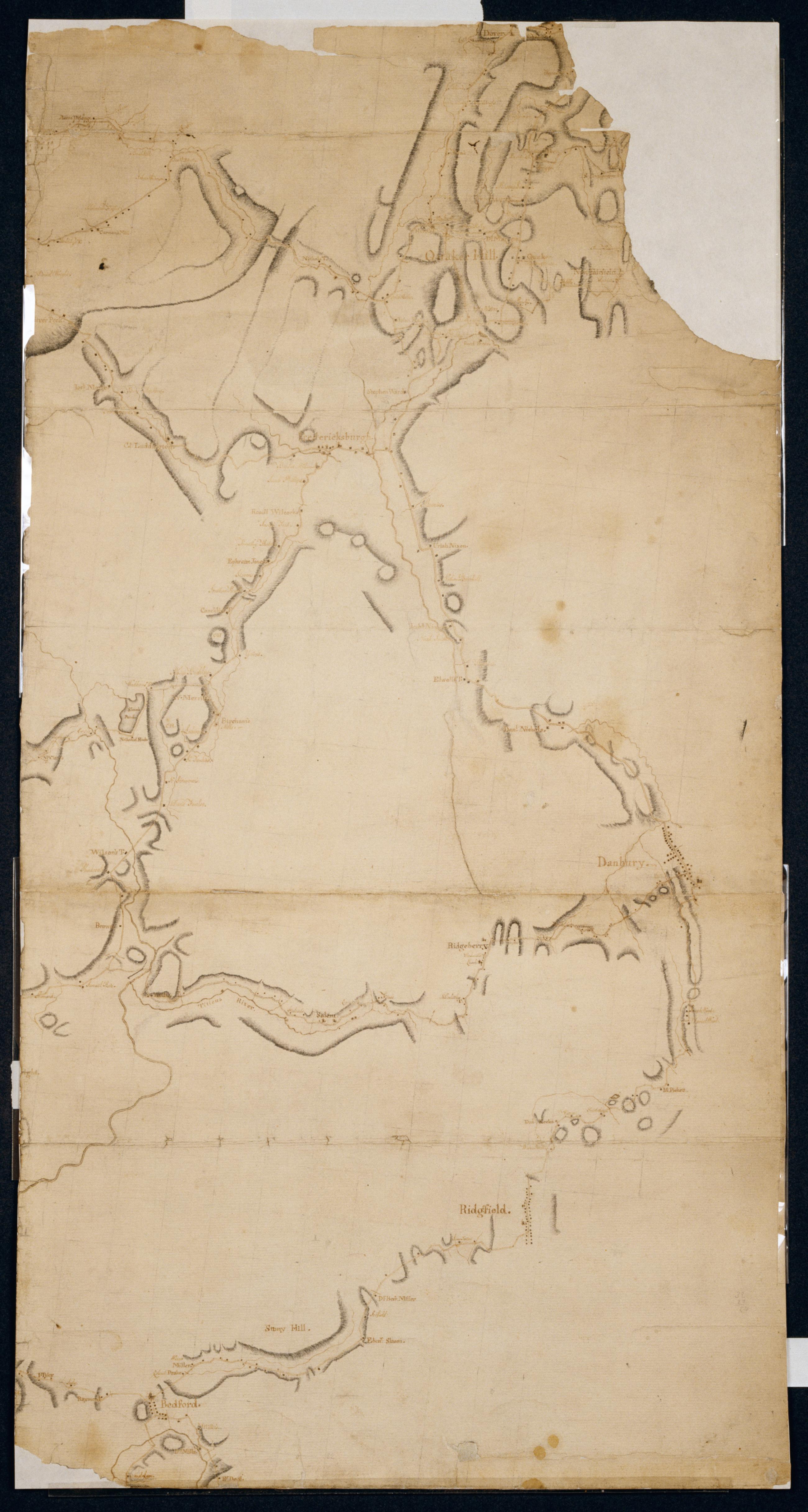
Cartographic [Map of roads in the area bounded by Peekskill and Fishkill (N.Y.), Quaker Hill and Ridgeberry (Conn.)] No 131 Attributed to Eskine by cataloger. Date based on attribution to Erskine. In pencil on recto: "No 131". Military topographic map. Covers the towns of Dover, Pawling, Beekman and East Fishkill in Dutchess County; of Phillipstown, Putnam Valley, Kent, Carmel, South East and Patterson in Putnam County; and of North Salem, Somers, Yorktown and Cortlandt in Westchester County, New York; also the town of Ridgefield in Fairfield County, Connecticut. Map shows buildings and owners' names, landforms and streams. Pen-and-ink, pencil on laid paper. Watercolor for some township boundary lines. View Item
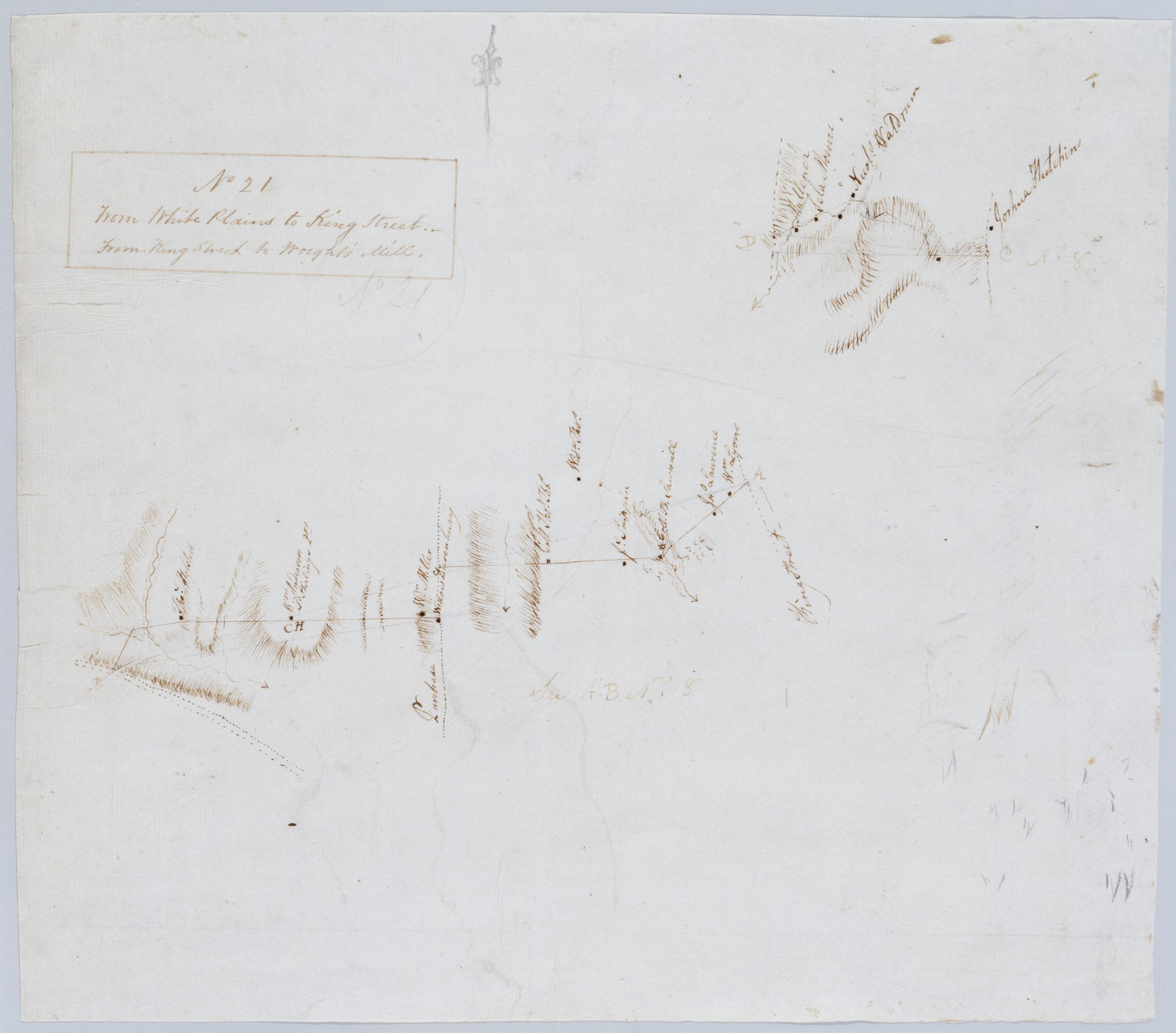
Cartographic From White Plains to King Street., From King Street to Wright's Mill. No 21 / by Robert Erskine F.R.S. Geogr. A. U.S. and Assistants. Coordinates given above concern the larger map. Foxed, creased, frayed, and abraded. Mounted on cloth, bound and cropped, disbound and silked by subsequent owners. Cleaned after removal of backings 1999; some fill remains. Sheathed in mylar. In ink on verso: "No 21". Includes text: "See AB No. 8". Military topographic maps. The larger one covers the towns of North Castle and Harrison in Westchester County, New York; it shows roads running from White Plains through Purchase; King Street runs along the modern border between New York and Connecticut. The smaller map has not been identified. View Item
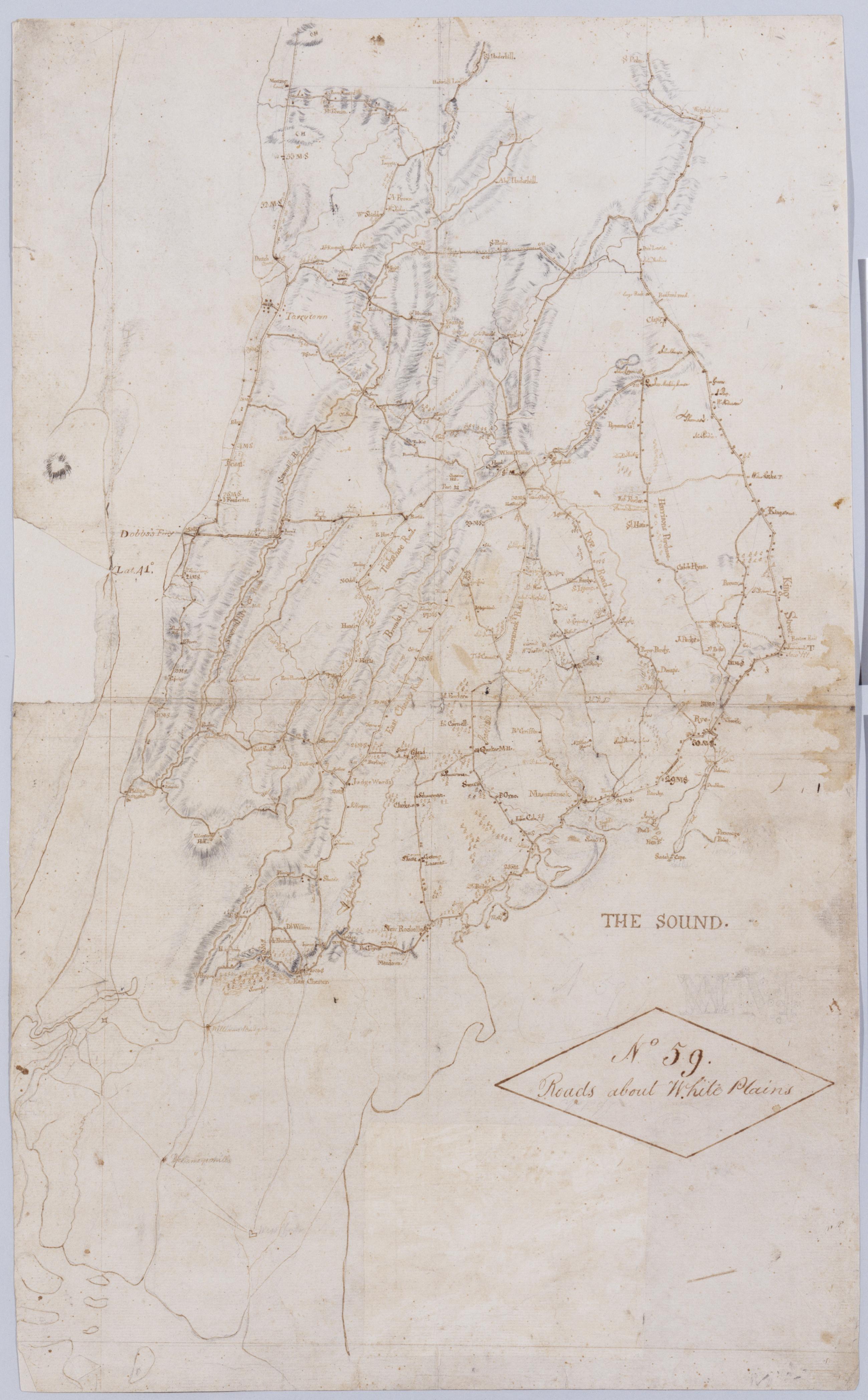
Cartographic Roads about White Plains. No 59 / by Robert Erskine F.R.S. Geogr. A. U.S. and Assistants. A variant of the title given by Guthorn: appears on map No. 120 of the series which, as soiling shows, was once pasted above the lower margin of this map, no. 59. In ink on verso: "No. 59 Joined to No. 25. 32 & 60." There is no evidence that these sheets were ever physically joined, although nos. 25 and 32 do cover adjacent areas. (Map no. 25 is missing.) No. 60 is a copy of this map, no. 59. Military topographic map. Covers most of Westchester County, New York and western Fairfield County, Connecticut; also covers northern New York City. View Item
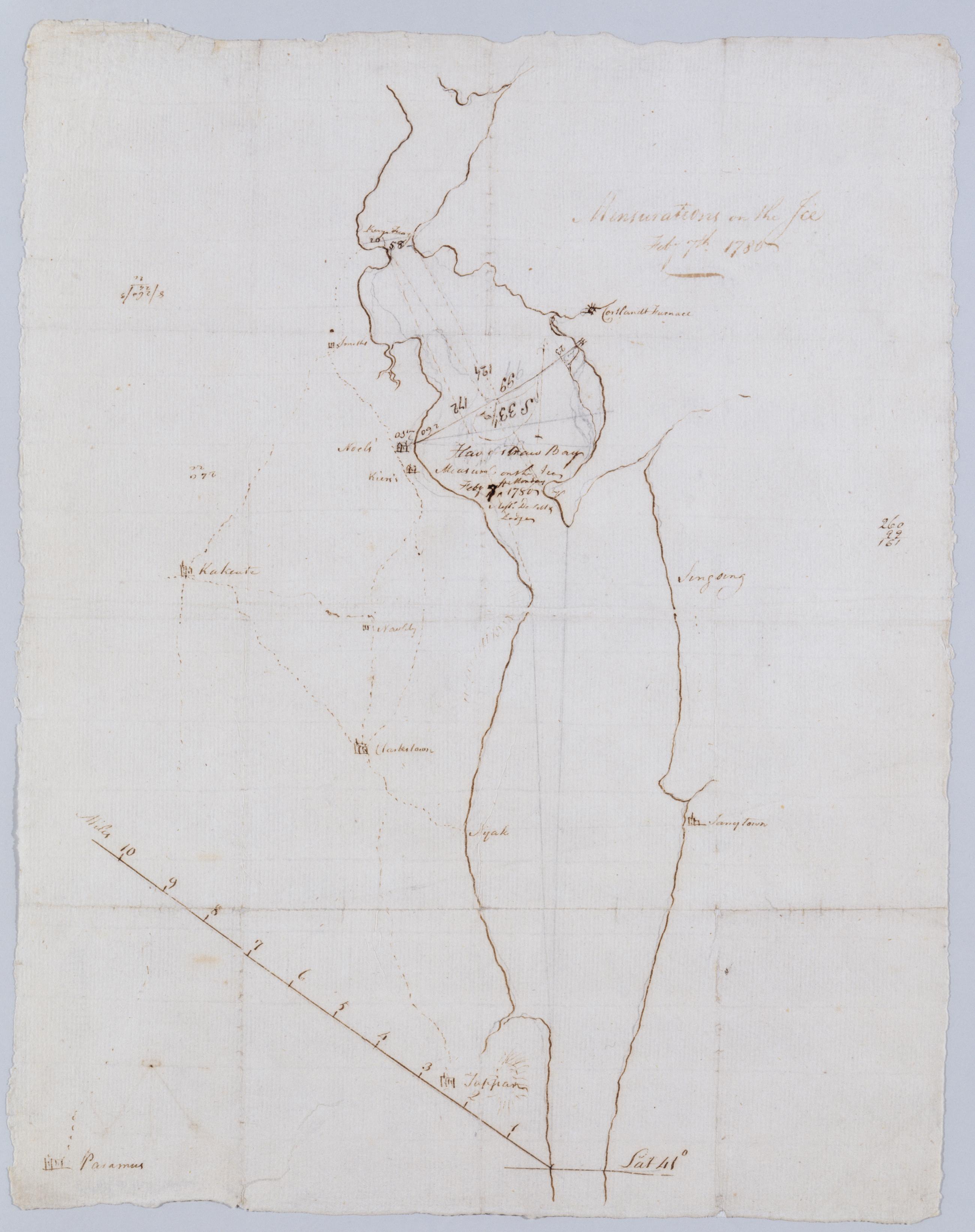
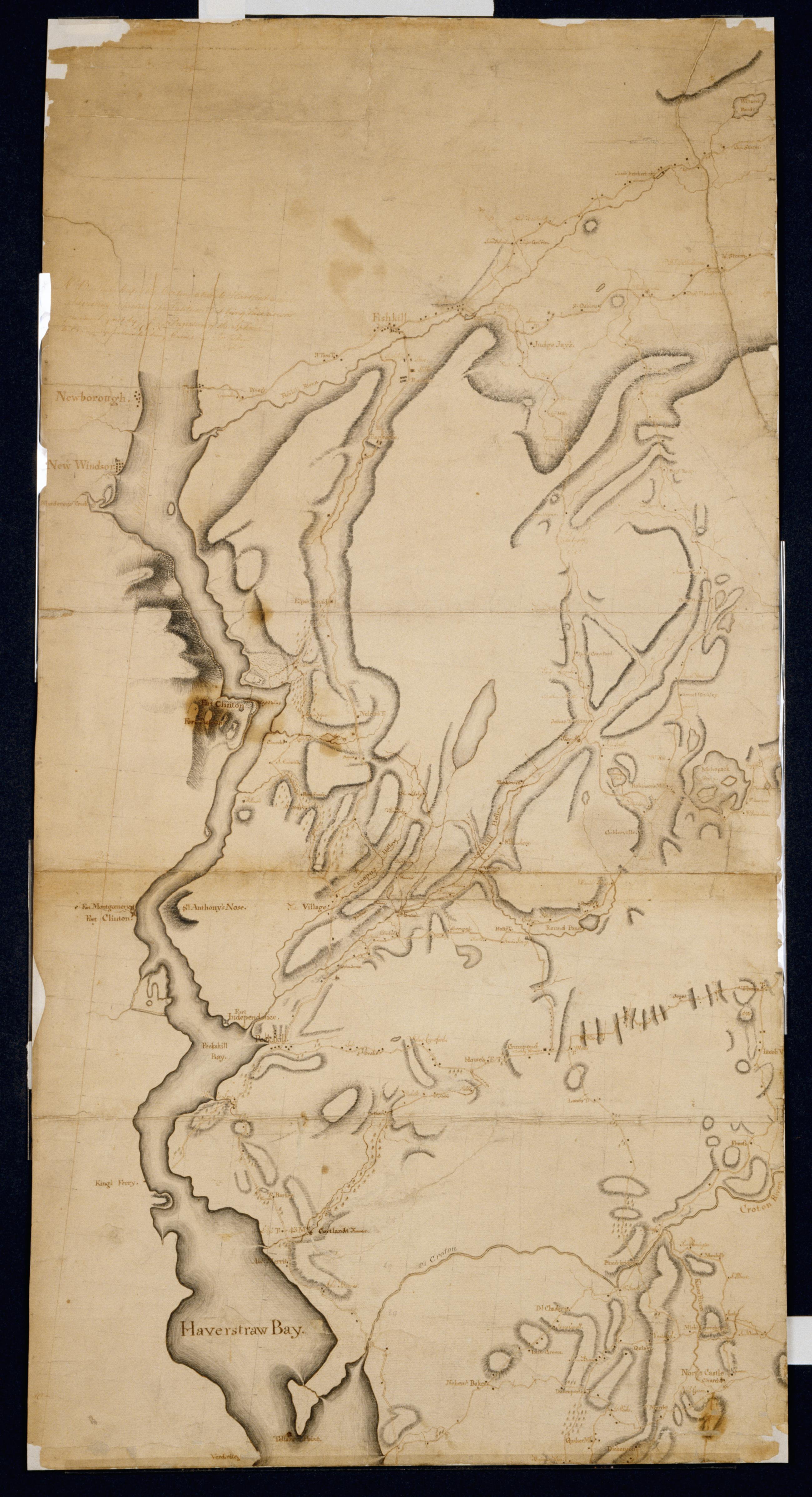
Cartographic Mensurations on the Ice : Feby 7th 1780. Includes text: "Measured on the Ice Feby. 7th Monday 1780 by [...] De[Witt] & Lodge". Both these men served under Erskine. Military topographic map. Covers the counties of Rockland and Westchester in New York. Shows dimensions of that widening of the Hudson River called "Haverstraw Bay." Also shows some roads. Pen-and-ink, pencil on laid paper. Soiled, foxed, creased, frayed and abraded. Sheathed in mylar. Watermark: none. References: Guthorn, Peter J. American maps and map makers of the revolution, p. 18. View Item
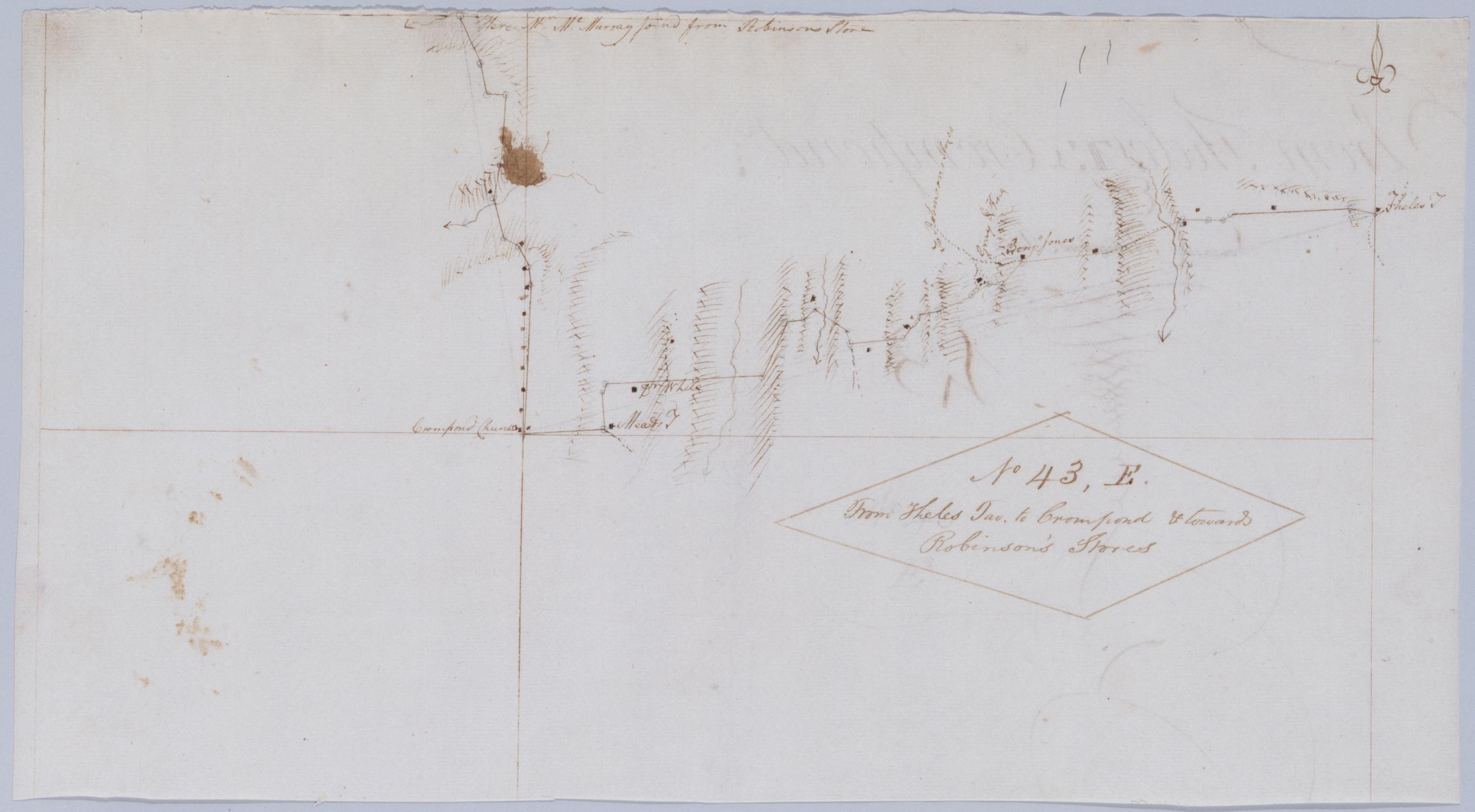
Cartographic From Theles Tav. to Crompond & towards Robinson's Stores. No 43, E / by Robert Erskine F.R.S. Geogr. A. U.S. and Assistants. Foxed, creased, frayed, and abraded. Mounted on cloth, bound and cropped, disbound and silked by subsequent owners. Cleaned after removal of backings 1999; some fill remains. Sheathed in mylar. Includes text: "Here Mr. McMurray joind from Robinsons Store". Military topographic map. Covers the townships of Somers and Yorktown in Westchester County, New York. Shows roads running through Somers Center, West Somers and Yorktown. Also shows buildings and owners' names, landforms and streams. Pen-and-ink, pencil on laid paper. Shows relief by hachures. View Item
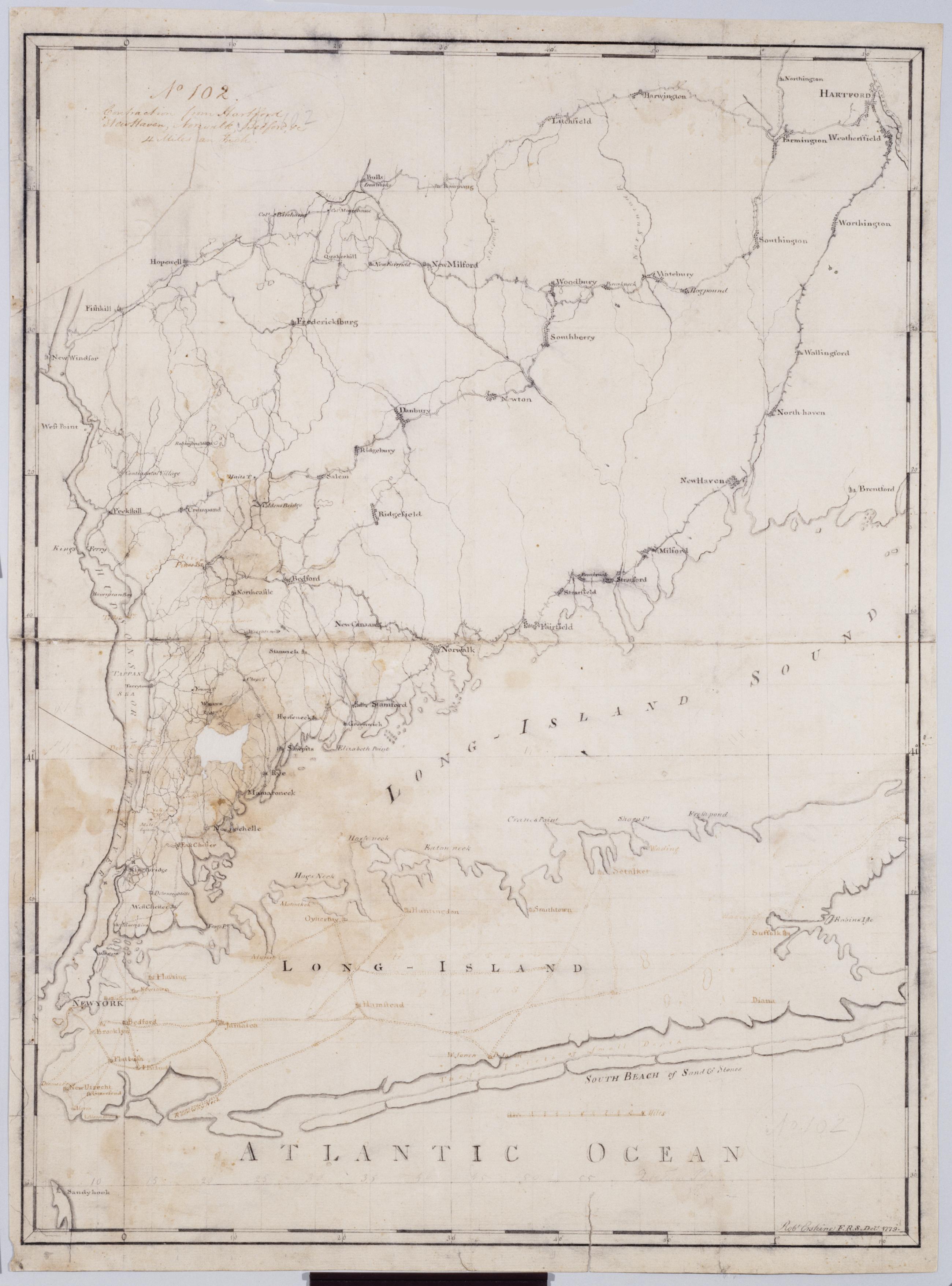
Cartographic Contraction from Hartford New Haven, Norwalk, Bedford +c. No 102 / Robt Erskine F.R.S. Delt. 1779 ; by RE ; by Robert Erskine F.R.S. Geogr. A. U.S. and Assistants. Imperfect: lacking 2 x 3 cm. at left center. In ink on verso: "No. 102". In pencil on recto: "No 102". Military topographic map. Covers Westchester, Putnam, Nassau and Suffolk counties in New York, and also New York City; and Fairfield, Litchfield, New Haven and Hartford Counties in Connecticut. Pen-and-ink, pencil on laid paper. Planar projection. Soiled, stained, mildewed creased, frayed and abraded. Mounted on cloth, bound, disbound and silked by subsequent owners. Cleaned after removal of backings 1999; relined with China paper. Sheathed in mylar. View Item
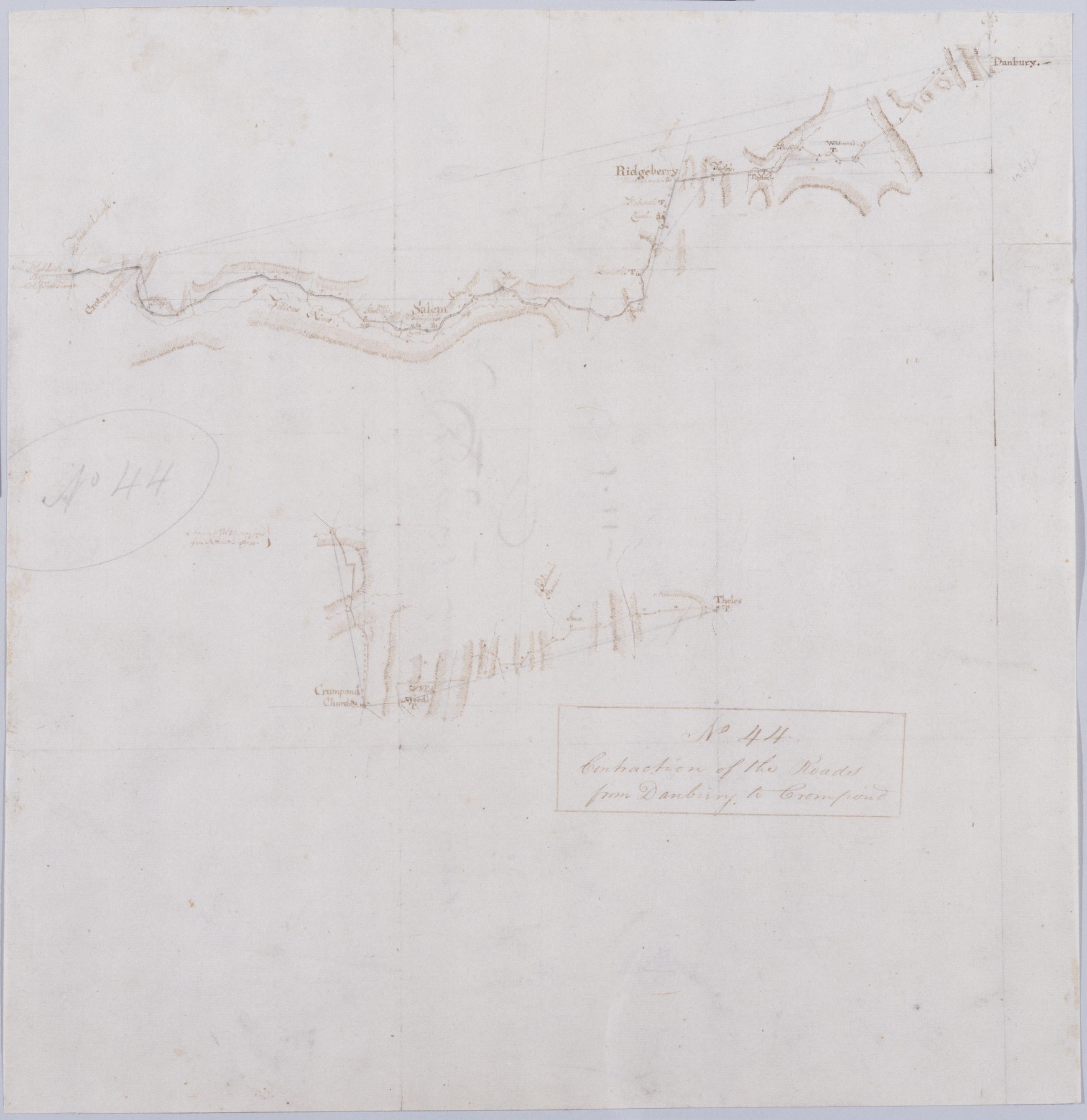
Cartographic Contraction of the Roads from Danbury to Crompond. No 44 / by Robert Erskine F.R.S. Geogr. A. U.S. and Assistants. Foxed, creased, frayed, and abraded. Razorcut along roads for copying. Mounted on cloth, bound and cropped, disbound and silked by subsequent owners. Cleaned after removal of backings 1999; some fill remains. Sheathed in mylar. In pencil on recto: "No 44". Military topographic map; lower segment lies to west of upper segment. Map covers the towns of Ridgefield and Bethel in Fairfield County, Connecticut, and of Yorktown, Somers and North Salem in Westchester County, New York. View Item
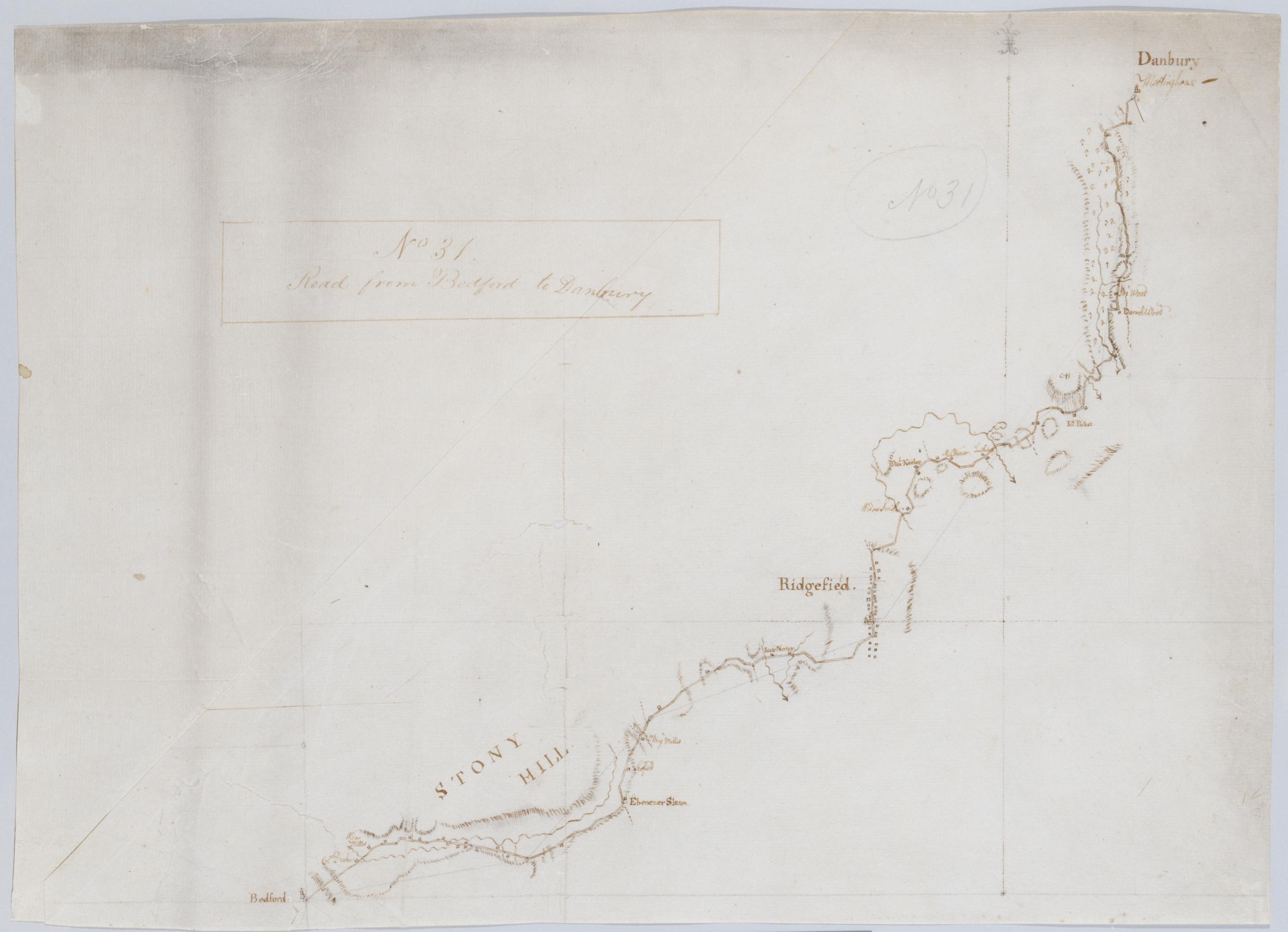
Cartographic Road from Bedford to Danbury. No 31 / by Robert Erskine F.R.S. Geogr. A. U.S. and Assistants. Foxed, creased, frayed, and abraded. Mounted on cloth, bound and cropped, disbound and silked by subsequent owners. Cleaned after removal of backings 1999; some fill remains. Sheathed in mylar. In pencil on recto: "No 31". Military topographic map. Covers the towns of Bedford, Poundridge and Lewisboro in Westchester County, New York and the towns of Bethel and Ridgefield in Fairfield County, Connecticut. Map shows roads running through Danbury, Ridgefield and Bedford. Also shows buildings and owners' names, landforms and streams. Pen-and-ink, pencil on laid paper. View Item
Cartographic Cross-road above Dobbs Ferry from Post Road to Saw-mill Rd. No 16 / by Robert Erskine F.R.S. Geogr. A. U.S. and Assistants. Foxed, creased, soiled and abraded. Mounted on cloth, bound and cropped, disbound and silked by subsequent owners. Cleaned after removal of backings 1999; some fill remains. Sheathed in mylar. In pencil on recto: "No 16." In ink on verso: "N. 16". Includes text: "Ends at Road below the 28 mile stone in No. 9". Military topographic map. Covers the town of Greenburg, Westchester County, New York. Shows roads running through Dublin (modern Irvington) as well as Dobbs Ferry. Also shows buildings and owners' names, landforms and streams. Pen-and-ink, pencil on laid paper. Shows relief by hachures. View Item
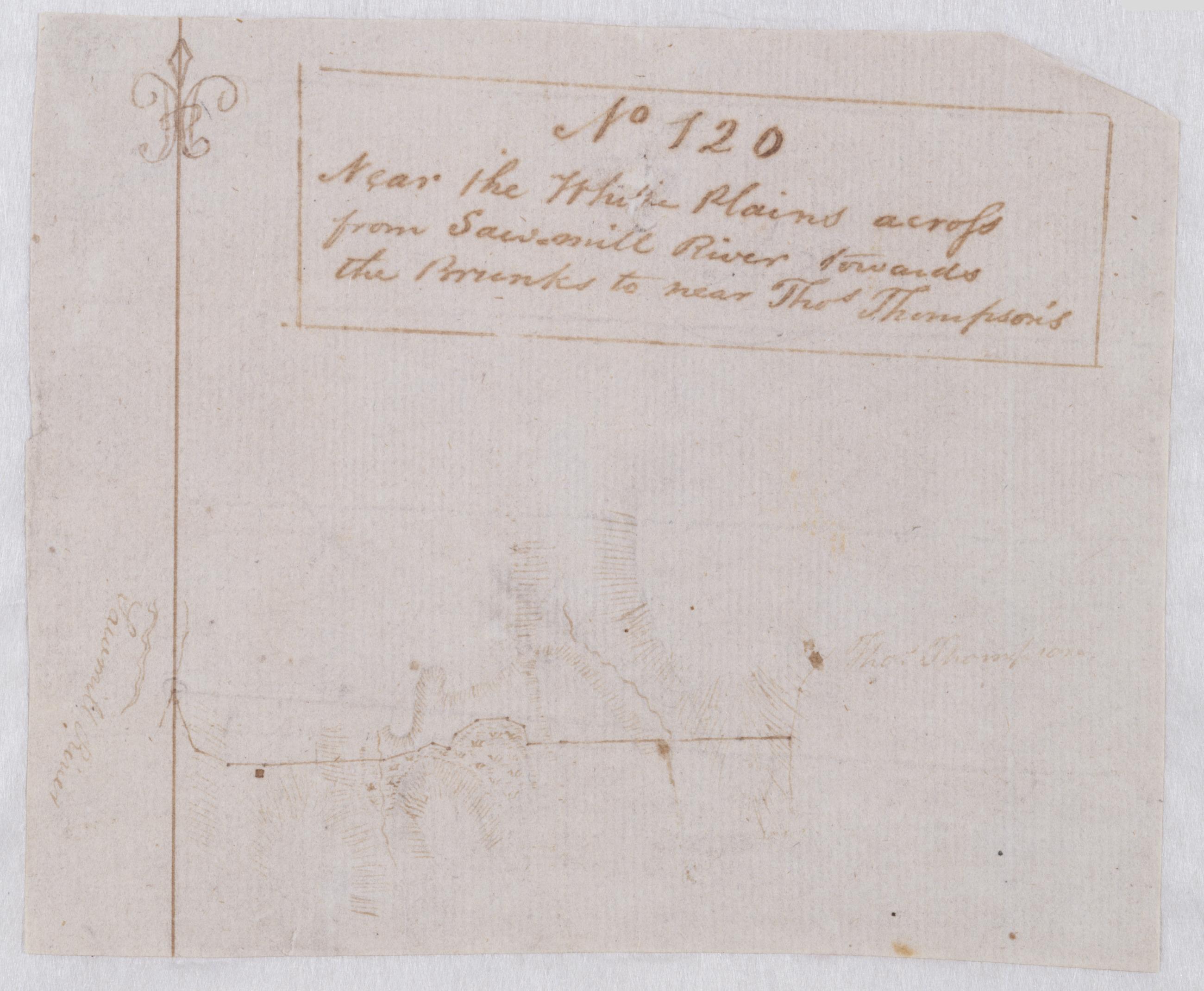
Cartographic Near the White Plains across from Sawmill River towards the Brunks to near Thos. Thompson's. No 120 / by Robert Erskine F.R.S. Geogr. A. U.S. and Assistants. Foxed and severely abraded. Cropped. For a time pasted above the lower margin of map No. 59 in series. Cleaned after removal of backings 1999; some fill remains. Sheathed in mylar. Military topographic map covering an area in Westchester County, New York. Probably the road shown as a dotted line on the map titled "A Draught of the Ground between the White Plains and Kingsbridge." This map shows buildings, landforms and streams. Pen-and-ink, pencil on laid paper. Shows relief by hachures. Title proper from recto is the work of a later editor--Simeon DeWitt or his assign--subsequent to 1820. View Item
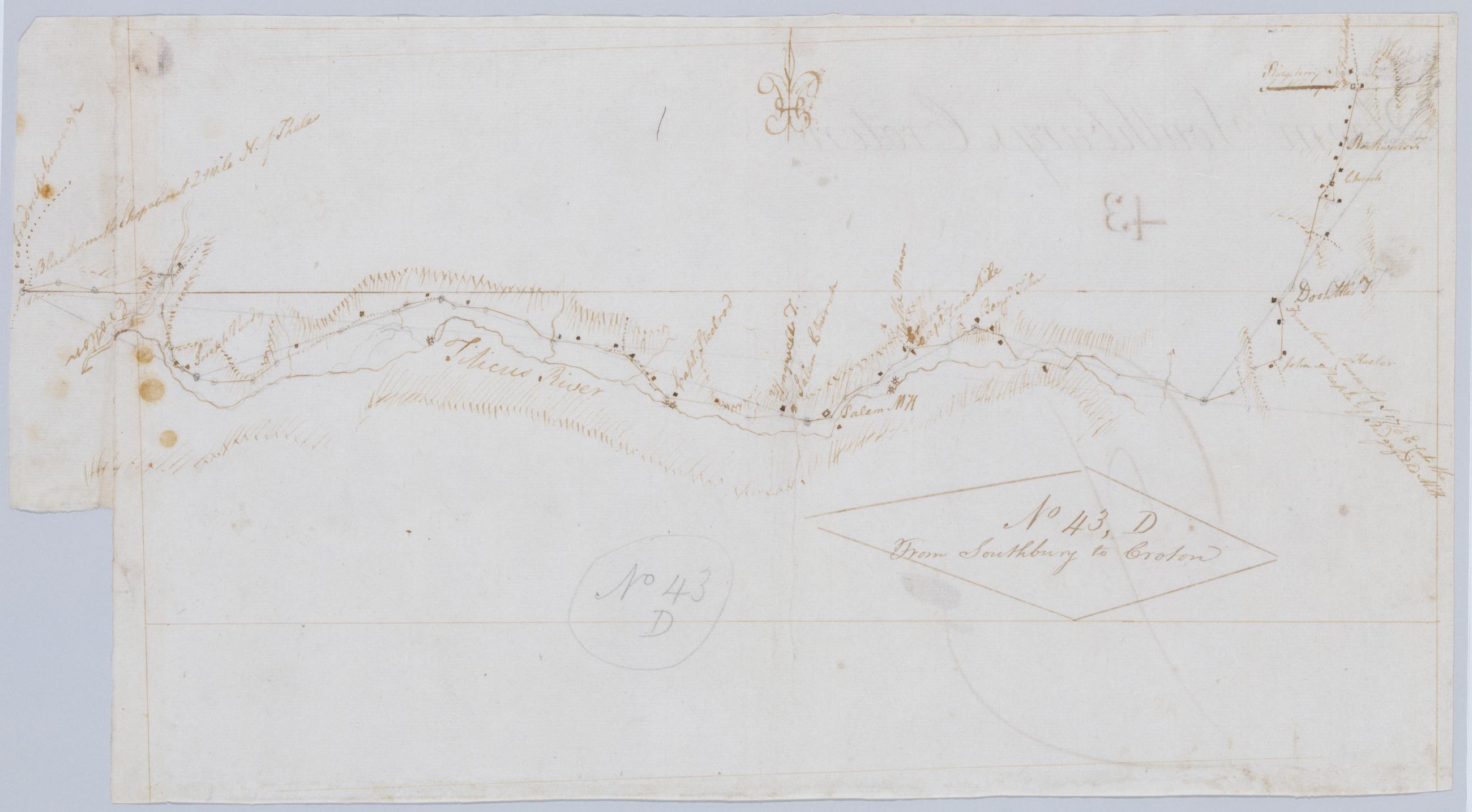
Cartographic From Southbury to Croton. No 43, D / by Robert Erskine F.R.S. Geogr. A. U.S. and Assistants. Foxed, creased, frayed, and abraded. Mounted on cloth, bound and cropped, disbound and silked by subsequent owners. Cleaned after removal of backings 1999; some fill remains. Sheathed in mylar. In pencil on recto: "No 43 D". Military topographic map. Covers the townships of North Salem and Somers in Westchester County, New York, and of Ridgefield in Fairfield County, Connecticut. Shows roads running through Ridgebury, North Salem, Salem Center, Purdy and Somers. Also shows buildings and owners' names, landforms and streams. Pen-and-ink, pencil on laid paper. Shows relief by hachures. View Item
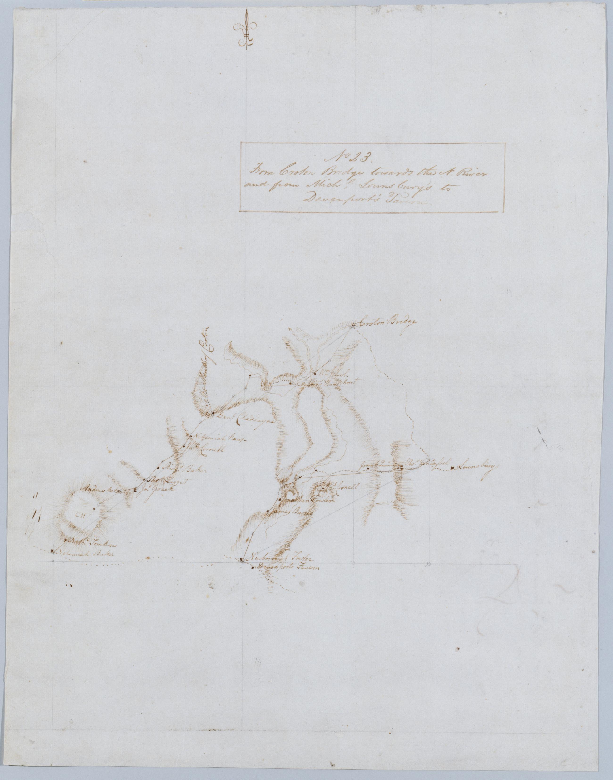
Cartographic From Croton Bridge towards the N. River and from Michl. Lounsbury's to Devenport's Tavern. No 23 / by Robert Erskine F.R.S. Geogr. A. U.S. and Assistants. Foxed, creased and abraded. Mounted on cloth, bound and cropped, disbound and silked by subsequent owners. Cleaned after removal of backings 1999; some fill remains. Sheathed in mylar. In ink on verso: "No 23". Military topographic map. Covers the towns of Yorktown and Newcastle in Westchester County, New York. Map shows roads running through Kitchawan, Pine Bridge and Tompkins Corners. Also shows buildings and owners' names, landforms and streams. Pen-and-ink, pencil on laid paper. Shows relief by hachures. View Item
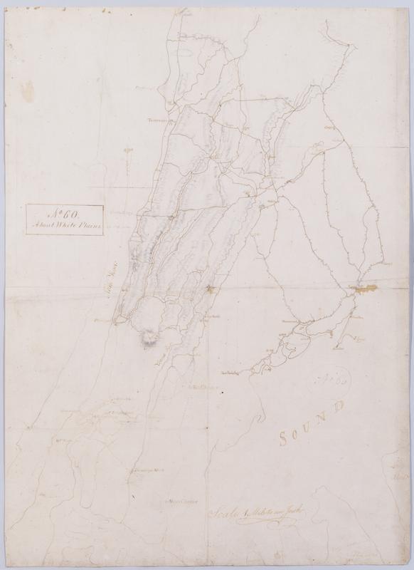
Cartographic About White Plains. No 60 / by Robert Erskine F.R.S. Geogr. A. U.S. and Assistants. In ink on recto: geometrical sketches, "No. 60". In pencil on recto: "No 60". Military topographic map. Covers most of Westchester County, New York and western Fairfield County, Connecticut; also covers northern New York City. Shows roads, buildings and owners' names, also landforms and streams. Pen-and-ink, pencil on laid paper. Shows relief by hachures. Stained, soiled, foxed, creased, frayed and abraded. Mounted on cloth, bound and cropped, disbound and silked by subsequent owners. Cleaned after removal of backings 1999; some fill remains. Sheathed in mylar. View Item
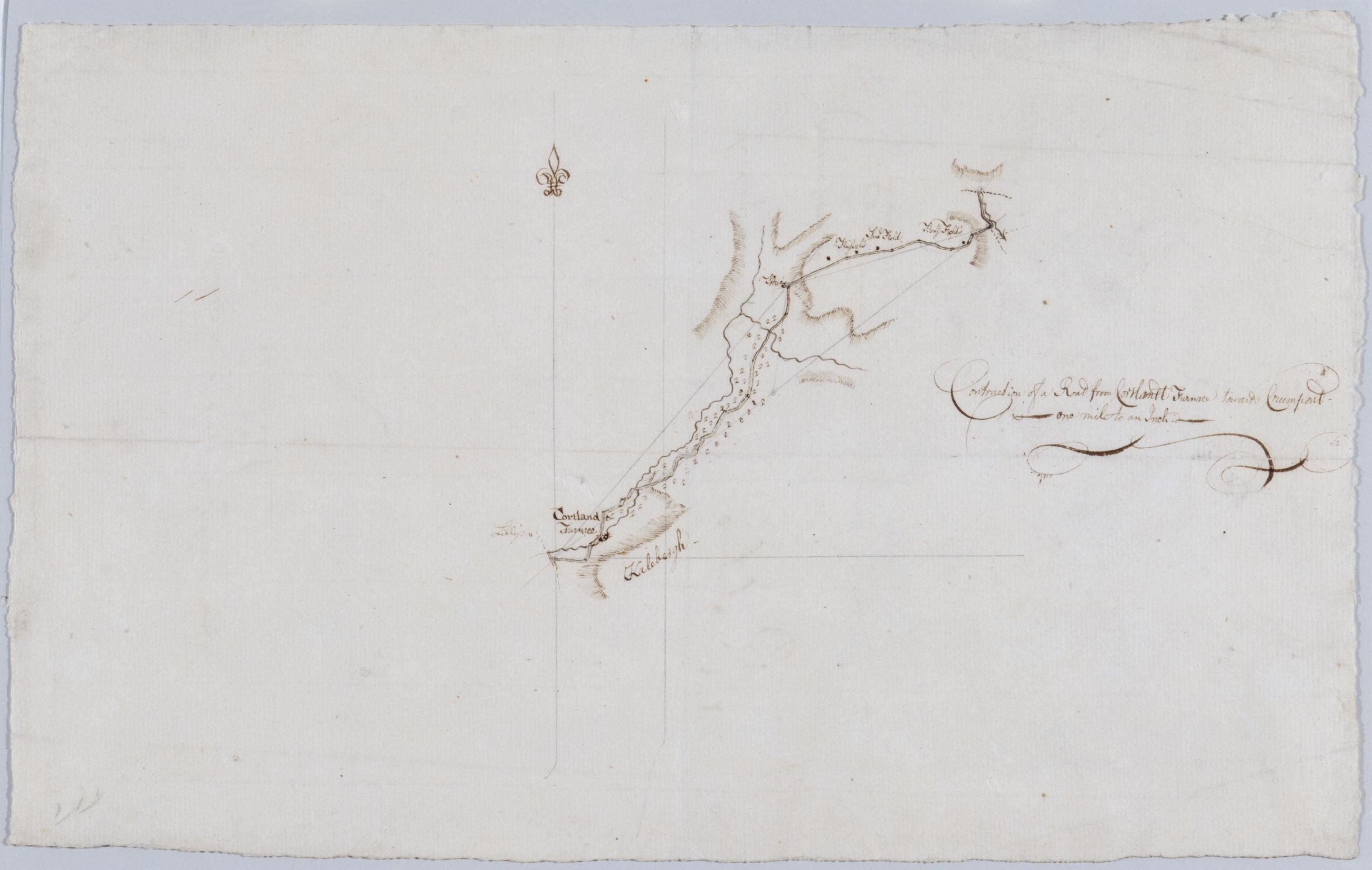
Cartographic Contraction of a Road from Cortlandt Furnace towards Crumpont / by Robert Erskine F.R.S. Geogr. A. U.S. and Assistants. Title as given by Guthorn: Contraction of a Road from Cortlandt Furnace towards Crum pond. Foxed, creased and abraded. Mounted on cloth, bound, disbound and silked by subsequent owners. Cleaned after removal of backings 1999; some fill remains. Sheathed in mylar. In ink on verso: "Belonging to No. 1" repeated twice; also "E" once. In pencil: "Should be attached to Map in DeWitt [Atlas]". Military topographic map. Covers an area SE of Peekskill, in the towns of Cortlandt and Yorktown, Westchester County, on the east bank of the Hudson River. View Item
Cartographic Cross Roads to East Chester, and above. No 19 / by Robert Erskine F.R.S. Geogr. A. U.S. and Assistants. Foxed, creased, frayed, and abraded. Mounted on cloth, bound and cropped, disbound and silked by subsequent owners. Cleaned after removal of backings 1999; some fill remains. Sheathed in mylar. In ink on verso: "No. 19". Military topographic map. Covers southern Westchester County and the Bronx, New York. Shows roads running through East Chester in the Bronx, New Rochelle, Larchmont and Mamaronek; also Tuckahoe and Scarsdale. Also shows buildings and owners' names, landforms and streams. Pen-and-ink, pencil on laid paper. Scale roughly estimated. Shows relief by hachures. View Item
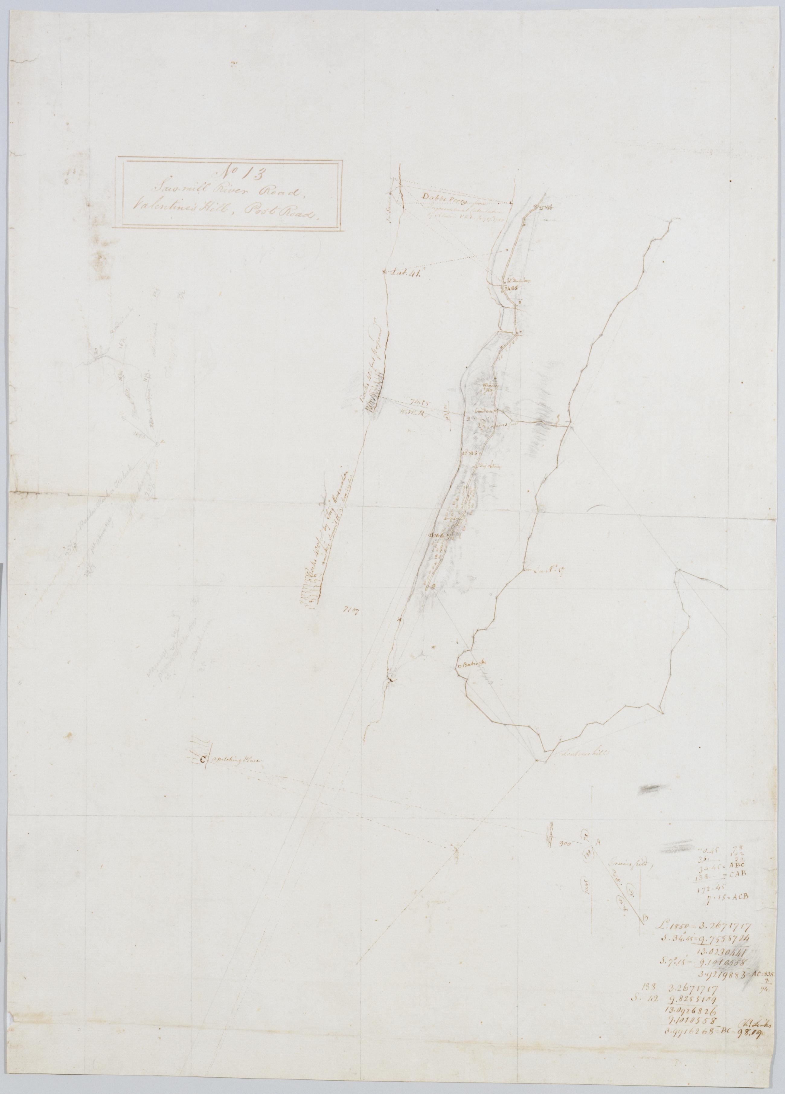
Cartographic Saw-mill River Road, Valentine's Hill, Post Road. No 13 / by Robert Erskine F.R.S. Geogr. A. U.S. and Assistants Foxed, mildewed, creased, frayed, and abraded. Mounted on cloth, bound and cropped, disbound and silked by subsequent owners. Cleaned after removal of backings 1999; some fill remains. Sheathed in mylar. Military topographic map. Covers Yonkers and the town of Greenburg in Westchester County, New York. Shows roads running through Dobbs Ferry, Hastings-on Hudson and Yonkers in the east, and Ardsley, Primrose, Nepera Park, Dunwoodie, Bronxville and Tuckahoe on the west. Also shows buildings and owners' names; landforms and streams. Pen-and-ink, pencil on laid paper. Shows relief by hachures. View Item
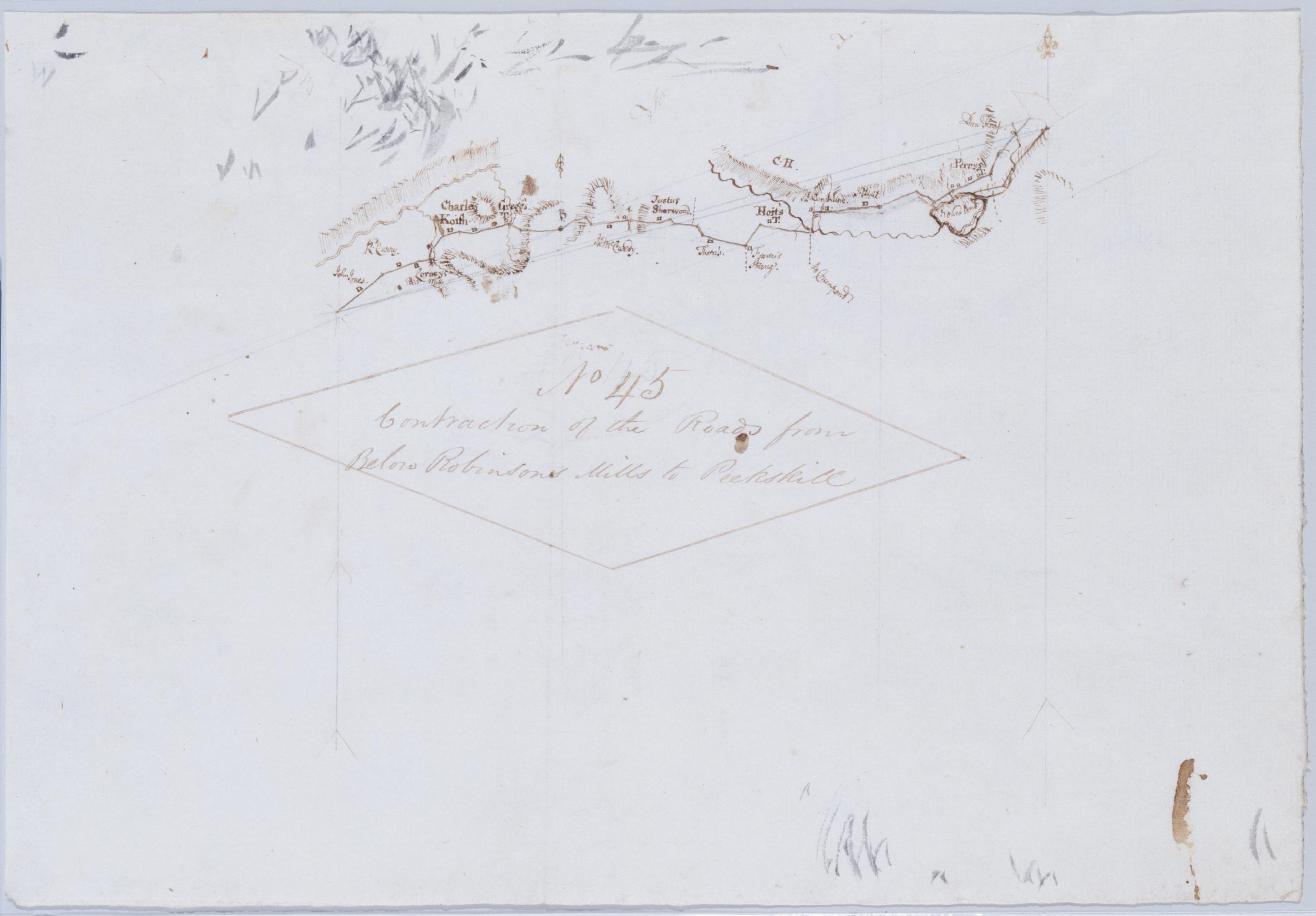
Cartographic Contraction of the Roads from Below Robinsons Mills to Peekskill. No 45 / by Robert Erskine F.R.S. Geogr. A. U.S. and Assistants. Foxed, creased, frayed, and abraded. Razorcuts and pinpricks for copying. Mounted on cloth, bound and cropped, disbound and silked by subsequent owners. Cleaned after removal of backings 1999; some fill remains. Sheathed in mylar. Military topographic map. Covers an area within the towns of Cortlandt and Yorktown, Westchester County, New York. Shows roads running through Jefferson Valley, Shrub Oak and Cortlandville. Also shows buildings and owners' names, landforms and streams. Pen-and-ink, pencil on laid paper. Shows relief by hachures. View Item
Cartographic Projections for Closing, and trying the meeting of Surveys. No 99, D / Large paper by Capt. Scull ; by Robert Erskine F.R.S. Geogr. A. U.S. and Assistants. In ink on verso: "No. 99 D". In pencil on recto: "No 99 D". Military topographic map; an early draft. Covers Dutchess, Orange, Putnam, Rockland and Westchester counties in New York. Pen-and-ink, pencil on laid paper. Soiled, creased and abraded. Mounted on cloth, bound and cropped, disbound and silked by subsequent owners. Cleaned after removal of backings 1999; some fill remains. Sheathed in mylar. Title proper from recto is the work of a later editor--Simeon DeWitt or his assign--subsequent to 1820. View Item
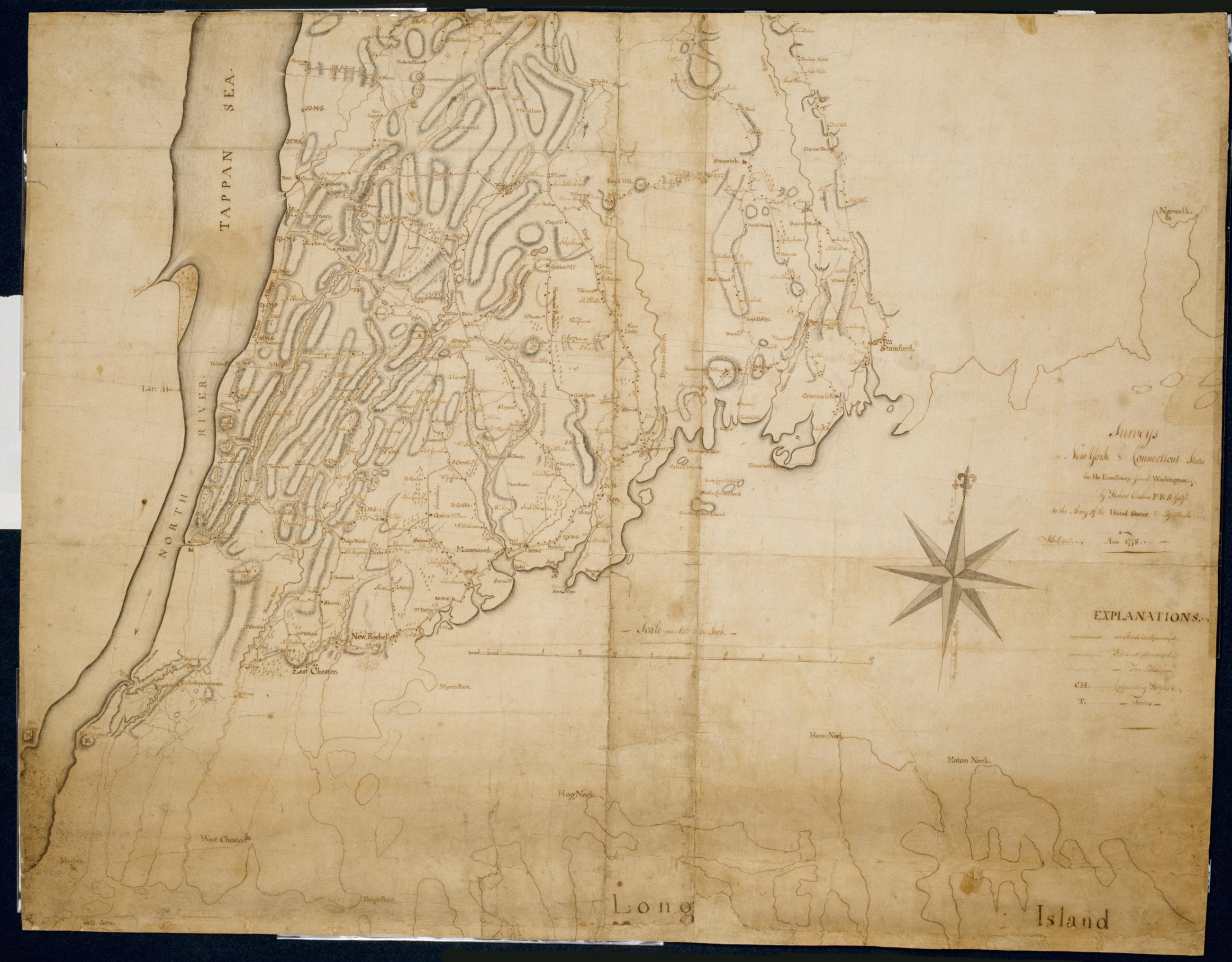
Cartographic Surveys in New York & Connecticut States for His Excellency General Washington : Anno 1778 by Robert Erskine F.R.S. Geogr: to the Army of the United States & Assistants ; W Scull delint., first fragment Has projection grid in faint pencil. Imperfect: lacks 19 x 12 at upper right corner and 3 x 8 cm. at center. Minor losses along frayed top and left edge. Military topographic map; not listed in Heusser nor Guthorn. Covers the counties of Fairfield in Connecticut and of Dutchess, Putnam and Westchester in New York; New York City and the northern shore of Long Island are also shown, but with less detail. Shows some buildings and owners' names, landforms and streams. Pen-and-ink, pencil on laid paper. View Item
Cartographic Surveys in New York & Connecticut States for His Excellency General Washington : Anno 1778 by Robert Erskine F.R.S. Geogr: to the Army of the United States & Assistants ; W Scull delint., third fragment Has projection grid in faint pencil. Imperfect: lacks 19 x 12 at upper right corner and 3 x 8 cm. at center. Minor losses along frayed top and left edge. Military topographic map; not listed in Heusser nor Guthorn. Covers the counties of Fairfield in Connecticut and of Dutchess, Putnam and Westchester in New York; New York City and the northern shore of Long Island are also shown, but with less detail. Shows some buildings and owners' names, landforms and streams. Pen-and-ink, pencil on laid paper. View Item
Cartographic Surveys in New York & Connecticut States for His Excellency General Washington : Anno 1778 by Robert Erskine F.R.S. Geogr: to the Army of the United States & Assistants ; W Scull delint., second fragment Has projection grid in faint pencil. Imperfect: lacks 19 x 12 at upper right corner and 3 x 8 cm. at center. Minor losses along frayed top and left edge. Military topographic map; not listed in Heusser nor Guthorn. Covers the counties of Fairfield in Connecticut and of Dutchess, Putnam and Westchester in New York; New York City and the northern shore of Long Island are also shown, but with less detail. Shows some buildings and owners' names, landforms and streams. Pen-and-ink, pencil on laid paper. View Item
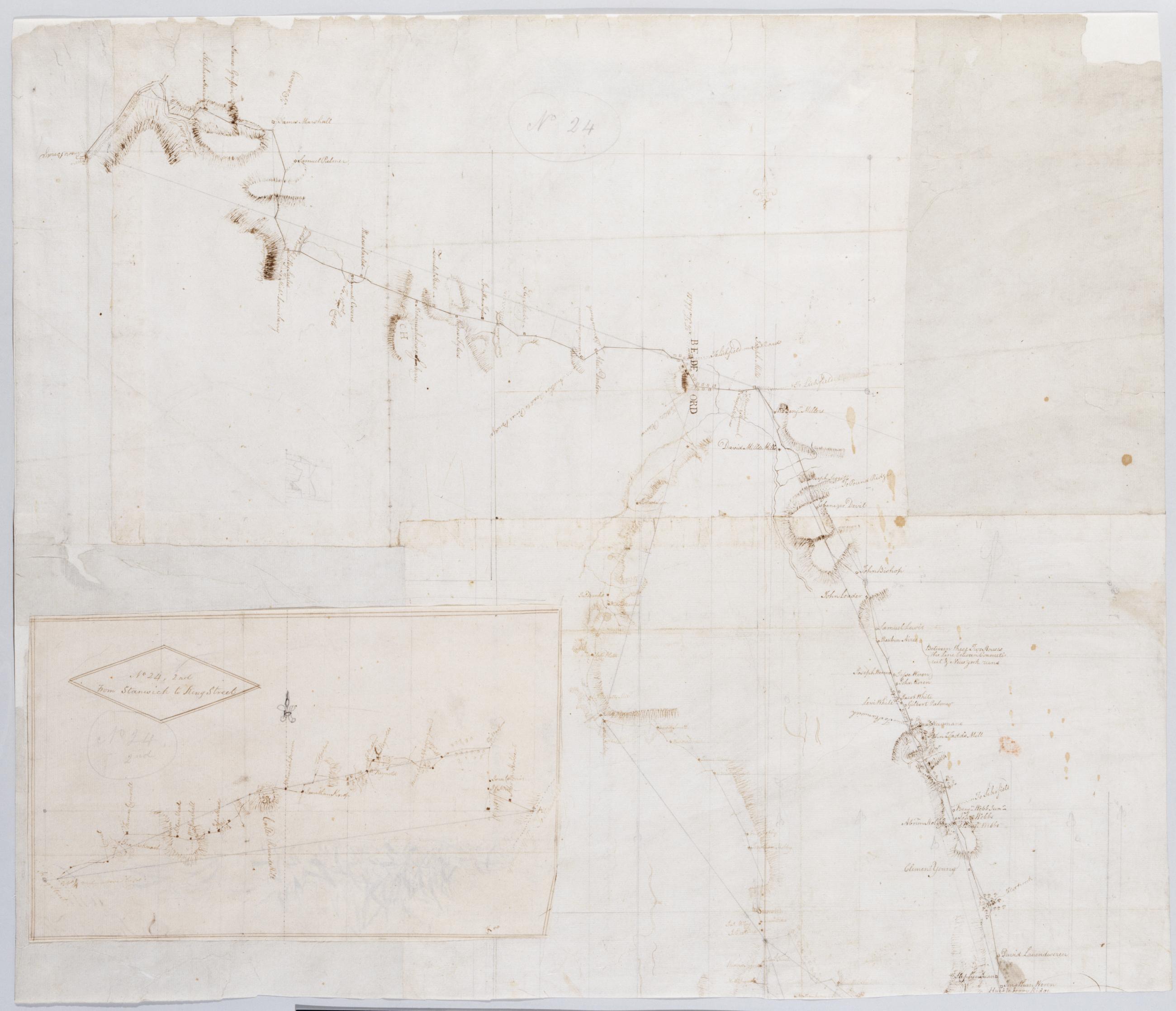
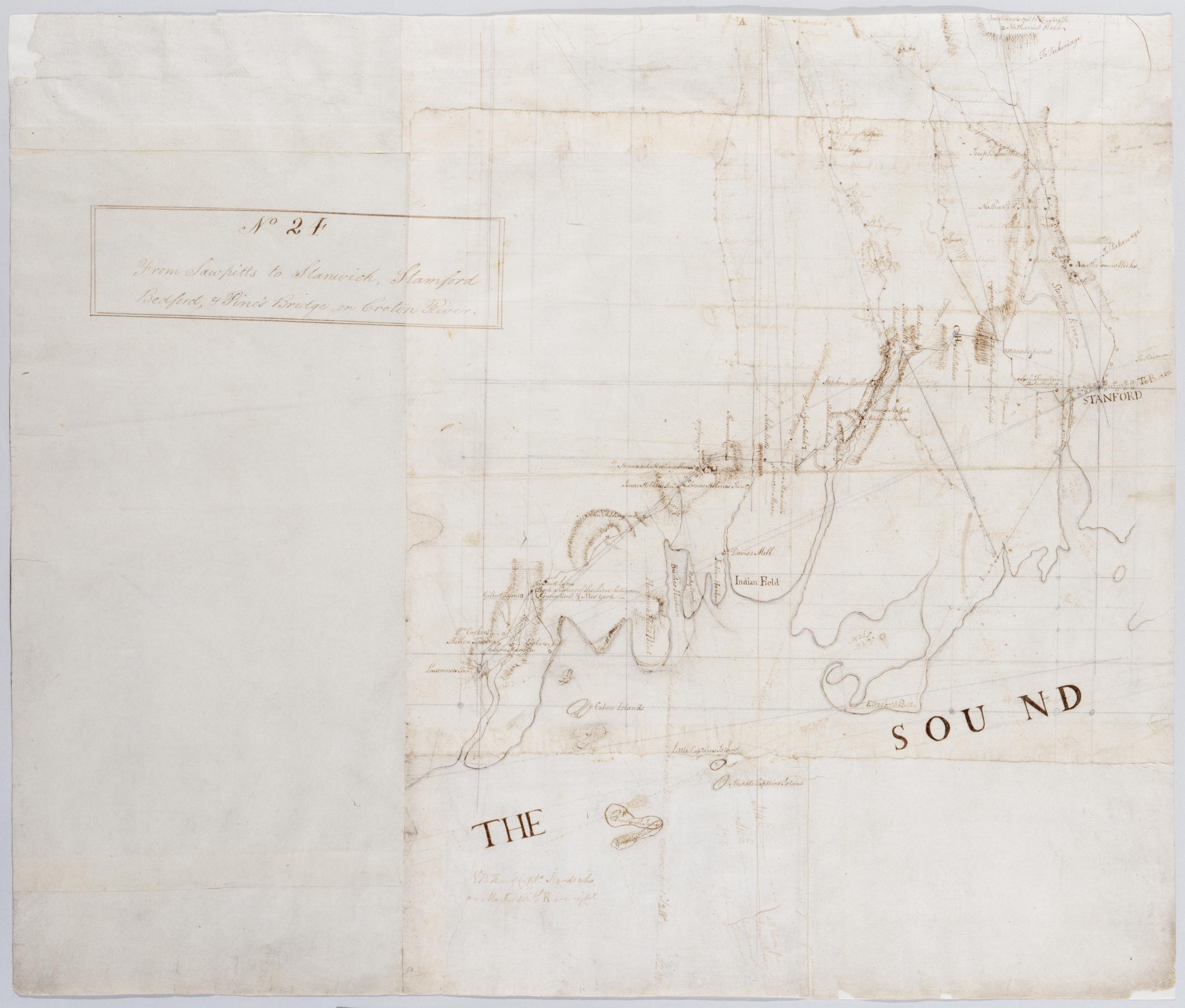
Cartographic From Sawpitts to Stanwich, Stamford Bedford, & Pine's Bridge on Croton River. No. 24 / by Robert Erskine F.R.S. Geogr. A. U.S. and Assistants, inset. Military topographic map. Covers the towns of Yorktown, Newcastle, Bedford, North Castle and Pound Ridge in eastern Westchester County, New York, and the towns of Stamford and Greenwich in Fairfield County, Connecticut. The map itself gives Stamford as "Stanford" and the Mill or Rippowam River as the "Stanford River." It shows roads, buildings and owners' names, also landforms and streams. Maps shows relief by hachures. Titles proper from recto and recto of inset are the work of a later editor--Simeon DeWitt or his assign--subsequent to 1820. View Item
Cartographic From Sawpitts to Stanwich, Stamford Bedford, & Pine's Bridge on Croton River. No. 24 / by Robert Erskine F.R.S. Geogr. A. U.S. and Assistants. Military topographic map. Covers the towns of Yorktown, Newcastle, Bedford, North Castle and Pound Ridge in eastern Westchester County, New York, and the towns of Stamford and Greenwich in Fairfield County, Connecticut. The map itself gives Stamford as "Stanford" and the Mill or Rippowam River as the "Stanford River." It shows roads, buildings and owners' names, also landforms and streams. Maps shows relief by hachures. Titles proper from recto and recto of inset are the work of a later editor--Simeon DeWitt or his assign--subsequent to 1820. View Item