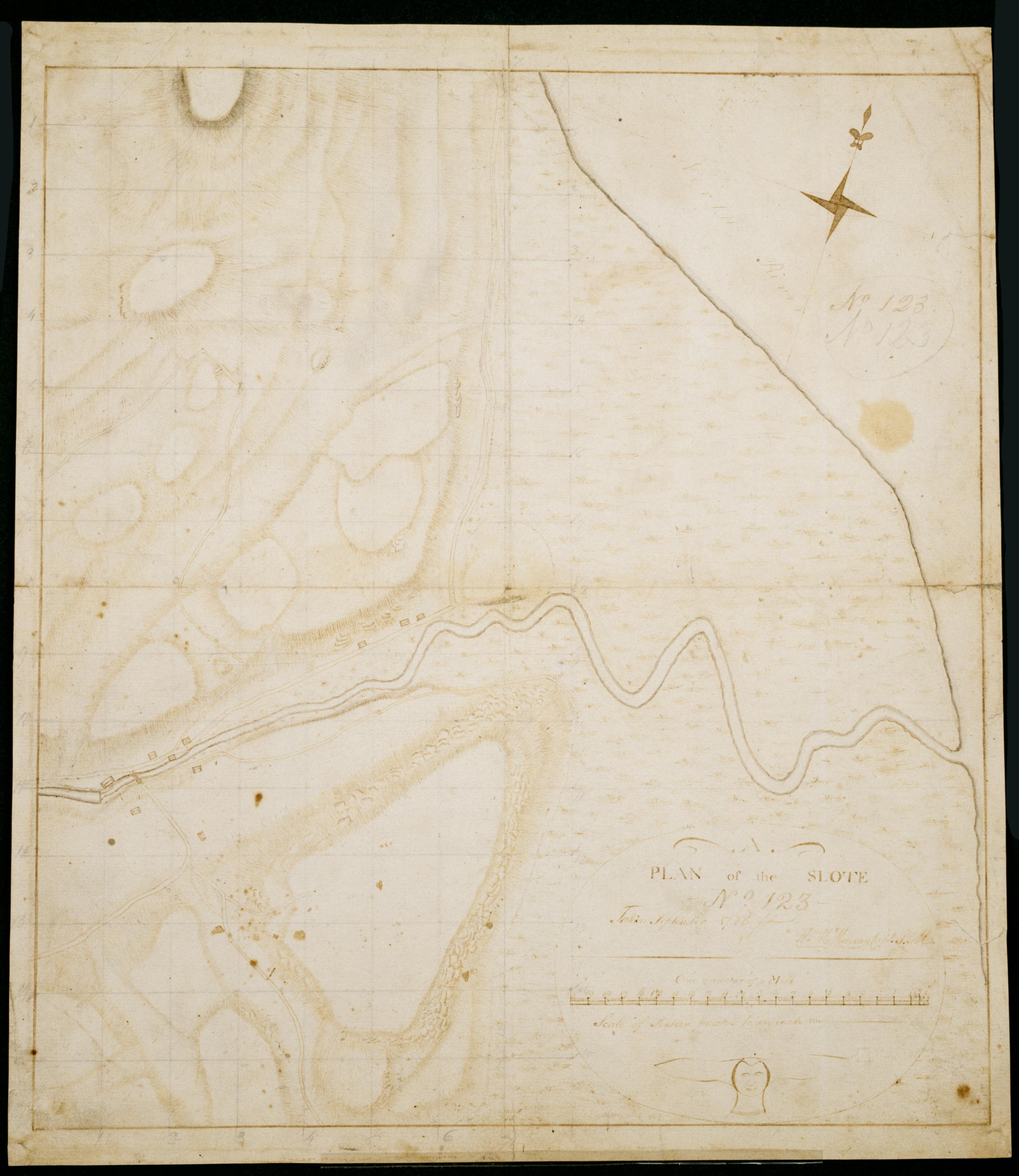
Cartographic Plan of the Slote No 123 / Taken September 1780 Wm. Mc'Murray Capt. P.M. ; by Robert Erskine F.R.S. Geogr. A. U.S. and Assistants. In both ink and pencil on recto: "No 123." Same text in ink on verso. Lengthy pencil text on verso illigible. Military topographic map. Covers the township of Orangetown in Rockland County, New York. Shows roads running through Piermont and Sparkill. Also shows buildings, landforms and streams. Original title proper and first statement of responsiblity from map recto. Index title, second statement of responsibility, series title and series numbering contemporaneous, but on separate index sheet filed at head of series. This sheet bears no title on map verso. Pen-and-ink, pencil on laid paper. View Item
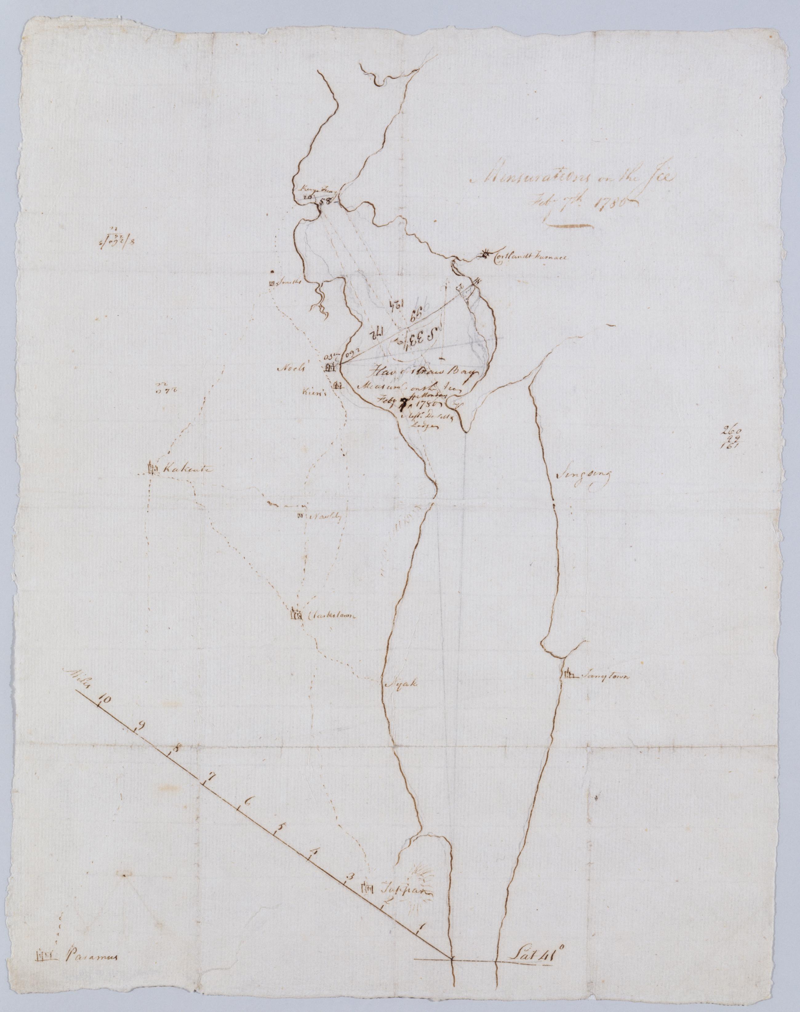
Cartographic Mensurations on the Ice : Feby 7th 1780. Includes text: "Measured on the Ice Feby. 7th Monday 1780 by [...] De[Witt] & Lodge". Both these men served under Erskine. Military topographic map. Covers the counties of Rockland and Westchester in New York. Shows dimensions of that widening of the Hudson River called "Haverstraw Bay." Also shows some roads. Pen-and-ink, pencil on laid paper. Soiled, foxed, creased, frayed and abraded. Sheathed in mylar. Watermark: none. References: Guthorn, Peter J. American maps and map makers of the revolution, p. 18. View Item
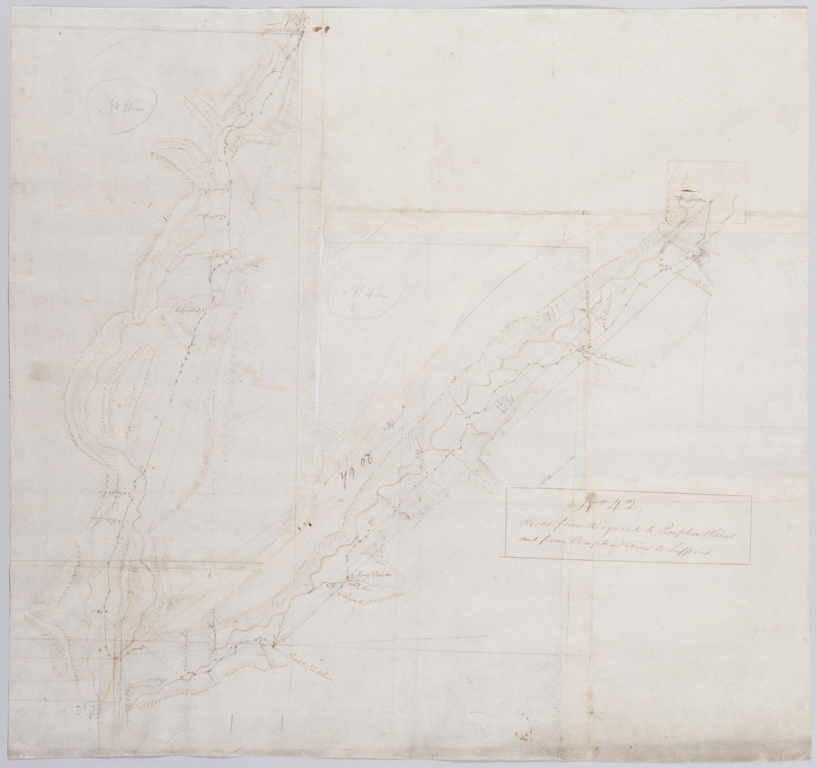
Cartographic Roads from Ringwood to Pompton Plains and from Pompton Plains to Sufferns. No 42 / by Robert Erskine F.R.S. Geogr. A. U.S. and Assistants. Also in ink on verso: "42". Foxed, creased, frayed, and abraded. Mounted on cloth, bound and cropped, disbound and silked by subsequent owners. Cleaned after removal of backings 1999; some fill remains. Sheathed in mylar. In pencil on recto: "No 42" (twice). Military topographic map. Covers the townships of Franklin and Hohokus in Bergen County, New Jersey; of Pompton in Passaic County, New Jersey; and of Ramapo in Rockland County, New York. Shows roads running though Ringwood, Erskine, Ringwood Junction, Midvale, Wanaque, Haskell, Pompton Lakes, Oakland, Darlington and Suffern. View Item
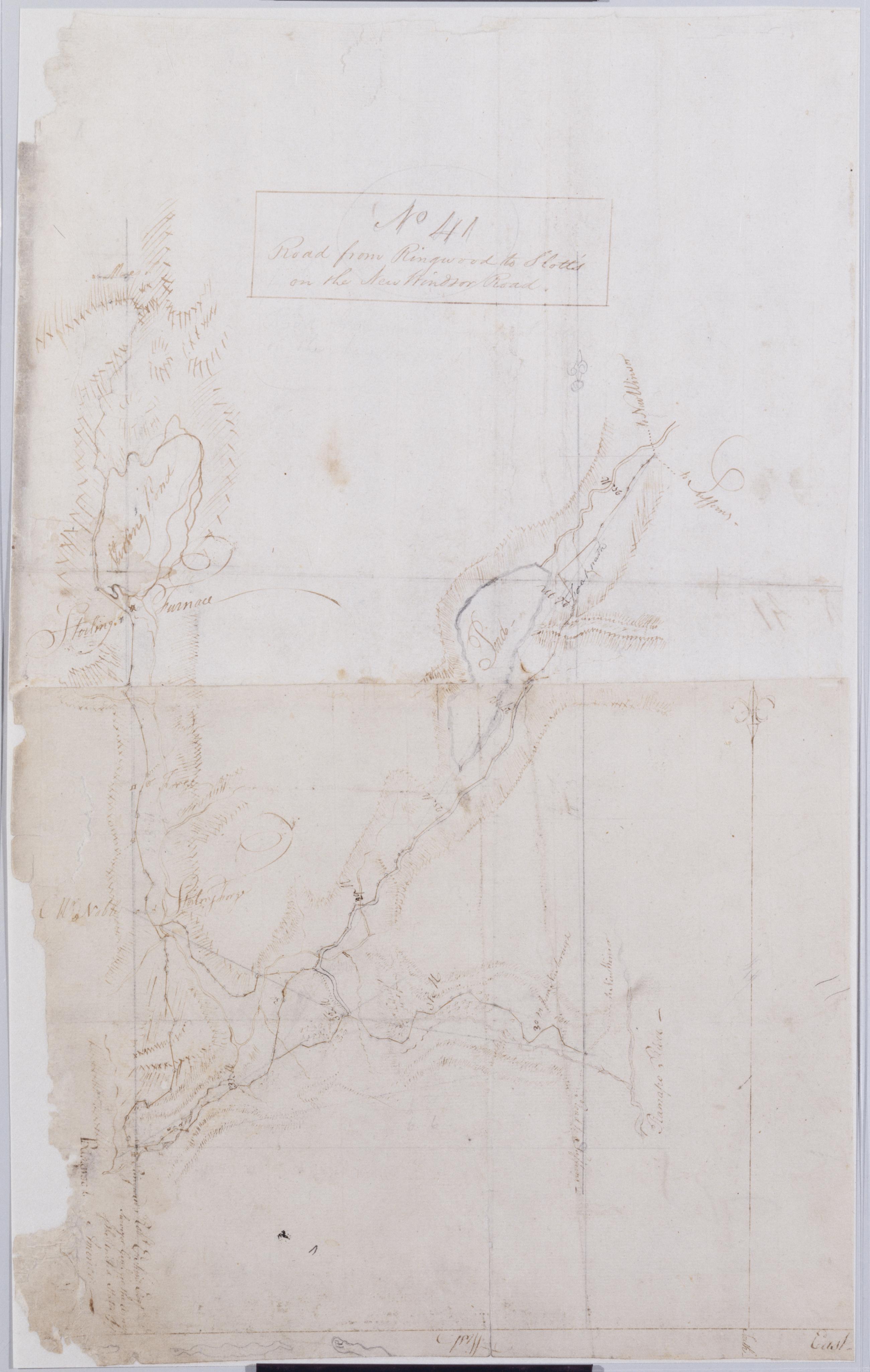
Cartographic Road from Ringwood to Slott's on the New Windsor Road. No 41 / by Robert Erskine F.R.S. Geogr. A. U.S. and Assistants. Foxed, creased, frayed, and abraded. Mounted on cloth, bound and cropped, disbound and silked by subsequent owners. Cleaned after removal of backings 1999; some fill remains. Sheathed in mylar. Map label at Ringwood: "Robt. Erskine Esqr. Surveyor Genl. for the Army of the United States of America--". Military topographic map. Covers the townships of Werwick and Tuxedo in Orange County, New York, Ramapo in Rockland County, New York, and Pompton in Passaic County, New Jersey. Shows roads running though Lakeville, Sterling Furnace, Ringwood, Eagle Valley, Sloatsburg and the Tuxedo Lake area. View Item
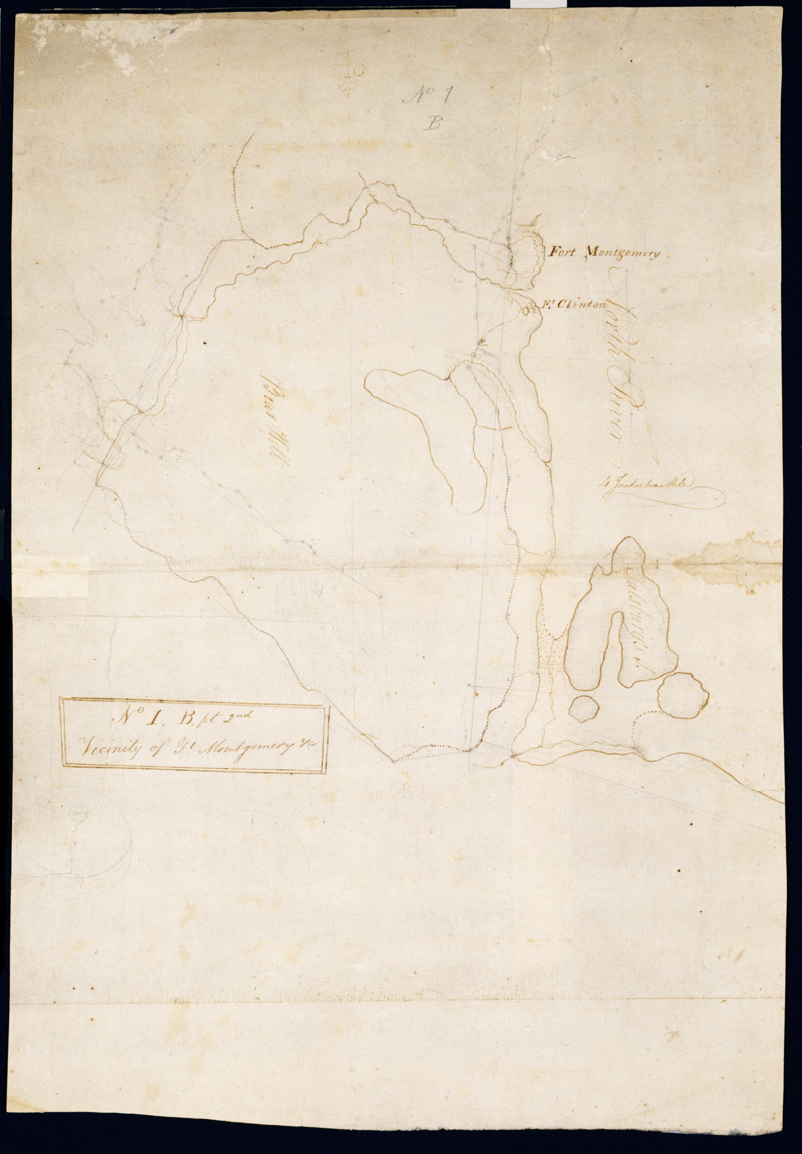
Cartographic Vicinity of Ft Montgomery +c. No 1, B, pt. 2nd / by Robert Erskine F.R.S. Geogr. A. U.S. and Assistants. Foxed, creased, frayed and abraded. Mounted on cloth, bound and cropped, disbound and silked by subsequent owners. Cleaned after removal of backings 1999; some fill remains. Sheathed in mylar. In ink on verso "Part of No. 1 Large Scale N.1.B". In pencil on recto: "No 1 B." Military topographic map. Covers the towns of Stony Point in Rockland County and of Highland and Woodbury in Orange County, New York. Shows roads, forts, landforms, streams and wetlands. Pen-and-ink, pencil on laid paper. Shows relief by hachures. View Item
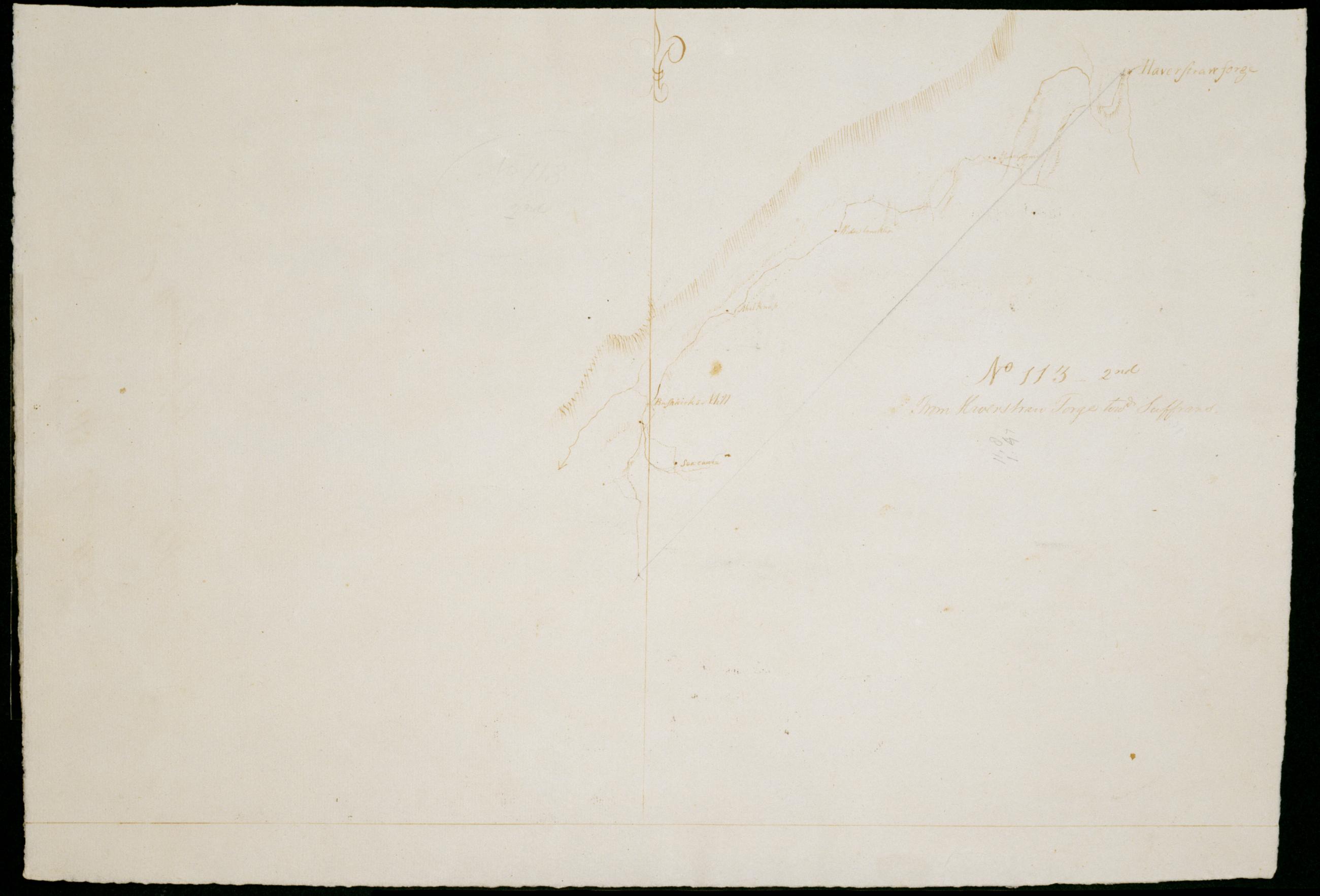
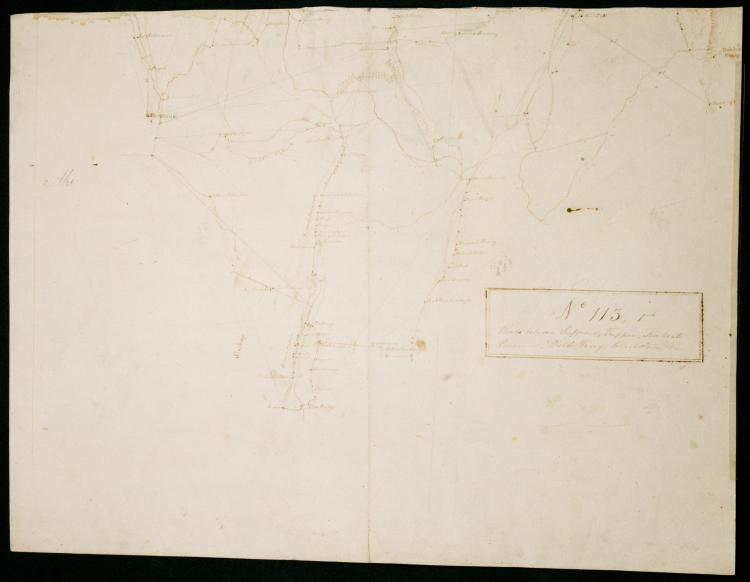
Cartographic From Haverstran Forge towd Suffrans. No 113 - 2nd / by Robert Erskine F.R.S. Geogr. A. U.S. and Assistants. Foxed, soiled, creased and abraded. Mounted on cloth, bound and cropped, disbound and silked by subsequent owners. Cleaned after removal of backings 1999; some fill remains. Sheathed in mylar. In erased pencil on recto: "No 113 2nd". Military topographic map. Covers the townships of Haverstraw and Ramapo in Rockland County, New York. Shows roads running through Thiels, Camp Hill, Ladentown and Wesley Chapel. Also shows buildings and owners' names, landforms and streams. Pen-and-ink, pencil on laid paper. Shows relief by hachures. View Item
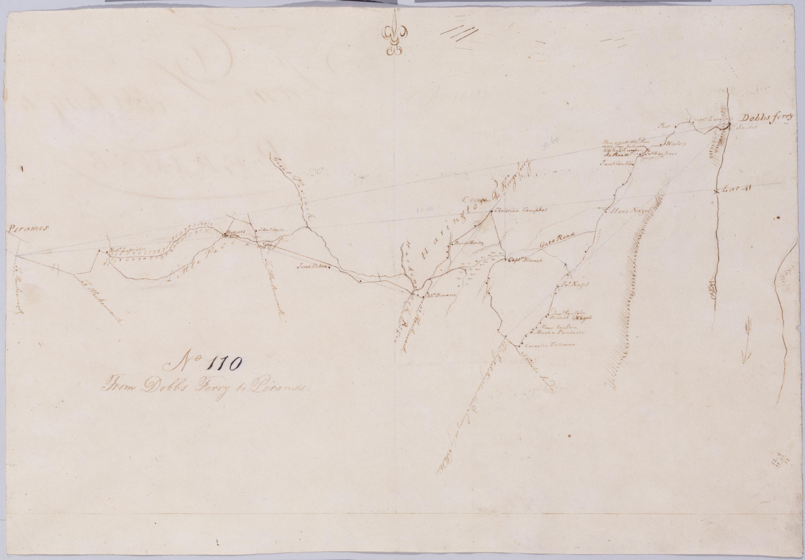
Cartographic From Dobbs Ferry to Peramus. No 110 / by Robert Erskine F.R.S. Geogr. A. U.S. and Assistants. In erased pencil on recto: "No 110". Military topographic map. Covers the townships of Orangetown in Rockland County, New York, and of Harrington and Washington in Bergen County, New Jersey. Shows roads running through Sneden Landing N.Y., Harrington Park, Westwood and Paramus N.J. Also shows buildings and owners' names, landforms and streams. Pen-and-ink, pencil on laid paper. Shows relief by hachures. Soiled, creased and abraded. Mounted on cloth, bound and cropped, disbound and silked by subsequent owners. Cleaned after removal of backings 1999; some fill remains. Sheathed in mylar. View Item
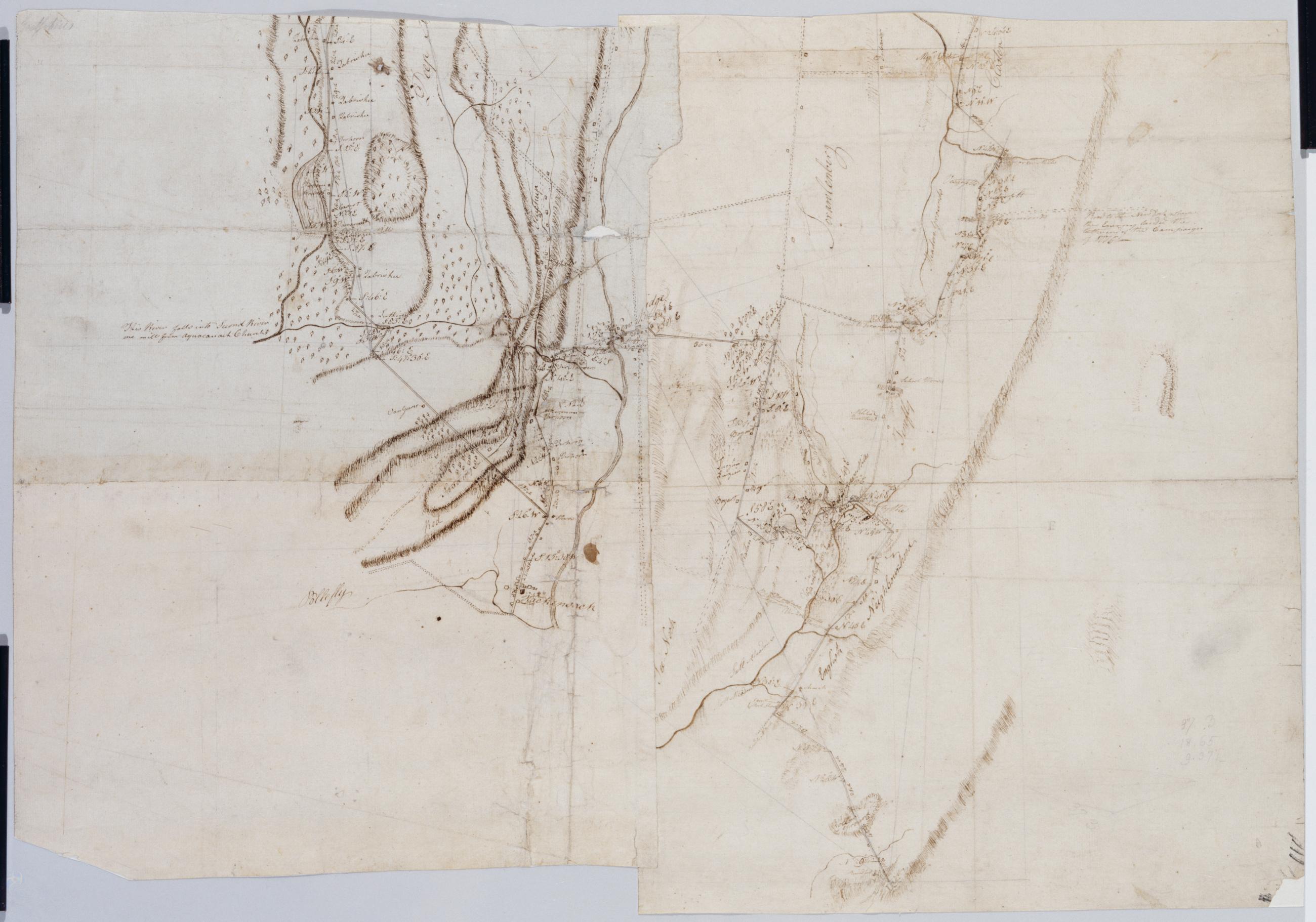
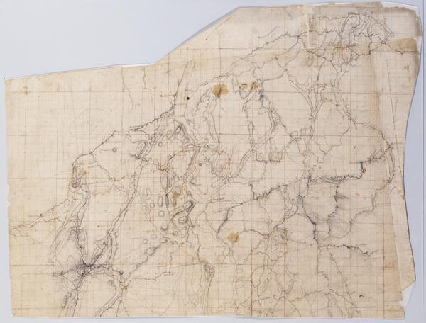
Cartographic Projections for Closing, and trying the meeting of Surveys. No 99, D / Large paper by Capt. Scull ; by Robert Erskine F.R.S. Geogr. A. U.S. and Assistants. In ink on verso: "No. 99 D". In pencil on recto: "No 99 D". Military topographic map; an early draft. Covers Dutchess, Orange, Putnam, Rockland and Westchester counties in New York. Pen-and-ink, pencil on laid paper. Soiled, creased and abraded. Mounted on cloth, bound and cropped, disbound and silked by subsequent owners. Cleaned after removal of backings 1999; some fill remains. Sheathed in mylar. Title proper from recto is the work of a later editor--Simeon DeWitt or his assign--subsequent to 1820. View Item
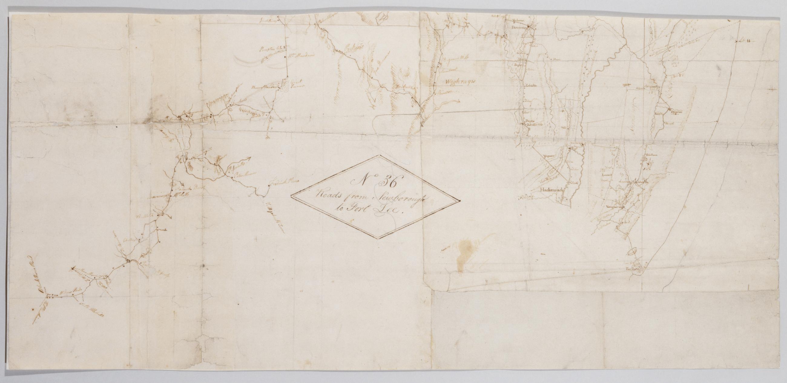
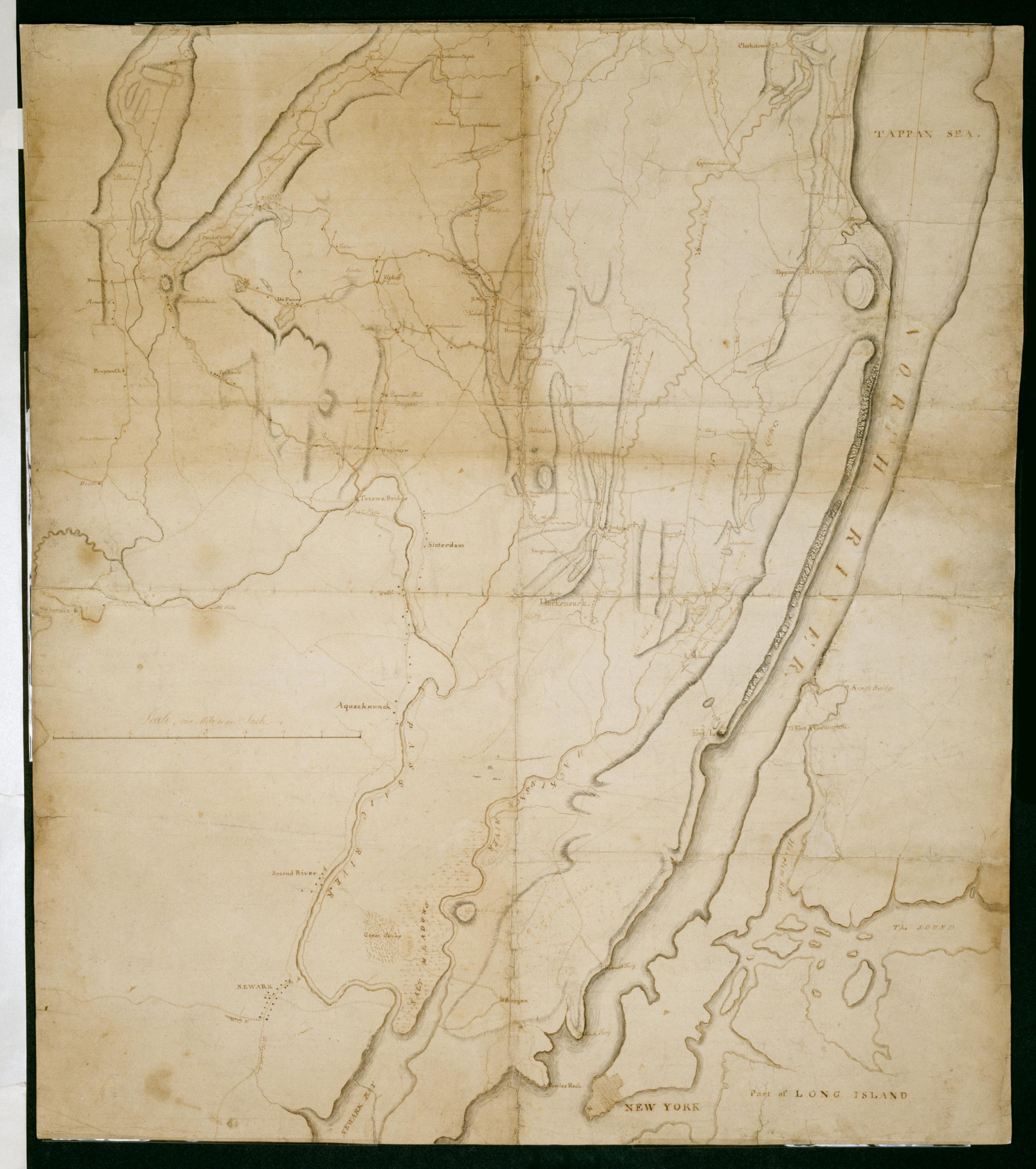
Cartographic Roads from Newborough to Fort Lee. No 36 / by Robert Erskine F.R.S. Geogr. A. U.S. and Assistants, bottom Military topographic map. Covers Orange and Rockland Counties in New York and Bergen, Passaic, Morris and Essex Counties in New Jersey. Shows roads, buildings and owners' names, also landforms, wetlands and streams. Shows relief by hachures. Title proper from recto is the work of a later editor--Simeon DeWitt or his assign--subsequent to 1820. Index title, statement of responsibility, date, series title and series numbering also by Erskine, but on separate index sheet filed at head of series. Pen-and-ink, pencil on laid paper. View Item
Cartographic Roads from Newborough to Fort Lee. No 36 / by Robert Erskine F.R.S. Geogr. A. U.S. and Assistants, top Military topographic map. Covers Orange and Rockland Counties in New York and Bergen, Passaic, Morris and Essex Counties in New Jersey. Shows roads, buildings and owners' names, also landforms, wetlands and streams. Shows relief by hachures. Title proper from recto is the work of a later editor--Simeon DeWitt or his assign--subsequent to 1820. Index title, statement of responsibility, date, series title and series numbering also by Erskine, but on separate index sheet filed at head of series. Pen-and-ink, pencil on laid paper. View Item
Cartographic Roads from Newborough to Fort Lee. No 36 / by Robert Erskine F.R.S. Geogr. A. U.S. and Assistants, center Military topographic map. Covers Orange and Rockland Counties in New York and Bergen, Passaic, Morris and Essex Counties in New Jersey. Shows roads, buildings and owners' names, also landforms, wetlands and streams. Shows relief by hachures. Title proper from recto is the work of a later editor--Simeon DeWitt or his assign--subsequent to 1820. Index title, statement of responsibility, date, series title and series numbering also by Erskine, but on separate index sheet filed at head of series. Pen-and-ink, pencil on laid paper. View Item
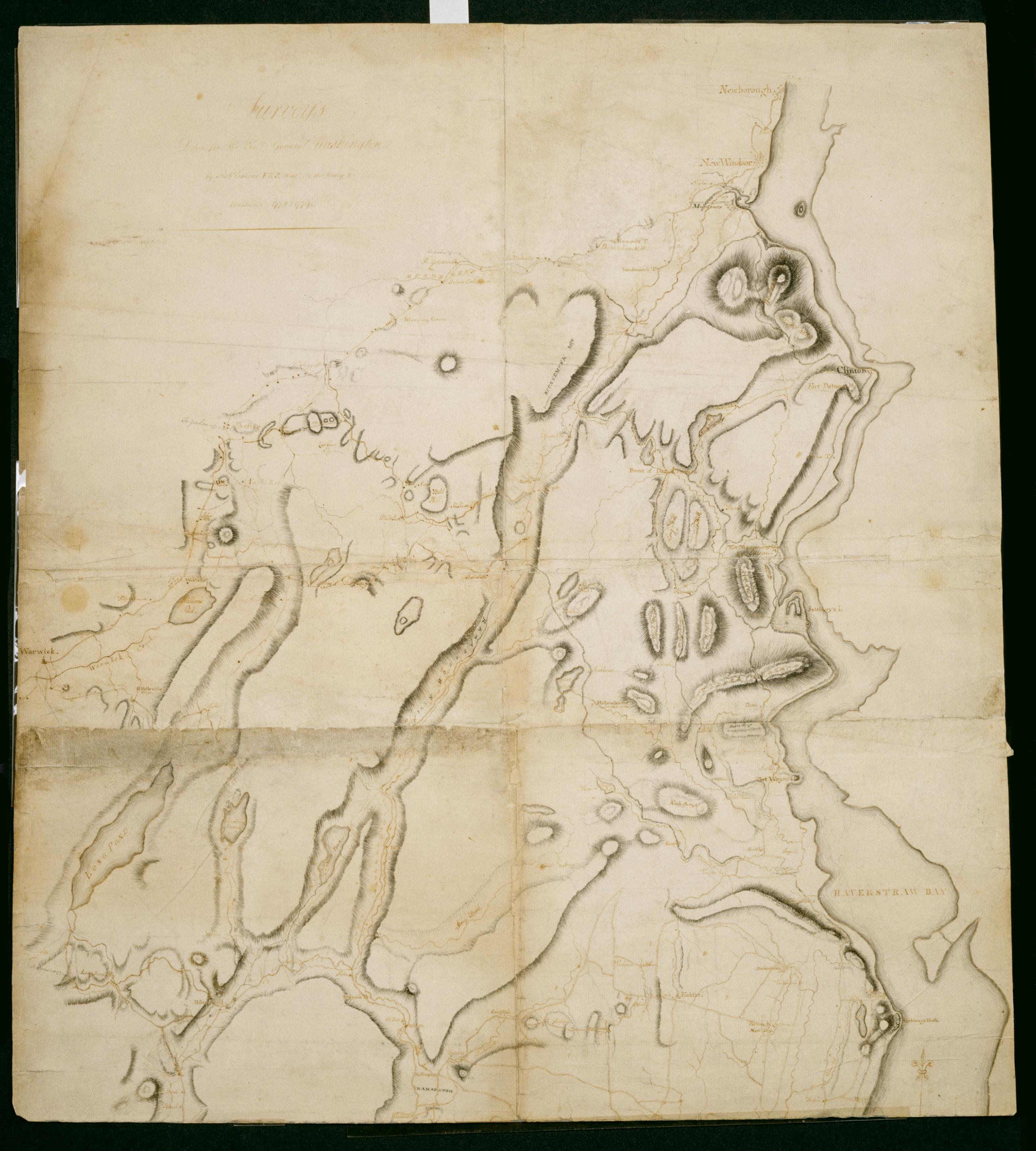
Cartographic Surveys Done for His Excy General Washington : 1778 & 1779 / by Robt Erskine F.R.S. Geogr to the Army & Assistants, second sheet Verso title: Map of North River made by Robt Erskine 1778 & 9. Second verso title: Map of part of the State of New York. Military topographic map; not listed in Heusser nor Guthorn. Covers the counties of Orange and Rockland in New York and of Passaic, Bergen, Hudson and Essex in New Jersey. Shows some roads; map appears to be incomplete in this respect as of date given. Also shows some buildings and owners' names, landforms and streams. Shows relief by hachures. Title proper and statement of responsibility from recto is original. Titles on verso are later. View Item
Cartographic Surveys Done for His Excy General Washington : 1778 & 1779 / by Robt Erskine F.R.S. Geogr to the Army & Assistants, first sheet Verso title: Map of North River made by Robt Erskine 1778 & 9. Second verso title: Map of part of the State of New York. Military topographic map; not listed in Heusser nor Guthorn. Covers the counties of Orange and Rockland in New York and of Passaic, Bergen, Hudson and Essex in New Jersey. Shows some roads; map appears to be incomplete in this respect as of date given. Also shows some buildings and owners' names, landforms and streams. Shows relief by hachures. Title proper and statement of responsibility from recto is original. Titles on verso are later. View Item
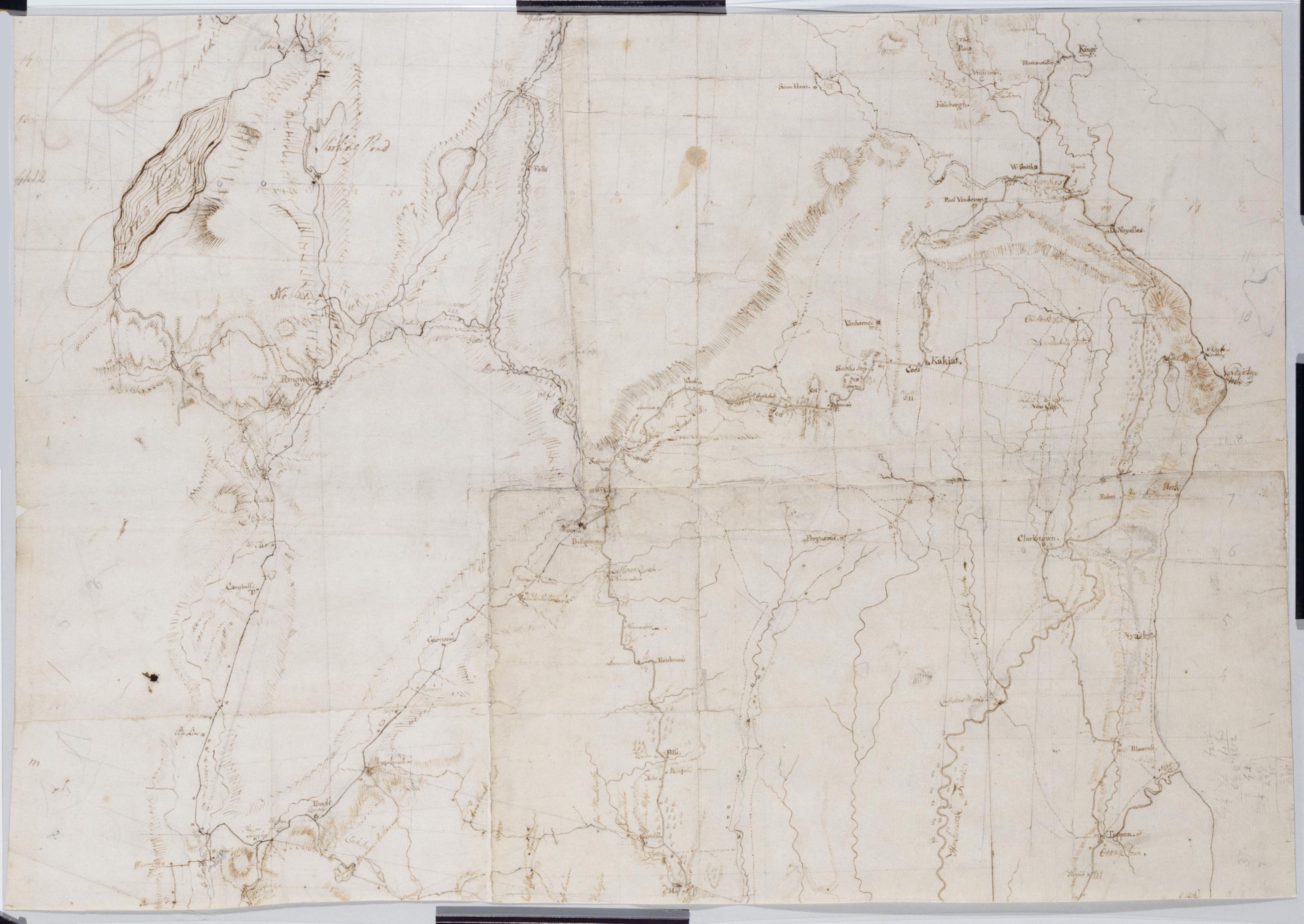
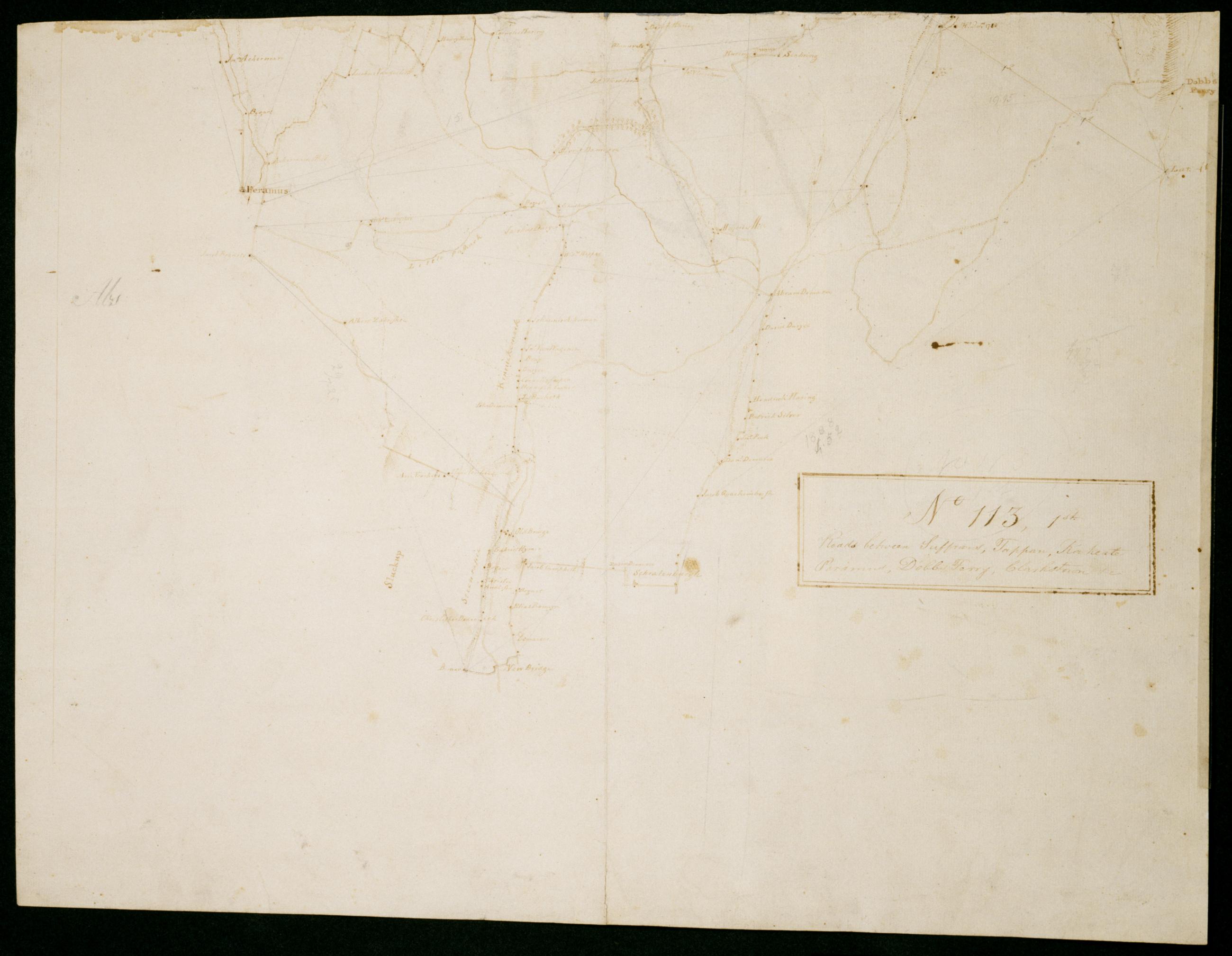
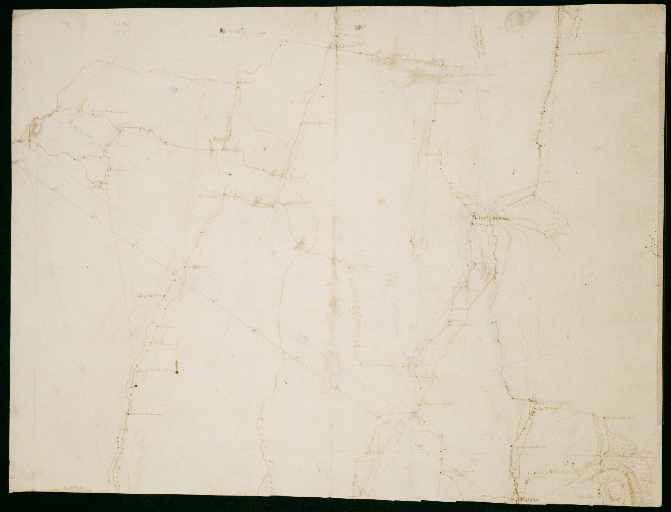
Cartographic Roads between Suffrans, Tappan, Kakeate Peramus, Dobbs Ferry, Clarkstown +c. No 113, 1st / by Robert Erskine F.R.S. Geogr. A. U.S. and Assistants, first fragment Military topographic map. Covers the townships of Orangetown, Ramapo and Clarkstown in Rockland County, New York, and of Herrington, Washington, Palisades, Midland, Ridgewood and Orvil in Bergen County, New Jersey. Shows buildings and owners' names, landforms and streams. Shows relief by hachures. Title proper from recto is the work of a later editor--Simeon DeWitt or his assign--subsequent to 1820. Title from verso is in Erskine's hand and may be cited as such. View Item
Cartographic Roads between Suffrans, Tappan, Kakeate Peramus, Dobbs Ferry, Clarkstown +c. No 113, 1st / by Robert Erskine F.R.S. Geogr. A. U.S. and Assistants, second fragment Military topographic map. Covers the townships of Orangetown, Ramapo and Clarkstown in Rockland County, New York, and of Herrington, Washington, Palisades, Midland, Ridgewood and Orvil in Bergen County, New Jersey. Shows buildings and owners' names, landforms and streams. Shows relief by hachures. Title proper from recto is the work of a later editor--Simeon DeWitt or his assign--subsequent to 1820. Title from verso is in Erskine's hand and may be cited as such. View Item
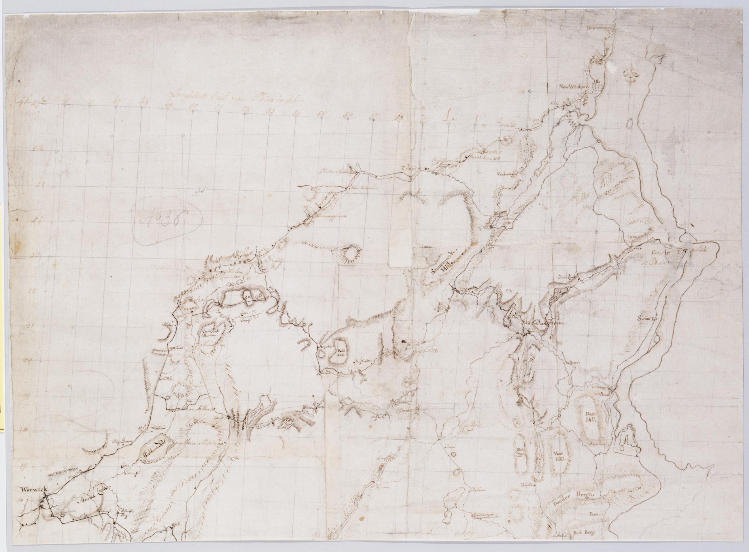
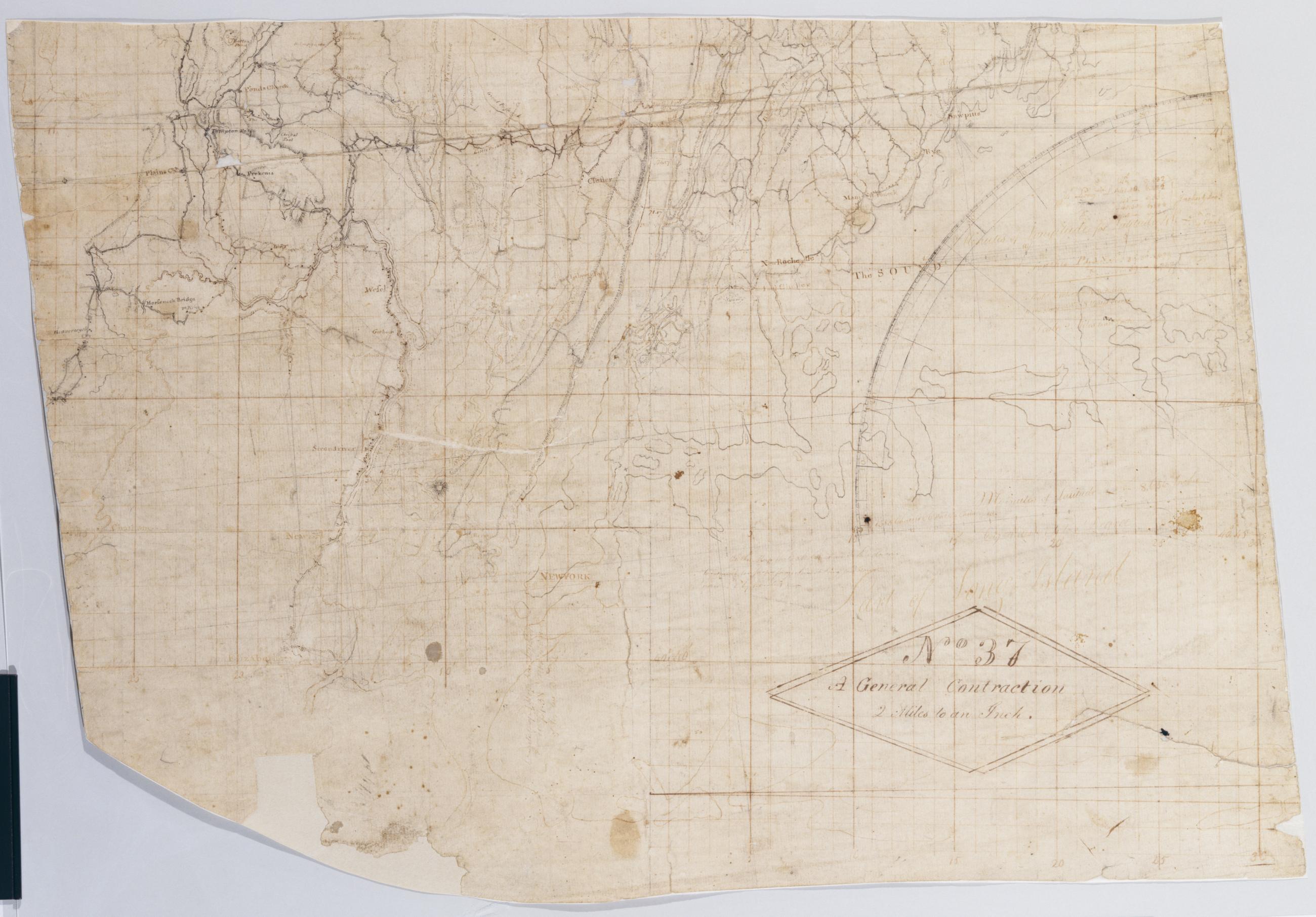
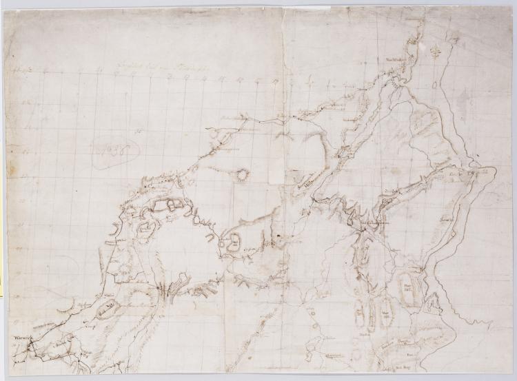
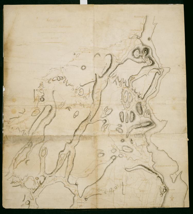
Cartographic A General Contraction 2 Miles to an Inch. No 37 / by R.E. ; by Robert Erskine F.R.S. Geogr. A. U.S. and Assistants, bottom Military topographic map. Covers the lower Hudson River Valley in New York, New Jersey and Connecticut, from Warwick (N.Y.) and Pompton Plains (N.J.) to New Milford and Danbury (Conn.), and from Newburgh (N.Y.) to Staten Island (N.Y.). Shows roads, buildings and owners' names, also landforms and streams. Shows relief by hachures. Title proper from recto is the work of a later editor--Simeon DeWitt or his assign--subsequent to 1820. Index title, both statements of responsibility, date, series title and series numbering by Erskine, but on separate index sheet filed at head of series. View Item
Cartographic A General Contraction 2 Miles to an Inch. No 37 / by R.E. ; by Robert Erskine F.R.S. Geogr. A. U.S. and Assistants, top Military topographic map. Covers the lower Hudson River Valley in New York, New Jersey and Connecticut, from Warwick (N.Y.) and Pompton Plains (N.J.) to New Milford and Danbury (Conn.), and from Newburgh (N.Y.) to Staten Island (N.Y.). Shows roads, buildings and owners' names, also landforms and streams. Shows relief by hachures. Title proper from recto is the work of a later editor--Simeon DeWitt or his assign--subsequent to 1820. Index title, both statements of responsibility, date, series title and series numbering by Erskine, but on separate index sheet filed at head of series. View Item
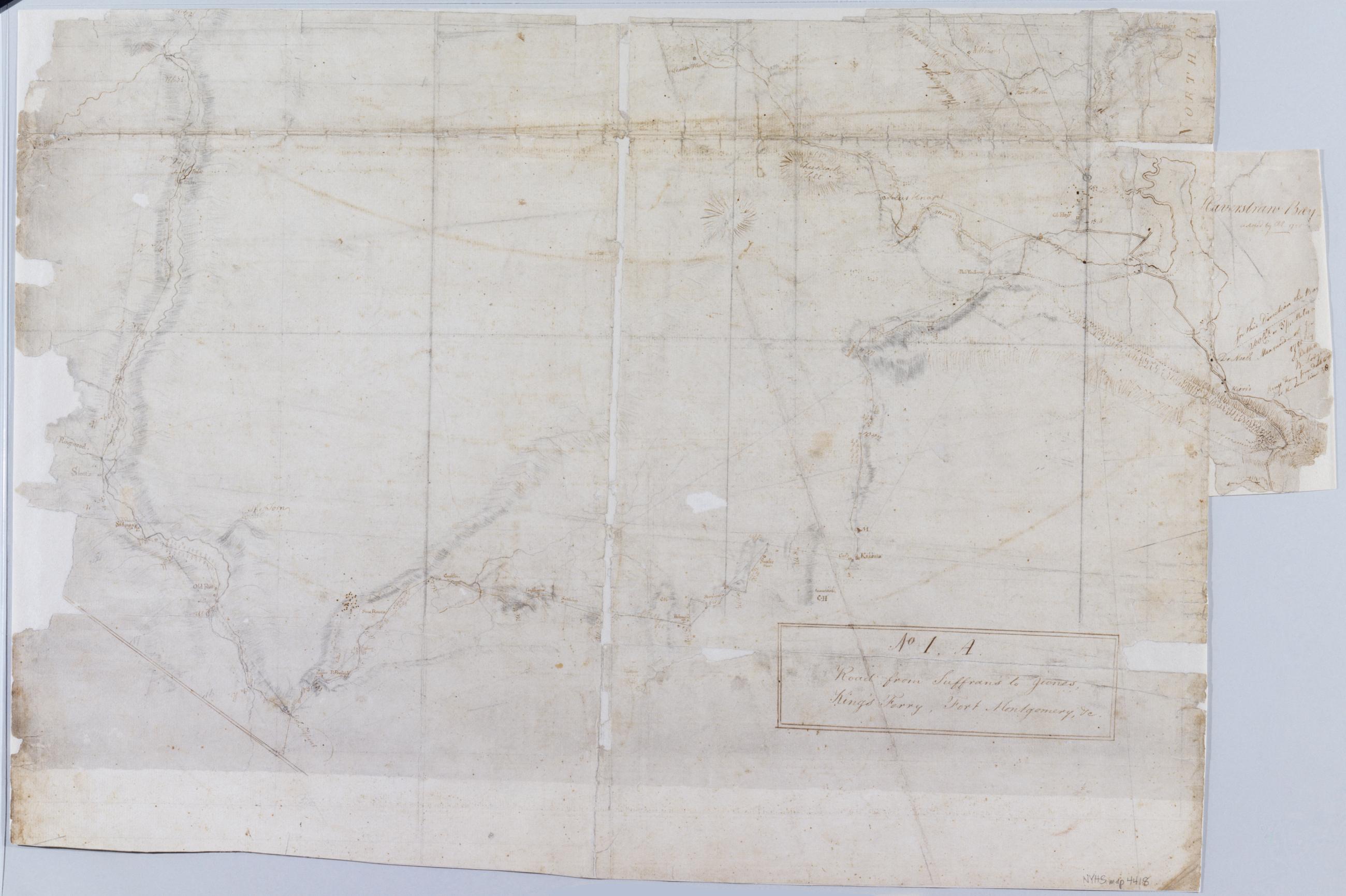
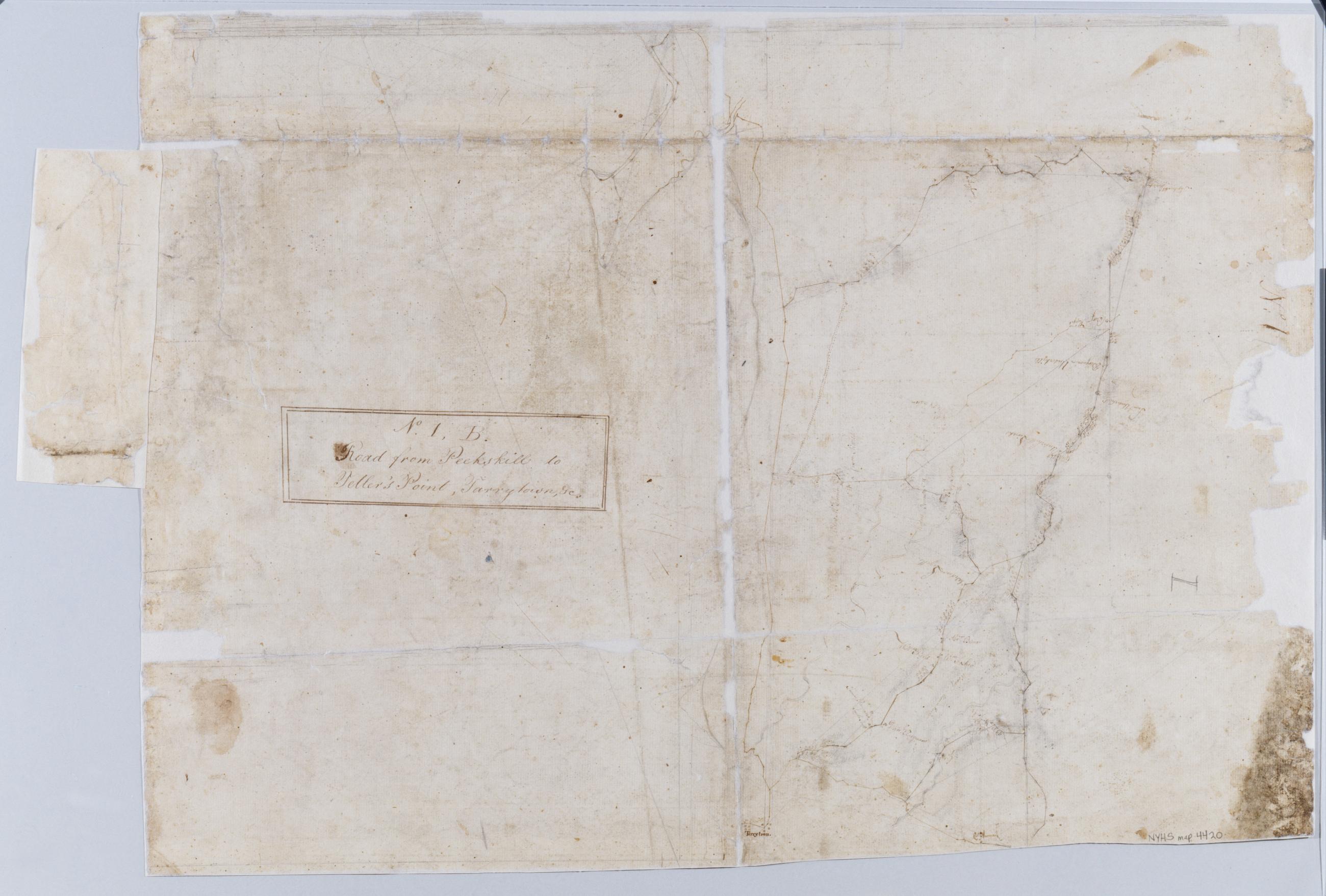
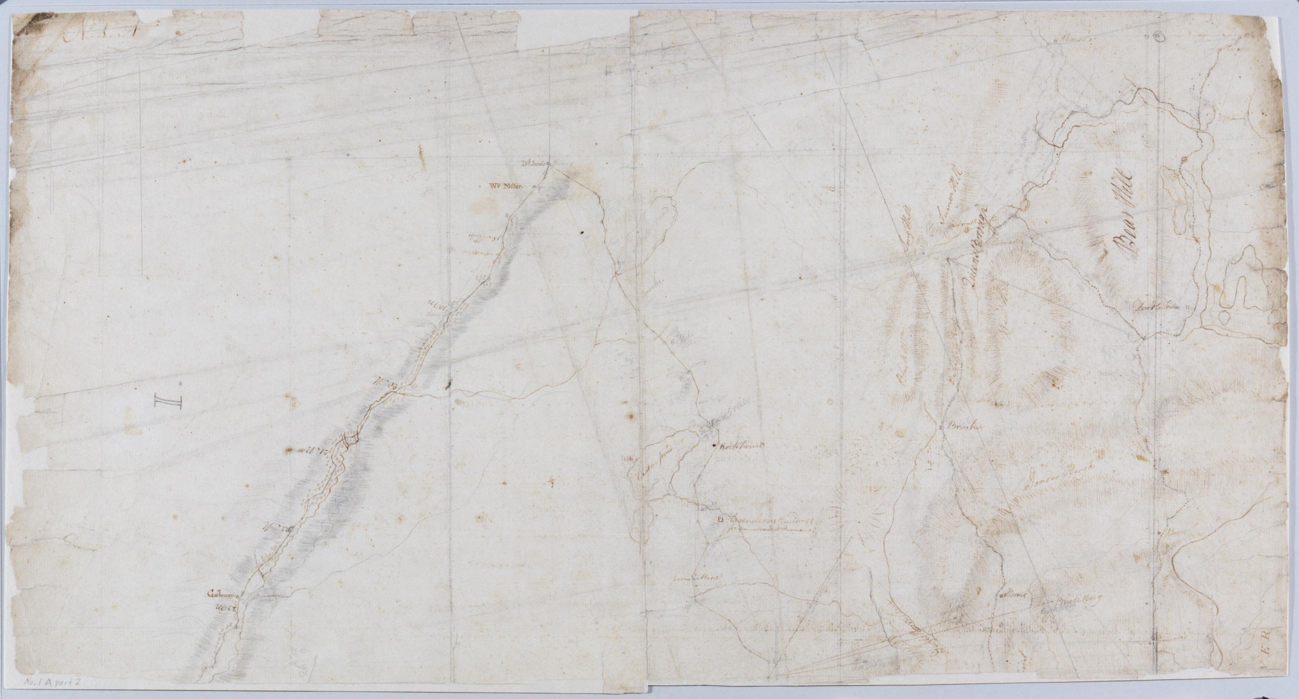
Cartographic Road from Suffrans to June's, King's Ferry, Fort Montgomery, +c. No 1, A ; Road from Peekskill to Teller's Point, Tarrytown, +c. No 1, B / by Robert Erskine F.R.S. Geogr. A. U.S. and Assistants, 1B, part 2 Military topographic maps. Map 1A on recto covers the towns of Woodbury and Tuxedo in Orange County, and of Highland, Stoney Point, Haverstraw and Ramapo in Rockland County, New York; it shows roads running through Fort Montgomery, West Haverstraw, Hempstead, Viola, Suffern, Ramapo, Sloatsburg, Tuxedo, Southfield, Arden, Willow Grove and Thiells. Map 1B on verso covers the towns of Cortlandt, Newcastle, Ossining and Mt. View Item
Cartographic Road from Suffrans to June's, King's Ferry, Fort Montgomery, +c. No 1, A ; Road from Peekskill to Teller's Point, Tarrytown, +c. No 1, B / by Robert Erskine F.R.S. Geogr. A. U.S. and Assistants., 1A, part 1 Military topographic maps. Map 1A on recto covers the towns of Woodbury and Tuxedo in Orange County, and of Highland, Stoney Point, Haverstraw and Ramapo in Rockland County, New York; it shows roads running through Fort Montgomery, West Haverstraw, Hempstead, Viola, Suffern, Ramapo, Sloatsburg, Tuxedo, Southfield, Arden, Willow Grove and Thiells. Map 1B on verso covers the towns of Cortlandt, Newcastle, Ossining and Mt. View Item
Cartographic Road from Suffrans to June's, King's Ferry, Fort Montgomery, +c. No 1, A ; Road from Peekskill to Teller's Point, Tarrytown, +c. No 1, B / by Robert Erskine F.R.S. Geogr. A. U.S. and Assistants, 1B, part 1 Military topographic maps. Map 1A on recto covers the towns of Woodbury and Tuxedo in Orange County, and of Highland, Stoney Point, Haverstraw and Ramapo in Rockland County, New York; it shows roads running through Fort Montgomery, West Haverstraw, Hempstead, Viola, Suffern, Ramapo, Sloatsburg, Tuxedo, Southfield, Arden, Willow Grove and Thiells. Map 1B on verso covers the towns of Cortlandt, Newcastle, Ossining and Mt. View Item
Cartographic Road from Suffrans to June's, King's Ferry, Fort Montgomery, +c. No 1, A ; Road from Peekskill to Teller's Point, Tarrytown, +c. No 1, B / by Robert Erskine F.R.S. Geogr. A. U.S. and Assistants, 1A, part 2 Military topographic maps. Map 1A on recto covers the towns of Woodbury and Tuxedo in Orange County, and of Highland, Stoney Point, Haverstraw and Ramapo in Rockland County, New York; it shows roads running through Fort Montgomery, West Haverstraw, Hempstead, Viola, Suffern, Ramapo, Sloatsburg, Tuxedo, Southfield, Arden, Willow Grove and Thiells. Map 1B on verso covers the towns of Cortlandt, Newcastle, Ossining and Mt. View Item
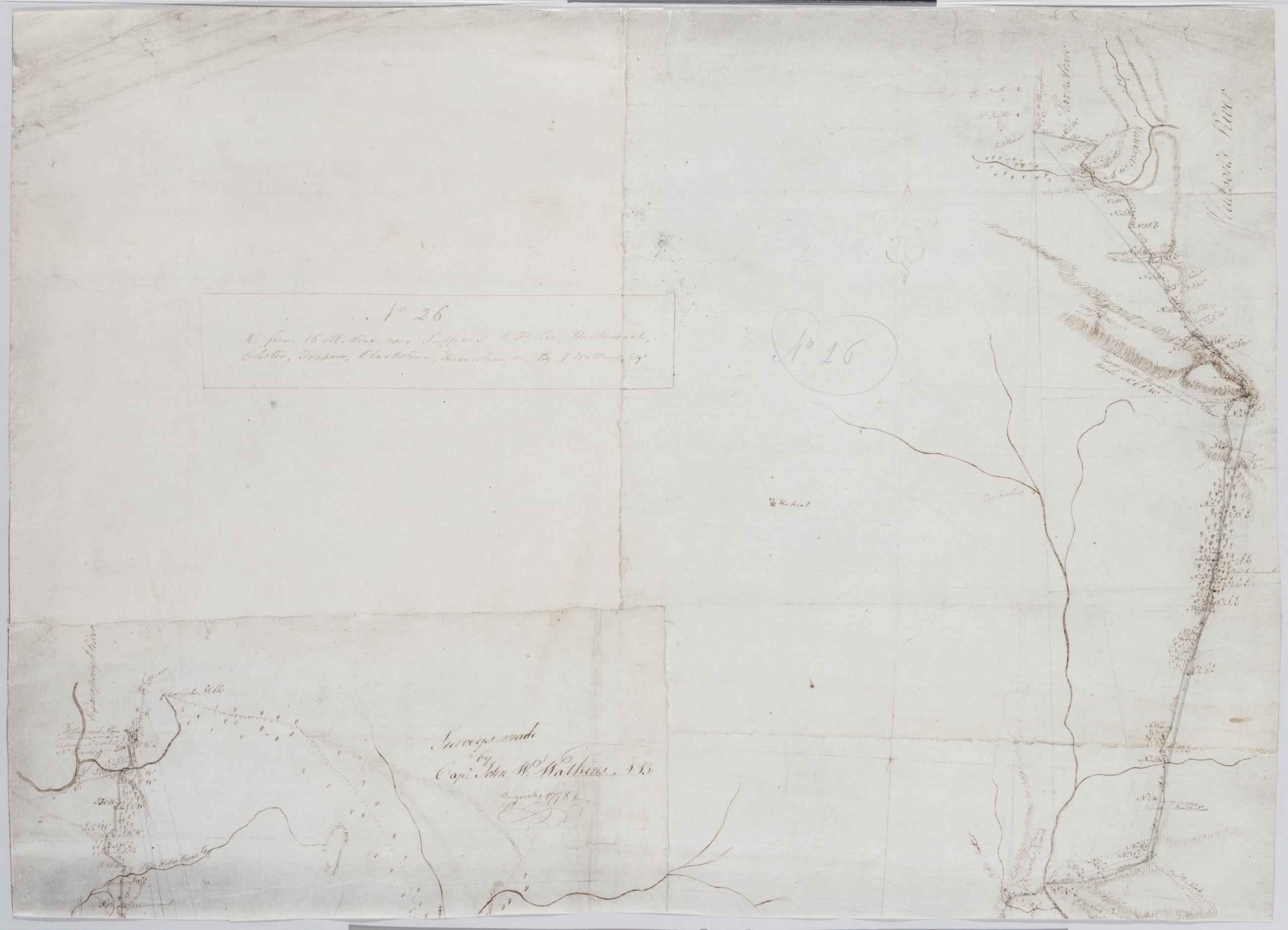
Cartographic R. from 15 M. stone, near Suffran's to Ft Lee, Hackensack, Closter, Tappan, Clarkstown, Haverstraw +c. No 26 / by J. Watkins Esqr ; surveys made by Capt: John W: Watkins A:B: ; by Robert Erskine F.R.S. Geogr. A. U.S. and Assistants, bottom Military topographic map. Covers most of Rockland County, New York, and Bergen County, New Jersey. Shows roads running through Suffern, Saddle River, Paramus and Hackensack, as well as Haverstraw, Clarksville, Tappan, Tenefly and Closter. Also shows buildings and owners' names, landforms, ground cover, wetlands and streams. Shows relief by hachures. Title proper and first statement of responsibility from recto are the work of a later editor--Simeon DeWitt or his assign--subsequent to 1820. Second statement of responsibility and detailed date also from apparently written by Watkins. View Item
Cartographic R. from 15 M. stone, near Suffran's to Ft Lee, Hackensack, Closter, Tappan, Clarkstown, Haverstraw +c. No 26 / by J. Watkins Esqr ; surveys made by Capt: John W: Watkins A:B: ; by Robert Erskine F.R.S. Geogr. A. U.S. and Assistants, top Military topographic map. Covers most of Rockland County, New York, and Bergen County, New Jersey. Shows roads running through Suffern, Saddle River, Paramus and Hackensack, as well as Haverstraw, Clarksville, Tappan, Tenefly and Closter. Also shows buildings and owners' names, landforms, ground cover, wetlands and streams. Shows relief by hachures. Title proper and first statement of responsibility from recto are the work of a later editor--Simeon DeWitt or his assign--subsequent to 1820. Second statement of responsibility and detailed date also from apparently written by Watkins. View Item
Cartographic R. from 15 M. stone, near Suffran's to Ft Lee, Hackensack, Closter, Tappan, Clarkstown, Haverstraw +c. No 26 / by J. Watkins Esqr ; surveys made by Capt: John W: Watkins A:B: ; by Robert Erskine F.R.S. Geogr. A. U.S. and Assistants, center Military topographic map. Covers most of Rockland County, New York, and Bergen County, New Jersey. Shows roads running through Suffern, Saddle River, Paramus and Hackensack, as well as Haverstraw, Clarksville, Tappan, Tenefly and Closter. Also shows buildings and owners' names, landforms, ground cover, wetlands and streams. Shows relief by hachures. Title proper and first statement of responsibility from recto are the work of a later editor--Simeon DeWitt or his assign--subsequent to 1820. Second statement of responsibility and detailed date also from apparently written by Watkins. View Item
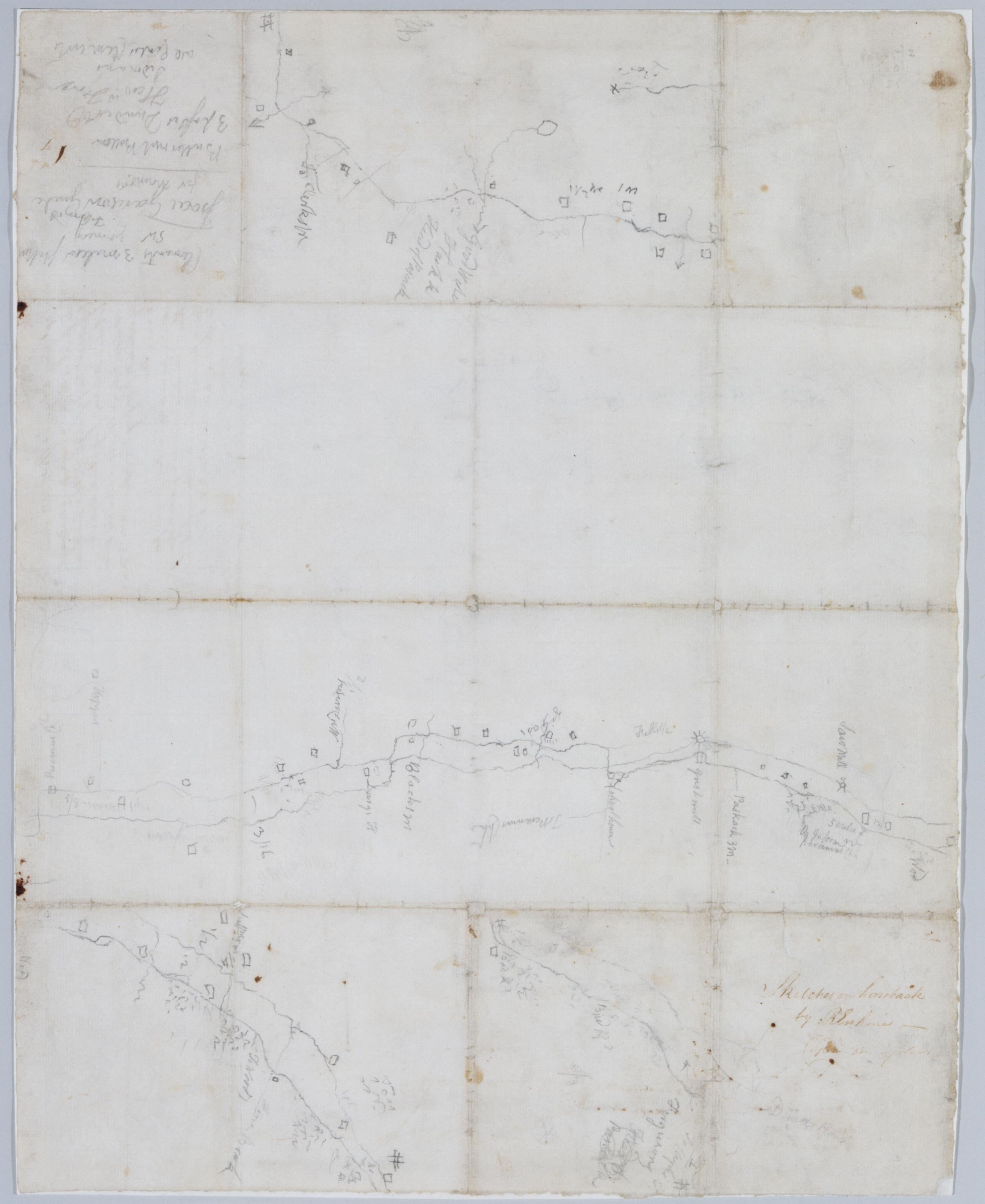
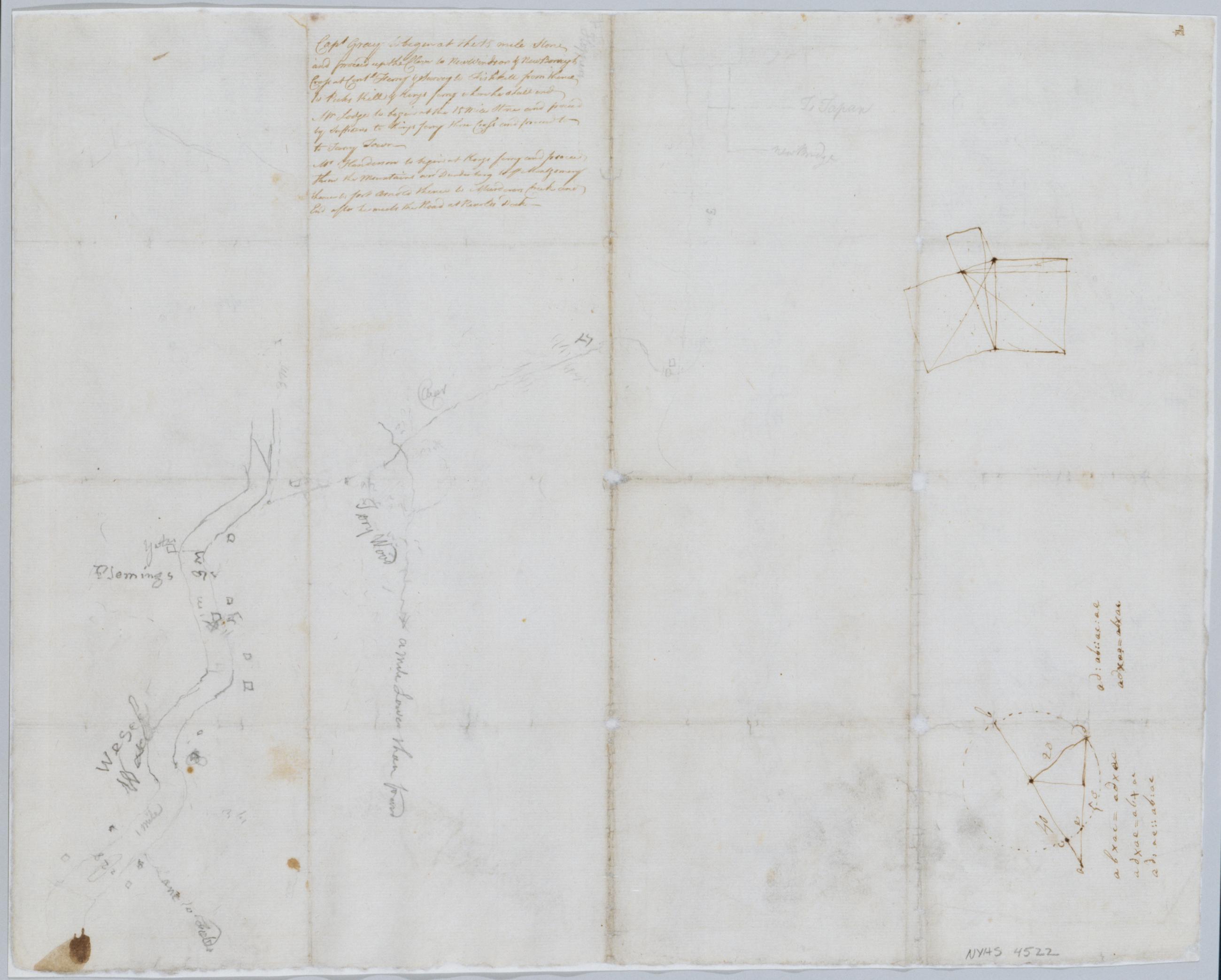
Cartographic Sketches on horseback / by R Erskine cop[ied] on plans, recto Date based on comparison with Erskine's "Surveys Done for His Excy General Washington 1778 & 1779." Foxed, creased and abraded. Cleaned after removal of backings 1999; some fill remains. Sheathed in mylar. Includes unrelated text in ink on verso: "Capt Gray to begin at the 15 mile Stone and proceed up the Clove to New Windsor & New Borough Cross at Contl Ferry & Survey to Fishkill from thence to Peeks Kill & Kings ferry where he shall end. Mr Lodge to begin at the 15 Mile Stone and proceed by Suffrans to Kings ferry there Cross and proceed to to [sic] Tarry Town. View Item
Cartographic Sketches on horseback / by R Erskine cop[ied] on plans, verso Date based on comparison with Erskine's "Surveys Done for His Excy General Washington 1778 & 1779." Foxed, creased and abraded. Cleaned after removal of backings 1999; some fill remains. Sheathed in mylar. Includes unrelated text in ink on verso: "Capt Gray to begin at the 15 mile Stone and proceed up the Clove to New Windsor & New Borough Cross at Contl Ferry & Survey to Fishkill from thence to Peeks Kill & Kings ferry where he shall end. Mr Lodge to begin at the 15 Mile Stone and proceed by Suffrans to Kings ferry there Cross and proceed to to [sic] Tarry Town. View Item
Image Cartographic 3 Items Roads from Newborough to Fort Lee. No 36 / by Robert Erskine F.R.S. Geogr. A. U.S. and Assistants. Military topographic map. Covers Orange and Rockland Counties in New York and Bergen, Passaic, Morris and Essex Counties in New Jersey. Shows roads, buildings and owners' names, also landforms, wetlands and streams. Shows relief by hachures. Title proper from recto is the work of a later editor--Simeon DeWitt or his assign--subsequent to 1820. Index title, statement of responsibility, date, series title and series numbering also by Erskine, but on separate index sheet filed at head of series. Pen-and-ink, pencil on laid paper. View Item
Image Cartographic 2 Items Surveys Done for His Excy General Washington : 1778 & 1779 / by Robt Erskine F.R.S. Geogr to the Army & Assistants Military topographic map; not listed in Heusser nor Guthorn. Covers the counties of Orange and Rockland in New York and of Passaic, Bergen, Hudson and Essex in New Jersey. Shows some roads; map appears to be incomplete in this respect as of date given. Also shows some buildings and owners' names, landforms and streams. Shows relief by hachures. Title proper and statement of responsibility from recto is original. Titles on verso are later. Date by cataloger, based on comparison to Erskine's dated sketch, "Mensurations on the Ice". Pen-and-ink, pencil on laid paper. View Item
Image Cartographic 2 Items Roads between Suffrans, Tappan, Kakeate Peramus, Dobbs Ferry, Clarkstown +c. No 113, 1st / by Robert Erskine F.R.S. Geogr. A. U.S. and Assistants. Military topographic map. Covers the townships of Orangetown, Ramapo and Clarkstown in Rockland County, New York, and of Herrington, Washington, Palisades, Midland, Ridgewood and Orvil in Bergen County, New Jersey. Shows buildings and owners' names, landforms and streams. Shows relief by hachures. Title proper from recto is the work of a later editor--Simeon DeWitt or his assign--subsequent to 1820. Title from verso is in Erskine's hand and may be cited as such. View Item
Image Cartographic 2 Items A General Contraction 2 Miles to an Inch. No 37 / by R.E. ; by Robert Erskine F.R.S. Geogr. A. U.S. and Assistants. Military topographic map. Covers the lower Hudson River Valley in New York, New Jersey and Connecticut, from Warwick (N.Y.) and Pompton Plains (N.J.) to New Milford and Danbury (Conn.), and from Newburgh (N.Y.) to Staten Island (N.Y.). Shows roads, buildings and owners' names, also landforms and streams. Shows relief by hachures. Title proper from recto is the work of a later editor--Simeon DeWitt or his assign--subsequent to 1820. Index title, both statements of responsibility, date, series title and series numbering by Erskine, but on separate index sheet filed at head of series. View Item