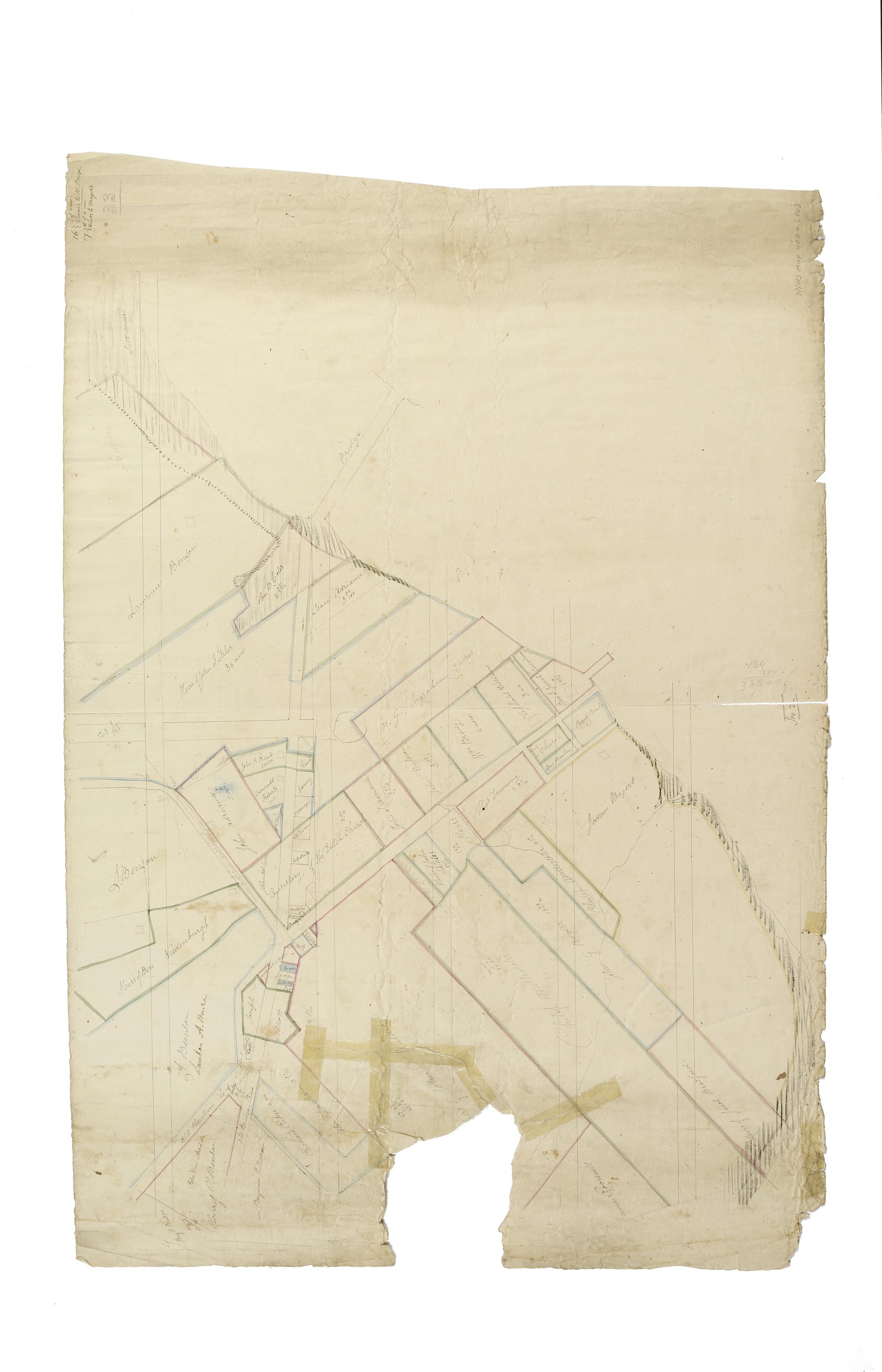
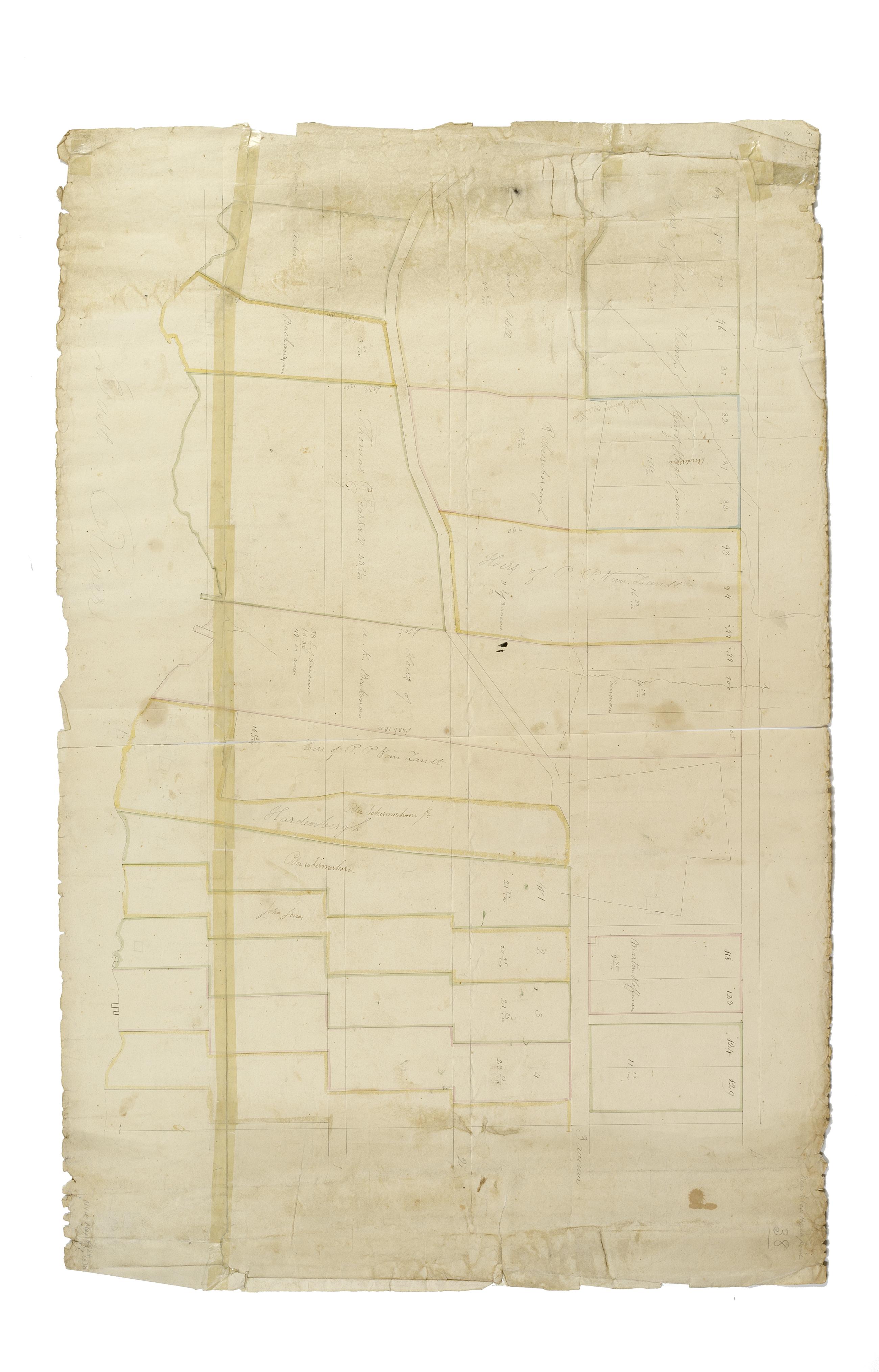
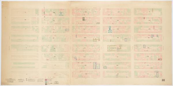
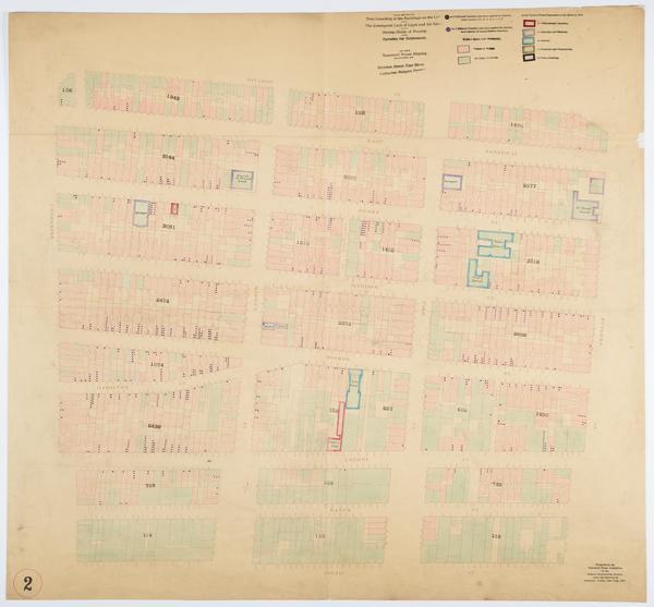
Still Image [Map of the area later bounded by 114th and 137th Streets, the Harlem River and 5th Avenue, Manhattan, New York, N.Y.]. Scale [ca. 1:2,450]. Cadastral map. Shows property lines and owners' names, some existing roads and projected streets. Shows relief by hachures. Pen-and-ink, watercolor on paper. Imperfect: lacking 15 cm. square at bottom center margin. Annotations in a later hand on the recto of this sheet give the number 16. The map on verso of this one belongs to the same series and is separately cataloged under the title, [Map of the area later bounded by 113th and 136th Streets, Park or Morningside and St. Nicholas Avenues, Manhattan, New York, N.Y.]. View Item
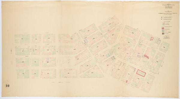
Still Image [Cadastral map of Manhattan]. Scale [ca. 1:2,450]. Digital composite of a cadastral map of Manhattan in 26 sections on 13 sheets which appears to be a draft for another map, owned by New York City and printed in Sackersdorff, Otto. Maps of farms, commonly called the Blue Book 1815 (New York: 1868). Shows property lines and owners' names, some existing roads and projected streets. Shows relief by hachures. Pen-and-ink, watercolor on paper. Sackersdorff gives the date of the manuscript map as circa 1815. Title and edition statement devised by cataloger. Attributed to Randel by cataloger; for provenance, see Stokes, I.N.P. View Item
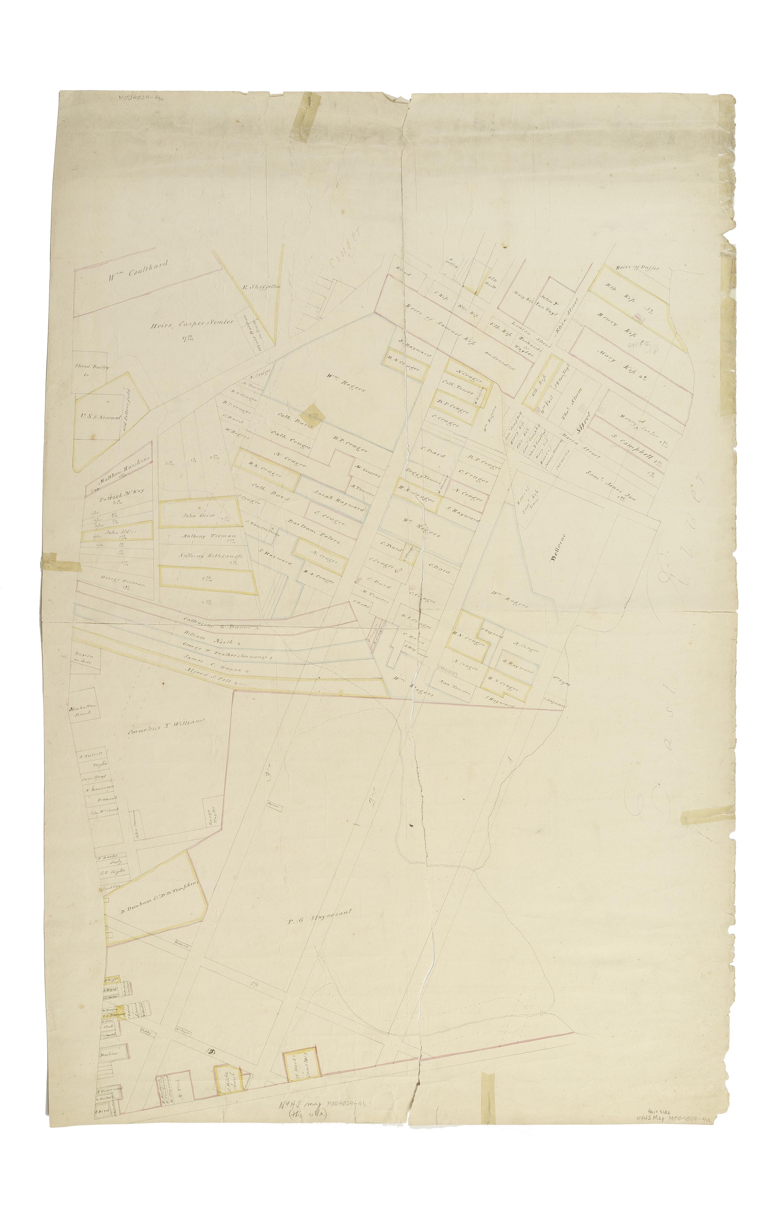
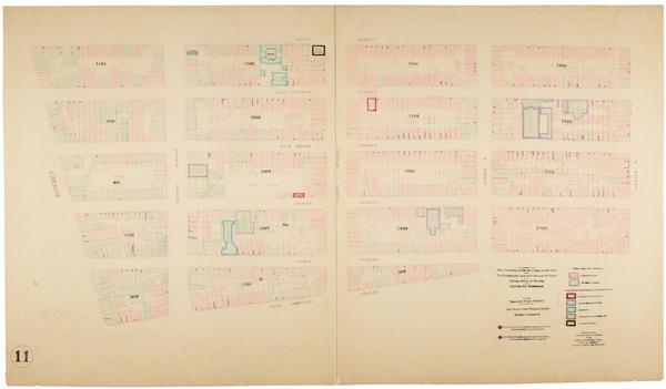
Still Image [Map of the area later bounded by 8th and 34th Streets, the East River and 5th Avenue, Manhattan, New York, N.Y.]. Scale [ca. 1:2,450]. Cadastral map. Shows property lines and owners' names, some existing roads and projected streets. Pen-and-ink, watercolor on paper. The map on verso of this one belongs to the same series and is separately cataloged under the title, [Map of the area later bounded by 52nd and 74th Streets, Park Avenue, and 8th Avenue or Central Park West, Manhattan, New York, N.Y.]. View Item
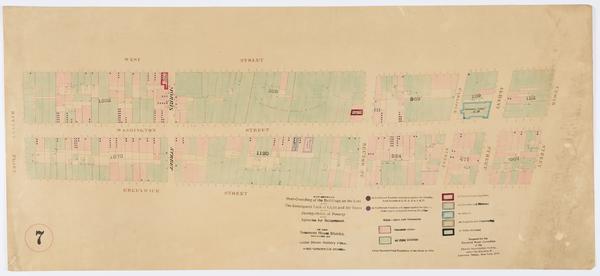
Still Image [Map of the area later bounded by 56th and 78th Streets, 7th Avenue or Central Park, and the Hudson River, Manhattan, New York, N.Y.]. Scale [ca. 1:2,450]. Cadastral map. Shows property lines and owners' names, some existing roads and projected streets. Shows relief by hachures. Pen-and-ink, watercolor on paper. Imperfect: lacking 15 cm. at bottom margin. Annotations in a later hand on the recto of this sheet give the number 10. The map on recto of this sheet belongs to the same series and is separately cataloged under the title, [Map of the area later bounded by 8th and 20th Streets, 7th Avenue and the Hudson River, Manhattan, New York, N.Y.]. View Item
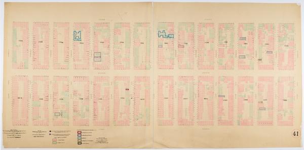
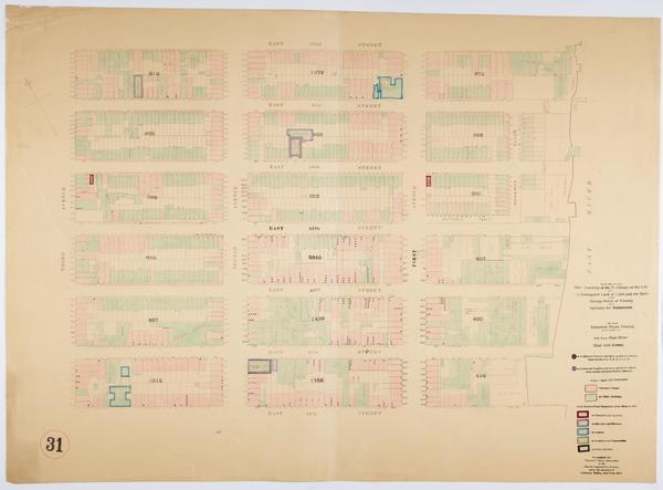
Still Image [Map of the area later bounded by 52nd and 73rd Streets, the East River and Park Avenue, Manhattan, New York, N.Y.]. Scale [ca. 1:2,450]. Cadastral map. Shows property lines and owners' names, some existing roads and projected streets. Shows relief by hachures. Pen-and-ink, watercolor on paper. Annotations in a later hand on the recto of this sheet give the number 5. The map on verso of this one belongs to the same series and is separately cataloged under the title, [Map of the area later bounded by 15th and 33rd Streets, 6th and 10th Avenues, Manhattan, New York, N.Y.]. View Item
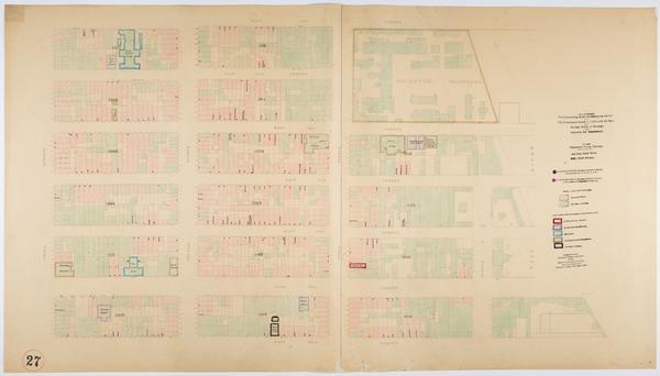
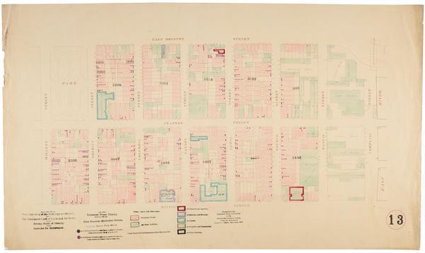
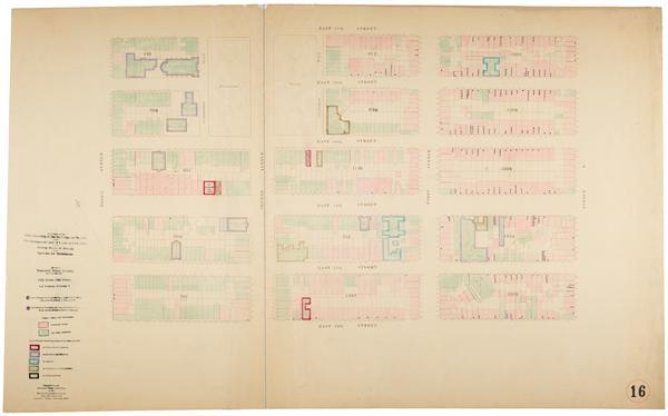
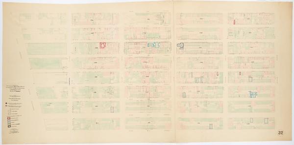
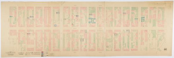
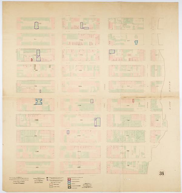
Still Image Map showing over-crowding of the buildings on the lots and the consequent lack of light and air space also strong-holds of poverty and agencies for betterment in the tenement house district bounded by 3rd Ave., East River, 28th, 22nd Streets / prepared fo Scale [ca. 1:650]. View Item
Still Image Map showing over-crowding of the buildings on the lots and the consequent lack of light and air space also strong-holds of poverty and agencies for betterment in the tenement house district bounded by East Houston, Rivington Streets, Willett Street, East Scale [ca. 1:650]. View Item
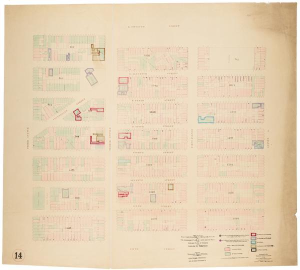
Still Image Map showing over-crowding of the buildings on the lots and the consequent lack of light and air space also strong-holds of poverty and agencies for betterment in the tenement house district bounded by 17th Street, 12th Street, 3rd Avenue, Avenue A / prepa Scale [ca. 1:650]. View Item
Still Image Map showing over-crowding of the buildings on the lots and the consequent lack of light and air space also strong-holds of poverty and agencies for betterment in the tenement house district bounded by 12th & 13th Ave., 7th Avenue, 38th, 30th Streets / pre Scale [ca. 1:650]. View Item
Still Image Map showing over-crowding of the buildings on the lots and the consequent lack of light and air space also strong-holds of poverty and agencies for betterment in the tenement house district bounded by 5th Street, East Houston Street, Bowery, Avenue B / pr Scale [ca. 1:650]. View Item
Still Image Map showing over-crowding of the buildings on the lots and the consequent lack of light and air space also strong-holds of poverty and agencies for betterment in the tenement house district bounded by 3rd Avenue, 1st Avenue, 86th, 72nd Streets / prepared Scale [ca. 1:650]. Oriented with north to upper right of sheet. View Item
Still Image Map showing over-crowding of the buildings on the lots and the consequent lack of light and air space also strong-holds of poverty and agencies for betterment in the tenement house district bounded by West 12th & Bank Streets, W. 10th Street, West Street, Scale [ca. 1:650]. View Item
Still Image Map showing over-crowding of the buildings on the lots and the consequent lack of light and air space also strong-holds of poverty and agencies for betterment in the tenement house district bounded by 3rd Avenue, 1st Avenue, 72nd, 62nd Streets / prepared Scale [ca. 1:650]. Oriented with north to the upper right of sheet. View Item
Still Image Map showing over-crowding of the buildings on the lots and the consequent lack of light and air space also strong-holds of poverty and agencies for betterment in the tenement house district bounded by 5th Street, East Houston Street, Avenue B, East River Scale [ca. 1:650]. View Item
Still Image Map showing over-crowding of the buildings on the lots and the consequent lack of light and air space also strong-holds of poverty and agencies for betterment in the tenement house district bounded by Division Street, East River, Rutgers, Corlears Street Scale [ca. 1:650]. View Item
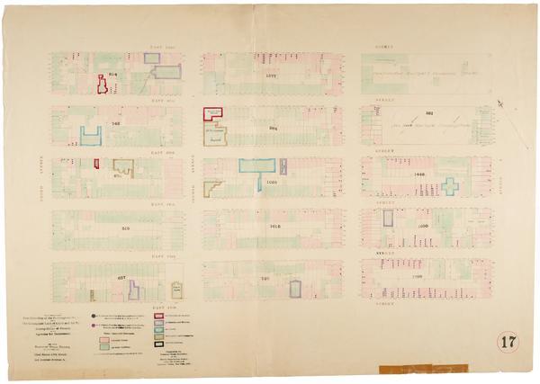
Still Image Map showing over-crowding of the buildings on the lots and the consequent lack of light and air space also strong-holds of poverty and agencies for betterment in the tenement house district bounded by 12th & 13th Ave., 7th Avenue, 52nd, 46th Streets / pre Scale [ca. 1:650]. View Item
Still Image Map showing over-crowding of the buildings on the lots and the consequent lack of light and air space also strong-holds of poverty and agencies for betterment in the tenement house district bounded by 12th & 13th Ave., 7th Avenue, 30th, 22nd Street / prep Scale [ca. 1:650]. View Item
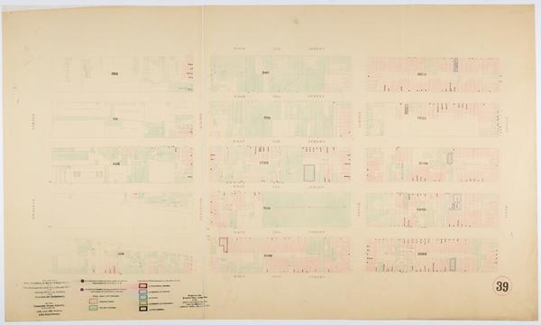
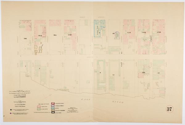
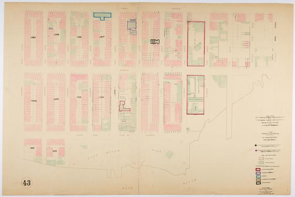
Still Image Map showing over-crowding of the buildings on the lots and the consequent lack of light and air space also strong-holds of poverty and agencies for betterment in the tenement house district bounded by 3rd Ave., East River, 52nd, 46th Streets / prepared fo Scale [ca. 1:650]. View Item
Still Image Map showing over-crowding of the buildings on the lots and the consequent lack of light and air space also strong-holds of poverty and agencies for betterment in the tenement house district bounded by Cedar Street, Battery Place, West, Greenwich Streets / Scale [ca. 1:650]. Oriented with north to right of sheet. View Item
Still Image Map showing over-crowding of the buildings on the lots and the consequent lack of light and air space also strong-holds of poverty and agencies for betterment in the tenement house district bounded by 3rd Avenue, 1st Avenue, 130th, 110th Sts. / prepared f Scale [ca. 1:650]. Oriented with north to upper right of sheet. View Item
Still Image Map showing over-crowding of the buildings on the lots and the consequent lack of light and air space also strong-holds of poverty and agencies for betterment in the tenement house district bounded by 3rd Ave., East River, 62nd, 52nd Streets / prepared fo Scale [ca. 1:650]. View Item
Still Image Map showing over-crowding of the buildings on the lots and the consequent lack of light and air space also strong-holds of poverty and agencies for betterment in the tenement house district bounded by 12th Ave., 9th Avenue, 57th, 52nd Streets / prepared f Scale [ca. 1:650]. View Item
Still Image Map showing over-crowding of the buildings on the lots and the consequent lack of light and air space also strong-holds of poverty and agencies for betterment in the tenement house district bounded by Division Street, East River, Catharine, Rutgers Street Scale [ca. 1:650]. View Item
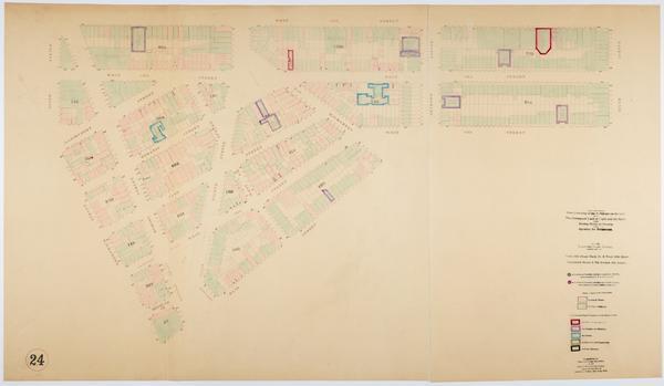
Still Image Map showing over-crowding of the buildings on the lots and the consequent lack of light and air space also strong-holds of poverty and agencies for betterment in the tenement house district bounded by West 4th, Jones, Commerce & Barrow Streets, W. Houston Scale [ca. 1:650]. View Item
Still Image Map showing over-crowding of the buildings on the lots and the consequent lack of light and air space also strong-holds of poverty and agencies for betterment in the tenement house district bounded by 1st Avenue, East River, 72nd St., 62nd Streets / prepa Scale [ca. 1:650]. Oriented with north to upper right of sheet. View Item
Still Image Map showing over-crowding of the buildings on the lots and the consequent lack of light and air space also strong-holds of poverty and agencies for betterment in the tenement house district bounded by 3rd Ave., East River, 40th, 34th Streets / prepared fo Scale [ca. 1:650]. View Item
Still Image Map showing over-crowding of the buildings on the lots and the consequent lack of light and air space also strong-holds of poverty and agencies for betterment in the tenement house district bounded by 12th Street, 5th Street, 3rd Avenue, Avenue A / prepar Scale [ca. 1:650]. View Item
Still Image Map showing over-crowding of the buildings on the lots and the consequent lack of light and air space also strong-holds of poverty and agencies for betterment in the tenement house district bounded by West 14th Street, Bank St. & West 12th Street, Greenwi Scale [ca. 1:650]. View Item
Still Image Map showing over-crowding of the buildings on the lots and the consequent lack of light and air space also strong-holds of poverty and agencies for betterment in the tenement house district bounded by 1st Avenue, East River, 93rd, 82nd Streets / prepared Scale [ca. 1:650]. Oriented with north to upper right of sheet. View Item
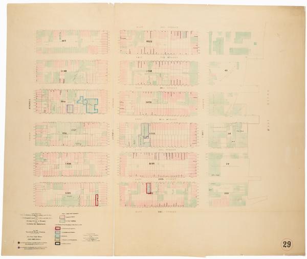
Still Image Map showing over-crowding of the buildings on the lots and the consequent lack of light and air space also strong-holds of poverty and agencies for betterment in the tenement house district bounded by 22nd Street, 17th Street, 3rd Avenue, Avenue A / prepa Scale [ca. 1:650]. View Item