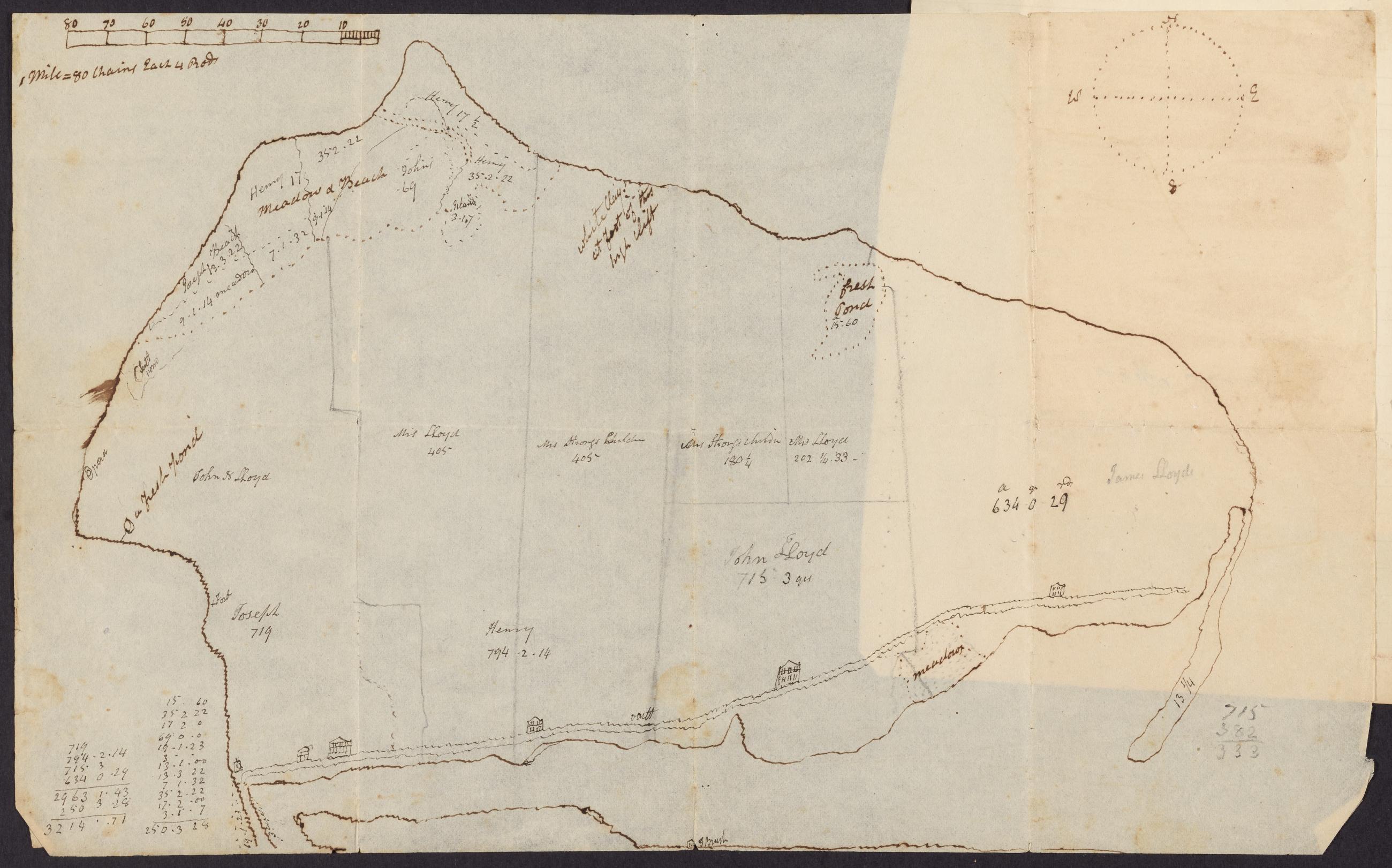
Cartographic Manuscript map of Lloyd Neck, 19th century. 19th century manuscript map of Lloyd Neck showing the holding of different Lloyd family members. View Item
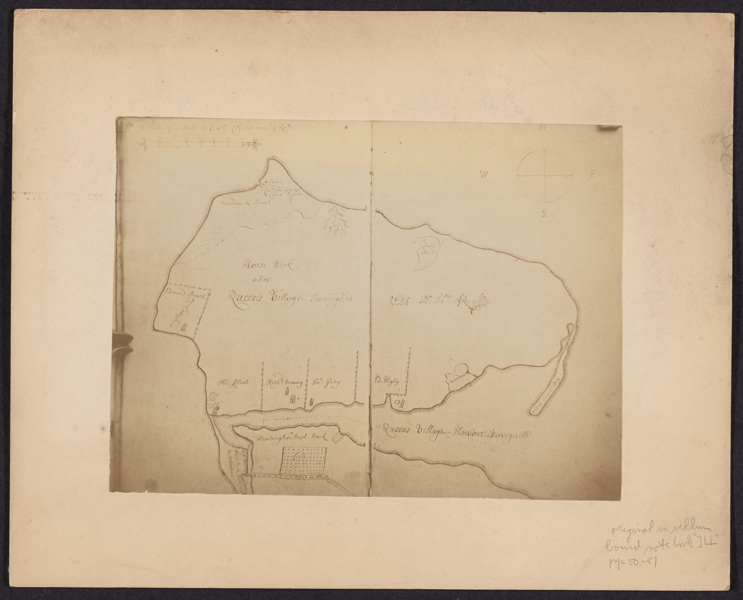
Image Text 2 Items Photograph of manuscript map of Queen's Village, Lloyd Neck. Mounted 19th century photograph of late 17th century manuscript map of Queen's Village, Lloyd Neck. View Item
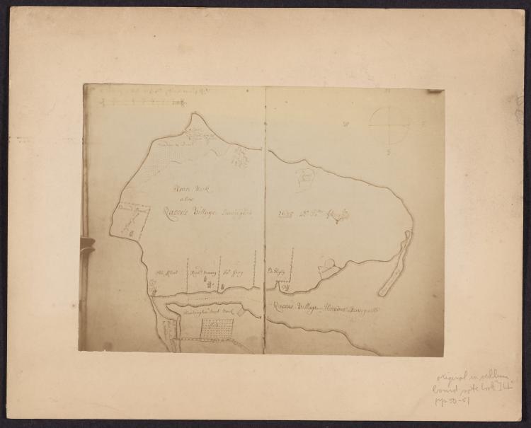
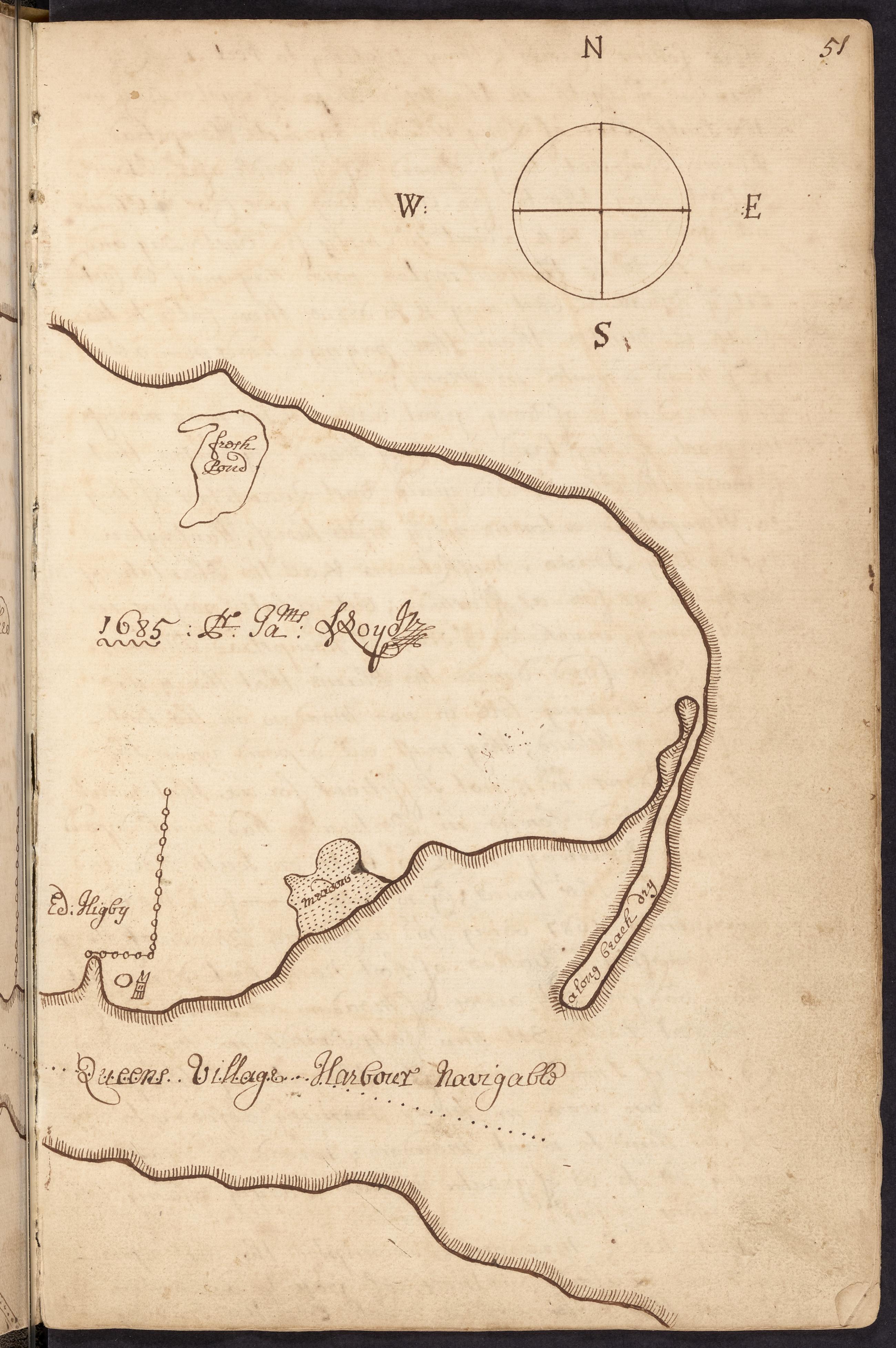
Text Lloyd family record book, 1654-1894, page 51, Map of Lloyd Neck [east half], 1685 [i.e. 1686] View Item
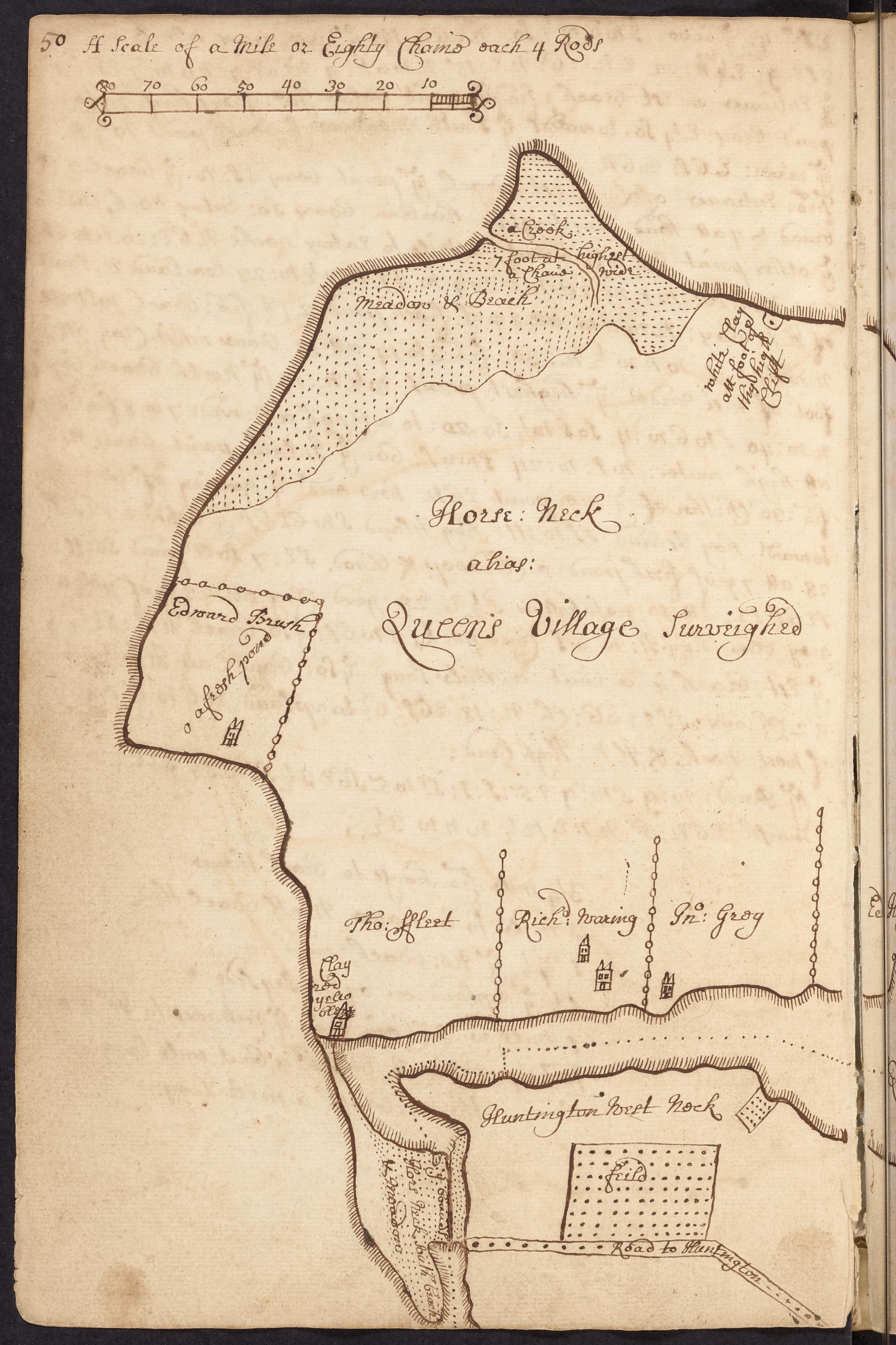
Text Lloyd family record book, 1654-1894, page 50, Map of Lloyd Neck [west half], 1685 [i.e. 1686] Manuscript map of Lloyd Neck from James Lloyd's March 9, 1686 survey; map shows features including meadows, ponds, and tracts and buildings belonging to lessees. View Item