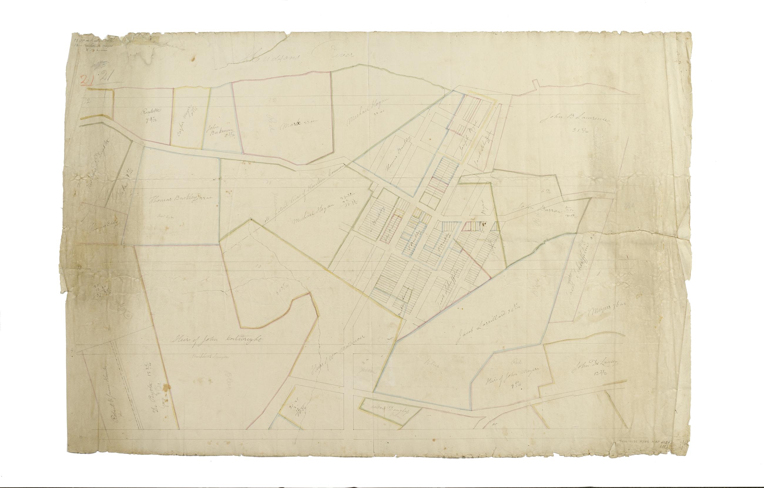
Still Image [Map of the area later bounded by 123rd and 132th Streets, St. Nicholas Park and the Hudson River, Manhattan, New York, N.Y.] / surveyed and laid into lots by Adolphus Loss. Scale not given. Alternate title: Manhattanville. Cadastral map. Shows property lines and owners' names, some existing roads and projected streets. Date of ms. ca. 1815, based on comparison with map on recto of this sheet. Shows relief by hachures. Attributed to Randel's supervision by cataloger, based on map appearing on recto of this sheet. Pen-and-ink, watercolor on paper. The map on recto of this sheet is separately cataloged--see Randel, John. Map of the area later bounded by 114th and 137th Streets, Douglass Boulevard and the Hudson River, Manhattan, New York, N.Y. View Item
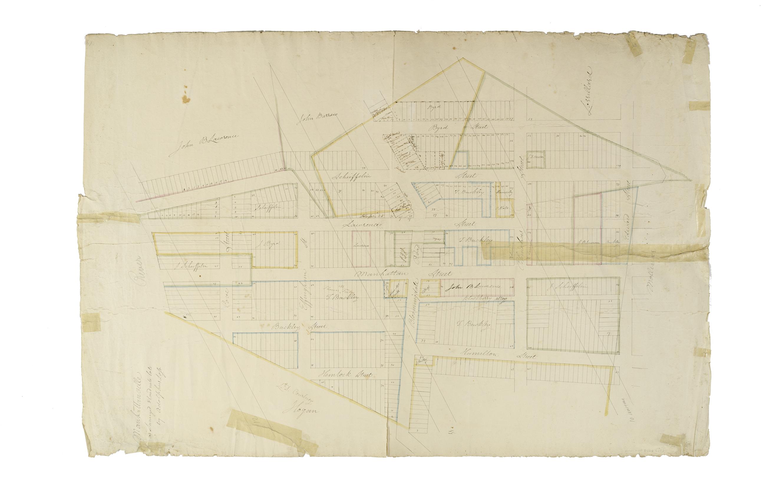
Still Image [Map of the area later bounded by 114th and 137th Streets, Douglass Boulevard and the Hudson River, Manhattan, New York, N.Y.]. Scale [ca. 1:2,450]. Cadastral map. Shows property lines and owners' names, some existing roads and projected streets. Shows relief by hachures. Pen-and-ink, watercolor on paper. Annotations in a later hand on the recto of this sheet also give the number 18. The map on verso of this one does not belong to the series and is separately cataloged--see Loss, Charles, surveyor. [Map of the area later bounded by 124th and 132nd Streets, 9th Avenue and the Hudson River, Manhattan, New York, N.Y.]. View Item